Beaumont Plantation

Wood, Forest in Surrey Elmbridge

England

Beaumont Plantation

Horsley Road Entrance to Highway Farm.
Horsley Road Credit: James Emmans

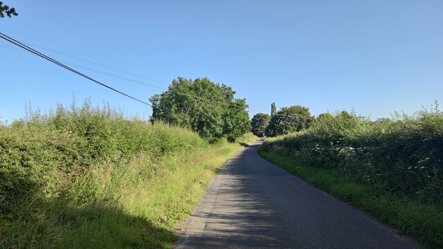
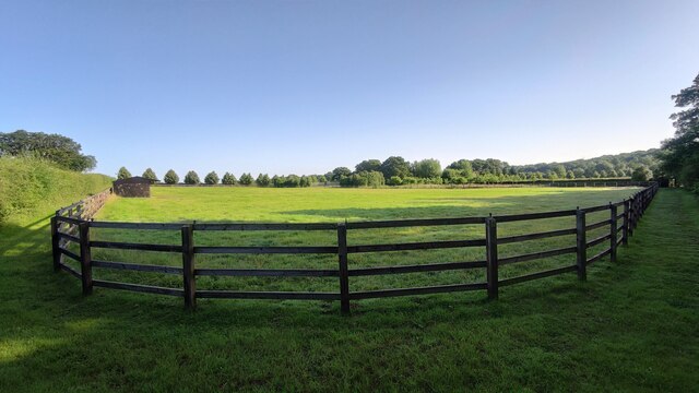
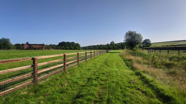
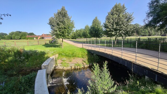
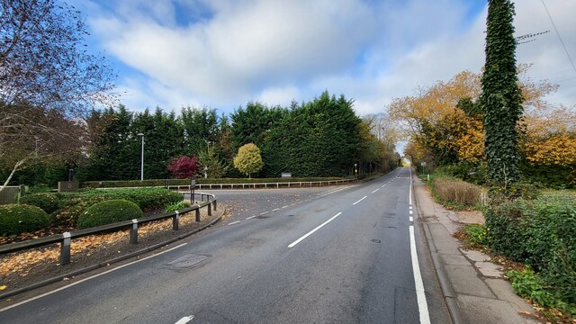
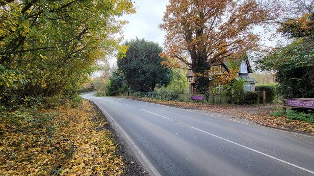
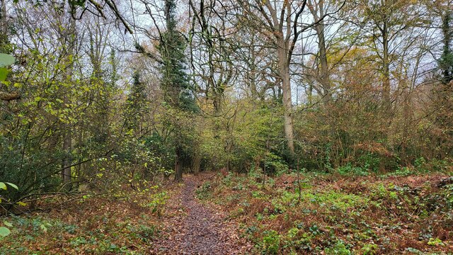
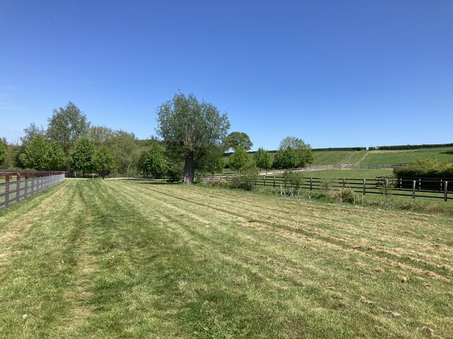
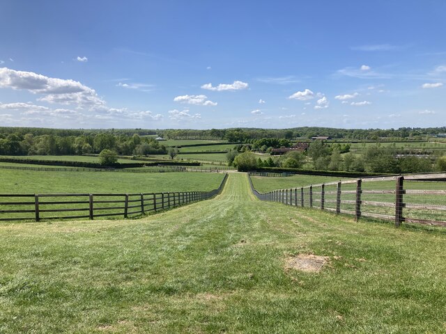
Beaumont Plantation is a picturesque woodland area located in Surrey, England. Situated in the heart of the county, it covers an expansive area of lush greenery and is known for its natural beauty and tranquil atmosphere. This idyllic woodland is often referred to as Beaumont Forest due to its dense, tree-covered landscape.

The plantation is home to a wide variety of tree species, including oak, beech, and birch. These towering trees provide shade and create a serene environment, ideal for nature enthusiasts and those seeking solace in the great outdoors. The woodland floor is carpeted with a diverse range of flora, such as bluebells, foxgloves, and wild garlic, adding splashes of color to the serene surroundings.

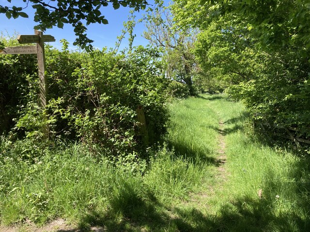
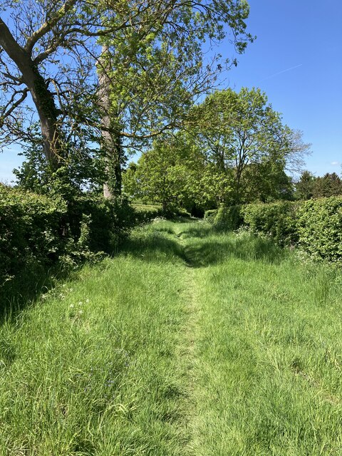
Beaumont Plantation offers several walking trails, allowing visitors to explore the area's natural wonders at their own pace. These paths wind through the woodland, offering glimpses of wildlife and opportunities for birdwatching. The plantation is particularly renowned for its resident bird population, including woodpeckers, owls, and various songbirds.

In addition to its natural beauty, Beaumont Plantation holds historical significance. It is believed to have been part of the hunting grounds for King Henry VIII, who used the area for recreational purposes. Today, the plantation serves as a popular destination for nature lovers, hikers, and families looking to escape the hustle and bustle of city life.

Overall, Beaumont Plantation in Surrey is a captivating woodland retreat, offering a peaceful haven for both locals and tourists alike. Its scenic beauty, diverse flora and fauna, and historical significance make it a must-visit destination for nature enthusiasts and those seeking a tranquil escape.

If you have any feedback on the listing, please let us know in the comments section below.

Beaumont Plantation Images

Images are sourced within 2km of 51.308604/-0.40127147 or Grid Reference TQ1157. Thanks to Geograph Open Source API. All images are credited.

Horsley Road Entrance to Highway Farm.
Horsley Road
Entrance to Highway Farm.
Ploughed field next to Chilbrook Farm
St Michael's Chapel View from the Downside footpath that leads to Cobham.
St Michael's Chapel
View from the Downside footpath that leads to Cobham.
Bookham Road Rural road that leads to Little Bookham Common. It goes under the M25 and the New Guildford Railway (1885).
Bookham Road
Rural road that leads to Little Bookham Common. It goes under the M25 and the New Guildford Railway (1885).
Paddock near Chasemore Farm
Paddock next to Chasemore Farm Chasemore Farm building is on the left.
Paddock next to Chasemore Farm
Chasemore Farm building is on the left.
Casemore Farm access road Bridge over a stream that has a check dam to prevent excess erosion during wet weather.
Casemore Farm access road
Bridge over a stream that has a check dam to prevent excess erosion during wet weather.
Grass verge along Tilt Road Cobham
Railway bridge on Stoke Road The A245 going over the 'New Guildford Line' (1885)
Railway bridge on Stoke Road
The A245 going over the 'New Guildford Line' (1885)
Cobham Road A busy semi-rural 'A' road with sloping narrow verge poorly designed for walkers.
Cobham Road
A busy semi-rural 'A' road with sloping narrow verge poorly designed for walkers.
Chelsea Football Club The main entrance to the training grounds on Stoke Road, Stoke D'Abernon.
Chelsea Football Club
The main entrance to the training grounds on Stoke Road, Stoke D'Abernon.
Historic South Lodge The old southern entrance to the Manor that is now a private school.
Historic South Lodge
The old southern entrance to the Manor that is now a private school.
The River Mole snakes pass Slyfield House
Great Bookham Common Path near the National Trust carpark.
Great Bookham Common
Path near the National Trust carpark.
Footpath near Chasemore Farm Footpath Esher 81/Leatherhead 600 near Chasemore Farm. The true line of the right of way passes through the paddock to the left (which, given the footpath was diverted out of the farm some while ago, suggests a lack of foresight). The stream, on the right, is the borough boundary between Elmbridge and Mole Valley — save that the boundary actually follows the old, meandering course of the stream which would twice have crossed this lower part of the field (this is why the footpath has two numbers).
Footpath near Chasemore Farm
Footpath Esher 81/Leatherhead 600 near Chasemore Farm. The true line of the right of way passes through the paddock to the left (which, given the footpath was diverted out of the farm some while ago, suggests a lack of foresight). The stream, on the right, is the borough boundary between Elmbridge and Mole Valley — save that the boundary actually follows the old, meandering course of the stream which would twice have crossed this lower part of the field (this is why the footpath has two numbers).
Chasemore Farm from footpath 1 Footpath Leatherhead 1 descends between horse paddocks towards a bridge over a stream marking the boundary between Mole Valley district and Elmbridge borough. Beyond is Chasemore Farm.
Chasemore Farm from footpath 1
Footpath Leatherhead 1 descends between horse paddocks towards a bridge over a stream marking the boundary between Mole Valley district and Elmbridge borough. Beyond is Chasemore Farm.
Stents Lane near Bookham Lodge Stents Lane at the junction between footpaths Leatherhead 1 and 6.  Footpath 6 here follows Stents Lane.
Stents Lane near Bookham Lodge
Stents Lane at the junction between footpaths Leatherhead 1 and 6. Footpath 6 here follows Stents Lane.
Stents Lane Footpath Leatherhead 6 here follows the course of Stents Lane behind <a href="https://www.geograph.org.uk/photo/676464">TQ1257 : Bookham Lodge</a>..
Stents Lane
Footpath Leatherhead 6 here follows the course of Stents Lane behind TQ1257 : Bookham Lodge..
Show me another place!

Beaumont Plantation is located at Grid Ref: TQ1157 (Lat: 51.308604, Lng: -0.40127147)

Administrative County: Surrey

District: Elmbridge

Police Authority: Surrey

What 3 Words

///rang.honey.suffice. Near Cobham, Surrey

Related Wikis

Cobham MSA

Cobham services is a motorway service area on the M25 motorway in Surrey between junctions 9 and 10. It is operated by Extra MSA and was opened for business...

Downside, Surrey

Downside is a small village in the English county of Surrey, in the local government district of Elmbridge, centred on Downside Common which is 18 miles...

Cobham & Stoke d'Abernon railway station

Cobham & Stoke d'Abernon railway station is in the village of Stoke d'Abernon in Surrey, England and also serves the nearby town of Cobham. It is 18 miles...

Bookham Lodge

The Grange is a gothic regency manor house in Stoke d'Abernon, Surrey that dates back to the 15th Century. It was part of the Eastwick Manor estate and...

Cobham Training Centre

The Cobham Training Centre, is the training ground of Chelsea Football Club located in the village of Stoke d'Abernon near the village of Cobham, Surrey...

Parkside School, Cobham

Parkside School is a private preparatory school located in Cobham. Founded in 1879, the school caters for boys aged 2 to 13 and for girls in the nursery...

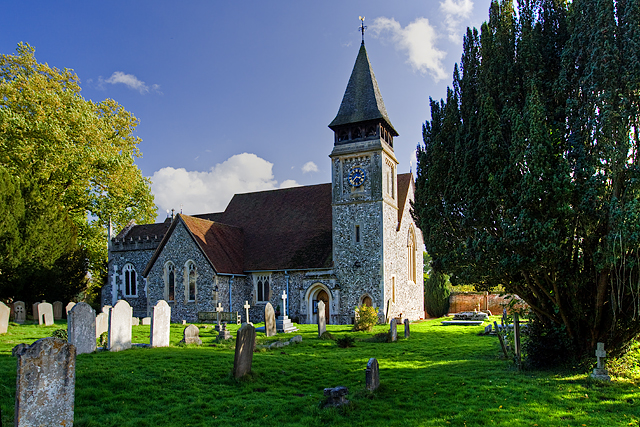
St Mary's Church, Stoke d'Abernon

The Church of St Mary is an Anglican church in the village of Stoke d'Abernon, Surrey, in the Diocese of Guildford. The church, the oldest parts of which...
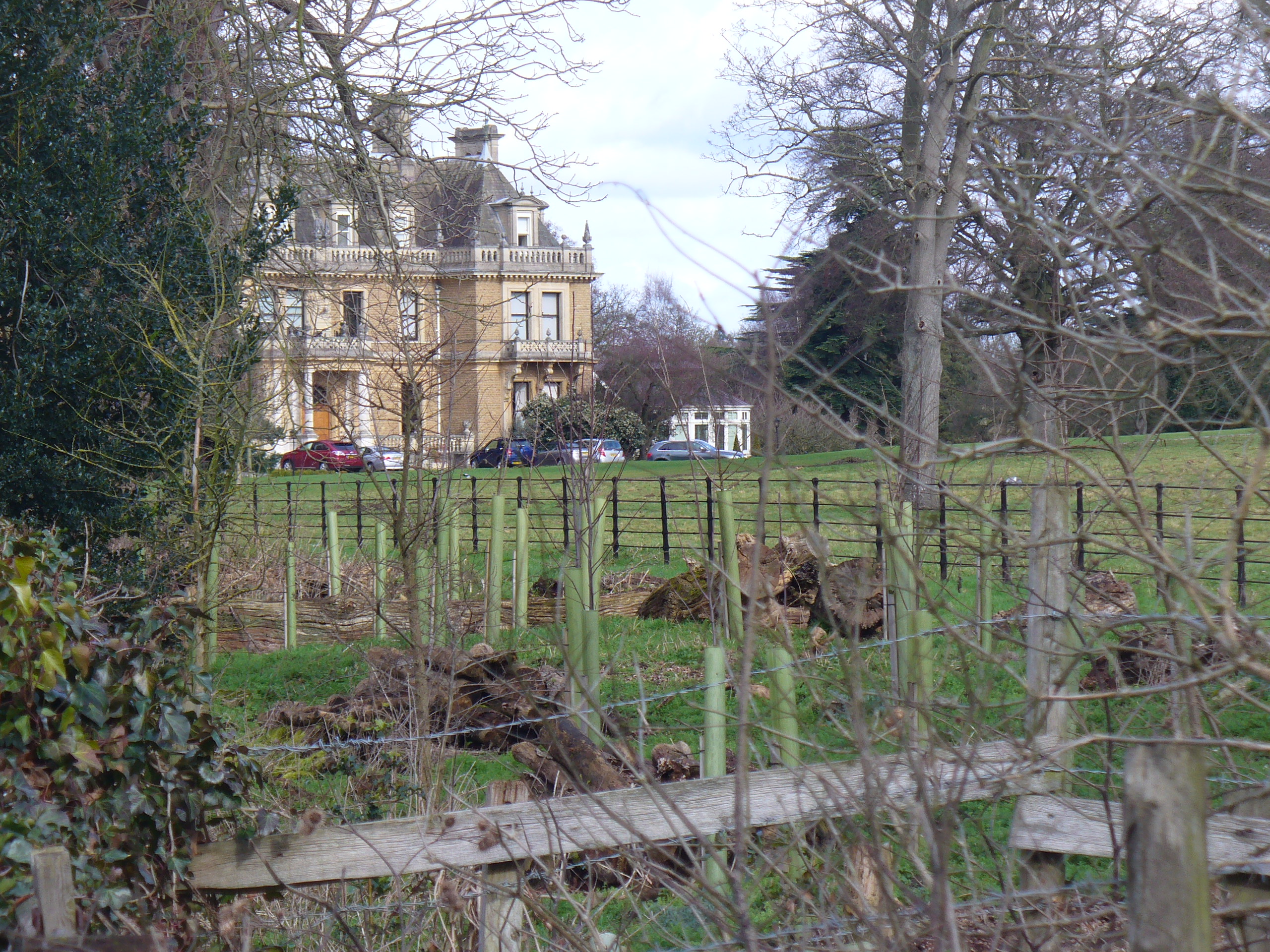
Cobham Park

Cobham Park is a set of about 22 apartments in and around a converted country mansion and associated lawn, gardens, fields and woodlands in the mainly...

Nearby Amenities

Located within 500m of 51.308604,-0.40127147
Motorway Junction
Cobham Services
Lat/Long: 51.3058311/-0.402679
Phone
Emergency: phone
Operator: National Highways
Operator Wikidata: Q5760006
Lat/Long: 51.3058105/-0.3983657
Phone
Emergency: phone
Operator: National Highways
Operator Wikidata: Q5760006
Lat/Long: 51.3061922/-0.3984594
Turning Circle
Lat/Long: 51.3093399/-0.4077503
Man Made: tower
Tower Type: communication
Lat/Long: 51.305865/-0.3966386
Crossing
Crossing: marked
Tactile Paving: yes
Traffic Calming: table
Lat/Long: 51.3048134/-0.4051157
Crossing
Crossing: marked
Tactile Paving: yes
Traffic Calming: table
Lat/Long: 51.3049621/-0.4051378
Crossing
Crossing: marked
Tactile Paving: yes
Traffic Calming: table
Lat/Long: 51.3051075/-0.4051595
Crossing
Crossing: marked
Tactile Paving: yes
Traffic Calming: table
Lat/Long: 51.3052491/-0.4051806
Crossing
Crossing: marked
Tactile Paving: yes
Lat/Long: 51.3053977/-0.4052027
Crossing
Crossing: uncontrolled
Crossing Markings: yes
Lat/Long: 51.3047572/-0.4044763
Street Lamp
Lamp Model: Urbis ZX3
Lamp Type: SON
Source: Mapillary (2019-02-15)
Lat/Long: 51.3063564/-0.3955025
Street Lamp
Lamp Model: Urbis ZX3
Lamp Type: SON
Source: Mapillary (2019-02-15)
Lat/Long: 51.3062609/-0.3961274
Street Lamp
Lamp Model: Urbis ZX3
Lamp Type: SON
Source: Mapillary (2019-02-15)
Lat/Long: 51.3061787/-0.3967229
Street Lamp
Lamp Model: Urbis ZX3
Lamp Type: SON
Source: Mapillary (2019-02-15)
Lat/Long: 51.3061116/-0.3972968
Street Lamp
Lamp Model: Urbis ZX3
Lamp Type: SON
Source: Mapillary (2019-02-15)
Lat/Long: 51.306063/-0.3978869
Street Lamp
Lamp Model: Urbis ZX3
Lamp Type: SON
Source: Mapillary (2019-02-15)
Lat/Long: 51.3060127/-0.3984636
Street Lamp
Lamp Model: Urbis ZX3
Lamp Type: SON
Source: Mapillary (2019-02-15)
Lat/Long: 51.3059691/-0.3990564
Street Lamp
Lamp Model: Urbis ZX3
Lamp Type: SON
Source: Mapillary (2019-02-15)
Lat/Long: 51.3059238/-0.3996438
Street Lamp
Lamp Model: Urbis ZX3
Lamp Type: SON
Source: Mapillary (2019-02-15)
Lat/Long: 51.305902/-0.4002473
Traffic Sign: variable_message
Variable Message Model: MS2
Lat/Long: 51.3062453/-0.3977437
Traffic Sign: variable_message
Variable Message Model: MS2
Lat/Long: 51.3062005/-0.3977331
Traffic Sign: variable_message
Variable Message Model: MS2
Lat/Long: 51.3061711/-0.3977262
Traffic Sign: variable_message
Variable Message Model: MS2
Lat/Long: 51.3061389/-0.3977186
Traffic Sign: variable_message
Variable Message Model: MS2
Lat/Long: 51.3061081/-0.3977113
Phone
Emergency: phone
Operator: National Highways
Operator Wikidata: Q5760006
Lat/Long: 51.30625/-0.4043095
Phone
Emergency: phone
Operator: National Highways
Operator Wikidata: Q5760006
Lat/Long: 51.3066568/-0.4075741
Traffic Sign: variable_message
Variable Message Model: MS2
Lat/Long: 51.3058991/-0.3976619
Traffic Sign: variable_message
Variable Message Model: AMI
Lat/Long: 51.3059407/-0.3976717
Traffic Sign: variable_message
Variable Message Model: AMI
Lat/Long: 51.305974/-0.3976796
Traffic Sign: variable_message
Variable Message Model: AMI
Lat/Long: 51.3060027/-0.3976863
Traffic Sign: variable_message
Variable Message Model: AMI
Lat/Long: 51.3060336/-0.3976936
Camera Mount: pole
Camera Type: panning
Height: 8
Man Made: surveillance
Surveillance: public
Surveillance Type: camera
Surveillance Zone: traffic
Lat/Long: 51.3058601/-0.397604
Bench
Backrest: yes
Lat/Long: 51.3104296/-0.4073598
Drinking Water: no
Handle: lever
Heritage: 2
Heritage Operator: Historic England
Historic: yes
Inscription: THIS PUMP|WAS ERECTED & THE|WATER BROUGHT|FROM A DISTANCE|FOR THE SUPPLY|& COMFORT OF THE|COTTAGERS ON|DOWNSIDE|COMMON COBHAM|BY|HARVEY COMBE ESQR|1858.
Listed Status: Grade II
Man Made: water_well
Mechanical Driver: manual
Pump: manual
Pump Status: locked
Ref GB Nhle: 1030210
Lat/Long: 51.3108685/-0.4064479
Give Way
Lat/Long: 51.3055229/-0.4038146
Give Way
Direction: forward
Lat/Long: 51.3049214/-0.4037309
Give Way
Direction: forward
Lat/Long: 51.3052225/-0.4037728
Street Lamp
Lat/Long: 51.3055924/-0.4043448
Give Way
Direction: forward
Lat/Long: 51.3048088/-0.404483
Give Way
Direction: forward
Lat/Long: 51.3055557/-0.4044787
The data included in this document is from www.openstreetmap.org. The data is made available under ODbL.

Have you been to Beaumont Plantation?

Leave your review of Beaumont Plantation below (or comments, questions and feedback).