Down Wood

Wood, Forest in Surrey Elmbridge

England

Down Wood

Horsley Road Entrance to Highway Farm.
Horsley Road Credit: James Emmans

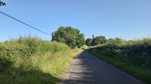
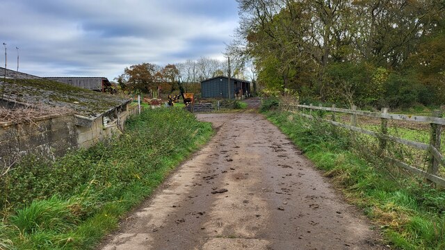
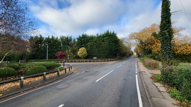
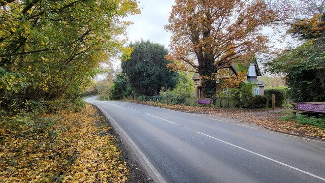
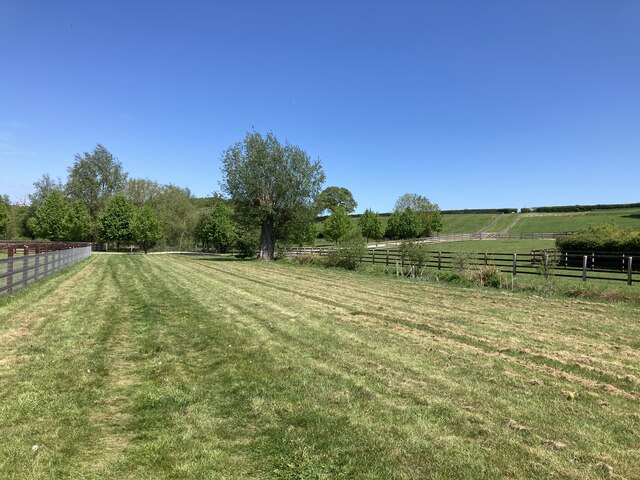
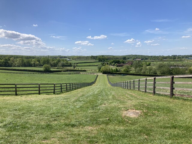
Down Wood, Surrey is a picturesque woodland located in the county of Surrey, England. Spanning over a vast area, the wood is a part of the larger Surrey Hills Area of Outstanding Natural Beauty. It is situated near the village of Forest Green, and is easily accessible from the nearby towns of Dorking and Cranleigh.

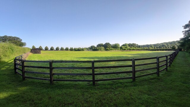
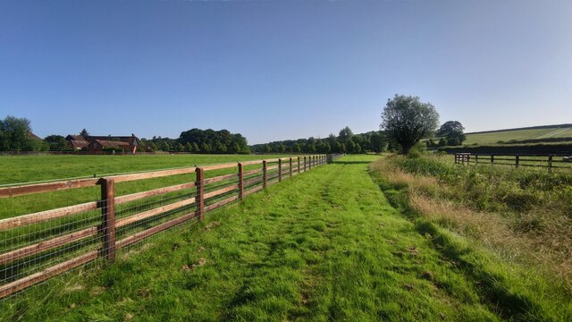
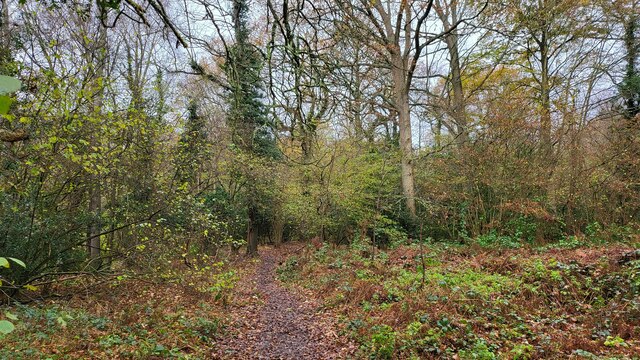
The woodland boasts a diverse range of flora and fauna, making it a haven for nature enthusiasts. The tree cover is predominantly made up of native species such as oak, beech, and birch, creating a serene and peaceful atmosphere. The forest floor is adorned with a carpet of bluebells in the spring, adding a burst of color to the landscape.

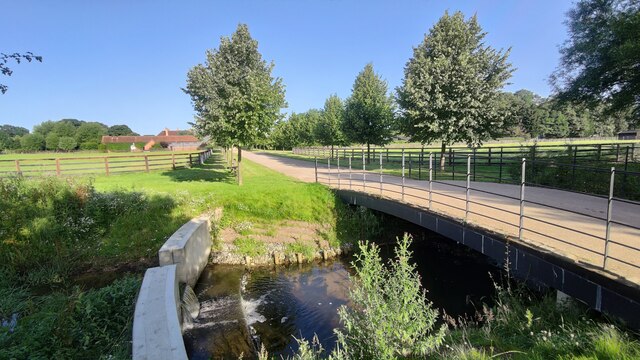
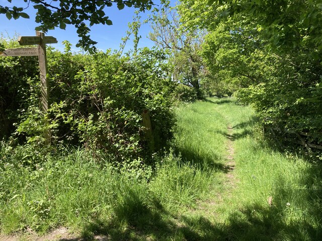
Down Wood offers numerous walking trails and footpaths, allowing visitors to explore its beauty at their own pace. The trails are well-maintained and offer varying levels of difficulty, catering to both casual strollers and more adventurous hikers. Along the way, visitors may encounter wildlife such as deer, badgers, and a wide variety of bird species.

The woodland also holds historical significance, with remnants of ancient settlements and iron age forts scattered throughout its expanse. These archaeological sites provide a glimpse into the area's rich history and offer an intriguing backdrop for exploration.

Overall, Down Wood, Surrey is a captivating destination for nature lovers, history enthusiasts, and anyone seeking an escape from the hustle and bustle of everyday life. With its stunning natural beauty and diverse wildlife, it offers a perfect retreat for those looking to connect with nature and immerse themselves in the tranquility of the woodland surroundings.

If you have any feedback on the listing, please let us know in the comments section below.

Down Wood Images

Images are sourced within 2km of 51.306963/-0.39563282 or Grid Reference TQ1157. Thanks to Geograph Open Source API. All images are credited.

Horsley Road Entrance to Highway Farm.
Horsley Road
Entrance to Highway Farm.
Ploughed field next to Chilbrook Farm
St Michael's Chapel View from the Downside footpath that leads to Cobham.
St Michael's Chapel
View from the Downside footpath that leads to Cobham.
Bookham Road Rural road that leads to Little Bookham Common. It goes under the M25 and the New Guildford Railway (1885).
Bookham Road
Rural road that leads to Little Bookham Common. It goes under the M25 and the New Guildford Railway (1885).
Paddock near Chasemore Farm
Paddock next to Chasemore Farm Chasemore Farm building is on the left.
Paddock next to Chasemore Farm
Chasemore Farm building is on the left.
Casemore Farm access road Bridge over a stream that has a check dam to prevent excess erosion during wet weather.
Casemore Farm access road
Bridge over a stream that has a check dam to prevent excess erosion during wet weather.
Grass verge along Tilt Road Cobham
Railway bridge on Stoke Road The A245 going over the 'New Guildford Line' (1885)
Railway bridge on Stoke Road
The A245 going over the 'New Guildford Line' (1885)
Cobham Road A busy semi-rural 'A' road with sloping narrow verge poorly designed for walkers.
Cobham Road
A busy semi-rural 'A' road with sloping narrow verge poorly designed for walkers.
Farm Track Access road for Slyfield Farm and a public footpath.
Farm Track
Access road for Slyfield Farm and a public footpath.
Chelsea Football Club The main entrance to the training grounds on Stoke Road, Stoke D'Abernon.
Chelsea Football Club
The main entrance to the training grounds on Stoke Road, Stoke D'Abernon.
Historic South Lodge The old southern entrance to the Manor that is now a private school.
Historic South Lodge
The old southern entrance to the Manor that is now a private school.
The River Mole snakes pass Slyfield House
Great Bookham Common Path near the National Trust carpark.
Great Bookham Common
Path near the National Trust carpark.
Footpath near Chasemore Farm Footpath Esher 81/Leatherhead 600 near Chasemore Farm. The true line of the right of way passes through the paddock to the left (which, given the footpath was diverted out of the farm some while ago, suggests a lack of foresight). The stream, on the right, is the borough boundary between Elmbridge and Mole Valley — save that the boundary actually follows the old, meandering course of the stream which would twice have crossed this lower part of the field (this is why the footpath has two numbers).
Footpath near Chasemore Farm
Footpath Esher 81/Leatherhead 600 near Chasemore Farm. The true line of the right of way passes through the paddock to the left (which, given the footpath was diverted out of the farm some while ago, suggests a lack of foresight). The stream, on the right, is the borough boundary between Elmbridge and Mole Valley — save that the boundary actually follows the old, meandering course of the stream which would twice have crossed this lower part of the field (this is why the footpath has two numbers).
Chasemore Farm from footpath 1 Footpath Leatherhead 1 descends between horse paddocks towards a bridge over a stream marking the boundary between Mole Valley district and Elmbridge borough. Beyond is Chasemore Farm.
Chasemore Farm from footpath 1
Footpath Leatherhead 1 descends between horse paddocks towards a bridge over a stream marking the boundary between Mole Valley district and Elmbridge borough. Beyond is Chasemore Farm.
Stents Lane near Bookham Lodge Stents Lane at the junction between footpaths Leatherhead 1 and 6.  Footpath 6 here follows Stents Lane.
Stents Lane near Bookham Lodge
Stents Lane at the junction between footpaths Leatherhead 1 and 6. Footpath 6 here follows Stents Lane.
Show me another place!

Down Wood is located at Grid Ref: TQ1157 (Lat: 51.306963, Lng: -0.39563282)

Administrative County: Surrey

District: Elmbridge

Police Authority: Surrey

What 3 Words

///cute.jazzy.trap. Near Cobham, Surrey

Related Wikis

Bookham Lodge

The Grange is a gothic regency manor house in Stoke d'Abernon, Surrey that dates back to the 15th Century. It was part of the Eastwick Manor estate and...

Cobham MSA

Cobham services is a motorway service area on the M25 motorway in Surrey between junctions 9 and 10. It is operated by Extra MSA and was opened for business...

Downside, Surrey

Downside is a small village in the English county of Surrey, in the local government district of Elmbridge, centred on Downside Common which is 18 miles...

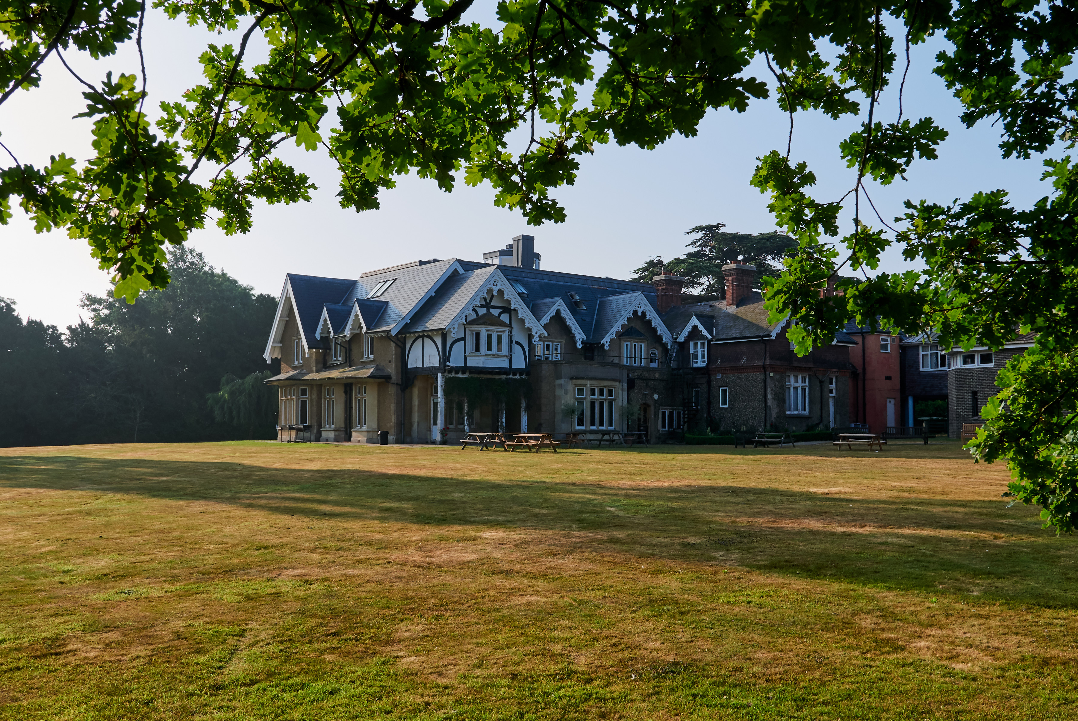
Parkside School, Cobham

Parkside School is a private preparatory school located in Cobham. Founded in 1879, the school caters for boys aged 2 to 13 and for girls in the nursery...

Cobham & Stoke d'Abernon railway station

Cobham & Stoke d'Abernon railway station is in the village of Stoke d'Abernon in Surrey, England and also serves the nearby town of Cobham. It is 18 miles...

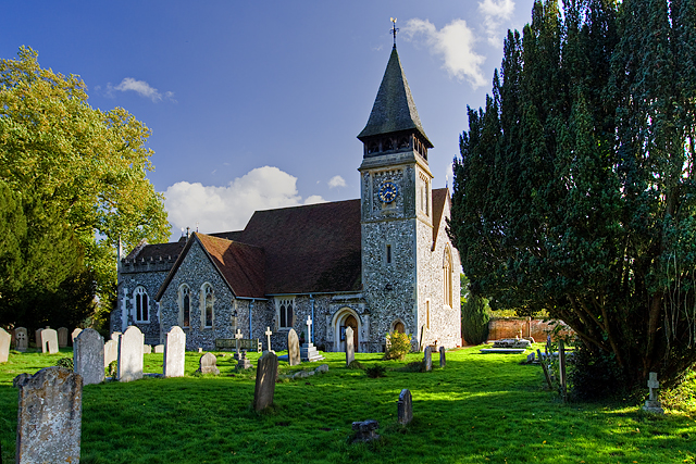
St Mary's Church, Stoke d'Abernon

The Church of St Mary is an Anglican church in the village of Stoke d'Abernon, Surrey, in the Diocese of Guildford. The church, the oldest parts of which...

Cobham Training Centre

The Cobham Training Centre, is the training ground of Chelsea Football Club located in the village of Stoke d'Abernon near the village of Cobham, Surrey...

Yehudi Menuhin School

The Yehudi Menuhin School is a specialist music school in Stoke d'Abernon, Surrey, England, founded in 1963 by violinist and conductor Yehudi Menuhin....

Nearby Amenities

Located within 500m of 51.306963,-0.39563282
Phone
Emergency: phone
Operator: National Highways
Operator Wikidata: Q5760006
Lat/Long: 51.3072279/-0.3904061
Phone
Emergency: phone
Operator: National Highways
Operator Wikidata: Q5760006
Lat/Long: 51.3075942/-0.3905788
Phone
Emergency: phone
Operator: National Highways
Operator Wikidata: Q5760006
Lat/Long: 51.3058105/-0.3983657
Phone
Emergency: phone
Operator: National Highways
Operator Wikidata: Q5760006
Lat/Long: 51.3061922/-0.3984594
Man Made: tower
Tower Type: communication
Lat/Long: 51.305865/-0.3966386
Street Lamp
Lamp Model: Urbis ZX3
Lamp Type: SON
Source: Mapillary (2019-02-15)
Lat/Long: 51.3078136/-0.3889659
Street Lamp
Lamp Model: Urbis ZX3
Lamp Type: SON
Source: Mapillary (2019-02-15)
Lat/Long: 51.307661/-0.3895319
Street Lamp
Lamp Model: Urbis ZX3
Lamp Type: SON
Source: Mapillary (2019-02-15)
Lat/Long: 51.307505/-0.3901085
Street Lamp
Lamp Model: Urbis ZX3
Lamp Type: SON
Source: Mapillary (2019-02-15)
Lat/Long: 51.3073592/-0.3906745
Street Lamp
Lamp Model: Urbis ZX3
Lamp Type: SON
Source: Mapillary (2019-02-15)
Lat/Long: 51.30722/-0.3912592
Street Lamp
Lamp Model: Urbis ZX3
Lamp Type: SON
Source: Mapillary (2019-02-15)
Lat/Long: 51.3070808/-0.3918466
Street Lamp
Lamp Model: Urbis ZX3
Lamp Type: SON
Source: Mapillary (2019-02-15)
Lat/Long: 51.3069433/-0.3924367
Street Lamp
Lamp Model: Urbis ZX3
Lamp Type: SON
Source: Mapillary (2019-02-15)
Lat/Long: 51.3068159/-0.3930402
Street Lamp
Lamp Model: Urbis ZX3
Lamp Type: SON
Source: Mapillary (2019-02-15)
Lat/Long: 51.3066952/-0.3936437
Street Lamp
Lamp Model: Urbis ZX3
Lamp Type: SON
Source: Mapillary (2019-02-15)
Lat/Long: 51.3065744/-0.3942525
Street Lamp
Lamp Model: Urbis ZX3
Lamp Type: SON
Source: Mapillary (2019-02-15)
Lat/Long: 51.3064654/-0.3948721
Street Lamp
Lamp Model: Urbis ZX3
Lamp Type: SON
Source: Mapillary (2019-02-15)
Lat/Long: 51.3063564/-0.3955025
Street Lamp
Lamp Model: Urbis ZX3
Lamp Type: SON
Source: Mapillary (2019-02-15)
Lat/Long: 51.3062609/-0.3961274
Street Lamp
Lamp Model: Urbis ZX3
Lamp Type: SON
Source: Mapillary (2019-02-15)
Lat/Long: 51.3061787/-0.3967229
Street Lamp
Lamp Model: Urbis ZX3
Lamp Type: SON
Source: Mapillary (2019-02-15)
Lat/Long: 51.3061116/-0.3972968
Street Lamp
Lamp Model: Urbis ZX3
Lamp Type: SON
Source: Mapillary (2019-02-15)
Lat/Long: 51.306063/-0.3978869
Street Lamp
Lamp Model: Urbis ZX3
Lamp Type: SON
Source: Mapillary (2019-02-15)
Lat/Long: 51.3060127/-0.3984636
Street Lamp
Lamp Model: Urbis ZX3
Lamp Type: SON
Source: Mapillary (2019-02-15)
Lat/Long: 51.3059691/-0.3990564
Street Lamp
Lamp Model: Urbis ZX3
Lamp Type: SON
Source: Mapillary (2019-02-15)
Lat/Long: 51.3059238/-0.3996438
Street Lamp
Lamp Model: Urbis ZX3
Lamp Type: SON
Source: Mapillary (2019-02-15)
Lat/Long: 51.305902/-0.4002473
Speed Camera
Maxspeed: 70 mph
Lat/Long: 51.3074817/-0.3893254
Traffic Sign: variable_message
Variable Message Model: AMI
Lat/Long: 51.3077979/-0.3895541
Traffic Sign: variable_message
Variable Message Model: AMI
Lat/Long: 51.307768/-0.3895321
Traffic Sign: variable_message
Variable Message Model: AMI
Lat/Long: 51.3077364/-0.389509
Traffic Sign: variable_message
Variable Message Model: AMI
Lat/Long: 51.3077074/-0.3894877
Traffic Sign: variable_message
Variable Message Model: MS2
Lat/Long: 51.3062453/-0.3977437
Traffic Sign: variable_message
Variable Message Model: MS2
Lat/Long: 51.3062005/-0.3977331
Traffic Sign: variable_message
Variable Message Model: MS2
Lat/Long: 51.3061711/-0.3977262
Traffic Sign: variable_message
Variable Message Model: MS2
Lat/Long: 51.3061389/-0.3977186
Traffic Sign: variable_message
Variable Message Model: MS2
Lat/Long: 51.3061081/-0.3977113
Traffic Sign: variable_message
Variable Message Model: MS2
Lat/Long: 51.3058991/-0.3976619
Traffic Sign: variable_message
Variable Message Model: AMI
Lat/Long: 51.3059407/-0.3976717
Traffic Sign: variable_message
Variable Message Model: AMI
Lat/Long: 51.305974/-0.3976796
Traffic Sign: variable_message
Variable Message Model: AMI
Lat/Long: 51.3060027/-0.3976863
Traffic Sign: variable_message
Variable Message Model: AMI
Lat/Long: 51.3060336/-0.3976936
Camera Mount: pole
Camera Type: panning
Height: 8
Man Made: surveillance
Surveillance: public
Surveillance Type: camera
Surveillance Zone: traffic
Lat/Long: 51.3058601/-0.397604
Traffic Sign: variable_message
Variable Message Model: AMI
Lat/Long: 51.3075569/-0.3893773
Traffic Sign: variable_message
Variable Message Model: AMI
Lat/Long: 51.307588/-0.3894001
Traffic Sign: variable_message
Variable Message Model: AMI
Lat/Long: 51.3076216/-0.3894247
Traffic Sign: variable_message
Variable Message Model: AMI
Lat/Long: 51.3076479/-0.3894441
Traffic Sign: variable_message
Variable Message Model: MS2
Lat/Long: 51.3074925/-0.38933
Traffic Sign: variable_message
Variable Message Model: MS2
Lat/Long: 51.3078618/-0.3896009
The data included in this document is from www.openstreetmap.org. The data is made available under ODbL.

Have you been to Down Wood?

Leave your review of Down Wood below (or comments, questions and feedback).