Mill Plantation

Wood, Forest in Lincolnshire North Kesteven

England

Mill Plantation

Thorpe Drove climbing the flank of Cliff Hill At the eastern end of the Ancaster Gap
Thorpe Drove climbing the flank of Cliff Hill Credit: Tim Heaton

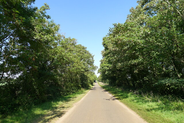
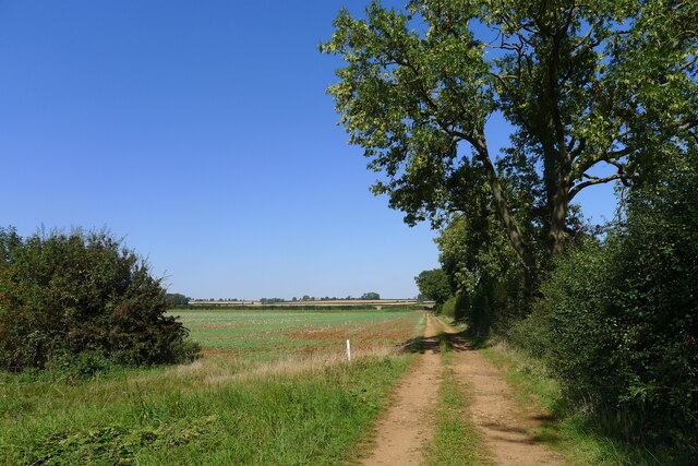
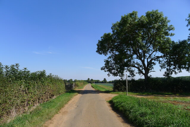
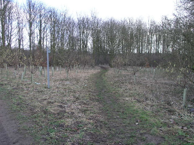
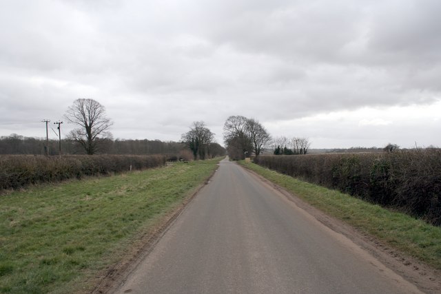
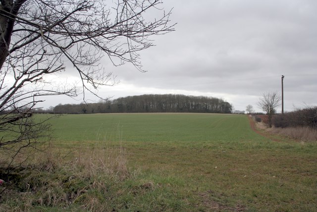
Mill Plantation is a picturesque woodland located in Lincolnshire, England. Covering an area of approximately 100 acres, it is a popular destination for nature enthusiasts and hikers. The plantation is characterized by its dense and diverse collection of trees, creating a lush and vibrant forest environment.

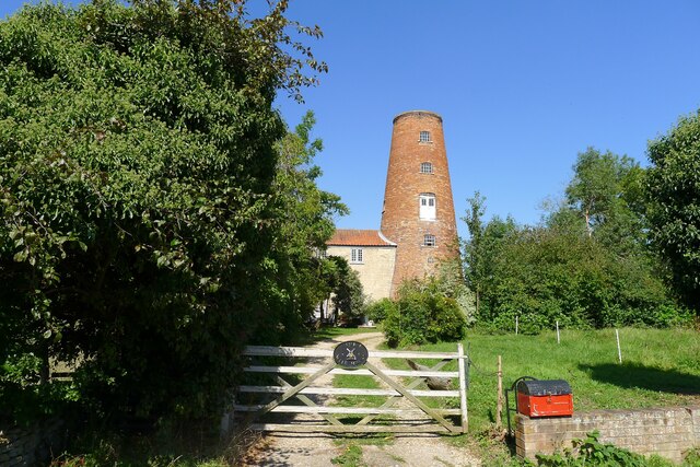
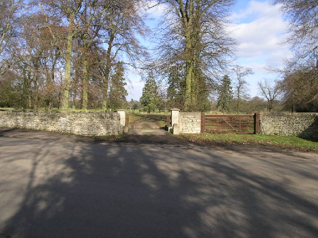
One of the prominent features of Mill Plantation is its historic mill, which dates back to the 19th century. The mill stands tall and proud, serving as a reminder of the area's rich industrial past. Visitors can explore the mill and learn about its fascinating history through informative displays and exhibits.

The woodland itself is home to a wide variety of flora and fauna. The tree species found in the plantation include oak, beech, ash, and birch, among others. This diversity provides a habitat for numerous bird species, making it a haven for birdwatchers. Wildlife enthusiasts may also spot small mammals such as squirrels, rabbits, and hedgehogs scurrying through the undergrowth.

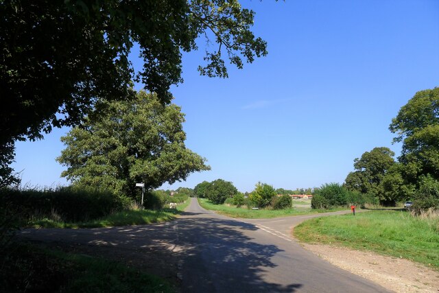
Mill Plantation offers a range of recreational activities for visitors to enjoy. There are several well-maintained walking trails that wind their way through the woodland, allowing visitors to explore its natural beauty at their own pace. Picnic areas are scattered throughout the plantation, providing a peaceful spot to relax and enjoy the surroundings.

Overall, Mill Plantation is a charming woodland destination that offers a tranquil escape from the hustle and bustle of everyday life. With its rich history, diverse flora and fauna, and recreational opportunities, it is a must-visit for nature lovers and history enthusiasts alike.

If you have any feedback on the listing, please let us know in the comments section below.

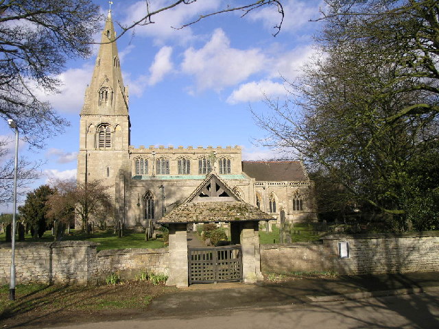
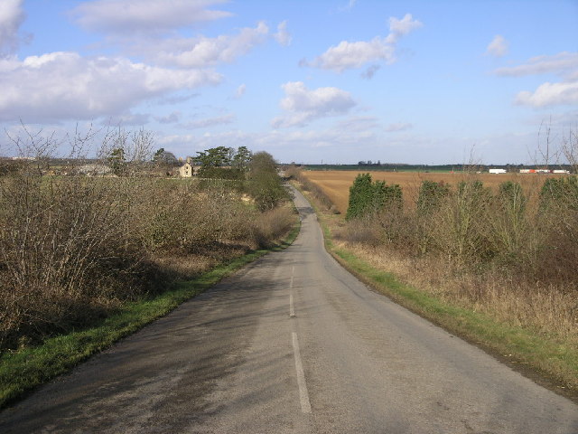
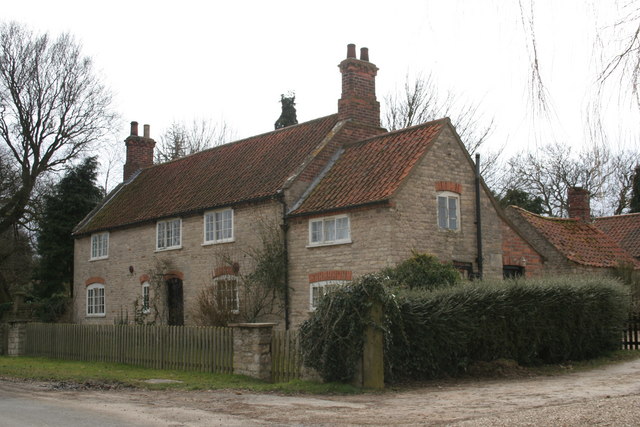
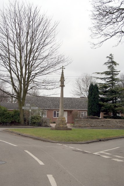
Mill Plantation Images

Images are sourced within 2km of 52.999881/-0.47943392 or Grid Reference TF0245. Thanks to Geograph Open Source API. All images are credited.

Thorpe Drove climbing the flank of Cliff Hill At the eastern end of the Ancaster Gap
Thorpe Drove climbing the flank of Cliff Hill
At the eastern end of the Ancaster Gap
Thorpe Drove leading to South Rauceby Waterwell lane to the left, and Cliffe View to the right.
Thorpe Drove leading to South Rauceby
Waterwell lane to the left, and Cliffe View to the right.
The Bustard Inn, South Rauceby Listed Grade II, from 1860 <span class="nowrap"><a title="https://thebustardinn.co.uk/" rel="nofollow ugc noopener" href="https://thebustardinn.co.uk/">Link</a><img style="margin-left:2px;" alt="External link" title="External link - shift click to open in new window" src="https://s1.geograph.org.uk/img/external.png" width="10" height="10"/></span>. But the last bustard in Britain died in the 1830s, so when did the inn get its name?
The Bustard Inn, South Rauceby
Listed Grade II, from 1860 LinkExternal link. But the last bustard in Britain died in the 1830s, so when did the inn get its name?
70 Main Street, South Rauceby Listed Grade II, a former early 19th century tower mill <span class="nowrap"><a title="https://historicengland.org.uk/listing/the-list/list-entry/1061775?section=official-list-entry" rel="nofollow ugc noopener" href="https://historicengland.org.uk/listing/the-list/list-entry/1061775?section=official-list-entry">Link</a><img style="margin-left:2px;" alt="External link" title="External link - shift click to open in new window" src="https://s1.geograph.org.uk/img/external.png" width="10" height="10"/></span>
70 Main Street, South Rauceby
Listed Grade II, a former early 19th century tower mill LinkExternal link
Track running towards Waterwell Lane
Waterwell Lane heading east towards South Rauceby The footpath runs south-west to Wilford
Waterwell Lane heading east towards South Rauceby
The footpath runs south-west to Wilford
Field of carrots south of Waterwell Lane Carrots prefer a sandy, stone-free soil, provided here by Quaternary sand deposits in the Ancaster Gap.
Field of carrots south of Waterwell Lane
Carrots prefer a sandy, stone-free soil, provided here by Quaternary sand deposits in the Ancaster Gap.
Waterwell Lane Remnants of a Lincolnshire Limestone dry stone wall bound long sections of the north side of the lane.
Waterwell Lane
Remnants of a Lincolnshire Limestone dry stone wall bound long sections of the north side of the lane.
Footpath To Quarrington This footpath leads from South Rauceby through a small copse and over the fields to Quarrington.
Footpath To Quarrington
This footpath leads from South Rauceby through a small copse and over the fields to Quarrington.
Cattle Grid Access This access gate to Rauceby Hall is protected by a cattle grid.
Cattle Grid Access
This access gate to Rauceby Hall is protected by a cattle grid.
St Peter's Church St Peter's Church in North Rauceby has an interesting lyche gate with a carved inscription which suggests it was built in memory of a former parishioner.
St Peter's Church
St Peter's Church in North Rauceby has an interesting lyche gate with a carved inscription which suggests it was built in memory of a former parishioner.
A17 Horizon The A17 runs along the horizon with Cranwell just beyond.
A17 Horizon
The A17 runs along the horizon with Cranwell just beyond.
Farmhouse at North Rauceby
The village cross at North Rauceby
Thorpe Drove, South Rauceby
Stack Hill woods
Stack Hill woods
St.Peter's church, North Rauceby
St.Peter's tower & spire
Show me another place!

Mill Plantation is located at Grid Ref: TF0245 (Lat: 52.999881, Lng: -0.47943392)

Administrative County: Lincolnshire

District: North Kesteven

Police Authority: Lincolnshire

What 3 Words

///picturing.month.invested. Near Ancaster, Lincolnshire

Related Wikis

South Rauceby

South Rauceby is a village and civil parish in the North Kesteven district of Lincolnshire, England. It is situated 2.5 miles (4.0 km) west from Sleaford...

North Rauceby

North Rauceby is a village and civil parish in the North Kesteven district of Lincolnshire, England. It is situated 4 miles (6 km) north-west from Sleaford...

South Rauceby Hall

South Rauceby Hall, South Rauceby, Lincolnshire, England is a country house dating from the mid-19th century. It was designed by William Burn in 1842 for...

Rauceby railway station

Rauceby railway station is a station near the town of Sleaford, Lincolnshire, England, lying close to the western border of the Parish of Old Sleaford...

Rauceby Hospital

Rauceby Hospital, originally called Kesteven County Asylum, is a now-defunct mental institution in the parish of Quarrington, Lincolnshire, England. Originally...

Wilsford, Lincolnshire

Wilsford is a village and civil parish in the North Kesteven district of Lincolnshire, England. The population of the civil parish was 400 at the 2011...

No. 16 Squadron RAF

Number 16 Squadron Royal Air Force, nicknamed 'the Saints', is a flying squadron of the Royal Air Force (RAF) who currently provide elementary flying training...

RAF Cranwell

Royal Air Force Cranwell or more simply RAF Cranwell (ICAO: EGYD) is a Royal Air Force station in Lincolnshire, England, close to the village of Cranwell...

Nearby Amenities

Located within 500m of 52.999881,-0.47943392
Bus Stop
Tom Lane
Naptan AtcoCode: 270000008394
Naptan Bearing: E
Naptan CommonName: Tom Lane
Naptan Indicator: adj
Naptan Landmark: Tom Lane
Naptan NaptanCode: lingpwaj
Naptan Street: Main Street
Naptan Verified: no
Source: naptan_import
Lat/Long: 52.9978406/-0.4734984
Bus Stop
Primary School
Naptan AtcoCode: 270002700080
Naptan Bearing: SE
Naptan CommonName: Primary School
Naptan Indicator: opp
Naptan Landmark: Primary School
Naptan NaptanCode: linjtamt
Naptan Street: Tom Lane
Naptan Verified: no
Source: naptan_import
Lat/Long: 53.0028208/-0.4755731
Bus Stop
Primary School
Naptan AtcoCode: 2700LNRP2425
Naptan Bearing: NW
Naptan CommonName: Primary School
Naptan Indicator: adj
Naptan Landmark: Primary School
Naptan NaptanCode: linatada
Naptan Street: Tom Lane
Naptan Verified: no
Source: naptan_import
Lat/Long: 53.0027591/-0.4756647
Bus Stop
Tom Lane
Naptan AtcoCode: 2700LSRB1516
Naptan Bearing: W
Naptan CommonName: Tom Lane
Naptan Indicator: opp
Naptan Landmark: Tom Lane
Naptan NaptanCode: linamagw
Naptan Street: Main Street
Naptan Verified: no
Source: naptan_import
Lat/Long: 52.997752/-0.4736058
Tom Lane Hill
Place: locality
Source: Bing
Lat/Long: 52.9993203/-0.4727862
Historic Amenity: place_of_worship
Religion: christian
Lat/Long: 52.9980236/-0.4770141
The data included in this document is from www.openstreetmap.org. The data is made available under ODbL.

Have you been to Mill Plantation?

Leave your review of Mill Plantation below (or comments, questions and feedback).