Beetlehook Common

Wood, Forest in Sussex Chichester

England

Beetlehook Common

Foxbridge Golf Club from the air Wephurst Wood lies to the east of the course; Furze Field and Broad Field, also shown in <a href="https://www.geograph.org.uk/photo/5151386">TQ0129 : Woodland near Ifold from the air</a>, are at lower left. Ifold is the village set in woodland at the top.
Foxbridge Golf Club from the air Credit: Derek Harper

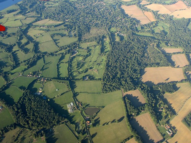
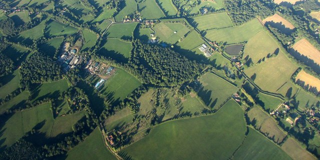
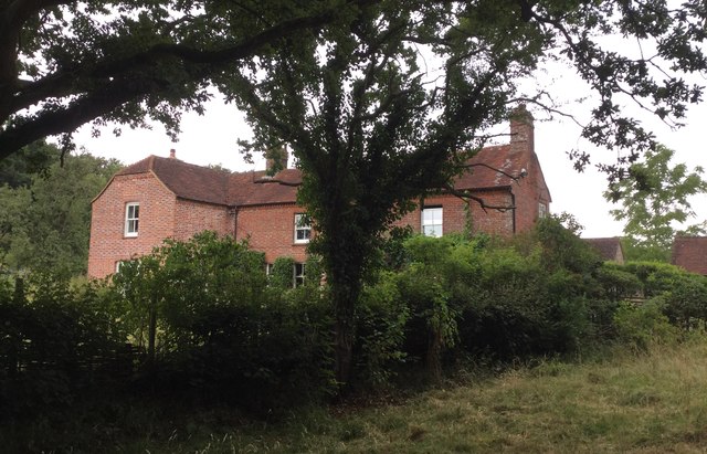
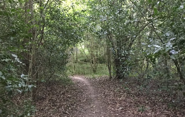
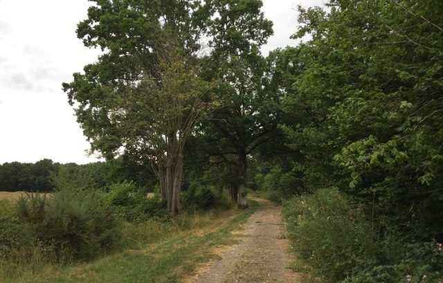
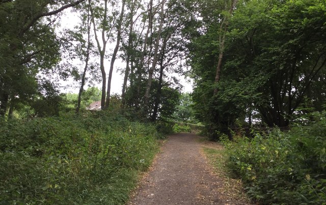
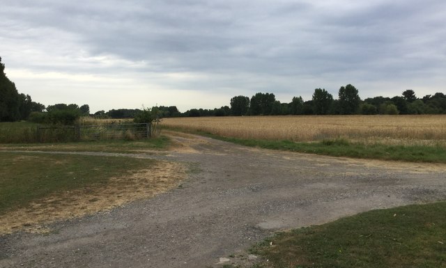
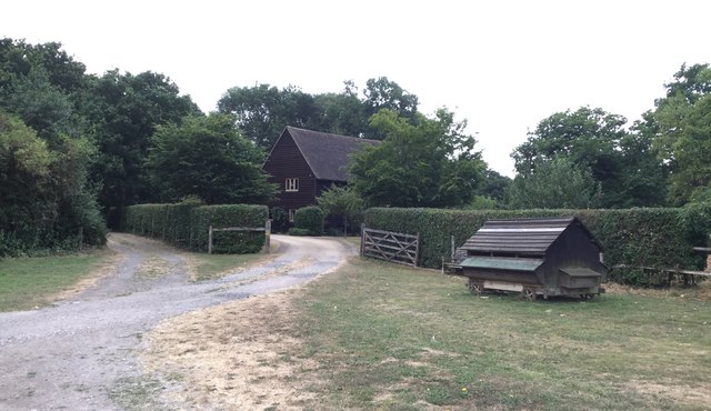
Beetlehook Common is a picturesque woodland area located in Sussex, England. Situated in the heart of the South Downs National Park, it covers an expansive area of approximately 500 acres. The common is known for its dense forest, comprising predominantly of oak, beech, and birch trees, which provide a stunning canopy of green throughout the year.

The woodland is a haven for wildlife, offering a diverse range of habitats for various species. It is home to a rich array of birdlife, including woodpeckers, owls, and songbirds, which can often be heard singing their melodic tunes. In addition, the common provides a habitat for deer, foxes, badgers, and an array of small mammals and insects.

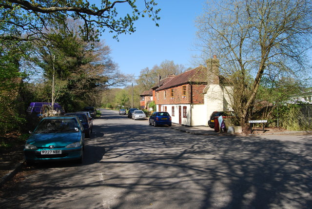
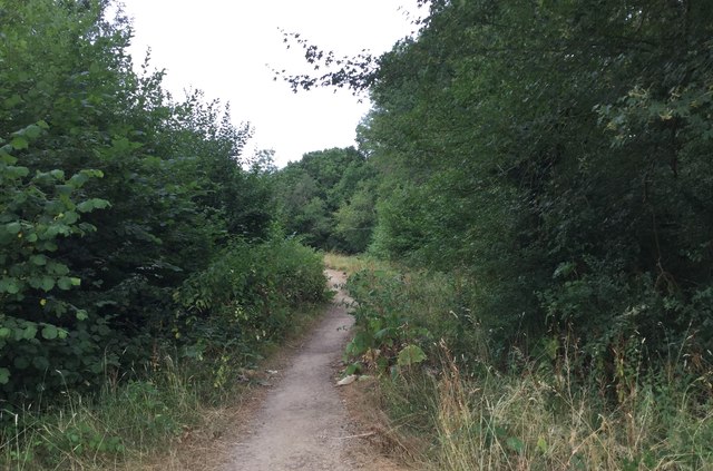
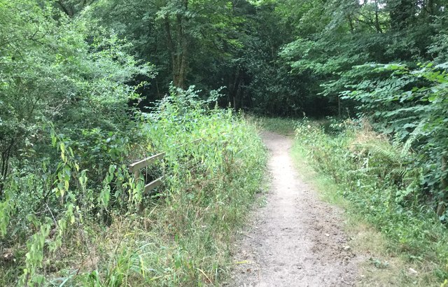
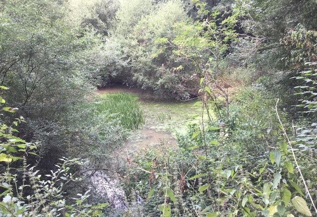
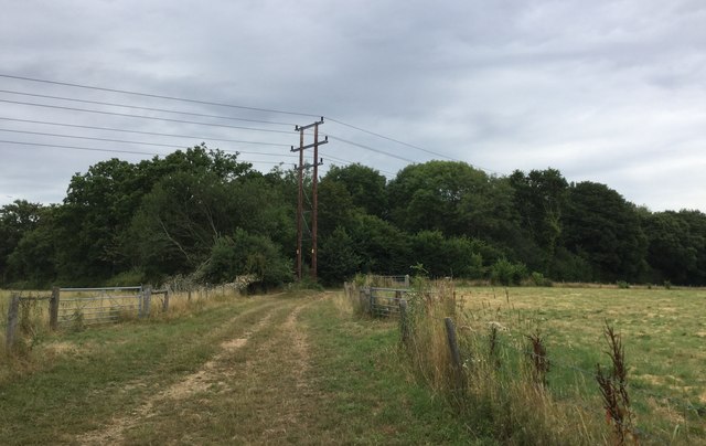
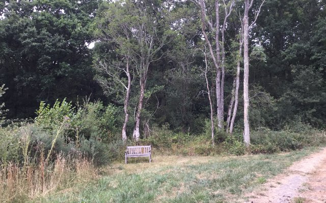
Beetlehook Common offers a tranquil escape for nature enthusiasts and outdoor enthusiasts alike. The area boasts a network of well-maintained trails and footpaths, allowing visitors to explore the beauty of the woodland at their own pace. The walking routes provide opportunities to discover hidden ponds, ancient trees, and breathtaking views across the surrounding countryside.

The common is also a popular spot for recreational activities such as picnicking, wildlife watching, and photography. The serene atmosphere and natural beauty of Beetlehook Common make it an ideal location for those seeking a peaceful retreat or a place to connect with nature.

Overall, Beetlehook Common is a captivating woodland area in Sussex, offering a sanctuary for wildlife and a place of tranquility for visitors to enjoy the beauty of nature in a serene setting.

If you have any feedback on the listing, please let us know in the comments section below.

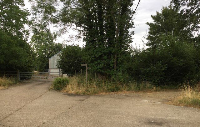
Beetlehook Common Images

Images are sourced within 2km of 51.043001/-0.55352349 or Grid Reference TQ0128. Thanks to Geograph Open Source API. All images are credited.

Foxbridge Golf Club from the air Wephurst Wood lies to the east of the course; Furze Field and Broad Field, also shown in <a href="https://www.geograph.org.uk/photo/5151386">TQ0129 : Woodland near Ifold from the air</a>, are at lower left. Ifold is the village set in woodland at the top.
Foxbridge Golf Club from the air
Wephurst Wood lies to the east of the course; Furze Field and Broad Field, also shown in TQ0129 : Woodland near Ifold from the air, are at lower left. Ifold is the village set in woodland at the top.
Woodland near Ifold from the air The woods at Furze Field and Broad Field also appear in the aerial shot at <a href="https://www.geograph.org.uk/photo/5151368">TQ0229 : Foxbridge Golf Club from the air</a>. The houses at the top are along Rickman's Lane. Left of the wood is Crouchlands Farm.
Woodland near Ifold from the air
The woods at Furze Field and Broad Field also appear in the aerial shot at TQ0229 : Foxbridge Golf Club from the air. The houses at the top are along Rickman's Lane. Left of the wood is Crouchlands Farm.
Road through Kirdford
The Bothy The Bothy at Barkfold Manor.
The Bothy
The Bothy at Barkfold Manor.
Barkfold Farmhouse
Barkfold Farmhouse
Path Junction at Barkfold Farm
Bridleway beside Kiln Copse
Underneath the flight path for Gatwick A number of planes were passing overhead at this point and making a final turn to the right to begin the landing approach for Gatwick Airport. This plane was the Norwegian Air International flight IBK1RL from Oslo at around 5,000 feet according to the Flightradar24 app on my smartphone.
Underneath the flight path for Gatwick
A number of planes were passing overhead at this point and making a final turn to the right to begin the landing approach for Gatwick Airport. This plane was the Norwegian Air International flight IBK1RL from Oslo at around 5,000 feet according to the Flightradar24 app on my smartphone.
Bridge over the Boxal Brook Crossing the Boxal Brook over a fairly well hidden bridge.
Bridge over the Boxal Brook
Crossing the Boxal Brook over a fairly well hidden bridge.
Pond at Boxal Brook A small pond formed by the Boxal Brook, which was probably connected with the former Ironworks sited in Kiln Copse.
Pond at Boxal Brook
A small pond formed by the Boxal Brook, which was probably connected with the former Ironworks sited in Kiln Copse.
Path through Kiln Copse
Approaching Barkfold Rough
Bridleway beside Barkfold Rough
Seat beside Barkfold Rough An isolated seat beside the woodland and the bridleway.
Seat beside Barkfold Rough
An isolated seat beside the woodland and the bridleway.
Approaching Chandler’s Barn On the bridleway nearing Chandler’s Barn.
Approaching Chandler’s Barn
On the bridleway nearing Chandler’s Barn.
Chandler’s Barn The barn viewed from the passing bridleway.
Chandler’s Barn
The barn viewed from the passing bridleway.
Four way Junction The junction of paths at Chandler’s Barn.
Four way Junction
The junction of paths at Chandler’s Barn.
Driveway to Chandler’s Barn
Show me another place!

Beetlehook Common is located at Grid Ref: TQ0128 (Lat: 51.043001, Lng: -0.55352349)

Administrative County: West Sussex

District: Chichester

Police Authority: Sussex

What 3 Words

///riskiest.farmer.soccer. Near Billingshurst, West Sussex

Related Wikis

St Ronan's School

Saint Ronan's School is an independent co-educational preparatory school for boys and girls from 3 to 13 years located in Hawkhurst in Kent, England. It...

Kirdford

Kirdford is a village and civil parish in the Chichester District of West Sussex, England. Its nearest town is Petworth, located 6.5 miles (10.5 km) southwest...

Petworth (electoral division)

Petworth is an electoral division of West Sussex in the United Kingdom, and returns one member to sit on West Sussex County Council. == Extent == The division...

Ifold

Ifold is a hamlet in West Sussex and part of the civil Parish of Plaistow, of which it is the largest settlement. Ifold is classified as a hamlet, because...

Plaistow, West Sussex

Plaistow ( PLAST-oh) is a village and civil parish in the north of the Chichester District of West Sussex, England. There is a village green, a recreation...

Loxwood F.C.

Loxwood Football Club is a football club based in Loxwood, West Sussex, England. Nicknamed "The Magpies" and affiliated to the Surrey County FA, they are...

Balls Cross

Balls Cross is a hamlet in Ebernoe civil parish in the Chichester District of West Sussex, England.The hamlet comprises a few houses together with a small...

Ebernoe

Ebernoe is a hamlet and civil parish in the District of Chichester in West Sussex, England, and 4 miles (6 km) north of Petworth near the A283 road. The...

Nearby Amenities

Located within 500m of 51.043001,-0.55352349
Bus Stop
Mackerel's Common
Naptan AtcoCode: 4400HR0274
Naptan Bearing: SW
Naptan BusStopType: CUS
Naptan CommonName: Mackerel's Common
Naptan Indicator: opp 15
Naptan Landmark: Mackerel's Common
Naptan NaptanCode: wsxawadw
Naptan Street: Plaistow Road
Naptan Verified: no
Source: naptan_import
Lat/Long: 51.0437472/-0.5489312
Bus Stop
Mackerel's Common
Naptan AtcoCode: 4400HR0275
Naptan Bearing: NE
Naptan BusStopType: CUS
Naptan CommonName: Mackerel's Common
Naptan Indicator: o/s 18
Naptan Landmark: Mackerel's Common
Naptan NaptanCode: wsxawaga
Naptan Street: Plaistow Road
Naptan Verified: no
Source: naptan_import
Lat/Long: 51.0440349/-0.5489222
Bus Stop
Plaistow Road
Naptan AtcoCode: 4400HR0929
Naptan Bearing: SW
Naptan BusStopType: CUS
Naptan CommonName: Plaistow Road
Naptan Indicator: HAR
Naptan Landmark: Hail & Ride
Naptan NaptanCode: wsxgajmg
Naptan Street: Plaistow Road
Naptan Verified: no
Source: naptan_import
Lat/Long: 51.0398269/-0.553333
Bus Stop
Plaistow Road
Naptan AtcoCode: 4400HR0930
Naptan Bearing: NE
Naptan BusStopType: CUS
Naptan CommonName: Plaistow Road
Naptan Indicator: HAR
Naptan Landmark: Hail & Ride
Naptan NaptanCode: wsxgajmj
Naptan Street: Plaistow Road
Naptan Verified: no
Source: naptan_import
Lat/Long: 51.0398553/-0.5534462
Post Box
Operator: Royal Mail
Post Box Type: wall
Ref: RH14 65
Royal Cypher: EVIIR
Royal Cypher Wikidata: Q33102324
Lat/Long: 51.0433282/-0.5493003
Mackerel's Common
Place: hamlet
Lat/Long: 51.0429184/-0.5515587
The data included in this document is from www.openstreetmap.org. The data is made available under ODbL.

Have you been to Beetlehook Common?

Leave your review of Beetlehook Common below (or comments, questions and feedback).