Ham Lands

Wood, Forest in Surrey Waverley

England

Ham Lands

National Cycle Network route 22 near Bramley This path, shared by pedestrians and cyclists, forms part of National Cycle Network route 22.  The bridge ahead carries the Downs Link path, on a former railway alignment, across the path.
National Cycle Network route 22 near Bramley Credit: Malc McDonald

Ham Lands is a picturesque woodland located in Surrey, England. Stretching across an area of approximately 72 hectares, it is nestled between the River Thames and Richmond Park. This enchanting landscape provides a serene escape from the bustling city life of London.

Ham Lands is characterized by its diverse range of flora and fauna, making it a popular destination for nature enthusiasts and wildlife lovers. The woodland is dominated by a mix of trees, including oak, birch, and beech, which provide a rich canopy and a home to numerous bird species. The forest floor is adorned with a vibrant carpet of bluebells and wildflowers during spring, adding to the beauty of the surroundings.

The River Thames borders the eastern side of Ham Lands, offering stunning river views and opportunities for recreational activities such as fishing and boating. The riverbank also supports a variety of aquatic life, including fish, waterfowl, and amphibians.

The woodlands of Ham Lands have a long history, dating back to ancient times. It has been used for various purposes over the years, including timber production and agricultural practices. Today, it is managed by the local council and conservation organizations to preserve its natural beauty and protect its wildlife.

Visitors to Ham Lands can enjoy a range of activities, such as walking, cycling, and picnicking, along the well-maintained paths that wind through the woodland. The area is also a popular spot for dog walkers, providing ample space for pets to roam and explore.

Overall, Ham Lands is a tranquil oasis in Surrey, offering a perfect blend of natural beauty, wildlife, and recreational opportunities for visitors to enjoy.

If you have any feedback on the listing, please let us know in the comments section below.

Ham Lands Images

Images are sourced within 2km of 51.181058/-0.57344397 or Grid Reference SU9943. Thanks to Geograph Open Source API. All images are credited.

National Cycle Network route 22 near Bramley This path, shared by pedestrians and cyclists, forms part of National Cycle Network route 22.  The bridge ahead carries the Downs Link path, on a former railway alignment, across the path.
National Cycle Network route 22 near Bramley
This path, shared by pedestrians and cyclists, forms part of National Cycle Network route 22. The bridge ahead carries the Downs Link path, on a former railway alignment, across the path.
National Cycle Network route 22 near Bramley This path, shared by people walking and cycling, forms part of National Cycle Network route 22.  The bridge ahead carries another shared path, the Downs Link, which follows the course of a dismantled railway.
National Cycle Network route 22 near Bramley
This path, shared by people walking and cycling, forms part of National Cycle Network route 22. The bridge ahead carries another shared path, the Downs Link, which follows the course of a dismantled railway.
Bramley - Old Pound This pleasant little walled garden beside the parish church on Bramley's High Street was used in the 19th century as a cattle pound.
Bramley - Old Pound
This pleasant little walled garden beside the parish church on Bramley's High Street was used in the 19th century as a cattle pound.
Bramley - Jolly Farmer "The Jolly" is an independent and family-run historic pub on Bramley's High Street. Its interior is notable for its "breweriana".
<span class="nowrap"><a title="www.jollyfarmer.co.uk" rel="nofollow ugc noopener" href="http://www.jollyfarmer.co.uk">Link</a><img style="margin-left:2px;" alt="External link" title="External link - shift click to open in new window" src="https://s1.geograph.org.uk/img/external.png" width="10" height="10"/></span>
Bramley - Jolly Farmer
"The Jolly" is an independent and family-run historic pub on Bramley's High Street. Its interior is notable for its "breweriana". LinkExternal link
Bramley - Jolly Farmer Sign "The Jolly" has a jovial pub sign and is an independent and family-run historic pub on Bramley's High Street. Its interior is notable for its "breweriana".
<span class="nowrap"><a title="www.jollyfarmer.co.uk" rel="nofollow ugc noopener" href="http://www.jollyfarmer.co.uk">Link</a><img style="margin-left:2px;" alt="External link" title="External link - shift click to open in new window" src="https://s1.geograph.org.uk/img/external.png" width="10" height="10"/></span>
Bramley - Jolly Farmer Sign
"The Jolly" has a jovial pub sign and is an independent and family-run historic pub on Bramley's High Street. Its interior is notable for its "breweriana". LinkExternal link
Catteshall Grange On Catteshall Road.
Catteshall Grange
On Catteshall Road.
Former engine house for Catteshall paper mills Now residential, along with the rest of the mill site.
Former engine house for Catteshall paper mills
Now residential, along with the rest of the mill site.
Postbox on a muddy corner Reference GU7 23, on the corner of Brock's Close, Catteshall.
Postbox on a muddy corner
Reference GU7 23, on the corner of Brock's Close, Catteshall.
Catteshall Terrace on Catteshall Road This is the old route of the road, which appears to have retained its identity although the newer corner cutting road off to the right is also Catteshall Road to map makers, it is not actually plated.
Catteshall Terrace on Catteshall Road
This is the old route of the road, which appears to have retained its identity although the newer corner cutting road off to the right is also Catteshall Road to map makers, it is not actually plated.
Esso garage on the corner of Station Road, Bramley
Mill Pond, Bramley
Mill Pond, Bramley
Large house on Thorncombe Street I thought this was a row of cottages but it only has one front door
Large house on Thorncombe Street
I thought this was a row of cottages but it only has one front door
Barn at Slades Farm
Barn at Slades Farm
Landscape Near Thorncombe Street Located to the south-east of the village.
Landscape Near Thorncombe Street
Located to the south-east of the village.
Bramley - The Jolly Farmer Inn Old sign at this popular village pub.
Bramley - The Jolly Farmer Inn
Old sign at this popular village pub.
Holy Trinity, Bramley: early February 2017
Holy Trinity, Bramley: incumbency board
Holy Trinity, Bramley: font
Show me another place!

Ham Lands is located at Grid Ref: SU9943 (Lat: 51.181058, Lng: -0.57344397)

Administrative County: Surrey

District: Waverley

Police Authority: Surrey

What 3 Words

///outfit.slim.edges. Near Bramley, Surrey

Related Wikis

Orchards, Surrey

Orchards is an Arts and Crafts style house in Bramley in Surrey, England. It is on Bramley's boundary with Busbridge and 1 mile (1.6 km) south-east of...

Munstead Wood

Munstead Wood is a Grade I listed house and garden in Munstead Heath, Busbridge on the boundary of the town of Godalming in Surrey, England, 1 mile (1...
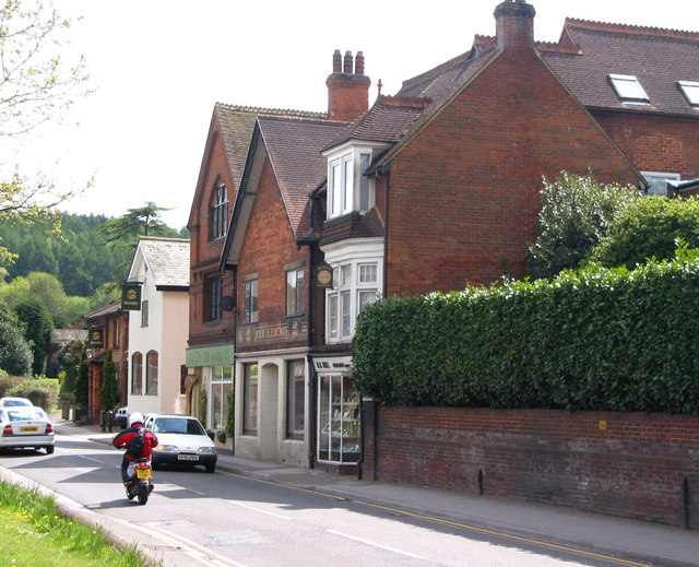
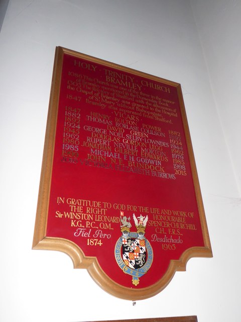
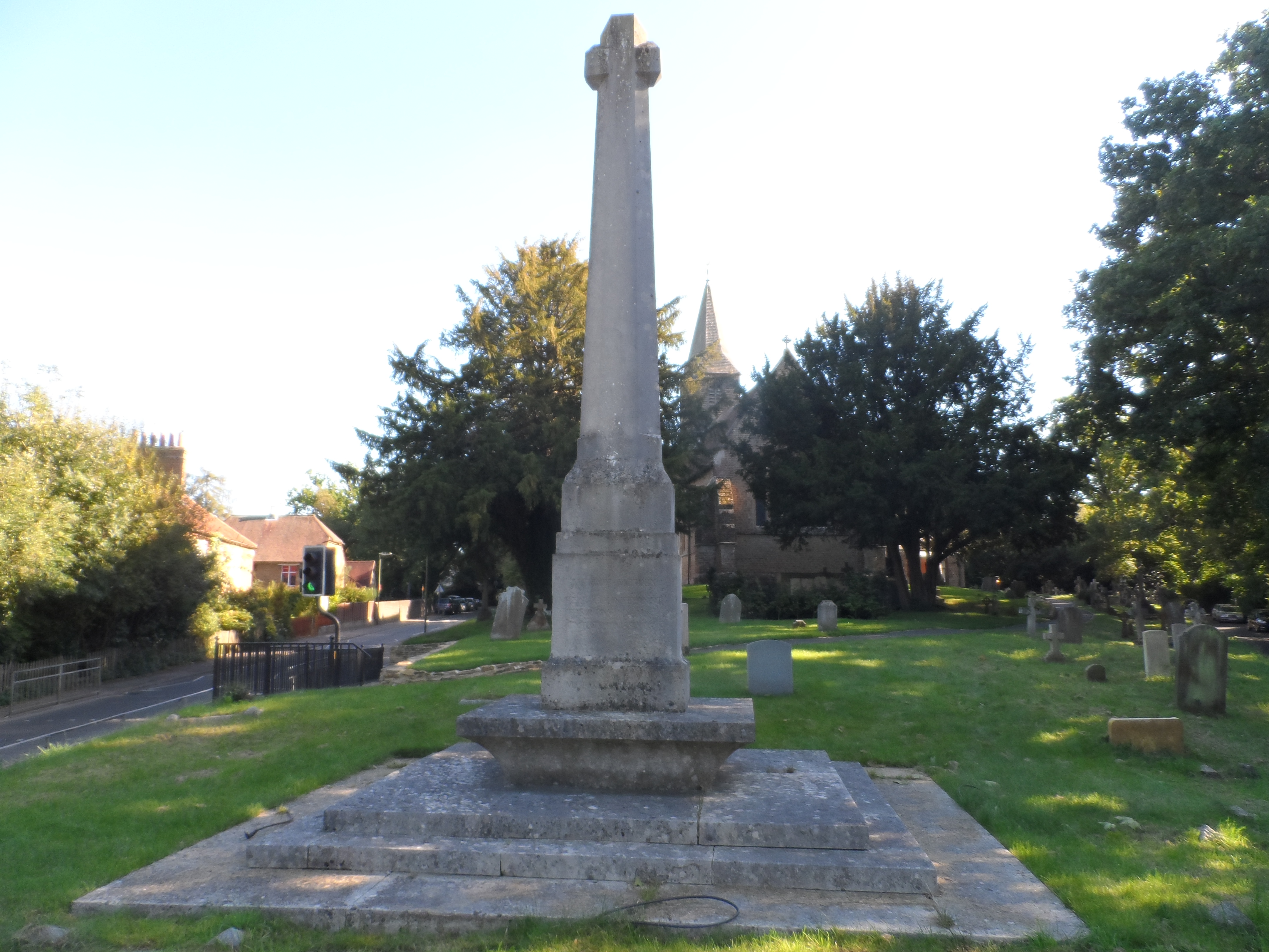
Bramley, Surrey

Bramley is a village and civil parish about three miles (5 km) south of Guildford in the Borough of Waverley in Surrey, south east England. Most of the...

Jekyll Memorial, Busbridge

The Jekyll Memorial, Busbridge, Surrey, England, commemorates the gardener Gertrude Jekyll and members of her family. Designed by Jekyll's friend and collaborator...

Busbridge

Busbridge is a village and civil parish in the borough of Waverley in Surrey, England that adjoins the town of Godalming. It forms part of the Waverley...

Busbridge Church

Busbridge Church or St John the Baptist Church, is an evangelical Anglican Church in Busbridge, Godalming, England. Busbridge Church is part of a joint...

Busbridge War Memorial

Busbridge War Memorial is a First World War memorial in the churchyard of St John's Church in village of Busbridge in Surrey, south-eastern England. Designed...

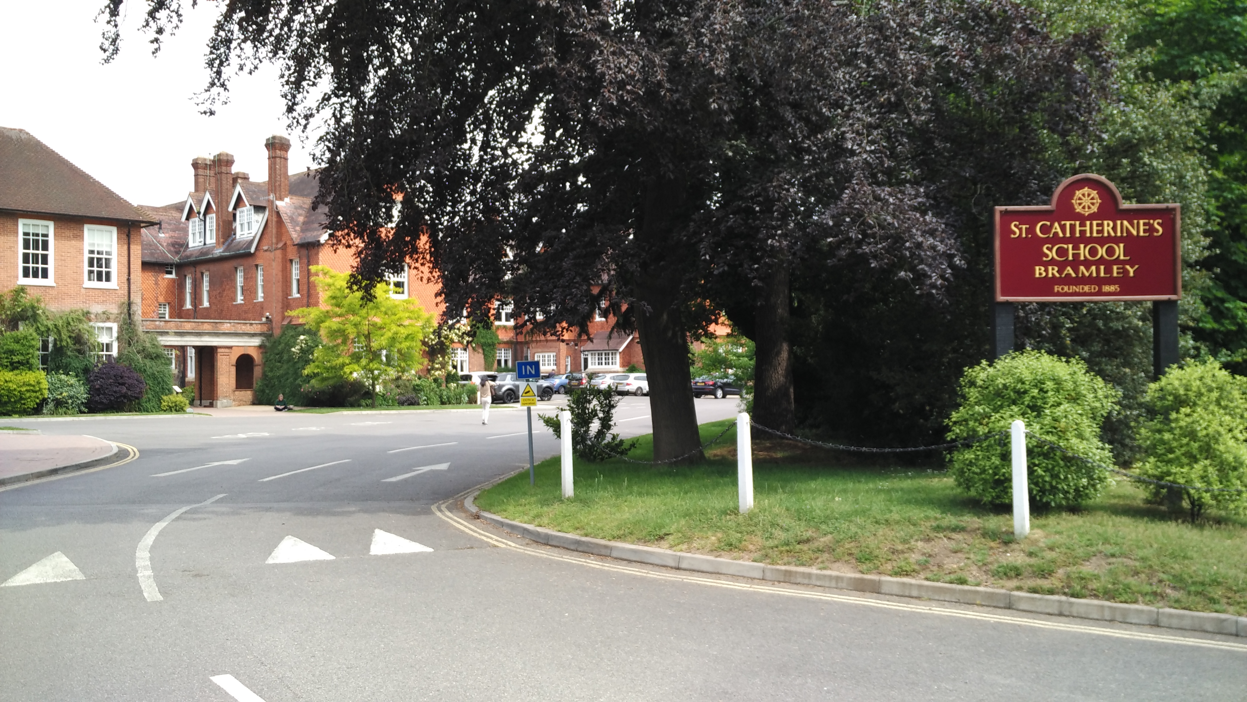
St Catherine's School, Bramley

St Catherine's School is an independent girls' boarding and day school in the village of Bramley, near Guildford, Surrey, England. The school is divided...

Nearby Amenities

Located within 500m of 51.181058,-0.57344397
Orchard Cottage
Building: yes
Lat/Long: 51.1853698/-0.5721267
The data included in this document is from www.openstreetmap.org. The data is made available under ODbL.

Have you been to Ham Lands?

Leave your review of Ham Lands below (or comments, questions and feedback).