Daintry Wood

Wood, Forest in Bedfordshire

England

Daintry Wood

Fields near Castle farm Washers Wood in the distance.
Fields near Castle farm Credit: James Emmans

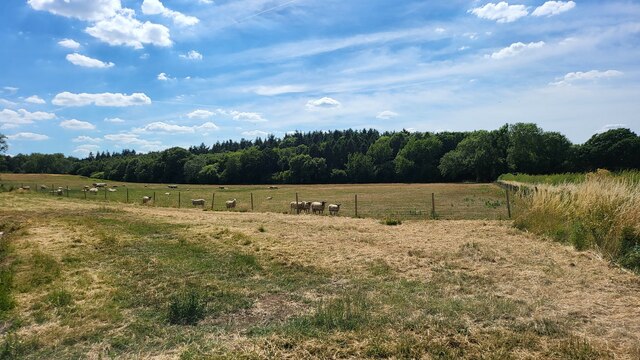
Daintry Wood is a serene and picturesque woodland located in Bedfordshire, England. Covering an area of approximately 50 acres, it is nestled within the charming rural landscape of the Bedfordshire countryside. The woodland is known for its rich biodiversity and stunning natural beauty, making it a popular destination for nature enthusiasts and hikers alike.

Daintry Wood is predominantly made up of deciduous trees such as oak, beech, and birch, which provide a dense canopy and create a tranquil atmosphere. The forest floor is adorned with vibrant wildflowers, ferns, and mosses, adding to the area's enchanting ambiance. Various species of birds, including woodpeckers and songbirds, can be spotted flitting among the branches, while small mammals like squirrels and rabbits scuttle through the undergrowth.

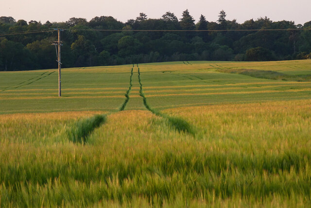
The woodland is crisscrossed with well-maintained footpaths and trails, allowing visitors to explore the area at their own pace. The paths wind through the woods, offering glimpses of babbling brooks and small ponds along the way. These water features are home to a diverse range of aquatic life, including frogs, newts, and dragonflies.

Daintry Wood is not only a haven for flora and fauna but also offers recreational activities for visitors. Picnic areas are scattered throughout the forest, inviting families and friends to relax and enjoy the peaceful surroundings. The woodland is also a popular spot for photography enthusiasts, who are drawn to its idyllic landscapes and the opportunity to capture the changing seasons.

Overall, Daintry Wood in Bedfordshire is a delightful destination for individuals seeking solace in nature, offering a tranquil escape from the hustle and bustle of everyday life.

If you have any feedback on the listing, please let us know in the comments section below.

Daintry Wood Images

Images are sourced within 2km of 51.971859/-0.54851358 or Grid Reference SP9931. Thanks to Geograph Open Source API. All images are credited.

Fields near Castle farm Washers Wood in the distance.
Fields near Castle farm
Washers Wood in the distance.
Farmland, Toddington Oats to the north-west of Happy Land Farm.
Farmland, Toddington
Oats to the north-west of Happy Land Farm.
Farmland, Tingrith Spring barley to the north of Castle Farm.
Farmland, Tingrith
Spring barley to the north of Castle Farm.
Matrix gantry - M1 southbound
Footbridge over M1 southbound
Matrix gantry - M1 southbound
Field access track Wood House is in Daintry Wood uses this track.
Field access track
Wood House is in Daintry Wood uses this track.
Southbound M1 near to Tingrith The M1 is a north–south motorway connecting London to Leeds, where it joins the A1(M) near Aberford. It was the first motorway to be completed in the United Kingdom.
The motorway is 193 miles long and was constructed in four phases. Most of the motorway was opened between 1959 and 1968 but the southern end was extended in 1977 and the northern end was extended in 1999.
Southbound M1 near to Tingrith
The M1 is a north–south motorway connecting London to Leeds, where it joins the A1(M) near Aberford. It was the first motorway to be completed in the United Kingdom. The motorway is 193 miles long and was constructed in four phases. Most of the motorway was opened between 1959 and 1968 but the southern end was extended in 1977 and the northern end was extended in 1999.
Bridge Over the M1 near Tingrith The M1 is a north–south motorway connecting London to Leeds, where it joins the A1(M) near Aberford. It was the first motorway to be completed in the United Kingdom.
The motorway is 193 miles long and was constructed in four phases. Most of the motorway was opened between 1959 and 1968 but the southern end was extended in 1977 and the northern end was extended in 1999.
Bridge Over the M1 near Tingrith
The M1 is a north–south motorway connecting London to Leeds, where it joins the A1(M) near Aberford. It was the first motorway to be completed in the United Kingdom. The motorway is 193 miles long and was constructed in four phases. Most of the motorway was opened between 1959 and 1968 but the southern end was extended in 1977 and the northern end was extended in 1999.
Southbound M1, Sign Gantry at Toddington Junction The sign gantry at junction 12 of the M1 (Toddington and Flitwick).
Southbound M1, Sign Gantry at Toddington Junction
The sign gantry at junction 12 of the M1 (Toddington and Flitwick).
St. John the Baptist, Eversholt One of the many chocolate-brown churches in this part of Bedfordshire. The blue shape in the foreground is not an apparition of the Holy Grail, but more prosaically lens glare !
More information about Eversholt and its church here <span class="nowrap"><a title="http://www.british-history.ac.uk/report.asp?compid=42449" rel="nofollow ugc noopener" href="http://www.british-history.ac.uk/report.asp?compid=42449">Link</a><img style="margin-left:2px;" alt="External link" title="External link - shift click to open in new window" src="https://s1.geograph.org.uk/img/external.png" width="10" height="10"/></span>
St. John the Baptist, Eversholt
One of the many chocolate-brown churches in this part of Bedfordshire. The blue shape in the foreground is not an apparition of the Holy Grail, but more prosaically lens glare ! More information about Eversholt and its church here LinkExternal link
St John the Baptist - Tower & Porch Eversholt is quite a straggly village, the church here is (unsurprisingly) at Church End but near to Brook End. Another part of the village is called Witts End - which I've been at many times! 
More information about Eversholt and its church here <span class="nowrap"><a title="http://www.british-history.ac.uk/report.asp?compid=42449" rel="nofollow ugc noopener" href="http://www.british-history.ac.uk/report.asp?compid=42449">Link</a><img style="margin-left:2px;" alt="External link" title="External link - shift click to open in new window" src="https://s1.geograph.org.uk/img/external.png" width="10" height="10"/></span>
St John the Baptist - Tower & Porch
Eversholt is quite a straggly village, the church here is (unsurprisingly) at Church End but near to Brook End. Another part of the village is called Witts End - which I've been at many times! More information about Eversholt and its church here LinkExternal link
The Green Man, Eversholt A solid looking pub directly opposite the church in Eversholt. Apparently it dates from 1835 
Own website - <span class="nowrap"><a title="http://www.greenmaneversholt.com/Home.html" rel="nofollow ugc noopener" href="http://www.greenmaneversholt.com/Home.html">Link</a><img style="margin-left:2px;" alt="External link" title="External link - shift click to open in new window" src="https://s1.geograph.org.uk/img/external.png" width="10" height="10"/></span>
The Green Man, Eversholt
A solid looking pub directly opposite the church in Eversholt. Apparently it dates from 1835 Own website - LinkExternal link
War Memorial, Eversholt In the churchyard of St.John the Baptist, Eversholt is this quite unusual war memorial topped by an angel (St. Michael perhaps) rather than the more usual cross.
War Memorial, Eversholt
In the churchyard of St.John the Baptist, Eversholt is this quite unusual war memorial topped by an angel (St. Michael perhaps) rather than the more usual cross.
View towards Tyrell's End Taken next to St. John the Baptist's church in Eversholt looking down the lane towards Tyrell's End.
View towards Tyrell's End
Taken next to St. John the Baptist's church in Eversholt looking down the lane towards Tyrell's End.
The Thatch, Brook End This cottage is called "The Thatch" appropriately enough. It is in a part of Eversholt called Brook End.
The Thatch, Brook End
This cottage is called "The Thatch" appropriately enough. It is in a part of Eversholt called Brook End.
Wheat Field near Milton Bryan A field of wheat looking ready for harvest. This field is to the south of Park Road which links Milton Bryan to Toddington. Just a few yards of the road cut the NE corner of the square, this field is to the southwest of that point.
Wheat Field near Milton Bryan
A field of wheat looking ready for harvest. This field is to the south of Park Road which links Milton Bryan to Toddington. Just a few yards of the road cut the NE corner of the square, this field is to the southwest of that point.
Track to Herne Farm Herne Farm has a lake and a fishery which is advertised at the beginning of this lane to the farm off Park Road near to Toddington.
Track to Herne Farm
Herne Farm has a lake and a fishery which is advertised at the beginning of this lane to the farm off Park Road near to Toddington.
Show me another place!

Daintry Wood is located at Grid Ref: SP9931 (Lat: 51.971859, Lng: -0.54851358)

Unitary Authority: Central Bedfordshire

Police Authority: Bedfordshire

What 3 Words

///puncture.motivate.verge. Near Eversholt, Bedfordshire

Related Wikis

Eversholt

Eversholt is a village and civil parish located in Bedfordshire, England. It was mentioned in the Domesday Book and is over 1000 years old. "Eversholt...

Tingrith

Tingrith is a small village and civil parish in Bedfordshire, England. It is located adjacent to the M1 motorway near the large village of Toddington....

Church of St Nicholas, Tingrith

The Church of St Nicholas is a Grade I listed church in Tingrith, Bedfordshire, England. It became a listed building on 23 January 1961.The brown sandstone...

Toddington Manor, Bedfordshire

Toddington Manor is a Tudor country house in the English county of Bedfordshire, near the village of Toddington and is a Grade II listed building with...

Nearby Amenities

Located within 500m of 51.971859,-0.54851358
Barrier: kissing_gate
Bicycle: no
Foot: designated
Horse: no
Motor Vehicle: no
Prow Ref: Tingrith FP 5
Lat/Long: 51.972856/-0.551437
Barrier: kissing_gate
Foot: designated
Lat/Long: 51.9699753/-0.5516658
The data included in this document is from www.openstreetmap.org. The data is made available under ODbL.

Have you been to Daintry Wood?

Leave your review of Daintry Wood below (or comments, questions and feedback).