Coxley Bushes

Wood, Forest in Bedfordshire

England

Coxley Bushes

Fields near Castle farm Washers Wood in the distance.
Fields near Castle farm Credit: James Emmans

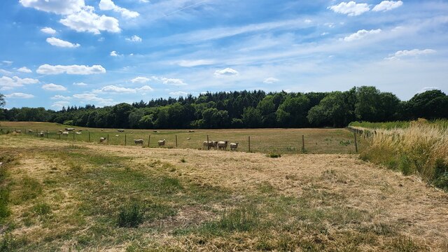
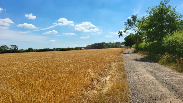
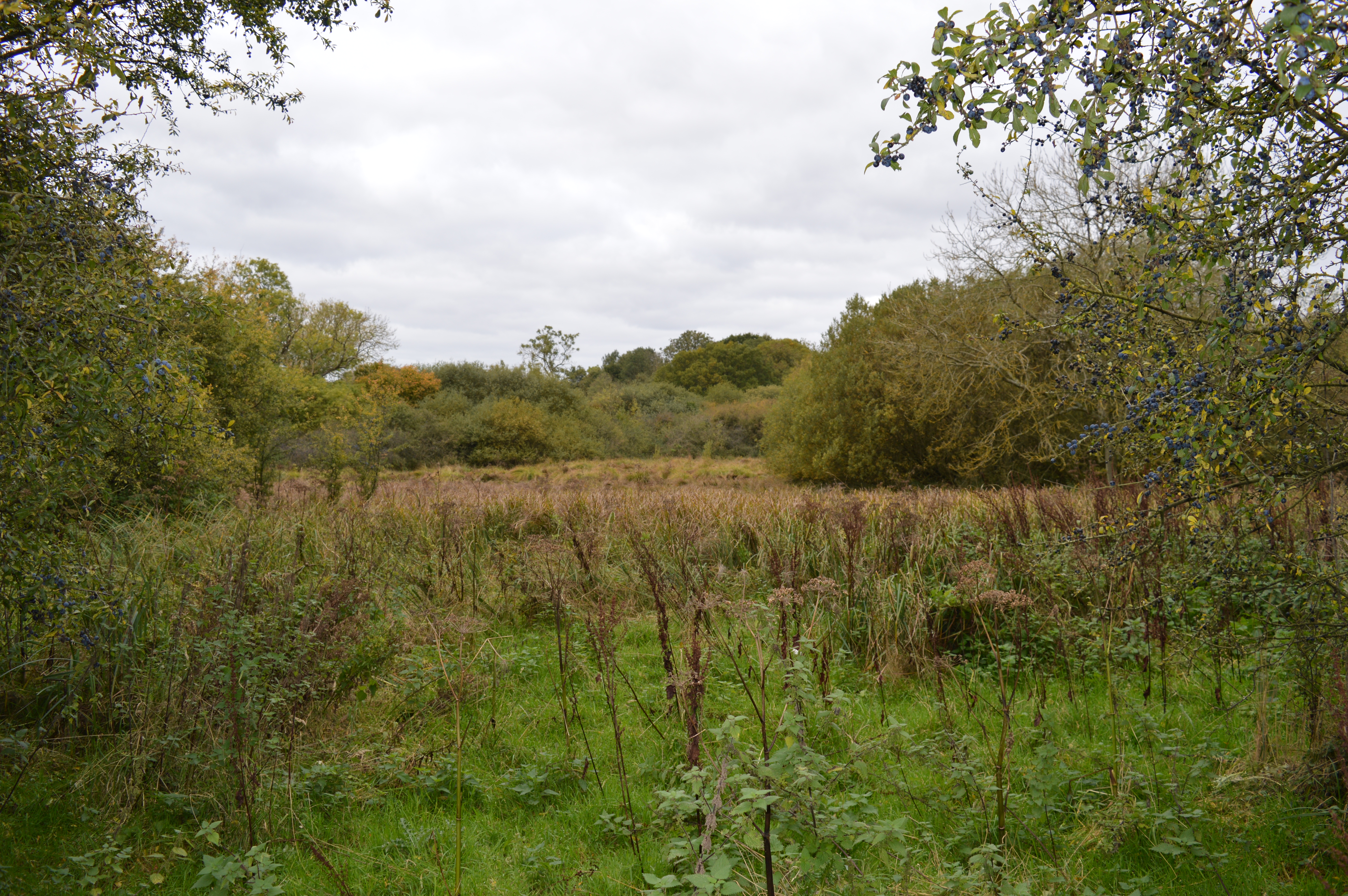
Coxley Bushes is a small woodland area located in Bedfordshire, England. Covering an area of approximately 25 acres, it is a popular destination for nature enthusiasts and locals seeking a peaceful retreat. The woodland is situated on the outskirts of the village of Coxley and is easily accessible by foot or by car.

Comprised mainly of deciduous trees such as oak, beech, and birch, Coxley Bushes boasts a diverse range of flora and fauna. The woodland floor is adorned with an array of wildflowers and ferns, creating a picturesque and enchanting atmosphere. Visitors can expect to encounter a variety of bird species, including woodpeckers, song thrushes, and owls, making it a paradise for birdwatchers.

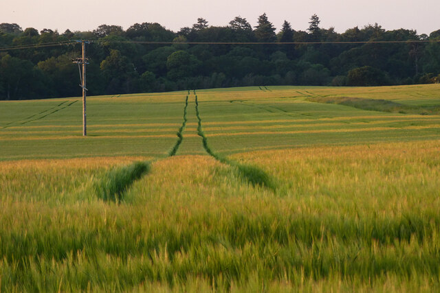
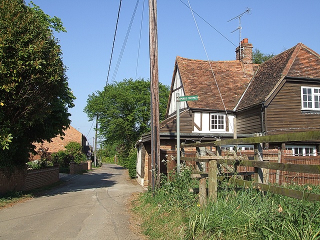
The woodland is crisscrossed by a network of well-maintained footpaths and trails, allowing visitors to explore the area at their own pace. These paths wind through the dense foliage, offering glimpses of the surrounding countryside and providing opportunities for peaceful walks and picnics.

Coxley Bushes is also home to a number of small mammals, such as squirrels, rabbits, and hedgehogs. Nature lovers can observe these creatures in their natural habitats, adding to the overall experience of the woodland.

The management of Coxley Bushes is overseen by local conservation organizations, ensuring its preservation and protection for future generations. In recent years, efforts have been made to enhance the biodiversity of the woodland, with the introduction of new plant species and the creation of habitats for specific animals.

Overall, Coxley Bushes offers visitors a tranquil and immersive experience in the heart of Bedfordshire's natural beauty.

If you have any feedback on the listing, please let us know in the comments section below.

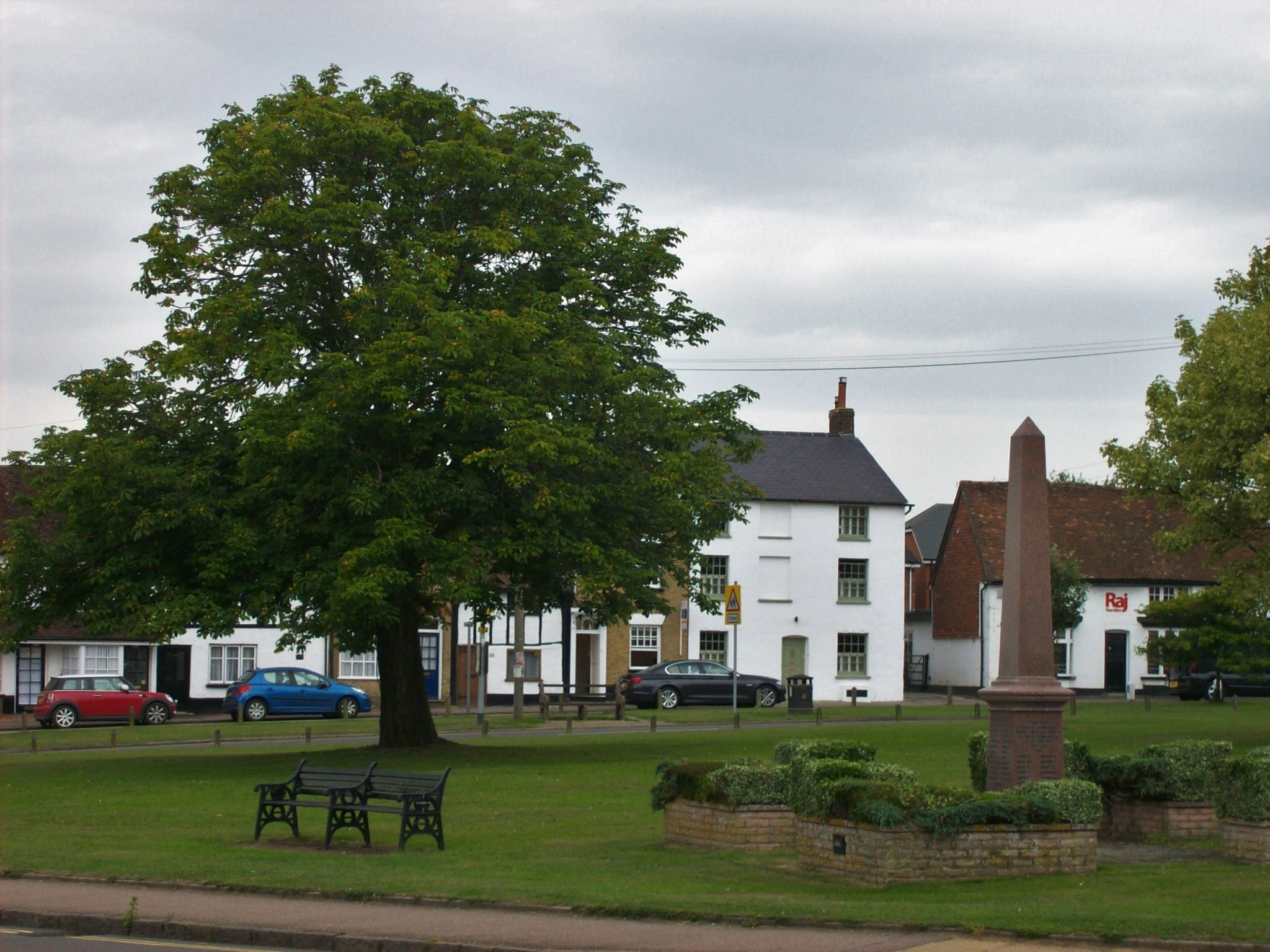
Coxley Bushes Images

Images are sourced within 2km of 51.969138/-0.5495768 or Grid Reference SP9931. Thanks to Geograph Open Source API. All images are credited.

Fields near Castle farm Washers Wood in the distance.
Fields near Castle farm
Washers Wood in the distance.
Farmland, Milton Bryan A footpath through wheat to the north-east of the village.
Farmland, Milton Bryan
A footpath through wheat to the north-east of the village.
Farmland, Toddington Oats to the north-west of Happy Land Farm.
Farmland, Toddington
Oats to the north-west of Happy Land Farm.
Farmland, Tingrith Spring barley to the north of Castle Farm.
Farmland, Tingrith
Spring barley to the north of Castle Farm.
Footbridge over M1 southbound
Matrix gantry - M1 southbound
Field access track Wood House is in Daintry Wood uses this track.
Field access track
Wood House is in Daintry Wood uses this track.
Southbound M1 near to Tingrith The M1 is a north–south motorway connecting London to Leeds, where it joins the A1(M) near Aberford. It was the first motorway to be completed in the United Kingdom.
The motorway is 193 miles long and was constructed in four phases. Most of the motorway was opened between 1959 and 1968 but the southern end was extended in 1977 and the northern end was extended in 1999.
Southbound M1 near to Tingrith
The M1 is a north–south motorway connecting London to Leeds, where it joins the A1(M) near Aberford. It was the first motorway to be completed in the United Kingdom. The motorway is 193 miles long and was constructed in four phases. Most of the motorway was opened between 1959 and 1968 but the southern end was extended in 1977 and the northern end was extended in 1999.
Bridge Over the M1 near Tingrith The M1 is a north–south motorway connecting London to Leeds, where it joins the A1(M) near Aberford. It was the first motorway to be completed in the United Kingdom.
The motorway is 193 miles long and was constructed in four phases. Most of the motorway was opened between 1959 and 1968 but the southern end was extended in 1977 and the northern end was extended in 1999.
Bridge Over the M1 near Tingrith
The M1 is a north–south motorway connecting London to Leeds, where it joins the A1(M) near Aberford. It was the first motorway to be completed in the United Kingdom. The motorway is 193 miles long and was constructed in four phases. Most of the motorway was opened between 1959 and 1968 but the southern end was extended in 1977 and the northern end was extended in 1999.
Southbound M1, Sign Gantry at Toddington Junction The sign gantry at junction 12 of the M1 (Toddington and Flitwick).
Southbound M1, Sign Gantry at Toddington Junction
The sign gantry at junction 12 of the M1 (Toddington and Flitwick).
Wheat Field near Milton Bryan A field of wheat looking ready for harvest. This field is to the south of Park Road which links Milton Bryan to Toddington. Just a few yards of the road cut the NE corner of the square, this field is to the southwest of that point.
Wheat Field near Milton Bryan
A field of wheat looking ready for harvest. This field is to the south of Park Road which links Milton Bryan to Toddington. Just a few yards of the road cut the NE corner of the square, this field is to the southwest of that point.
Track to Herne Farm Herne Farm has a lake and a fishery which is advertised at the beginning of this lane to the farm off Park Road near to Toddington.
Track to Herne Farm
Herne Farm has a lake and a fishery which is advertised at the beginning of this lane to the farm off Park Road near to Toddington.
Leaning Pines A rather splendid avenue of pines (Scots Pines I think) line the lane to Herne Poplar Farm. This view is back along the lane towards the main road with the farm and its associated developments behind the photographer.
Leaning Pines
A rather splendid avenue of pines (Scots Pines I think) line the lane to Herne Poplar Farm. This view is back along the lane towards the main road with the farm and its associated developments behind the photographer.
Autumn's round the corner ! The tree in the foreground, near to the entrance to the lane that leads to Herne Poplar is already showing decided signs of autumnal plumage - and it's only the middle of August ! I think the hot dry summer has taken its toll on this particular specimen.
Autumn's round the corner !
The tree in the foreground, near to the entrance to the lane that leads to Herne Poplar is already showing decided signs of autumnal plumage - and it's only the middle of August ! I think the hot dry summer has taken its toll on this particular specimen.
Higher Rads End - Houses A view back along the <a href="https://www.geograph.org.uk/photo/426745">SP9932 : No-Through-Road, Higher Rads End</a> from near its dead-end. The footpath signposted to the right heads roughly southwards across fields towards Castle Farm.
Higher Rads End - Houses
A view back along the SP9932 : No-Through-Road, Higher Rads End from near its dead-end. The footpath signposted to the right heads roughly southwards across fields towards Castle Farm.
No-Through-Road, Higher Rads End Taken from its junction with the lane through Higher and Lower Rads End, this is the view up the No-through-road that leads to <a href="https://www.geograph.org.uk/photo/426742">SP9932 : Higher Rads End - Houses</a>
No-Through-Road, Higher Rads End
Taken from its junction with the lane through Higher and Lower Rads End, this is the view up the No-through-road that leads to SP9932 : Higher Rads End - Houses
Rads End Farm This mellow bricked farm is on a right/left kink in the lane through Higher & Lower Rads End. I think the wooden top to the roof is a dovecote, and it looks as though two of its residents are flying above it.
Rads End Farm
This mellow bricked farm is on a right/left kink in the lane through Higher & Lower Rads End. I think the wooden top to the roof is a dovecote, and it looks as though two of its residents are flying above it.
Spring Greens The nearest tree at least is sporting green leaves, though the ones on the field boundary to its left look rather bleak still. This field is on the southern side of Park Road out of Milton Bryan. The clump of trees to the rear right is part of Greatfield Spinney.
Spring Greens
The nearest tree at least is sporting green leaves, though the ones on the field boundary to its left look rather bleak still. This field is on the southern side of Park Road out of Milton Bryan. The clump of trees to the rear right is part of Greatfield Spinney.
Show me another place!

Coxley Bushes is located at Grid Ref: SP9931 (Lat: 51.969138, Lng: -0.5495768)

Unitary Authority: Central Bedfordshire

Police Authority: Bedfordshire

What 3 Words

///seeing.boost.tent. Near Eversholt, Bedfordshire

Related Wikis

Toddington Manor, Bedfordshire

Toddington Manor is a Tudor country house in the English county of Bedfordshire, near the village of Toddington and is a Grade II listed building with...

Eversholt

Eversholt is a village and civil parish located in Bedfordshire, England. It was mentioned in the Domesday Book and is over 1000 years old. "Eversholt...

Tingrith

Tingrith is a small village and civil parish in Bedfordshire, England. It is located adjacent to the M1 motorway near the large village of Toddington....

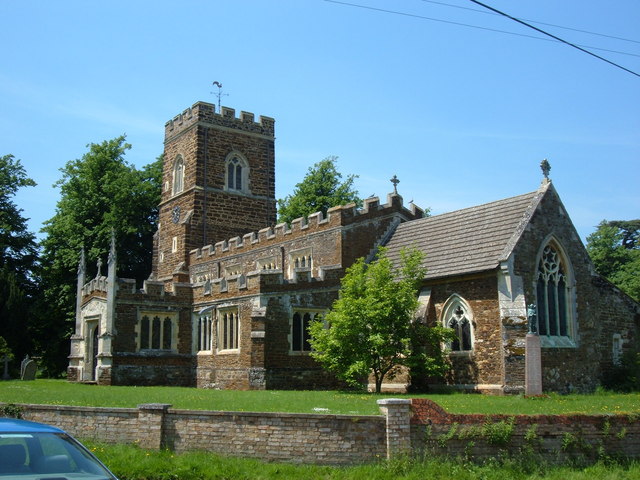
Church of St Nicholas, Tingrith

The Church of St Nicholas is a Grade I listed church in Tingrith, Bedfordshire, England. It became a listed building on 23 January 1961.The brown sandstone...

Church of St George, Toddington, Bedfordshire

Church of St George is a Grade I listed church in Toddington, Bedfordshire, England. It became a listed building on 3 February 1967. == History == The...

Toddington, Bedfordshire

Toddington is a large village and civil parish in the county of Bedfordshire, England. It is situated 5 miles north-north-west of Luton, 4 miles (6 km...

Toddington Castle

Toddington Castle, today known as "Conger Hill Motte", is an artificial earthen mound located in the village of Toddington, in the county of Bedfordshire...

Tebworth Marsh

Tebworth Marsh is a 5.6-hectare biological Site of Special Scientific Interest north of Tebworth in Bedfordshire. It was notified under Section 28 of the...

Nearby Amenities

Located within 500m of 51.969138,-0.5495768
Barrier: kissing_gate
Bicycle: no
Foot: designated
Horse: no
Motor Vehicle: no
Prow Ref: Tingrith FP 5
Lat/Long: 51.972856/-0.551437
Barrier: kissing_gate
Bicycle: no
Foot: designated
Horse: no
Motor Vehicle: no
Lat/Long: 51.9676259/-0.552426
Barrier: kissing_gate
Foot: designated
Lat/Long: 51.9699753/-0.5516658
Barrier: kissing_gate
Bicycle: no
Foot: designated
Horse: no
Motor Vehicle: no
Wheelchair: no
Lat/Long: 51.9656877/-0.5540498
Barrier: kissing_gate
Bicycle: no
Foot: designated
Horse: no
Material: metal
Motor Vehicle: no
Lat/Long: 51.9667439/-0.5525822
The data included in this document is from www.openstreetmap.org. The data is made available under ODbL.

Have you been to Coxley Bushes?

Leave your review of Coxley Bushes below (or comments, questions and feedback).