Virginia Water Plantations

Wood, Forest in Surrey Runnymede

England

Virginia Water Plantations

Totem Pole, Windsor Great Park The 100-foot pole bears traditional First Nations carvings and was a gift from the Canadian province of British Columbia to the Queen in 1958.
Totem Pole, Windsor Great Park Credit: Mark Percy

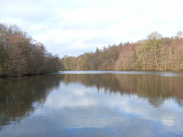
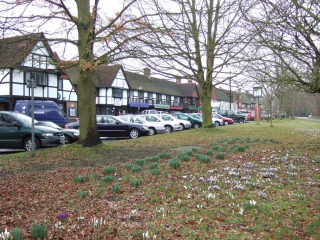
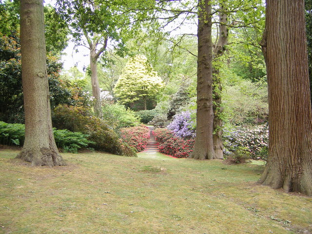
Virginia Water Plantations is a picturesque area located in Surrey, England. Situated near the village of Virginia Water, it is known for its beautiful woodlands and forests that cover a significant part of the region. The plantations are a popular destination for nature lovers, hikers, and those seeking tranquility in the heart of nature.

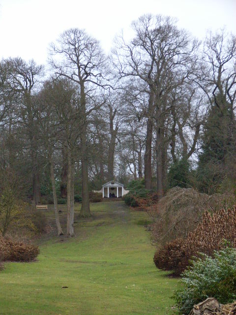
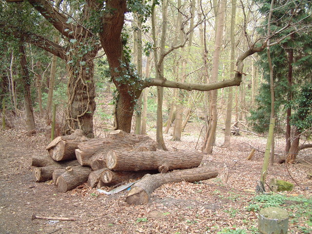
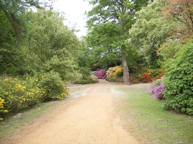
The woodlands in Virginia Water Plantations are characterized by a diverse range of trees, including oak, beech, and pine, creating a rich and varied ecosystem. The forest floor is adorned with a carpet of wildflowers during the spring and summer months, adding to the enchanting beauty of the area. These woodlands provide a habitat for a wide array of wildlife, such as deer, foxes, rabbits, and numerous species of birds.

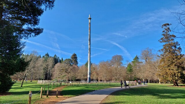
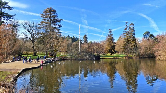
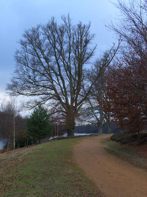
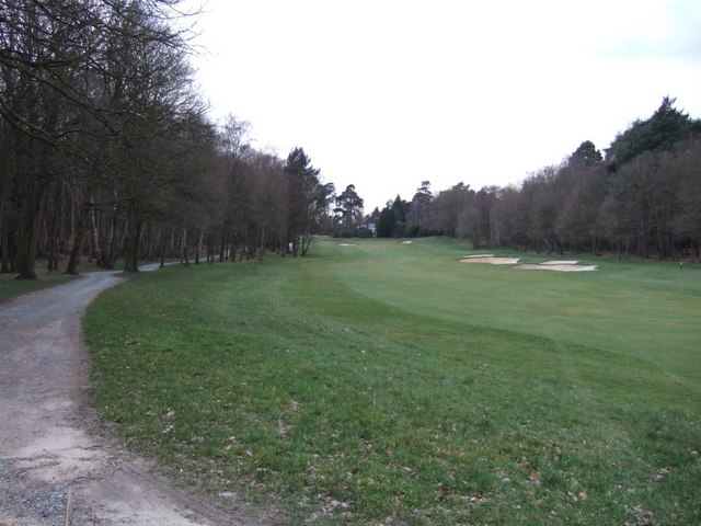
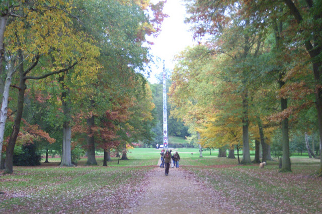
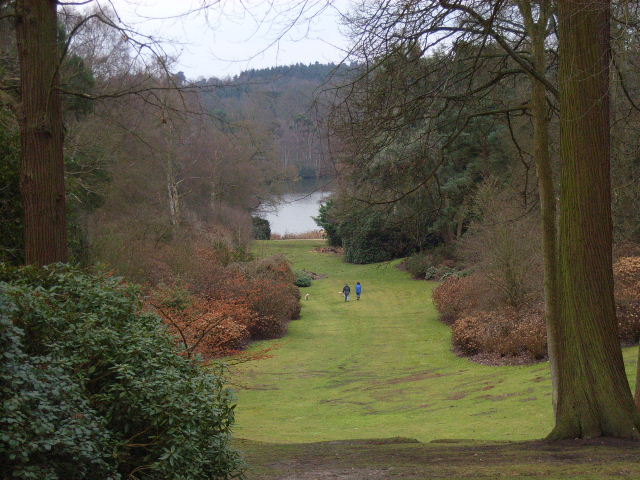
The plantations offer several walking trails that wind through the dense forest, allowing visitors to explore the natural wonders at their own pace. The paths are well-maintained and vary in difficulty, catering to both casual walkers and more experienced hikers. Along the way, visitors can enjoy breathtaking views of the surrounding countryside, including the iconic Virginia Water Lake.

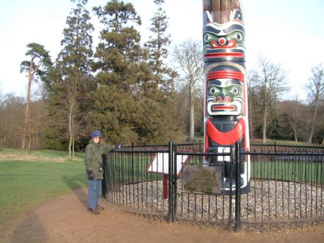
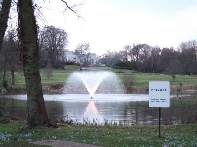
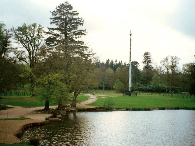
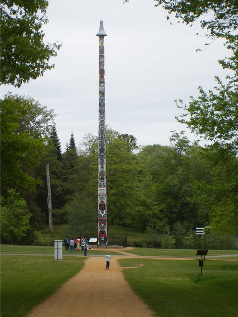
In addition to its natural beauty, Virginia Water Plantations also boasts several man-made attractions. The most notable is the Virginia Water Lake itself, which was created in the 18th century and covers approximately 150 acres. The lake is adorned with ornamental cascades, charming bridges, and a stunning 100-foot-high totem pole, making it a popular spot for photography and leisurely walks.

Overall, Virginia Water Plantations in Surrey is a captivating destination for those seeking to immerse themselves in the beauty of nature. With its dense woodlands, diverse wildlife, and man-made attractions, it offers a unique and enchanting experience for visitors of all ages.

If you have any feedback on the listing, please let us know in the comments section below.

Virginia Water Plantations Images

Images are sourced within 2km of 51.413346/-0.58880272 or Grid Reference SU9869. Thanks to Geograph Open Source API. All images are credited.

Totem Pole, Windsor Great Park The 100-foot pole bears traditional First Nations carvings and was a gift from the Canadian province of British Columbia to the Queen in 1958.
Totem Pole, Windsor Great Park
The 100-foot pole bears traditional First Nations carvings and was a gift from the Canadian province of British Columbia to the Queen in 1958.
Wick Pond, Windsor Great Park Looking across Wick Pond to the totem pole.
Wick Pond, Windsor Great Park
Looking across Wick Pond to the totem pole.
Virginia Water This Totem Pole is located on the extreme western edge of the square in Virginia Water.
Virginia Water
This Totem Pole is located on the extreme western edge of the square in Virginia Water.
Wentworth The entrance to the world famous championship golf course.
Wentworth
The entrance to the world famous championship golf course.
Johnson's Pond, Windsor Great Park A small waterfall connects this to Virginia Water.
Johnson's Pond, Windsor Great Park
A small waterfall connects this to Virginia Water.
The Valley Gardens, Windsor Great Park The view from a gazebo in the gardens down to Virginia Water.
The Valley Gardens, Windsor Great Park
The view from a gazebo in the gardens down to Virginia Water.
Christ Church, Virginia Water
The banks of Virginia Water in Valley Gardens
Gazebo in Valley Gardens
Station Approach Local shops near Virginia Water station.
Station Approach
Local shops near Virginia Water station.
Wentworth Golf Course
Callow Hill Wood As seen from the track that leads east from the Rose and Olive Branch public house.
Callow Hill Wood
As seen from the track that leads east from the Rose and Olive Branch public house.
Totem pole at Virginia Water The totem pole is situated at the northern end of Virginia Water lake in Windsor Great Park
Totem pole at Virginia Water
The totem pole is situated at the northern end of Virginia Water lake in Windsor Great Park
Totem pole, Virginia Water, Surrey Autumn in the park
Totem pole, Virginia Water, Surrey
Autumn in the park
Totem Pole, Virginia Water Given to The Queen in 1958.
Totem Pole, Virginia Water
Given to The Queen in 1958.
Valley Gardens, Virginia Water
Devil's Punchbowl, Valley Gardens Virginia Water
Devil's Punchbowl, Valley Gardens
Virginia Water
Show me another place!

Virginia Water Plantations is located at Grid Ref: SU9869 (Lat: 51.413346, Lng: -0.58880272)

Administrative County: Surrey

District: Runnymede

Police Authority: Surrey

What 3 Words

///intro.fixed.speak. Near Virginia Water, Surrey

Related Wikis

Virginia Water Lake

Virginia Water Lake lies on the southern edge of Windsor Great Park, in the borough of Runnymede in Surrey and the civil parishes of Old Windsor and Sunningdale...

Valley Gardens

The Valley Gardens are 220 acres (0.89 km2) of woodland garden, part of the Crown Estate located near Englefield Green in the English county of Surrey...

Virginia Water

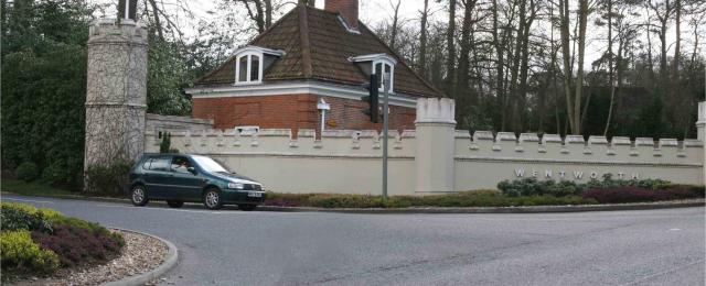
Virginia Water is a commuter village in the Borough of Runnymede in northern Surrey, England. It is home to the Wentworth Estate and the Wentworth Club...

2009 BMW PGA Championship

The 2009 BMW PGA Championship was the 55th edition of the BMW PGA Championship, an annual professional golf tournament on the European Tour. It was held...

1995 Volvo PGA Championship

The 1995 Volvo PGA Championship was the 41st edition of the Volvo PGA Championship, an annual professional golf tournament on the European Tour. It was...

2008 BMW PGA Championship

The 2008 BMW PGA Championship was the 54th edition of the BMW PGA Championship, an annual professional golf tournament on the European Tour. It was held...

1990 Volvo PGA Championship

The 1990 Volvo PGA Championship was the 36th edition of the Volvo PGA Championship, an annual professional golf tournament on the European Tour. It was...

2002 Volvo PGA Championship

The 2002 Volvo PGA Championship was the 48th edition of the Volvo PGA Championship, an annual professional golf tournament on the European Tour. It was...

Nearby Amenities

Located within 500m of 51.413346,-0.58880272
Totem Pole
Historic: monument
Image: https://upload.wikimedia.org/wikipedia/commons/0/06/Virginia_Water_Totem_Pole.jpg
Man Made: totem_pole
Website: http://www.thamesweb.co.uk/windsor/info/totem.html
Lat/Long: 51.416663/-0.5920581
Fuel
Shell
Addr City: Virginia Water
Addr Postcode: GU25 4QE
Addr Street: London Road
Brand: Shell
Brand Wikidata: Q110716465
Opening Hours: 24/7
Phone: +44 1344 843436
Ref Navads: NVDS353_12038635
Source Addr Postcode: code-point_open
Website: https://find.shell.com/gb/fuel/12038635-shell-little-waitrose-wheatsheaf
Lat/Long: 51.4093558/-0.5912627
Crossing
Bicycle: yes
Crossing Island: yes
Kerb: lowered
Sloped Curb: yes
Lat/Long: 51.4100749/-0.5907031
Bus Stop
Wheatsheaf
Naptan AtcoCode: 40004401208A
Naptan Bearing: NE
Naptan CommonName: Wheatsheaf
Naptan Indicator: Just after
Naptan Landmark: Wheatsheaf
Naptan NaptanCode: suratwap
Naptan Street: London Road
Naptan Verified: no
Public Transport: platform
Source: naptan_import
Lat/Long: 51.4100209/-0.5909247
Toilets
Lat/Long: 51.4097378/-0.5924693
Virginia Water Plantations
Natural: wood
Lat/Long: 51.4134734/-0.5890488
Cut Hills
Place: locality
Lat/Long: 51.4143244/-0.5850292
The Clockcase
Place: isolated_dwelling
Lat/Long: 51.4101279/-0.5838973
Crossing
Bicycle: yes
Crossing: unmarked
Kerb: lowered
Sloped Curb: yes
Lat/Long: 51.4102945/-0.5919574
Barrier: lift_gate
Lat/Long: 51.4099499/-0.5923767
Barrier: lift_gate
Lat/Long: 51.4098963/-0.5923171
Bench
Backrest: no
Lat/Long: 51.412629/-0.5916867
Bench
Backrest: no
Lat/Long: 51.4139757/-0.5907421
Bench
Backrest: no
Lat/Long: 51.4149646/-0.5906394
Bench
Backrest: no
Lat/Long: 51.414954/-0.5906261
Bench
Backrest: no
Lat/Long: 51.416801/-0.5890326
Bench
Backrest: no
Lat/Long: 51.4161377/-0.5898954
Bench
Backrest: no
Lat/Long: 51.4170858/-0.5880203
Vending Machine
Vending: parking_tickets
Lat/Long: 51.4102857/-0.5920835
Vending Machine
Vending: parking_tickets
Lat/Long: 51.4103853/-0.5919324
Waste Basket
Lat/Long: 51.4103828/-0.5919202
Waste Basket
Lat/Long: 51.4102891/-0.5920905
Crossing
Bicycle: yes
Crossing: unmarked
Kerb: lowered
Sloped Curb: yes
Lat/Long: 51.4099134/-0.5912095
Crossing
Bicycle: yes
Crossing: unmarked
Kerb: lowered
Sloped Curb: yes
Lat/Long: 51.4095823/-0.5912764
Crossing
Bicycle: yes
Crossing: unmarked
Kerb: lowered
Sloped Curb: yes
Lat/Long: 51.4093898/-0.5915756
Crossing
Bicycle: yes
Crossing: unmarked
Kerb: lowered
Sloped Curb: yes
Lat/Long: 51.4101084/-0.5916039
Crossing
Bicycle: yes
Crossing: unmarked
Kerb: lowered
Sloped Curb: yes
Lat/Long: 51.4102036/-0.591788
Barrier: lift_gate
Lat/Long: 51.4102662/-0.59097
Traffic Signals
Source: Bing
Traffic Signals Direction: forward
Lat/Long: 51.4092766/-0.5918526
Toilets
Lat/Long: 51.4101518/-0.5924852
Cafe
Operator: Casa Caffé
Lat/Long: 51.4103567/-0.5924825
Access: yes
Drinking Water: yes
Man Made: water_tap
Lat/Long: 51.410223/-0.592316
Barrier: lift_gate
Lat/Long: 51.4102982/-0.5910556
Bicycle Parking
Bicycle Parking: stands
Capacity: 12
Covered: no
Lat/Long: 51.4104863/-0.5925731
The data included in this document is from www.openstreetmap.org. The data is made available under ODbL.

Have you been to Virginia Water Plantations?

Leave your review of Virginia Water Plantations below (or comments, questions and feedback).