Wick Pond

Lake, Pool, Pond, Freshwater Marsh in Surrey Runnymede

England

Wick Pond

Totem Pole, Windsor Great Park The 100-foot pole bears traditional First Nations carvings and was a gift from the Canadian province of British Columbia to the Queen in 1958.
Totem Pole, Windsor Great Park Credit: Mark Percy

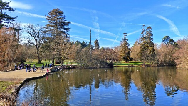
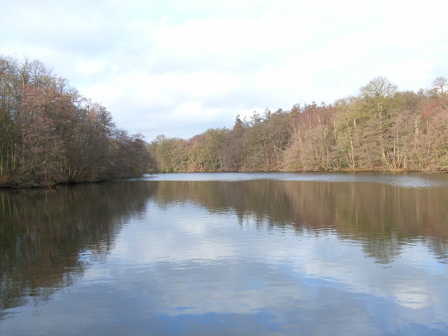
Wick Pond is a picturesque freshwater marsh located in the county of Surrey, England. Spread over an area of approximately 10 acres, the pond is nestled amidst stunning natural surroundings, making it a popular destination for nature enthusiasts and locals alike.

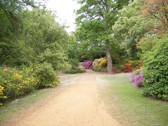
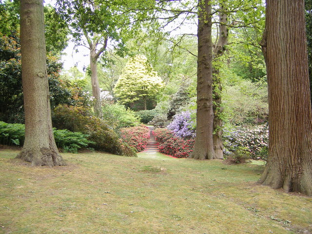
The pond is a haven for various species of flora and fauna, providing a diverse ecosystem. The surrounding marshland is adorned with lush green vegetation, including reeds, rushes, and water lilies, which add to the pond's charm. This thriving vegetation attracts a wide range of bird species, making it an ideal spot for birdwatching. Visitors can often spot ducks, geese, herons, and kingfishers gracefully gliding across the calm waters of the pond.

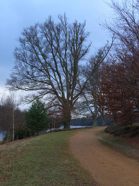
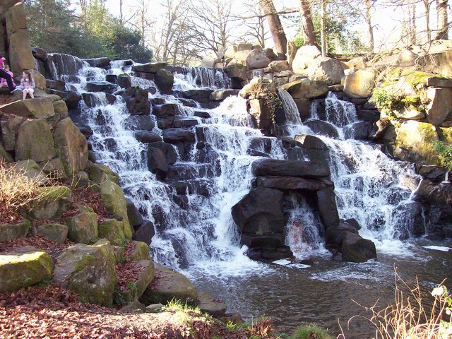
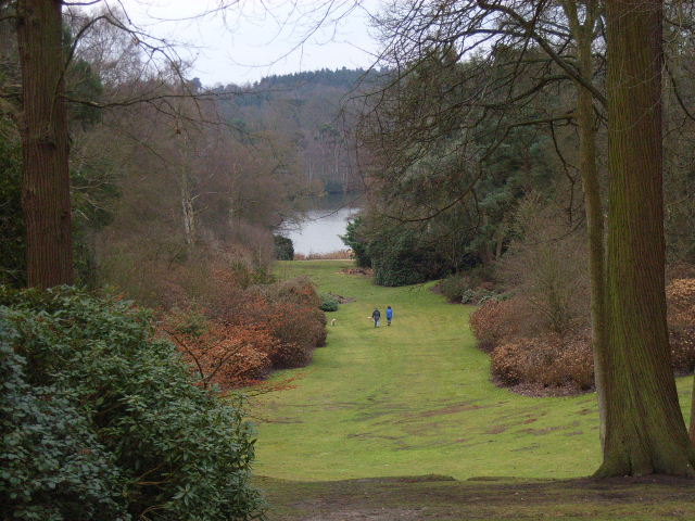
Wick Pond offers a tranquil and serene environment, making it an ideal location for relaxation and unwinding. The pond's crystal-clear waters reflect the beautiful surrounding landscape, creating a visually stunning experience for visitors. The area is equipped with well-maintained footpaths, allowing visitors to explore the pond and its surroundings at their own pace.

Fishing is a popular activity at Wick Pond, as it is home to a variety of freshwater fish species. Anglers can often be seen casting their lines, hoping to catch a prized catch of carp, perch, or roach.

Overall, Wick Pond is a hidden gem in Surrey, offering a serene and peaceful escape from the hustle and bustle of everyday life. Its vibrant ecosystem and scenic beauty make it a must-visit destination for nature lovers and those seeking solace in nature's embrace.

If you have any feedback on the listing, please let us know in the comments section below.

Wick Pond Images

Images are sourced within 2km of 51.417353/-0.59142616 or Grid Reference SU9869. Thanks to Geograph Open Source API. All images are credited.

Totem Pole, Windsor Great Park The 100-foot pole bears traditional First Nations carvings and was a gift from the Canadian province of British Columbia to the Queen in 1958.
Totem Pole, Windsor Great Park
The 100-foot pole bears traditional First Nations carvings and was a gift from the Canadian province of British Columbia to the Queen in 1958.
Wick Pond, Windsor Great Park Looking across Wick Pond to the totem pole.
Wick Pond, Windsor Great Park
Looking across Wick Pond to the totem pole.
Virginia Water This Totem Pole is located on the extreme western edge of the square in Virginia Water.
Virginia Water
This Totem Pole is located on the extreme western edge of the square in Virginia Water.
Wentworth The entrance to the world famous championship golf course.
Wentworth
The entrance to the world famous championship golf course.
Johnson's Pond, Windsor Great Park A small waterfall connects this to Virginia Water.
Johnson's Pond, Windsor Great Park
A small waterfall connects this to Virginia Water.
The Valley Gardens, Windsor Great Park The view from a gazebo in the gardens down to Virginia Water.
The Valley Gardens, Windsor Great Park
The view from a gazebo in the gardens down to Virginia Water.
Christ Church, Virginia Water
The banks of Virginia Water in Valley Gardens
Gazebo in Valley Gardens
Callow Hill Wood As seen from the track that leads east from the Rose and Olive Branch public house.
Callow Hill Wood
As seen from the track that leads east from the Rose and Olive Branch public house.
Totem pole at Virginia Water The totem pole is situated at the northern end of Virginia Water lake in Windsor Great Park
Totem pole at Virginia Water
The totem pole is situated at the northern end of Virginia Water lake in Windsor Great Park
Totem pole, Virginia Water, Surrey Autumn in the park
Totem pole, Virginia Water, Surrey
Autumn in the park
Totem Pole, Virginia Water Given to The Queen in 1958.
Totem Pole, Virginia Water
Given to The Queen in 1958.
Valley Gardens, Virginia Water
Devil's Punchbowl, Valley Gardens Virginia Water
Devil's Punchbowl, Valley Gardens
Virginia Water
The Cascade, Virginia Water The Cascade was constructed in the 18ct, reputedly using stones taken from the site of a Saxon settlement on Bagshot Heath. For a view of the Cascade taken in Nov 2013 refer to picture <a href="https://www.geograph.org.uk/photo/3734030">SU9768 : The Cascade, Virginia Water</a>.
The Cascade, Virginia Water
The Cascade was constructed in the 18ct, reputedly using stones taken from the site of a Saxon settlement on Bagshot Heath. For a view of the Cascade taken in Nov 2013 refer to picture SU9768 : The Cascade, Virginia Water.
Leptis Magna, Virginia Water, (left view) The remains of a Roman Temple from Leptis Magna, near Tripoli, Libya, were given to the Prince Regent, (later King George IV), in 1816. After languishing at the British Museum for 10 years they were erected, not necessarily correctly, in Virginia Water by Sir Jeffery Wyatville. Refer to picture <a href="https://www.geograph.org.uk/photo/2660610">SU9768 : Leptis Magna</a> for a view of Leptis Magna taken in Oct 2011.
Leptis Magna, Virginia Water, (left view)
The remains of a Roman Temple from Leptis Magna, near Tripoli, Libya, were given to the Prince Regent, (later King George IV), in 1816. After languishing at the British Museum for 10 years they were erected, not necessarily correctly, in Virginia Water by Sir Jeffery Wyatville. Refer to picture SU9768 : Leptis Magna for a view of Leptis Magna taken in Oct 2011.
Leptis Magna, Virginia Water, (right view) The remains of a Roman Temple from Leptis Magna, near Tripoli, were given to the Prince Regent, (later King George IV), in 1816. After languishing at the British Museum for 10 years they were erected, not necessarily correctly, in Virginia Water by Sir Jeffery Wyatville. Refer to picture <a href="https://www.geograph.org.uk/photo/705840">SU9768 : Leptis Magna, Virginia Water, (left view)</a> for a view of the LH columns.
Leptis Magna, Virginia Water, (right view)
The remains of a Roman Temple from Leptis Magna, near Tripoli, were given to the Prince Regent, (later King George IV), in 1816. After languishing at the British Museum for 10 years they were erected, not necessarily correctly, in Virginia Water by Sir Jeffery Wyatville. Refer to picture SU9768 : Leptis Magna, Virginia Water, (left view) for a view of the LH columns.
Show me another place!

Wick Pond is located at Grid Ref: SU9869 (Lat: 51.417353, Lng: -0.59142616)

Administrative County: Surrey

District: Runnymede

Police Authority: Surrey

What 3 Words

///alien.slips.ending. Near Virginia Water, Surrey

Related Wikis

Valley Gardens

The Valley Gardens are 220 acres (0.89 km2) of woodland garden, part of the Crown Estate located near Englefield Green in the English county of Surrey...

Virginia Water Lake

Virginia Water Lake lies on the southern edge of Windsor Great Park, in the borough of Runnymede in Surrey and the civil parishes of Old Windsor and Sunningdale...

Savill Building

The Savill Building is a visitor centre at the entrance to The Savill Garden in Windsor Great Park, Surrey, England designed by Glen Howells Architects...

Savill Garden

The Savill Garden is an enclosed part of Windsor Great Park in England, created by Sir Eric Savill in the 1930s. It is managed by the Crown Estate and...

Nearby Amenities

Located within 500m of 51.417353,-0.59142616
Totem Pole
Historic: monument
Image: https://upload.wikimedia.org/wikipedia/commons/0/06/Virginia_Water_Totem_Pole.jpg
Man Made: totem_pole
Website: http://www.thamesweb.co.uk/windsor/info/totem.html
Lat/Long: 51.416663/-0.5920581
Pub
The Bailiwick
Addr Housename: The Bailiwick Free House
Addr Postcode: TW20 0HN
Addr Street: Wick Road
Email: reservations@thebailiwick.co.uk
Facebook: https://www.facebook.com/thebailiwickfreehouse
Fhrs Id: 315440
Instagram: https://www.instagram.com/thebailiwickfreehouse/
Phone: +44 1784 682888
Source Addr: FHRS Open Data
Website: https://thebailiwick.co.uk/
Lat/Long: 51.4199915/-0.5882184
Parking
Access: yes
Fee: no
Parking: street_side
Lat/Long: 51.4201342/-0.5872022
Oxtead Clump
Natural: wood
Lat/Long: 51.4164216/-0.5966417
Scarlet Oak Plantation
Natural: wood
Lat/Long: 51.4209318/-0.5932085
Virginia Water Plantations
Natural: wood
Lat/Long: 51.4134734/-0.5890488
Egham Wick
Place: hamlet
Source: OS OpenMap Local
Lat/Long: 51.4204339/-0.5874435
Bench
Backrest: no
Lat/Long: 51.4139757/-0.5907421
Bench
Backrest: no
Lat/Long: 51.4149646/-0.5906394
Bench
Backrest: no
Lat/Long: 51.414954/-0.5906261
Bench
Backrest: no
Lat/Long: 51.416801/-0.5890326
Bench
Backrest: no
Lat/Long: 51.4161377/-0.5898954
Bench
Backrest: no
Lat/Long: 51.4194247/-0.5950452
Bench
Backrest: no
Lat/Long: 51.4170858/-0.5880203
The data included in this document is from www.openstreetmap.org. The data is made available under ODbL.

Have you been to Wick Pond?

Leave your review of Wick Pond below (or comments, questions and feedback).