Brookland Copse
Wood, Forest in Surrey Waverley
England
Brookland Copse

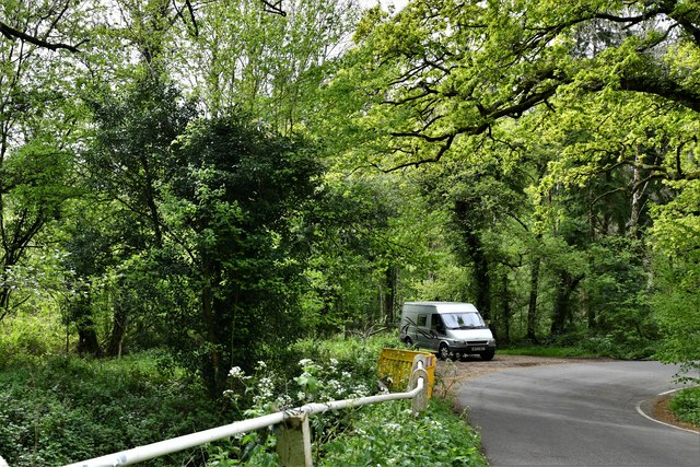
Brookland Copse is a picturesque wood located in the county of Surrey, England. Covering an area of approximately 50 acres, it is nestled in the heart of the beautiful Surrey Hills Area of Outstanding Natural Beauty. The copse is situated just outside the village of Brookland, near the town of Guildford.
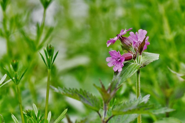
This enchanting forest boasts a diverse range of tree species, including oak, beech, birch, and chestnut. The towering trees provide a dense canopy, creating an atmosphere of tranquility and seclusion. The woodland floor is adorned with a rich carpet of bluebells and wildflowers during spring, adding a splash of color to the verdant landscape.
A network of well-maintained paths meanders through the copse, offering visitors the opportunity to explore and appreciate its natural beauty. The trails are suitable for all ages and abilities, making it an ideal destination for families and nature enthusiasts alike. Additionally, the copse provides a habitat for a variety of wildlife, including deer, squirrels, and a myriad of bird species, making it a popular spot for birdwatching.
Brookland Copse is also home to a small stream that meanders through the woodland, adding to its charm and providing a peaceful soundtrack to the surroundings. The stream is lined with moss-covered rocks and fallen logs, creating a habitat for amphibians and small water-dwelling creatures.
Overall, Brookland Copse offers a serene and idyllic escape from the hustle and bustle of everyday life. Its natural beauty, tranquil atmosphere, and abundant wildlife make it a cherished gem within the Surrey countryside.
If you have any feedback on the listing, please let us know in the comments section below.
Brookland Copse Images
Images are sourced within 2km of 51.108811/-0.59871112 or Grid Reference SU9835. Thanks to Geograph Open Source API. All images are credited.


Brookland Copse is located at Grid Ref: SU9835 (Lat: 51.108811, Lng: -0.59871112)
Administrative County: Surrey
District: Waverley
Police Authority: Surrey
What 3 Words
///sheds.snap.premature. Near Chiddingfold, Surrey
Nearby Locations
Related Wikis

Pickhurst
Pickhurst is a grade II* listed house set in 130 acres (53 ha) of land near Chiddingfold, Surrey, England. == History == It was designed by the Scottish...

Chiddingfold
Chiddingfold is a village and civil parish in the Weald in the Waverley district of Surrey, England. It lies on the A283 road between Milford and Petworth...

St Teresa of Avila Church, Chiddingfold
St Teresa of Avila Church is a Roman Catholic Parish church in Chiddingfold, Surrey. It is situated on the corner of Petworth Road and Woodside Road in...

The Farm (recording studio)
The Farm (also known as Fisher Lane Farm) was a recording studio in Chiddingfold, Surrey owned by the rock band Genesis. The group bought the property...

Chiddingfold Forest
Chiddingfold Forest is a 542.5-hectare (1,341-acre) biological Site of Special Scientific Interest in Chiddingfold in Surrey and West Sussex. One part...

Dunsfold
Dunsfold is a village in the borough of Waverley, Surrey, England, 8.7 miles (14.0 kilometres) south of Guildford. It lies in the Weald and reaches in...

Shillinglee
Shillinglee is an 18th-century house and estate in West Sussex, England near the Surrey border, in between the villages of Chiddingfold and Plaistow. It...

Oakhurst Cottage
Oakhurst Cottage is a tiny 16th or 17th-century cottage in Hambledon, Surrey, in the United Kingdom. It is a Grade II listed building.The cottage was given...
Nearby Amenities
Located within 500m of 51.108811,-0.59871112Have you been to Brookland Copse?
Leave your review of Brookland Copse below (or comments, questions and feedback).