Ashlett

Settlement in Hampshire New Forest

England

Ashlett
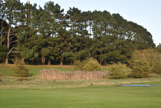
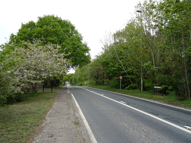
Line of trees beside Fawley Road Screening the view of the oil refinery from the recreation ground at Gang Warily.
Line of trees beside Fawley Road Credit: David Martin

Ashlett is a small village located in the county of Hampshire, England. Situated on the eastern bank of the River Test, it is part of the New Forest district. The village is approximately three miles southeast of Fawley and five miles southwest of Hythe.

Ashlett is known for its picturesque surroundings, with stunning views of the river and the surrounding countryside. The area is a haven for nature lovers, offering ample opportunities for walking, birdwatching, and other outdoor activities. The nearby Lepe Country Park, with its sandy beach and nature reserve, is a popular attraction for both locals and visitors.

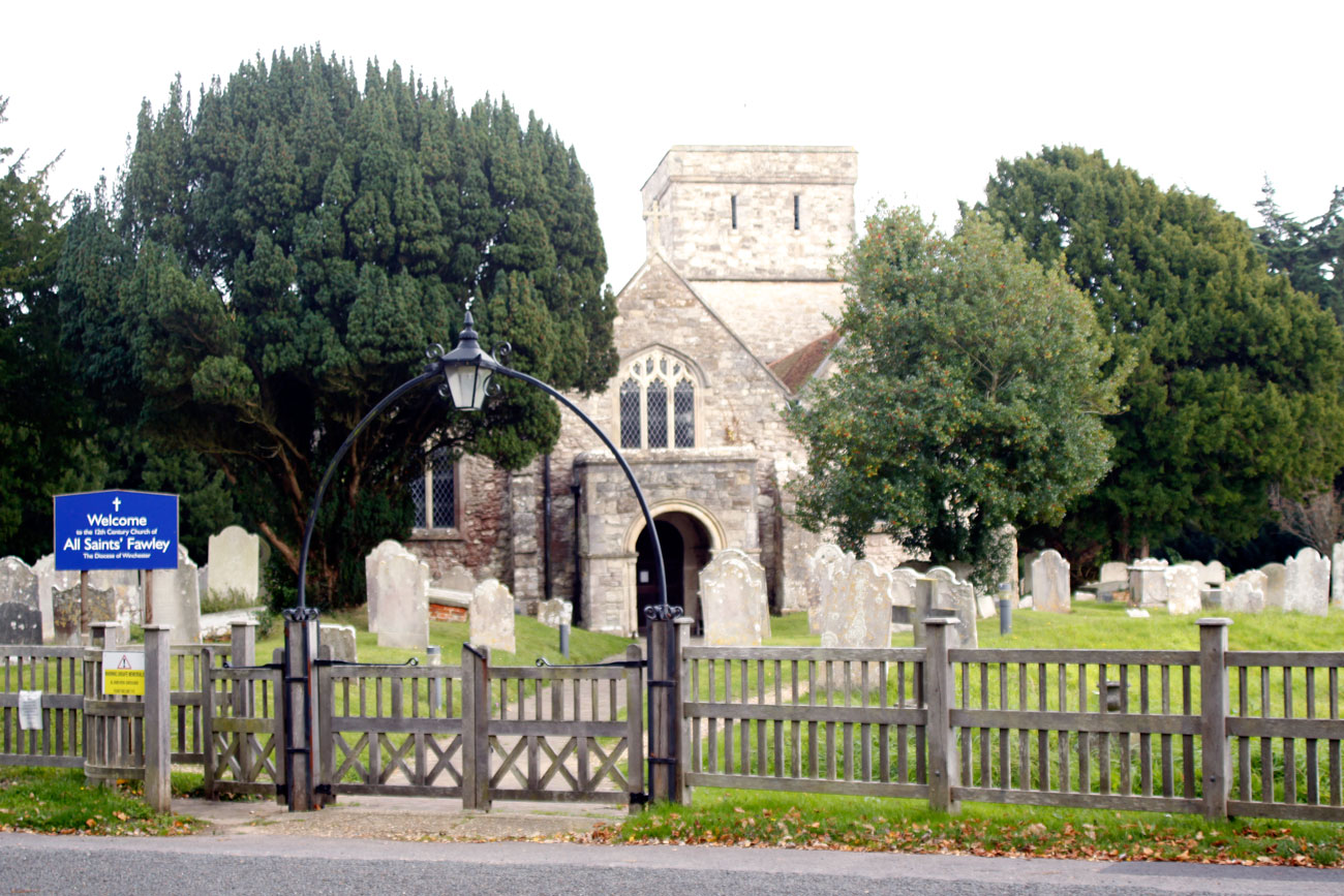
The village itself has a small, tight-knit community, with a population of around 500 residents. It boasts a few amenities, including a village hall, a primary school, and a church. The village hall serves as a hub for community events and activities, hosting regular gatherings, clubs, and classes.

Ashlett is well-connected to nearby towns and cities, with good road links to Fawley, Hythe, and Southampton. The village is also served by a local bus service, providing access to further transport links.

Overall, Ashlett offers a peaceful and idyllic setting for those seeking a rural retreat. With its charming countryside, proximity to the river, and a strong sense of community, it is a desirable place to live or visit for those looking to escape the hustle and bustle of urban life.

If you have any feedback on the listing, please let us know in the comments section below.

Ashlett Images

Images are sourced within 2km of 50.827225/-1.341586 or Grid Reference SU4603. Thanks to Geograph Open Source API. All images are credited.
Line of trees beside Fawley Road Screening the view of the oil refinery from the recreation ground at Gang Warily.
Line of trees beside Fawley Road
Screening the view of the oil refinery from the recreation ground at Gang Warily.
Chapel Lane, Fawley
Chapel Lane, Fawley
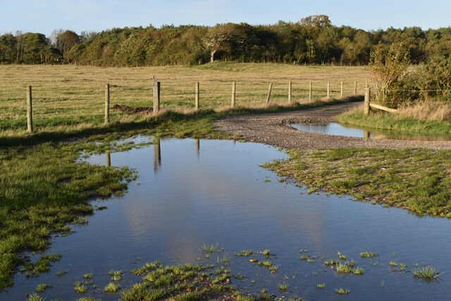
Flooded track junction south of Fawley village
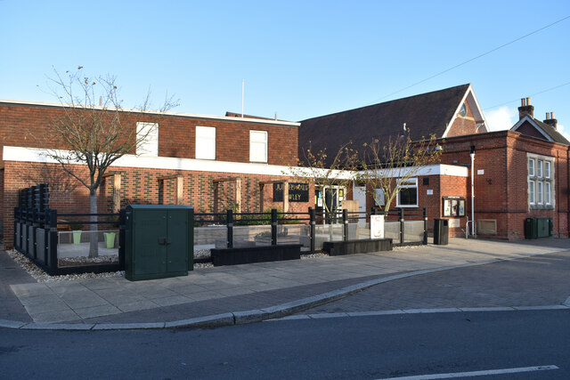
The Jubilee Hall, Fawley
New Forest School, Fawley
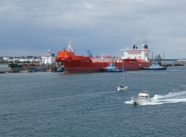
Tanker 'Leon Zeus' berthing at Fawley It was turning before coming alongside the jetty. There were two tugs on the other side, revealed when it has turned more.
Tanker 'Leon Zeus' berthing at Fawley
It was turning before coming alongside the jetty. There were two tugs on the other side, revealed when it has turned more.
'Torill Knutsen' at Fawley Marine Terminal
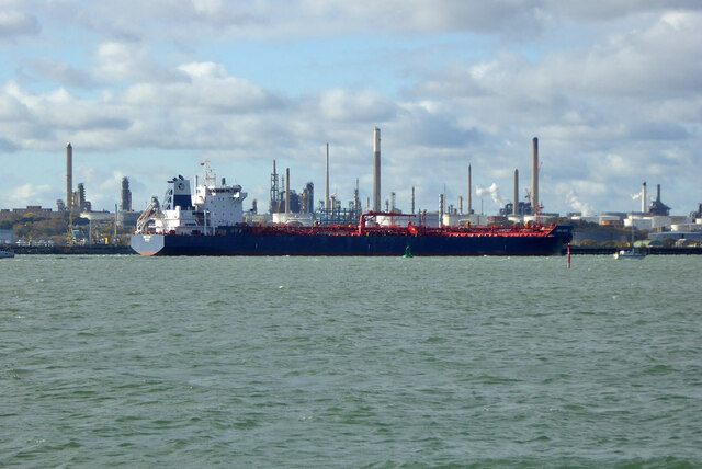
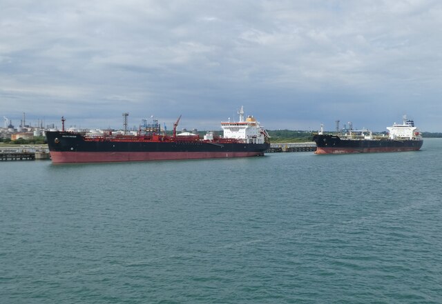
Tankers at Fawley Marine Terminal
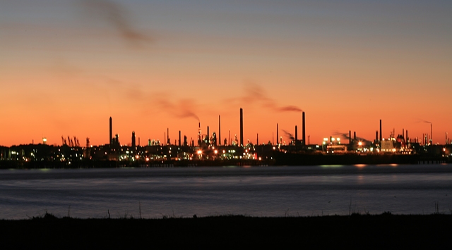
View towards Fawley Oil Refinery
Oil Tankers at Fawley Marine terminal Southampton Water is a tidal estuary north of the Solent and the Isle of Wight. Geographically, it is classified as a ria, or drowned valley, of the English Channel. It was formed by the rivers Test, Itchen and Hamble which flow into it, and became an inlet of the sea at the end of the last ice age when sea levels rose, flooding many valleys in the south of England.

The city of Southampton lies at the most northerly point of Southampton Water. Its emergence as a major port, and particularly as a port handling very large vessels, depended partly on certain geographical features of Southampton Water. Its depth, even in its undeveloped state, was generous; this depth of water has been increased over the years with comparative ease since the soft silt of the river-bed allows for easy dredging. An additional factor is the phenomenon of the "double tide", which results in unusually prolonged periods of high water. This greatly facilitates the movements of very large ships.

Together with the Solent, Southampton Water is world-renowned for yachting. 

<span class="nowrap"><a title="https://en.wikipedia.org/wiki/Southampton_Water" rel="nofollow ugc noopener" href="https://en.wikipedia.org/wiki/Southampton_Water">Link</a><img style="margin-left:2px;" alt="External link" title="External link - shift click to open in new window" src="https://s1.geograph.org.uk/img/external.png" width="10" height="10"/></span>  Wikipedia
Oil Tankers at Fawley Marine terminal
Southampton Water is a tidal estuary north of the Solent and the Isle of Wight. Geographically, it is classified as a ria, or drowned valley, of the English Channel. It was formed by the rivers Test, Itchen and Hamble which flow into it, and became an inlet of the sea at the end of the last ice age when sea levels rose, flooding many valleys in the south of England. The city of Southampton lies at the most northerly point of Southampton Water. Its emergence as a major port, and particularly as a port handling very large vessels, depended partly on certain geographical features of Southampton Water. Its depth, even in its undeveloped state, was generous; this depth of water has been increased over the years with comparative ease since the soft silt of the river-bed allows for easy dredging. An additional factor is the phenomenon of the "double tide", which results in unusually prolonged periods of high water. This greatly facilitates the movements of very large ships. Together with the Solent, Southampton Water is world-renowned for yachting. LinkExternal link Wikipedia
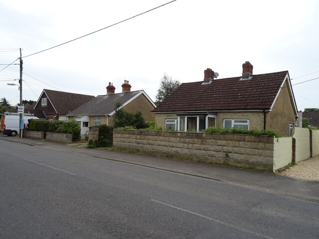
Houses on Blackfield Road
Blackfield Road
Blackfield Road
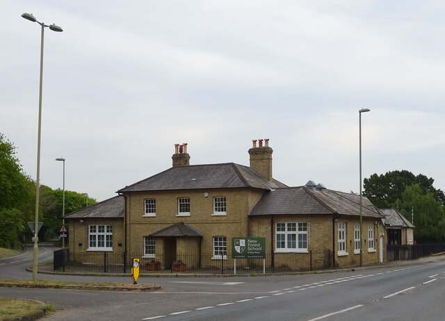
New Forest School
New Forest School
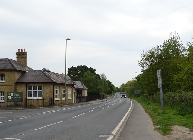
Fawley Road (B3053)
Fawley Road (B3053)
Church Lane
Church Lane
B3053 towards Holbury
Elizabeth II postbox on  Blackfield Road, Fawley  Postbox No. SO45 357.
Elizabeth II postbox on Blackfield Road, Fawley
Postbox No. SO45 357.
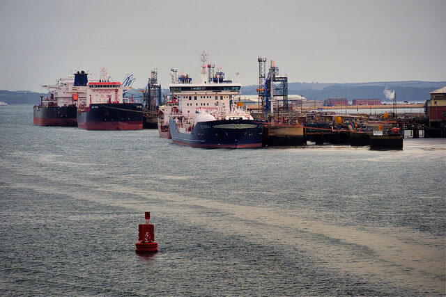
Fawley Marine Terminal Tankers berthed at Fawley Marine Terminal.  The disused Fawley Power Station chimney can be seen on the horizon.
Fawley Marine Terminal
Tankers berthed at Fawley Marine Terminal. The disused Fawley Power Station chimney can be seen on the horizon.
Show me another place!

Ashlett is located at Grid Ref: SU4603 (Lat: 50.827225, Lng: -1.341586)

Administrative County: Hampshire

District: New Forest

Police Authority: Hampshire

What 3 Words

///pampered.lamplight.lease. Near Hamble-le-Rice, Hampshire

Have you been to Ashlett?

Leave your review of Ashlett below (or comments, questions and feedback).
Nearby Amenities

Located within 500m of 50.827225,-1.341586
Source: PGS
Lat/Long: 50.8274324/-1.3401069
Source: PGS
Lat/Long: 50.8277908/-1.3404807
Source: PGS
Lat/Long: 50.8297893/-1.3418694
Source: PGS
Lat/Long: 50.8300038/-1.3420826
Source: PGS
Lat/Long: 50.8303184/-1.341697
Source: PGS
Lat/Long: 50.829568/-1.340679
Source: PGS
Lat/Long: 50.8294675/-1.340596
Source: PGS
Lat/Long: 50.8294555/-1.3402129
Source: PGS
Lat/Long: 50.8289606/-1.3394844
Source: PGS
Lat/Long: 50.82869/-1.3392609
Source: PGS
Lat/Long: 50.8282915/-1.3388232
Source: PGS
Lat/Long: 50.8285068/-1.3387256
Source: PGS
Lat/Long: 50.8289546/-1.3385378
Source: PGS
Lat/Long: 50.8293469/-1.3382106
Source: PGS
Lat/Long: 50.8295683/-1.3382712
Source: PGS
Lat/Long: 50.8298203/-1.3385314
Source: PGS
Lat/Long: 50.8300372/-1.3387031
Source: PGS
Lat/Long: 50.8303516/-1.3389091
Source: PGS
Lat/Long: 50.8310021/-1.3392181
Ashlett Hard
Leisure: slipway
Lat/Long: 50.8270716/-1.3392985
Barrier: cycle_barrier
Lat/Long: 50.8272236/-1.335998
Ashlett Creek Sailing Club
Leisure: marina
Seamark Harbour Category: marina
Seamark Type: harbour
Lat/Long: 50.8272786/-1.3380194
Ashlett
Place: hamlet
Wikidata: Q4805331
Wikipedia: en:Ashlett
Lat/Long: 50.826689/-1.3400934
Stonehills
Place: hamlet
Lat/Long: 50.8238928/-1.3444211
Direction: 145
Generator Method: photovoltaic
Generator Output Electricity: yes
Generator Solar Modules: 8
Generator Source: solar
Generator Type: solar_photovoltaic_panel
Location: roof
Power: generator
Lat/Long: 50.8289801/-1.3480271
Direction: 145
Generator Method: photovoltaic
Generator Output Electricity: yes
Generator Solar Modules: 5
Generator Source: solar
Generator Type: solar_photovoltaic_panel
Location: roof
Power: generator
Lat/Long: 50.8289711/-1.348095
Direction: 235
Generator Method: photovoltaic
Generator Output Electricity: yes
Generator Solar Modules: 16
Generator Source: solar
Generator Type: solar_photovoltaic_panel
Location: roof
Power: generator
Lat/Long: 50.8245371/-1.3437882
Direction: WSW
Generator Method: photovoltaic
Generator Output Electricity: yes
Generator Solar Modules: 4
Generator Source: solar
Generator Type: solar_photovoltaic_panel
Location: roof
Power: generator
Lat/Long: 50.823984/-1.3433961
Direction: WSW
Generator Method: photovoltaic
Generator Output Electricity: yes
Generator Solar Modules: 4
Generator Source: solar
Generator Type: solar_photovoltaic_panel
Location: roof
Power: generator
Lat/Long: 50.8239434/-1.3433747
Direction: ENE
Generator Method: photovoltaic
Generator Output Electricity: yes
Generator Solar Modules: 9
Generator Source: solar
Generator Type: solar_photovoltaic_panel
Location: roof
Power: generator
Lat/Long: 50.8239802/-1.3433331
Information: guidepost
Material: wood
Tourism: information
Lat/Long: 50.8256222/-1.3379853
Defibrillator
Defibrillator Location: Outside on side of building near toilets
Emergency: defibrillator
Indoor: no
Note: Code lock, call 999 for access
Lat/Long: 50.8276446/-1.3370296
The data included in this document is from www.openstreetmap.org. The data is made available under ODbL.