Button's Copse

Wood, Forest in Hampshire East Hampshire

England

Button's Copse

Grassland, Hawkley Descending through a flowery meadow, the footpath connecting Noar Hill and Selborne.
Grassland, Hawkley Credit: Andrew Smith

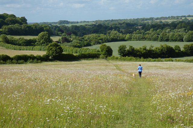
Button's Copse is a picturesque woodland located in the county of Hampshire, England. Spanning an area of approximately 30 acres, it is a well-preserved example of a traditional British copse or small woodland. Situated near the village of Bramshaw, Button's Copse is a popular destination for nature enthusiasts, hikers, and birdwatchers.

The copse is predominantly made up of native deciduous trees, including oak, beech, and birch, which provide a dense canopy and create a serene and tranquil atmosphere. The forest floor is covered with a variety of flora, such as bluebells, wild garlic, and ferns, adding to the area's natural beauty.

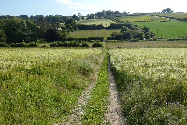
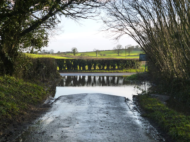
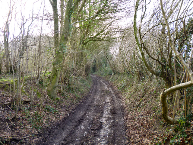
Visitors to Button's Copse can enjoy a network of well-maintained footpaths that wind through the wood, offering a chance to explore the diverse plant and animal life. The copse is home to a wide range of wildlife, including deer, foxes, badgers, and numerous species of birds, making it a haven for birdwatchers. The melodious songs of thrushes, robins, and blackbirds can often be heard echoing through the trees.

Button's Copse also holds historical significance, with remnants of ancient earthworks and boundaries still visible within its boundaries. These features provide a glimpse into the copse's long-standing presence in the landscape and its importance to the local community throughout the centuries.

Overall, Button's Copse offers visitors a chance to immerse themselves in the beauty of nature, providing a peaceful retreat from the hustle and bustle of everyday life.

If you have any feedback on the listing, please let us know in the comments section below.

Button's Copse Images

Images are sourced within 2km of 51.071641/-0.95004722 or Grid Reference SU7330. Thanks to Geograph Open Source API. All images are credited.

Grassland, Hawkley Descending through a flowery meadow, the footpath connecting Noar Hill and Selborne.
Grassland, Hawkley
Descending through a flowery meadow, the footpath connecting Noar Hill and Selborne.
Farmland, Newton Valence Descending through barley, the restricted byway below King's Farm.
Farmland, Newton Valence
Descending through barley, the restricted byway below King's Farm.
Farmland, Priors Dean A crop of oats on the hillside to the west of Goleigh Farm.
Farmland, Priors Dean
A crop of oats on the hillside to the west of Goleigh Farm.
A big puddle At the bottom of Hullam Lane.
A big puddle
At the bottom of Hullam Lane.
Holtham Lane A public byway.
Holtham Lane
A public byway.
Holy Rood, Empshott: family memorial
Holy Rood, Empshott: memorial to a general's daughter Also see <span class="nowrap"><a title="https://en.wikipedia.org/wiki/Lord_William_Seymour_(British_Army_officer)" rel="nofollow ugc noopener" href="https://en.wikipedia.org/wiki/Lord_William_Seymour_(British_Army_officer)">Link</a><img style="margin-left:2px;" alt="External link" title="External link - shift click to open in new window" src="https://s1.geograph.org.uk/img/external.png" width="10" height="10"/></span>
Holy Rood, Empshott: memorial to a general's daughter
Also see LinkExternal link
Holy Rood, Empshott: war memorial
Holy Rood, Empshott:  memorial on the organ
Holy Rood, Empshott: memorial on the organ
Holy Rood, Empshott:  memorial to a churchwarden
Holy Rood, Empshott: memorial to a churchwarden
Holy Rood, Empshott:  The Ten Commandments (i to iv)
Holy Rood, Empshott: The Ten Commandments (i to iv)
Holy Rood, Empshott:  The  Ten Commandments (v to x)
Holy Rood, Empshott: The Ten Commandments (v to x)
Holy Rood, Empshott:  memorial to a sapper Also see <span class="nowrap"><a title="http://www.cwgc.org/find-war-dead/casualty/719992/BURTON,%20FRANK" rel="nofollow ugc noopener" href="http://www.cwgc.org/find-war-dead/casualty/719992/BURTON,%20FRANK">Link</a><img style="margin-left:2px;" alt="External link" title="External link - shift click to open in new window" src="https://s1.geograph.org.uk/img/external.png" width="10" height="10"/></span>
Holy Rood, Empshott: memorial to a sapper
Also see LinkExternal link
Holy Rood, Empshott:  memorial to a North Devonian
Holy Rood, Empshott: memorial to a North Devonian
Holy Rood, Empshott:  memorial to a Major Also see <span class="nowrap"><a title="http://www.cwgc.org/find-war-dead/casualty/322923/JOHNSTONE,%20JAMES%20HENRY%20WALLER" rel="nofollow ugc noopener" href="http://www.cwgc.org/find-war-dead/casualty/322923/JOHNSTONE,%20JAMES%20HENRY%20WALLER">Link</a><img style="margin-left:2px;" alt="External link" title="External link - shift click to open in new window" src="https://s1.geograph.org.uk/img/external.png" width="10" height="10"/></span>
Holy Rood, Empshott: memorial to a Major
Also see LinkExternal link
Holy Rood, Empshott:  memorial to a vicar's mother Harnett's father was Falkiner Minchin Harnett, who was District Inspector of the Royal Irish Constabulary at Cashel, County Tipperary, Ireland. He was educated at the University of Durham and ordained in 1903. He came to Empshott in 1915 after curacies at Oldswinford, Southampton and Bournemouth. He married Caroline Elise Blunt, daughter of Maj.-Gen. Grant Blunt and Rachel Eliza Pile, on 2 September 1919. In 1924 he left to become Vicar of Hatherden
Holy Rood, Empshott: memorial to a vicar's mother
Harnett's father was Falkiner Minchin Harnett, who was District Inspector of the Royal Irish Constabulary at Cashel, County Tipperary, Ireland. He was educated at the University of Durham and ordained in 1903. He came to Empshott in 1915 after curacies at Oldswinford, Southampton and Bournemouth. He married Caroline Elise Blunt, daughter of Maj.-Gen. Grant Blunt and Rachel Eliza Pile, on 2 September 1919. In 1924 he left to become Vicar of Hatherden
Holy Rood, Empshott:  memorial to a nineteenth century incumbent The only thing I could find out was that he died while travelling by train to London (Carlisle Patriot Cumbria, England 19 February 1897)
Holy Rood, Empshott: memorial to a nineteenth century incumbent
The only thing I could find out was that he died while travelling by train to London (Carlisle Patriot Cumbria, England 19 February 1897)
Holy Rood, Empshott:  memorial to an eldest son Also see <span class="nowrap"><a title="http://www.thepeerage.com/p57300.htm#i572999" rel="nofollow ugc noopener" href="http://www.thepeerage.com/p57300.htm#i572999">Link</a><img style="margin-left:2px;" alt="External link" title="External link - shift click to open in new window" src="https://s1.geograph.org.uk/img/external.png" width="10" height="10"/></span>
Holy Rood, Empshott: memorial to an eldest son
Also see LinkExternal link
Show me another place!

Button's Copse is located at Grid Ref: SU7330 (Lat: 51.071641, Lng: -0.95004722)

Administrative County: Hampshire

District: East Hampshire

Police Authority: Hampshire

What 3 Words

///provide.barrel.entrust. Near Liss, Hampshire

Related Wikis

Goleigh Hill

Goleigh Hill is one of the highest points in the county of Hampshire, England. It is part of the Hampshire Downs and reaches a height of 220 metres (720...

Noar Hill

Noar Hill is a 63-hectare (160-acre) biological Site of Special Scientific Interest south of Selborne in Hampshire. It is a Nature Conservation Review...

Priors Dean

Priors Dean is a hamlet in the Hampshire Downs about 3 miles (5 km) west of Liss and about 4 miles (6.4 km) north of Petersfield, Hampshire, England. It...

Empshott

Empshott is a village and former civil parish, now in the parish of Hawkley, in the East Hampshire district of Hampshire, England. It lies 3.5 miles (5...

Upper Greensand Hangers: Empshott to Hawkley

Upper Greensand Hangers: Empshott to Hawkley is a 37.7-hectare (93-acre) biological Site of Special Scientific Interest north of Petersfield in Hampshire...

Hawkley

Hawkley is a village, ecclesiastical parish and civil parish in the East Hampshire district of Hampshire, England. It is 3.5 miles (5.7 km) north of Petersfield...

Newton Valence

Newton Valence is a village and civil parish in the East Hampshire district of Hampshire, England. It is 4.4 miles (7.1 km) south of Alton, just off the...

Selborne Hill

Selborne Hill is one of the highest points in the county of Hampshire, England. It is one of the East Hampshire Hangers, a line of prominent hills on the...

Nearby Amenities

Located within 500m of 51.071641,-0.95004722
Barrier: stile
Lat/Long: 51.0727122/-0.9433918
Barrier: stile
Source: survey
Lat/Long: 51.06769/-0.9487268
Barrier: stile
Lat/Long: 51.0698996/-0.9455543
Barrier: stile
Lat/Long: 51.0696203/-0.9482008
Barrier: stile
Lat/Long: 51.0717329/-0.9457227
Natural: spring
Lat/Long: 51.0674024/-0.9489032
Keyham Farm
Place: farm
Lat/Long: 51.0700301/-0.9560624
The data included in this document is from www.openstreetmap.org. The data is made available under ODbL.

Have you been to Button's Copse?

Leave your review of Button's Copse below (or comments, questions and feedback).