Ashlee Wood
Wood, Forest in Oxfordshire South Oxfordshire
England
Ashlee Wood

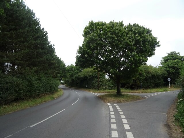
Ashlee Wood is a picturesque and idyllic forest located in Oxfordshire, England. Covering an area of approximately 500 acres, it is a popular destination for nature lovers and outdoor enthusiasts. The wood is characterized by its dense and diverse collection of trees, including oak, beech, and birch, creating a vibrant and vibrant green landscape.
One of the notable features of Ashlee Wood is its extensive network of walking trails and paths, which allow visitors to explore the forest at their own pace. These trails wind their way through the woodland, offering stunning views of the surrounding countryside and providing opportunities for birdwatching and wildlife spotting. The wood is home to a variety of bird species, including woodpeckers, owls, and various songbirds.
Ashlee Wood is also rich in history and heritage. It is believed to have been in existence since medieval times, and remnants of ancient settlements and stone structures can still be found within its boundaries. The wood has been carefully preserved and managed to maintain its natural beauty and ecological integrity.
Visitors to Ashlee Wood can take advantage of the facilities available, such as picnic areas and designated camping spots. The forest is also a popular location for educational activities, with schools and nature organizations often organizing field trips and workshops for children and adults alike.
Overall, Ashlee Wood offers a tranquil and enchanting escape from the hustle and bustle of city life. Its stunning natural beauty, rich wildlife, and historical significance make it a must-visit destination for anyone seeking a connection with nature and a sense of peace and serenity.
If you have any feedback on the listing, please let us know in the comments section below.
Ashlee Wood Images
Images are sourced within 2km of 51.527794/-1.0527661 or Grid Reference SU6581. Thanks to Geograph Open Source API. All images are credited.


Ashlee Wood is located at Grid Ref: SU6581 (Lat: 51.527794, Lng: -1.0527661)
Administrative County: Oxfordshire
District: South Oxfordshire
Police Authority: Thames Valley
What 3 Words
///requests.guitars.crouches. Near Rotherfield Peppard, Oxfordshire
Nearby Locations
Related Wikis

Exlade Street
Exlade Street is a hamlet in Checkendon civil parish in Oxfordshire, about 6 miles (9.7 km) northwest of Reading, in the Chiltern Hills. The hamlet is...

The Oratory School
The Oratory School () is an HMC co-educational private Roman Catholic boarding and day school for pupils aged 11–18 located in Woodcote, 6 miles (9.7 km...

Hook End Recording Studios
Hook End Recording Studios was a recording studio located in Hook End Manor, a 16th-century Elizabethan house near Checkendon, Oxfordshire, England. Its...

Langtree School
Langtree School is a coeducational secondary school located in the village of Woodcote in South Oxfordshire, England. The school has approximately 624...

Woodcote
Woodcote is a village and civil parish in South Oxfordshire, about 5 miles (8 km) southeast of Wallingford and about 7 miles (11 km) northwest of Reading...

St Peter and St Paul, Checkendon
St Peter and St Paul is the Church of England parish church of Checkendon, a village in Oxfordshire, England. Its parish is part of the Deanery of Henley...
Checkendon
Checkendon is a village and civil parish about 6 miles (10 km) west of Henley-on-Thames in South Oxfordshire and about 9 miles (14 km) north west of Reading...
Crays Pond
Crays Pond is a hamlet situated in the parish of Goring Heath in South Oxfordshire. Crays Pond is about 2.4 miles (3.9 km) northeast of Goring-on-Thames...
Nearby Amenities
Located within 500m of 51.527794,-1.0527661Have you been to Ashlee Wood?
Leave your review of Ashlee Wood below (or comments, questions and feedback).