Eagle Tor

Settlement in Derbyshire Derbyshire Dales

England

Eagle Tor

Cottages in Stanton in Peak A long thin village climbing the hillside. A shower is passing a couple of miles to the north.
Cottages in Stanton in Peak Credit: Bill Boaden

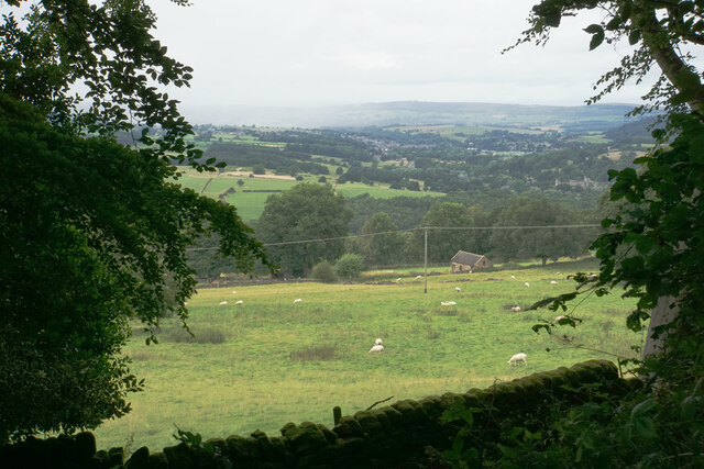
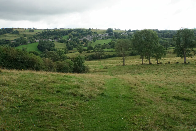
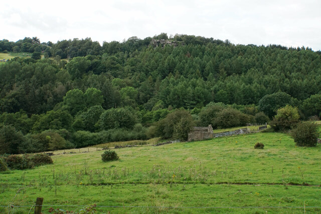
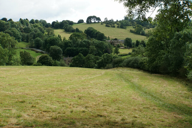
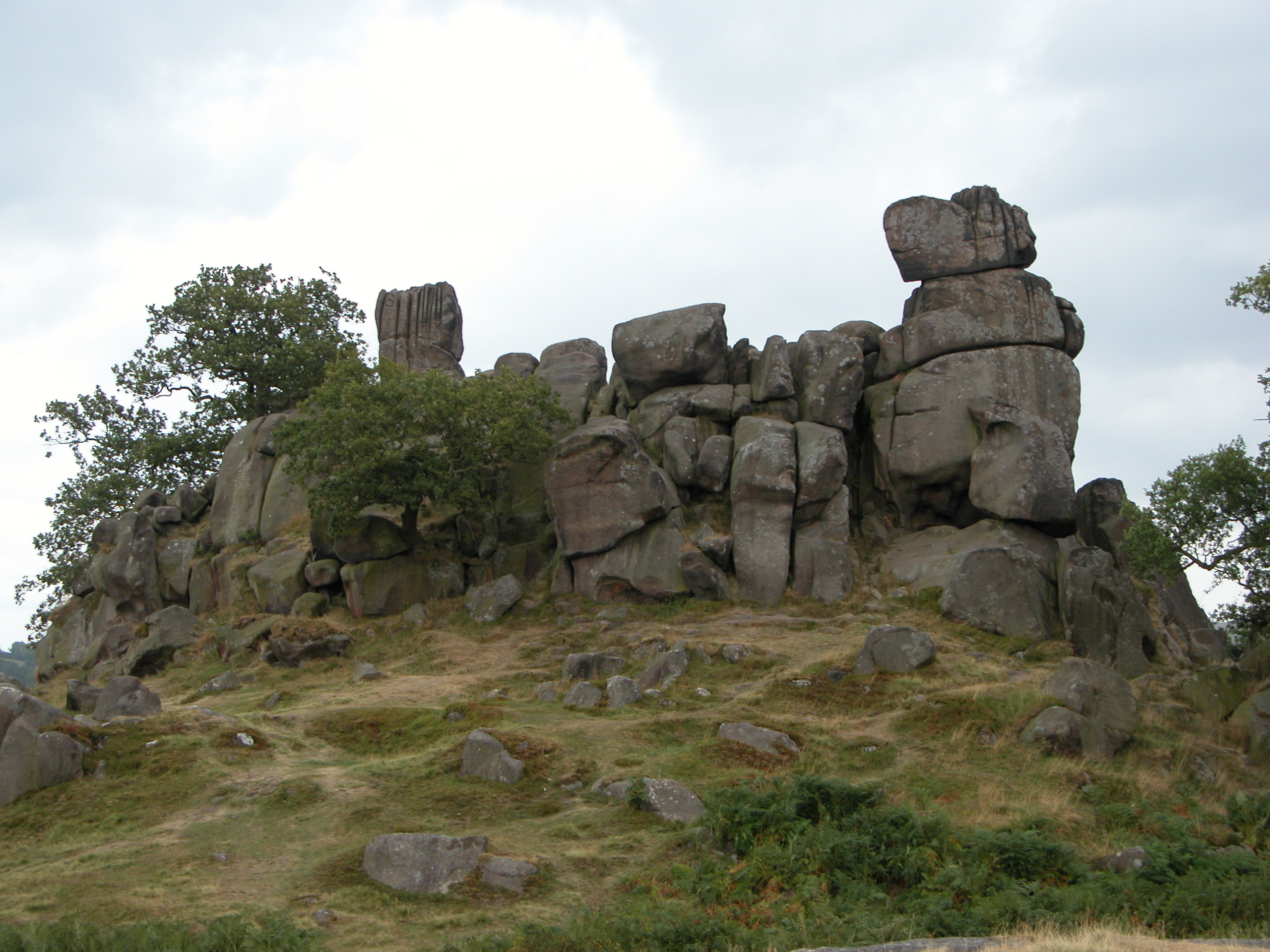
Eagle Tor is a prominent limestone outcrop located in the county of Derbyshire, England. Situated near the village of Brassington, it forms part of the picturesque Peak District National Park. The tor stands at an elevation of approximately 400 meters (1,312 feet) above sea level and offers stunning panoramic views of the surrounding landscape.

Eagle Tor is notable for its distinctive shape, resembling the head of an eagle in flight, which has earned it its name. The rock formation is composed of layers of limestone, a characteristic feature of the region's geology. Over the years, weathering and erosion have sculpted the tor, resulting in its unique and captivating appearance.

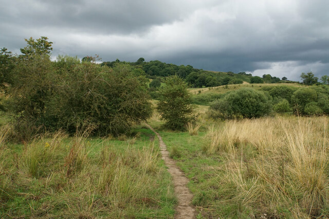
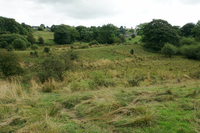
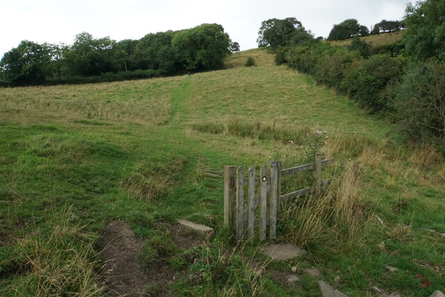
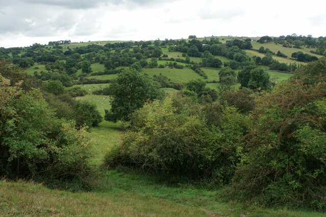
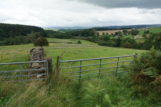
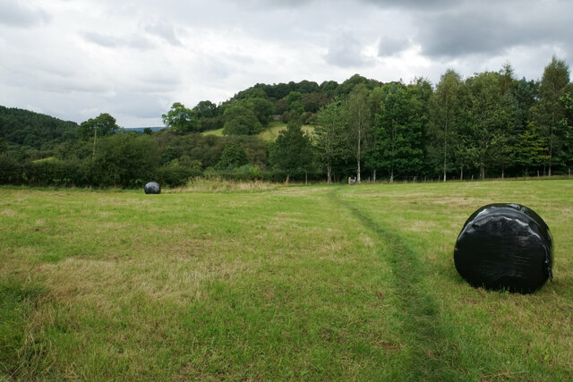
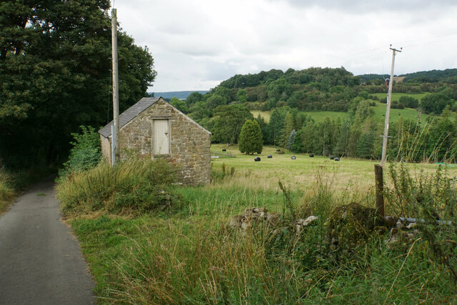
The tor is a popular destination for hikers and nature enthusiasts, thanks to its accessibility and breathtaking vistas. The surrounding area boasts a diverse range of flora and fauna, with heather, bracken, and bilberry covering the slopes, and various bird species frequently spotted soaring above.

Visitors to Eagle Tor can embark on a number of scenic walks, taking in the stunning views of the Derbyshire Dales and the nearby Carsington Water reservoir. The tor also provides an excellent vantage point for photographers, capturing the beauty of the Peak District's rolling hills and valleys.

In conclusion, Eagle Tor is a remarkable limestone outcrop located in Derbyshire's Peak District National Park. Its distinctive shape, breathtaking views, and accessibility make it a popular destination for outdoor enthusiasts and nature lovers alike.

If you have any feedback on the listing, please let us know in the comments section below.

Eagle Tor Images

Images are sourced within 2km of 53.160913/-1.65597 or Grid Reference SK2362. Thanks to Geograph Open Source API. All images are credited.

Cottages in Stanton in Peak A long thin village climbing the hillside. A shower is passing a couple of miles to the north.
Cottages in Stanton in Peak
A long thin village climbing the hillside. A shower is passing a couple of miles to the north.
Field near Stanton in Peak A view from the top of the village, which is off to the left.
Field near Stanton in Peak
A view from the top of the village, which is off to the left.
Cottages in Stanton in Peak Near the bottom of the long thin village.
Cottages in Stanton in Peak
Near the bottom of the long thin village.
Field at Stanton in Peak Right at the bottom of the village.
Field at Stanton in Peak
Right at the bottom of the village.
Stanton in Peak From the bottom of the village looking up. The spire of Holy Trinity Church is seen but the village continues quite a long way past that.
Stanton in Peak
From the bottom of the village looking up. The spire of Holy Trinity Church is seen but the village continues quite a long way past that.
Stanton in Peak The village pub, the Flying Childers, is straight ahead, and the spire of Holy Trinity Church is behind.
Stanton in Peak
The village pub, the Flying Childers, is straight ahead, and the spire of Holy Trinity Church is behind.
Path from Winster to Birchover Necessarily paved because the ground can be soggy. It is crossing rough grazing land which does not seem to be currently grazed.
Path from Winster to Birchover
Necessarily paved because the ground can be soggy. It is crossing rough grazing land which does not seem to be currently grazed.
Footpath to Winster It crosses an area of rough grazing with a propensity to be very soft when damp. It is fine in the summer months.
Footpath to Winster
It crosses an area of rough grazing with a propensity to be very soft when damp. It is fine in the summer months.
Path to Birchover It is necessary to climb up Birchover Edge.
Path to Birchover
It is necessary to climb up Birchover Edge.
Path to Winster The village of Winster is seen on the hill ahead.
Path to Winster
The village of Winster is seen on the hill ahead.
Fields near Birchover The village is seen in the background from this point on Birchover Edge.
Fields near Birchover
The village is seen in the background from this point on Birchover Edge.
Fields below Birchover Edge Looking roughly towards Winster which is slightly off to the left.
Fields below Birchover Edge
Looking roughly towards Winster which is slightly off to the left.
Fields below Birchover Looking down towards the valley of Ivy Bar Brook.
Fields below Birchover
Looking down towards the valley of Ivy Bar Brook.
Ruined barn near Birchover Hermit's Cave and Robin Hood's Stride are rocky outcrops on the opposite hill.
Ruined barn near Birchover
Hermit's Cave and Robin Hood's Stride are rocky outcrops on the opposite hill.
Path towards Elton Elton is over the top of the hill seen ahead.
Path towards Elton
Elton is over the top of the hill seen ahead.
Path to Birchover The path leaves Dudwood Lane by Meadowside Farm. The field has been harvested for silage.
Path to Birchover
The path leaves Dudwood Lane by Meadowside Farm. The field has been harvested for silage.
Barn by Dudwood Lane The valley of Ivy Bar Brook is down to the right, and Bradley Rocks are in the trees on the other side.
Barn by Dudwood Lane
The valley of Ivy Bar Brook is down to the right, and Bradley Rocks are in the trees on the other side.
The top of Dudwood Lane The lane is also the route of the Limestone Way.
The top of Dudwood Lane
The lane is also the route of the Limestone Way.
Show me another place!

Eagle Tor is located at Grid Ref: SK2362 (Lat: 53.160913, Lng: -1.65597)

Administrative County: Derbyshire

District: Derbyshire Dales

Police Authority: Derbyshire

What 3 Words

///curtains.fended.scrolled. Near Youlgreave, Derbyshire

Related Wikis

Nine Stones Close

Nine Stones Close, also known as the Grey Ladies, is a stone circle on Harthill Moor in Derbyshire in the English East Midlands. It is part of a tradition...

Doll Tor

Doll Tor is a stone circle located just to the west of Stanton Moor, near the village of Birchover, Derbyshire in the English East Midlands. Doll Tor is...

St Michael's Church, Birchover

St Michael's Church, Birchover, also known as Rowtor Chapel, is a Grade II listed parish church in the Church of England in Birchover, Derbyshire. Located...

Robin Hood's Stride

Robin Hood's Stride (also known as Mock Beggar's Mansion) is a rock formation on the Limestone Way in Derbyshire close to the village of Elton. The nearest...

Nearby Amenities

Located within 500m of 53.160913,-1.65597
Barrier: stile
Lat/Long: 53.1587262/-1.6561118
Bus Stop
Bus: yes
Public Transport: platform
Lat/Long: 53.1606088/-1.6549124
Bus Stop
Bus: yes
Public Transport: platform
Lat/Long: 53.1607632/-1.6549639
Bus Stop
Bus: yes
Ele: 189.9848633
Public Transport: platform
Lat/Long: 53.1590438/-1.6506944
Bus Stop
Bus: yes
Public Transport: platform
Lat/Long: 53.1589795/-1.6508204
Hermits Cave
Natural: cave_entrance
Lat/Long: 53.1577095/-1.6607304
Crucifixion
Artwork Type: sculpture
Material: stone
Tourism: artwork
Lat/Long: 53.1577115/-1.6607043
The data included in this document is from www.openstreetmap.org. The data is made available under ODbL.

Have you been to Eagle Tor?

Leave your review of Eagle Tor below (or comments, questions and feedback).