Dungeon Plantation

Wood, Forest in Derbyshire Derbyshire Dales

England

Dungeon Plantation

Path down from Stanton Moor
Path down from Stanton Moor Credit: David Lally

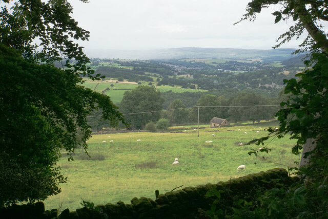
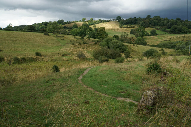
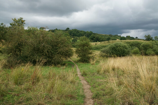
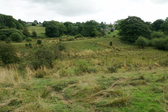
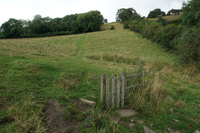
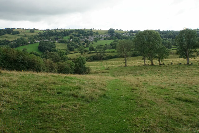
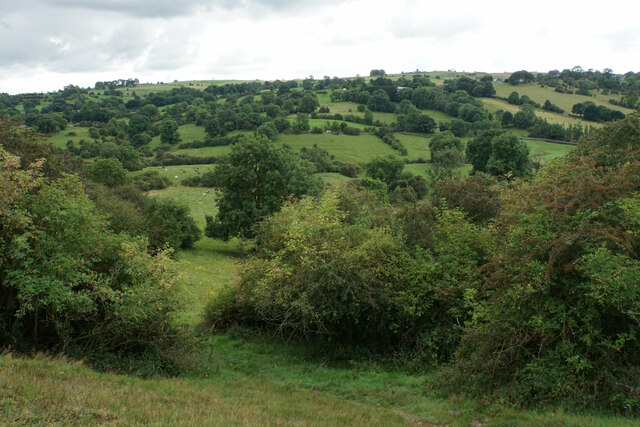
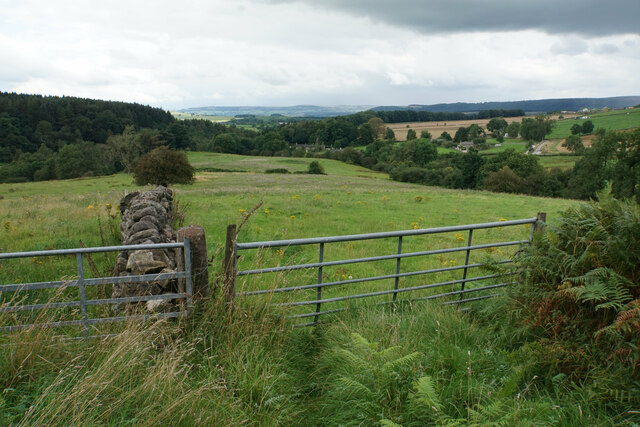
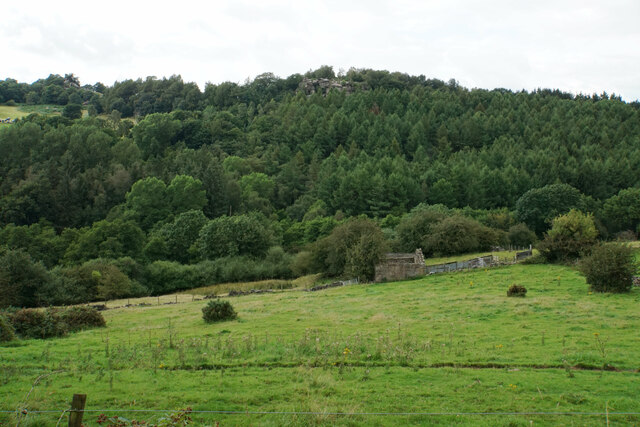
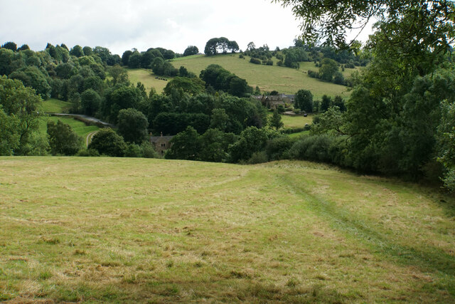
Dungeon Plantation is a picturesque woodland area located in Derbyshire, England. Spanning across a sprawling landscape, this enchanting forest is a haven for nature enthusiasts and outdoor adventurers alike. With its dense foliage and towering trees, Dungeon Plantation offers a serene and tranquil escape from the hustle and bustle of everyday life.

The woodland is home to a diverse range of plant and animal species, making it a hotspot for wildlife enthusiasts. Visitors can expect to encounter a variety of bird species, such as woodpeckers and owls, as well as small mammals like squirrels and rabbits. The forest floor is adorned with a carpet of wildflowers, adding a splash of color to the already vibrant surroundings.

Dungeon Plantation also boasts several well-maintained walking trails, allowing visitors to explore the woodland at their own pace. These trails wind through the forest, offering glimpses of hidden waterfalls, babbling brooks, and ancient stone formations. The tranquil atmosphere and breathtaking scenery make it a popular spot for nature walks, photography, and picnics.

For those seeking a more adventurous experience, Dungeon Plantation provides opportunities for camping and hiking. The dense forest provides ample shade and privacy, making it an ideal location for camping under the stars. Hiking enthusiasts can tackle the challenging terrain, with various trails catering to different skill levels.

Overall, Dungeon Plantation in Derbyshire offers a captivating and immersive experience for nature lovers. With its rich biodiversity, stunning landscapes, and recreational activities, it is a must-visit destination for anyone seeking to reconnect with nature in the heart of England.

If you have any feedback on the listing, please let us know in the comments section below.

Dungeon Plantation Images

Images are sourced within 2km of 53.157739/-1.6440911 or Grid Reference SK2362. Thanks to Geograph Open Source API. All images are credited.

Path down from Stanton Moor
Leaning oak Wind-blown on Stanton Moor.
Leaning oak
Wind-blown on Stanton Moor.
Cottages in Stanton in Peak A long thin village climbing the hillside. A shower is passing a couple of miles to the north.
Cottages in Stanton in Peak
A long thin village climbing the hillside. A shower is passing a couple of miles to the north.
Field near Stanton in Peak A view from the top of the village, which is off to the left.
Field near Stanton in Peak
A view from the top of the village, which is off to the left.
Stanton in Peak The village pub, the Flying Childers, is straight ahead, and the spire of Holy Trinity Church is behind.
Stanton in Peak
The village pub, the Flying Childers, is straight ahead, and the spire of Holy Trinity Church is behind.
Main Street, Winster The old market hall is the most prominent feature. Almost every building in this view is listed.
Main Street, Winster
The old market hall is the most prominent feature. Almost every building in this view is listed.
Winster Methodist Church A Wesleyan Reform Chapel from 1852. As I took this, I could hear lusty hymn-singing from inside.
Winster Methodist Church
A Wesleyan Reform Chapel from 1852. As I took this, I could hear lusty hymn-singing from inside.
Woodhouse Lane A narrow residential street off Main Street.
Woodhouse Lane
A narrow residential street off Main Street.
Path to Birchover Crossing the declivity between Winster and Birchover.
Path to Birchover
Crossing the declivity between Winster and Birchover.
Path from Winster to Birchover Necessarily paved because the ground can be soggy. It is crossing rough grazing land which does not seem to be currently grazed.
Path from Winster to Birchover
Necessarily paved because the ground can be soggy. It is crossing rough grazing land which does not seem to be currently grazed.
Footpath to Winster It crosses an area of rough grazing with a propensity to be very soft when damp. It is fine in the summer months.
Footpath to Winster
It crosses an area of rough grazing with a propensity to be very soft when damp. It is fine in the summer months.
Path to Birchover It is necessary to climb up Birchover Edge.
Path to Birchover
It is necessary to climb up Birchover Edge.
Path to Winster The village of Winster is seen on the hill ahead.
Path to Winster
The village of Winster is seen on the hill ahead.
Fields near Birchover The village is seen in the background from this point on Birchover Edge.
Fields near Birchover
The village is seen in the background from this point on Birchover Edge.
Fields below Birchover Edge Looking roughly towards Winster which is slightly off to the left.
Fields below Birchover Edge
Looking roughly towards Winster which is slightly off to the left.
Fields below Birchover Looking down towards the valley of Ivy Bar Brook.
Fields below Birchover
Looking down towards the valley of Ivy Bar Brook.
Ruined barn near Birchover Hermit's Cave and Robin Hood's Stride are rocky outcrops on the opposite hill.
Ruined barn near Birchover
Hermit's Cave and Robin Hood's Stride are rocky outcrops on the opposite hill.
Path towards Elton Elton is over the top of the hill seen ahead.
Path towards Elton
Elton is over the top of the hill seen ahead.
Show me another place!

Dungeon Plantation is located at Grid Ref: SK2362 (Lat: 53.157739, Lng: -1.6440911)

Administrative County: Derbyshire

District: Derbyshire Dales

Police Authority: Derbyshire

What 3 Words

///tickets.emerge.elsewhere. Near Youlgreave, Derbyshire

Related Wikis

St Michael's Church, Birchover

St Michael's Church, Birchover, also known as Rowtor Chapel, is a Grade II listed parish church in the Church of England in Birchover, Derbyshire. Located...

Doll Tor

Doll Tor is a stone circle located just to the west of Stanton Moor, near the village of Birchover, Derbyshire in the English East Midlands. Doll Tor is...
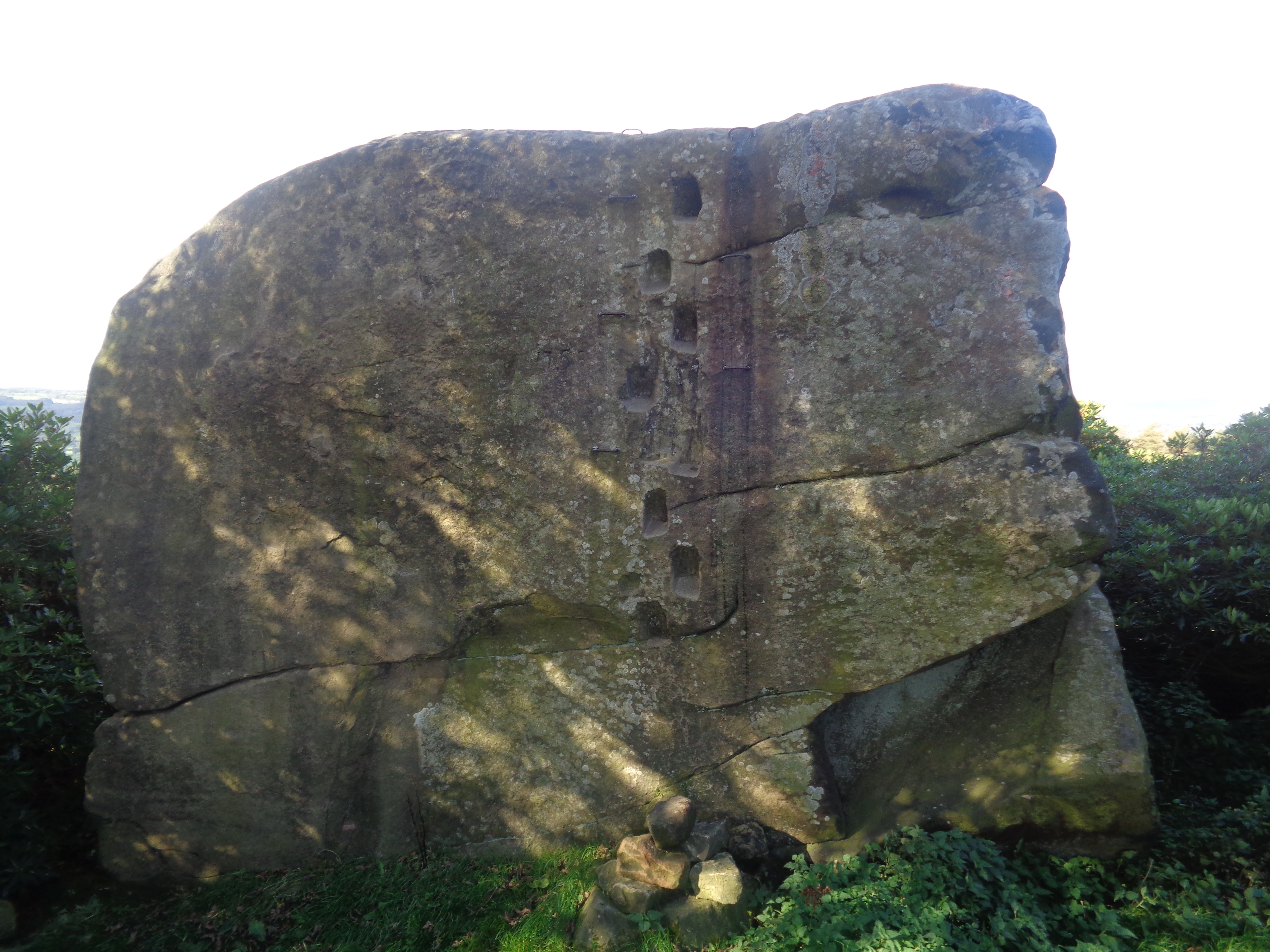
Andle Stone

The Andle Stone is a large gritstone boulder on Stanton Moor in Derbyshire. The stone block is 6m long, 4m high and lies within a low, circular, dry stone...
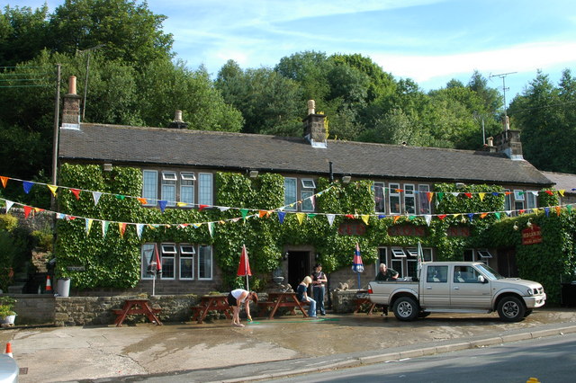
Birchover

Birchover is a village and civil parish in the Peak District National Park in Derbyshire, England, five miles north-west of Matlock. At the 2001 Census...

Derbyshire Dales (UK Parliament constituency)

Derbyshire Dales ( DAR-bee-sheer, -⁠shər) is a constituency that has been represented in the House of Commons of the UK Parliament since 2019 by Sarah...

Stanton Moor

Stanton Moor is a small upland area in the Derbyshire Peak District of central northern England, lying between Matlock and Bakewell near the villages of...

Nine Stones Close

Nine Stones Close, also known as the Grey Ladies, is a stone circle on Harthill Moor in Derbyshire in the English East Midlands. It is part of a tradition...
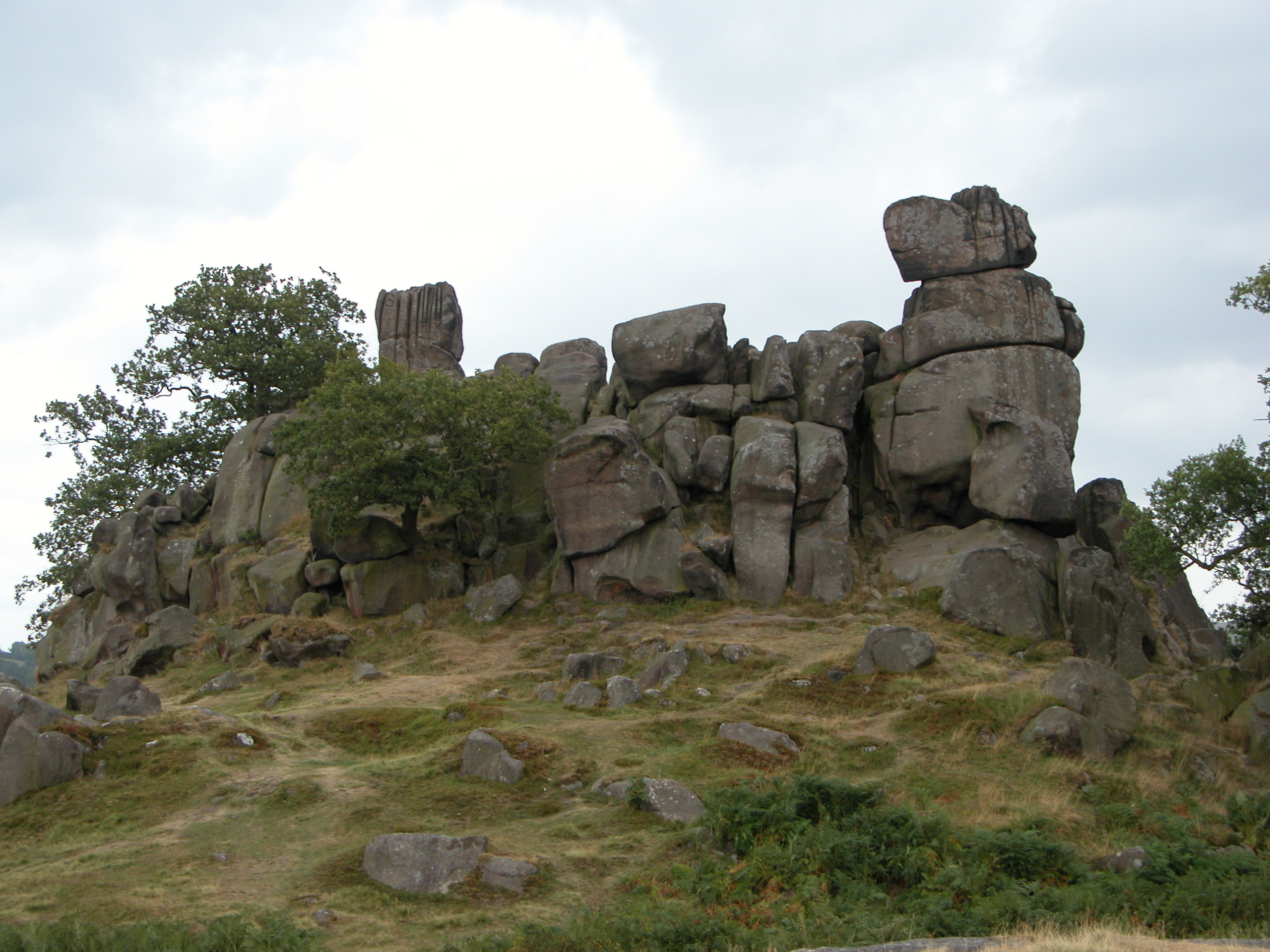
Robin Hood's Stride

Robin Hood's Stride (also known as Mock Beggar's Mansion) is a rock formation on the Limestone Way in Derbyshire close to the village of Elton. The nearest...

Related Videos

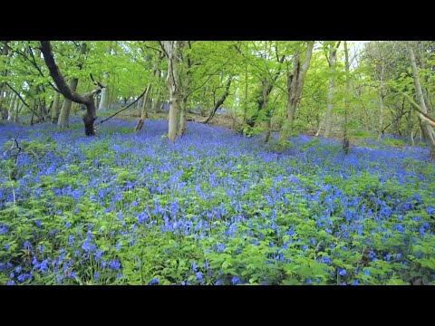
A Walk through a Bluebell Forest, English Countryside 4K

https://www.buymeacoffee.com/Daveswalks All support is hugely appreciated and it helps me keep the channel going! No talking ...

Doll Tor (Six Stones) Stone Circle - Peak District | Solo Hiking

Explore the enchanting Doll Tor (Six Stones) stone circle in the Peak District. Join me for a short cinematic adventure and discover ...

Cork Stone & Nine Ladies Stone Circle | Solo Hiking Film

Unveiling the Mysteries and Witches of Cork Stone and Nine Ladies Stone Circle in Stanton Moor - 5K Cinematic Travel Video ...

Nearby Amenities

Located within 500m of 53.157739,-1.6440911
Birchover
Is In Country: UK
Is In County: Derbyshire
Place: village
Wikidata: Q4915766
Lat/Long: 53.1559941/-1.6444649
Bus Stop
Bus: yes
Public Transport: platform
Lat/Long: 53.1561314/-1.6451105
Bench
Created By: Potlatch 0.10f
Lat/Long: 53.1560078/-1.6460547
Bus Stop
Bus: yes
Public Transport: platform
Lat/Long: 53.1560339/-1.6460897
Post Box
Brand: Royal Mail
Brand Wikidata: Q638098
Brand Wikipedia: en:Royal Mail
Operator: Royal Mail
Operator Wikidata: Q638098
Post Box Type: wall
Ref: DE4 978
Royal Cypher: GR
Royal Cypher Wikidata: Q33102273
Lat/Long: 53.1561365/-1.6453509
Pub
The Druid
Addr City: Matlock
Addr Postcode: DE4 2BL
Addr Street: Main Street
Addr Village: Birchover
Description Floor: stone
Fhrs Id: 1626207
Food: yes
Outdoor Seating: yes
Parking: yes
Real Ale: 3 beers
Website: https://druidbirchover.co.uk/
Wikidata: Q26619590
Lat/Long: 53.1559523/-1.6480157
Post Box
Brand: Royal Mail
Brand Wikidata: Q638098
Brand Wikipedia: en:Royal Mail
Operator: Royal Mail
Operator Wikidata: Q638098
Ref: DE4 948
Lat/Long: 53.1581776/-1.6497668
Bus Stop
Bus: yes
Ele: 189.9848633
Public Transport: platform
Lat/Long: 53.1590438/-1.6506944
Ele: 218.3433838
Lat/Long: 53.15719/-1.6471272
Bus Stop
Bus: yes
Public Transport: platform
Lat/Long: 53.1589795/-1.6508204
Ele: 279.0000000
Lat/Long: 53.1584039/-1.6384129
Ele: 272.0000000
Lat/Long: 53.15768/-1.6394037
Ele: 264.0000000
Lat/Long: 53.1571352/-1.6400932
Teo's Village Shop and Deli
Pies: no
Shop: convenience
Lat/Long: 53.1560941/-1.6465068
Toilets
Ele: 229.0000000
Lat/Long: 53.1561647/-1.6453015
Ele: 230.0000000
Information: board
Tourism: information
Lat/Long: 53.1561177/-1.6454755
Ele: 215
Lat/Long: 53.1557771/-1.6483102
Barrier: stile
Source: survey;bing;gps
Stile: squeezer
Lat/Long: 53.1557672/-1.6416524
Defibrillator
Access: yes
Booth: K6
Check Date: 2023-03-09
Covered: booth
Defibrillator Location: In old telephone box.
Disused Amenity: telephone
Emergency: defibrillator
Indoor: no
Opening Hours: 24/7
Ref GB The Circuit: 062027BD-8810-421E-AF2B-B0BD009F284F
Lat/Long: 53.1559442/-1.6460984
Barn Farm Campsite & Bunk Barns
Tourism: hostel
Lat/Long: 53.1572574/-1.6370792
Barn Farm Campsite & Bunk Barns
Addr City: Matlock
Addr Postcode: DE4 2BL
Addr Village: Birchover
Phone: +44 1629 650245
Source: survey
Tourism: camp_site
Lat/Long: 53.1572992/-1.6369558
Taxi
DJG Taxis Office
Lat/Long: 53.1552373/-1.643774
Barrier: entrance
Source: survey;gps
Lat/Long: 53.1557758/-1.6483203
Generator Method: photovoltaic
Generator Output Electricity: yes
Generator Source: solar
Generator Type: solar_photovoltaic_panel
Location: roof
Power: generator
Lat/Long: 53.1551336/-1.6438284
Generator Method: photovoltaic
Generator Output Electricity: yes
Generator Source: solar
Generator Type: solar_photovoltaic_panel
Location: roof
Power: generator
Lat/Long: 53.1558/-1.6476156
Parking
Access: yes
Capacity Disabled: 4
Fee: no
Lat/Long: 53.1559498/-1.6477548
Surface: gravel
Tourism: camp_pitch
Lat/Long: 53.1570318/-1.6384555
Surface: gravel
Tourism: camp_pitch
Lat/Long: 53.1569928/-1.6385622
Surface: gravel
Tourism: camp_pitch
Lat/Long: 53.1569522/-1.6386721
Surface: gravel
Tourism: camp_pitch
Lat/Long: 53.156912/-1.6387828
Surface: gravel
Tourism: camp_pitch
Lat/Long: 53.156867/-1.6389048
Surface: gravel
Tourism: camp_pitch
Lat/Long: 53.1568227/-1.6390201
Surface: gravel
Tourism: camp_pitch
Lat/Long: 53.1567837/-1.6391254
Surface: gravel
Tourism: camp_pitch
Lat/Long: 53.1567395/-1.6392428
Surface: gravel
Tourism: camp_pitch
Lat/Long: 53.1566852/-1.6393903
Barrier: entrance
Lat/Long: 53.1608041/-1.6397272
Shippon Cottage
Addr City: Birchover
Addr Housenumber: 17
Addr Street: Main Street
Tourism: chalet
Website: https://shipponcottage.com/
Lat/Long: 53.1562633/-1.6443356
The data included in this document is from www.openstreetmap.org. The data is made available under ODbL.

Have you been to Dungeon Plantation?

Leave your review of Dungeon Plantation below (or comments, questions and feedback).