Breechwell Plantation

Wood, Forest in Derbyshire Derbyshire Dales

England

Breechwell Plantation

Path down from Stanton Moor
Path down from Stanton Moor Credit: David Lally

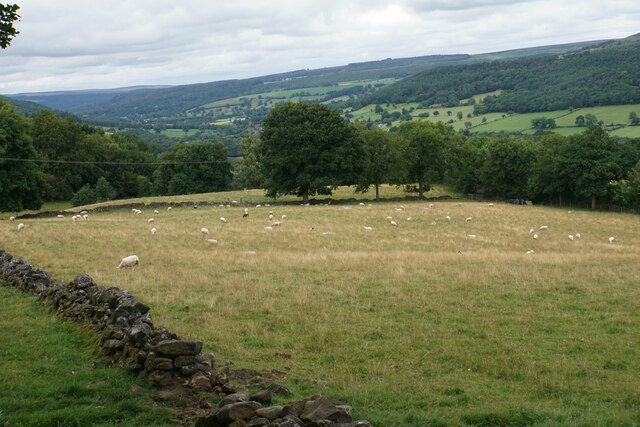
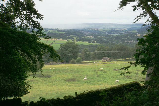
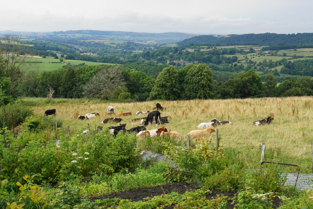
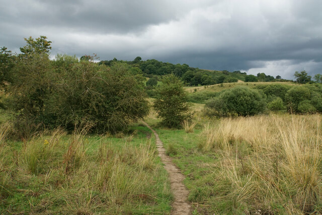
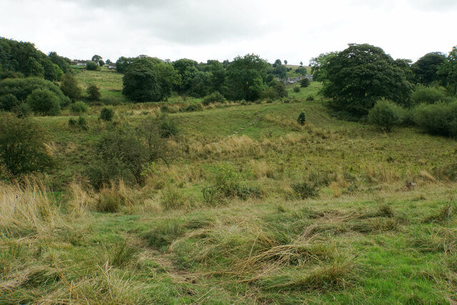
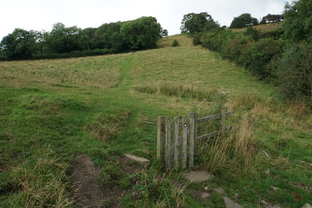
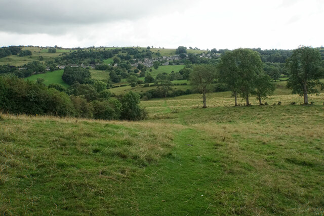
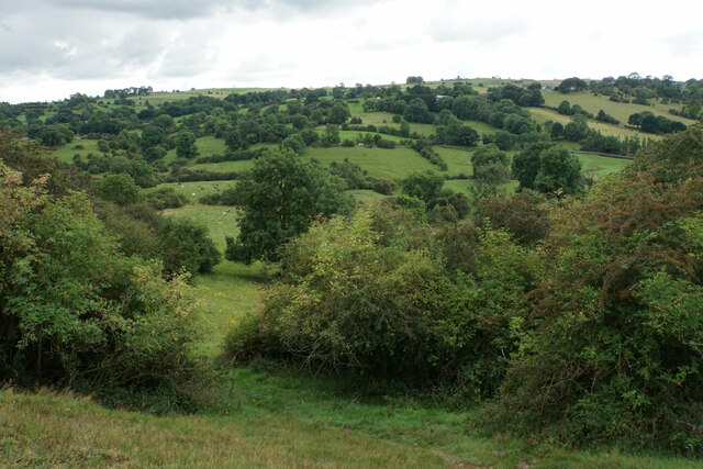
Breechwell Plantation, located in Derbyshire, England, is a picturesque woodland area that spans over a vast expanse of 500 acres. Situated in the heart of the county, the plantation is known for its serene and tranquil environment, attracting nature enthusiasts and outdoor adventurers alike.

The woodland is predominantly made up of deciduous trees, including oak, beech, and chestnut, which create a rich tapestry of colors during the autumn months. The dense canopy provides a sheltered habitat for a diverse range of wildlife, including deer, foxes, and various bird species. Nature lovers can often be seen exploring the plantation, immersing themselves in the captivating beauty of the woodland.

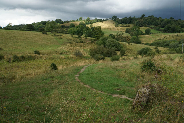
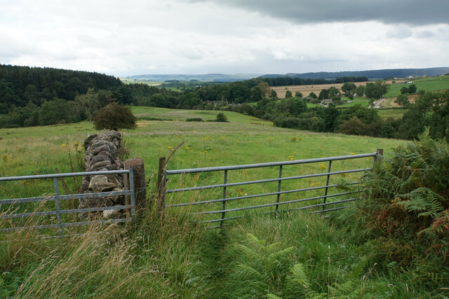
Breechwell Plantation offers several well-maintained walking trails and paths, allowing visitors to explore the area at their own pace. These trails wind through ancient woodlands, offering glimpses of wildflowers and rare plant species that thrive in the understory. The plantation also features a small lake, adding to the tranquility of the surroundings and providing a habitat for waterfowl.

For those seeking a more active experience, Breechwell Plantation offers opportunities for cycling and horseback riding, with designated trails catering to these activities. The plantation is well-equipped with facilities such as picnic areas and restrooms, ensuring visitors have a comfortable and enjoyable experience.

Overall, Breechwell Plantation in Derbyshire is a haven for nature enthusiasts, offering a diverse range of flora and fauna, scenic walking trails, and recreational activities. Its unspoiled beauty and peaceful atmosphere make it a perfect destination for those seeking solace in the midst of nature's wonders.

If you have any feedback on the listing, please let us know in the comments section below.

Breechwell Plantation Images

Images are sourced within 2km of 53.162284/-1.6429767 or Grid Reference SK2362. Thanks to Geograph Open Source API. All images are credited.

Path down from Stanton Moor
Leaning oak Wind-blown on Stanton Moor.
Leaning oak
Wind-blown on Stanton Moor.
Sheep above Stanton Woodhouse Looking up the Derwent valley.
Sheep above Stanton Woodhouse
Looking up the Derwent valley.
Cottages in Stanton in Peak A long thin village climbing the hillside. A shower is passing a couple of miles to the north.
Cottages in Stanton in Peak
A long thin village climbing the hillside. A shower is passing a couple of miles to the north.
Field near Stanton in Peak A view from the top of the village, which is off to the left.
Field near Stanton in Peak
A view from the top of the village, which is off to the left.
Cottages in Stanton in Peak Near the bottom of the long thin village.
Cottages in Stanton in Peak
Near the bottom of the long thin village.
Field at Stanton in Peak Right at the bottom of the village.
Field at Stanton in Peak
Right at the bottom of the village.
Stanton in Peak From the bottom of the village looking up. The spire of Holy Trinity Church is seen but the village continues quite a long way past that.
Stanton in Peak
From the bottom of the village looking up. The spire of Holy Trinity Church is seen but the village continues quite a long way past that.
Stanton in Peak The village pub, the Flying Childers, is straight ahead, and the spire of Holy Trinity Church is behind.
Stanton in Peak
The village pub, the Flying Childers, is straight ahead, and the spire of Holy Trinity Church is behind.
Allotments and cattle at Stanton in Peak Looking down on the valley of the River Wye where Haddon Hall can be seen.
Allotments and cattle at Stanton in Peak
Looking down on the valley of the River Wye where Haddon Hall can be seen.
Path to Birchover Crossing the declivity between Winster and Birchover.
Path to Birchover
Crossing the declivity between Winster and Birchover.
Path from Winster to Birchover Necessarily paved because the ground can be soggy. It is crossing rough grazing land which does not seem to be currently grazed.
Path from Winster to Birchover
Necessarily paved because the ground can be soggy. It is crossing rough grazing land which does not seem to be currently grazed.
Footpath to Winster It crosses an area of rough grazing with a propensity to be very soft when damp. It is fine in the summer months.
Footpath to Winster
It crosses an area of rough grazing with a propensity to be very soft when damp. It is fine in the summer months.
Path to Birchover It is necessary to climb up Birchover Edge.
Path to Birchover
It is necessary to climb up Birchover Edge.
Path to Winster The village of Winster is seen on the hill ahead.
Path to Winster
The village of Winster is seen on the hill ahead.
Fields near Birchover The village is seen in the background from this point on Birchover Edge.
Fields near Birchover
The village is seen in the background from this point on Birchover Edge.
Fields below Birchover Edge Looking roughly towards Winster which is slightly off to the left.
Fields below Birchover Edge
Looking roughly towards Winster which is slightly off to the left.
Fields below Birchover Looking down towards the valley of Ivy Bar Brook.
Fields below Birchover
Looking down towards the valley of Ivy Bar Brook.
Show me another place!

Breechwell Plantation is located at Grid Ref: SK2362 (Lat: 53.162284, Lng: -1.6429767)

Administrative County: Derbyshire

District: Derbyshire Dales

Police Authority: Derbyshire

What 3 Words

///sweeter.topples.depending. Near Youlgreave, Derbyshire

Related Wikis

Doll Tor

Doll Tor is a stone circle located just to the west of Stanton Moor, near the village of Birchover, Derbyshire in the English East Midlands. Doll Tor is...
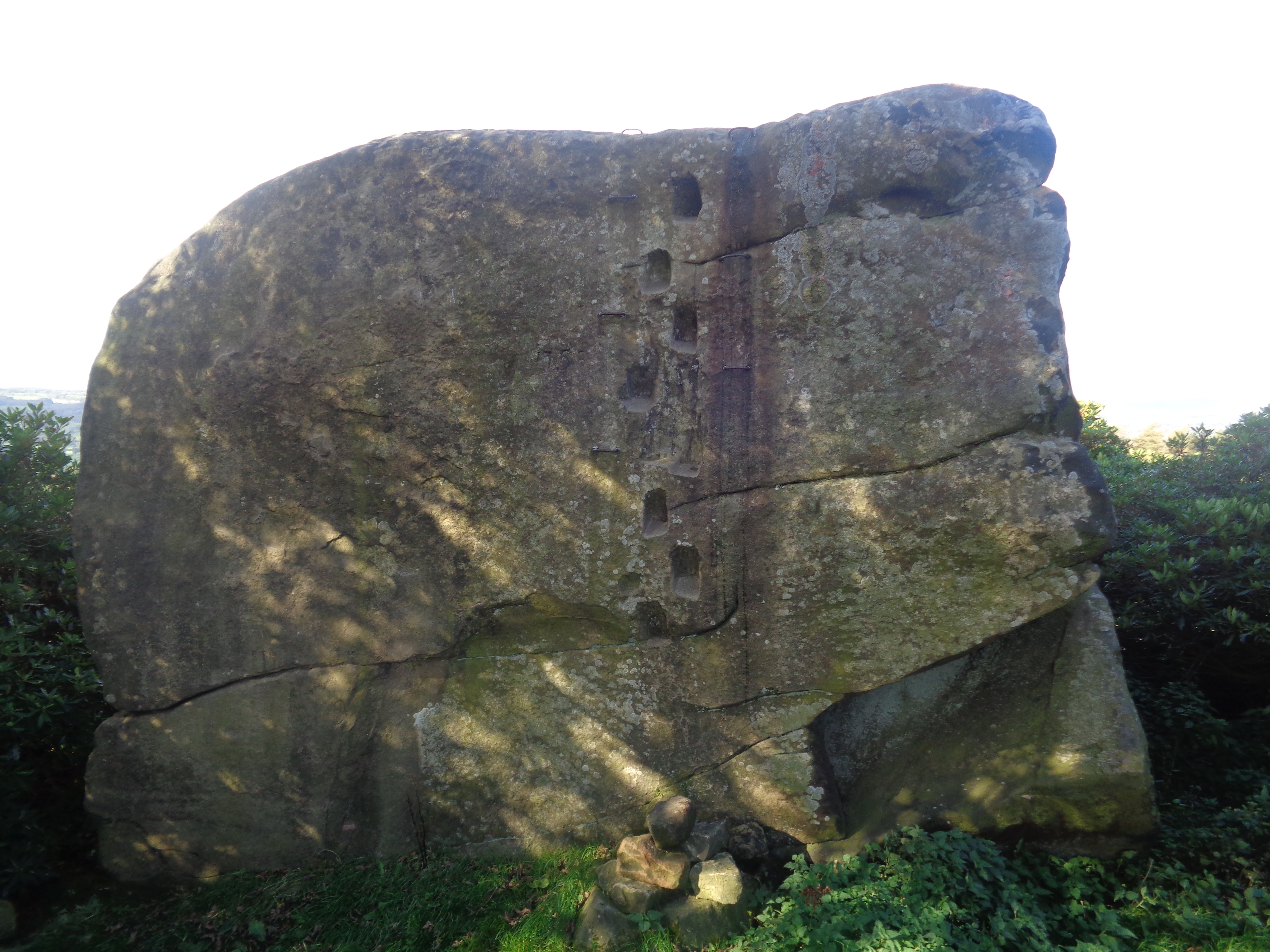
Andle Stone

The Andle Stone is a large gritstone boulder on Stanton Moor in Derbyshire. The stone block is 6m long, 4m high and lies within a low, circular, dry stone...

St Michael's Church, Birchover

St Michael's Church, Birchover, also known as Rowtor Chapel, is a Grade II listed parish church in the Church of England in Birchover, Derbyshire. Located...

Stanton Moor

Stanton Moor is a small upland area in the Derbyshire Peak District of central northern England, lying between Matlock and Bakewell near the villages of...

Nine Ladies

The Nine Ladies is a stone circle located on Stanton Moor in Derbyshire in the English East Midlands. The Nine Ladies is part of a tradition of stone circle...

Stanton Hall, Stanton in Peak

Stanton Hall is a privately owned country house at Stanton in Peak in the Derbyshire Peak District, the home of the Davie-Thornhill family. It is a Grade...

Holy Trinity Church, Stanton-in-Peak

Holy Trinity Church, Stanton-in-Peak is a Grade II listed parish church in the Church of England in Stanton in Peak, Derbyshire. == History == The church...

Birchover

Birchover is a village and civil parish in the Peak District National Park in Derbyshire, England, five miles north-west of Matlock. At the 2001 Census...

Nearby Amenities

Located within 500m of 53.162284,-1.6429767
Cork Stone
Natural: stone
Tourism: attraction
Wikidata: Q45370863
Lat/Long: 53.1616459/-1.6373601
Doll Tor Stone Circle
Alt Name: Doll Tor
Archaeological Site: megalith
Description: Small 6 stones circle formed part of a larger complex with a ditch, cairn (stone mound) and nearby boulders possibly associated
He Inscription Date: 1956-09-20
Heritage: Scheduled Monument
Heritage Operator: English Heritage
Heritage Website: https://historicengland.org.uk/listing/the-list/list-entry/1017664
Historic: archaeological_site
Historic Civilization: prehistoric
Historic Period: bronze-age
Megalith Type: stone_circle
Official Name: Doll Tor stone circle and cairn
Operator: Historic England;Peak National Park Authority
Ref He: 1017664
Wikidata: Q5289184
Wikipedia: en:Doll Tor
Lat/Long: 53.1624837/-1.6449916
Stanton Moor Life and death in the Bronze Age
Board Type: history
Information: board
Tourism: information
Lat/Long: 53.161734/-1.6388317
Barrier: kissing_gate
Source: survey;gps
Lat/Long: 53.1617178/-1.6388962
Barrier: stile
Material: wood
Source: survey;gps
Stile: stepover
Lat/Long: 53.1615445/-1.6374404
Barrier: entrance
Lat/Long: 53.1608041/-1.6397272
Man Made: utility_pole
Lat/Long: 53.1636936/-1.6450631
Man Made: utility_pole
Lat/Long: 53.1634134/-1.6440282
Man Made: utility_pole
Lat/Long: 53.1631075/-1.6429445
Man Made: utility_pole
Lat/Long: 53.162446/-1.6411759
Man Made: utility_pole
Lat/Long: 53.162764/-1.6420541
The data included in this document is from www.openstreetmap.org. The data is made available under ODbL.

Have you been to Breechwell Plantation?

Leave your review of Breechwell Plantation below (or comments, questions and feedback).