Booth's Shaw

Wood, Forest in Oxfordshire South Oxfordshire

England

Booth's Shaw

K6 telephone box and bus shelter, Cray's Pond
K6 telephone box and bus shelter, Cray's Pond Credit: JThomas

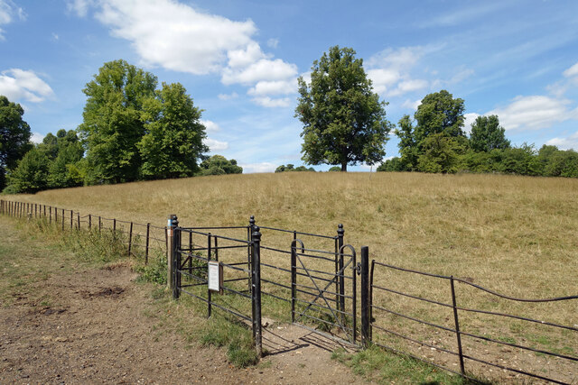
Booth's Shaw is a woodland area located in Oxfordshire, England. Situated near the town of Woodstock, it covers a vast expanse of approximately 200 acres. The Shaw is known for its picturesque beauty, dense foliage, and serene atmosphere, making it a popular destination for nature enthusiasts and hikers.

The woodland is predominantly composed of various species of trees, including oak, beech, and birch. This creates a diverse and vibrant ecosystem, providing a habitat for a wide range of flora and fauna. The forest floor is adorned with an array of wildflowers and ferns, further enhancing its natural charm.

Booth's Shaw is intersected by several walking trails, allowing visitors to explore its enchanting surroundings. These trails offer breathtaking views of the woodland, with occasional glimpses of wildlife such as deer, squirrels, and numerous bird species. The peaceful ambiance of this forest provides a perfect escape from the hustle and bustle of everyday life.

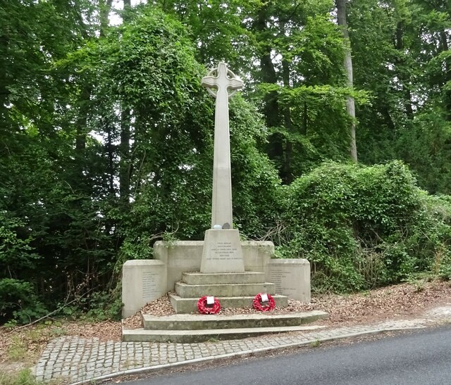
The Shaw holds historical significance as well. It is believed to have been used as a hunting ground during the reign of King Henry VIII, and traces of these activities can still be found in the form of ancient ditches and mounds. The woodland has also been mentioned in various literary works, adding to its cultural significance.

Overall, Booth's Shaw in Oxfordshire is a captivating woodland that offers a tranquil retreat for nature enthusiasts. With its diverse flora and fauna, scenic trails, and historical significance, it is a must-visit destination for those seeking solace in the beauty of nature.

If you have any feedback on the listing, please let us know in the comments section below.

Booth's Shaw Images

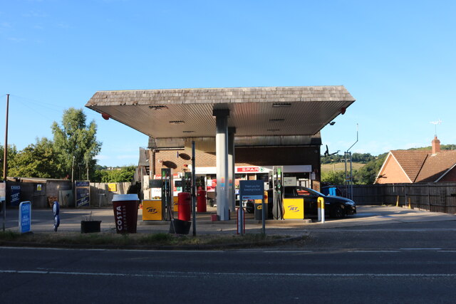
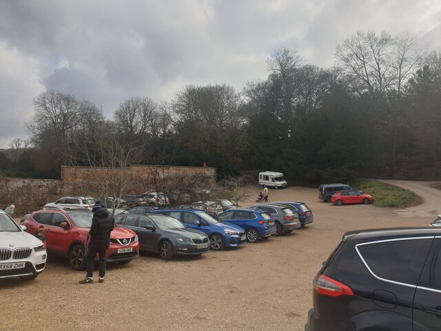
Images are sourced within 2km of 51.509636/-1.0979132 or Grid Reference SU6279. Thanks to Geograph Open Source API. All images are credited.

K6 telephone box and bus shelter, Cray's Pond
Bus shelter on the B4526, Cray's Pond
B4526, Cray's Pond
B4526, Cray's Pond
The White Lion, Cray's Pond Not currently open (2022).
See <a href="https://www.geograph.org.uk/photo/2829589">SU6380 : The White Lion, Crays Pond</a> for happier times.
The White Lion, Cray's Pond
Not currently open (2022). See SU6380 : The White Lion, Crays Pond for happier times.
Garage and car sales, Cray's Pond
Petrol station on the A329, Lower Basildon
Gate in Basildon Park The gates in Basildon Park are a mixture of sturdy new wooden ones put in by the National Trust, and some of these older ironwork ones with varying amounts of decorative curls and knobs depending on their importance.
Gate in Basildon Park
The gates in Basildon Park are a mixture of sturdy new wooden ones put in by the National Trust, and some of these older ironwork ones with varying amounts of decorative curls and knobs depending on their importance.
War Memorial, Whitchurch-on-Thames
Grazing off the B471
B471 heading north Towards Woodcote.
B471 heading north
Towards Woodcote.
 St John the Baptist Church, Whitchurch Hill
St John the Baptist Church, Whitchurch Hill
Grazing and woodland, Whitchurch Hill
B471, Whitchurch Hill Heading north towards Woodcote.
B471, Whitchurch Hill
Heading north towards Woodcote.
Elizabeth II postbox, Whitchurch Hill Postbox No. RG8 216.
Elizabeth II postbox, Whitchurch Hill
Postbox No. RG8 216.
Basildon Park: the most important bits Being usually either a school teacher or a chauffeur for my mother, the shop and the café !
Basildon Park: the most important bits
Being usually either a school teacher or a chauffeur for my mother, the shop and the café !
Basildon Park: signs of summer and autumn The grass is not really back to luscious green but the leaves have started to fall...
Basildon Park: signs of summer and autumn
The grass is not really back to luscious green but the leaves have started to fall...
Looking from Park Wall Lane onto the A329
Basildon Park car park The main car park at Basildon Park, a National Trust property in Lower Basildon.
Basildon Park car park
The main car park at Basildon Park, a National Trust property in Lower Basildon.
Show me another place!

Booth's Shaw is located at Grid Ref: SU6279 (Lat: 51.509636, Lng: -1.0979132)

Administrative County: Oxfordshire

District: South Oxfordshire

Police Authority: Thames Valley

What 3 Words

///elevates.validated.complain. Near Goring, Oxfordshire

Related Wikis

Goring Rural District

Goring was a rural district in Oxfordshire, England from 1894 to 1932. It was formed from that part of the Bradfield rural sanitary district which was...

Hartslock

Hartslock, also known as Hartslock Woods, is a 41.8-hectare (103-acre) biological Site of Special Scientific Interest (SSSI) in a wooded area on the north...

Goring Heath

Goring Heath is a hamlet and civil parish in the Chiltern Hills in South Oxfordshire. The civil parish includes the villages of Whitchurch Hill and Crays...

Beale Wildlife Park

Beale Wildlife Park is situated by the River Thames, between the villages of Pangbourne and Lower Basildon in Berkshire, England. It has three main areas...

Nearby Amenities

Located within 500m of 51.509636,-1.0979132
Barrier: kissing_gate
Lat/Long: 51.5073908/-1.0917877
Barrier: kissing_gate
Lat/Long: 51.50779/-1.0927533
Created By: Merkaartor 0.13
Lat/Long: 51.5081637/-1.0932069
Created By: Merkaartor 0.13
Lat/Long: 51.508305/-1.0935258
Barrier: kissing_gate
Foot: yes
Lat/Long: 51.5082791/-1.0940807
Created By: Merkaartor 0.13
Lat/Long: 51.5098714/-1.0935473
Created By: Merkaartor 0.13
Lat/Long: 51.5102577/-1.0938477
Created By: Merkaartor 0.13
Lat/Long: 51.5124893/-1.094191
Created By: Merkaartor 0.13
Lat/Long: 51.512566/-1.0941654
Created By: Merkaartor 0.13
Lat/Long: 51.5126824/-1.0941266
Created By: Merkaartor 0.13
Lat/Long: 51.5129828/-1.093955
Paul's Grove
Natural: wood
Lat/Long: 51.508636/-1.1044216
Barrier: kissing_gate
Bicycle: no
Foot: yes
Lat/Long: 51.5126214/-1.0940129
Barrier: yes
Lat/Long: 51.5065143/-1.1012076
The data included in this document is from www.openstreetmap.org. The data is made available under ODbL.

Have you been to Booth's Shaw?

Leave your review of Booth's Shaw below (or comments, questions and feedback).