Coombe End Belt

Wood, Forest in Oxfordshire South Oxfordshire

England

Coombe End Belt

K6 telephone box and bus shelter, Cray's Pond
K6 telephone box and bus shelter, Cray's Pond Credit: JThomas

Coombe End Belt is a picturesque woodland area located in Oxfordshire, England. Covering an approximate area of 100 acres, it is situated near the village of Coombe, within close proximity to the city of Oxford. This beautiful woodland is a part of the larger Shotover Estate, which is renowned for its diverse and abundant wildlife.

Coombe End Belt is characterized by its dense and ancient trees, creating a peaceful and serene environment for visitors. The dominant tree species found here include oak, beech, and birch, which have thrived in this area for centuries. The woodland floor is adorned with a variety of wildflowers, such as bluebells, primroses, and wood anemones, adding a vibrant touch to the surroundings.

The woodland plays an important role in the local ecosystem, providing a habitat for numerous species of birds, mammals, and insects. Birdwatchers can spot a wide range of species, including woodpeckers, tawny owls, and various songbirds. Additionally, mammals like foxes, badgers, and deer can be occasionally seen roaming through the trees.

Coombe End Belt provides a tranquil setting for nature enthusiasts, hikers, and photographers alike. The area is crisscrossed with footpaths and trails, allowing visitors to explore the woodland and enjoy its natural beauty. The woodland is privately owned but is accessible to the public, making it a popular destination for locals and tourists alike.

In conclusion, Coombe End Belt in Oxfordshire is a charming and diverse woodland, offering a haven for wildlife and a peaceful retreat for visitors seeking solace in nature.

If you have any feedback on the listing, please let us know in the comments section below.

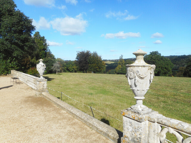
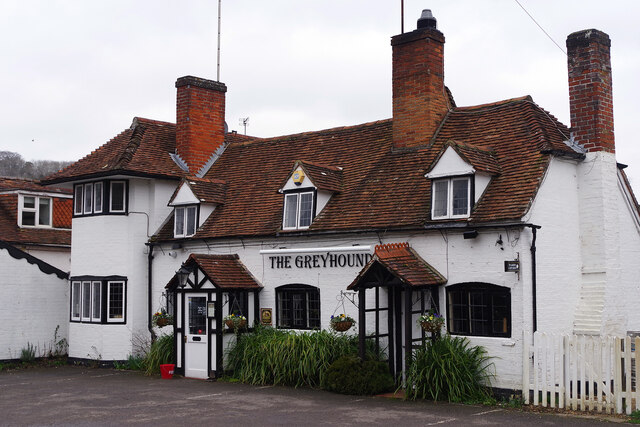
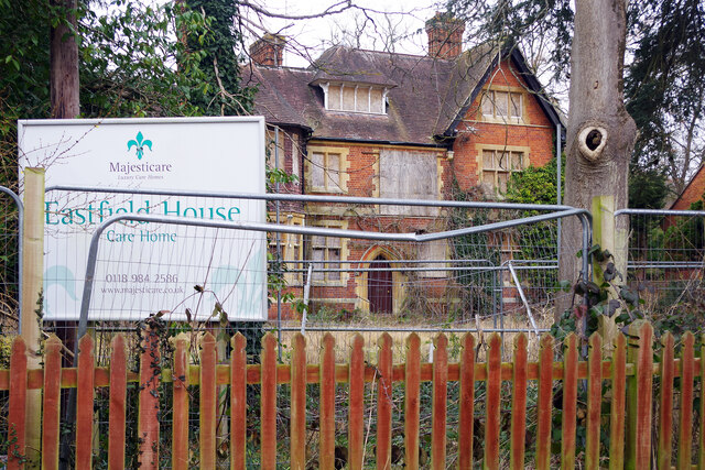
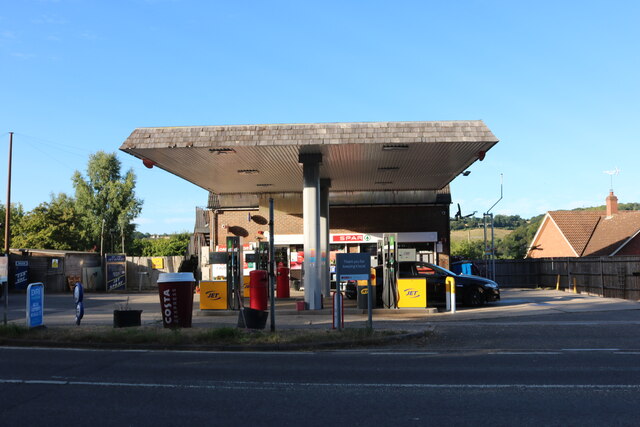
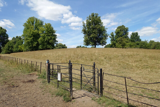
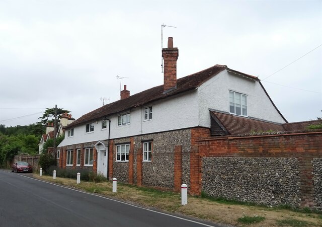
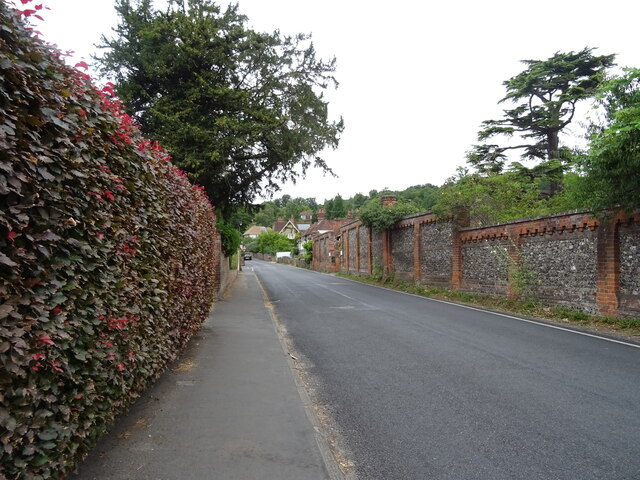
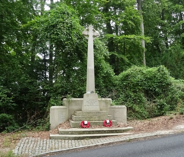
Coombe End Belt Images

Images are sourced within 2km of 51.506565/-1.0950201 or Grid Reference SU6279. Thanks to Geograph Open Source API. All images are credited.

K6 telephone box and bus shelter, Cray's Pond
Bus shelter on the B4256, Cray's Pond
B4526, Cray's Pond
B4526, Cray's Pond
The White Lion, Cray's Pond Not currently open (2022).
See <a href="https://www.geograph.org.uk/photo/2829589">SU6380 : The White Lion, Crays Pond</a> for happier times.
The White Lion, Cray's Pond
Not currently open (2022). See SU6380 : The White Lion, Crays Pond for happier times.
Garage and car sales, Cray's Pond
Edge of the Terrace, Basildon Park An ornamental wall at the edge of the formal garden on the east side of Basildon House.
Edge of the Terrace, Basildon Park
An ornamental wall at the edge of the formal garden on the east side of Basildon House.
The Greyhound, Whitchurch-on-Thames One of two pubs in the village, the Greyhound was first recorded as a public house in 1831 and was converted by Blatch's Brewery of Theale, Berkshire from cottage properties; further major alterations were made in 1879. It is believed that the building may have been occupied at one time by a ferryman, although this would presumably have been before 1792 when the bridge was opened. Blatch's pub estate of 22 houses was absorbed by Ind Coope in 1965 and since 2021 the Greyhound has been part of Oak Taverns Group.
The Greyhound, Whitchurch-on-Thames
One of two pubs in the village, the Greyhound was first recorded as a public house in 1831 and was converted by Blatch's Brewery of Theale, Berkshire from cottage properties; further major alterations were made in 1879. It is believed that the building may have been occupied at one time by a ferryman, although this would presumably have been before 1792 when the bridge was opened. Blatch's pub estate of 22 houses was absorbed by Ind Coope in 1965 and since 2021 the Greyhound has been part of Oak Taverns Group.
Eastfield House, Pangbourne Surrounded by Heras fencing and boarded up, Eastfield House operated as a care home until its closure in 2016. As is usually the case with derelict properties like this, there is a long history of planning wrangles that are still not resolved. The owner is Majesticare and the house was registered to provide accommodation for 27 residents; the company first applied to demolish the building in 2014 but this was rejected. Despite obtaining permission (on appeal) in 2016 to build an extension that would increase the provision to 45 bedrooms, Majesticare then announced that the building was unsuitable for continued use as a care home for several reasons amongst which was the impossibility of providing en-suite facilities for all of the bedrooms. Their new proposal was for a completely new building in a similar red brick style that would have a larger basement to accommodate a kitchen and laundry. This was again refused by South Oxfordshire District Council on the grounds that it could adversely affect the conservation area and could harm two protected trees on the site. That decision was reported early in 2019 and three years later nothing appears to have happened except that, no doubt, the building is gradually deteriorating. This must surely be an unsatisfactory state of affairs for all concerned.
Eastfield House, Pangbourne
Surrounded by Heras fencing and boarded up, Eastfield House operated as a care home until its closure in 2016. As is usually the case with derelict properties like this, there is a long history of planning wrangles that are still not resolved. The owner is Majesticare and the house was registered to provide accommodation for 27 residents; the company first applied to demolish the building in 2014 but this was rejected. Despite obtaining permission (on appeal) in 2016 to build an extension that would increase the provision to 45 bedrooms, Majesticare then announced that the building was unsuitable for continued use as a care home for several reasons amongst which was the impossibility of providing en-suite facilities for all of the bedrooms. Their new proposal was for a completely new building in a similar red brick style that would have a larger basement to accommodate a kitchen and laundry. This was again refused by South Oxfordshire District Council on the grounds that it could adversely affect the conservation area and could harm two protected trees on the site. That decision was reported early in 2019 and three years later nothing appears to have happened except that, no doubt, the building is gradually deteriorating. This must surely be an unsatisfactory state of affairs for all concerned.
Coombeside Cottage, Whitchurch-on-Thames Somehow reminiscent of a doll's house, this building, originally two cottages now one, is dated by Historic England as 'probably late 18th century' although other sources suggest 1820. The gothic-style windows are a distinctive feature although the one above the doors has been painted on the wall. At one time one of the cottages served as the village post office. It is grade II listed.
Coombeside Cottage, Whitchurch-on-Thames
Somehow reminiscent of a doll's house, this building, originally two cottages now one, is dated by Historic England as 'probably late 18th century' although other sources suggest 1820. The gothic-style windows are a distinctive feature although the one above the doors has been painted on the wall. At one time one of the cottages served as the village post office. It is grade II listed.
Petrol station on the A329, Lower Basildon
Gate in Basildon Park The gates in Basildon Park are a mixture of sturdy new wooden ones put in by the National Trust, and some of these older ironwork ones with varying amounts of decorative curls and knobs depending on their importance.
Gate in Basildon Park
The gates in Basildon Park are a mixture of sturdy new wooden ones put in by the National Trust, and some of these older ironwork ones with varying amounts of decorative curls and knobs depending on their importance.
The Greyhound, Whitchurch-on-Thames On High Street.
See <a href="https://www.geograph.org.uk/photo/7246350">SU6377 : Sign for the Greyhound, Whitchurch-on-Thames</a> for sign.
The Greyhound, Whitchurch-on-Thames
Sign for the Greyhound, Whitchurch-on-Thames See <a href="https://www.geograph.org.uk/photo/7246349">SU6377 : The Greyhound, Whitchurch-on-Thames</a> for context.
Sign for the Greyhound, Whitchurch-on-Thames
House on High Street, Whitchurch-on-Thames
High Street (B471), Whitchurch-on-Thames
War Memorial, Whitchurch-on-Thames
Grazing off the B471
B471 heading north Towards Woodcote.
B471 heading north
Towards Woodcote.
Show me another place!

Coombe End Belt is located at Grid Ref: SU6279 (Lat: 51.506565, Lng: -1.0950201)

Administrative County: Oxfordshire

District: South Oxfordshire

Police Authority: Thames Valley

What 3 Words

///chess.bandstand.adopters. Near Pangbourne, Berkshire

Related Wikis

Goring Rural District

Goring was a rural district in Oxfordshire, England from 1894 to 1932. It was formed from that part of the Bradfield rural sanitary district which was...

Hartslock

Hartslock, also known as Hartslock Woods, is a 41.8-hectare (103-acre) biological Site of Special Scientific Interest (SSSI) in a wooded area on the north...

Beale Wildlife Park

Beale Wildlife Park is situated by the River Thames, between the villages of Pangbourne and Lower Basildon in Berkshire, England. It has three main areas...

Whitchurch Hill

Whitchurch Hill is a village in the Chiltern Hills in Oxfordshire, about 5.5 miles (9 km) northwest of Reading, Berkshire, near Whitchurch-on-Thames. The...

The Oratory Preparatory School

The Oratory Prep School is a Roman Catholic day and boarding school for some 330 boys and girls aged from two to thirteen, founded in 1925. The school...

Goring Heath

Goring Heath is a hamlet and civil parish in the Chiltern Hills in South Oxfordshire. The civil parish includes the villages of Whitchurch Hill and Crays...

St Bartholomew's Church, Lower Basildon

St Bartholomew's Church is the redundant Church of England parish church of Basildon in the English county of Berkshire. It lies in the hamlet of Lower...

Crays Pond

Crays Pond is a hamlet situated in the parish of Goring Heath in South Oxfordshire. Crays Pond is about 2.4 miles (3.9 km) northeast of Goring-on-Thames...

Nearby Amenities

Located within 500m of 51.506565,-1.0950201
Barrier: kissing_gate
Lat/Long: 51.5063481/-1.0890312
Barrier: kissing_gate
Lat/Long: 51.5073908/-1.0917877
Barrier: kissing_gate
Lat/Long: 51.50779/-1.0927533
Created By: Merkaartor 0.13
Lat/Long: 51.5081637/-1.0932069
Created By: Merkaartor 0.13
Lat/Long: 51.508305/-1.0935258
Barrier: kissing_gate
Foot: yes
Lat/Long: 51.5082791/-1.0940807
Created By: Merkaartor 0.13
Lat/Long: 51.5098714/-1.0935473
Created By: Merkaartor 0.13
Lat/Long: 51.5102577/-1.0938477
Barrier: yes
Lat/Long: 51.5065143/-1.1012076
The data included in this document is from www.openstreetmap.org. The data is made available under ODbL.

Have you been to Coombe End Belt?

Leave your review of Coombe End Belt below (or comments, questions and feedback).