Gedling Wood

Wood, Forest in Nottinghamshire Gedling

England

Gedling Wood

On the first day of Christmas . . . . . . the birds couldn't get their numbers right - neither six geese a-laying nor seven swans a-swimming.
On the first day of Christmas . . . Credit: Alan Murray-Rust

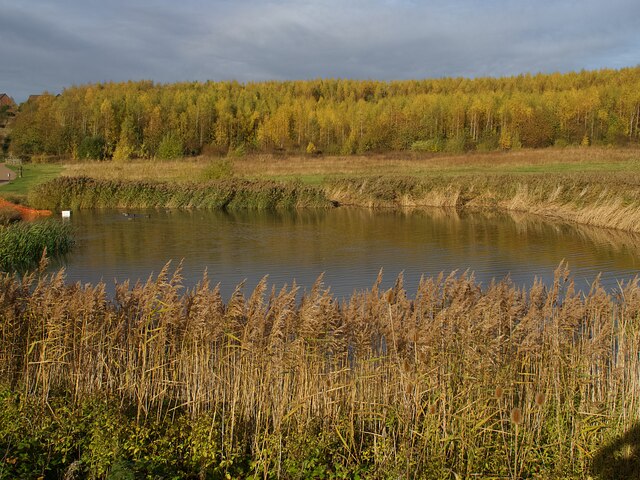
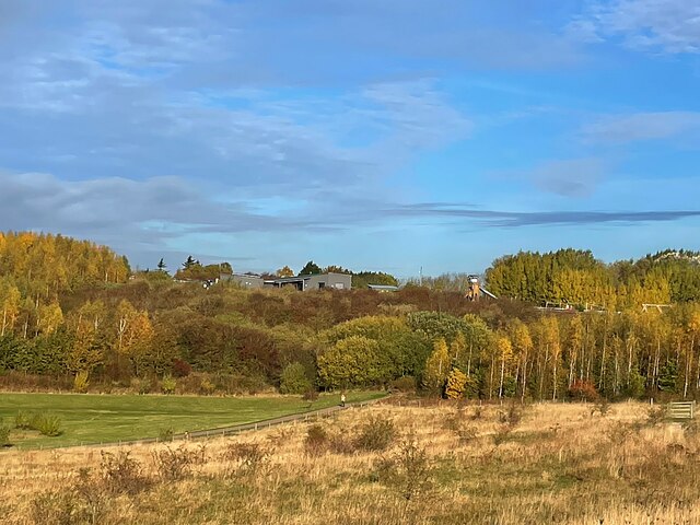
Gedling Wood, located in Nottinghamshire, is a picturesque forest spanning over 240 acres. It is situated on the outskirts of the village of Gedling and is easily accessible to both locals and visitors alike. The wood is known for its diverse range of flora and fauna, making it a haven for nature enthusiasts.

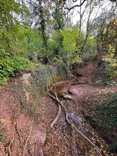
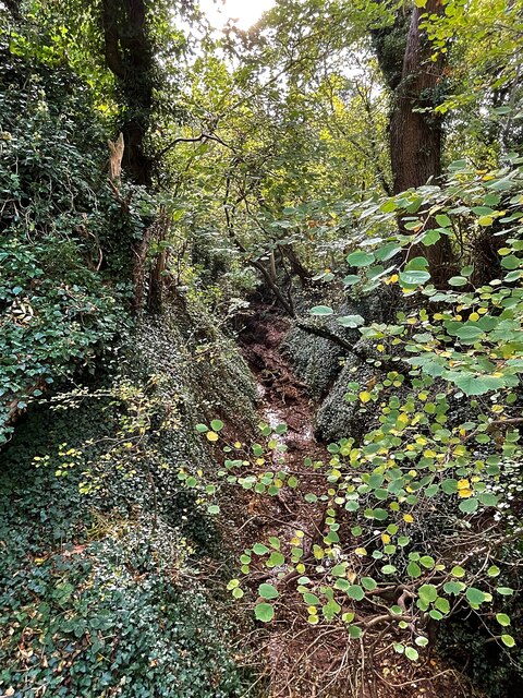
The woodland consists primarily of broadleaf trees, including oak, birch, and beech, which create a dense canopy providing shade and shelter. The forest floor is adorned with an array of wildflowers, such as bluebells and primroses, adding a pop of color to the landscape during the spring and summer months.

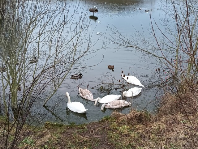
Gedling Wood is home to a variety of wildlife species. Visitors may spot deer, foxes, and rabbits roaming freely, while birdwatchers can observe a multitude of avian species, including woodpeckers, owls, and songbirds. The wood's tranquil atmosphere and abundance of wildlife make it a popular spot for nature walks and photography.

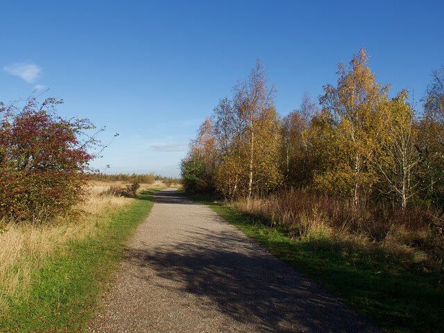
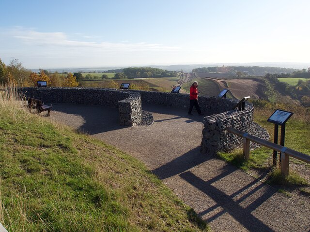
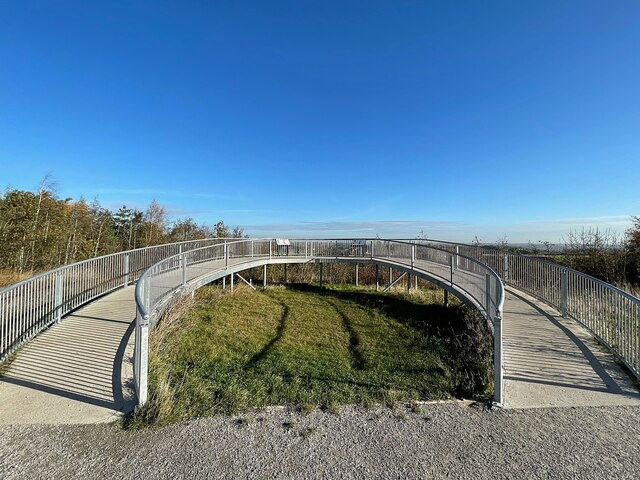
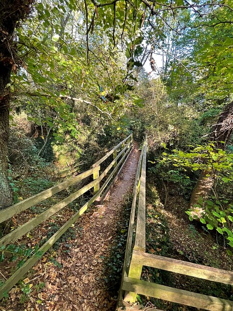
The forest is crisscrossed with well-maintained footpaths, offering visitors the opportunity to explore the wood at their leisure. There are also designated picnic areas and benches scattered throughout, providing ideal spots for relaxation and enjoying the natural surroundings.

Gedling Wood is not only a haven for wildlife but also a valuable resource for the local community. It offers educational programs, guided walks, and workshops to promote environmental awareness and conservation. The wood also plays a crucial role in maintaining the area's ecological balance and acts as a natural carbon sink, contributing to the mitigation of climate change.

Overall, Gedling Wood is a beautiful and diverse woodland that offers a peaceful retreat for those seeking to reconnect with nature in the heart of Nottinghamshire.

If you have any feedback on the listing, please let us know in the comments section below.
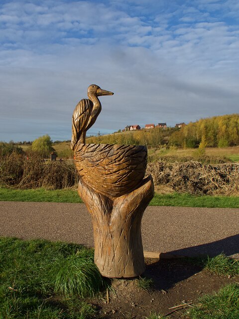
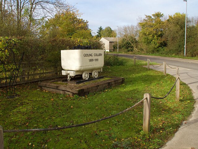
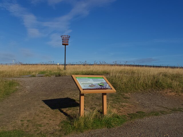
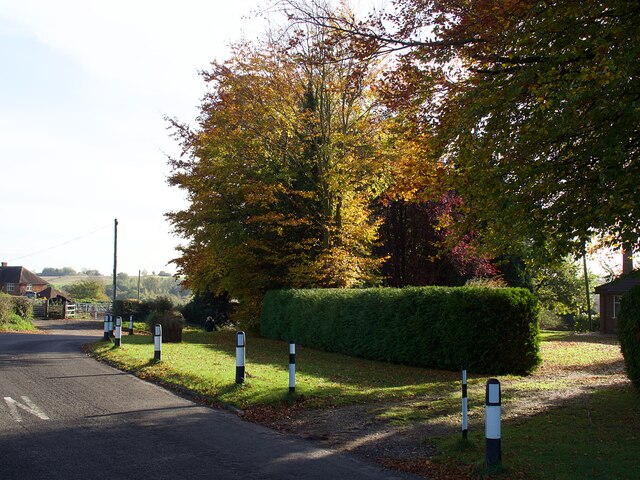
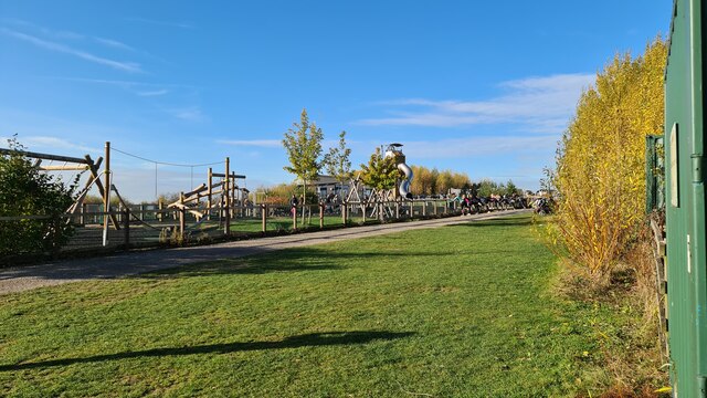
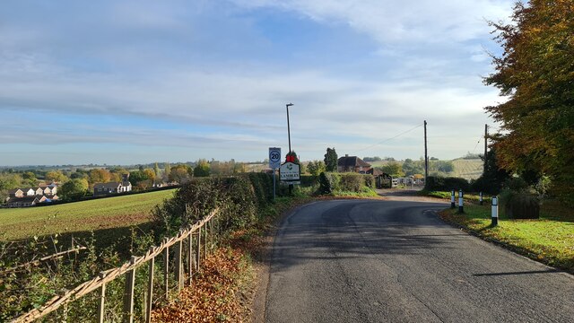
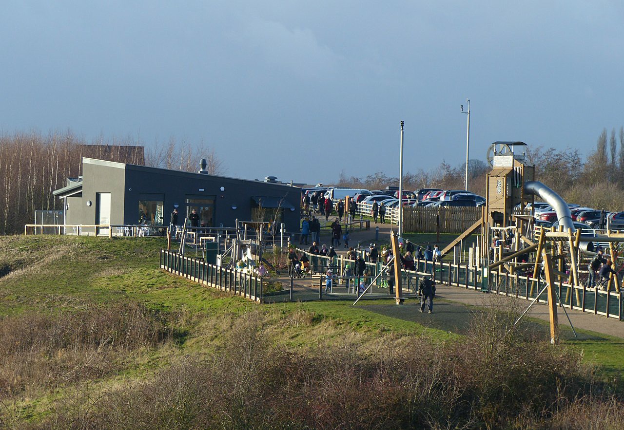
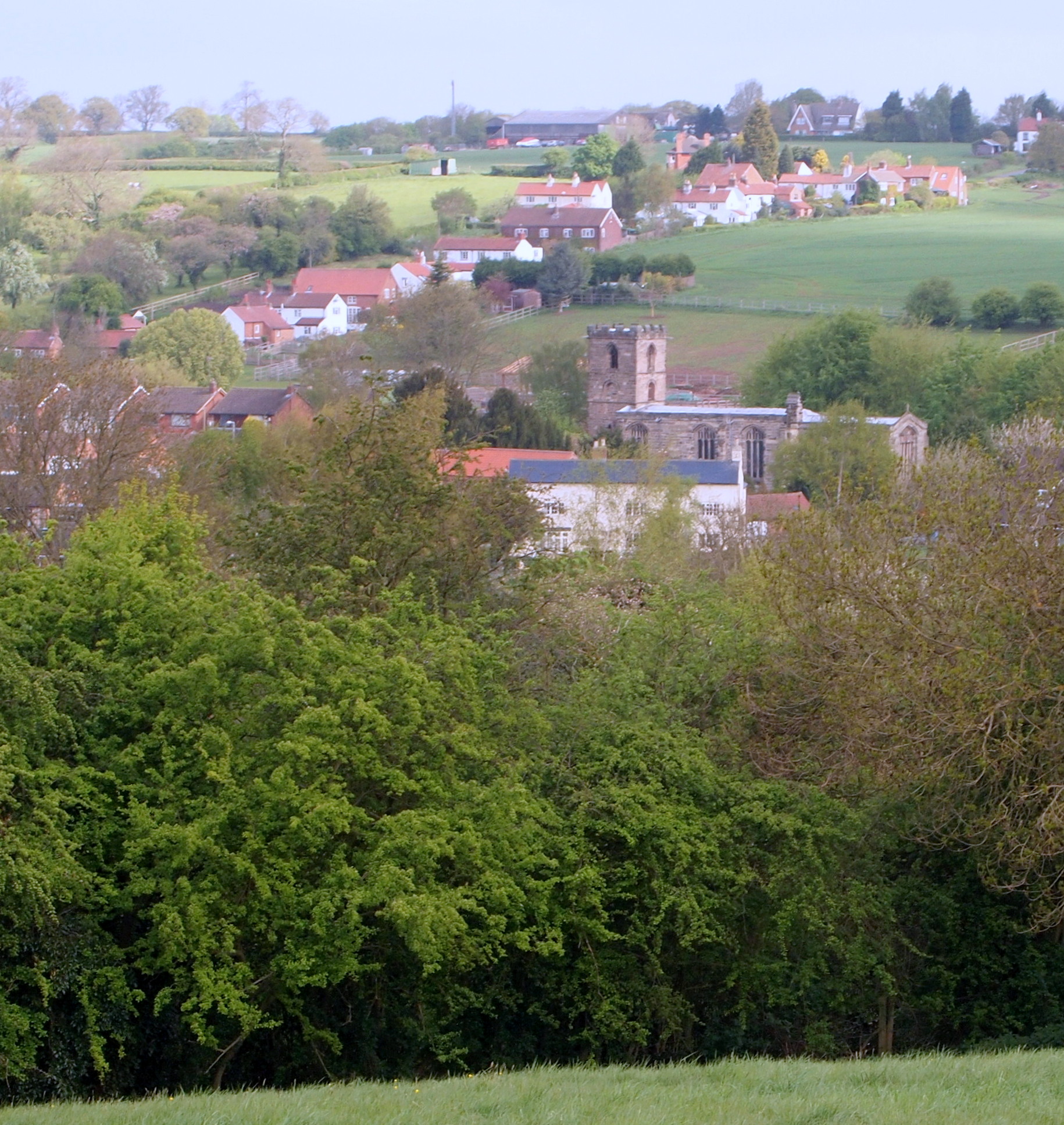
Gedling Wood Images

Images are sourced within 2km of 52.987503/-1.0691359 or Grid Reference SK6243. Thanks to Geograph Open Source API. All images are credited.

On the first day of Christmas . . . . . . the birds couldn't get their numbers right - neither six geese a-laying nor seven swans a-swimming.
On the first day of Christmas . . .
. . . the birds couldn't get their numbers right - neither six geese a-laying nor seven swans a-swimming.
Path in Gedling Country Park The park is on the grounds of the former Gedling Colliery, which closed in 1991.  The site was converted into the present country park in 2015.
Path in Gedling Country Park
The park is on the grounds of the former Gedling Colliery, which closed in 1991. The site was converted into the present country park in 2015.
The South Viewing Platform in Gedling Country Park Providing extensive views to the south and west over Nottingham and the Trent Valley.
The South Viewing Platform in Gedling Country Park
Providing extensive views to the south and west over Nottingham and the Trent Valley.
Lagoon in Gedling Country Park .
Gedling Country Park was established as such by Gedling Borough Council in 2014 and opened to the public in 2015. It comprises the area of the waste tips of the former Gedling Colliery which closed in 1991.

The area of the colliery itself is excluded from the park and is not formally open to the public, although there are some unbarriered access points.

The park is largely open ground sloping steeply to the south west, resulting from artificial and natural seeding of grass and limited scrub woodland to maintain stability of the waste material.

Much of the open space is fenced off to provide protection for ground nesting birds such as skylark and lapwing which are already a feature of the Park. The result is that human activity is largely restricted to the extensive network of paths. These have been developed as multi-user routes, suitable for pedestrians, cyclists and, within the constraints of the steep nature of the site, wheelchair users. There are 4 defined circuits, of different lengths, named after the various seams mined by the colliery – High Hazles, Main Bright, Top Hard, Low Hazles.

There are three lagoons, one in the upper area and two at the foot of the Park.   These are part of the overall drainage scheme for the tip, an essential feature to maintain the stability of the spoil. These lagoons are being managed as wildlife habitats for both birds and invertebrates.

As at the end of 2017, the following features have been established. An extensive children's play area was opened in 2016, including the Mining Tower, a slide feature reflecting the former winding headgear of the colliery.

A visitor centre with cafe, toilets and terrace opened in June 2017, and will eventually incorporate displays covering the history of the colliery. The cafe has the name 'Cafe 1899', reflecting the date when the colliery commenced operation.

A Memorial Garden on the slopes below the visitor centre opened in April 2017.  This incorporates a pergola formed from a series of the rings used to support the roof of one of the main underground roadways of the colliery. In December 2017 a flame-shaped sculpture was unveiled, with cut-outs of various aspects of mining.

Two features of note are not within the park itself. On the highest part of the tip a large solar farm with an output of 5.74MW has been established as an enclave within the park, but not of it. Within its boundaries wildlife in the form of the ground nesting birds mentioned above flourishes. Within the old colliery area itself, a small generating plant has been set up, fuelled by methane tapped from the remaining coal underground.
Lagoon in Gedling Country Park
. Gedling Country Park was established as such by Gedling Borough Council in 2014 and opened to the public in 2015. It comprises the area of the waste tips of the former Gedling Colliery which closed in 1991. The area of the colliery itself is excluded from the park and is not formally open to the public, although there are some unbarriered access points. The park is largely open ground sloping steeply to the south west, resulting from artificial and natural seeding of grass and limited scrub woodland to maintain stability of the waste material. Much of the open space is fenced off to provide protection for ground nesting birds such as skylark and lapwing which are already a feature of the Park. The result is that human activity is largely restricted to the extensive network of paths. These have been developed as multi-user routes, suitable for pedestrians, cyclists and, within the constraints of the steep nature of the site, wheelchair users. There are 4 defined circuits, of different lengths, named after the various seams mined by the colliery – High Hazles, Main Bright, Top Hard, Low Hazles. There are three lagoons, one in the upper area and two at the foot of the Park. These are part of the overall drainage scheme for the tip, an essential feature to maintain the stability of the spoil. These lagoons are being managed as wildlife habitats for both birds and invertebrates. As at the end of 2017, the following features have been established. An extensive children's play area was opened in 2016, including the Mining Tower, a slide feature reflecting the former winding headgear of the colliery. A visitor centre with cafe, toilets and terrace opened in June 2017, and will eventually incorporate displays covering the history of the colliery. The cafe has the name 'Cafe 1899', reflecting the date when the colliery commenced operation. A Memorial Garden on the slopes below the visitor centre opened in April 2017. This incorporates a pergola formed from a series of the rings used to support the roof of one of the main underground roadways of the colliery. In December 2017 a flame-shaped sculpture was unveiled, with cut-outs of various aspects of mining. Two features of note are not within the park itself. On the highest part of the tip a large solar farm with an output of 5.74MW has been established as an enclave within the park, but not of it. Within its boundaries wildlife in the form of the ground nesting birds mentioned above flourishes. Within the old colliery area itself, a small generating plant has been set up, fuelled by methane tapped from the remaining coal underground.
Wood sculpture in Gedling Country Park The sculpture is of a grey heron which can sometimes be seen fishing in the adjacent lagoon.
Wood sculpture in Gedling Country Park
The sculpture is of a grey heron which can sometimes be seen fishing in the adjacent lagoon.
The Spring Lane entrance to Gedling Country Park Featuring a wagon typical of those used in the former colliery on which the park has been developed.
The Spring Lane entrance to Gedling Country Park
Featuring a wagon typical of those used in the former colliery on which the park has been developed.
Exposition Board in Gedling Country Park Giving details of the solar power installation and the extraction of methane gas from the abandioned mine workings.
Exposition Board in Gedling Country Park
Giving details of the solar power installation and the extraction of methane gas from the abandioned mine workings.
Autumn colour on the approach to Lambley On Catfoot Lane to the west of the village.
Autumn colour on the approach to Lambley
On Catfoot Lane to the west of the village.
The North Viewing Platform in Gedling Country Park Providing extensive views to the north and east with Lincoln Cathedral said to be visible on a clear day, some 28 miles distant.
The North Viewing Platform in Gedling Country Park
Providing extensive views to the north and east with Lincoln Cathedral said to be visible on a clear day, some 28 miles distant.
From coal power to solar power This solar farm in Gedling Country Park on the site of  the former Gedling Colliery is capable of generating 5.7 MW, enough to power 1,700 homes.
From coal power to solar power
This solar farm in Gedling Country Park on the site of the former Gedling Colliery is capable of generating 5.7 MW, enough to power 1,700 homes.
Gedling Country Park .
Gedling Country Park was established as such by Gedling Borough Council in 2014 and opened to the public in 2015. It comprises the area of the waste tips of the former Gedling Colliery which closed in 1991.

The area of the colliery itself is excluded from the park and is not formally open to the public, although there are some unbarriered access points.

The park is largely open ground sloping steeply to the south west, resulting from artificial and natural seeding of grass and limited scrub woodland to maintain stability of the waste material.

Much of the open space is fenced off to provide protection for ground nesting birds such as skylark and lapwing which are already a feature of the Park. The result is that human activity is largely restricted to the extensive network of paths. These have been developed as multi-user routes, suitable for pedestrians, cyclists and, within the constraints of the steep nature of the site, wheelchair users. There are 4 defined circuits, of different lengths, named after the various seams mined by the colliery – High Hazles, Main Bright, Top Hard, Low Hazles.

There are three lagoons, one in the upper area and two at the foot of the Park.   These are part of the overall drainage scheme for the tip, an essential feature to maintain the stability of the spoil. These lagoons are being managed as wildlife habitats for both birds and invertebrates.

As at the end of 2017, the following features have been established. An extensive children's play area was opened in 2016, including the Mining Tower, a slide feature reflecting the former winding headgear of the colliery.

A visitor centre with cafe, toilets and terrace opened in June 2017, and will eventually incorporate displays covering the history of the colliery. The cafe has the name 'Cafe 1899', reflecting the date when the colliery commenced operation.

A Memorial Garden on the slopes below the visitor centre opened in April 2017.  This incorporates a pergola formed from a series of the rings used to support the roof of one of the main underground roadways of the colliery. In December 2017 a flame-shaped sculpture was unveiled, with cut-outs of various aspects of mining.

Two features of note are not within the park itself. On the highest part of the tip a large solar farm with an output of 5.74MW has been established as an enclave within the park, but not of it. Within its boundaries wildlife in the form of the ground nesting birds mentioned above flourishes. Within the old colliery area itself, a small generating plant has been set up, fuelled by methane tapped from the remaining coal underground.
Gedling Country Park
. Gedling Country Park was established as such by Gedling Borough Council in 2014 and opened to the public in 2015. It comprises the area of the waste tips of the former Gedling Colliery which closed in 1991. The area of the colliery itself is excluded from the park and is not formally open to the public, although there are some unbarriered access points. The park is largely open ground sloping steeply to the south west, resulting from artificial and natural seeding of grass and limited scrub woodland to maintain stability of the waste material. Much of the open space is fenced off to provide protection for ground nesting birds such as skylark and lapwing which are already a feature of the Park. The result is that human activity is largely restricted to the extensive network of paths. These have been developed as multi-user routes, suitable for pedestrians, cyclists and, within the constraints of the steep nature of the site, wheelchair users. There are 4 defined circuits, of different lengths, named after the various seams mined by the colliery – High Hazles, Main Bright, Top Hard, Low Hazles. There are three lagoons, one in the upper area and two at the foot of the Park. These are part of the overall drainage scheme for the tip, an essential feature to maintain the stability of the spoil. These lagoons are being managed as wildlife habitats for both birds and invertebrates. As at the end of 2017, the following features have been established. An extensive children's play area was opened in 2016, including the Mining Tower, a slide feature reflecting the former winding headgear of the colliery. A visitor centre with cafe, toilets and terrace opened in June 2017, and will eventually incorporate displays covering the history of the colliery. The cafe has the name 'Cafe 1899', reflecting the date when the colliery commenced operation. A Memorial Garden on the slopes below the visitor centre opened in April 2017. This incorporates a pergola formed from a series of the rings used to support the roof of one of the main underground roadways of the colliery. In December 2017 a flame-shaped sculpture was unveiled, with cut-outs of various aspects of mining. Two features of note are not within the park itself. On the highest part of the tip a large solar farm with an output of 5.74MW has been established as an enclave within the park, but not of it. Within its boundaries wildlife in the form of the ground nesting birds mentioned above flourishes. Within the old colliery area itself, a small generating plant has been set up, fuelled by methane tapped from the remaining coal underground.
Top Dumble One of the Lambley Dumbles, a local dialect word for a steep-sided watercourse flowing through woodland.
Top Dumble
One of the Lambley Dumbles, a local dialect word for a steep-sided watercourse flowing through woodland.
One of the Lambley Dumbles Dumble is a local dialect word for a steep-sided watercourse flowing through woodland.
One of the Lambley Dumbles
Dumble is a local dialect word for a steep-sided watercourse flowing through woodland.
Bridge over Bottom Dumble One of the Lambley Dumbles, a local dialect word for a steep-sided watercourse flowing through woodland.
Bridge over Bottom Dumble
One of the Lambley Dumbles, a local dialect word for a steep-sided watercourse flowing through woodland.
North-East viewing platform, Gedling Country Park
View from North-East viewing platform, Gedling Country Park
Playground at Gedling Country Park
Catfoot Lane, Lambley
Show me another place!

Gedling Wood is located at Grid Ref: SK6243 (Lat: 52.987503, Lng: -1.0691359)

Administrative County: Nottinghamshire

District: Gedling

Police Authority: Nottinghamshire

What 3 Words

///soil.discouraged.manliness. Near Burton Joyce, Nottinghamshire

Related Wikis

Gedling Country Park

Gedling Country Park is a country park in Gedling, Nottingham, England. == History == The park is on the grounds of the former Gedling Colliery, which...

Carlton le Willows Academy

Carlton le Willows Academy is an 11–18 mixed, secondary school and sixth form with academy status in Gedling, Nottinghamshire, England. It is part of the...

Mary Hardstaff Homes

The Mary Hardstaff Homes, are 10 almshouses on Arnold Lane in Gedling, Nottingham. These were built as Almshouses in 1936 for the widows and orphans of...

Borough of Gedling

Gedling is a local government district with borough status in Nottinghamshire, England. The council is based in Arnold. The borough also includes Carlton...

Gedling and Carlton railway station

Gedling and Carlton railway station was a former railway station built to serve the villages of Gedling and Carlton in Nottinghamshire. == History... ==

Lambley, Nottinghamshire

Lambley is an English village and civil parish near Nottingham, England, hardly touched by urbanisation, as it lies in a green belt. The population recorded...

Gedling

Gedling is a village and former civil parish which gives its name to the larger Borough of Gedling in Nottinghamshire, England. It lies 4 miles (6.4 km...

Sherwood Academy

Sherwood Academy (formerly Sherwood E-ACT Academy, The Gedling School and Gedling Secondary Modern) was a secondary school with academy status located...

Nearby Amenities

Located within 500m of 52.987503,-1.0691359
Crossing
Bicycle: yes
Crossing: uncontrolled
Crossing Island: no
Kerb: lowered
Tactile Paving: yes
Lat/Long: 52.9880002/-1.0757272
Crossing
Button Operated: yes
Crossing: traffic_signals
Crossing Island: no
Crossing Ref: puffin
Kerb: lowered
Tactile Paving: yes
Lat/Long: 52.9836223/-1.07272
Barrier: swing_gate
Lat/Long: 52.983588/-1.0727636
Barrier: kissing_gate
Lat/Long: 52.9842887/-1.0712755
The data included in this document is from www.openstreetmap.org. The data is made available under ODbL.

Have you been to Gedling Wood?

Leave your review of Gedling Wood below (or comments, questions and feedback).