Garden Copse

Wood, Forest in Oxfordshire South Oxfordshire

England

Garden Copse

Wheatley: High Street and the United Reformed Church This is the eastern end of the High Street with Friday Lane leading off to the right, and the United Reformed Church <span class="nowrap"><a title="http://www.findachurch.co.uk/churches/sp/sp50/wheatleyurc/" rel="nofollow ugc noopener" href="http://www.findachurch.co.uk/churches/sp/sp50/wheatleyurc/">Link</a><img style="margin-left:2px;" alt="External link" title="External link - shift click to open in new window" src="https://s1.geograph.org.uk/img/external.png" width="10" height="10"/></span> on the left.
Wheatley: High Street and the United Reformed Church Credit: Nigel Cox

Garden Copse is a picturesque woodland located in Oxfordshire, England. Spanning over a vast area, it is a perfect haven for nature enthusiasts and those seeking tranquility amidst the bustling city life. The copse is predominantly made up of deciduous trees, including oak, beech, and birch, which create a lush green canopy throughout the year.

As one steps into the copse, they are immediately greeted by a sense of serenity and natural beauty. The forest floor is covered with a carpet of wildflowers, including bluebells, primroses, and wood anemones, adding a splash of color to the surroundings. The air is filled with the sweet scent of the flowers and the earthy aroma of the forest.

Garden Copse is home to a diverse range of wildlife, making it a haven for animal lovers. Squirrels playfully scamper across the branches, while birdsong fills the air as various species of birds nest and feed in the trees. If one is lucky, they may even catch a glimpse of a deer or a fox, gracefully moving through the undergrowth.

The copse offers numerous walking trails and paths, allowing visitors to explore its natural wonders at their own pace. These paths wind through the woods, leading to hidden clearings and secluded spots, where one can sit and absorb the peaceful ambiance.

Garden Copse is a cherished natural gem in Oxfordshire, providing a welcome escape from the chaos of everyday life. Its beauty and tranquility make it a popular destination for locals and tourists alike, who seek solace in its enchanting embrace.

If you have any feedback on the listing, please let us know in the comments section below.

Garden Copse Images

Images are sourced within 2km of 51.750251/-1.1256069 or Grid Reference SP6006. Thanks to Geograph Open Source API. All images are credited.

Wheatley: High Street and the United Reformed Church This is the eastern end of the High Street with Friday Lane leading off to the right, and the United Reformed Church <span class="nowrap"><a title="http://www.findachurch.co.uk/churches/sp/sp50/wheatleyurc/" rel="nofollow ugc noopener" href="http://www.findachurch.co.uk/churches/sp/sp50/wheatleyurc/">Link</a><img style="margin-left:2px;" alt="External link" title="External link - shift click to open in new window" src="https://s1.geograph.org.uk/img/external.png" width="10" height="10"/></span> on the left.
Wheatley: High Street and the United Reformed Church
This is the eastern end of the High Street with Friday Lane leading off to the right, and the United Reformed Church LinkExternal link on the left.
Lychgate to Saint Bartholomew Lychgate leading to the churchyard at Saint Bartholomew, Holton.
Lychgate to Saint Bartholomew
Lychgate leading to the churchyard at Saint Bartholomew, Holton.
Churchyard at Saint Bartholomew's The churchyard as you walk in the lychgate at Saint Bartholomew Holton
Churchyard at Saint Bartholomew's
The churchyard as you walk in the lychgate at Saint Bartholomew Holton
The Holton Millennium Stone Millennium stone in the churchyard at Saint Bartholomew
The Holton Millennium Stone
Millennium stone in the churchyard at Saint Bartholomew
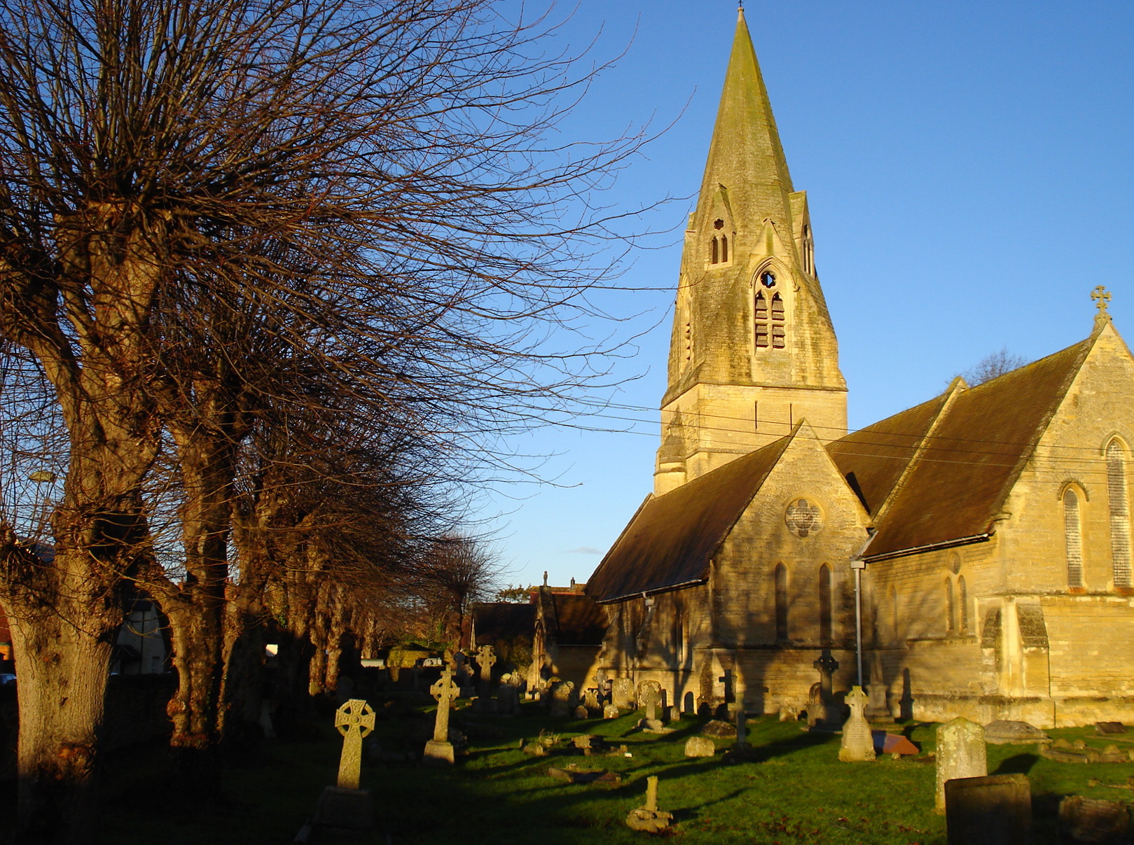
Saint Bartholomew Holton Saint Bartholomew Holton, not much to add other than it's a 12th century church sitting in a large churchyard.
Saint Bartholomew Holton
Saint Bartholomew Holton, not much to add other than it's a 12th century church sitting in a large churchyard.
Graves by the Path Some of the graves and a lamp along the path leading to Saint Bartholomew Holton
Graves by the Path
Some of the graves and a lamp along the path leading to Saint Bartholomew Holton
The older Graves These are some of the older burials at Saint Bartholomew Holton in a prominent position to be seen
The older Graves
These are some of the older burials at Saint Bartholomew Holton in a prominent position to be seen
Back by the Path Looking back to the west along the path at Saint Bartholomew Holton
Back by the Path
Looking back to the west along the path at Saint Bartholomew Holton
The tower on Saint Bartholomew View of the south side and bell tower on Saint Bartholomew Holton
The tower on Saint Bartholomew
View of the south side and bell tower on Saint Bartholomew Holton
West end on Saint Bartholomew View of the west end of Saint Bartholomew Holton
West end on Saint Bartholomew
View of the west end of Saint Bartholomew Holton
Through the Window The open door on the bell tower at Saint Bartholomew Holton is walled up inside with a window where you can see some of the church. This is as near as I got as the door to the church is locked.
Through the Window
The open door on the bell tower at Saint Bartholomew Holton is walled up inside with a window where you can see some of the church. This is as near as I got as the door to the church is locked.
Window in the Doorway A window has been fitted inside the old doorway at the base of the bell tower on Saint Bartholomew Holton
Window in the Doorway
A window has been fitted inside the old doorway at the base of the bell tower on Saint Bartholomew Holton
Window over the doorway Gothic window over the old doorway leading to Saint Bartholomew Holton
Window over the doorway
Gothic window over the old doorway leading to Saint Bartholomew Holton
Steps on the Tower Just over to the left of them is a benchmark at Saint Bartholomew Holton
Steps on the Tower
Just over to the left of them is a benchmark at Saint Bartholomew Holton
Cutmark on Saint Bartholomew Holton Cut benchmark on Saint Bartholomew Holton <a href="https://www.geograph.org.uk/photo/4681262">SP6006 : Steps on the Tower</a>
Cutmark on Saint Bartholomew Holton
Cut benchmark on Saint Bartholomew Holton SP6006 : Steps on the Tower
Headstones in the Long Grass Over on the south side of Saint Bartholomew Holton are a lot of graves of the same family lost in the long grass
Headstones in the Long Grass
Over on the south side of Saint Bartholomew Holton are a lot of graves of the same family lost in the long grass
South Side Saint Bartholomew Holton South Side of Saint Bartholomew Holton
South Side Saint Bartholomew Holton
South Side of Saint Bartholomew Holton
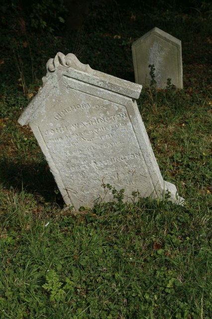
Headstone & Footstone One of the head & footstones around the churchyard at Saint Bartholomew Holton
Headstone & Footstone
One of the head & footstones around the churchyard at Saint Bartholomew Holton
Show me another place!

Garden Copse is located at Grid Ref: SP6006 (Lat: 51.750251, Lng: -1.1256069)

Administrative County: Oxfordshire

District: South Oxfordshire

Police Authority: Thames Valley

What 3 Words

///tasteful.huts.traded. Near Wheatley, Oxfordshire

Related Wikis

Bullingdon Rural District

Bullingdon Rural District was a rural district in Oxfordshire, England from 1932 to 1974, covering an area to the south-east of the city of Oxford. The...

St Mary the Virgin, Wheatley

The Church of St Mary the Virgin is a parish church in Wheatley, Oxfordshire, in the Church of England Diocese of Oxford. The church was designed by George...

Wheatley Park School

Wheatley Park School (WPS) is a co-educational state secondary school of approximately 1,150 pupils situated in Holton, Oxfordshire, England about 8 miles...

Wheatley, Oxfordshire

Wheatley is a village and civil parish in Oxfordshire, about 5 miles (8 km) east of Oxford. The parish includes the hamlet of Littleworth, which is immediately...

Nearby Amenities

Located within 500m of 51.750251,-1.1256069
Mini Roundabout
Direction: clockwise
Lat/Long: 51.7468279/-1.1297254
Barrier: stile
Lat/Long: 51.7487526/-1.1228477
Fire Station
Source: photograph
Lat/Long: 51.7462827/-1.1255684
Crossing
Crossing: zebra
Crossing Island: no
Crossing Ref: zebra
Source: photograph
Lat/Long: 51.7461945/-1.1278423
Bus Stop
Ambrose Rise
Bus: yes
Naptan AtcoCode: 340001686CAR
Naptan Bearing: W
Naptan CommonName: Ambrose Rise
Naptan Indicator: Corner
Naptan Landmark: Sunnyside
Naptan NaptanCode: oxfgawpd
Naptan Street: London Road
Public Transport: platform
Route Ref: 103;104;113;275;280
Shelter: yes
Source: naptan_import;survey
Lat/Long: 51.7462315/-1.1281295
Post Box
Operator: Royal Mail
Operator Type: private
Operator Wikidata: Q638098
Ref: OX33 472
Lat/Long: 51.7459559/-1.1273313
Bus Stop
Ambrose Rise
Bench: yes
Bus: yes
Naptan AtcoCode: 340001686OAR
Naptan Bearing: E
Naptan CommonName: Ambrose Rise
Naptan Indicator: Opposite
Naptan Landmark: Sunnyside
Naptan NaptanCode: oxfgawpa
Naptan Street: London Road
Public Transport: platform
Route Ref: 103;104;113;275;280
Shelter: yes
Source: naptan_import;survey
Lat/Long: 51.7460518/-1.1272443
Bus Stop
Wheatley Campus
Bus: yes
Naptan AtcoCode: 340001698CPS
Naptan Bearing: E
Naptan CommonName: Wheatley Campus
Naptan Indicator: Campus
Naptan Landmark: Brookes College
Naptan NaptanCode: oxfgatdm
Naptan Street: College Close
Naptan Verified: no
Public Transport: platform
Source: naptan_import
Lat/Long: 51.7493409/-1.1256907
Bus Stop
Tyndale
Bench: no
Bin: no
Bus: yes
Local Ref: adj
Naptan AtcoCode: 340003093CNR
Naptan Bearing: E
Naptan CommonName: Tyndale
Naptan Crossing: Tyndale
Naptan Indicator: Corner
Naptan NaptanCode: oxfawgam
Naptan ShortCommonName: Tyndale
Naptan Street: Old London Road
Naptan Verified: no
Public Transport: platform
Shelter: no
Source: naptan_import
Tactile Paving: no
Lat/Long: 51.7468427/-1.1258838
Bus Stop
Tyndale
Bus: yes
Local Ref: opp
Naptan AtcoCode: 340003093OPP
Naptan Bearing: W
Naptan BusStopType: CUS
Naptan CommonName: Tyndale
Naptan Crossing: Tyndale
Naptan Indicator: Opposite
Naptan NaptanCode: oxfawgat
Naptan ShortCommonName: Tyndale
Naptan Street: Old London Road
Naptan Verified: no
Public Transport: platform
Source: naptan_import
Lat/Long: 51.7468256/-1.126
Grit Bin
Lat/Long: 51.7534024/-1.1257909
118
Ele: 75.588745
Wpt Description: G ST BARTS
Wpt Symbol: Trail Head
Lat/Long: 51.7532819/-1.1248359
Cafe
Eights Cafe
Lat/Long: 51.74962/-1.1254956
Post Box
Brand: Post Office
Brand Wikidata: Q1783168
Brand Wikipedia: en:Post Office Ltd
Operator: Royal Mail
Operator Type: private
Operator Wikidata: Q638098
Ref: OX33 821
Lat/Long: 51.7495971/-1.1247563
Speed Camera
Lat/Long: 51.7463876/-1.1282678
Crossing
Crossing: zebra
Crossing Island: no
Tactile Paving: yes
Lat/Long: 51.7469066/-1.1300403
Entrance: yes
Lat/Long: 51.7538421/-1.1274407
Power: pole
Source: Bing
Lat/Long: 51.7510721/-1.1214399
Power: pole
Source: Bing
Lat/Long: 51.7495859/-1.1211153
Power: pole
Source: Bing
Lat/Long: 51.7497885/-1.1197206
Power: pole
Source: Bing
Lat/Long: 51.7503398/-1.1212924
Power: pole
Source: Bing
Lat/Long: 51.7487024/-1.1212307
Power: pole
Source: Bing
Lat/Long: 51.7526843/-1.1219683
Power: pole
Source: Bing
Lat/Long: 51.7478871/-1.1213406
Power: pole
Source: Bing
Lat/Long: 51.7518475/-1.1216089
Material: wood
Power: pole
Source: Bing
Lat/Long: 51.7471597/-1.121464
Power: pole
Source: Bing
Lat/Long: 51.7535362/-1.1219871
Traffic Calming: island
Lat/Long: 51.7470767/-1.1306915
Fixme: solar panels?
Lat/Long: 51.7462179/-1.1253936
Turning Circle
Turning Circle: knuckle
Lat/Long: 51.7467245/-1.1261614
Fixme: solar panels?
Lat/Long: 51.746929/-1.1280006
Direction: 110
Generator Method: photovoltaic
Generator Output Electricity: yes
Generator Solar Modules: 14
Generator Source: solar
Generator Type: solar_photovoltaic_panel
Location: roof
Power: generator
Lat/Long: 51.7475104/-1.1303441
Direction: 180
Generator Method: photovoltaic
Generator Output Electricity: yes
Generator Solar Modules: 16
Generator Source: solar
Generator Type: solar_photovoltaic_panel
Location: roof
Power: generator
Lat/Long: 51.7535072/-1.1230801
Direction: 175
Generator Method: photovoltaic
Generator Output Electricity: yes
Generator Solar Modules: 14
Generator Source: solar
Generator Type: solar_photovoltaic_panel
Location: roof
Power: generator
Lat/Long: 51.7534751/-1.1234107
Addr Housename: Willowdene
Addr Housenumber: 10
Addr Street: Old London Road
Lat/Long: 51.7470124/-1.1270975
The data included in this document is from www.openstreetmap.org. The data is made available under ODbL.

Have you been to Garden Copse?

Leave your review of Garden Copse below (or comments, questions and feedback).