Horn's Copse

Wood, Forest in Berkshire

England

Horn's Copse

Windmill Lane Off Carbinswood Lane, leading to School Hill.
Windmill Lane Credit: Oscar

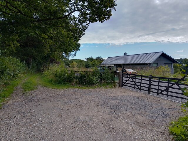
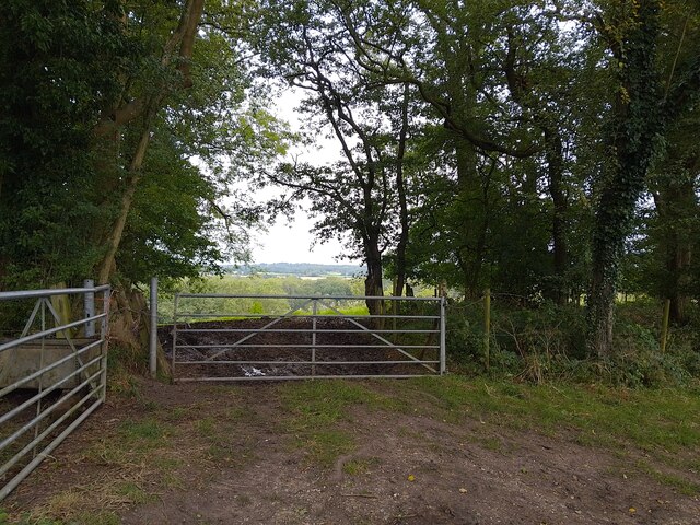
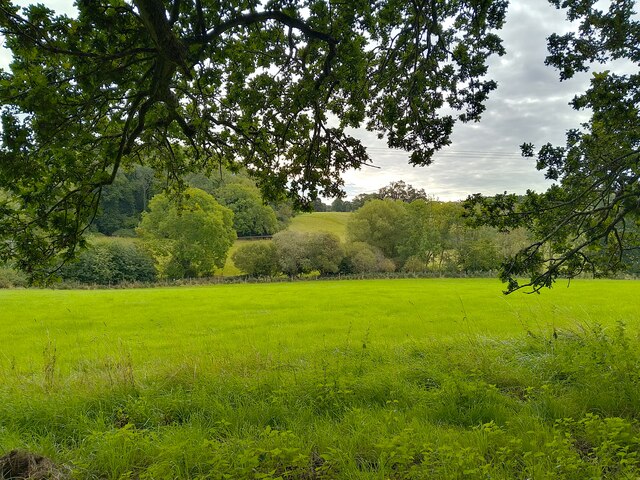
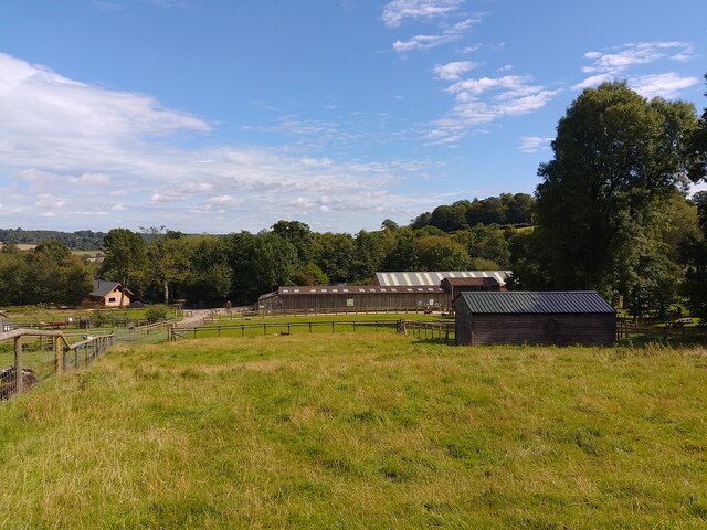
Horn's Copse is a picturesque woodland located in Berkshire, England. Covering an area of approximately 50 acres, it is a captivating example of a traditional English copse or small wooded area. The copse is situated near the village of Berkshire, offering a tranquil escape from the bustling urban life.

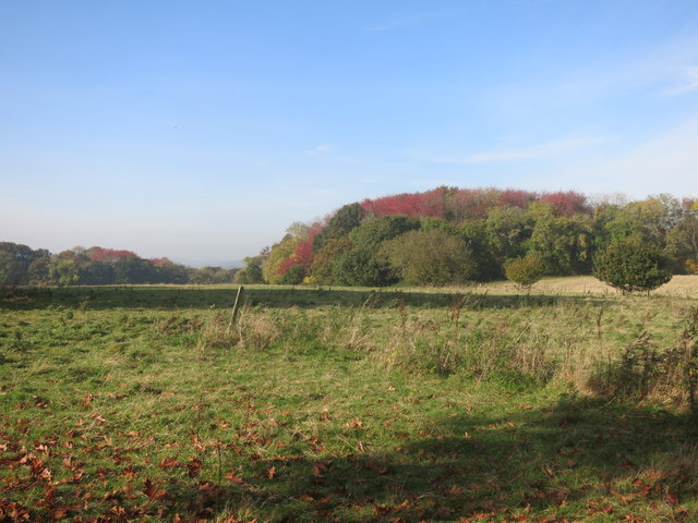
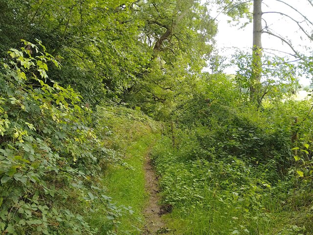
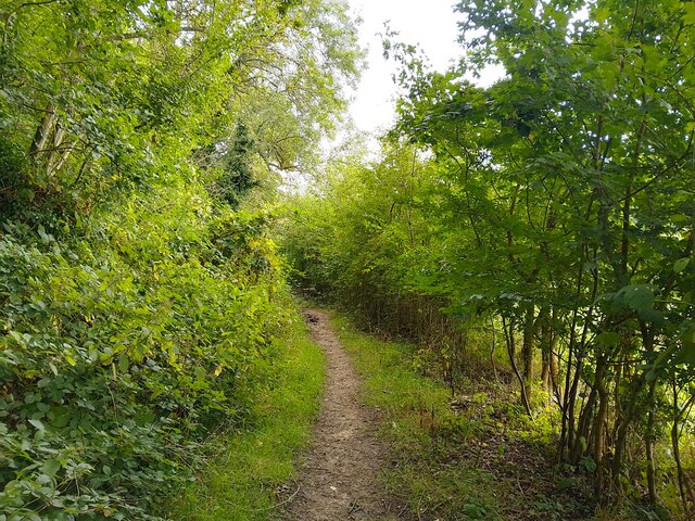
The woodland is primarily composed of deciduous trees, including oak, beech, and ash, creating a rich and diverse ecosystem. These trees provide a dense canopy, allowing only dappled sunlight to filter through, creating an enchanting atmosphere within the copse. The forest floor is covered in a lush carpet of ferns, wildflowers, and mosses, further enhancing the natural beauty of the area.

Horn's Copse is home to an abundance of wildlife, making it a popular spot for nature enthusiasts and birdwatchers. Visitors may catch glimpses of various bird species, such as woodpeckers, owls, and warblers. Additionally, the copse provides a habitat for small mammals like squirrels, hedgehogs, and foxes.

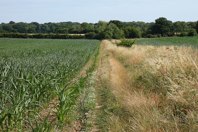
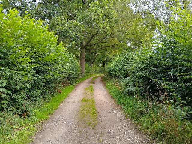
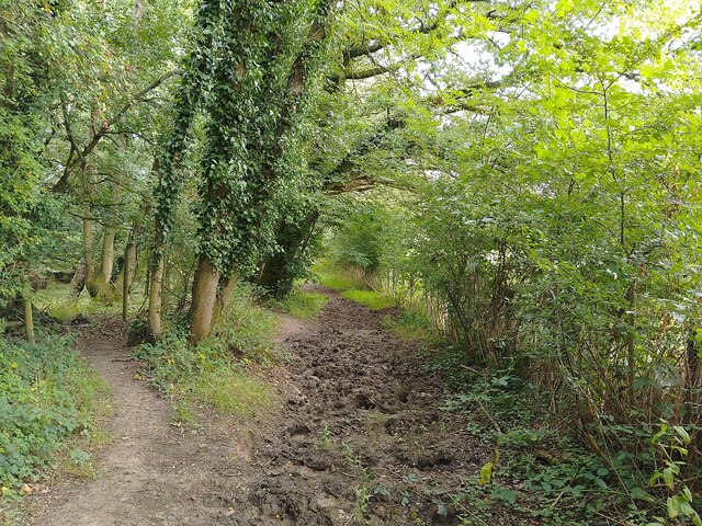
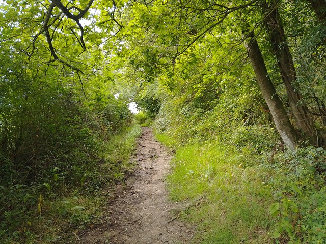
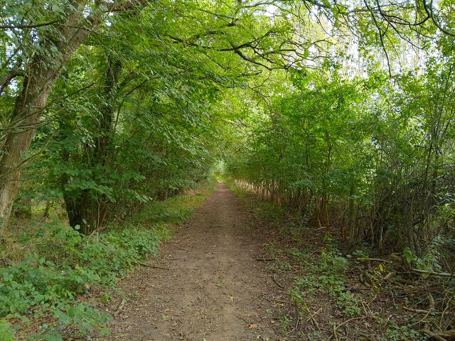
There are several walking trails that wind through Horn's Copse, allowing visitors to immerse themselves in the tranquil surroundings. These trails offer stunning views of the woodland and provide opportunities for visitors to explore the copse at their own pace.

Overall, Horn's Copse in Berkshire offers a serene and idyllic escape from the modern world, providing a perfect retreat for nature lovers and those seeking solace in the beauty of the natural world.

If you have any feedback on the listing, please let us know in the comments section below.
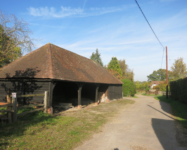
Horn's Copse Images

Images are sourced within 2km of 51.413976/-1.1882448 or Grid Reference SU5668. Thanks to Geograph Open Source API. All images are credited.

Windmill Lane Off Carbinswood Lane, leading to School Hill.
Windmill Lane
Off Carbinswood Lane, leading to School Hill.
Douai Abbey A Benedictine Abbey in Upper Woolhampton. The abbey was completed in 1993.
Douai Abbey
A Benedictine Abbey in Upper Woolhampton. The abbey was completed in 1993.
Douai Abbey A Benedictine Abbey in Upper Woolhampton. The abbey was completed in 1993.
Douai Abbey
A Benedictine Abbey in Upper Woolhampton. The abbey was completed in 1993.
Barn, Well and Granary at Hillfoot Farm Original farm buildings by a new forecourt.
Barn, Well and Granary at Hillfoot Farm
Original farm buildings by a new forecourt.
Barn at Nine Elms Nine Elms Farm, or just Nine Elms depending which map you look at, is at the end of this drive. A short footpath through surrounding fields begins just beside the barn here.
Barn at Nine Elms
Nine Elms Farm, or just Nine Elms depending which map you look at, is at the end of this drive. A short footpath through surrounding fields begins just beside the barn here.
Red Leaves in King's Copse A typical view for the area, mixed fields and woods.
Red Leaves in King's Copse
A typical view for the area, mixed fields and woods.
Farmland, Bucklebury A footpath makes its way between fields of maize, the growth of which has been somewhat stunted due to dry conditions.
Farmland, Bucklebury
A footpath makes its way between fields of maize, the growth of which has been somewhat stunted due to dry conditions.
Chapel Row bridleway A bridleway that runs from Chapel Row to Jewell's Farm.
Chapel Row bridleway
A bridleway that runs from Chapel Row to Jewell's Farm.
St Crispins Farm bridleway A bridleway passing the farm.
St Crispins Farm bridleway
A bridleway passing the farm.
Old Orchard Wood from bridleway Looking from a bridleway near St Crispin's Farm down the hill past a gate towards Old Orchard Wood.
Old Orchard Wood from bridleway
Looking from a bridleway near St Crispin's Farm down the hill past a gate towards Old Orchard Wood.
St Crispins Farm bridleway A bridleway that runs from Chapel Row to Jewell's Farm.
St Crispins Farm bridleway
A bridleway that runs from Chapel Row to Jewell's Farm.
St Crispins Farm bridleway A bridleway that runs from Chapel Row to Jewell's Farm.
St Crispins Farm bridleway
A bridleway that runs from Chapel Row to Jewell's Farm.
King's Copse on Clay Hill Looking from a bridleway at the other side of the valley.
King's Copse on Clay Hill
Looking from a bridleway at the other side of the valley.
St Crispins Farm bridleway A bridleway that runs from Chapel Row to Jewell's Farm.
St Crispins Farm bridleway
A bridleway that runs from Chapel Row to Jewell's Farm.
St Crispins Farm bridleway A bridleway that runs from Chapel Row to Jewell's Farm.
St Crispins Farm bridleway
A bridleway that runs from Chapel Row to Jewell's Farm.
Coombe Wood bridleway A bridleway that runs from Chapel Row to Jewell's Farm.
Coombe Wood bridleway
A bridleway that runs from Chapel Row to Jewell's Farm.
Bucklebury Farm footpath A public footpath crossing Bucklebury Farm. The route of the path is a little confusing across the attraction itself.

If approaching from the north, you cross the car park after crossing the field near Pease Hill, follow the pedestrian entrance to the park, then walk through the "exit" gate to the right (west) of the admissions building. You then climb or open and close three metal gates to fields, and walk on the left (east) side of the fence in this field until you reach two stiles. Cross these and then follow the fenceline until you reach a gate and exit to the restricted byway.

If approaching from the south, you go through the metal gate from the restricted byway, follow the fenceline to a pair of stiles, cross both and follow the fenceline down to a series of three gates. Open and close or climb over these three through fields until you reach the exit gate. Go through the gate and follow the pedestrian walk to the car park and continue to the metal gate crossing a field beside the entrance driveway.

Shoutout to the kind gentleman who helped me with the route on my walk!
Bucklebury Farm footpath
A public footpath crossing Bucklebury Farm. The route of the path is a little confusing across the attraction itself. If approaching from the north, you cross the car park after crossing the field near Pease Hill, follow the pedestrian entrance to the park, then walk through the "exit" gate to the right (west) of the admissions building. You then climb or open and close three metal gates to fields, and walk on the left (east) side of the fence in this field until you reach two stiles. Cross these and then follow the fenceline until you reach a gate and exit to the restricted byway. If approaching from the south, you go through the metal gate from the restricted byway, follow the fenceline to a pair of stiles, cross both and follow the fenceline down to a series of three gates. Open and close or climb over these three through fields until you reach the exit gate. Go through the gate and follow the pedestrian walk to the car park and continue to the metal gate crossing a field beside the entrance driveway. Shoutout to the kind gentleman who helped me with the route on my walk!
Bucklebury Farm and footpath A public footpath crossing Bucklebury Farm. The route of the path is a little confusing across the attraction itself.

If approaching from the north, you cross the car park after crossing the field near Pease Hill, follow the pedestrian entrance to the park, then walk through the "exit" gate to the right (west) of the admissions building. You then climb or open and close three metal gates to fields, and walk on the left (east) side of the fence in this field until you reach two stiles. Cross these and then follow the fenceline until you reach a gate and exit to the restricted byway.

If approaching from the south, you go through the metal gate from the restricted byway, follow the fenceline to a pair of stiles, cross both and follow the fenceline down to a series of three gates. Open and close or climb over these three through fields until you reach the exit gate. Go through the gate and follow the pedestrian walk to the car park and continue to the metal gate crossing a field beside the entrance driveway.

Shoutout to the kind gentleman who helped me with the route on my walk!
Bucklebury Farm and footpath
A public footpath crossing Bucklebury Farm. The route of the path is a little confusing across the attraction itself. If approaching from the north, you cross the car park after crossing the field near Pease Hill, follow the pedestrian entrance to the park, then walk through the "exit" gate to the right (west) of the admissions building. You then climb or open and close three metal gates to fields, and walk on the left (east) side of the fence in this field until you reach two stiles. Cross these and then follow the fenceline until you reach a gate and exit to the restricted byway. If approaching from the south, you go through the metal gate from the restricted byway, follow the fenceline to a pair of stiles, cross both and follow the fenceline down to a series of three gates. Open and close or climb over these three through fields until you reach the exit gate. Go through the gate and follow the pedestrian walk to the car park and continue to the metal gate crossing a field beside the entrance driveway. Shoutout to the kind gentleman who helped me with the route on my walk!
Show me another place!

Horn's Copse is located at Grid Ref: SU5668 (Lat: 51.413976, Lng: -1.1882448)

Unitary Authority: West Berkshire

Police Authority: Thames Valley

What 3 Words

///jogged.mountains.terribly. Near Thatcham, Berkshire

Related Wikis

Midgham Green

Midgham Green is a hamlet in the civil parish of Midgham in the English county of Berkshire. The settlement lies near to the A4 road and is located approximately...

Bucklebury Common

Bucklebury Common is an elevated common consisting of woodland with a few relatively small clearings in the English county of Berkshire, within the civil...

Chapel Row

Chapel Row is a hamlet in West Berkshire, England, and part of the civil parish of Bucklebury. In 2019 it had an estimated population of 627. == History... ==

The Bladebone Inn

The Bladebone Inn is a public house at Chapel Row in the civil parish of Bucklebury in the English county of Berkshire. == History == Records show that...

Douai Abbey

Douai Abbey is a Benedictine Abbey at Upper Woolhampton, near Thatcham, in the English county of Berkshire, situated within the Roman Catholic Diocese...

Elstree School

Elstree School is an English preparatory school for children aged 3–13 at Woolhampton House in Woolhampton, near Newbury in the English county of Berkshire...

Upper Woolhampton

Upper Woolhampton is a village in the English county of Berkshire. It is situated on higher ground, 0.5 miles (800 m) to the north of the parent village...

Bucklebury Manor

Bucklebury Manor is a Grade II listed manor house in the civil parish of Bucklebury in the English county of Berkshire. Since 2012, it has been the home...

Nearby Amenities

Located within 500m of 51.413976,-1.1882448
Turning Loop
Lat/Long: 51.4122622/-1.1900116
The data included in this document is from www.openstreetmap.org. The data is made available under ODbL.

Have you been to Horn's Copse?

Leave your review of Horn's Copse below (or comments, questions and feedback).