Lodge Copse

Wood, Forest in Berkshire

England

Lodge Copse

Turners Green, Upper Bucklebury Apple Tree Cottage to the left, a small church to the centre and Turners Green House to the right.
Turners Green, Upper Bucklebury Credit: Oscar

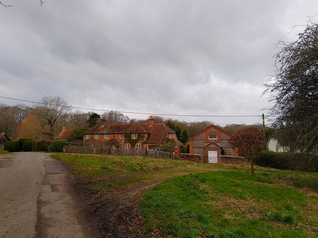
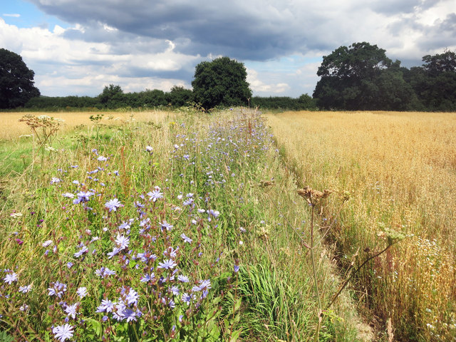
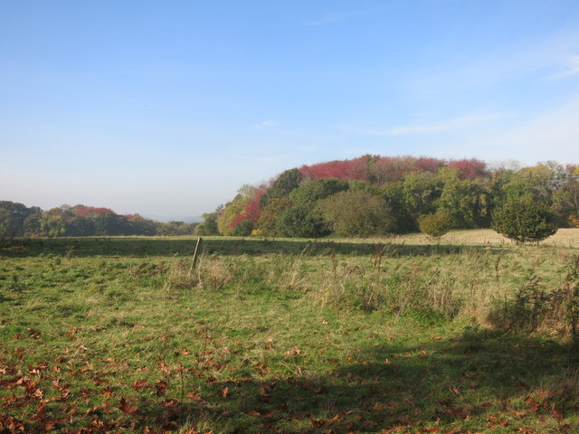
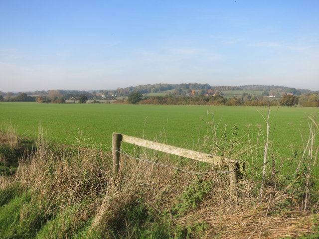
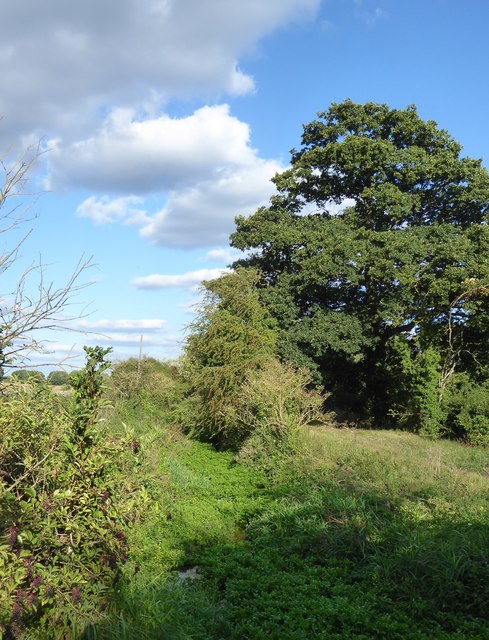
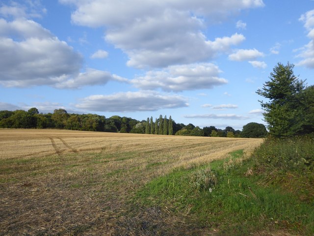
Lodge Copse is a picturesque woodland area situated in Berkshire, England. It spans over a vast expanse of land, covering approximately 100 acres. Nestled within the beautiful countryside, Lodge Copse offers a serene and tranquil environment for visitors to enjoy the wonders of nature.

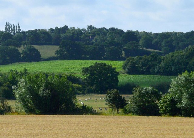
The copse is primarily composed of a variety of deciduous trees such as oak, beech, and birch, which create a stunning canopy overhead, especially during the spring and summer months when the foliage is at its fullest. The forest floor is adorned with a carpet of vibrant wildflowers, adding to the enchanting atmosphere.

One of the notable features of Lodge Copse is its diverse wildlife population. The woodland is home to a range of animal species, including deer, foxes, badgers, and a plethora of bird species. Birdwatchers will particularly enjoy their time here, as they can catch sight of woodpeckers, owls, and various songbirds.

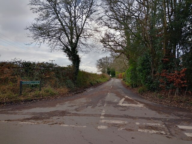
The copse also offers various walking trails and paths that wind their way through the forest, allowing visitors to explore the area at their own pace. These trails cater to different levels of difficulty, accommodating both casual strollers and avid hikers. Additionally, there are designated picnic areas, where visitors can relax and enjoy a meal surrounded by the natural beauty of the forest.

Lodge Copse is a popular destination for nature enthusiasts and families looking to escape the hustle and bustle of urban life. Its stunning woodland scenery, diverse wildlife, and well-maintained trails make it an ideal location for a peaceful day out in nature.

If you have any feedback on the listing, please let us know in the comments section below.
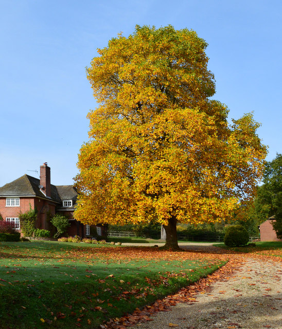
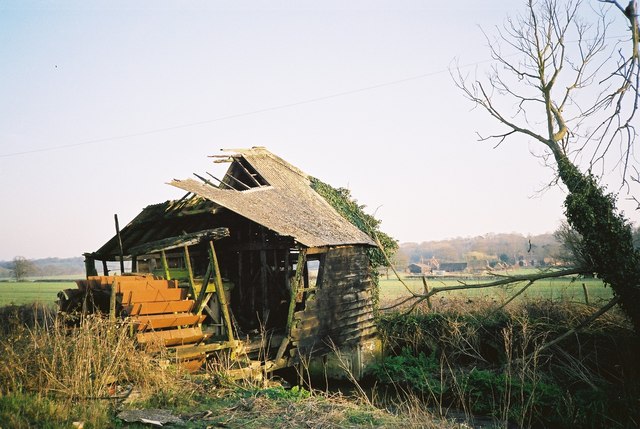
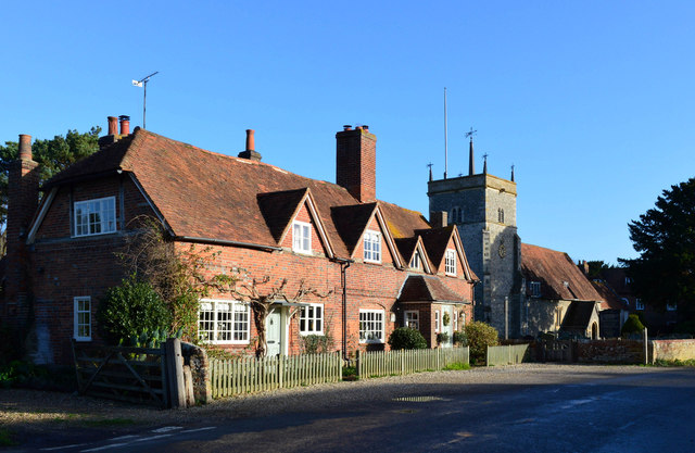
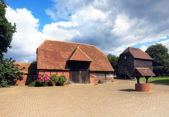
Lodge Copse Images

Images are sourced within 2km of 51.422968/-1.1986277 or Grid Reference SU5569. Thanks to Geograph Open Source API. All images are credited.

Turners Green, Upper Bucklebury Apple Tree Cottage to the left, a small church to the centre and Turners Green House to the right.
Turners Green, Upper Bucklebury
Apple Tree Cottage to the left, a small church to the centre and Turners Green House to the right.
Windmill Lane Off Carbinswood Lane, leading to School Hill.
Windmill Lane
Off Carbinswood Lane, leading to School Hill.
Pastoral scene, Stanford Dingley, Berkshire
Former school, Bucklebury, Berkshire School, now house. C17 with C19 refacing and additions to south and east. Timber framed with angle braces, brick nogging and later brick facing to rear; tiled roof with ridge stack off-centre to left above door. 3 framed bays. 2 storeys. 2 first floor 2-light C19 segmental headed casements to right with 3-light casement and small casement to left, 2 ground floor 3-light C20 casements to right with boarded door to left beneath stack. Block to left: timber framed with brick facing, hipped tile roof with stack to rear. One storey and attic. 2-light segmental headed casement to right and boarded door to left.

(Source:Historic England)
Former school, Bucklebury, Berkshire
School, now house. C17 with C19 refacing and additions to south and east. Timber framed with angle braces, brick nogging and later brick facing to rear; tiled roof with ridge stack off-centre to left above door. 3 framed bays. 2 storeys. 2 first floor 2-light C19 segmental headed casements to right with 3-light casement and small casement to left, 2 ground floor 3-light C20 casements to right with boarded door to left beneath stack. Block to left: timber framed with brick facing, hipped tile roof with stack to rear. One storey and attic. 2-light segmental headed casement to right and boarded door to left. (Source:Historic England)
Tree in autumn glory, Stanford Dingley, Berkshire The photo was taken from outside the property. The foreground has been cut away to give prominence to the magnificent tree.
Tree in autumn glory, Stanford Dingley, Berkshire
The photo was taken from outside the property. The foreground has been cut away to give prominence to the magnificent tree.
Remains of a Mill in 1993 I thought I had lost this one. This is the same mill as in my 2013 picture <a href="https://www.geograph.org.uk/photo/3462437">SU5571 : Remains of a Mill</a> only taken 20 years earlier.
Enough of the structure still remains to get an idea of what the working mill must have been like.
Remains of a Mill in 1993
I thought I had lost this one. This is the same mill as in my 2013 picture SU5571 : Remains of a Mill only taken 20 years earlier. Enough of the structure still remains to get an idea of what the working mill must have been like.
Glebe House, Bucklebury, Berkshire 18 with C20 porch. Red brick with plat band to right. Half hipped old tile roof, 4 gabled eaves dormers to right with 2-light casements, end stack to right, ridge stack above door off-centre to right, and 3 stacks to rear. Altered lobby entrance type. 1 1/2 storeys. 4 ground floor 3-light casements, 2 to right with segmental relieving arches. 4-panelled door with porch between first and second windows from left, porch with hipped tile roof, panelled door and flanking windows between third and fourth windows from left.

(Source:Historic England)
Glebe House, Bucklebury, Berkshire
18 with C20 porch. Red brick with plat band to right. Half hipped old tile roof, 4 gabled eaves dormers to right with 2-light casements, end stack to right, ridge stack above door off-centre to right, and 3 stacks to rear. Altered lobby entrance type. 1 1/2 storeys. 4 ground floor 3-light casements, 2 to right with segmental relieving arches. 4-panelled door with porch between first and second windows from left, porch with hipped tile roof, panelled door and flanking windows between third and fourth windows from left. (Source:Historic England)
Barn, Well and Granary at Hillfoot Farm Original farm buildings by a new forecourt.
Barn, Well and Granary at Hillfoot Farm
Original farm buildings by a new forecourt.
Wild Flowers by the Footpath
Red Leaves in King's Copse A typical view for the area, mixed fields and woods.
Red Leaves in King's Copse
A typical view for the area, mixed fields and woods.
The Pang Valley near Bucklebury The River Pang flows through farmland in a shallow valley between Bucklebury and Stanford Dingley.
The Pang Valley near Bucklebury
The River Pang flows through farmland in a shallow valley between Bucklebury and Stanford Dingley.
Shallow Ford That is what its name is, apparently, not just what it is called. A very unusual three way ford, well paved in concrete up to certain limits, the marker on the right indicates what the limit is in that direction.
Shallow Ford
That is what its name is, apparently, not just what it is called. A very unusual three way ford, well paved in concrete up to certain limits, the marker on the right indicates what the limit is in that direction.
Bucklebury church: 17th century stained glass (sundial?) A relic of 'sad, distracted times' - the maker has signed his work at the top of the panel - 'S:S: me fecit 1649'.  Around the border - at the end of radiating lines as if on a sundial - appear the Roman numerals I to XI (with a cross where XII might be expected).  Some are partly obscured by the lead mounting, so that while VI is fully legible (top left), VII and VIII (starting top right) both appear to replicate VI.

Beneath the escutcheon (shield) an inscription reads: 'Th:S & St' - the meaning of which I can't guess at.

Two areas of blue pigment have been lost from above the chevron on the left.   The golden yellow pigment could well be gamboge.

Afterthought (12.9.2018): on reflection, this must have been intended as a sundial (of sorts) - though it would seem to need a 'pointer'.  The numbering of the hours suggests that it was designed for a south-facing window, not its current position in the north aisle.
Bucklebury church: 17th century stained glass (sundial?)
A relic of 'sad, distracted times' - the maker has signed his work at the top of the panel - 'S:S: me fecit 1649'. Around the border - at the end of radiating lines as if on a sundial - appear the Roman numerals I to XI (with a cross where XII might be expected). Some are partly obscured by the lead mounting, so that while VI is fully legible (top left), VII and VIII (starting top right) both appear to replicate VI. Beneath the escutcheon (shield) an inscription reads: 'Th:S & St' - the meaning of which I can't guess at. Two areas of blue pigment have been lost from above the chevron on the left. The golden yellow pigment could well be gamboge. Afterthought (12.9.2018): on reflection, this must have been intended as a sundial (of sorts) - though it would seem to need a 'pointer'. The numbering of the hours suggests that it was designed for a south-facing window, not its current position in the north aisle.
Bucklebury church: man-and-wheel carving To be found quite high up on a buttress of the church tower - to the right of the clock and at a slightly lower level. 

Am I right in thinking that there's a weathered inscription above the figure?  In any case, what is he doing to the wheel, and what is the implement in his hands?  Is there any significance in the fact that the wheel has twelve spokes, and the orientation is much like a clock face?

In terms of style, I'm reminded of these figures at Saffron Walden: <a title="https://www.geograph.org.uk/photo/3546187" href="https://www.geograph.org.uk/photo/3546187">Link</a> - which may give a clue to date.
Bucklebury church: man-and-wheel carving
To be found quite high up on a buttress of the church tower - to the right of the clock and at a slightly lower level. Am I right in thinking that there's a weathered inscription above the figure? In any case, what is he doing to the wheel, and what is the implement in his hands? Is there any significance in the fact that the wheel has twelve spokes, and the orientation is much like a clock face? In terms of style, I'm reminded of these figures at Saffron Walden: Link - which may give a clue to date.
Bucklebury: church of St Mary the Virgin
Street scene at Bucklebury The road turns right, then left - leading to a bridge over the little River Pang.
Street scene at Bucklebury
The road turns right, then left - leading to a bridge over the little River Pang.
Streambed of the River Pang at Bucklebury The streambed seems all but dry, the flow little more than a trickle.  The reason, no doubt, is that a relief channel was dug after flooding earlier in the century: <a title="https://www.geograph.org.uk/photo/3469627" href="https://www.geograph.org.uk/photo/3469627">Link</a>  <a title="https://www.geograph.org.uk/photo/503402" href="https://www.geograph.org.uk/photo/503402">Link</a>
Streambed of the River Pang at Bucklebury
The streambed seems all but dry, the flow little more than a trickle. The reason, no doubt, is that a relief channel was dug after flooding earlier in the century: Link Link
Farmland north of the Pang valley On the first of the rising ground as you get away from the Pang floodplain.  Photo taken in the first week of September from a field-entrance west of Rushdens Farm.
Farmland north of the Pang valley
On the first of the rising ground as you get away from the Pang floodplain. Photo taken in the first week of September from a field-entrance west of Rushdens Farm.
Show me another place!

Lodge Copse is located at Grid Ref: SU5569 (Lat: 51.422968, Lng: -1.1986277)

Unitary Authority: West Berkshire

Police Authority: Thames Valley

What 3 Words

///marinated.march.dribble. Near Cold Ash, Berkshire

Related Wikis

Bucklebury Common

Bucklebury Common is an elevated common consisting of woodland with a few relatively small clearings in the English county of Berkshire, within the civil...

Bucklebury Manor

Bucklebury Manor is a Grade II listed manor house in the civil parish of Bucklebury in the English county of Berkshire. Since 2012, it has been the home...

Bucklebury Farm Park

Bucklebury Farm Park is an animal park located in Bucklebury in Berkshire, England. The Farm Park consists of mostly Animals, Play equipment, Deer and...

The Bladebone Inn

The Bladebone Inn is a public house at Chapel Row in the civil parish of Bucklebury in the English county of Berkshire. == History == Records show that...

Chapel Row

Chapel Row is a hamlet in West Berkshire, England, and part of the civil parish of Bucklebury. In 2019 it had an estimated population of 627. == History... ==

Bucklebury

Bucklebury is a village and civil parish in West Berkshire, England, about 5 miles (8 km) north-east of Newbury and 1–3 miles (1.6–4.8 km) north of the...

Briff Lane Meadows

Briff Lane Meadows is a 8.9-hectare (22-acre) biological Site of Special Scientific Interest north of Thatcham in Berkshire.These meadows have unimproved...

Midgham Green

Midgham Green is a hamlet in the civil parish of Midgham in the English county of Berkshire. The settlement lies near to the A4 road and is located approximately...

Nearby Amenities

Located within 500m of 51.422968,-1.1986277
Barrier: stile
Lat/Long: 51.4255526/-1.2013983
Lodge Copse
Natural: wood
Lat/Long: 51.4235987/-1.1978209
The data included in this document is from www.openstreetmap.org. The data is made available under ODbL.

Have you been to Lodge Copse?

Leave your review of Lodge Copse below (or comments, questions and feedback).