Burgess' Copse

Wood, Forest in Berkshire

England

Burgess' Copse

Pastoral scene, Stanford Dingley, Berkshire
Pastoral scene, Stanford Dingley, Berkshire Credit: Oswald Bertram

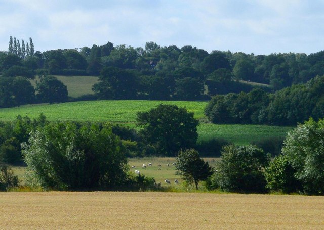
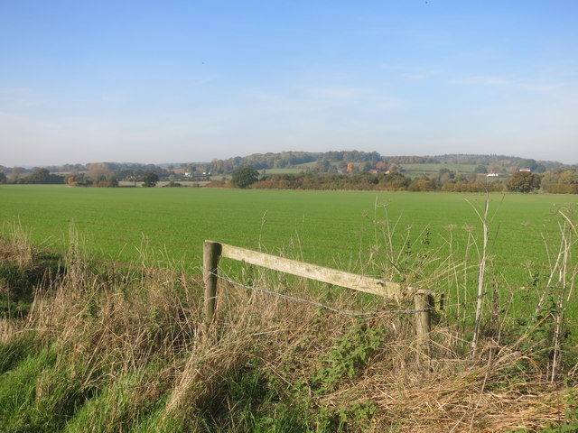
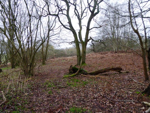
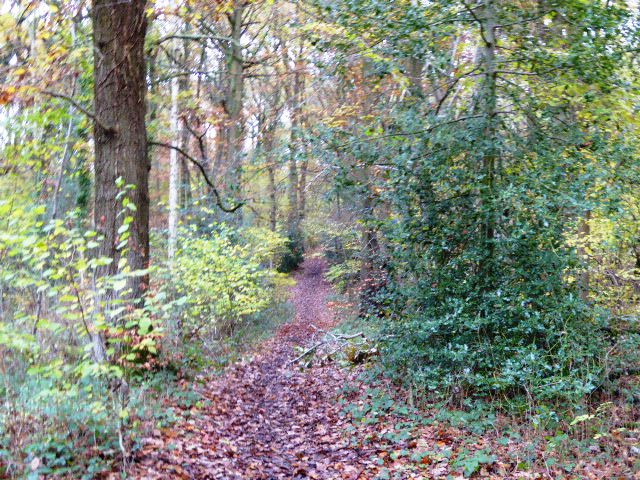
Burgess' Copse is a picturesque woodland located in Berkshire, England. Situated near the village of Burgess Hill, the copse covers an area of approximately 50 hectares, making it a significant woodland in the region. The copse is predominantly composed of deciduous trees, including oak, beech, and ash, which create a diverse and vibrant ecosystem.

The woodland is known for its rich biodiversity and is home to a wide array of flora and fauna. Bluebells, primroses, and foxgloves carpet the forest floor during spring, creating a stunning display of colors. The diverse habitat supports a variety of bird species, such as woodpeckers, nuthatches, and owls. Visitors may also spot small mammals like foxes, badgers, and rabbits roaming through the copse.

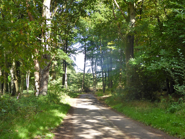
Burgess' Copse offers numerous walking trails, providing visitors with the opportunity to explore the woodland's natural beauty. The well-maintained paths wind through the trees, offering peaceful and serene surroundings. There are also picnic areas and benches scattered throughout the copse, allowing visitors to immerse themselves in the tranquil environment and enjoy a picnic in nature.

The copse is managed by the local authorities, ensuring its preservation and protection. It serves as an important recreational space for the local community, providing a peaceful retreat for nature enthusiasts, walkers, and families alike. Burgess' Copse is a hidden gem in Berkshire, offering a haven of tranquility and natural beauty for all to enjoy.

If you have any feedback on the listing, please let us know in the comments section below.

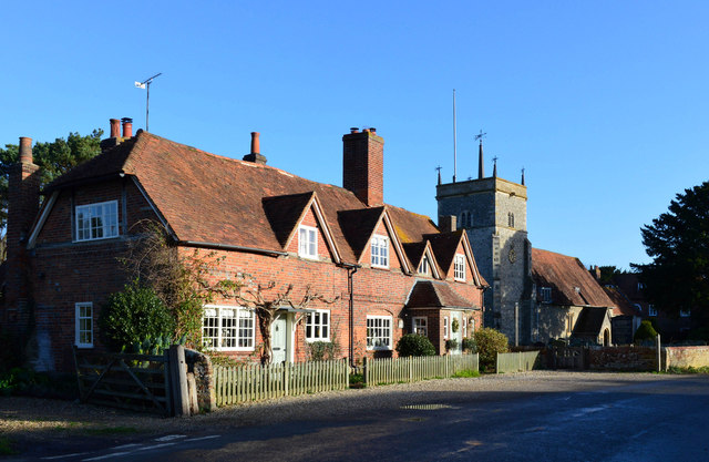
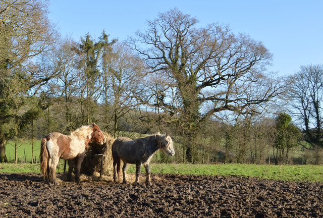
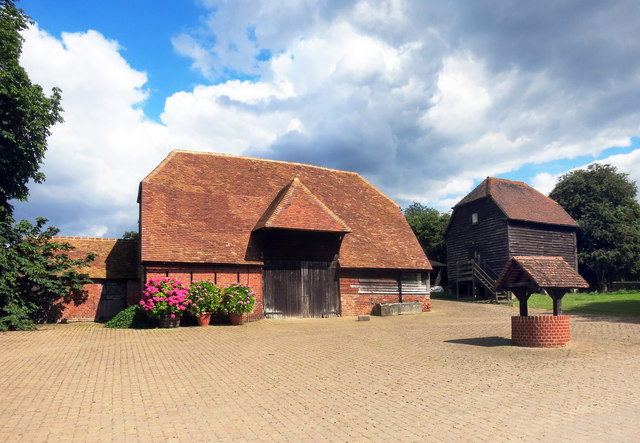
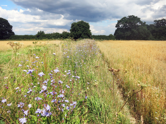
Burgess' Copse Images

Images are sourced within 2km of 51.444617/-1.1981914 or Grid Reference SU5572. Thanks to Geograph Open Source API. All images are credited.

Pastoral scene, Stanford Dingley, Berkshire
Former school, Bucklebury, Berkshire School, now house. C17 with C19 refacing and additions to south and east. Timber framed with angle braces, brick nogging and later brick facing to rear; tiled roof with ridge stack off-centre to left above door. 3 framed bays. 2 storeys. 2 first floor 2-light C19 segmental headed casements to right with 3-light casement and small casement to left, 2 ground floor 3-light C20 casements to right with boarded door to left beneath stack. Block to left: timber framed with brick facing, hipped tile roof with stack to rear. One storey and attic. 2-light segmental headed casement to right and boarded door to left.

(Source:Historic England)
Former school, Bucklebury, Berkshire
School, now house. C17 with C19 refacing and additions to south and east. Timber framed with angle braces, brick nogging and later brick facing to rear; tiled roof with ridge stack off-centre to left above door. 3 framed bays. 2 storeys. 2 first floor 2-light C19 segmental headed casements to right with 3-light casement and small casement to left, 2 ground floor 3-light C20 casements to right with boarded door to left beneath stack. Block to left: timber framed with brick facing, hipped tile roof with stack to rear. One storey and attic. 2-light segmental headed casement to right and boarded door to left. (Source:Historic England)
The Spring, Standford Dingley, Berkshire Late C16 with C20 additions. Timber framed with angled braces, brick ground floor, first floor plaster panels, and tile hung gable end to left. Old tile roof with catslide to rear, part to right with slightly lower eaves; central ridge stack, and ridge stack off-centre to right. 3 framed bays to left. 2 storeys. 3 first floor 2-light C20 leaded casements, 4 ground floor C20 leaded casements, canted bay second from left with hipped tile roof. 

(Source:Historic England)
The Spring, Standford Dingley, Berkshire
Late C16 with C20 additions. Timber framed with angled braces, brick ground floor, first floor plaster panels, and tile hung gable end to left. Old tile roof with catslide to rear, part to right with slightly lower eaves; central ridge stack, and ridge stack off-centre to right. 3 framed bays to left. 2 storeys. 3 first floor 2-light C20 leaded casements, 4 ground floor C20 leaded casements, canted bay second from left with hipped tile roof. (Source:Historic England)
Tree in autumn glory, Stanford Dingley, Berkshire The photo was taken from outside the property. The foreground has been cut away to give prominence to the magnificent tree.
Tree in autumn glory, Stanford Dingley, Berkshire
The photo was taken from outside the property. The foreground has been cut away to give prominence to the magnificent tree.
Remains of a Mill in 1993 I thought I had lost this one. This is the same mill as in my 2013 picture <a href="https://www.geograph.org.uk/photo/3462437">SU5571 : Remains of a Mill</a> only taken 20 years earlier.
Enough of the structure still remains to get an idea of what the working mill must have been like.
Remains of a Mill in 1993
I thought I had lost this one. This is the same mill as in my 2013 picture SU5571 : Remains of a Mill only taken 20 years earlier. Enough of the structure still remains to get an idea of what the working mill must have been like.
Glebe House, Bucklebury, Berkshire 18 with C20 porch. Red brick with plat band to right. Half hipped old tile roof, 4 gabled eaves dormers to right with 2-light casements, end stack to right, ridge stack above door off-centre to right, and 3 stacks to rear. Altered lobby entrance type. 1 1/2 storeys. 4 ground floor 3-light casements, 2 to right with segmental relieving arches. 4-panelled door with porch between first and second windows from left, porch with hipped tile roof, panelled door and flanking windows between third and fourth windows from left.

(Source:Historic England)
Glebe House, Bucklebury, Berkshire
18 with C20 porch. Red brick with plat band to right. Half hipped old tile roof, 4 gabled eaves dormers to right with 2-light casements, end stack to right, ridge stack above door off-centre to right, and 3 stacks to rear. Altered lobby entrance type. 1 1/2 storeys. 4 ground floor 3-light casements, 2 to right with segmental relieving arches. 4-panelled door with porch between first and second windows from left, porch with hipped tile roof, panelled door and flanking windows between third and fourth windows from left. (Source:Historic England)
Farmland, Stanford Dingley, Berkshire
Chapel Lane Bridge, M4 The M4 is 190 miles long and runs from London to South Wales. Major centres close to the motorway include Reading, Swindon, Bristol, Newport, Cardiff and Swansea. The motorway was constructed between 1961 and 1996. The M4 originally crossed the first Severn Road Bridge. It has now been diverted to use the Second Severn Crossing and the motorway over the older bridge has been renumbered as M48.
Wikipedia: <span class="nowrap"><a title="http://en.wikipedia.org/wiki/M4_motorway" rel="nofollow ugc noopener" href="http://en.wikipedia.org/wiki/M4_motorway">Link</a><img style="margin-left:2px;" alt="External link" title="External link - shift click to open in new window" src="https://s1.geograph.org.uk/img/external.png" width="10" height="10"/></span>
Chapel Lane Bridge, M4
The M4 is 190 miles long and runs from London to South Wales. Major centres close to the motorway include Reading, Swindon, Bristol, Newport, Cardiff and Swansea. The motorway was constructed between 1961 and 1996. The M4 originally crossed the first Severn Road Bridge. It has now been diverted to use the Second Severn Crossing and the motorway over the older bridge has been renumbered as M48. Wikipedia: LinkExternal link
Pond in Hawkridge Wood Ponds like this are found all around this area, probably old clay pits.
Pond in Hawkridge Wood
Ponds like this are found all around this area, probably old clay pits.
Path in Hawkridge Wood On the map, this is given the Long Distance Path coding, and is named as one of the Berkshire Circular Walks.
No other information is available about these routes, something which has been raised on various walk forums.
This comment is taken from one of them, (WalkingForum.co.uk)  and seems likely enough :-
"I suspect these walks were promoted by Berkshire County Council, which was abolished and replaced by unitary authorities in 1998.
I can't find any mention of them on the West Berkshire Council website, and I can't remember seeing any waymarking for them last time I walked in the area."
Path in Hawkridge Wood
On the map, this is given the Long Distance Path coding, and is named as one of the Berkshire Circular Walks. No other information is available about these routes, something which has been raised on various walk forums. This comment is taken from one of them, (WalkingForum.co.uk) and seems likely enough :- "I suspect these walks were promoted by Berkshire County Council, which was abolished and replaced by unitary authorities in 1998. I can't find any mention of them on the West Berkshire Council website, and I can't remember seeing any waymarking for them last time I walked in the area."
Lane near the Motorway Motorway contractors don't do country lanes. Like many small roads that were in the path of motorway construction, this bit of lane has all the signs of being rebuilt to a much better standard than the unaltered bits at each end, which are still as winding and pot holed as ever.
Lane near the Motorway
Motorway contractors don't do country lanes. Like many small roads that were in the path of motorway construction, this bit of lane has all the signs of being rebuilt to a much better standard than the unaltered bits at each end, which are still as winding and pot holed as ever.
Footpath, Hawkridge Wood Like many of the woods round here, this one is quite walker friendly with several paths through it.
Footpath, Hawkridge Wood
Like many of the woods round here, this one is quite walker friendly with several paths through it.
Barn, Well and Granary at Hillfoot Farm Original farm buildings by a new forecourt.
Barn, Well and Granary at Hillfoot Farm
Original farm buildings by a new forecourt.
Wild Flowers by the Footpath
The Pang Valley near Bucklebury The River Pang flows through farmland in a shallow valley between Bucklebury and Stanford Dingley.
The Pang Valley near Bucklebury
The River Pang flows through farmland in a shallow valley between Bucklebury and Stanford Dingley.
High straw stack At New Barn Farm.
High straw stack
At New Barn Farm.
Chapel Lane Heading north towards Yattendon.
Chapel Lane
Heading north towards Yattendon.
Show me another place!

Burgess' Copse is located at Grid Ref: SU5572 (Lat: 51.444617, Lng: -1.1981914)

Unitary Authority: West Berkshire

Police Authority: Thames Valley

What 3 Words

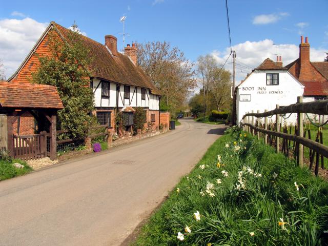
///using.oaks.marathons. Near Bradfield, Berkshire

Related Wikis

Bucklebury

Bucklebury is a village and civil parish in West Berkshire, England, about 5 miles (8 km) north-east of Newbury and 1–3 miles (1.6–4.8 km) north of the...

Frilsham

Frilsham is a village and civil parish 4 miles (6.4 km) from Newbury, in the English county of Berkshire. == Geography == Frilsham is near the Berkshire...

Bucklebury Farm Park

Bucklebury Farm Park is an animal park located in Bucklebury in Berkshire, England. The Farm Park consists of mostly Animals, Play equipment, Deer and...

Stanford Dingley

Stanford Dingley is a small village and civil parish in West Berkshire, England, between Newbury and Theale. == Geography == Stanford Dingley fills part...

Bucklebury Manor

Bucklebury Manor is a Grade II listed manor house in the civil parish of Bucklebury in the English county of Berkshire. Since 2012, it has been the home...

Coombe Wood, Frilsham

Coombe Wood, Frilsham is a 19.3-hectare (48-acre) biological Site of Special Scientific Interest south of Frilsham in Berkshire. It is in the North Wessex...

King's Copse

King's Copse is a 13.7-hectare (34-acre) biological Site of Special Scientific Interest between Chapel Row and Clay Hill in Berkshire. It is in the North...

Briff Lane Meadows

Briff Lane Meadows is a 8.9-hectare (22-acre) biological Site of Special Scientific Interest north of Thatcham in Berkshire.These meadows have unimproved...

Nearby Amenities

Located within 500m of 51.444617,-1.1981914
Barrier: kissing_gate
Foot: yes
Lat/Long: 51.4408382/-1.1972171
The data included in this document is from www.openstreetmap.org. The data is made available under ODbL.

Have you been to Burgess' Copse?

Leave your review of Burgess' Copse below (or comments, questions and feedback).