Woodground Shaw

Wood, Forest in Berkshire

England

Woodground Shaw

Roundfield, Upper Bucklebury One of two cul-de-sacs sharing the same name.
Roundfield, Upper Bucklebury Credit: Oscar

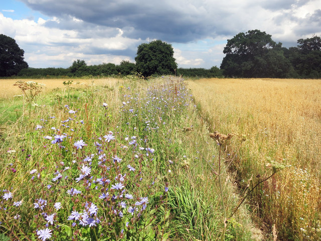
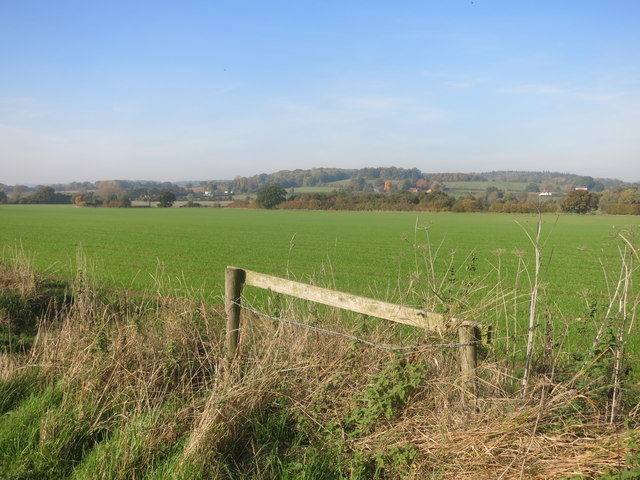
Woodground Shaw is a picturesque forested area located in Berkshire, England. Covering an area of approximately 100 acres, it is a popular destination for nature enthusiasts and hikers alike. The woodland is characterized by its dense and diverse vegetation, consisting mainly of deciduous and evergreen trees such as oak, beech, and pine, providing a rich habitat for a variety of wildlife.

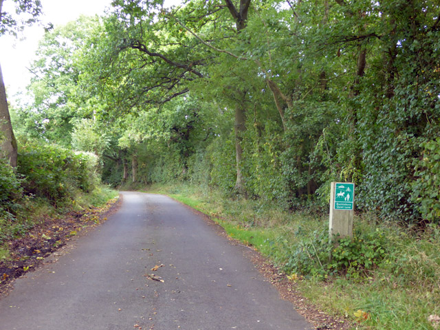
The forest is crisscrossed by a network of well-maintained trails, allowing visitors to explore its beauty at their own pace. These trails lead to various points of interest, including a tranquil pond, where visitors can observe a range of water-loving creatures, such as ducks and dragonflies. Additionally, the forest is home to a diverse range of bird species, making it a favorite spot for birdwatchers.

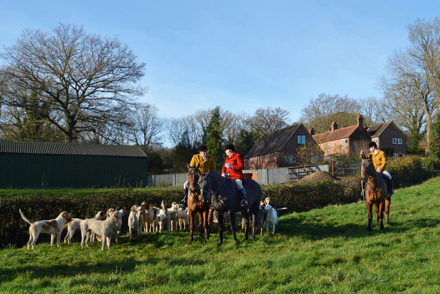
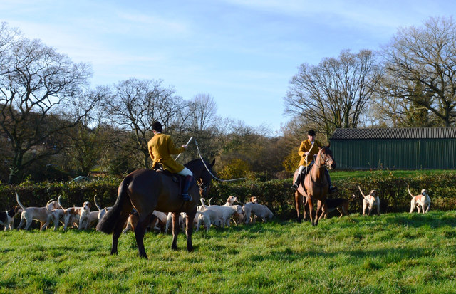
Woodground Shaw is also known for its historical significance. It is believed to have been used as a hunting ground during medieval times, and remnants of old hunting lodges and deer hides can still be found within the forest. The area has been carefully preserved to maintain its natural charm and historical heritage.

Aside from its natural beauty, Woodground Shaw offers recreational facilities such as picnic areas and camping spots, allowing visitors to fully immerse themselves in the tranquil surroundings. The forest is open to the public year-round, and various events and guided walks are organized throughout the year to further enhance the visitor experience.

In conclusion, Woodground Shaw in Berkshire is a captivating forested area that offers a blend of natural beauty, historical significance, and recreational opportunities. A visit to this enchanting woodland promises a rejuvenating experience for nature lovers and history enthusiasts alike.

If you have any feedback on the listing, please let us know in the comments section below.

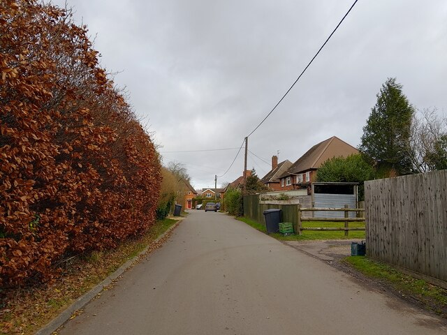
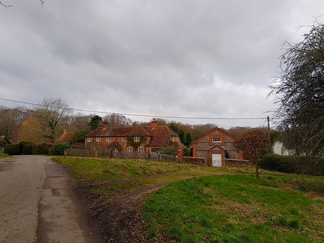
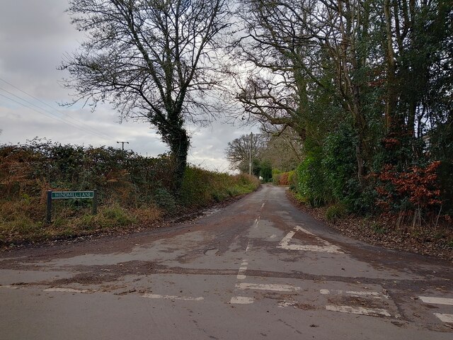
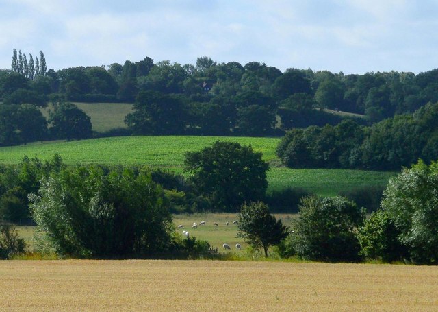
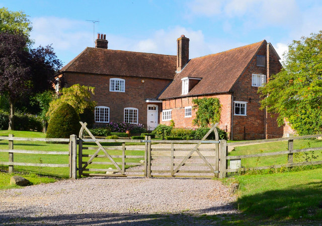
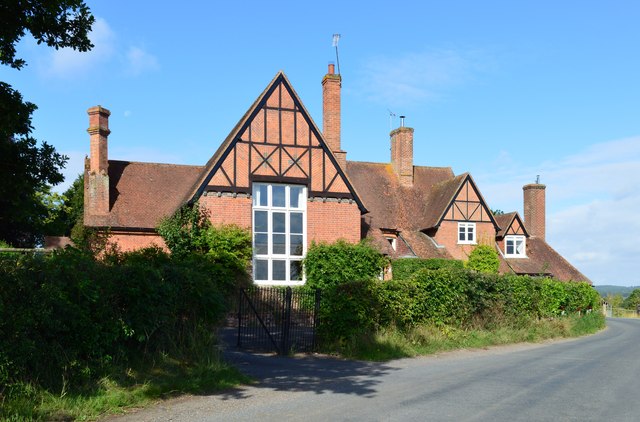
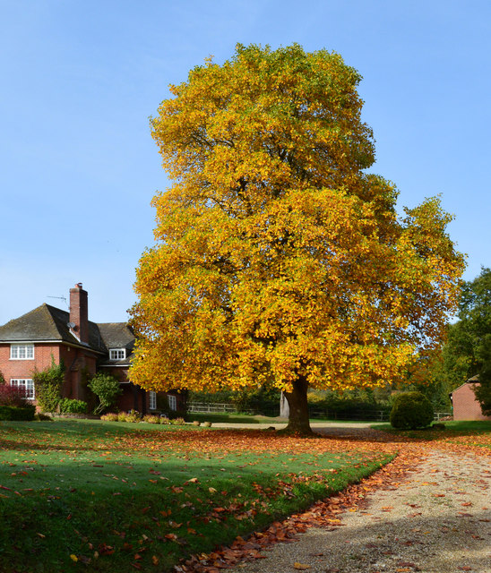
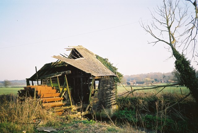
Woodground Shaw Images

Images are sourced within 2km of 51.425236/-1.205535 or Grid Reference SU5569. Thanks to Geograph Open Source API. All images are credited.

Roundfield, Upper Bucklebury One of two cul-de-sacs sharing the same name.
Roundfield, Upper Bucklebury
One of two cul-de-sacs sharing the same name.
Turners Green, Upper Bucklebury Apple Tree Cottage to the left, a small church to the centre and Turners Green House to the right.
Turners Green, Upper Bucklebury
Apple Tree Cottage to the left, a small church to the centre and Turners Green House to the right.
Windmill Lane Off Carbinswood Lane, leading to School Hill.
Windmill Lane
Off Carbinswood Lane, leading to School Hill.
Pastoral scene, Stanford Dingley, Berkshire
Hillhouse Farmhouse, Bucklebury, Berkshire Circa 1600 with some C19 refacing and large C19 wing to south. Brick, timber framed with brick nogging, some later brick refacing. Old tile roof, hipped over projecting wing to left with stack off-centre to left, stack to right and C20 dormer with casements. L-plan: 3 framed bays of one storey and attic with large C19 two storey wing projecting to left. East front: brick faced bay to right, 2-light C19 casement in centre bay and 5-light C19 casement in left-hand bay. Projecting wing, right-hand return wall: one first floor 3-light segemental headed casement and 2 ground floor 3-light segmental headed casements to left. 5-panelled door to right with rectangular overlight under segmental head and C20 porch. Interior: frame includes one pair of cruck blades.

(Source:Historic England)
Hillhouse Farmhouse, Bucklebury, Berkshire
Circa 1600 with some C19 refacing and large C19 wing to south. Brick, timber framed with brick nogging, some later brick refacing. Old tile roof, hipped over projecting wing to left with stack off-centre to left, stack to right and C20 dormer with casements. L-plan: 3 framed bays of one storey and attic with large C19 two storey wing projecting to left. East front: brick faced bay to right, 2-light C19 casement in centre bay and 5-light C19 casement in left-hand bay. Projecting wing, right-hand return wall: one first floor 3-light segemental headed casement and 2 ground floor 3-light segmental headed casements to left. 5-panelled door to right with rectangular overlight under segmental head and C20 porch. Interior: frame includes one pair of cruck blades. (Source:Historic England)
Former school, Bucklebury, Berkshire School, now house. C17 with C19 refacing and additions to south and east. Timber framed with angle braces, brick nogging and later brick facing to rear; tiled roof with ridge stack off-centre to left above door. 3 framed bays. 2 storeys. 2 first floor 2-light C19 segmental headed casements to right with 3-light casement and small casement to left, 2 ground floor 3-light C20 casements to right with boarded door to left beneath stack. Block to left: timber framed with brick facing, hipped tile roof with stack to rear. One storey and attic. 2-light segmental headed casement to right and boarded door to left.

(Source:Historic England)
Former school, Bucklebury, Berkshire
School, now house. C17 with C19 refacing and additions to south and east. Timber framed with angle braces, brick nogging and later brick facing to rear; tiled roof with ridge stack off-centre to left above door. 3 framed bays. 2 storeys. 2 first floor 2-light C19 segmental headed casements to right with 3-light casement and small casement to left, 2 ground floor 3-light C20 casements to right with boarded door to left beneath stack. Block to left: timber framed with brick facing, hipped tile roof with stack to rear. One storey and attic. 2-light segmental headed casement to right and boarded door to left. (Source:Historic England)
Tree in autumn glory, Stanford Dingley, Berkshire The photo was taken from outside the property. The foreground has been cut away to give prominence to the magnificent tree.
Tree in autumn glory, Stanford Dingley, Berkshire
The photo was taken from outside the property. The foreground has been cut away to give prominence to the magnificent tree.
Remains of a Mill in 1993 I thought I had lost this one. This is the same mill as in my 2013 picture <a href="https://www.geograph.org.uk/photo/3462437">SU5571 : Remains of a Mill</a> only taken 20 years earlier.
Enough of the structure still remains to get an idea of what the working mill must have been like.
Remains of a Mill in 1993
I thought I had lost this one. This is the same mill as in my 2013 picture SU5571 : Remains of a Mill only taken 20 years earlier. Enough of the structure still remains to get an idea of what the working mill must have been like.
Before the hunt, Bucklebury, Berkshire
Glebe House, Bucklebury, Berkshire 18 with C20 porch. Red brick with plat band to right. Half hipped old tile roof, 4 gabled eaves dormers to right with 2-light casements, end stack to right, ridge stack above door off-centre to right, and 3 stacks to rear. Altered lobby entrance type. 1 1/2 storeys. 4 ground floor 3-light casements, 2 to right with segmental relieving arches. 4-panelled door with porch between first and second windows from left, porch with hipped tile roof, panelled door and flanking windows between third and fourth windows from left.

(Source:Historic England)
Glebe House, Bucklebury, Berkshire
18 with C20 porch. Red brick with plat band to right. Half hipped old tile roof, 4 gabled eaves dormers to right with 2-light casements, end stack to right, ridge stack above door off-centre to right, and 3 stacks to rear. Altered lobby entrance type. 1 1/2 storeys. 4 ground floor 3-light casements, 2 to right with segmental relieving arches. 4-panelled door with porch between first and second windows from left, porch with hipped tile roof, panelled door and flanking windows between third and fourth windows from left. (Source:Historic England)
Excited hounds, Bucklebury, Berkshire
Towards Hillhouse Farm A short public footpath runs across this valley from here to the farm opposite.
Towards Hillhouse Farm
A short public footpath runs across this valley from here to the farm opposite.
Barn, Well and Granary at Hillfoot Farm Original farm buildings by a new forecourt.
Barn, Well and Granary at Hillfoot Farm
Original farm buildings by a new forecourt.
Wild Flowers by the Footpath
The Pang Valley near Bucklebury The River Pang flows through farmland in a shallow valley between Bucklebury and Stanford Dingley.
The Pang Valley near Bucklebury
The River Pang flows through farmland in a shallow valley between Bucklebury and Stanford Dingley.
Tylers Lane, Bucklebury Signed as a 'Bucklebury Quiet Lane'.
Tylers Lane, Bucklebury
Signed as a 'Bucklebury Quiet Lane'.
Rural road junction Tylers Lane straight on, Fannys Lane right, a public byway left.
Rural road junction
Tylers Lane straight on, Fannys Lane right, a public byway left.
High straw stack At New Barn Farm.
High straw stack
At New Barn Farm.
Show me another place!

Woodground Shaw is located at Grid Ref: SU5569 (Lat: 51.425236, Lng: -1.205535)

Unitary Authority: West Berkshire

Police Authority: Thames Valley

What 3 Words

///hands.spectacle.chat. Near Cold Ash, Berkshire

Related Wikis

Bucklebury Manor

Bucklebury Manor is a Grade II listed manor house in the civil parish of Bucklebury in the English county of Berkshire. Since 2012, it has been the home...

Bucklebury Farm Park

Bucklebury Farm Park is an animal park located in Bucklebury in Berkshire, England. The Farm Park consists of mostly Animals, Play equipment, Deer and...

Bucklebury Common

Bucklebury Common is an elevated common consisting of woodland with a few relatively small clearings in the English county of Berkshire, within the civil...

Bucklebury

Bucklebury is a village and civil parish in West Berkshire, England, about 5 miles (8 km) north-east of Newbury and 1–3 miles (1.6–4.8 km) north of the...

Briff Lane Meadows

Briff Lane Meadows is a 8.9-hectare (22-acre) biological Site of Special Scientific Interest north of Thatcham in Berkshire.These meadows have unimproved...

The Bladebone Inn

The Bladebone Inn is a public house at Chapel Row in the civil parish of Bucklebury in the English county of Berkshire. == History == Records show that...

Chapel Row

Chapel Row is a hamlet in West Berkshire, England, and part of the civil parish of Bucklebury. In 2019 it had an estimated population of 627. == History... ==

Midgham Green

Midgham Green is a hamlet in the civil parish of Midgham in the English county of Berkshire. The settlement lies near to the A4 road and is located approximately...

Nearby Amenities

Located within 500m of 51.425236,-1.205535
Cafe
Woody's Cafe and Tea Room
Lat/Long: 51.4273804/-1.2066408
Toilets
Access: customers
Lat/Long: 51.4274929/-1.2063929
Barrier: stile
Lat/Long: 51.4255526/-1.2013983
Roe Deer
Board Type: nature
Information: board
Tourism: information
Lat/Long: 51.4262526/-1.2052194
Leisure: picnic_table
Lat/Long: 51.4262742/-1.2052935
Entrance: yes
Lat/Long: 51.4273598/-1.2065471
Shop: ticket
Lat/Long: 51.4273633/-1.2067486
Shop: farm
Website: http://www.buckleburyfarmpark.co.uk/farm-shop/
Lat/Long: 51.4273988/-1.2068029
Entrance: main
Lat/Long: 51.4274342/-1.2067371
Entrance: yes
Lat/Long: 51.4272782/-1.2065469
Entrance: main
Lat/Long: 51.4274348/-1.2067774
Playground: structure
Playground Theme: tractor
Lat/Long: 51.4270694/-1.2057482
Man Made: insect_hotel
Lat/Long: 51.4275293/-1.2061022
Bench
Backrest: no
Lat/Long: 51.4262908/-1.2047782
Handwashing Station
Lat/Long: 51.4276133/-1.2075543
Handwashing Station
Lat/Long: 51.4271783/-1.2065649
Playground: tyre_swing
Lat/Long: 51.4264631/-1.2058796
Bench
Backrest: no
Lat/Long: 51.4263837/-1.2045553
Playground: structure
Lat/Long: 51.4269805/-1.205883
Playground: structure
Lat/Long: 51.4271254/-1.2059145
Playground: slide
Lat/Long: 51.4269473/-1.2057602
Playground: structure
Playground Theme: tractor
Lat/Long: 51.427079/-1.2058239
Playground: springy
Lat/Long: 51.4269256/-1.2058327
Playground: slide
Playground Theme: train
Lat/Long: 51.4268984/-1.2056996
Playground: slide
Lat/Long: 51.4270123/-1.2059098
Playground: toddler_swing
Lat/Long: 51.4268164/-1.2055108
Barrier: kissing_gate
Lat/Long: 51.4286295/-1.2055942
The data included in this document is from www.openstreetmap.org. The data is made available under ODbL.

Have you been to Woodground Shaw?

Leave your review of Woodground Shaw below (or comments, questions and feedback).