Deddington Plantation

Wood, Forest in Nottinghamshire Broxtowe

England

Deddington Plantation

Wroxham Drive near twitchell over Tottle Brook
Wroxham Drive near twitchell over Tottle Brook Credit: SK53

Deddington Plantation is a picturesque woodland area located in Nottinghamshire, England. Situated in the heart of the county, the plantation covers a vast expanse of land and is renowned for its natural beauty and diverse ecosystem.

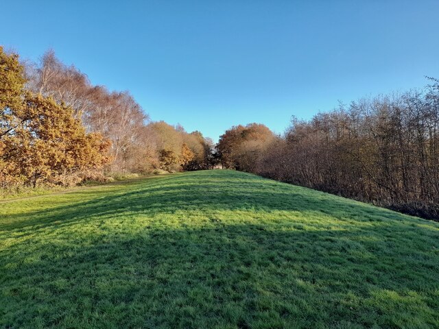
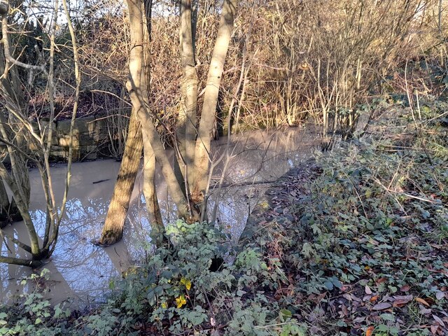
The plantation is predominantly composed of mature trees, including oak and beech, which create a dense canopy providing shade and shelter for a wide range of wildlife. The forest floor is adorned with a rich carpet of ferns, wildflowers, and mosses, adding to the enchanting ambiance of the area.

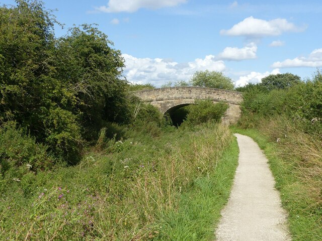
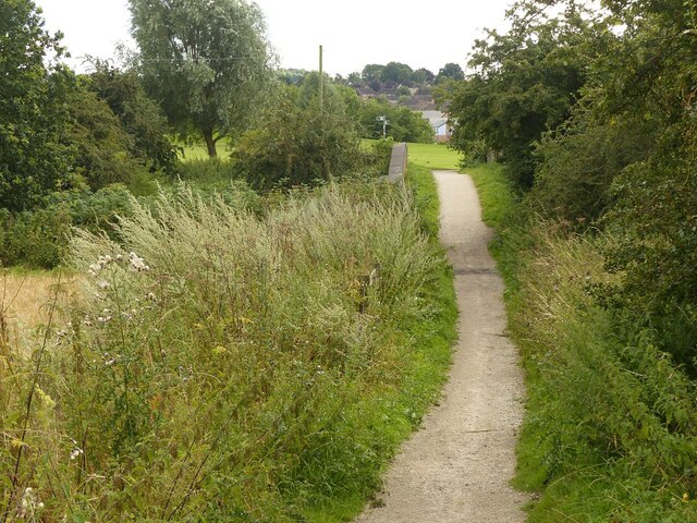
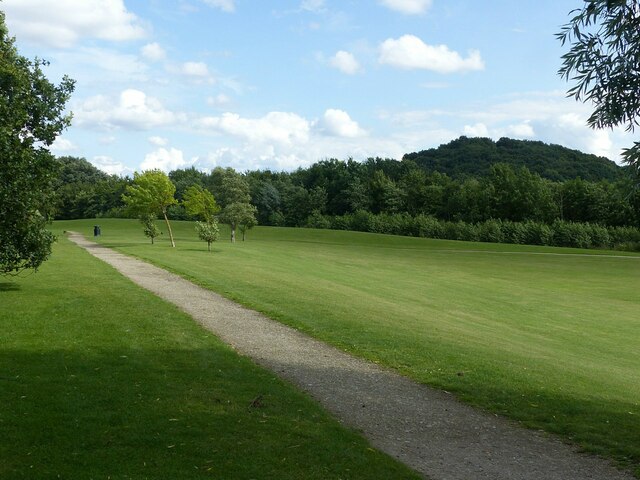
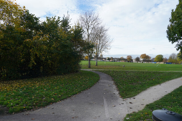
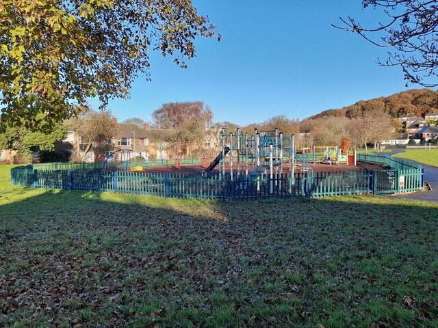
The plantation is crisscrossed by a network of well-maintained trails, making it a popular destination for hikers, nature enthusiasts, and outdoor adventurers. These trails offer visitors the opportunity to explore the plantation's hidden gems, including secluded ponds, babbling brooks, and ancient stone ruins.

The wildlife at Deddington Plantation is abundant and diverse. The area is home to a variety of bird species, including woodpeckers, owls, and songbirds, which fill the air with their melodious calls. Deer, foxes, and rabbits can often be spotted darting through the undergrowth, adding to the allure of the plantation.

The plantation is carefully managed to preserve its natural beauty and protect the delicate ecosystem. Conservation efforts include tree planting initiatives, controlled burns, and the establishment of protected areas for vulnerable species.

For those seeking tranquility and a connection with nature, Deddington Plantation offers a serene retreat amidst the hustle and bustle of modern life. Its unspoiled beauty and peaceful ambiance make it a true gem in the Nottinghamshire countryside.

If you have any feedback on the listing, please let us know in the comments section below.

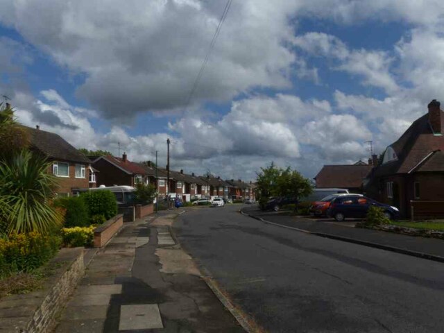
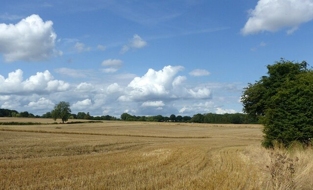
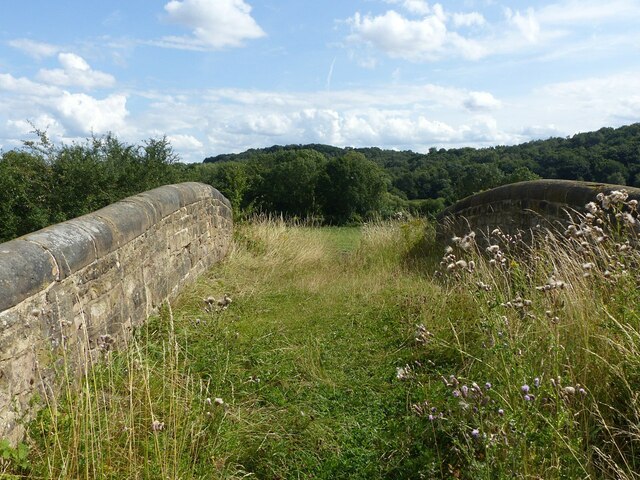
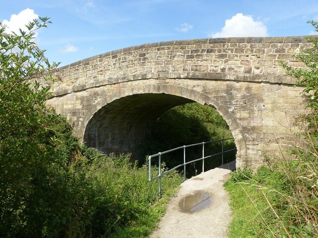
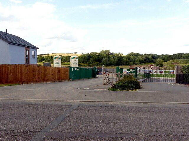
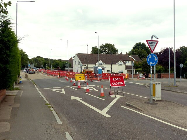
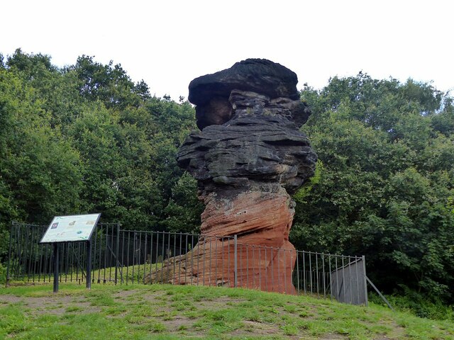
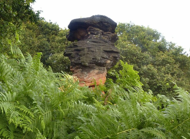
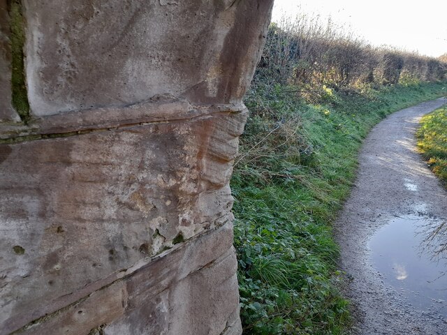
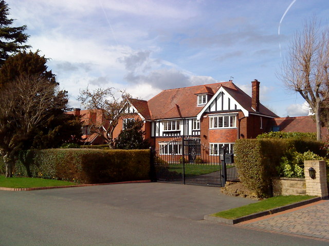
Deddington Plantation Images

Images are sourced within 2km of 52.943687/-1.2381329 or Grid Reference SK5138. Thanks to Geograph Open Source API. All images are credited.

Wroxham Drive near twitchell over Tottle Brook
Partly harvested field Near the former Swancar Farm.
Partly harvested field
Near the former Swancar Farm.
Swancar Bridge over the Nottingham Canal -1 An original bridge from the creation of the Nottingham Canal, c.1795, Listed Grade II. Originally providing field access, it is now bypassed by a track through the former canal bed alongside.
Swancar Bridge over the Nottingham Canal -1
An original bridge from the creation of the Nottingham Canal, c.1795, Listed Grade II. Originally providing field access, it is now bypassed by a track through the former canal bed alongside.
Swancar Bridge over the Nottingham Canal -2 An original bridge from the creation of the Nottingham Canal, c.1795, Listed Grade II. Originally providing field access, it is now bypassed by a track through the former canal bed alongside. The former canal towpath has been developed as part of the Erewash Valley Trail and also National Cycle Route 6.
Swancar Bridge over the Nottingham Canal -2
An original bridge from the creation of the Nottingham Canal, c.1795, Listed Grade II. Originally providing field access, it is now bypassed by a track through the former canal bed alongside. The former canal towpath has been developed as part of the Erewash Valley Trail and also National Cycle Route 6.
Swancar Bridge over the Nottingham Canal -3 An original bridge from the creation of the Nottingham Canal, c.1795, Listed Grade II. Originally providing field access, it is now bypassed by a track through the former canal bed alongside. The former canal towpath has been developed as part of the Erewash Valley Trail and also National Cycle Route 6.
Swancar Bridge over the Nottingham Canal -3
An original bridge from the creation of the Nottingham Canal, c.1795, Listed Grade II. Originally providing field access, it is now bypassed by a track through the former canal bed alongside. The former canal towpath has been developed as part of the Erewash Valley Trail and also National Cycle Route 6.
Footpath over the railway near Trowell Originally an agricultural accommodation bridge. The path is now part of the Robin Hood Way and Erewash Valley Trail long distance footpaths.
Footpath over the railway near Trowell
Originally an agricultural accommodation bridge. The path is now part of the Robin Hood Way and Erewash Valley Trail long distance footpaths.
Pit Lane Recreation Area Redevelopment of the former Trowell Moor Colliery area as open space.
Pit Lane Recreation Area
Redevelopment of the former Trowell Moor Colliery area as open space.
Train to Nottingham and Norwich Looking east from the footbridge near Pit Lane. The train consists of two Class 158 units, 158 806 and 158 864. Now operated by East Midland Railway, the units are still in the old Stagecoach Group livery of East Midlands Trains.
Train to Nottingham and Norwich
Looking east from the footbridge near Pit Lane. The train consists of two Class 158 units, 158 806 and 158 864. Now operated by East Midland Railway, the units are still in the old Stagecoach Group livery of East Midlands Trains.
Field Farm housing development, Stapleford The farm occupied the area beyond the lighting column.
Field Farm housing development, Stapleford
The farm occupied the area beyond the lighting column.
Ilkeston Road closure, Stapleford A significant closure with substantial diversions while Severn Trent make 'new connections'. The closure notices do not state whether this is for water supply or sewerage.
Ilkeston Road closure, Stapleford
A significant closure with substantial diversions while Severn Trent make 'new connections'. The closure notices do not state whether this is for water supply or sewerage.
The Hemlock Stone Almost recreating this 'First' for the square <a title="https://www.geograph.org.uk/photo/17658" href="https://www.geograph.org.uk/photo/17658">Link</a> . The position of the notice board relative to the rock shows that this is not taken from exactly the same position. This view <a title="https://www.geograph.org.uk/photo/6928773" href="https://www.geograph.org.uk/photo/6928773">Link</a> shows the result of doing so.

This outcrop is what is known as an inselberg, the result of differential erosion. The waisted form is the result of the upper layers being a slightly harder material which has weathered less. Both layers form part of the Nottingham Castle Sandstone group, but are of slightly different ages.
The Hemlock Stone
Almost recreating this 'First' for the square Link . The position of the notice board relative to the rock shows that this is not taken from exactly the same position. This view Link shows the result of doing so. This outcrop is what is known as an inselberg, the result of differential erosion. The waisted form is the result of the upper layers being a slightly harder material which has weathered less. Both layers form part of the Nottingham Castle Sandstone group, but are of slightly different ages.
The Hemlock Stone Recreating this 'First' for the square <a title="https://www.geograph.org.uk/photo/17658" href="https://www.geograph.org.uk/photo/17658">Link</a> . The original photographer clearly had the camera at a low level to get the top of the stone against the sky. The growth of the trees behind means that very little of the stone now projects above the tree line. For a view of the whole stone from nearly the same point, see <a title="https://www.geograph.org.uk/photo/6928764" href="https://www.geograph.org.uk/photo/6928764">Link</a>
The Hemlock Stone
Recreating this 'First' for the square Link . The original photographer clearly had the camera at a low level to get the top of the stone against the sky. The growth of the trees behind means that very little of the stone now projects above the tree line. For a view of the whole stone from nearly the same point, see Link
Playing fields The playing fields are part of the Ilkeston Road Recreation Grounds.
Playing fields
The playing fields are part of the Ilkeston Road Recreation Grounds.
Children's play area in Ilkeston Road Recreation Ground
The New Stapleford Community Centre Hosting, amongst other things, dancing nights, short mat bowls and karate.
The New Stapleford Community Centre
Hosting, amongst other things, dancing nights, short mat bowls and karate.
Former sidings on the site of Trowell Moor Colliery Trowell Moor Colliery was active from 1881 until 1926.
Former sidings on the site of Trowell Moor Colliery
Trowell Moor Colliery was active from 1881 until 1926.
Rope grooves on a Nottingham Canal bridge Tow ropes from horse-drawn canal boats have worn grooves into the stonework of this old canal bridge.
Rope grooves on a Nottingham Canal bridge
Tow ropes from horse-drawn canal boats have worn grooves into the stonework of this old canal bridge.
Narrow point on the former Nottingham Canal The channel of the old Nottingham Canal is restricted by stonework, for some purpose, here.
Narrow point on the former Nottingham Canal
The channel of the old Nottingham Canal is restricted by stonework, for some purpose, here.
Show me another place!

Deddington Plantation is located at Grid Ref: SK5138 (Lat: 52.943687, Lng: -1.2381329)

Administrative County: Nottinghamshire

District: Broxtowe

Police Authority: Nottinghamshire

What 3 Words

///reply.thanks.wash. Near Basford, Nottinghamshire

Related Wikis

Bramcote Hills

Bramcote Hills forms the northern area of the village and Nottingham suburb of Bramcote, Nottinghamshire, built in the 1950s. It is separated from the...

The White Hills Park Federation Trust

The White Hills Park Trust, is a collective group of academies in Nottinghamshire, England. The name is derived from the three schools originally within...

Alderman White School

Alderman White School is a mixed, 11-18 secondary school in Bramcote, Nottinghamshire. The school is a member of The White Hills Park Federation Trust...

Bramcote Hills Sport and Community College

Bramcote Hills Sports and Community College was a mixed state school in Nottinghamshire. It taught children from 11 to 18 (Years 7-13). It is located in...

Bramcote College

Bramcote College is a co-educational secondary school located in Bramcote, Nottinghamshire, England. It is a member of The White Hills Park Federation...

Beeston Fields Drive

Beeston Fields Drive is a street in Beeston, Nottinghamshire, England. It runs from its junction with Wollaton Road, Beeston, to Cow Lane, Bramcote....

Church of St Michael and All Angels, Bramcote

The Church of St Michael and All Angels, Bramcote is an Anglican parish church in Bramcote, Broxtowe, Nottinghamshire, England. == History and description... ==

Bramcote

Bramcote (, locally ) is a suburban village and former civil parish in the Broxtowe district of Nottinghamshire, England, between Stapleford and Beeston...

Nearby Amenities

Located within 500m of 52.943687,-1.2381329
Turning Circle
Lat/Long: 52.9453566/-1.2384798
Bramcote Hills
Place: suburb
Wikidata: Q15204152
Wikipedia: en:Bramcote Hills
Lat/Long: 52.9407689/-1.2408153
Turning Circle
Source: yahoo
Lat/Long: 52.9406412/-1.2373694
Turning Circle
Lat/Long: 52.9420338/-1.2424295
Barrier: cycle_barrier
Lat/Long: 52.9436409/-1.2338843
Traffic Signals
Button Operated: yes
Crossing: traffic_signals
Crossing Ref: pelican
Tactile Paving: yes
Traffic Signals Sound: yes
Traffic Signals Vibration: yes
Lat/Long: 52.9413973/-1.2397761
Bus Stop
Kevin Road
Both Ways: yes
Bus: yes
Local Ref: WO96
Naptan AtcoCode: 3390WO96
Naptan Bearing: SE
Naptan CommonName: Kevin Road
Naptan Indicator: Stop WO96
Naptan Landmark: Kevin Road
Naptan NaptanCode: ntmaptam
Naptan PlusbusZoneRef: NTNG
Naptan Street: Kevin Road
Naptan Verified: yes
Public Transport: platform
Shelter: no
Source: naptan_import
Lat/Long: 52.9456722/-1.2344568
Bus Stop
Humberston Road
Both Ways: yes
Bus: yes
Local Ref: WO97
Naptan AtcoCode: 3390WO97
Naptan Bearing: SE
Naptan CommonName: Humberston Road
Naptan Indicator: Stop WO97
Naptan Landmark: Humberston Road
Naptan NaptanCode: ntmapwgt
Naptan PlusbusZoneRef: NTNG
Naptan Street: Grangewood Road
Naptan Verified: yes
Public Transport: platform
Shelter: no
Source: naptan_import
Lat/Long: 52.9469159/-1.2391379
Bus Stop
Sandringham Drive
Bench: no
Bin: no
Bus: yes
Lit: no
Naptan AtcoCode: 3300BR0087
Naptan Bearing: N
Naptan CommonName: Sandringham Drive
Naptan Crossing: Sandringham Drive
Naptan Indicator: opp
Naptan NaptanCode: ntsawmam
Naptan Notes: (This stop renumbered to 3300BN67) -BW--3300BR0499
Naptan PlusbusZoneRef: NTNG
Naptan Street: Thoresby Road
Naptan Verified: no
Note: Both ways
Public Transport: platform
Shelter: no
Source: naptan_import
Tactile Paving: no
Lat/Long: 52.9399284/-1.2401533
Bus Stop
Burnside Drive
Bench: no
Bin: no
Bus: yes
Lit: no
Naptan AtcoCode: 3300BR0088
Naptan Bearing: SW
Naptan CommonName: Burnside Drive
Naptan Crossing: Burnside Drive
Naptan Indicator: adj
Naptan NaptanCode: ntsawmap
Naptan Notes: none (This stop renumbered to 3300BN60)
Naptan PlusbusZoneRef: NTNG
Naptan Street: Thoresby Road
Naptan Verified: yes
Public Transport: platform
Shelter: no
Source: naptan_import
Tactile Paving: no
Lat/Long: 52.9420071/-1.2390752
Bus Stop
Burnside Drive
Bench: no
Bin: no
Bus: yes
Lit: no
Naptan AtcoCode: 3300BR0089
Naptan Bearing: NE
Naptan CommonName: Burnside Drive
Naptan Crossing: Burnside Drive
Naptan Indicator: opp
Naptan NaptanCode: ntsawmat
Naptan Notes: none (This stop renumbered to 3300BN68)
Naptan PlusbusZoneRef: NTNG
Naptan Street: Thoresby Road
Naptan Verified: yes
Public Transport: platform
Shelter: no
Source: naptan_import
Tactile Paving: no
Lat/Long: 52.942451/-1.2385484
Bus Stop
Rivergreen Crescent
Bench: no
Bin: no
Bus: yes
Lit: yes
Naptan AtcoCode: 3300BR0441
Naptan Bearing: NW
Naptan CommonName: Rivergreen Crescent
Naptan Crossing: Deddington Lane
Naptan Indicator: NW-bound
Naptan NaptanCode: ntsawgja
Naptan Notes: (This stop renumbered to 3300WO68)
Naptan PlusbusZoneRef: NTNG
Naptan Street: Rivergreen Crescent
Naptan Verified: yes
Public Transport: platform
Shelter: no
Source: naptan_import
Tactile Paving: no
Lat/Long: 52.9447807/-1.2356185
Bus Stop
Deddington Lane
Bench: no
Bin: no
Both Ways: yes
Bus: yes
Lit: no
Naptan AtcoCode: 3300BR0442
Naptan Bearing: W
Naptan CommonName: Deddington Lane
Naptan Crossing: Rivergreen Crescent
Naptan Indicator: W-bound
Naptan NaptanCode: ntsawgjd
Naptan Notes: (This stop renumbered to 3300WO69)-BW--3300BR0498
Naptan PlusbusZoneRef: NTNG
Naptan Street: Deddington Lane
Naptan Verified: yes
Public Transport: platform
Shelter: no
Source: naptan_import
Tactile Paving: no
Lat/Long: 52.9441055/-1.2396634
Bus Stop
Eyam Close
Bus: yes
Local Ref: BR0443
Naptan AtcoCode: 3300BR0443
Naptan Bearing: N
Naptan CommonName: Eyam Close
Naptan Crossing: Eyam Close
Naptan Indicator: opp
Naptan NaptanCode: ntsawgjg
Naptan Notes: None (This stop renumbered to 3300WO70)
Naptan PlusbusZoneRef: NTNG
Naptan Street: Eastcote Avenue
Naptan Verified: yes
Public Transport: platform
Shelter: yes
Source: naptan_import
Lat/Long: 52.945783/-1.2427966
Bus Stop
Eyam Close
Bus: yes
Naptan AtcoCode: 3300BR0444
Naptan Bearing: S
Naptan CommonName: Eyam Close
Naptan Crossing: Eyam Close
Naptan Indicator: adj
Naptan NaptanCode: ntsawgjm
Naptan Notes: None (This stop renumbered to 3300WO74)
Naptan PlusbusZoneRef: NTNG
Naptan Street: Eastcote Avenue
Naptan Verified: yes
Public Transport: platform
Shelter: no
Source: naptan_import
Lat/Long: 52.9462751/-1.2424041
Bus Stop
Rivergreen Crescent
Bench: no
Bin: yes
Bus: yes
Naptan AtcoCode: 3300BR0445
Naptan Bearing: SE
Naptan CommonName: Rivergreen Crescent
Naptan Crossing: Deddington Lane
Naptan Indicator: SE-bound
Naptan NaptanCode: ntsdmawp
Naptan Notes: None
Naptan PlusbusZoneRef: NTNG
Naptan Street: Rivergreen Crescent
Naptan Verified: yes
Public Transport: platform
Shelter: no
Source: naptan_import
Tactile Paving: no
Lat/Long: 52.944725/-1.2353367
Bus Stop
Deddington Lane
Bench: no
Bin: no
Bus: yes
Lit: no
Naptan AtcoCode: 3300BR0498
Naptan Bearing: E
Naptan BusStopType: CUS
Naptan CommonName: Deddington Lane
Naptan Crossing: Rivergreen Crescent
Naptan Indicator: E-bound
Naptan NaptanCode: ntsgjpwt
Naptan Notes: 3300WO69
Naptan PlusbusZoneRef: NTNG
Naptan Street: Deddington Lane
Naptan Verified: no
Public Transport: platform
Shelter: no
Source: naptan_import
Tactile Paving: no
Lat/Long: 52.9441384/-1.2391866
Sandringham Drive
Naptan AtcoCode: 3300BR0499
Naptan Bearing: S
Naptan BusStopType: CUS
Naptan CommonName: Sandringham Drive
Naptan Crossing: Sandringham Drive
Naptan Indicator: adj
Naptan NaptanCode: ntsgjtad
Naptan Notes: CUS--3300BR0087
Naptan PlusbusZoneRef: NTNG
Naptan Street: Thoresby Road
Naptan Verified: no
Source: naptan_import
Lat/Long: 52.9398735/-1.2400054
Post Box
Brand: Royal Mail
Brand Wikidata: Q638098
Brand Wikipedia: en:Royal Mail
Collection Times: Mo-Fr 09:00; Sa 07:00
Operator: Royal Mail
Operator Wikidata: Q638098
Post Box Type: pillar
Ref: NG9 667D
Royal Cypher: GR
Royal Cypher Wikidata: Q33102273
Source: GPS; survey
Lat/Long: 52.9458177/-1.2446262
Post Box
Brand: Royal Mail
Brand Wikidata: Q638098
Brand Wikipedia: en:Royal Mail
Collection Times: Mo-Fr 16:45; Sa 11:30
Operator: Royal Mail
Operator Wikidata: Q638098
Post Box Type: pillar
Ref: NG9 663
Royal Cypher: EIIR
Royal Cypher Wikidata: Q33102113
Source: survey
Lat/Long: 52.9409572/-1.2417926
Post Box
Brand: Royal Mail
Brand Wikidata: Q638098
Brand Wikipedia: en:Royal Mail
Collection Times: Mo-Fr 09:00; Sa 07:00
Operator: Royal Mail
Operator Wikidata: Q638098
Post Box Type: pillar
Ref: NG9 651D
Royal Cypher: EIIR
Royal Cypher Wikidata: Q33102113
Source: survey
Lat/Long: 52.9413839/-1.2359583
Noexit: yes
Lat/Long: 52.9404478/-1.2333011
Crossing
Bicycle: no
Button Operated: yes
Crossing: traffic_signals
Crossing Island: no
Crossing Ref: pelican
Foot: yes
Tactile Paving: yes
Traffic Signals Sound: yes
Traffic Signals Vibration: yes
Lat/Long: 52.9462598/-1.2321756
Addr Housenumber: 8
Addr Street: Appledore Avenue
Source: extrapolation
Lat/Long: 52.9442192/-1.2318744
Addr Housenumber: 10
Addr Street: Appledore Avenue
Source: extrapolation
Lat/Long: 52.9441449/-1.2317671
Addr Housenumber: 12
Addr Street: Appledore Avenue
Source: extrapolation
Lat/Long: 52.9438766/-1.2313004
Addr Housenumber: 14
Addr Street: Appledore Avenue
Source: extrapolation
Lat/Long: 52.9438022/-1.2311609
Addr Housenumber: 14
Source: survey
Lat/Long: 52.9450405/-1.2318053
Addr Housenumber: 20
Source: survey
Lat/Long: 52.9448528/-1.2315021
Addr Housenumber: 1
Source: survey
Lat/Long: 52.9457094/-1.231987
Addr Housenumber: 1
Addr Street: Appledore Avenue
Source: survey
Lat/Long: 52.9446976/-1.2319066
Addr Housenumber: 11
Addr Street: Appledore Avenue
Source: survey
Lat/Long: 52.9443582/-1.2313809
Addr Housenumber: 1
Source: survey
Lat/Long: 52.9455348/-1.231633
Addr Housenumber: 11
Source: survey
Lat/Long: 52.9451631/-1.2311341
Addr Housenumber: 15
Source: survey
Lat/Long: 52.9451114/-1.231059
Addr Housenumber: 15
Addr Street: Appledore Avenue
Source: interpolation
Lat/Long: 52.9442838/-1.2312788
Barrier: cycle_barrier
Cycle Barrier: tilted
Lat/Long: 52.944287/-1.2412003
Post Box
Brand: Royal Mail
Brand Wikidata: Q638098
Brand Wikipedia: en:Royal Mail
Collection Times: Mo-Fr 16:45; Sa 10:30
Operator: Royal Mail
Operator Wikidata: Q638098
Post Box Type: pillar
Ref: NG8 489
Ref GB Uprn: 10015446010
Royal Cypher: EIIR
Royal Cypher Wikidata: Q33102113
Source: survey
Lat/Long: 52.9461326/-1.2376148
Bicycle Parking
Bicycle Parking: stands
Capacity: 4
Covered: no
Source: survey
Lat/Long: 52.9460422/-1.2322768
Barrier: cycle_barrier
Cycle Barrier: double
Cycle Barrier Installation: fixed
Source: survey
Lat/Long: 52.9465348/-1.232422
Barrier: cycle_barrier
Cycle Barrier: double
Cycle Barrier Installation: fixed
Source: survey
Lat/Long: 52.9468535/-1.2328849
Betfred
Addr City: Nottingham
Addr Housenumber: 168
Addr Postcode: NG8 2QP
Addr Street: Bramcote Lane
Brand: Betfred
Brand Wikidata: Q4897425
Brand Wikipedia: en:Betfred
Shop: bookmaker
Source: survey
Source Postcode: NCC Open Data
Lat/Long: 52.9461387/-1.2328406
Pharmacy
Boots
Addr City: Nottingham
Addr Housenumber: 164
Addr Postcode: NG8 2QP
Addr Street: Bramcote Lane
Brand: Boots
Brand Wikidata: Q6123139
Brand Wikipedia: en:Boots (company)
Fhrs Id: 1014020
Healthcare: pharmacy
Source: survey
Source Postcode: NCC Open Data
Website: https://www.boots.com/stores/1923-nottingham-bramcote-lane-ng8-2qp
Lat/Long: 52.946277/-1.2325939
David Towers
Addr City: Nottingham
Addr Housenumber: 168a
Addr Postcode: NG8 2QP
Addr Street: Bramcote Lane
Healthcare: podiatrist
Healthcare Speciality: chiropractic
Source Addr: website
Website: https://www.totalfeet.co.uk/index.html
Lat/Long: 52.946219/-1.2327745
Children's Air Ambulance
Addr City: Nottingham
Addr Housenumber: 160
Addr Postcode: NG8 2QP
Addr Street: Bramcote Lane
Building: house
Shop: charity
Source: survey
Source Addr: NCC Open Data
Source Postcode: NCC Open Data
Lat/Long: 52.9463798/-1.2323973
Headmasters
Addr City: Nottingham
Addr Housenumber: 168a
Addr Postcode: NG8 2QP
Addr Street: Bramcote Lane
Brand: Headmasters
Brand Wikidata: Q113700332
Gender: male
Male: yes
Shop: hairdresser
Source: survey
Lat/Long: 52.9462065/-1.2327272
Fast Food
Jade Garden
Addr City: Nottingham
Addr Housenumber: 166
Addr Postcode: NG8 2QP
Addr Street: Bramcote Lane
Cuisine: chinese
Fhrs Id: 216374
Source: survey
Source Postcode: NCC Open Data
Lat/Long: 52.9462347/-1.232667
Mayfields of Wollaton
Addr City: Nottingham
Addr Housenumber: 168a
Addr Postcode: NG8 2QP
Addr Street: Bramcote Lane
Female: yes
Gender: female
Shop: hairdresser
Source: survey
Source Postcode: NCC Open Data
Lat/Long: 52.9461906/-1.2327567
Addr City: Nottingham
Addr Housenumber: 164a
Addr Postcode: NG8 2QP
Addr Street: Bramcote Lane
Addr Suburb: Wollaton
Disused Lawyer: solicitor
Disused Office: lawyer
Old Name: Rotheras Solicitors;Rothera Sharp Solicitors
Shop: vacant
Source: survey;local knowledge
Source Addr: website
Source Postcode: NCC Open Data
Lat/Long: 52.9463228/-1.2325095
Restaurant
The Cod's Scallops
Addr City: Nottingham
Addr Housenumber: 170
Addr Postcode: NG8 2QP
Addr Street: Bramcote Lane
Cuisine: fish_and_chips
Fhrs Id: 942573
Source: survey
Source Addr: website
Takeaway: yes
Website: https://www.codsscallops.com/
Lat/Long: 52.9460972/-1.2329181
Bairstow Eves
Addr City: Nottingham
Addr Housenumber: 205a
Addr Postcode: NG8 2QJ
Addr Street: Bramcote Lane
Addr Suburb: Wollaton
Brand: Bairstow Eves
Brand Wikidata: Q81074787
Office: estate_agent
Phone: +44 115 971 3246
Source Postcode: NCC Open Data
Website: https://www.bairstoweves.co.uk/forsaleoffice/Wollaton/328
Lat/Long: 52.94598/-1.2321967
Embrace
Addr City: Nottingham
Addr Housenumber: 207
Addr Postcode: NG8 2QJ
Addr Street: Bramcote Lane
Old Name: Bronze & Beauty
Old Website: http://www.bronzeandbeautynottingham.co.uk/
Shop: beauty
Source: survey
Source Addr: website
Lat/Long: 52.9458646/-1.2322699
Catherine's
Addr City: Nottingham
Addr Housenumber: 197
Addr Postcode: NG8 2QJ
Addr Street: Bramcote Lane
Gender: female
Shop: clothes
Source: survey
Source Postcode: NCC Open Data
Lat/Long: 52.9461019/-1.2319439
Fast Food
Burg
Addr City: Nottingham
Addr Housenumber: 205
Addr Postcode: NG8 2QJ
Addr Street: Bramcote Lane
Cuisine: burger
Disused Shop: interior_decoration
Fhrs Id: 1705298
Old Name: Homecraft Interiors
Source: survey
Source Addr: website
Source Postcode: NCC Open Data
Lat/Long: 52.9459374/-1.232282
The Dumb Brunette
Addr City: Nottingham
Addr Housenumber: 199-201
Addr Postcode: NG8 2QJ
Addr Street: Bramcote Lane
Female Signed: no
Male Signed: no
Old Name: Intensive Hair
Old Website: http://www.intensive-hair.co.uk/
Shop: hairdresser
Source: survey
Source Postcode: NCC Open Data
Lat/Long: 52.9460628/-1.2320371
Fast Food
Chai Roti
Addr City: Nottingham
Addr Housenumber: 162
Addr Postcode: NG8 2QP
Addr Street: Bramcote Lane
Cuisine: indian
Fhrs Id: 689607
Source: survey
Source Addr: interpolation
Lat/Long: 52.9463535/-1.2324641
Addr City: Nottingham
Addr Housenumber: 170a
Addr Postcode: NG8 2QP
Addr Street: Bramcote Lane
Source: survey
Source Postcode: interpolation
Lat/Long: 52.9460771/-1.2329469
Boundary Marker: metal
Man Made: boundary_marker
Note: 1933 City of Nottingham
Source: GPS
Lat/Long: 52.9420887/-1.2342658
Entrance: main
Lat/Long: 52.9460156/-1.2329864
Addr City: Nottingham
Addr Housenumber: 131
Addr Postcode: NG8 2SX
Addr Street: Grangewood Road
Entrance: main
Source: survey
Source Addr Postcode: OS Opendata Codepoint
Lat/Long: 52.9475979/-1.2411333
Addr City: Nottingham
Addr Housenumber: 133
Addr Postcode: NG8 2SX
Addr Street: Grangewood Road
Entrance: main
Source: survey
Source Addr Postcode: OS Opendata Codepoint
Lat/Long: 52.9475605/-1.2411828
Addr Housenumber: 58
Addr Street: Eastcote Avenue
Entrance: main
Source: survey
Lat/Long: 52.9476398/-1.2413566
Addr Housenumber: 60
Addr Street: Eastcote Avenue
Entrance: main
Source: survey
Lat/Long: 52.9476777/-1.2413068
Addr City: Nottingham
Addr Flats: 4
Addr Housename: Grangewood House
Addr Postcode: NG8 2QF
Addr Street: Bramcote Lane
Entrance: main
Source: survey
Source Addr Postcode: OS Opendata Codepoint
Lat/Long: 52.94575/-1.233532
Addr City: Nottingham
Addr Flats: 2;3
Addr Housename: Grangewood House
Addr Postcode: NG8 2QF
Addr Street: Bramcote Lane
Entrance: main
Source: survey
Source Addr Postcode: OS Opendata Codepoint
Lat/Long: 52.9457745/-1.2333956
Addr City: Nottingham
Addr Flats: 1
Addr Housename: Grangewood House
Addr Postcode: NG8 2QF
Addr Street: Bramcote Lane
Entrance: main
Source: survey
Source Addr Postcode: OS Opendata Codepoint
Lat/Long: 52.9458514/-1.2333671
Addr City: Nottingham
Addr Housenumber: 27a;27b;27c
Addr Postcode: NG8 2SJ
Addr Street: Grangewood Road
Entrance: yes
Entrance Use: residential
Source: survey
Lat/Long: 52.9464527/-1.2336289
Man Made: surveillance
Source: survey
Surveillance: public
Lat/Long: 52.9463553/-1.232134
Entrance: main
Lat/Long: 52.9466395/-1.23315
Addr City: Nottingham
Addr Housenumber: 1
Addr Postcode: NG9 3NG
Addr Street: Holyrood Court
Addr Suburb: Bramcote
Building: detached
Entrance: home
Lat/Long: 52.9392933/-1.2393996
Addr City: Nottingham
Addr Housenumber: 10
Addr Postcode: NG9 3NG
Addr Street: Holyrood Court
Addr Suburb: Bramcote
Building: detached
Entrance: home
Lat/Long: 52.9392979/-1.2389245
Addr City: Nottingham
Addr Housenumber: 11
Addr Postcode: NG9 3NG
Addr Street: Holyrood Court
Addr Suburb: Bramcote
Building: detached
Entrance: home
Lat/Long: 52.9392359/-1.2387395
Addr City: Nottingham
Addr Housenumber: 12
Addr Postcode: NG9 3NG
Addr Street: Holyrood Court
Addr Suburb: Bramcote
Building: detached
Entrance: home
Lat/Long: 52.9392868/-1.2387196
Addr City: Nottingham
Addr Housenumber: 2
Addr Postcode: NG9 3NG
Addr Street: Holyrood Court
Addr Suburb: Bramcote
Building: detached
Entrance: home
Lat/Long: 52.9393346/-1.2393603
Addr City: Nottingham
Addr Housenumber: 3
Addr Postcode: NG9 3NG
Addr Street: Holyrood Court
Addr Suburb: Bramcote
Building: detached
Entrance: home
Lat/Long: 52.9392891/-1.239188
Addr City: Nottingham
Addr Housenumber: 4
Addr Postcode: NG9 3NG
Addr Street: Holyrood Court
Addr Suburb: Bramcote
Building: detached
Entrance: home
Lat/Long: 52.9393212/-1.2391814
Addr City: Nottingham
Addr Housenumber: 5
Addr Postcode: NG9 3NG
Addr Street: Holyrood Court
Addr Suburb: Bramcote
Building: detached
Entrance: home
Lat/Long: 52.9392879/-1.2391761
Addr City: Nottingham
Addr Housenumber: 6
Addr Postcode: NG9 3NG
Addr Street: Holyrood Court
Addr Suburb: Bramcote
Building: detached
Entrance: home
Lat/Long: 52.939318/-1.2391426
Addr City: Nottingham
Addr Housenumber: 7
Addr Postcode: NG9 3NG
Addr Street: Holyrood Court
Addr Suburb: Bramcote
Building: detached
Entrance: home
Lat/Long: 52.9392705/-1.2389687
Addr City: Nottingham
Addr Housenumber: 8
Addr Postcode: NG9 3NG
Addr Street: Holyrood Court
Addr Suburb: Bramcote
Building: detached
Entrance: home
Lat/Long: 52.9393016/-1.2389622
Addr City: Nottingham
Addr Housenumber: 9
Addr Postcode: NG9 3NG
Addr Street: Holyrood Court
Addr Suburb: Bramcote
Building: detached
Entrance: home
Lat/Long: 52.9392698/-1.2389578
Advertising: board
Lat/Long: 52.9462142/-1.2321382
Barrier: kerb
Kerb: lowered
Tactile Paving: no
Lat/Long: 52.946009/-1.2329373
Barrier: kerb
Kerb: lowered
Tactile Paving: no
Lat/Long: 52.9460295/-1.2323399
Barrier: kerb
Kerb: lowered
Tactile Paving: no
Lat/Long: 52.9461032/-1.2327689
Barrier: kerb
Kerb: lowered
Tactile Paving: no
Lat/Long: 52.9461202/-1.2321732
Barrier: kerb
Kerb: lowered
Tactile Paving: no
Lat/Long: 52.9462001/-1.2325955
Barrier: kerb
Kerb: lowered
Tactile Paving: no
Lat/Long: 52.9462912/-1.2324327
Atm
Brand: Cashzone
Brand Wikidata: Q110738461
Network: Allpoint
Network Wikidata: Q4733264
Operator: Cash Zone
Lat/Long: 52.9460019/-1.2330104
Generator Location: roof
Generator Method: photovoltaic
Generator Output Electricity: yes
Generator Source: solar
Generator Type: solar_photovoltaic_panel
Note: roof household
Notional Area: 15 sq m
Power: generator
Lat/Long: 52.9479316/-1.2391242
Generator Location: roof
Generator Method: photovoltaic
Generator Output Electricity: yes
Generator Source: solar
Generator Type: solar_photovoltaic_panel
Note: roof household
Notional Area: 15 sq m
Power: generator
Lat/Long: 52.9474419/-1.2390518
Generator Location: roof
Generator Method: photovoltaic
Generator Output Electricity: yes
Generator Source: solar
Generator Type: solar_photovoltaic_panel
Note: roof household
Notional Area: 15 sq m
Power: generator
Lat/Long: 52.9478096/-1.2407336
Generator Location: roof
Generator Method: photovoltaic
Generator Output Electricity: yes
Generator Source: solar
Generator Type: solar_photovoltaic_panel
Note: roof household
Notional Area: 15 sq m
Power: generator
Lat/Long: 52.9461555/-1.2418024
Generator Location: roof
Generator Method: photovoltaic
Generator Output Electricity: yes
Generator Source: solar
Generator Type: solar_photovoltaic_panel
Note: roof household
Notional Area: 15 sq m
Power: generator
Lat/Long: 52.9456359/-1.2423456
Direction: SW
Generator Method: photovoltaic
Generator Output Electricity: yes
Generator Place: roof
Generator Solar Modules: 16
Generator Source: solar
Generator Type: solar_photovoltaic_panel
Power: generator
Lat/Long: 52.9441182/-1.2351375
Direction: SE
Generator Method: photovoltaic
Generator Output Electricity: yes
Generator Place: roof
Generator Solar Modules: 6
Generator Source: solar
Generator Type: solar_photovoltaic_panel
Power: generator
Lat/Long: 52.9438501/-1.2313209
Generator Method: photovoltaic
Generator Output Electricity: yes
Generator Place: roof
Generator Source: solar
Generator Type: solar_photovoltaic_panel
Power: generator
Lat/Long: 52.9459545/-1.2386615
Bench
Backrest: yes
Colour: green
Lit: no
Material: metal
Seats: 3
Lat/Long: 52.9429338/-1.2358396
Bench
Backrest: yes
Colour: green
Material: metal
Seats: 3
Lat/Long: 52.9421505/-1.2360003
Bench
Backrest: yes
Material: wood
Seats: 4
Lat/Long: 52.9420252/-1.2345148
Generator Location: roof
Generator Method: photovoltaic
Generator Output Electricity: yes
Generator Source: solar
Generator Type: solar_photovoltaic_panel
Location: roof
Note: roof household
Power: generator
Lat/Long: 52.9468183/-1.236065
Generator Location: roof
Generator Method: photovoltaic
Generator Output Electricity: yes
Generator Solar Modules: 16
Generator Source: solar
Generator Type: solar_photovoltaic_panel
Location: roof
Note: roof household
Notional Area: 15 sq m
Power: generator
Lat/Long: 52.9476731/-1.2404465
Direction: SW
Generator Method: photovoltaic
Generator Output Electricity: yes
Generator Solar Modules: 16
Generator Source: solar
Generator Type: solar_photovoltaic_panel
Location: roof
Power: generator
Lat/Long: 52.944895/-1.231587
Generator Location: roof
Generator Method: photovoltaic
Generator Output Electricity: yes
Generator Solar Modules: 16
Generator Source: solar
Generator Type: solar_photovoltaic_panel
Location: roof
Note: roof household
Notional Area: 15 sq m
Power: generator
Lat/Long: 52.9477782/-1.2407402
Generator Method: photovoltaic
Generator Output Electricity: yes
Generator Place: roof
Generator Source: solar
Generator Type: solar_photovoltaic_panel
Power: generator
Lat/Long: 52.9455303/-1.2356061
Direction: 125
Generator Method: photovoltaic
Generator Output Electricity: yes
Generator Solar Modules: 16
Generator Source: solar
Generator Type: solar_photovoltaic_panel
Location: roof
Power: generator
Lat/Long: 52.9429707/-1.2312968
Direction: 215
Generator Method: photovoltaic
Generator Output Electricity: yes
Generator Solar Modules: 12
Generator Source: solar
Generator Type: solar_photovoltaic_panel
Location: roof
Power: generator
Lat/Long: 52.943414/-1.231777
Generator Method: photovoltaic
Generator Output Electricity: yes
Generator Source: solar
Generator Type: solar_photovoltaic_panel
Location: roof
Power: generator
Lat/Long: 52.9446335/-1.2428981
Generator Method: photovoltaic
Generator Output Electricity: yes
Generator Source: solar
Generator Type: solar_photovoltaic_panel
Location: roof
Power: generator
Lat/Long: 52.9446512/-1.2426781
Generator Method: photovoltaic
Generator Output Electricity: yes
Generator Source: solar
Generator Type: solar_photovoltaic_panel
Location: roof
Power: generator
Lat/Long: 52.9448258/-1.243413
Generator Method: photovoltaic
Generator Output Electricity: yes
Generator Source: solar
Generator Type: solar_photovoltaic_panel
Location: roof
Power: generator
Lat/Long: 52.9448387/-1.2434989
Generator Method: photovoltaic
Generator Output Electricity: yes
Generator Source: solar
Generator Type: solar_photovoltaic_panel
Location: roof
Power: generator
Lat/Long: 52.9450068/-1.2424314
Generator Method: photovoltaic
Generator Output Electricity: yes
Generator Source: solar
Generator Type: solar_photovoltaic_panel
Location: roof
Power: generator
Lat/Long: 52.9450052/-1.2424662
Generator Method: photovoltaic
Generator Output Electricity: yes
Generator Source: solar
Generator Type: solar_photovoltaic_panel
Location: roof
Power: generator
Lat/Long: 52.9444023/-1.2411144
Generator Method: photovoltaic
Generator Output Electricity: yes
Generator Source: solar
Generator Type: solar_photovoltaic_panel
Location: roof
Power: generator
Lat/Long: 52.9445252/-1.2411519
Generator Method: photovoltaic
Generator Output Electricity: yes
Generator Source: solar
Generator Type: solar_photovoltaic_panel
Location: roof
Power: generator
Lat/Long: 52.9456517/-1.2408757
Generator Method: photovoltaic
Generator Output Electricity: yes
Generator Source: solar
Generator Type: solar_photovoltaic_panel
Location: roof
Power: generator
Lat/Long: 52.9403647/-1.2376007
Generator Method: photovoltaic
Generator Output Electricity: yes
Generator Source: solar
Generator Type: solar_photovoltaic_panel
Location: roof
Power: generator
Lat/Long: 52.9430328/-1.2424877
Generator Method: photovoltaic
Generator Output Electricity: yes
Generator Source: solar
Generator Type: solar_photovoltaic_panel
Location: roof
Power: generator
Lat/Long: 52.9431484/-1.2446026
Generator Method: photovoltaic
Generator Output Electricity: yes
Generator Source: solar
Generator Type: solar_photovoltaic_panel
Location: roof
Power: generator
Lat/Long: 52.9427674/-1.2434633
Generator Method: photovoltaic
Generator Output Electricity: yes
Generator Source: solar
Generator Type: solar_photovoltaic_panel
Location: roof
Power: generator
Lat/Long: 52.9427174/-1.2415476
Generator Method: photovoltaic
Generator Output Electricity: yes
Generator Source: solar
Generator Type: solar_photovoltaic_panel
Location: roof
Power: generator
Lat/Long: 52.9426609/-1.2412834
Generator Method: photovoltaic
Generator Output Electricity: yes
Generator Source: solar
Generator Type: solar_photovoltaic_panel
Location: roof
Power: generator
Lat/Long: 52.9426746/-1.2411814
Generator Method: photovoltaic
Generator Output Electricity: yes
Generator Source: solar
Generator Type: solar_photovoltaic_panel
Location: roof
Power: generator
Lat/Long: 52.9426568/-1.2410567
Generator Method: photovoltaic
Generator Output Electricity: yes
Generator Source: solar
Generator Type: solar_photovoltaic_panel
Location: roof
Power: generator
Lat/Long: 52.9412142/-1.2415717
Generator Method: photovoltaic
Generator Output Electricity: yes
Generator Source: solar
Generator Type: solar_photovoltaic_panel
Location: roof
Power: generator
Lat/Long: 52.9418286/-1.2431287
Generator Method: photovoltaic
Generator Output Electricity: yes
Generator Source: solar
Generator Type: solar_photovoltaic_panel
Location: roof
Power: generator
Lat/Long: 52.9418157/-1.243059
Generator Method: photovoltaic
Generator Output Electricity: yes
Generator Source: solar
Generator Type: solar_photovoltaic_panel
Location: roof
Power: generator
Lat/Long: 52.9418359/-1.2422396
Direction: 185
Generator Method: photovoltaic
Generator Output Electricity: yes
Generator Solar Modules: 8
Generator Source: solar
Generator Type: solar_photovoltaic_panel
Location: roof
Power: generator
Lat/Long: 52.9446868/-1.2442106
Direction: 185
Generator Method: photovoltaic
Generator Output Electricity: yes
Generator Solar Modules: 8
Generator Source: solar
Generator Type: solar_photovoltaic_panel
Location: roof
Power: generator
Lat/Long: 52.9446403/-1.2438444
Addr Housenumber: 2
Addr Postcode: NG8 2RG
Addr Street: Romney Avenue
Source: extrapolation
Lat/Long: 52.9440204/-1.2320855
Addr Housenumber: 24
Addr Postcode: NG8 2RG
Addr Street: Romney Avenue
Source: extrapolation
Lat/Long: 52.9433414/-1.2330974
Addr Housenumber: 1
Addr Postcode: NG8 2RG
Addr Street: Romney Avenue
Source: extrapolation
Lat/Long: 52.9439585/-1.2315306
Addr Housenumber: 23
Addr Postcode: NG8 2RG
Addr Street: Romney Avenue
Source: extrapolation
Lat/Long: 52.9433092/-1.2324217
Direction: SE
Generator Method: photovoltaic
Generator Output Electricity: yes
Generator Solar Modules: 16
Generator Source: solar
Generator Type: solar_photovoltaic_panel
Location: roof
Power: generator
Lat/Long: 52.9439227/-1.2354537
Direction: SW
Generator Method: photovoltaic
Generator Output Electricity: yes
Generator Solar Modules: 16
Generator Source: solar
Generator Type: solar_photovoltaic_panel
Location: roof
Power: generator
Lat/Long: 52.9445758/-1.2345468
Direction: SW
Generator Method: photovoltaic
Generator Output Electricity: yes
Generator Solar Modules: 8
Generator Source: solar
Generator Type: solar_photovoltaic_panel
Location: roof
Power: generator
Lat/Long: 52.9444697/-1.2347445
Direction: SE
Generator Method: photovoltaic
Generator Output Electricity: yes
Generator Place: roof
Generator Solar Modules: 6
Generator Source: solar
Generator Type: solar_photovoltaic_panel
Power: generator
Lat/Long: 52.9438787/-1.2312768
Maxspeed: 20 mph
Traffic Sign: maxspeed
Traffic Sign Direction: forward
Lat/Long: 52.9445964/-1.2350103
The data included in this document is from www.openstreetmap.org. The data is made available under ODbL.

Have you been to Deddington Plantation?

Leave your review of Deddington Plantation below (or comments, questions and feedback).