Nelson's Lodge Plantation

Wood, Forest in Hampshire New Forest

England

Nelson's Lodge Plantation

Cereal crop and pylon off Lepe Road
Cereal crop and pylon off Lepe Road Credit: JThomas

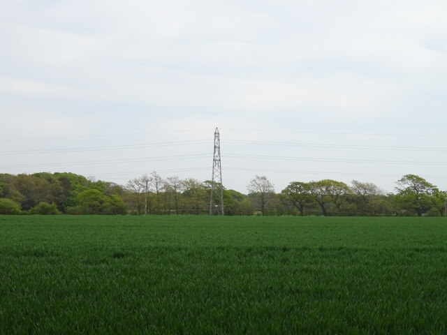
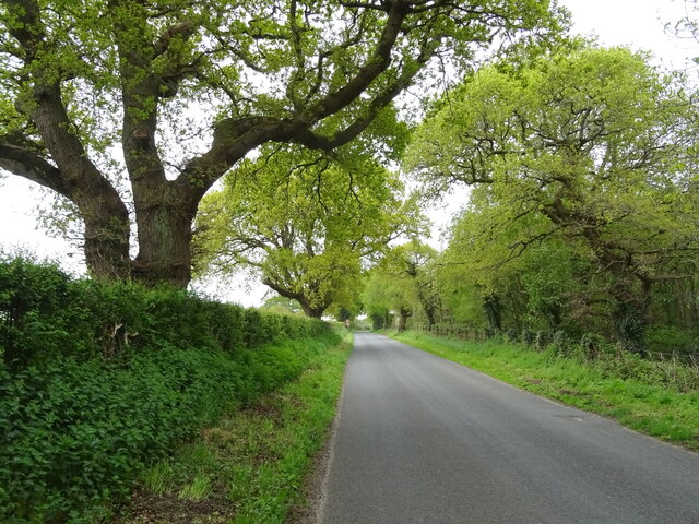
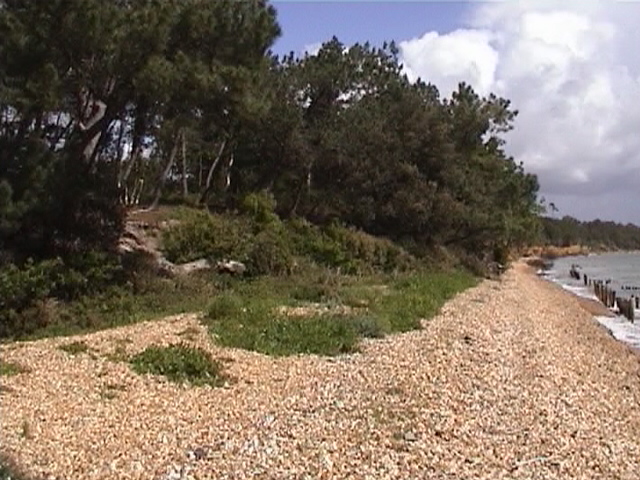
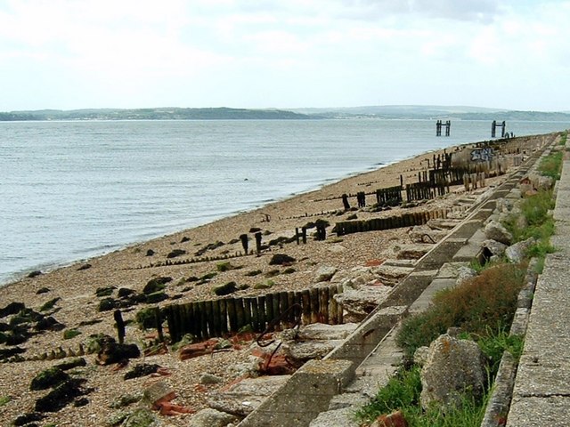
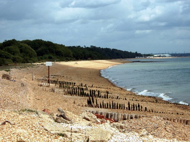
Nelson's Lodge Plantation is a picturesque woodland located in Hampshire, England. Situated in the heart of the New Forest National Park, this enchanting plantation spans several acres and is renowned for its natural beauty and diverse ecosystem.

The woodland is named after Admiral Lord Nelson, one of Britain's most celebrated naval heroes who had close ties to the area. It is believed that Nelson often visited this idyllic retreat to seek solace and inspiration amidst the tranquility of nature.

The plantation boasts a rich variety of tree species, including oak, beech, birch, and pine, which create a lush and vibrant canopy overhead. These towering trees provide a haven for a wide array of wildlife, making it a popular spot for birdwatching and nature enthusiasts.

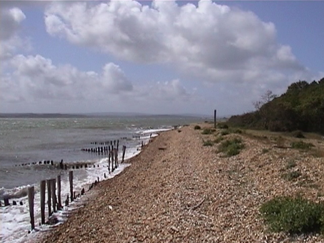
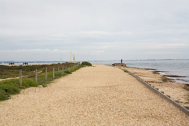
Visitors to Nelson's Lodge Plantation can explore its many trails, which wind their way through the forest, immersing them in a world of natural wonders. The pathways offer breathtaking views of the surrounding landscape, with glimpses of wildflowers, ferns, and mosses that thrive beneath the shade of the trees.

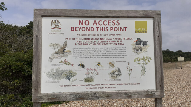
As part of the New Forest National Park, the plantation is also home to a variety of rare and protected species, such as the Dartford warbler and the silver-studded blue butterfly. Conservation efforts are in place to preserve the delicate balance of this unique ecosystem, ensuring the continued survival of these precious inhabitants.

Nelson's Lodge Plantation is not only a sanctuary for wildlife but also a place of solace and rejuvenation for visitors seeking respite from the hustle and bustle of everyday life. Its natural beauty and serene atmosphere make it a must-visit destination for nature lovers and history enthusiasts alike.

If you have any feedback on the listing, please let us know in the comments section below.

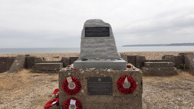
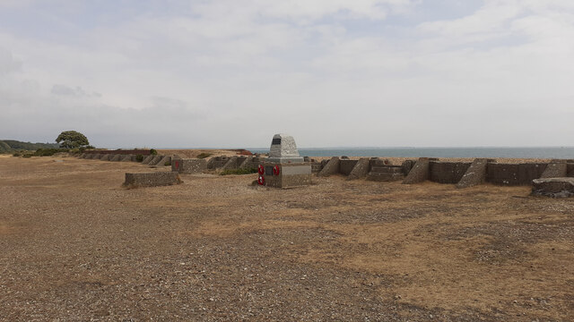
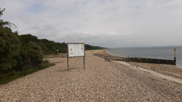
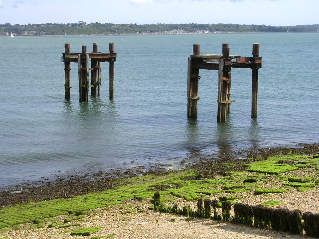
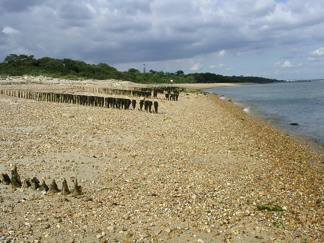
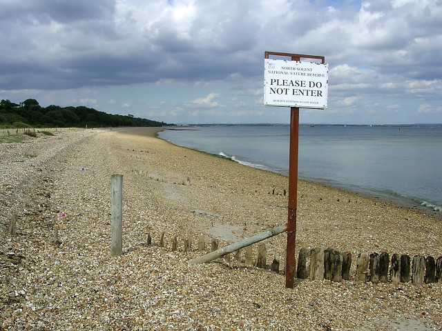
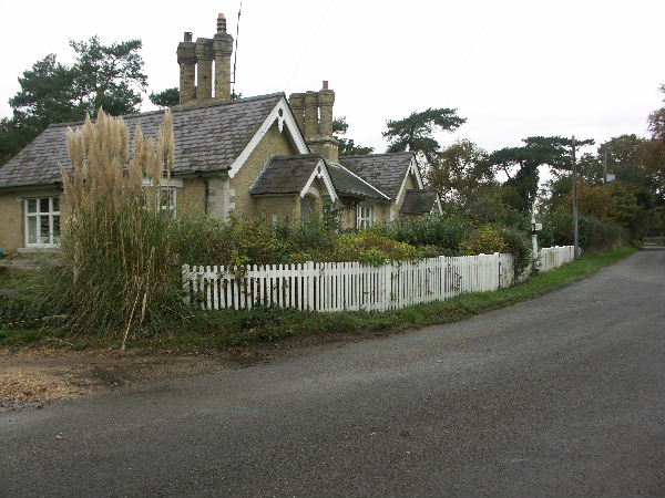
Nelson's Lodge Plantation Images

Images are sourced within 2km of 50.802767/-1.3336923 or Grid Reference SU4700. Thanks to Geograph Open Source API. All images are credited.

Cereal crop and pylon off Lepe Road
Lepe Road
Lepe Road
View of D-Day preparation area at Lepe To the right two bollards used to tie up ships. Beyond and above the righthand side of the noticeboard is a war memorial and the area used for constructing the massive concrete caissons that were floated across the Channel and then sunk. See also <a href="https://www.geograph.org.uk/photo/7529571">SZ4698 : Information board on D-Day at Lepe</a>.
View of D-Day preparation area at Lepe
To the right two bollards used to tie up ships. Beyond and above the righthand side of the noticeboard is a war memorial and the area used for constructing the massive concrete caissons that were floated across the Channel and then sunk. See also SZ4698 : Information board on D-Day at Lepe.
Information board on D-Day at Lepe
D-Day war memorial at Lepe To 4th/7th royal Dragoon Guards who lkeft here to land in Sherman amphibiopus tanks 5 minutes before the main assault on Gold beach. 124 men lost their lives. The top part of this memorial seems to be a recent addition. For earlier see <a title="https://www.geograph.org.uk/photo/4310851" href="https://www.geograph.org.uk/photo/4310851">Link</a> .

The inscription on the top part of the memorial reads:
Take these men for your example
Like them remember that propserity can
only be for the free,
that freedom is the sure possession of those
alone who have the courage to defend it.

On the seaward side of the memorial there is the same inscription in French.
D-Day war memorial at Lepe
To 4th/7th royal Dragoon Guards who lkeft here to land in Sherman amphibiopus tanks 5 minutes before the main assault on Gold beach. 124 men lost their lives. The top part of this memorial seems to be a recent addition. For earlier see Link . The inscription on the top part of the memorial reads: Take these men for your example Like them remember that propserity can only be for the free, that freedom is the sure possession of those alone who have the courage to defend it. On the seaward side of the memorial there is the same inscription in French.
Location of D-Day war memorial at Lepe For a closer view see <a title="https://www.geograph.org.uk/photo/7529573" href="https://www.geograph.org.uk/photo/7529573">Link</a> . The concrete wall beyond, buttressed at frequent intervals, was a rolling-track wall two of which were used in parallel to transport massive concrete caissons to the launch point (off-picture right) from the place where they were built (near tree at left). Each caisson was carried on 2m carriages that rolled along timber rails on 75 mm steel balls. See <a href="https://www.geograph.org.uk/photo/7529571">SZ4698 : Information board on D-Day at Lepe</a>
Location of D-Day war memorial at Lepe
For a closer view see Link . The concrete wall beyond, buttressed at frequent intervals, was a rolling-track wall two of which were used in parallel to transport massive concrete caissons to the launch point (off-picture right) from the place where they were built (near tree at left). Each caisson was carried on 2m carriages that rolled along timber rails on 75 mm steel balls. See SZ4698 : Information board on D-Day at Lepe
Limit of public access to the foreshore at Lepe Beyond is the North Solent National Nature Reserve. "Cadland beach is one of the last pristine areas of vegetated shingle left in the UK". For a closer view of the information board see <a href="https://www.geograph.org.uk/photo/7529596">SZ4699 : Information board about North Solent National Nature Reserve</a>.
Limit of public access to the foreshore at Lepe
Beyond is the North Solent National Nature Reserve. "Cadland beach is one of the last pristine areas of vegetated shingle left in the UK". For a closer view of the information board see SZ4699 : Information board about North Solent National Nature Reserve.
Information board about North Solent National Nature Reserve Marking the limit of public access to the foreshore at Lepe. For a wider view see <a href="https://www.geograph.org.uk/photo/7529591">SZ4699 : Limit of public access to the foreshore at Lepe</a>.
Information board about North Solent National Nature Reserve
Marking the limit of public access to the foreshore at Lepe. For a wider view see SZ4699 : Limit of public access to the foreshore at Lepe.
Second World War relics at Lepe Country Park These two metal skeletons (known as "dolphins") once formed part of the pierhead used to load ships departing for Normandy in 1944. On the foreshore are the remains of beach hardening mats, which resemble huge concrete bars of chocolate. They were laid out to strengthen the beach enough to take the weight of tanks and other vehicles being driven onto landing craft.
Second World War relics at Lepe Country Park
These two metal skeletons (known as "dolphins") once formed part of the pierhead used to load ships departing for Normandy in 1944. On the foreshore are the remains of beach hardening mats, which resemble huge concrete bars of chocolate. They were laid out to strengthen the beach enough to take the weight of tanks and other vehicles being driven onto landing craft.
Groynes between Lepe and Calshot, North Solent The shingle beach in the foreground is part of the Lepe Country Park, and it is less populated by visitors as it can only be accessed by a walk around Stansore Point from the car parks. It isn't possible to walk the length of this beach to Calshot as the beach in the distance is part of the North Solent Nature Reserve.
Groynes between Lepe and Calshot, North Solent
The shingle beach in the foreground is part of the Lepe Country Park, and it is less populated by visitors as it can only be accessed by a walk around Stansore Point from the car parks. It isn't possible to walk the length of this beach to Calshot as the beach in the distance is part of the North Solent Nature Reserve.
North Solent National Nature Reserve, between Lepe and Calshot At the north-east extreme of the Lepe Country Park the shingle beach is part of the National Nature Reserve (down to low water) and should not be disturbed.
North Solent National Nature Reserve, between Lepe and Calshot
At the north-east extreme of the Lepe Country Park the shingle beach is part of the National Nature Reserve (down to low water) and should not be disturbed.
Cottages at the junction of Stanswood Road and Lepe Road, Hants
Beach This is a view of Nelsons Place, from the Cadland House Beach.
Beach
This is a view of Nelsons Place, from the Cadland House Beach.
Beach. A view of the Beach in front of The Cadland House.
Beach.
A view of the Beach in front of The Cadland House.
Stansore Point, Lepe Country Park Compare this with <a href="https://www.geograph.org.uk/photo/33307">SZ4698 : Stansore Point, Lepe Country Park</a> taken in August 2005 to see what used to be bolted to the top of the concrete base the man is standing on.
Stansore Point, Lepe Country Park
Compare this with SZ4698 : Stansore Point, Lepe Country Park taken in August 2005 to see what used to be bolted to the top of the concrete base the man is standing on.
Junction between Lepe Road and Stanswood Road Also shown, numbers 1 & 2 Stone Cottages.
Junction between Lepe Road and Stanswood Road
Also shown, numbers 1 & 2 Stone Cottages.
Stansore Point Viewed from the North Solent National Nature Reserve towards Lepe.
Stansore Point
Viewed from the North Solent National Nature Reserve towards Lepe.
Stansore Point to Calshot The view along the coast.
Stansore Point to Calshot
The view along the coast.
Show me another place!

Nelson's Lodge Plantation is located at Grid Ref: SU4700 (Lat: 50.802767, Lng: -1.3336923)

Administrative County: Hampshire

District: New Forest

Police Authority: Hampshire

What 3 Words

///able.offshore.marinated. Near Gurnard, Isle of Wight

Related Wikis

Luttrell's Tower

Luttrell's Tower is a three-storey stuccoed yellow brick folly south of Southampton, Hampshire, England, near the village of Calshot. It has a six-storey...

Calshot

Calshot is a coastal village in Hampshire, England, at the west corner of Southampton Water where it joins the Solent. == History == In 1539, Henry VIII...

Fawley Power Station

Fawley Power Station was an oil-fired power station located on the western side of Southampton Water, between the villages of Fawley and Calshot in Hampshire...

Ashlett

Ashlett is a small settlement in Hampshire, England. It is in the civil parish of Fawley. It is at the end of Ashlett Creek, a tidal inlet of Southampton...

Calshot Marshes

Calshot Marshes is a 51.1-hectare (126-acre) Local Nature Reserve near Calshot, at the junction of The Solent and Southampton Water in Hampshire. It is...

Calshot Spit

Calshot Spit is a one-mile long sand and shingle bank, near the village of Calshot, located on the southern bank of the open end of Southampton Water,...

Solent Rescue

Solent Rescue is an independent inshore rescue lifeboat, not run by the RNLI, based at Lepe Country Park south of the New Forest, on the north shore of...

Calshot Activities Centre

Calshot Activities Centre is located on Calshot Spit near Southampton. Indoor facilities include the oldest indoor velodrome in Britain, a dry ski slope...

Nearby Amenities

Located within 500m of 50.802767,-1.3336923
Bourne Gap
Place: locality
Lat/Long: 50.7997152/-1.3298123
The data included in this document is from www.openstreetmap.org. The data is made available under ODbL.

Have you been to Nelson's Lodge Plantation?

Leave your review of Nelson's Lodge Plantation below (or comments, questions and feedback).