Stanswood Bay

Bay in Hampshire

England

Stanswood Bay

Bourne Gap red buoy
Bourne Gap red buoy Credit: Roger Cornfoot

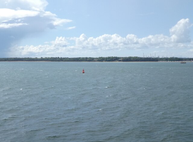
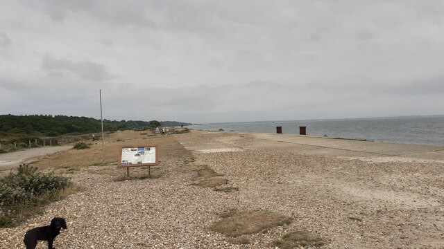
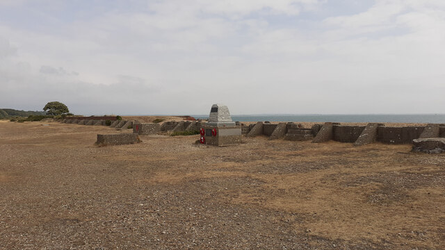
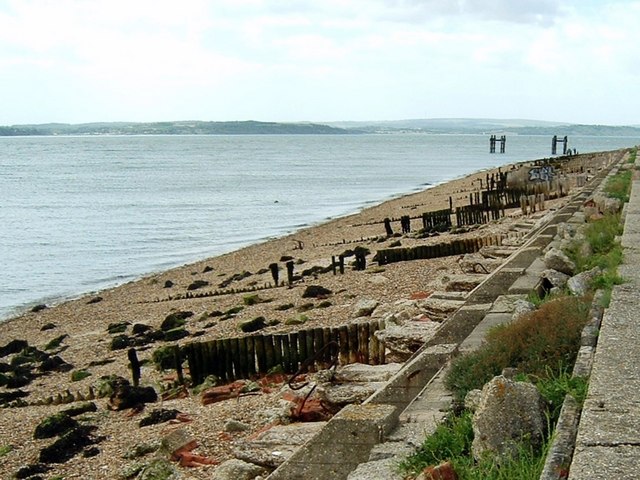
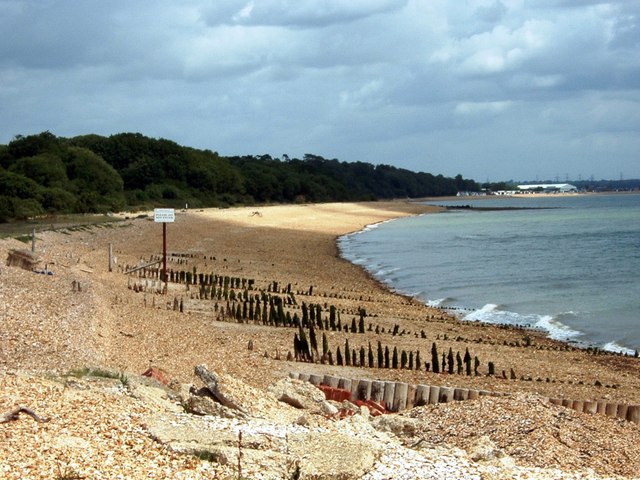
Stanswood Bay is a picturesque coastal area located in the county of Hampshire, England. Situated along the southern coast of the country, it is recognized for its stunning natural beauty and tranquil atmosphere. The bay stretches over a distance of approximately 3 kilometers and is nestled between two headlands, creating a sheltered and peaceful environment.

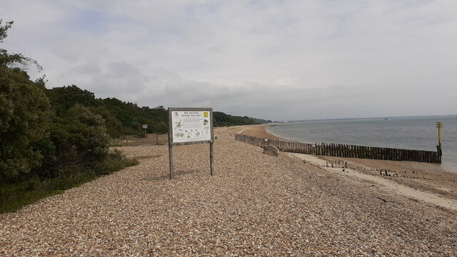
The bay's shoreline is characterized by golden sandy beaches, which are a major attraction for tourists and locals alike. The soft sands provide a perfect spot for sunbathing, picnicking, and building sandcastles during the warmer months. The crystal-clear waters of Stanswood Bay also invite visitors to indulge in various water activities, such as swimming, snorkeling, and kayaking.

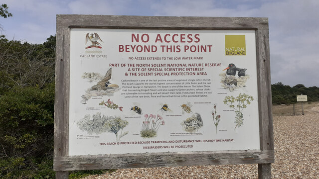
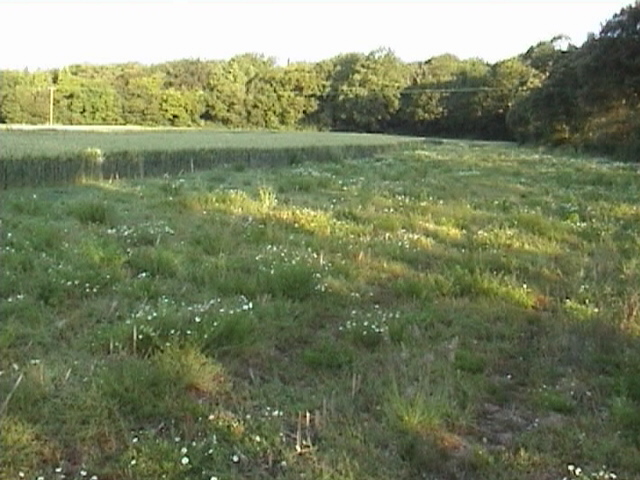
Surrounding the bay, visitors can find a diverse range of flora and fauna. The area is home to several species of seabirds, including gulls, terns, and cormorants, which nest and roost along the cliffs and rocky outcrops. The nearby Stanswood Nature Reserve also offers opportunities for nature enthusiasts to explore and discover a variety of unique plant and animal species.

Along the bay, there are a few small cafes and shops that cater to the needs of visitors, providing refreshments and beach essentials. Additionally, Stanswood Bay benefits from excellent transport links, making it easily accessible by road and public transportation.

Overall, Stanswood Bay offers a serene and idyllic coastal experience, with its beautiful beaches, rich wildlife, and peaceful ambiance, making it a popular destination for those seeking a relaxing getaway by the sea.

If you have any feedback on the listing, please let us know in the comments section below.

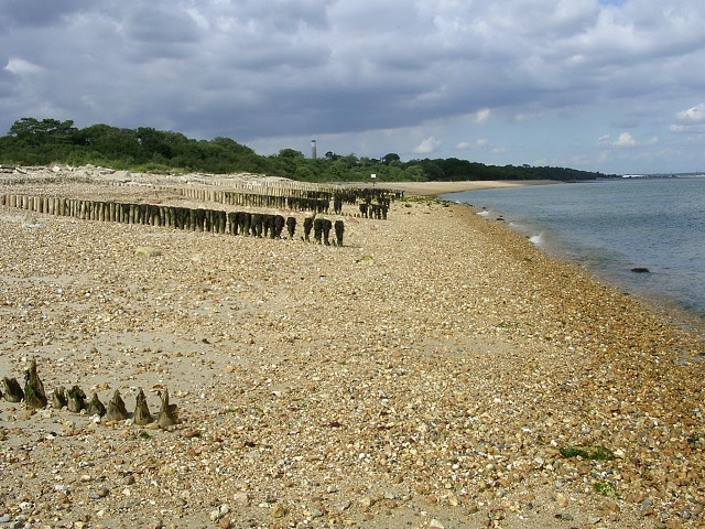
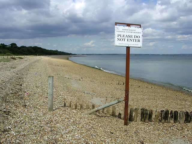
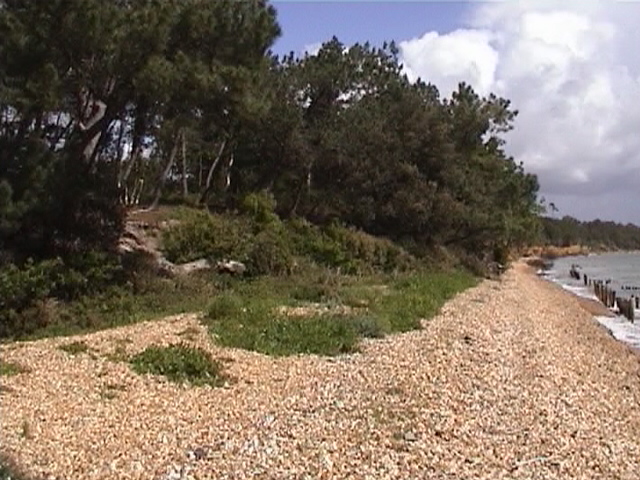
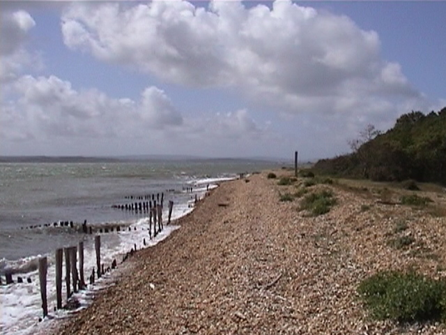
Stanswood Bay Images

Images are sourced within 2km of 50.79888/-1.3223957 or Grid Reference SU4700. Thanks to Geograph Open Source API. All images are credited.

Bourne Gap red buoy
Bourne Gap red buoy
View of D-Day preparation area at Lepe To the right two bollards used to tie up ships. Beyond and above the righthand side of the noticeboard is a war memorial and the area used for constructing the massive concrete caissons that were floated across the Channel and then sunk. See also <a href="https://www.geograph.org.uk/photo/7529571">SZ4698 : Information board on D-Day at Lepe</a>.
View of D-Day preparation area at Lepe
To the right two bollards used to tie up ships. Beyond and above the righthand side of the noticeboard is a war memorial and the area used for constructing the massive concrete caissons that were floated across the Channel and then sunk. See also SZ4698 : Information board on D-Day at Lepe.
Information board on D-Day at Lepe
D-Day war memorial at Lepe To 4th/7th royal Dragoon Guards who lkeft here to land in Sherman amphibiopus tanks 5 minutes before the main assault on Gold beach. 124 men lost their lives. The top part of this memorial seems to be a recent addition. For earlier see <a title="https://www.geograph.org.uk/photo/4310851" href="https://www.geograph.org.uk/photo/4310851">Link</a> .

The inscription on the top part of the memorial reads:
Take these men for your example
Like them remember that propserity can
only be for the free,
that freedom is the sure possession of those
alone who have the courage to defend it.

On the seaward side of the memorial there is the same inscription in French.
D-Day war memorial at Lepe
To 4th/7th royal Dragoon Guards who lkeft here to land in Sherman amphibiopus tanks 5 minutes before the main assault on Gold beach. 124 men lost their lives. The top part of this memorial seems to be a recent addition. For earlier see Link . The inscription on the top part of the memorial reads: Take these men for your example Like them remember that propserity can only be for the free, that freedom is the sure possession of those alone who have the courage to defend it. On the seaward side of the memorial there is the same inscription in French.
Location of D-Day war memorial at Lepe For a closer view see <a title="https://www.geograph.org.uk/photo/7529573" href="https://www.geograph.org.uk/photo/7529573">Link</a> . The concrete wall beyond, buttressed at frequent intervals, was a rolling-track wall two of which were used in parallel to transport massive concrete caissons to the launch point (off-picture right) from the place where they were built (near tree at left). Each caisson was carried on 2m carriages that rolled along timber rails on 75 mm steel balls. See <a href="https://www.geograph.org.uk/photo/7529571">SZ4698 : Information board on D-Day at Lepe</a>
Location of D-Day war memorial at Lepe
For a closer view see Link . The concrete wall beyond, buttressed at frequent intervals, was a rolling-track wall two of which were used in parallel to transport massive concrete caissons to the launch point (off-picture right) from the place where they were built (near tree at left). Each caisson was carried on 2m carriages that rolled along timber rails on 75 mm steel balls. See SZ4698 : Information board on D-Day at Lepe
Limit of public access to the foreshore at Lepe Beyond is the North Solent National Nature Reserve. "Cadland beach is one of the last pristine areas of vegetated shingle left in the UK". For a closer view of the information board see <a href="https://www.geograph.org.uk/photo/7529596">SZ4699 : Information board about North Solent National Nature Reserve</a>.
Limit of public access to the foreshore at Lepe
Beyond is the North Solent National Nature Reserve. "Cadland beach is one of the last pristine areas of vegetated shingle left in the UK". For a closer view of the information board see SZ4699 : Information board about North Solent National Nature Reserve.
Information board about North Solent National Nature Reserve Marking the limit of public access to the foreshore at Lepe. For a wider view see <a href="https://www.geograph.org.uk/photo/7529591">SZ4699 : Limit of public access to the foreshore at Lepe</a>.
Information board about North Solent National Nature Reserve
Marking the limit of public access to the foreshore at Lepe. For a wider view see SZ4699 : Limit of public access to the foreshore at Lepe.
Second World War relics at Lepe Country Park These two metal skeletons (known as "dolphins") once formed part of the pierhead used to load ships departing for Normandy in 1944. On the foreshore are the remains of beach hardening mats, which resemble huge concrete bars of chocolate. They were laid out to strengthen the beach enough to take the weight of tanks and other vehicles being driven onto landing craft.
Second World War relics at Lepe Country Park
These two metal skeletons (known as "dolphins") once formed part of the pierhead used to load ships departing for Normandy in 1944. On the foreshore are the remains of beach hardening mats, which resemble huge concrete bars of chocolate. They were laid out to strengthen the beach enough to take the weight of tanks and other vehicles being driven onto landing craft.
Groynes between Lepe and Calshot, North Solent The shingle beach in the foreground is part of the Lepe Country Park, and it is less populated by visitors as it can only be accessed by a walk around Stansore Point from the car parks. It isn't possible to walk the length of this beach to Calshot as the beach in the distance is part of the North Solent Nature Reserve.
Groynes between Lepe and Calshot, North Solent
The shingle beach in the foreground is part of the Lepe Country Park, and it is less populated by visitors as it can only be accessed by a walk around Stansore Point from the car parks. It isn't possible to walk the length of this beach to Calshot as the beach in the distance is part of the North Solent Nature Reserve.
North Solent National Nature Reserve, between Lepe and Calshot At the north-east extreme of the Lepe Country Park the shingle beach is part of the National Nature Reserve (down to low water) and should not be disturbed.
North Solent National Nature Reserve, between Lepe and Calshot
At the north-east extreme of the Lepe Country Park the shingle beach is part of the National Nature Reserve (down to low water) and should not be disturbed.
The Solent off Calshot A ship turning to enter Southampton Water with the power station in the background.
The Solent off Calshot
A ship turning to enter Southampton Water with the power station in the background.
Beach This is a view of Nelsons Place, from the Cadland House Beach.
Beach
This is a view of Nelsons Place, from the Cadland House Beach.
Beach. A view of the Beach in front of The Cadland House.
Beach.
A view of the Beach in front of The Cadland House.
Stansore Point Viewed from the North Solent National Nature Reserve towards Lepe.
Stansore Point
Viewed from the North Solent National Nature Reserve towards Lepe.
Stansore Point to Calshot The view along the coast.
Stansore Point to Calshot
The view along the coast.
Stanswood On the Cadland Estate.
Stanswood
On the Cadland Estate.
WW2 remains The remains of 1940s concrete structures on the beach near Lepe.
WW2 remains
The remains of 1940s concrete structures on the beach near Lepe.
WW2 relics near Lepe
Show me another place!

Stanswood Bay is located at Grid Ref: SU4700 (Lat: 50.79888, Lng: -1.3223957)

Administrative County: Hampshire

Police Authority: Hampshire

What 3 Words

///ocean.prancing.reap. Near Gurnard, Isle of Wight

Related Wikis

Luttrell's Tower

Luttrell's Tower is a three-storey stuccoed yellow brick folly south of Southampton, Hampshire, England, near the village of Calshot. It has a six-storey...

Calshot

Calshot is a coastal village in Hampshire, England, at the west corner of Southampton Water where it joins the Solent. == History == In 1539, Henry VIII...

Fawley Power Station

Fawley Power Station was an oil-fired power station located on the western side of Southampton Water, between the villages of Fawley and Calshot in Hampshire...

Calshot Marshes

Calshot Marshes is a 51.1-hectare (126-acre) Local Nature Reserve near Calshot, at the junction of The Solent and Southampton Water in Hampshire. It is...

Calshot Spit

Calshot Spit is a one-mile long sand and shingle bank, near the village of Calshot, located on the southern bank of the open end of Southampton Water,...
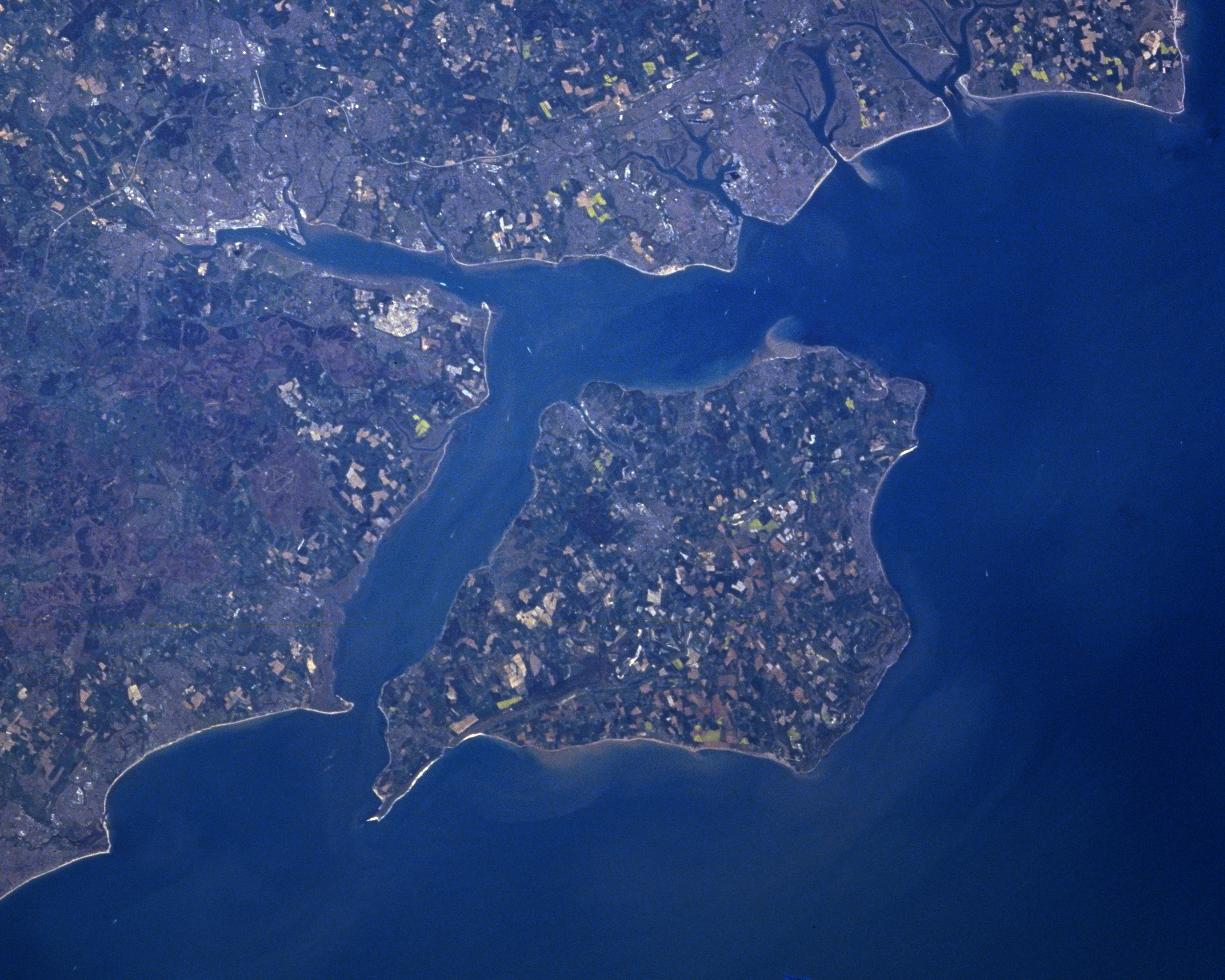
The Solent

The Solent ( SOH-lənt) is a strait between the Isle of Wight and mainland Great Britain; the major historic ports of Southampton and Portsmouth lie inland...

Calshot Activities Centre

Calshot Activities Centre is located on Calshot Spit near Southampton. Indoor facilities include the oldest indoor velodrome in Britain, a dry ski slope...

RNAS Calshot

RNAS Calshot was a First World War Royal Navy air station for seaplanes and flying boats, mainly operating as an experimental and training station, but...

Nearby Amenities

Located within 500m of 50.79888,-1.3223957
Stanswood Bay
Natural: bay
Lat/Long: 50.8017623/-1.318294
Royal Thames
Ref Scra: 3S
Seamark Buoy Special Purpose Colour: yellow
Seamark Buoy Special Purpose Shape: spherical
Seamark Information: all year
Seamark Light Character: Fl
Seamark Light Colour: yellow
Seamark Light Period: 4
Seamark Name: Royal Thames
Seamark Topmark Colour: yellow
Seamark Topmark Shape: x-shape
Seamark Type: buoy_special_purpose
Lat/Long: 50.796833/-1.320833
The data included in this document is from www.openstreetmap.org. The data is made available under ODbL.

Have you been to Stanswood Bay?

Leave your review of Stanswood Bay below (or comments, questions and feedback).