Draycot Fitz Payne
Settlement in Wiltshire
England
Draycot Fitz Payne
Draycot Fitz Payne is a small village located in the county of Wiltshire, England. Situated in the South West region of the country, it falls within the administrative district of Kennet. The village is approximately 5 miles southwest of Swindon, one of the larger towns in the area.
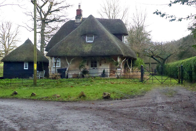
Draycot Fitz Payne is a rural settlement with a population of around 500 residents. It is surrounded by picturesque countryside, offering stunning views and a peaceful atmosphere. The village is characterized by its charming thatched cottages and traditional architecture, which add to its quaint and timeless appeal.
Despite its small size, Draycot Fitz Payne has a strong sense of community. It boasts a local pub, The Fitz, which serves as a popular meeting place for residents and visitors alike. The village also has a primary school, providing education for the local children.
For amenities and services not available within the village, residents can easily access nearby towns such as Swindon, where they can find a wider range of shops, supermarkets, healthcare facilities, and recreational opportunities.
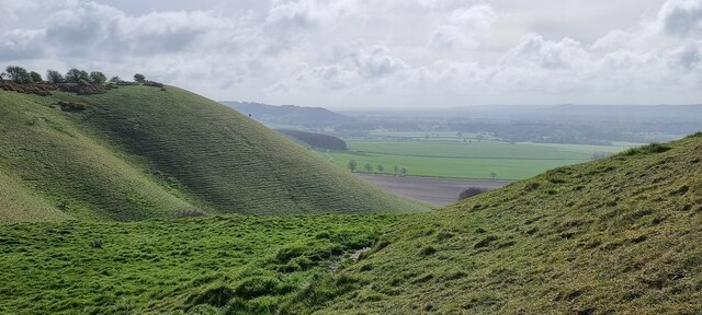
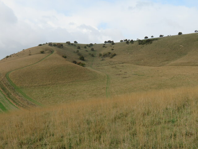
Draycot Fitz Payne offers excellent access to the surrounding countryside, making it an ideal location for outdoor enthusiasts. There are numerous walking and cycling routes in the area, allowing residents to explore the beautiful landscapes and enjoy a variety of outdoor activities.
In summary, Draycot Fitz Payne is a charming and close-knit village in Wiltshire, offering a peaceful and idyllic setting for its residents.
If you have any feedback on the listing, please let us know in the comments section below.
Draycot Fitz Payne Images
Images are sourced within 2km of 51.36484/-1.79327 or Grid Reference SU1462. Thanks to Geograph Open Source API. All images are credited.


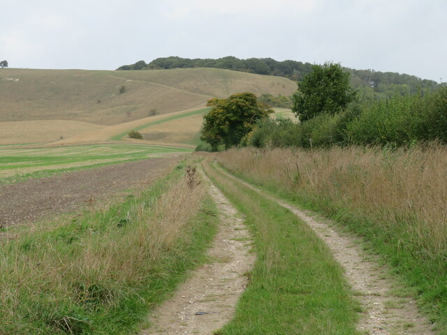
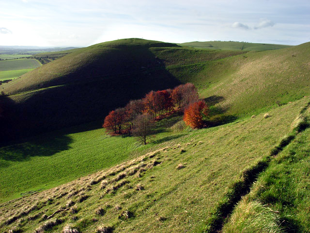
![Testing times ahead The gate marks the start of an enclosed section of bridleway heading towards a junction with the Wansdyke Path near the DMV of Shaw. The next 500m or so will test clothing [and legs if wearing shorts] as parts of the path are very narrow and lined with thorn bushes, brambles, nettles and thistles. A fine route for masochists.](https://s0.geograph.org.uk/geophotos/07/30/35/7303524_148fcbeb.jpg)


![Brick and thatch in Oare A view across the main road in the village to Pound Lane. An examination of old OS maps failed to reveal a village pound or pinfold anywhere along Pound Lane. The main road here is the A345 from Salisbury to Marlborough [and once to Swindon], but most traffic uses the A346 a little further east as much of the A345 is little better than a country lane.](https://s1.geograph.org.uk/geophotos/07/30/56/7305641_5a81c12f.jpg)
Draycot Fitz Payne is located at Grid Ref: SU1462 (Lat: 51.36484, Lng: -1.79327)
Unitary Authority: Wiltshire
Police Authority: Wiltshire
What 3 Words
///homecare.thankful.astounded. Near Huish, Wiltshire
Nearby Locations
Related Wikis

Oare Pavilion
The Oare Pavilion or Oare Tea House Pavilion is a summer house designed by I. M. Pei for the businessman Henry Keswick and his wife Tessa Keswick at Oare...

Huish, Wiltshire
Huish is a small village and former civil parish, now in the parish of Wilcot, Huish and Oare, in Wiltshire, England, 2 miles (3.2 km) northwest of Pewsey...

Oare House
Oare House is a Grade I listed country house in Oare, Wiltshire, England.The house was built in 1740 for a London wine merchant, Henry Deacon. It was largely...

Oare, Wiltshire
Oare is a small village in the east of the county of Wiltshire, England. The village lies about 2 miles (3.2 km) north of Pewsey, on the A345 road towards...
Stanchester Hoard
The Stanchester Hoard is a hoard of 1,166 Roman coins dating from the fourth to early fifth century found in 2000 at Wilcot, in the Vale of Pewsey, Wiltshire...

Wilcot
Wilcot is a village and former civil parish, now in the parish of Wilcot, Huish and Oare, in Wiltshire, England, in the Vale of Pewsey about 6 miles (10...
Knap Hill
Knap Hill lies on the northern rim of the Vale of Pewsey, in northern Wiltshire, England, about a mile (1.6 km) north of the village of Alton Priors....
Jones's Mill
Jones's Mill (grid reference SU168613) is an 11.6 hectare biological Site of Special Scientific Interest near Pewsey in Wiltshire, notified in 1975. The...
Have you been to Draycot Fitz Payne?
Leave your review of Draycot Fitz Payne below (or comments, questions and feedback).