Loin Copse

Wood, Forest in Wiltshire

England

Loin Copse

Wilcot Road towards Wilcot From Pewsey.
Wilcot Road towards Wilcot Credit: Robin Webster

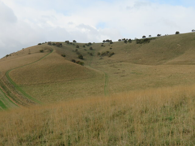
Loin Copse is a picturesque woodland located in the county of Wiltshire, England. Situated near the village of Loin Copse, the forest covers an area of approximately 50 acres, offering a tranquil and serene environment for visitors to explore.

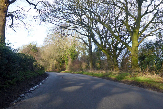
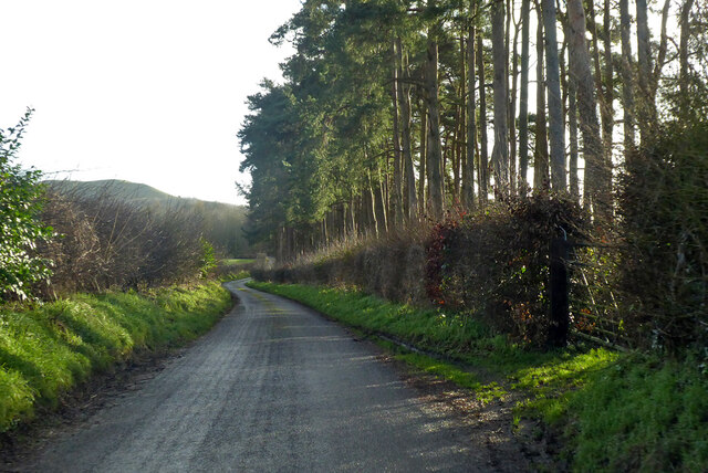
The copse is predominantly made up of deciduous trees, including oak, beech, and birch, which create a dense canopy that filters the sunlight and creates a cool and shaded atmosphere. The forest floor is carpeted with a rich variety of wildflowers, ferns, and mosses, adding to the natural beauty of the area.

Loin Copse is a haven for wildlife, providing a habitat for a diverse range of species. Birdwatchers can spot a variety of birds, including woodpeckers, owls, and various songbirds. The woodland is also home to mammals such as foxes, badgers, and deer, which can occasionally be seen roaming through the trees.

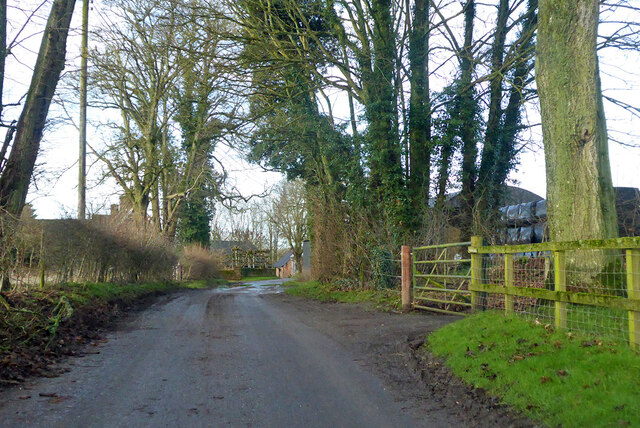
The copse is crisscrossed with a network of well-maintained footpaths, making it easily accessible for walkers and nature enthusiasts. These paths lead visitors through the forest, allowing them to immerse themselves in the tranquility of the surroundings and appreciate the beauty of the woodlands.

Loin Copse is a popular destination for outdoor activities such as hiking, picnicking, and nature photography. It offers a peaceful retreat from the hustle and bustle of everyday life, allowing visitors to connect with nature and enjoy the beauty of the English countryside.

If you have any feedback on the listing, please let us know in the comments section below.

Loin Copse Images

Images are sourced within 2km of 51.362247/-1.7974338 or Grid Reference SU1462. Thanks to Geograph Open Source API. All images are credited.
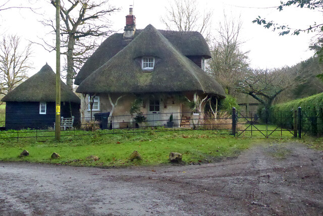
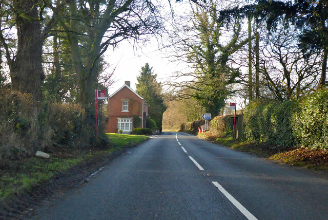
Wilcot Road towards Wilcot From Pewsey.
Wilcot Road towards Wilcot
From Pewsey.
Cottage at corner of Stowell Park Formerly a lodge for the park.
Cottage at corner of Stowell Park
Formerly a lodge for the park.
Lane by Draycot Farm Towards Huish.
Lane by Draycot Farm
Towards Huish.
Lane from Huish to Oare
A345 at Sunnyhill Lane turning Looking south.
A345 at Sunnyhill Lane turning
Looking south.
Golden Ball Hill, Wiltshire Looking south from Golden Ball Hill over farmland.
Golden Ball Hill, Wiltshire
Looking south from Golden Ball Hill over farmland.
Draycott Hill, Wiltshire Looking south over farmland from Draycott Hill.
Draycott Hill, Wiltshire
Looking south over farmland from Draycott Hill.
Gopher Wood, Wiltshire Bluebells, almost at their best, in Gopher Wood.
Gopher Wood, Wiltshire
Bluebells, almost at their best, in Gopher Wood.
Path into the vale There's a meeting of at least six paths near the NE corner of Gopher Wood, this one heads south downhill towards Huish in the Vale of Pewsey.
Path into the vale
There's a meeting of at least six paths near the NE corner of Gopher Wood, this one heads south downhill towards Huish in the Vale of Pewsey.
Heading towards the Downs Bridleway heading north from Draycot Fitz Payne towards the scarp slope of the Marlborough Downs.
Heading towards the Downs
Bridleway heading north from Draycot Fitz Payne towards the scarp slope of the Marlborough Downs.
A fold in the hills A bowl-shaped depression on the scarp slope of the Downs below Draycott Hill.
A fold in the hills
A bowl-shaped depression on the scarp slope of the Downs below Draycott Hill.
Path through Gopher Wood A bridleway through the wood. In places this would prove a difficult route for a horserider or cyclist due to encroaching vegetation and low overhanging branches.
Path through Gopher Wood
A bridleway through the wood. In places this would prove a difficult route for a horserider or cyclist due to encroaching vegetation and low overhanging branches.
Linear earthwork on the Downs The Downs are rich in earthworks of various types, the purpose of many being unknown. This particular ditch and bank is of unknown origin, but does appear in Savernake Forest charters of 1257 as 'bocus de Hulwerk'
Linear earthwork on the Downs
The Downs are rich in earthworks of various types, the purpose of many being unknown. This particular ditch and bank is of unknown origin, but does appear in Savernake Forest charters of 1257 as 'bocus de Hulwerk'
Downland view Looking north of west near the crest of the Downs on a fine path which is part of the Tan Hill Way.
Downland view
Looking north of west near the crest of the Downs on a fine path which is part of the Tan Hill Way.
Downland viewpoint Near the scarp edge of the Downs with a view across the Vale of Pewsey towards the trees on the top of the isolated Etchilhampton Hill.
Downland viewpoint
Near the scarp edge of the Downs with a view across the Vale of Pewsey towards the trees on the top of the isolated Etchilhampton Hill.
Brick and thatch in Oare A view across the main road in the village to Pound Lane.  An examination of old OS maps failed to reveal a village pound or pinfold anywhere along Pound Lane. The main road here is the A345 from Salisbury to Marlborough [and once to Swindon], but most traffic uses the A346 a little further east as much of the A345 is little better than a country lane.
Brick and thatch in Oare
A view across the main road in the village to Pound Lane. An examination of old OS maps failed to reveal a village pound or pinfold anywhere along Pound Lane. The main road here is the A345 from Salisbury to Marlborough [and once to Swindon], but most traffic uses the A346 a little further east as much of the A345 is little better than a country lane.
Village Hall, Oare Tucked away behind the main road through the village.
Village Hall, Oare
Tucked away behind the main road through the village.
Oare House park Looking towards the west front of Oare House from the path that crosses the park.
Oare House park
Looking towards the west front of Oare House from the path that crosses the park.
Show me another place!

Loin Copse is located at Grid Ref: SU1462 (Lat: 51.362247, Lng: -1.7974338)

Unitary Authority: Wiltshire

Police Authority: Wiltshire

What 3 Words

///doses.adjusted.prouder. Near Huish, Wiltshire

Related Wikis

Huish, Wiltshire

Huish is a small village and former civil parish, now in the parish of Wilcot, Huish and Oare, in Wiltshire, England, 2 miles (3.2 km) northwest of Pewsey...

Oare Pavilion

The Oare Pavilion or Oare Tea House Pavilion is a summer house designed by I. M. Pei for the businessman Henry Keswick and his wife Tessa Keswick at Oare...
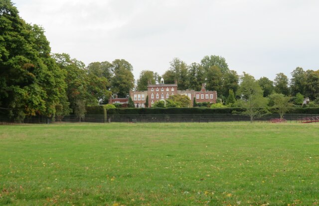
Oare House

Oare House is a Grade I listed country house in Oare, Wiltshire, England.The house was built in 1740 for a London wine merchant, Henry Deacon. It was largely...

Stanchester Hoard

The Stanchester Hoard is a hoard of 1,166 Roman coins dating from the fourth to early fifth century found in 2000 at Wilcot, in the Vale of Pewsey, Wiltshire...

Wilcot

Wilcot is a village and former civil parish, now in the parish of Wilcot, Huish and Oare, in Wiltshire, England, in the Vale of Pewsey about 6 miles (10...

Oare, Wiltshire

Oare is a small village in the east of the county of Wiltshire, England. The village lies about 2 miles (3.2 km) north of Pewsey, on the A345 road towards...
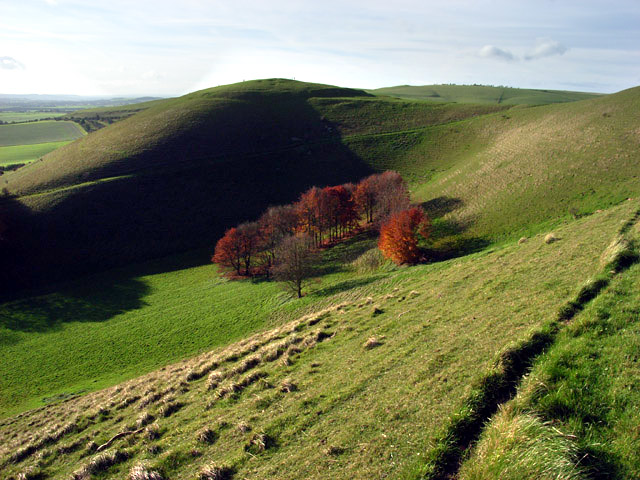
Knap Hill

Knap Hill lies on the northern rim of the Vale of Pewsey, in northern Wiltshire, England, about a mile (1.6 km) north of the village of Alton Priors....

Swanborough Tump

Swanborough Tump is a mound of earth in Manningford parish, Wiltshire, England. It has been considered to be a bowl barrow dating from the Bronze Age and...

Nearby Amenities

Located within 500m of 51.362247,-1.7974338
West Stowell
Place: hamlet
Lat/Long: 51.359859/-1.8032468
Post Box
Brand: Royal Mail
Brand Wikidata: Q638098
Collection Times: Mo-Fr 16:00; Sa 08:00
Drive Through: no
Operator: Royal Mail
Operator Wikidata: Q638098
Post Box Type: lamp
Ref: SN8 39
Royal Cypher: EIIR
Royal Cypher Wikidata: Q33102113
Lat/Long: 51.3612034/-1.8043996
The data included in this document is from www.openstreetmap.org. The data is made available under ODbL.

Have you been to Loin Copse?

Leave your review of Loin Copse below (or comments, questions and feedback).