Quebec Plantation

Wood, Forest in Yorkshire Hambleton

England

Quebec Plantation

Cowesby village Sandstone houses with pantile roofs are a feature of this tiny village nestled at the base of the Hambleton Hills.
Cowesby village Credit: Gordon Hatton

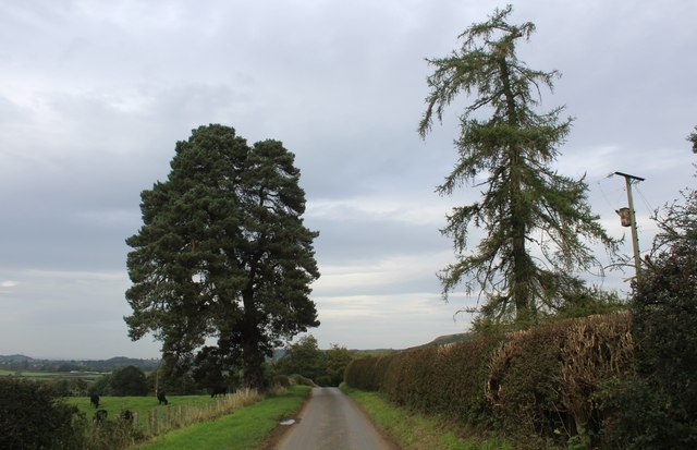
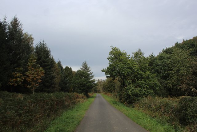
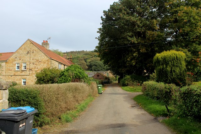
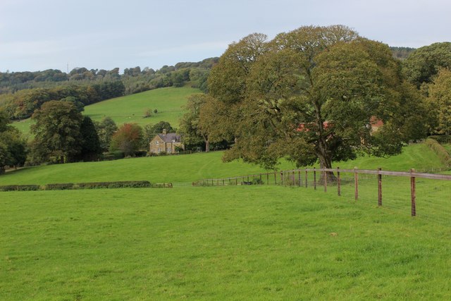
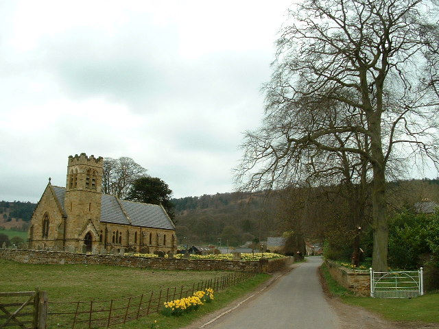
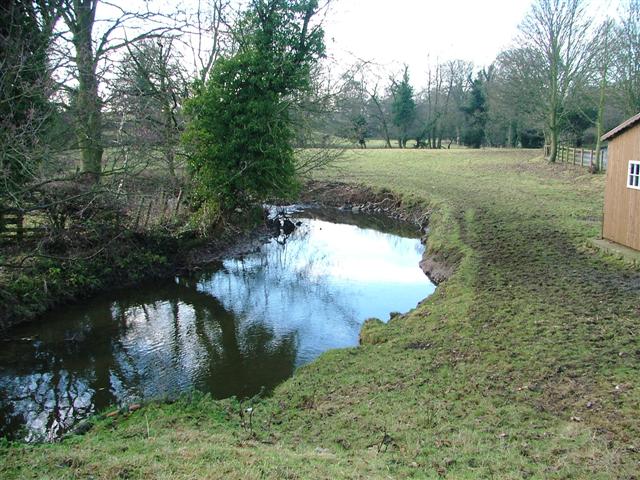
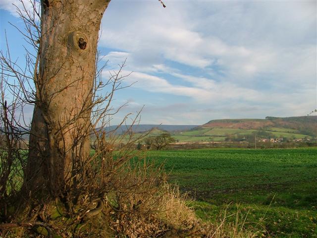
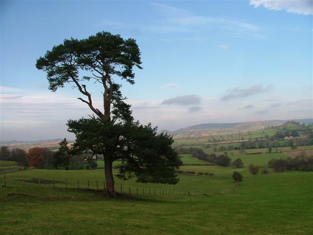
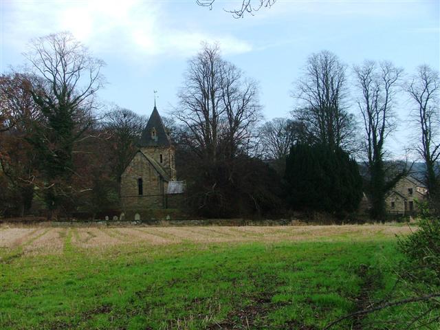
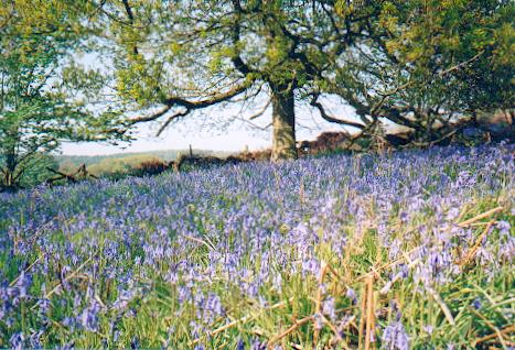
Quebec Plantation, located in Yorkshire, England, is a sprawling woodland area known for its picturesque beauty and rich biodiversity. Covering an area of approximately 200 acres, this plantation is a popular destination for nature lovers, hikers, and wildlife enthusiasts.

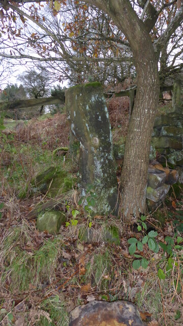
The woodland is primarily composed of a mix of coniferous and deciduous trees, creating a diverse habitat for a wide range of flora and fauna. Towering oak, beech, and birch trees dominate the landscape, providing a shady canopy, especially during the summer months. The plantation is also home to various species of conifers, including pine and spruce, which add to the overall charm of the woodland.

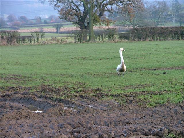
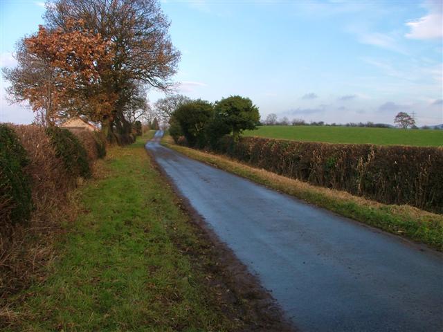
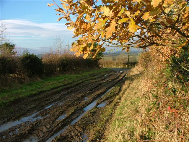
Visitors to Quebec Plantation can explore numerous well-maintained walking trails that wind through the woodland, offering stunning views of the surrounding countryside. The paths are suitable for all levels of hikers and provide an excellent opportunity to spot native wildlife such as deer, rabbits, foxes, and a variety of bird species.

Aside from its natural beauty, Quebec Plantation also serves as an important conservation area. The Yorkshire Wildlife Trust actively manages the woodland to preserve its ecological integrity and protect the diverse range of species that call it home.

The plantation provides a tranquil and serene setting for visitors to escape the hustle and bustle of everyday life. Its secluded location, combined with its natural beauty and abundant wildlife, makes Quebec Plantation an ideal destination for nature enthusiasts and those seeking a peaceful retreat amidst the beauty of Yorkshire's countryside.

If you have any feedback on the listing, please let us know in the comments section below.

Quebec Plantation Images

Images are sourced within 2km of 54.288175/-1.3039626 or Grid Reference SE4588. Thanks to Geograph Open Source API. All images are credited.

Cowesby village Sandstone houses with pantile roofs are a feature of this tiny village nestled at the base of the Hambleton Hills.
Cowesby village
Sandstone houses with pantile roofs are a feature of this tiny village nestled at the base of the Hambleton Hills.
Brickshed Cottage Isolated dwelling located at the foot of the North York Moors escarpment and below Boltby Forest.
Brickshed Cottage
Isolated dwelling located at the foot of the North York Moors escarpment and below Boltby Forest.
Ruddings Lane Section of quiet country lane between Kirby Knowle and Cowesby - outside Brickshed Cottage
Ruddings Lane
Section of quiet country lane between Kirby Knowle and Cowesby - outside Brickshed Cottage
Ingdale Lane in Gutta Wood Section of quiet country lane between Kirby Knowle and Cowesby
Ingdale Lane in Gutta Wood
Section of quiet country lane between Kirby Knowle and Cowesby
Whinmoor Hill Access lane leading up to Manor House Farm in Kirby Knowle
Whinmoor Hill
Access lane leading up to Manor House Farm in Kirby Knowle
Footpath heading down to Kirby Knowle The footpath follows the fence towards the village of Kirby Knowle from Wind Egg Plantation
Footpath heading down to Kirby Knowle
The footpath follows the fence towards the village of Kirby Knowle from Wind Egg Plantation
Old Boundary Marker between Brickshed Cottage and Seta Pike Boundary Marker at the end of a drystone wall on the north side of the bridleway between Brickshed Cottage and Seta Pike. On the boundary of Kirby Knowle and Cowesby parishes. Marked as a boundary stone on old and current Ordnance Survey Maps. The stone has no inscription and could just be a gate post.

Milestone Society National ID: YN_KKCO03bm
Old Boundary Marker between Brickshed Cottage and Seta Pike
Boundary Marker at the end of a drystone wall on the north side of the bridleway between Brickshed Cottage and Seta Pike. On the boundary of Kirby Knowle and Cowesby parishes. Marked as a boundary stone on old and current Ordnance Survey Maps. The stone has no inscription and could just be a gate post. Milestone Society National ID: YN_KKCO03bm
Kirby Knowle  church The church is dedicated to St Wilfrid.
Kirby Knowle church
The church is dedicated to St Wilfrid.
Cowesby Beck View west from the bridge leading to the Cleveland Rein.
Cowesby Beck
View west from the bridge leading to the Cleveland Rein.
Mucky Duck, in a Field Just off the Cleveland Rein. The Cleveland Rein is the name of a lane. The swan had been paddling in the mud until I disturbed it.
Mucky Duck, in a Field Just off the Cleveland Rein.
The Cleveland Rein is the name of a lane. The swan had been paddling in the mud until I disturbed it.
Cophill Lane Looking north up the lane mapped as Cophill Lane.
Cophill Lane
Looking north up the lane mapped as Cophill Lane.
Bank Lane A track seemingly going nowhere but heavily used by the farmer. View north towards the junction with the unclassified road.
Bank Lane
A track seemingly going nowhere but heavily used by the farmer. View north towards the junction with the unclassified road.
View North From Moor Road The village of Cowesby can be seen far right.
View North From Moor Road
The village of Cowesby can be seen far right.
View North From the Unclassified Road At spot height 163 to be precise.
View North From the Unclassified Road
At spot height 163 to be precise.
The church of St. Michael and All Angels, Cowesby View from the west.
The church of St. Michael and All Angels, Cowesby
View from the west.
Ostentation of Peacocks Taken on the doorstep of a farm in Woundales Lane.
Ostentation of Peacocks
Taken on the doorstep of a farm in Woundales Lane.
Bluebell wood near Brickyard Cottage The bridleway that climbs the scarp of the Hambleton Hills passes through woods thick with bluebells.
Bluebell wood near Brickyard Cottage
The bridleway that climbs the scarp of the Hambleton Hills passes through woods thick with bluebells.
Upsall This is something like the derelict village hall - most interesting doorway and sign above it.
Upsall
This is something like the derelict village hall - most interesting doorway and sign above it.
Show me another place!

Quebec Plantation is located at Grid Ref: SE4588 (Lat: 54.288175, Lng: -1.3039626)

Division: North Riding

Administrative County: North Yorkshire

District: Hambleton

Police Authority: North Yorkshire

What 3 Words

///toasters.dubbing.sharpens. Near Thirsk, North Yorkshire

Related Wikis

Upsall

Upsall is a hamlet in and civil parish in the Hambleton district of North Yorkshire, England. It is situated approximately four miles north-east of Thirsk...

Upsall Castle

Upsall Castle is a fourteenth-century ruin, park and manor house in Upsall, in the Hambleton district of North Yorkshire, England. == History == Some records...

Kirby Knowle

Kirby Knowle is a village and civil parish in Hambleton District of North Yorkshire, England, on the border of the North Yorkshire Moors and near Upsall...

Cowesby

Cowesby is a village and civil parish in the Hambleton District of North Yorkshire, England. Part of the village including The Cowesby Hall Estate is within...

Knayton with Brawith

Knayton with Brawith is a civil parish in the Hambleton district of North Yorkshire, England. The parish includes the village of Knayton and the hamlet...

Knayton

Knayton is a small village in North Yorkshire, England. It is located north of Thirsk just off the A19. It is linked with the hamlet of Brawith, approximately...

Borrowby, west North Yorkshire

Borrowby is a village and civil parish in North Yorkshire, England. It is situated halfway between Thirsk and Northallerton, about 25 miles (40 km) north...

Kepwick

Kepwick is a village and civil parish in the Hambleton district of North Yorkshire, England, on the North York Moors and near the A19. The population according...

Nearby Amenities

Located within 500m of 54.288175,-1.3039626
Foxhall Farm
Place: farm
Lat/Long: 54.2890838/-1.3098744
Man Made: tower
Tower Type: communication
Lat/Long: 54.2899945/-1.3103169
The data included in this document is from www.openstreetmap.org. The data is made available under ODbL.

Have you been to Quebec Plantation?

Leave your review of Quebec Plantation below (or comments, questions and feedback).