Ash

Settlement in Devon South Hams

England

Ash

Fuge Farm - South Hams A typical South Devon farm.
Fuge Farm - South Hams Credit: Richard Knights

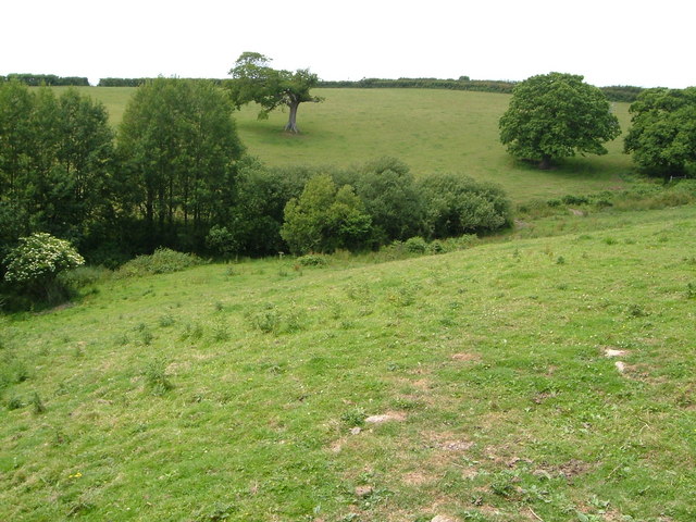
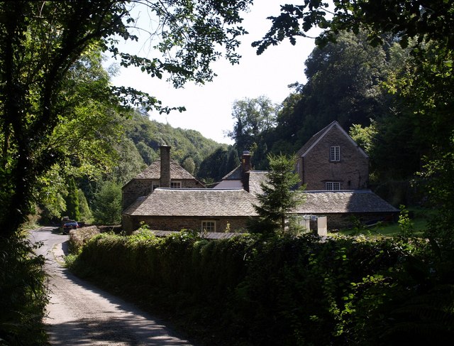
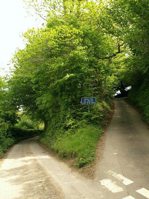
Ash is a small village located in the county of Devon, England. Situated on the eastern edge of Dartmoor National Park, it is surrounded by picturesque countryside and offers breathtaking views of rolling hills and woodland. The village is part of the Teignbridge district and is situated approximately 6 miles west of the market town of Newton Abbot.

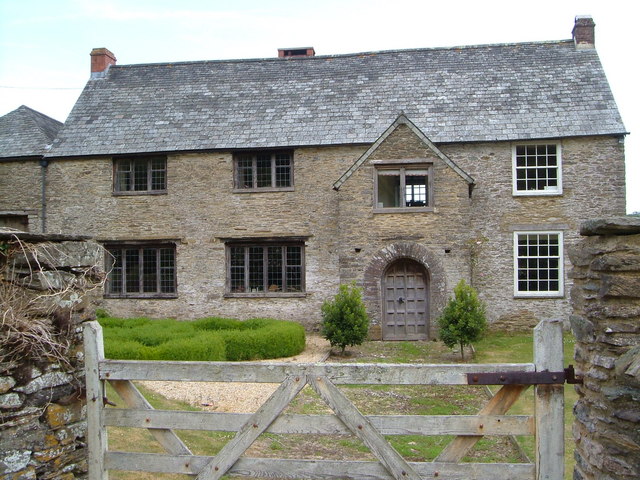
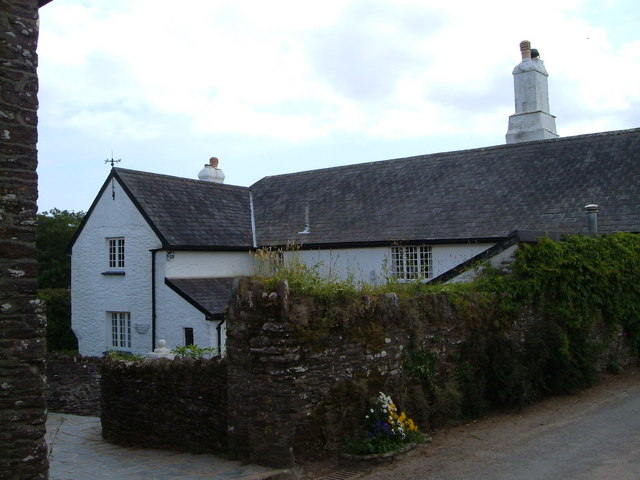
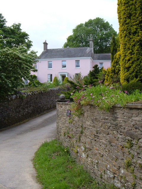
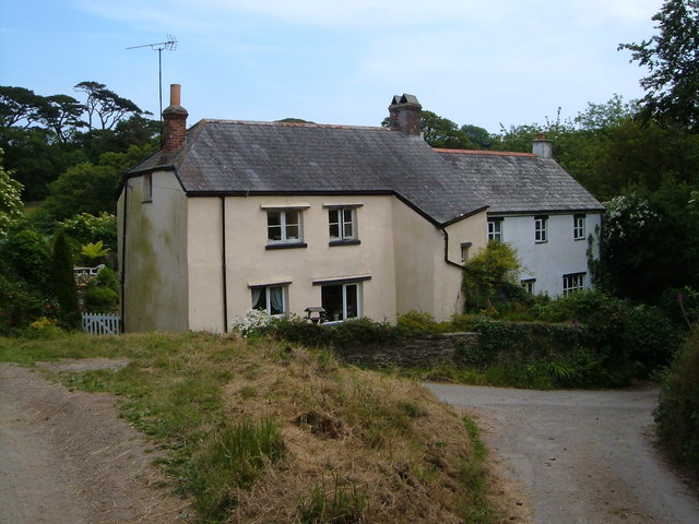
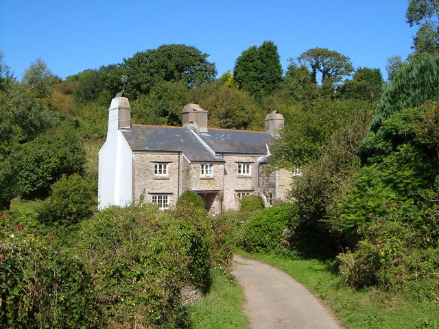
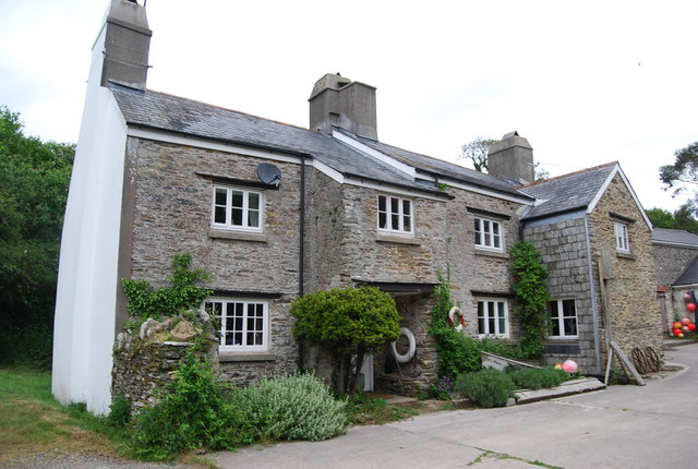
Ash has a rich history dating back to the medieval period, with evidence of habitation in the area since prehistoric times. The village is known for its charming thatched cottages and traditional architecture, which adds to its quaint and peaceful atmosphere.

Despite its small size, Ash offers a range of amenities for residents and visitors alike. The village has a local pub, The Golden Lion, which serves as a social hub for the community. There is also a primary school, providing education for young children in the area.

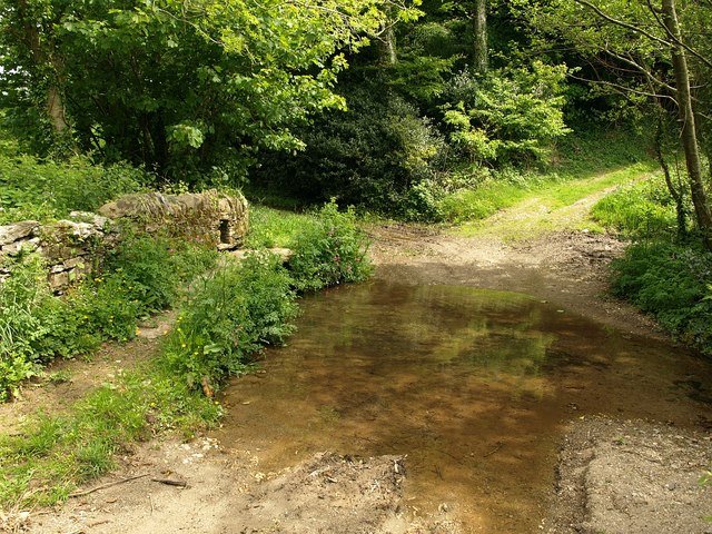
For outdoor enthusiasts, Ash is an ideal location. Dartmoor National Park is just a stone's throw away, offering endless opportunities for hiking, cycling, and exploring the rugged beauty of the moorland. The River Dart also runs through the village, providing a tranquil spot for fishing and leisurely walks along its banks.

Overall, Ash, Devon is a charming village that offers a serene countryside lifestyle while being within easy reach of larger towns and natural attractions. Its historical significance, idyllic setting, and range of amenities make it an appealing place to visit or call home.

If you have any feedback on the listing, please let us know in the comments section below.
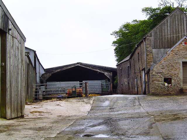
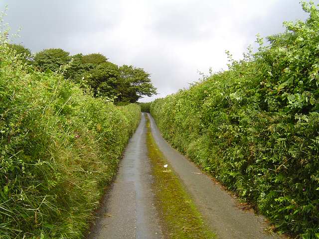
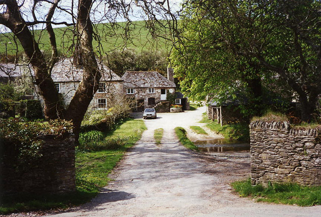
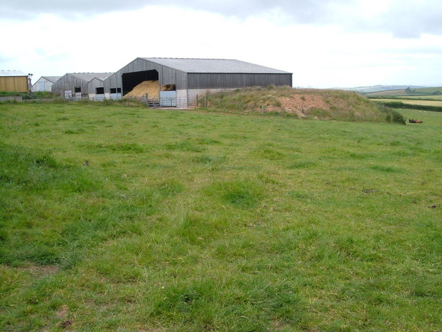
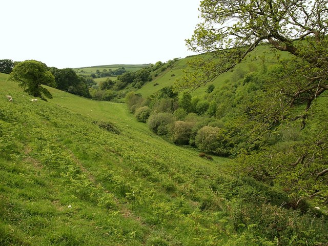
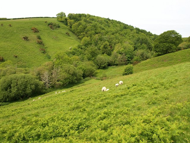
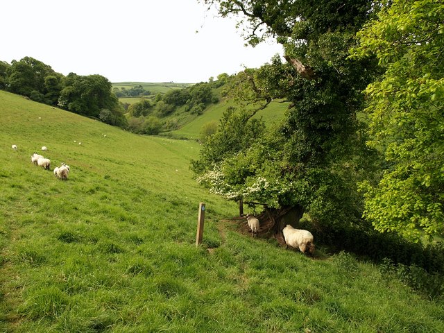
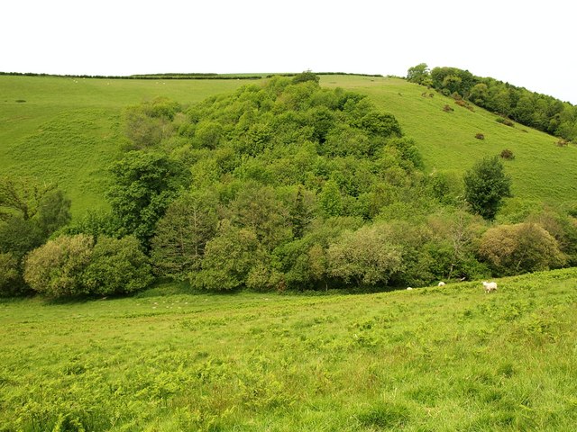
Ash Images

Images are sourced within 2km of 50.336101/-3.634901 or Grid Reference SX8349. Thanks to Geograph Open Source API. All images are credited.

Fuge Farm - South Hams A typical South Devon farm.
Fuge Farm - South Hams
A typical South Devon farm.
Devon small road Small road leading down to Forder
Devon small road
Small road leading down to Forder
Stoke Fleming: Riversbridge Once a farm and now, it appears, a private residence. A bridlepath runs through the property to Worden. Ponds here provided water to the four mills in the Em valley, which leads to Blackpool Sands
Stoke Fleming: Riversbridge
Once a farm and now, it appears, a private residence. A bridlepath runs through the property to Worden. Ponds here provided water to the four mills in the Em valley, which leads to Blackpool Sands
Homer Park, Strete Agricultural buildings on the east side of Homer Park, seen from Norns Lane.
Homer Park, Strete
Agricultural buildings on the east side of Homer Park, seen from Norns Lane.
Great Coombe, near Stoke Fleming According to Cherry & Pevsner, "a late C16 and C17 farmhouse adapted from an earlier ... building ...the two-storey porch with richly moulded doorcase and contemporary door are of c 1600". The very rich architectural heritage of this building is described at <span class="nowrap"><a title="http://www.imagesofengland.org.uk/Details/Default.aspx?id=99913&mode=adv" rel="nofollow ugc noopener" href="http://www.imagesofengland.org.uk/Details/Default.aspx?id=99913&mode=adv">Link</a><img style="margin-left:2px;" alt="External link" title="External link - shift click to open in new window" src="https://s1.geograph.org.uk/img/external.png" width="10" height="10"/></span> .
Great Coombe, near Stoke Fleming
According to Cherry & Pevsner, "a late C16 and C17 farmhouse adapted from an earlier ... building ...the two-storey porch with richly moulded doorcase and contemporary door are of c 1600". The very rich architectural heritage of this building is described at LinkExternal link .
View near Bowden From the lane between Bowden and Ash Cross just above Higher Bowden Holiday Cottages, looking across a small valley that joins the Blackpool valley.
View near Bowden
From the lane between Bowden and Ash Cross just above Higher Bowden Holiday Cottages, looking across a small valley that joins the Blackpool valley.
Higher Ash Farm Part of a hamlet in the South Hams consisting of several farms, their cottages, and a main house.
Higher Ash Farm
Part of a hamlet in the South Hams consisting of several farms, their cottages, and a main house.
Bowden House There are actually seven bays to the facade of this C18 country house inland from Blackpool Sands, but only the projecting central three can clearly be seen from the lane. "The centre 3 bays section is the original house and the flanking 2 bays set back are the early C19 wings." This and a great deal more at <span class="nowrap"><a title="http://www.imagesofengland.org.uk/Details/Default.aspx?id=99934&mode=adv" rel="nofollow ugc noopener" href="http://www.imagesofengland.org.uk/Details/Default.aspx?id=99934&mode=adv">Link</a><img style="margin-left:2px;" alt="External link" title="External link - shift click to open in new window" src="https://s1.geograph.org.uk/img/external.png" width="10" height="10"/></span>
Bowden House
There are actually seven bays to the facade of this C18 country house inland from Blackpool Sands, but only the projecting central three can clearly be seen from the lane. "The centre 3 bays section is the original house and the flanking 2 bays set back are the early C19 wings." This and a great deal more at LinkExternal link
Cottages at Lower Ash Cottages by a track junction in the hamlet of Ash, in the Devon South Hams.
Cottages at Lower Ash
Cottages by a track junction in the hamlet of Ash, in the Devon South Hams.
Lower Burlestone An old farmhouse with jetty porch beside a small tributary of the Gara.
Lower Burlestone
An old farmhouse with jetty porch beside a small tributary of the Gara.
Blackpool Mill One of four former mills within a few hundred metres of each other along Blackpool Lake.
Blackpool Mill
One of four former mills within a few hundred metres of each other along Blackpool Lake.
Tennis court, Worden Glimpsed from Stoke Fleming Bridleway 2. Below is the Em valley.
Tennis court, Worden
Glimpsed from Stoke Fleming Bridleway 2. Below is the Em valley.
Valley below Worden Stoke Fleming Bridleway 2 runs along this steep valley side on its way down to Riversbridge.
Valley below Worden
Stoke Fleming Bridleway 2 runs along this steep valley side on its way down to Riversbridge.
Valley below Worden (2) A view across <a href="https://www.geograph.org.uk/photo/1322368">SX8549 : Valley below Worden</a> from Stoke Fleming Bridleway 2. On the other side is North Hill Wood.
Valley below Worden (2)
A view across SX8549 : Valley below Worden from Stoke Fleming Bridleway 2. On the other side is North Hill Wood.
Oak trees by the bridleway A pair of oaks, one thickly covered in ivy and with a hawthorn beside it, shelter sheep by Stoke Fleming Bridleway 2 above <a href="https://www.geograph.org.uk/photo/1322368">SX8549 : Valley below Worden</a>. The bridleway continues to the right-hand edge of Ryland Copse, on the left.
Oak trees by the bridleway
A pair of oaks, one thickly covered in ivy and with a hawthorn beside it, shelter sheep by Stoke Fleming Bridleway 2 above SX8549 : Valley below Worden. The bridleway continues to the right-hand edge of Ryland Copse, on the left.
Frog Ford Copse Pieces of woodland occupy sections of the sides of <a href="https://www.geograph.org.uk/photo/1322368">SX8549 : Valley below Worden</a>, especially on the western slopes.
Frog Ford Copse
Pieces of woodland occupy sections of the sides of SX8549 : Valley below Worden, especially on the western slopes.
Ford near Riversbridge Stoke Fleming Bridleway 2 passes by this ford, with a little bridge beside the wall on the left, as it finally reaches the foot of <a href="https://www.geograph.org.uk/photo/1322368">SX8549 : Valley below Worden</a>.
Ford near Riversbridge
Stoke Fleming Bridleway 2 passes by this ford, with a little bridge beside the wall on the left, as it finally reaches the foot of SX8549 : Valley below Worden.
Lane junction near Embridge In effect, this is the eastern part of Embridge Cross, with Embridge Hill climbing to the right towards Stoke Fleming, and the lane on the left going up the valley to Venn.
Lane junction near Embridge
In effect, this is the eastern part of Embridge Cross, with Embridge Hill climbing to the right towards Stoke Fleming, and the lane on the left going up the valley to Venn.
Show me another place!

Ash is located at Grid Ref: SX8349 (Lat: 50.336101, Lng: -3.634901)

Administrative County: Devon

District: South Hams

Police Authority: Devon and Cornwall

What 3 Words

///dart.officials.funky. Near Dartmouth, Devon

Related Wikis

Woodbury, Stoke Fleming

Woodbury is an Iron Age hillfort situated in the parish of Stoke Fleming, close to Dartmouth in Devon, England. The fort is situated on a promontory on...

Bowden, Stoke Fleming

Bowden is a hamlet in the parish of Stoke Fleming in the South Hams district of Devon, England, about 1 mile (2 km) west of Stoke Fleming. Bowden House...

Ash, Devon

Ash is a village in Devon, England and is situated approximately 2.5 miles (4 km) south-west of Dartmouth. == References ==

Burlestone

Burlestone is a village in Devon, England. == References ==

A379 road

The A379 is a road in the English county of Devon. It links points on the edges of that county's two principal cities, Exeter and Plymouth, by an indirect...

Blackpool Sands, Dartmouth

Blackpool Sands is a gravel beach near Dartmouth, Devon, England named after the nearby village of Blackpool. It has been increasingly encroached on each...

Battle of Blackpool Sands

The Battle of Blackpool Sands was the result of an attempted French raid on the port of Dartmouth, South Devon, England, in April or May 1404. Local forces...

Dartmouth A.F.C.

Dartmouth Association Football Club is a football club based in Dartmouth, Devon, England. They are currently members of the South West Peninsula League...

Nearby Amenities

Located within 500m of 50.336101,-3.634901
Ash
Is In: Devon, England, UK
Place: hamlet
Lat/Long: 50.3357671/-3.6341583
Post Box
Brand: Royal Mail
Brand Wikidata: Q638098
Brand Wikipedia: en:Royal Mail
Collection Times: Mo-Fr 16:45; Sa 08:00; Su off
Operator: Royal Mail
Operator Wikidata: Q638098
Post Box Design: type_b
Post Box Mounting: hedge
Post Box Type: wall
Ref: TQ6 235
Royal Cypher: GR
Royal Cypher Wikidata: Q33102273
Source: survey;streetlevel imagery;aerial imagery
Lat/Long: 50.3392676/-3.6327417
Power: pole
Lat/Long: 50.3320174/-3.6322301
Power: pole
Lat/Long: 50.3326672/-3.6324693
Power: pole
Lat/Long: 50.333371/-3.632718
Power: pole
Lat/Long: 50.3339743/-3.632915
Power: pole
Lat/Long: 50.3346182/-3.6331378
Power: pole
Lat/Long: 50.3351841/-3.6334334
Power: pole
Lat/Long: 50.3360854/-3.6336445
Ash Cross
Place: locality
Lat/Long: 50.3392506/-3.6336209
The data included in this document is from www.openstreetmap.org. The data is made available under ODbL.

Have you been to Ash?

Leave your review of Ash below (or comments, questions and feedback).