Ash

Settlement in Surrey Guildford

England

Ash

Storage Warehouse by the Blackwater Now upstream of the generous input from Aldershot Sewage Works and much depleted as a result, the diminutive River Blackwater goes past here in a concrete trough of weeds after culverting under the busy A323.
Storage Warehouse by the Blackwater Credit: Des Blenkinsopp

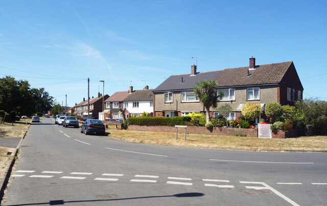
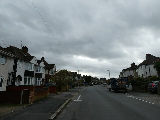
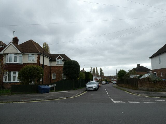
Ash is a picturesque village located in the borough of Guildford, in the county of Surrey, England. Situated on the borders of Surrey and Hampshire, it lies approximately 8 miles southwest of Guildford and 30 miles southwest of central London. The village is nestled in the tranquil countryside, surrounded by fields and woodlands, offering a peaceful and idyllic setting.

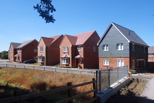
Ash is known for its rich history, dating back to Roman times, evidenced by the discovery of Roman pottery and coins in the area. The village has retained its historic charm and boasts an array of beautiful period properties, including thatched cottages and timber-framed houses.

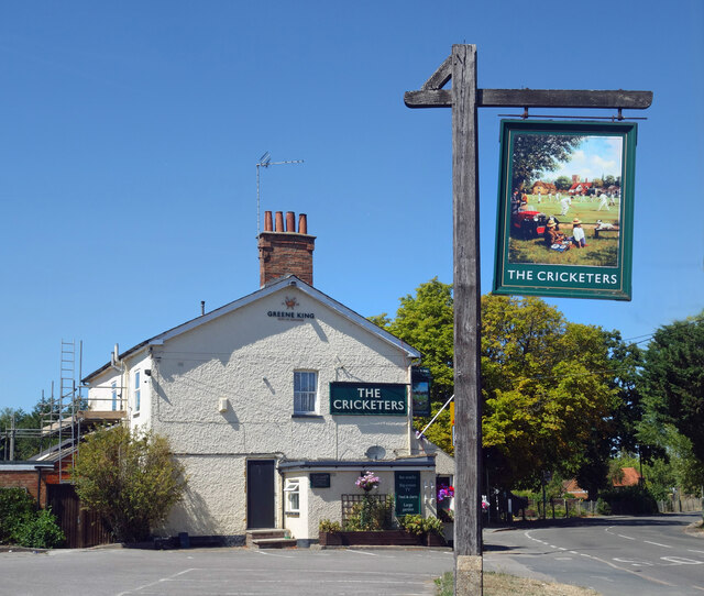
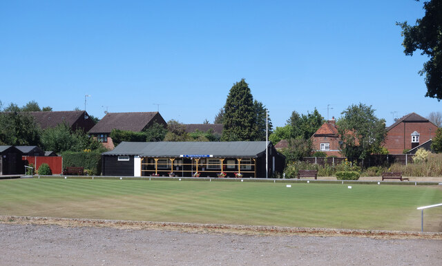
The village center features a range of amenities and services, including local shops, cafes, and traditional pubs, offering a warm and welcoming atmosphere. The nearby Ash Manor Sports Centre provides excellent recreational facilities, including a swimming pool, gym, and various sports courts.

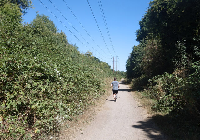
Nature enthusiasts can explore the stunning countryside surrounding Ash, with numerous walking and cycling trails to enjoy. The village is in close proximity to the Surrey Hills Area of Outstanding Natural Beauty, offering breathtaking views and diverse wildlife.

Transport links in Ash are well-connected, with easy access to major roads, including the A31 and the A331. Ash railway station provides regular train services to Guildford, London Waterloo, and other surrounding towns and cities.

Overall, Ash offers a delightful mix of rural tranquility, historic charm, and convenient amenities, making it an attractive place to live or visit in Surrey.

If you have any feedback on the listing, please let us know in the comments section below.
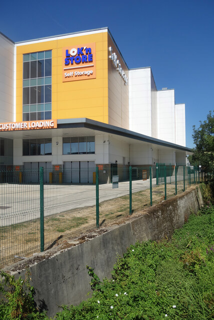
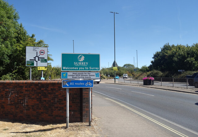
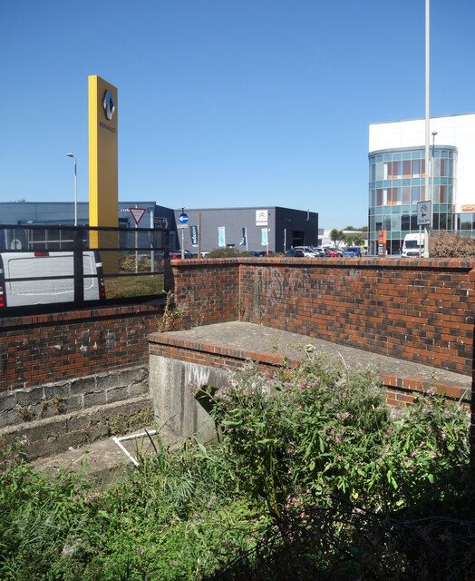
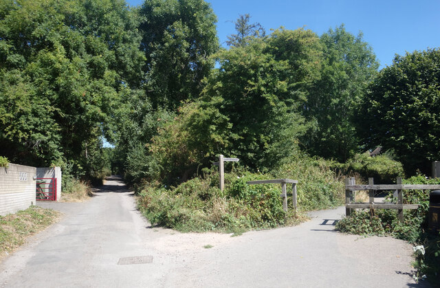
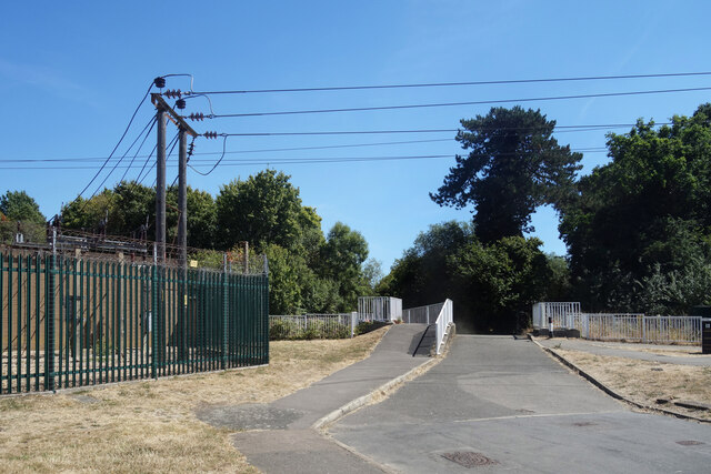
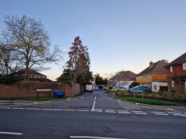
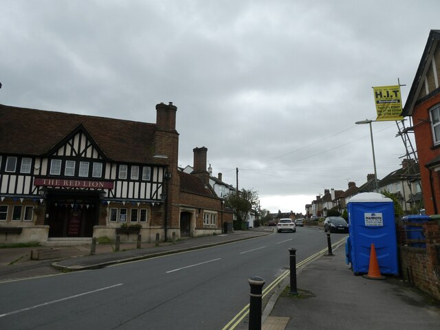
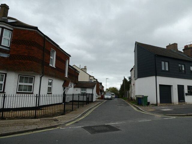
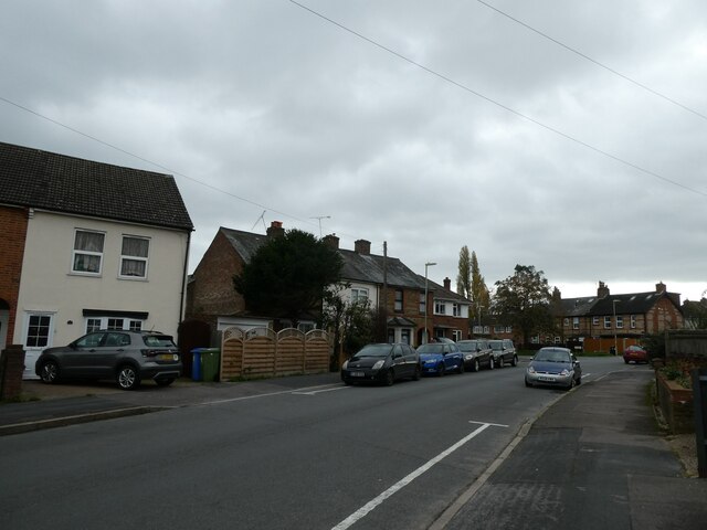
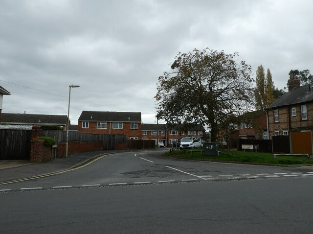
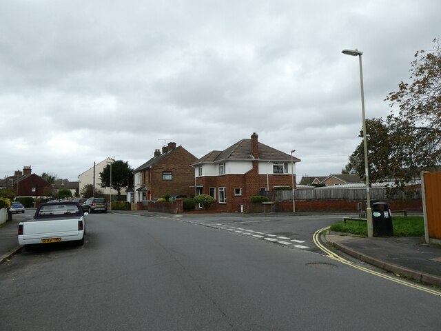
Ash Images

Images are sourced within 2km of 51.245662/-0.72559492 or Grid Reference SU8950. Thanks to Geograph Open Source API. All images are credited.

Storage Warehouse by the Blackwater Now upstream of the generous input from Aldershot Sewage Works and much depleted as a result, the diminutive River Blackwater goes past here in a concrete trough of weeds after culverting under the busy A323.
Storage Warehouse by the Blackwater
Now upstream of the generous input from Aldershot Sewage Works and much depleted as a result, the diminutive River Blackwater goes past here in a concrete trough of weeds after culverting under the busy A323.
Welcome to Surrey The River Blackwater is used as a county border for its whole length, firstly between Hampshire and Surrey and later between Hampshire and Berkshire. Here is where it goes under the A323 as that road crosses into Surrey county.
Welcome to Surrey
The River Blackwater is used as a county border for its whole length, firstly between Hampshire and Surrey and later between Hampshire and Berkshire. Here is where it goes under the A323 as that road crosses into Surrey county.
Weeds & Warehouses, River Blackwater The Blackwater is not at its best through here as it enters a culvert under the A323.
Weeds & Warehouses, River Blackwater
The Blackwater is not at its best through here as it enters a culvert under the A323.
Tongham Road, Aldershot
The Cricketers, Oxenden Road One of the Greene King Brewery's estate.
The Cricketers, Oxenden Road
One of the Greene King Brewery's estate.
Bowling Green, Tongham
More New Housing Land north of the old railway path is all being built on.
More New Housing
Land north of the old railway path is all being built on.
Jogging along the old railway path Along a bridleway on an old railway line.
Jogging along the old railway path
Along a bridleway on an old railway line.
Footpath Junction, Spoil Lane A more than usual number of footpaths and bridleways are shown on the map just here.
Some, like Spoil Lane, are residential lanes already, one is along an old railway, while others will vanish as footpaths when they are incorporated into urban streets as more houses are built.
Footpath Junction, Spoil Lane
A more than usual number of footpaths and bridleways are shown on the map just here. Some, like Spoil Lane, are residential lanes already, one is along an old railway, while others will vanish as footpaths when they are incorporated into urban streets as more houses are built.
Bridge over the Blackwater This leads to an underpass beneath the A331 and is blocked by bollards at the far end. I would guess it's for emergency vehicles only.
A small electricity sub station is on the left.
Bridge over the Blackwater
This leads to an underpass beneath the A331 and is blocked by bollards at the far end. I would guess it's for emergency vehicles only. A small electricity sub station is on the left.
Looking from Church Lane East into Warwick Close
Passing the Red Lion in Brighton Road
Looking from Brighton Road into Commercial Road
Looking south-east along Brighton Road
Looking from Brighton Road into Alfonso Close
Looking back towards the junction of Alfonso Close and Brighton Road
Mid-section of Brighton Road
Looking from Brighton Road into Gillian Avenue
Show me another place!

Ash is located at Grid Ref: SU8950 (Lat: 51.245662, Lng: -0.72559492)

Administrative County: Surrey

District: Guildford

Police Authority: Surrey

What 3 Words

///into.edgy.boots. Near Aldershot, Hampshire

Nearby Locations

Ash

Related Wikis

Ash, Surrey

Ash is a village and civil parish in the far west of the borough of Guildford, Surrey. Ash is on the eastern side of the River Blackwater, with a station...

Ash United F.C.

Ash United Football Club is a football club based in Ash, Surrey, England. They are currently members of the Wessex League Division One and play at Shawfields...

Ash Manor School

Ash Manor School is a comprehensive, community secondary school located in Manor Road, Ash, Surrey, England. Opened as Yeoman's Bridge School in 1948....

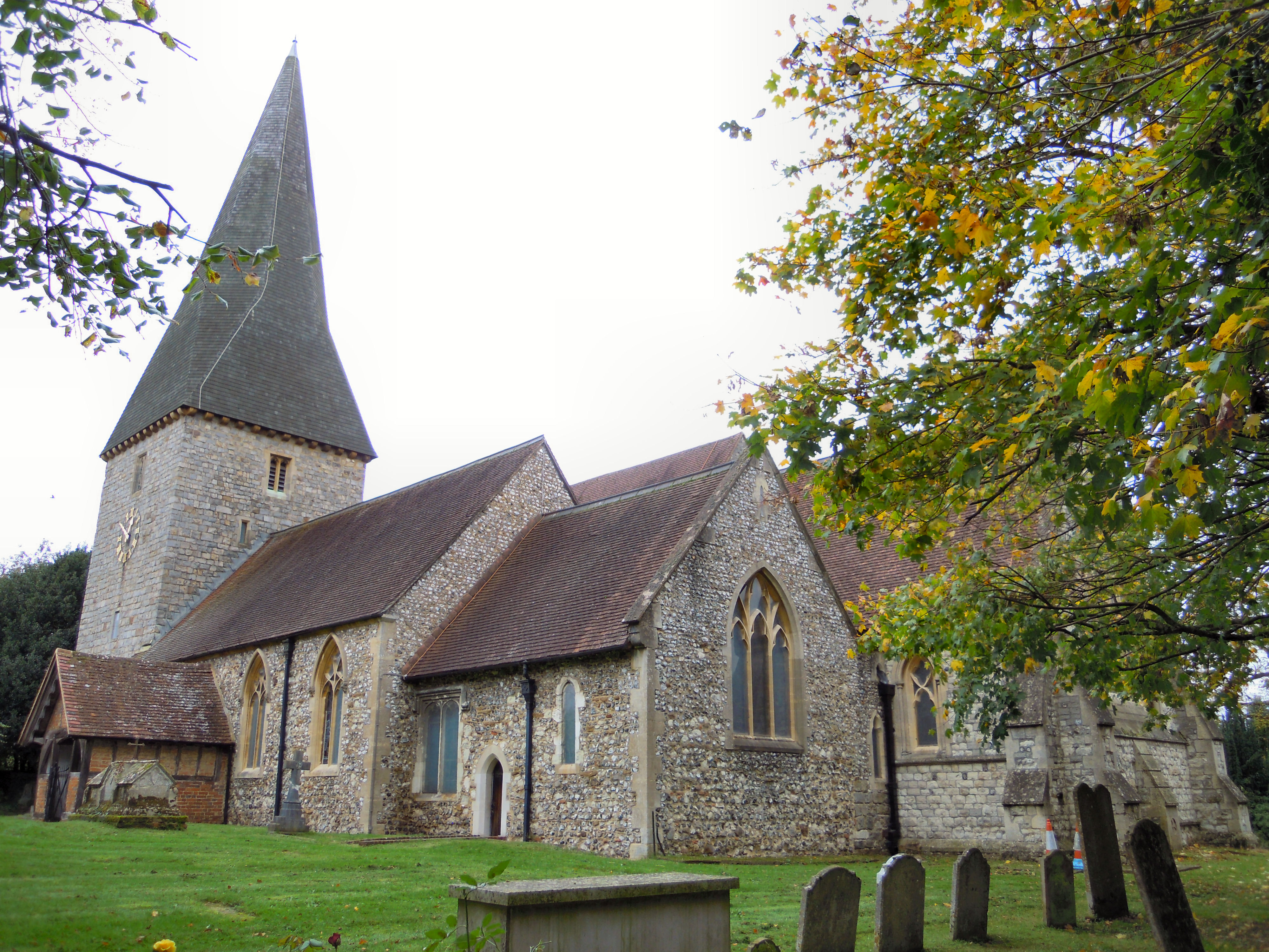
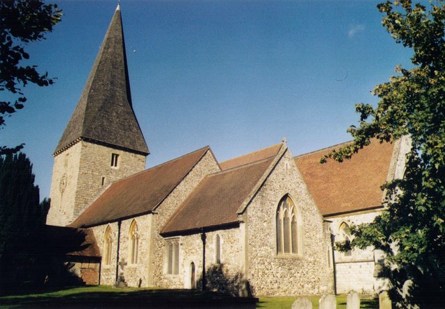
St Peter's church, Ash

St Peter's church is the Church of England parish church for the village of Ash in Surrey. Of 12th-century origin with later additions, the church has...

Ash Cemetery, Surrey

Ash Cemetery, also known as Emery Gates Cemetery on Church Road is the burial ground for the village of Ash in Surrey, England. == History == At a meeting...
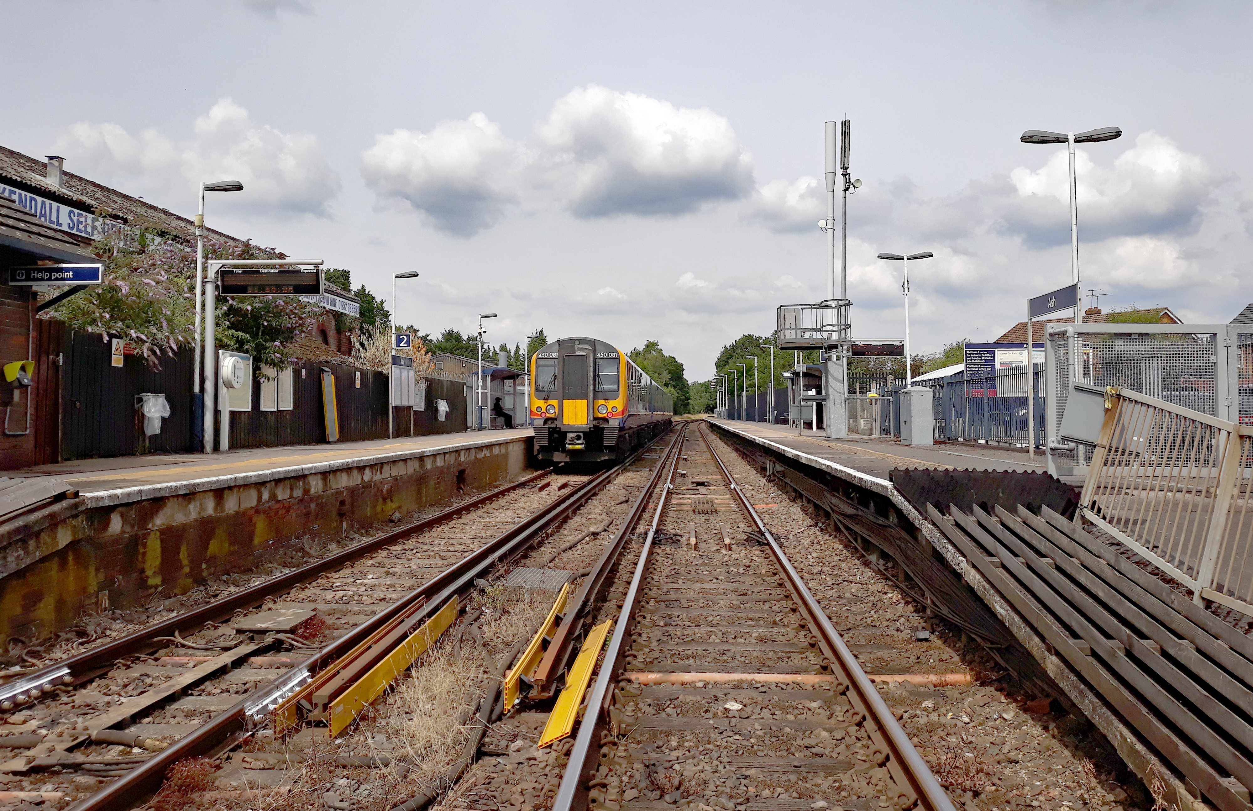
Ash railway station

Ash railway station serves the village of Ash in Surrey, England. The station is served by South Western Railway, who manage the station, and by Great...

Tongham

Tongham is a village northeast of the town of Farnham in Surrey, England. The village's buildings occupy most of the west of the civil parish, adjoining...

Ash Green Halt railway station

Ash Green Halt railway station known for a time as Ash Green, served the village of Ash, Surrey in England on the original route of the Alton Line which...

Related Videos

Easter VLOG | Rowhill Nature Reserve | Blackwaer Valley | Tice's Meadow | Hiking Family Trip | UK

Watch in my Easter VLOG how we hike at Rowhill Nature Reserve, Blackwater Valley, Tice's Meadow and Aldershot's Ivy Fields.

Travel with me #beltonlake #texas A dayout with my colleagues.

Travel with me / #beltonlake #texas A day out with my colleagues This video is captured by myself with the camera of ...

Nearby Amenities

Located within 500m of 51.245662,-0.72559492
Kerb: raised
Lat/Long: 51.2432076/-0.7237851
Crossing
Bicycle: yes
Crossing: unmarked
Crossing Island: no
Crossing Markings: no
Kerb: lowered
Tactile Paving: no
Lat/Long: 51.2422732/-0.7292848
Crossing
Bicycle: yes
Crossing: unmarked
Crossing Markings: no
Kerb: lowered
Lat/Long: 51.2435513/-0.7293183
Co-op Food
Addr City: Ash
Addr Country: GB
Addr Housenumber: 69
Addr Postcode: GU12 6LG
Addr Street: Ash Street
Brand: Co-op Food
Brand Wikidata: Q3277439
Delivery: deliveroo
Fhrs Authority: Guildford
Fhrs Id: 649800
Fhrs Local Authority Id: 4376
Opening Hours: Mo-Su 07:00-23:00
Operator: The Co-operative Group
Operator Wikidata: Q117202
Pay Point: yes
Payment Cash: yes
Phone: +44 1252 333881
Shop: convenience
Source: receipt from visit
Website: https://www.coop.co.uk/store-finder/GU12-6LG/69-ash-street
Wheelchair: yes
Lat/Long: 51.2461783/-0.7242726
Fuel
Tilthams Service Station
Addr City: Ash
Addr Country: GB
Addr Housenumber: 62-66
Addr Postcode: GU12 6LR
Addr Street: Ash Street
Brand: JET
Brand Wikidata: Q568940
Compressed Air: yes
Fhrs Authority: Guildford
Fhrs Id: 1028190
Fhrs Local Authority Id: 10553
Opening Hours: PH,Mo-Su 06:00-22:00
Payment Cash: yes
Wheelchair: yes
Lat/Long: 51.2457305/-0.7246789
Barrier: bollard
Bollard: fixed
Lat/Long: 51.2467798/-0.7240141
Barrier: kissing_gate
Lat/Long: 51.2418439/-0.7292069
Bicycle Parking
Bicycle Parking: stands
Capacity: 4
Covered: no
Lat/Long: 51.2461004/-0.7243456
Atm
Brand: Cashzone
Brand Wikidata: Q110738461
Cash In: no
Check Date: 2023-04-28
Network: Allpoint
Network Wikidata: Q4733264
Operator: Cash Zone
Lat/Long: 51.2461489/-0.724345
Check Date: 2024-03-15
Disused Amenity: police
Old Name: Ash Police Station
Wheelchair: yes
Lat/Long: 51.2465832/-0.7199641
Longfield Stores
Addr City: Ash
Addr Country: GB
Addr Housenumber: 69
Addr Postcode: GU12 6NB
Addr Street: Longfield Road
Fhrs Authority: Guildford
Fhrs Id: 649436
Fhrs Local Authority Id: 2654
Opening Hours: Mo-Su 08:00-20:00
Shop: convenience
Wheelchair: limited
Lat/Long: 51.2477787/-0.7236204
Turning Circle
Turning Circle: hammer
Lat/Long: 51.2428423/-0.7309663
One Stop
Addr City: Ash
Addr Housenumber: 58
Addr Postcode: GU12 6LR
Addr Street: Ash Street
Brand: One Stop
Brand Wikidata: Q65954217
Contact Website: https://www.onestop.co.uk/store?store=29b4af1d-28bd-4396-a813-97c616c6d79d
Shop: convenience
Source: local_knowledge
Lat/Long: 51.2455691/-0.7252958
Barrier: swing_gate
Lat/Long: 51.2462276/-0.7255238
Mini Roundabout
Direction: clockwise
Lat/Long: 51.2449453/-0.7269528
Crossing
Crossing: uncontrolled
Crossing Ref: zebra
Kerb: lowered
Source: Bing
Lat/Long: 51.2449468/-0.727527
West Surrey Foundation
Building: yes
Source: photo
Lat/Long: 51.2458662/-0.7258644
Post Box
Check Date: 2021-04-27
Collection Times: Mo-Fr 17:30; Sa 12:30
Mapillary: 1118919785251254
Operator: Royal Mail
Operator Wikidata: Q638098
Post Box Type: pillar
Postal Code: GU12
Ref: GU12 50
Royal Cypher: EIIR
Royal Cypher Wikidata: Q33102113
Survey Date: 2020-10-11
Lat/Long: 51.2456284/-0.725494
Atm
Brand: NoteMachine
Brand Wikidata: Q104368525
Cash In: no
Indoor: no
Operator: NoteMachine
Operator Short: NMATM
Operator Wikidata: Q104368525
Lat/Long: 51.2456094/-0.7254656
Post Box
Collection Times: Mo-Fr 09:00; Sa 07:00
Postal Code: GU12
Ref: GU12 10
Royal Cypher: EIIR
Royal Cypher Wikidata: Q33102113
Lat/Long: 51.2500094/-0.7264186
Village Hall
Lat/Long: 51.2490472/-0.720957
Turning Circle
Turning Circle: square
Lat/Long: 51.2463317/-0.72611
Parking
Access: private
Parking: surface
Lat/Long: 51.2471363/-0.7293305
Barrier: swing_gate
Bicycle: yes
Foot: yes
Motor Vehicle: private
Lat/Long: 51.2480345/-0.7310643
Barrier: kissing_gate
Foot: yes
Motor Vehicle: no
Lat/Long: 51.2480124/-0.7309358
Bicycle Parking
Bicycle Parking: stands
Capacity: 6
Covered: no
Source: photo
Lat/Long: 51.2470733/-0.7293046
Bus Stop
Shawfield Rec
Bench: no
Bin: no
Bus: yes
Lit: yes
Naptan AtcoCode: 40004407061A
Naptan Bearing: N
Naptan CommonName: Shawfield Rec
Naptan Indicator: adj
Naptan Landmark: Shawfield Rec
Naptan NaptanCode: suramptg
Naptan PlusbusZoneRef: ALDRSHT
Naptan Street: Shawfield Road
Naptan Verified: no
Public Transport: platform
Shelter: no
Source: naptan_import
Tactile Paving: no
Lat/Long: 51.2486788/-0.7276462
Bus Stop
Shawfield Rec
Bench: no
Bin: no
Bus: yes
Lit: yes
Naptan AtcoCode: 40004407061B
Naptan Bearing: SW
Naptan CommonName: Shawfield Rec
Naptan Indicator: Opp
Naptan Landmark: Shawfield Rec
Naptan NaptanCode: suramptj
Naptan PlusbusZoneRef: ALDRSHT
Naptan Street: Shawfield Road
Naptan Verified: no
Public Transport: platform
Shelter: no
Source: naptan_import
Tactile Paving: no
Lat/Long: 51.248979/-0.7271364
Bus Stop
Ash Lodge Drive
Bench: no
Bin: no
Bus: yes
Lit: yes
Naptan AtcoCode: 40004407062A
Naptan Bearing: S
Naptan CommonName: Ash Lodge Drive
Naptan Indicator: Just Before
Naptan Landmark: Lodge Drive
Naptan NaptanCode: suramptm
Naptan PlusbusZoneRef: ALDRSHT
Naptan Street: Manor Road
Naptan Verified: no
Public Transport: platform
Shelter: no
Source: naptan_import
Tactile Paving: no
Lat/Long: 51.2428555/-0.7293601
Bus Stop
Ash Lodge Drive
Bench: yes
Bin: no
Bus: yes
Lit: yes
Naptan AtcoCode: 40004407062B
Naptan Bearing: N
Naptan CommonName: Ash Lodge Drive
Naptan Indicator: Just after
Naptan Landmark: Lodge Drive
Naptan NaptanCode: suramptp
Naptan PlusbusZoneRef: ALDRSHT
Naptan Street: Manor Road
Naptan Verified: no
Public Transport: platform
Shelter: yes
Source: naptan_import
Tactile Paving: no
Lat/Long: 51.2430213/-0.7295345
Bus Stop
Underwood Avenue
Bench: yes
Bin: yes
Bus: yes
Lit: yes
Naptan AtcoCode: 40004407062C
Naptan Bearing: N
Naptan CommonName: Underwood Avenue
Naptan Indicator: adj
Naptan Landmark: The Greyhound
Naptan NaptanCode: suramptw
Naptan PlusbusZoneRef: ALDRSHT
Naptan Street: Shawfield Road
Naptan Verified: no
Public Transport: platform
Shelter: yes
Source: naptan_import
Tactile Paving: no
Lat/Long: 51.2451793/-0.7291755
Bus Stop
The Greyhound
Bench: no
Bin: no
Bus: yes
Lit: yes
Naptan AtcoCode: 40004407062D
Naptan Bearing: NE
Naptan CommonName: The Greyhound
Naptan Indicator: Just after
Naptan Landmark: The Greyhound
Naptan NaptanCode: surampwa
Naptan PlusbusZoneRef: ALDRSHT
Naptan Street: Ash Street
Naptan Verified: no
Public Transport: platform
Shelter: no
Source: naptan_import
Tactile Paving: no
Lat/Long: 51.244758/-0.7283305
Bus Stop
Underwood Avenue
Bench: no
Bin: no
Bus: yes
Lit: yes
Naptan AtcoCode: 40004407062E
Naptan Bearing: S
Naptan CommonName: Underwood Avenue
Naptan Indicator: Just after
Naptan Landmark: The Greyhound
Naptan NaptanCode: surampwd
Naptan PlusbusZoneRef: ALDRSHT
Naptan Street: Shawfield Road
Naptan Verified: no
Public Transport: platform
Shelter: no
Source: naptan_import
Tactile Paving: no
Lat/Long: 51.244622/-0.7291909
The Greyhound
Naptan AtcoCode: 40004407062F
Naptan Bearing: SW
Naptan BusStopType: CUS
Naptan CommonName: The Greyhound
Naptan Indicator: Just before
Naptan Landmark: The Greyhound
Naptan NaptanCode: surgptwm
Naptan Street: Ash Street
Naptan Verified: no
Source: naptan_import
Lat/Long: 51.2447365/-0.7281418
Bus Stop
Library
Bench: no
Bin: yes
Bus: yes
Lit: yes
Naptan AtcoCode: 40004407076A
Naptan Bearing: SW
Naptan CommonName: Library
Naptan Indicator: Opp
Naptan Landmark: Ash Library
Naptan NaptanCode: suramtgp
Naptan PlusbusZoneRef: ALDRSHT
Naptan Street: Ash Street
Naptan Verified: no
Public Transport: platform
Shelter: no
Source: naptan_import
Tactile Paving: no
Lat/Long: 51.2456836/-0.7253139
Bus Stop
Library
Bench: yes
Bin: no
Bus: yes
Lit: yes
Naptan AtcoCode: 40004407076B
Naptan Bearing: E
Naptan CommonName: Library
Naptan Indicator: Just after
Naptan Landmark: Ash Library
Naptan NaptanCode: suramtgt
Naptan PlusbusZoneRef: ALDRSHT
Naptan Street: Ash Street
Naptan Verified: no
Public Transport: platform
Shelter: no
Source: naptan_import
Tactile Paving: no
Lat/Long: 51.2459688/-0.7247424
Bus Stop
Police Station
Bench: yes
Bin: yes
Bus: yes
Lit: yes
Naptan AtcoCode: 40004407077A
Naptan Bearing: W
Naptan CommonName: Police Station
Naptan Indicator: O/s
Naptan Landmark: Ash Police Station
Naptan NaptanCode: suramtgw
Naptan PlusbusZoneRef: ALDRSHT
Naptan Street: Ash Street
Naptan Verified: no
Public Transport: platform
Shelter: yes
Source: naptan_import
Tactile Paving: no
Lat/Long: 51.2468187/-0.7201577
Bus Stop
Police Station
Bench: no
Bin: no
Bus: yes
Lit: yes
Naptan AtcoCode: 40004407077B
Naptan Bearing: E
Naptan CommonName: Police Station
Naptan Indicator: Opp
Naptan Landmark: Ash Police Station
Naptan NaptanCode: suramtja
Naptan PlusbusZoneRef: ALDRSHT
Naptan Street: Ash Street
Naptan Verified: no
Public Transport: platform
Shelter: no
Source: naptan_import
Tactile Paving: no
Lat/Long: 51.246929/-0.7201754
Bus Stop
Japonica Court
Bench: yes
Bin: yes
Bus: yes
Lit: yes
Naptan AtcoCode: 40004407438A
Naptan Bearing: N
Naptan CommonName: Japonica Court
Naptan Indicator: O/s
Naptan Landmark: Japonica Court
Naptan NaptanCode: suratjta
Naptan PlusbusZoneRef: ALDRSHT
Naptan Street: Shawfield Road
Naptan Verified: no
Public Transport: platform
Shelter: yes
Source: naptan_import
Tactile Paving: no
Lat/Long: 51.2467378/-0.7286024
Bus Stop
Japonica Court
Bench: no
Bin: no
Bus: yes
Lit: yes
Naptan AtcoCode: 40004407438B
Naptan Bearing: S
Naptan CommonName: Japonica Court
Naptan Indicator: Opp
Naptan Landmark: Japonica Court
Naptan NaptanCode: suratjtd
Naptan PlusbusZoneRef: ALDRSHT
Naptan Street: Shawfield Road
Naptan Verified: no
Public Transport: platform
Shelter: no
Source: naptan_import
Tactile Paving: no
Lat/Long: 51.2467012/-0.7285461
Barrier: kerb
Kerb: lowered
Tactile Paving: yes
Lat/Long: 51.2423165/-0.7292869
Barrier: kerb
Kerb: lowered
Tactile Paving: yes
Lat/Long: 51.242196/-0.7292811
Shawfield
Place: neighbourhood
Lat/Long: 51.2489844/-0.7282104
Give Way
Source: Surrey-Air_Survey
Lat/Long: 51.2441894/-0.7226746
Barrier: kerb
Kerb: flush
Tactile Paving: yes
Lat/Long: 51.2434223/-0.7293822
Barrier: kerb
Kerb: flush
Tactile Paving: yes
Lat/Long: 51.2436883/-0.7292683
Crossing
Bicycle: yes
Crossing: uncontrolled
Crossing Island: yes
Kerb: lowered
Tactile Paving: yes
Lat/Long: 51.2443047/-0.7288784
Crossing
Bicycle: yes
Crossing: uncontrolled
Crossing Island: yes
Kerb: lowered
Tactile Paving: yes
Lat/Long: 51.2442704/-0.7295482
Crossing
Bicycle: yes
Crossing: uncontrolled
Crossing Island: yes
Kerb: lowered
Tactile Paving: yes
Lat/Long: 51.2440864/-0.7293137
Crossing
Bicycle: yes
Crossing: uncontrolled
Crossing Island: yes
Kerb: lowered
Tactile Paving: yes
Lat/Long: 51.244444/-0.7293313
Crossing
Bicycle: yes
Crossing: uncontrolled
Crossing Island: yes
Kerb: lowered
Tactile Paving: yes
Lat/Long: 51.244451/-0.7292237
Crossing
Bicycle: yes
Crossing: uncontrolled
Crossing Island: yes
Kerb: lowered
Tactile Paving: yes
Lat/Long: 51.2443754/-0.7289292
Crossing
Bicycle: yes
Crossing: uncontrolled
Crossing Island: yes
Kerb: lowered
Tactile Paving: yes
Lat/Long: 51.2442037/-0.7295255
Crossing
Bicycle: yes
Crossing: uncontrolled
Crossing Island: yes
Kerb: lowered
Tactile Paving: yes
Lat/Long: 51.2440674/-0.7292028
Crossing
Crossing: uncontrolled
Crossing Island: no
Crossing Ref: zebra
Kerb: lowered
Source: Bing
Tactile Paving: yes
Lat/Long: 51.246229/-0.7287981
Crossing
Button Operated: yes
Crossing: traffic_signals
Crossing Island: no
Crossing Ref: pelican
Kerb: lowered
Tactile Paving: yes
Traffic Signals Sound: no
Traffic Signals Vibration: no
Lat/Long: 51.2450685/-0.7275036
Traffic Signals
Traffic Signals Direction: backward
Lat/Long: 51.2450834/-0.7274593
Traffic Signals
Traffic Signals Direction: forward
Lat/Long: 51.2450558/-0.7275411
Crossing
Crossing: uncontrolled
Crossing Ref: zebra
Kerb: lowered
Source: Bing
Lat/Long: 51.2448669/-0.726866
Crossing
Crossing: uncontrolled
Crossing Island: yes
Kerb: lowered
Tactile Paving: yes
Lat/Long: 51.2456461/-0.7256279
Barrier: kerb
Kerb: lowered
Tactile Paving: no
Lat/Long: 51.2448924/-0.7278247
Crossing
Crossing: unmarked
Crossing Markings: no
Kerb: lowered
Source: Bing
Lat/Long: 51.2448615/-0.7278812
Barrier: kerb
Kerb: lowered
Tactile Paving: no
Lat/Long: 51.24516/-0.727063
Crossing
Crossing: unmarked
Crossing Markings: no
Kerb: lowered
Source: Bing
Lat/Long: 51.2451775/-0.7269837
Crossing
Crossing: unmarked
Crossing Markings: no
Kerb: lowered
Source: Bing
Tactile Paving: no
Lat/Long: 51.2457748/-0.7250078
Crossing
Crossing: unmarked
Crossing Markings: no
Kerb: lowered
Source: Bing
Tactile Paving: no
Lat/Long: 51.2459234/-0.7244812
Give Way
Source: EsriWorldImagery
Lat/Long: 51.2423104/-0.7273691
Noexit: yes
Lat/Long: 51.2456485/-0.7239544
Give Way
Source: Surrey-Air_Survey
Lat/Long: 51.2446659/-0.722968
Give Way
Source: Surrey-Air_Survey
Lat/Long: 51.2461426/-0.7235154
Give Way
Source: Surrey-Air_Survey
Lat/Long: 51.2452821/-0.7232744
Barrier: bollard
Bollard: fixed
Lat/Long: 51.2453748/-0.7232536
Give Way
Source: EsriWorldImagery
Lat/Long: 51.2422389/-0.7268956
Give Way
Source: Surrey-Air_Survey
Lat/Long: 51.2444942/-0.7217796
Crossing
Crossing: uncontrolled
Crossing Island: yes
Kerb: lowered
Source: Bing
Tactile Paving: yes
Lat/Long: 51.2422797/-0.7268669
Post Box
Collection Times: Mo-Fr 16:00; Sa 10:30
Operator: Royal Mail
Operator Wikidata: Q638098
Ref: GU12 5
Royal Cypher: EIIR
Royal Cypher Wikidata: Q33102113
Lat/Long: 51.2468726/-0.7191292
Bicycle Parking
Bicycle Parking: stands
Capacity: 8
Covered: no
Lat/Long: 51.2458571/-0.7256539
Post Office
Ash Post Office
Addr City: Ash
Addr Housenumber: 58
Addr Postcode: GU12 6LR
Addr Street: Ash Street
Brand: Post Office
Brand Wikidata: Q1783168
Brand Wikipedia: en:Post Office Ltd
Contact Website: https://www.postoffice.co.uk/branch-finder/0529001/ash
Opening Hours: Mo-Fr 09:00-14:30, 15:30-21:00; Sa 09:00-21:00 || Mo-Fr 14:30-15:30 "Closed on school days, open non-school days"
Operator: One Stop
Ref Pol Id: 101
Wheelchair: yes
Lat/Long: 51.2456076/-0.7253307
Parking
Lat/Long: 51.2445472/-0.7301789
Access: no
Barrier: swing_gate
Lat/Long: 51.2480643/-0.7311446
Access: private
Barrier: swing_gate
Lat/Long: 51.2480072/-0.731053
Barrier: cycle_barrier
Cycle Barrier: double
Cycle Barrier Installation: fixed
Lat/Long: 51.2471821/-0.7242843
Barrier: cycle_barrier
Cycle Barrier: double
Cycle Barrier Installation: fixed
Lat/Long: 51.2496878/-0.7251348
Access: no
Barrier: bollard
Bollard: fixed
Foot: yes
Material: concrete
Lat/Long: 51.2464402/-0.7256276
Tuck Shop
Shop: food
Lat/Long: 51.2443057/-0.7264054
Bench
Backrest: no
Material: wood
Lat/Long: 51.2476928/-0.730011
Bench
Backrest: no
Material: wood
Lat/Long: 51.2473503/-0.7316494
Bench
Backrest: no
Material: plastic
Lat/Long: 51.2451502/-0.7309939
Bench
Backrest: no
Material: plastic
Lat/Long: 51.2451301/-0.7311973
Charging Station
Brand: BP Pulse
Brand Wikidata: Q39057719
Capacity: 2
Operator: BP Pulse
Operator Wikidata: Q39057719
Lat/Long: 51.2448808/-0.7289661
Fire Hydrant
Emergency: fire_hydrant
Fire Hydrant Diameter: 4"
Fire Hydrant Position: lane
Fire Hydrant Type: underground
Water Source: main
Lat/Long: 51.2461775/-0.7287863
Ford: yes
Lat/Long: 51.2456343/-0.7319404
Ford: yes
Lat/Long: 51.2469765/-0.7317415
Bench
Backrest: no
Lat/Long: 51.2462619/-0.7318514
Barrier: bollard
Lat/Long: 51.2486358/-0.7280018
Waste Basket
Lat/Long: 51.2488624/-0.7276535
Board Type: sport
Information: board
Tourism: information
Lat/Long: 51.2477195/-0.7308934
Recycling
Recycling Beverage Cartons: no
Recycling Cans: yes
Recycling Paper: yes
Recycling Plastic: no
Recycling Plastic Bottles: yes
Recycling Plastic Packaging: no
Recycling Type: container
Lat/Long: 51.2457037/-0.7252879
Waste Basket
Lat/Long: 51.2457064/-0.7252762
Fire Hydrant
Emergency: fire_hydrant
Fire Hydrant Diameter: 100
Fire Hydrant Position: sidewalk
Fire Hydrant Type: underground
Lat/Long: 51.248002/-0.7292775
Noexit: yes
Lat/Long: 51.2448119/-0.7246631
Fire Hydrant
Emergency: fire_hydrant
Lat/Long: 51.2424819/-0.7293127
Waste Basket
Lat/Long: 51.2463024/-0.7260303
Waste Basket
Lat/Long: 51.2462229/-0.7236269
Grit Bin
Seasonal: no
Lat/Long: 51.2475317/-0.7235031
Bench
Backrest: no
Lat/Long: 51.2496454/-0.7271119
Waste Basket
Lat/Long: 51.2461627/-0.7241501
Grit Bin
Seasonal: no
Lat/Long: 51.2469485/-0.7286211
Parcel Locker
Lat/Long: 51.244687/-0.7290466
Waste Basket
Waste: dog_excrement
Lat/Long: 51.2456211/-0.7290775
Man Made: street_cabinet
Lat/Long: 51.2456765/-0.7288121
Parking
Lat/Long: 51.2414995/-0.7248612
Waste Basket
Lat/Long: 51.2450517/-0.7292286
Man Made: street_cabinet
Lat/Long: 51.2444882/-0.7284094
Man Made: street_cabinet
Lat/Long: 51.2444119/-0.7285086
Waste Basket
Lat/Long: 51.2446329/-0.7290515
Man Made: street_cabinet
Lat/Long: 51.2448492/-0.7289266
Crossing
Crossing: unmarked
Crossing Markings: no
Lat/Long: 51.2450437/-0.7294811
Crossing
Crossing: unmarked
Crossing Markings: no
Lat/Long: 51.2447479/-0.7325392
Crossing
Crossing: unmarked
Crossing Markings: no
Lat/Long: 51.2449025/-0.7315242
Crossing
Crossing: unmarked
Crossing Markings: no
Lat/Long: 51.2446347/-0.7324817
Crossing
Crossing: unmarked
Crossing Markings: no
Lat/Long: 51.2450534/-0.7305141
Man Made: street_cabinet
Lat/Long: 51.2469347/-0.7286257
Waste Basket
Lat/Long: 51.245795/-0.7255819
Waste Basket
Lat/Long: 51.2467088/-0.7286683
The data included in this document is from www.openstreetmap.org. The data is made available under ODbL.

Have you been to Ash?

Leave your review of Ash below (or comments, questions and feedback).