Nalderhill Copse

Wood, Forest in Berkshire

England

Nalderhill Copse

Hoe Benham, Berkshire Looking southwest towards the B4000 junction in the west of the square.
Hoe Benham, Berkshire Credit: Brendan and Ruth McCartney

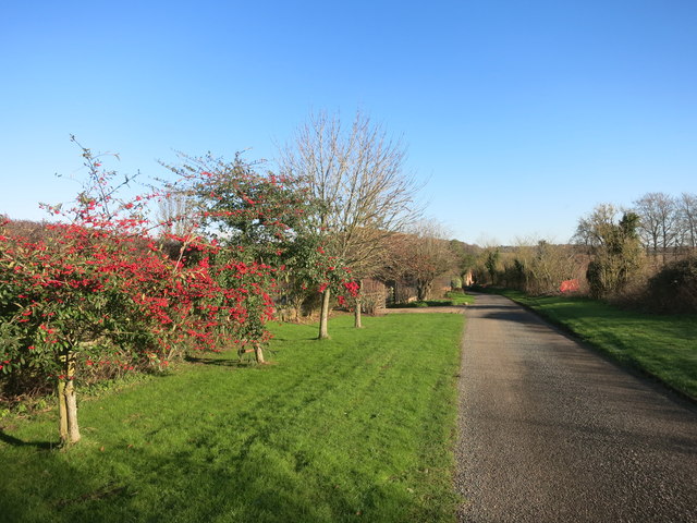
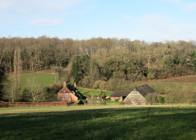
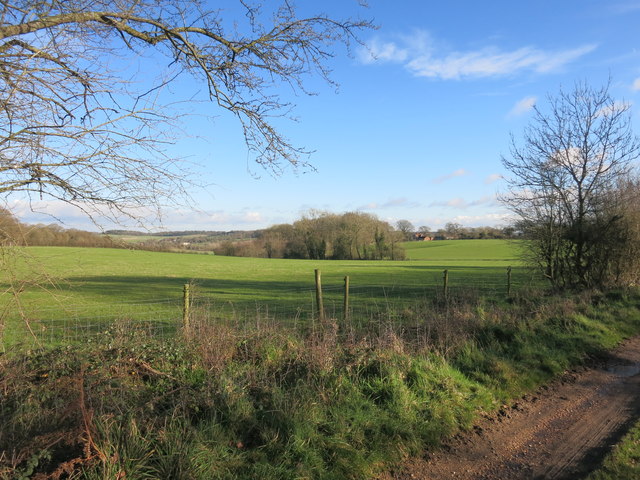
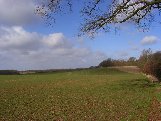
Nalderhill Copse is a picturesque woodland located in Berkshire, England. Covering an area of approximately 20 hectares, this enchanting forest is nestled within the rolling hills and verdant countryside of the county. The copse is situated a few miles outside of the village of Nalderhill, which gives it its name.

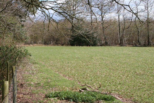
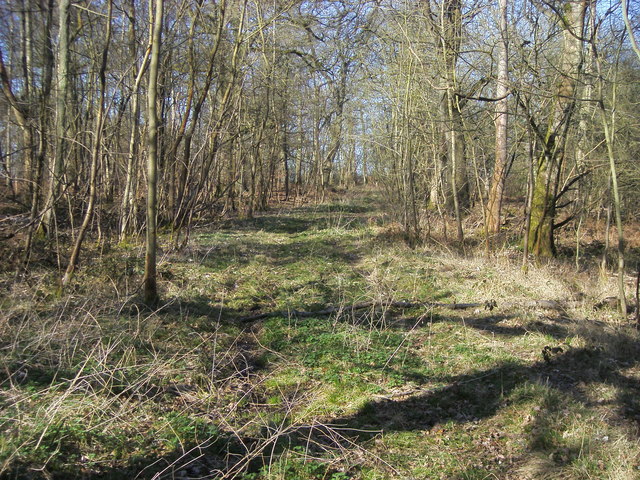
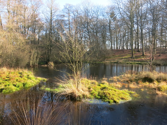
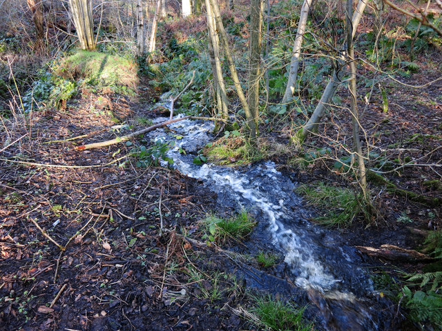
The woodland is predominantly composed of native deciduous trees, such as oak, beech, and birch, which create a rich tapestry of colors throughout the seasons. These trees form a dense canopy that filters sunlight, creating a cool and tranquil atmosphere within the copse. The forest floor is carpeted with a diverse array of wildflowers, ferns, and mosses, adding to its natural beauty.

Nalderhill Copse is a haven for wildlife, providing a habitat for numerous species. The woodland is home to a variety of birds, including woodpeckers, owls, and thrushes. Squirrels scurry amongst the branches, while rabbits and deer can occasionally be spotted grazing in the clearings. The copse also houses a diverse range of insects, from butterflies and dragonflies to beetles and spiders.

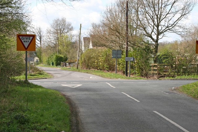
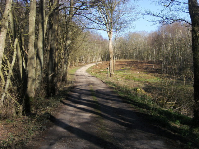
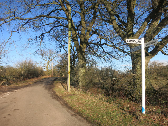
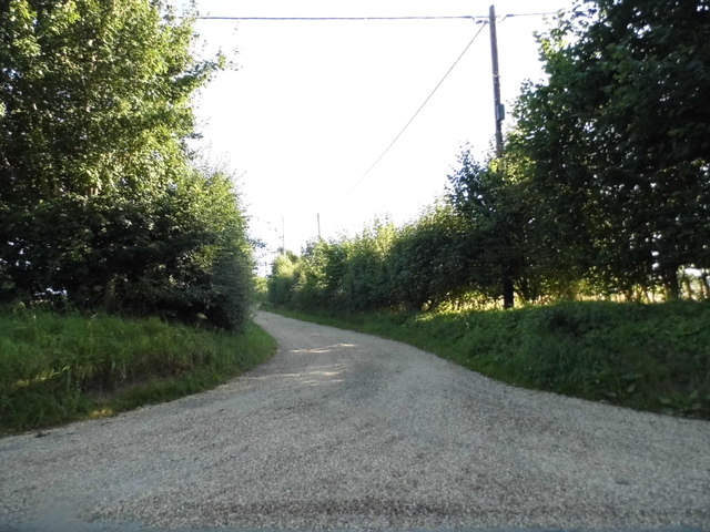
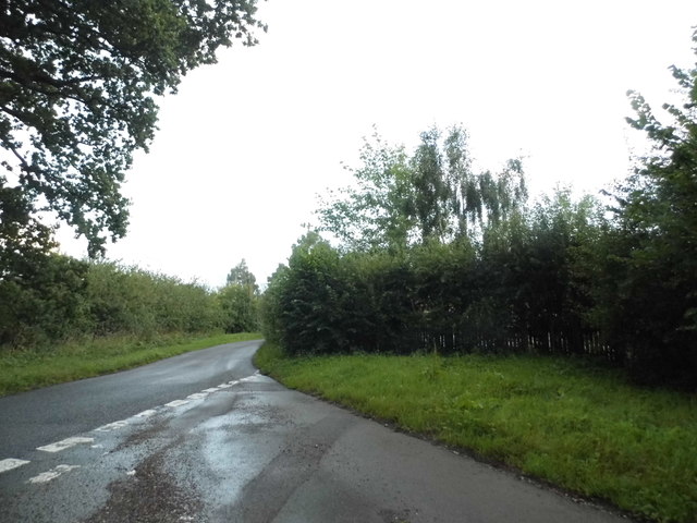
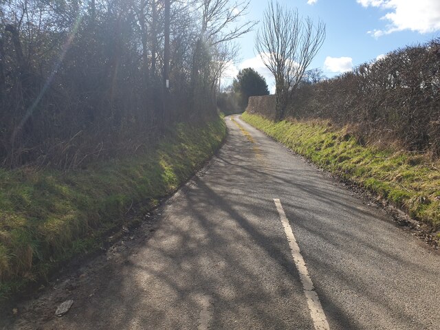
The woodland offers a network of well-maintained trails, allowing visitors to explore its serene surroundings. These paths wind through the forest, taking hikers on a journey through ancient trees, babbling brooks, and peaceful glades. The copse is a popular destination for nature enthusiasts, families, and dog walkers, who can enjoy the tranquility and natural beauty of the area.

Overall, Nalderhill Copse is a stunning woodland retreat in Berkshire, offering a glimpse into the rich biodiversity and natural wonders of the British countryside.

If you have any feedback on the listing, please let us know in the comments section below.

Nalderhill Copse Images

Images are sourced within 2km of 51.41861/-1.4027099 or Grid Reference SU4169. Thanks to Geograph Open Source API. All images are credited.

Hoe Benham, Berkshire Looking southwest towards the B4000 junction in the west of the square.
Hoe Benham, Berkshire
Looking southwest towards the B4000 junction in the west of the square.
Hoe Benham, Berkshire Paddock and woods beside the minor road in the southeast of the square.
Hoe Benham, Berkshire
Paddock and woods beside the minor road in the southeast of the square.
Path through Sole Plantation By Sole pond the path through Sole Plantation
Path through Sole Plantation
By Sole pond the path through Sole Plantation
Path through Sole Plantation Path through Sole Plantation heading for the B4000
Path through Sole Plantation
Path through Sole Plantation heading for the B4000
Red Berries at Coombesbury Farm Colourful winter fruit beside Coombesbury Lane.
Very neat along here. It looks like a private drive, but it's an ordinary road.
Red Berries at Coombesbury Farm
Colourful winter fruit beside Coombesbury Lane. Very neat along here. It looks like a private drive, but it's an ordinary road.
Lower Farm, Ownham Upper Farm is on the other side of the trees.
Lower Farm, Ownham
Upper Farm is on the other side of the trees.
Sole Common Pond Part of Sole Common nature reserve.
Sole Common Pond
Part of Sole Common nature reserve.
Stream in Sole Woods The overflow from Sole Common Pond runs down a steep valley through Sole Common nature reserve.
Stream in Sole Woods
The overflow from Sole Common Pond runs down a steep valley through Sole Common nature reserve.
No sign of Romans The map shows the course of a Roman Road going across this field between here and the clump of trees.
No sign of Romans
The map shows the course of a Roman Road going across this field between here and the clump of trees.
Very Pink Barriers I guess they show up, and that's a big part of the job.
Very Pink Barriers
I guess they show up, and that's a big part of the job.
Junction for Lambourn A lane near Hoe Benham.
Junction for Lambourn
A lane near Hoe Benham.
Track to Huntsgreen Farm, Hunt's Green
The B4000 heading for Newbury The B4000 between Lambourn and Newbury, which follows roughly the course of a Roman Road, can be quite busy but I did not have long to wait for a gap in the traffic. The turning to the right is for Hoe Benham and Halfway.
The B4000 heading for Newbury
The B4000 between Lambourn and Newbury, which follows roughly the course of a Roman Road, can be quite busy but I did not have long to wait for a gap in the traffic. The turning to the right is for Hoe Benham and Halfway.
Hedgerow in Hoe Benham
Junction on Hoe Benham Lane
Baydon Road, Hoe Benham
Crossroads on the B4000, Hoe Benham Looking towards High Street leading to Boxford
Crossroads on the B4000, Hoe Benham
Looking towards High Street leading to Boxford
Coomesbury Lane Looking up Coomesbury Lane from near to Lambourn Road.
Coomesbury Lane
Looking up Coomesbury Lane from near to Lambourn Road.
Show me another place!

Nalderhill Copse is located at Grid Ref: SU4169 (Lat: 51.41861, Lng: -1.4027099)

Unitary Authority: West Berkshire

Police Authority: Thames Valley

What 3 Words

///racing.cured.upstairs. Near Wickham, Berkshire

Related Wikis

Wickham Heath

Wickham Heath is a small hamlet in Berkshire, England, and part of the civil parish of Welford. The settlement lies on the B4000, approximately 4 miles...

Halfway, Berkshire

Halfway is a hamlet in the civil parish of Welford in the English county of Berkshire. It is located in the district of West Berkshire and the Newbury...

Hoe Benham

Hoe Benham is a hamlet in Berkshire, England, and part of the civil parish of Welford. The settlement lies near to the A4 and B4000 roads, and is located...

Ownham

Ownham is a hamlet in Berkshire, England, and part of the civil parish of Boxford (where according to the Grid Ref at the 2011 Census the majority of the...

Sole Common Pond

Sole Common Pond is a 3-hectare (7.4-acre) nature reserve south-west of Boxford in Berkshire in Berkshire. It is managed by the Berkshire, Buckinghamshire...

Dreweatt's Lock

Dreweatt's Lock is a lock on the Kennet and Avon Canal, between Kintbury and Newbury, Berkshire, England. The lock has a rise/fall of 5 ft 9 in (1.75 m...

Kennet Valley Alderwoods

Kennet Valley Alderwoods is a 57.3-hectare (142-acre) biological Site of Special Scientific Interest west of Newbury in Berkshire. It is a Special Area...

Elcot, Berkshire

Elcot is a hamlet in Berkshire, England, and part of the civil parish of Kintbury. It is the location of the four-star Elcot Park Hotel.The settlement...

Nearby Amenities

Located within 500m of 51.41861,-1.4027099
Power: pole
Source: Bing
Lat/Long: 51.4173627/-1.4050676
Power: pole
Source: Bing
Lat/Long: 51.4178896/-1.4055661
Power: pole
Source: Bing
Lat/Long: 51.418478/-1.4061362
Power: pole
Source: Bing
Lat/Long: 51.4190739/-1.4066561
Power: pole
Source: Bing
Lat/Long: 51.4197046/-1.4072207
Power: pole
Source: Bing
Lat/Long: 51.4203544/-1.4078698
Power: pole
Source: Bing
Lat/Long: 51.4210444/-1.4084921
Power: pole
Source: Bing
Lat/Long: 51.414821/-1.4008939
Power: pole
Source: Bing
Lat/Long: 51.4152911/-1.4016342
Power: pole
Source: Bing
Lat/Long: 51.4157648/-1.4023992
Power: pole
Source: Bing
Lat/Long: 51.4162289/-1.4031525
Power: pole
Source: Bing
Lat/Long: 51.4214358/-1.4048223
Power: pole
Source: Bing
Lat/Long: 51.4205262/-1.4059917
Power: pole
Source: Bing
Lat/Long: 51.4161672/-1.4082453
Power: pole
Source: Bing
Lat/Long: 51.4173615/-1.4083526
Power: pole
Source: Bing
Lat/Long: 51.4184722/-1.4077301
Power: pole
Lat/Long: 51.4224701/-1.4035946
Power: pole
Source: Bing
Lat/Long: 51.4171432/-1.4041358
Power: pole
Source: Bing
Lat/Long: 51.4169174/-1.4031457
The data included in this document is from www.openstreetmap.org. The data is made available under ODbL.

Have you been to Nalderhill Copse?

Leave your review of Nalderhill Copse below (or comments, questions and feedback).