Shire Brook Valley

Wood, Forest in Derbyshire

England

Shire Brook Valley

The New Anglers Formerly the Anglers Rest <a href="https://www.geograph.org.uk/photo/2971016">SK4086 : The Anglers Rest</a>.
The New Anglers Credit: David Lally

Shire Brook Valley is a beautiful woodland area located in Derbyshire, England. Covering an area of approximately 300 hectares, it offers a serene and picturesque setting for nature enthusiasts and outdoor enthusiasts alike.

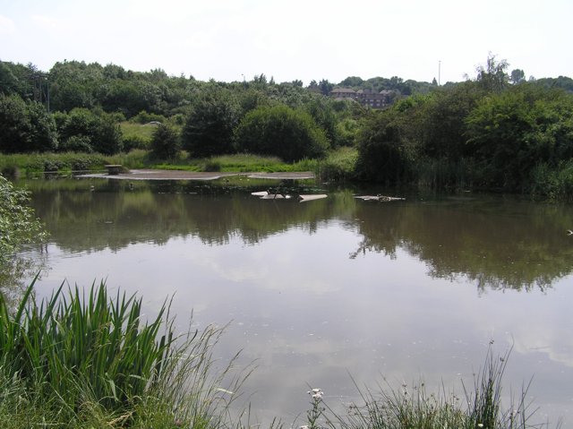
The valley is characterized by its dense, ancient woodlands, which are home to a diverse range of flora and fauna. The woodlands consist of a mixture of deciduous and coniferous trees, including oak, birch, beech, and pine. These trees provide a lush canopy, creating a peaceful and tranquil atmosphere within the valley.

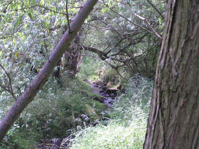
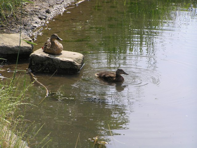
Shire Brook, a small stream that runs through the valley, adds to the charm of the area. The clear waters of the brook provide a habitat for various aquatic species, including brown trout and water voles. The brook also offers visitors the opportunity to observe a range of bird species, such as kingfishers and herons, that rely on the stream for their food source.

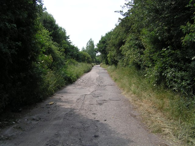
The valley is renowned for its network of well-maintained walking trails, which meander through the woodlands and offer stunning views of the surrounding countryside. These trails cater to all levels of fitness and provide opportunities for leisurely strolls as well as more challenging hikes.

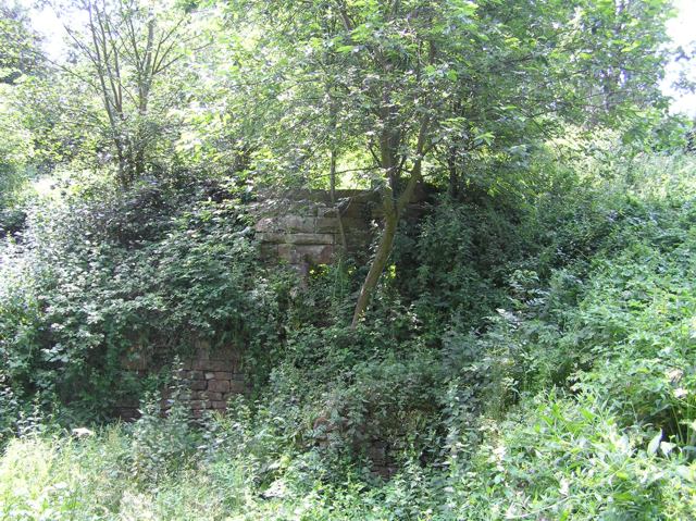
In addition to its natural beauty, Shire Brook Valley also boasts a rich cultural history. The area is dotted with remnants of past human activity, including ancient burial mounds and remnants of Roman settlements. These archaeological features add an intriguing dimension to the valley, attracting history enthusiasts and archaeology buffs.

Overall, Shire Brook Valley is a hidden gem in Derbyshire, offering visitors a chance to immerse themselves in nature, explore its rich history, and enjoy a peaceful escape from the hustle and bustle of everyday life.

If you have any feedback on the listing, please let us know in the comments section below.

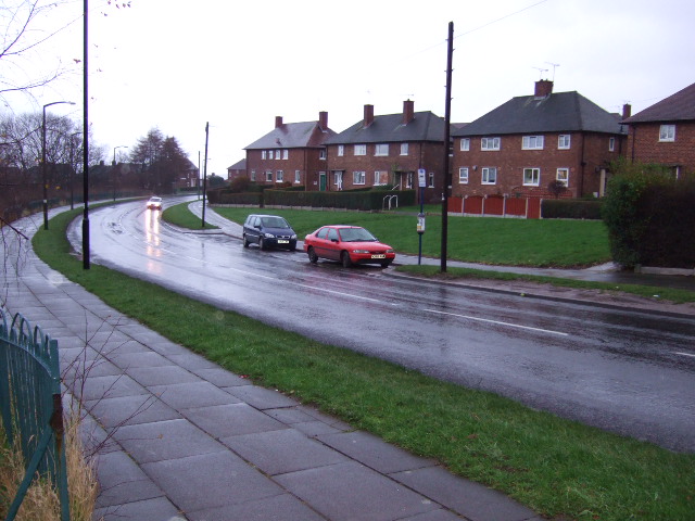
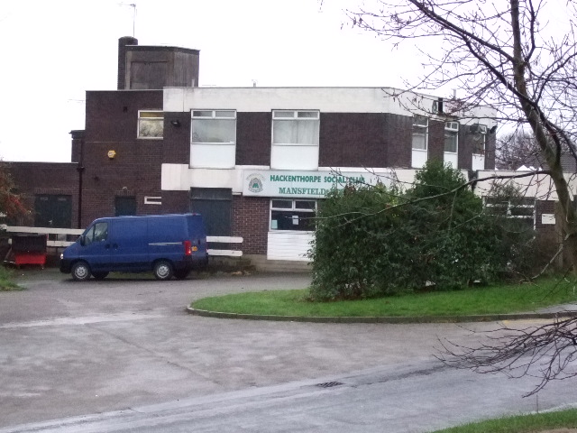
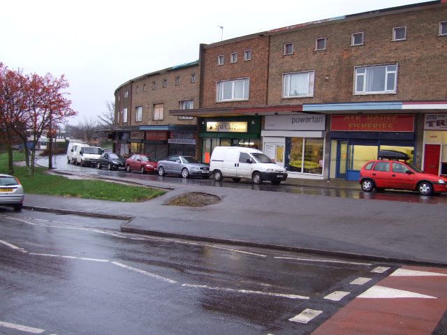
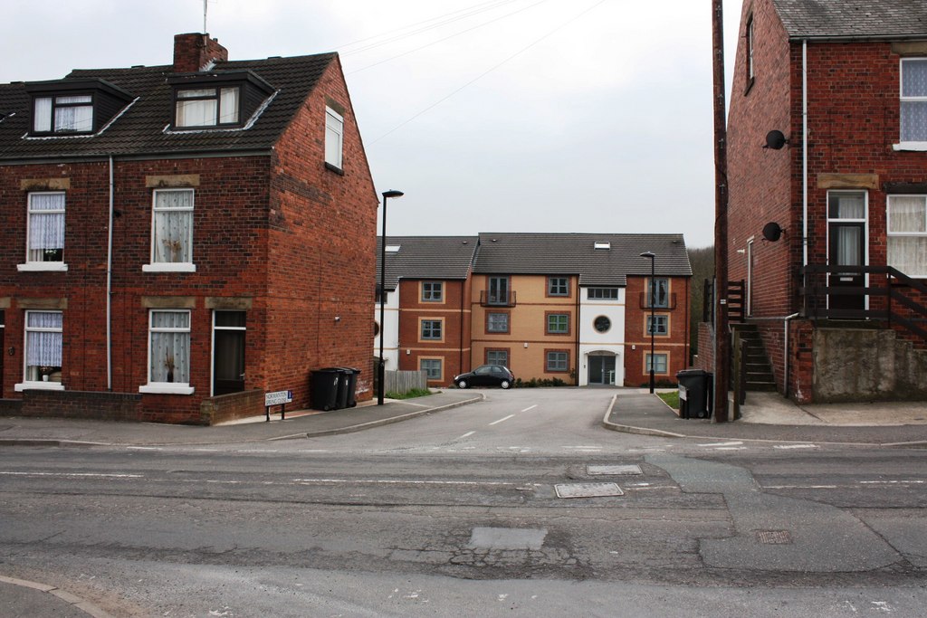
Shire Brook Valley Images

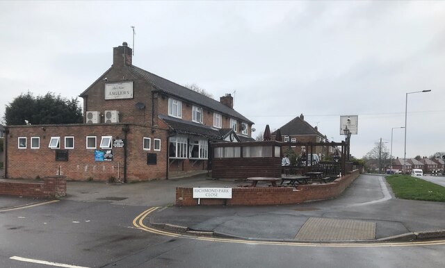
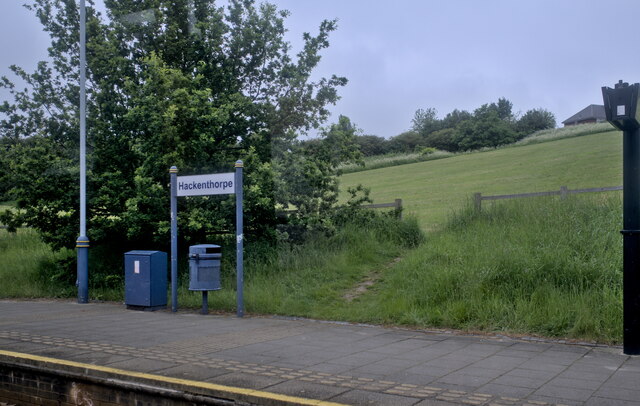
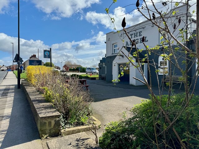
Images are sourced within 2km of 53.354609/-1.4025374 or Grid Reference SK3984. Thanks to Geograph Open Source API. All images are credited.

The New Anglers Formerly the Anglers Rest <a href="https://www.geograph.org.uk/photo/2971016">SK4086 : The Anglers Rest</a>.
The New Anglers
Formerly the Anglers Rest SK4086 : The Anglers Rest.
The sign of The New Anglers Not looking that new! Also <a href="https://www.geograph.org.uk/photo/7448947">SK4086 : The New Anglers</a>
The sign of The New Anglers
Not looking that new! Also SK4086 : The New Anglers
Hackenthorpe tram stop
Sheffield Supertram no.10 on Birley Lane – 1996 For a short distance the tram lines use this very unusual combination of one track in the roadway and the other on its own reserved track.
Sheffield Supertram no.10 on Birley Lane – 1996
For a short distance the tram lines use this very unusual combination of one track in the roadway and the other on its own reserved track.
The Angel
The Angel
The sign of The Angel See <a href="https://www.geograph.org.uk/photo/7732074">SK4184 : The Angel</a>.

I prefer the previous sign captured by Yorkshire Pudding in 2010 <a href="https://www.geograph.org.uk/photo/2153346">SK4184 : "The Angel" pub sign at Woodhouse</a>.
The sign of The Angel
See SK4184 : The Angel. I prefer the previous sign captured by Yorkshire Pudding in 2010 SK4184 : "The Angel" pub sign at Woodhouse.
Carr Forge Dam In the Shirebrook Valley below Woodhouse were several waterwheels, possibly dating back to Tudor times, and part of Sheffield's early industrial heritage. This shows Carr Forge Dam with the water levels lower than usual because of the prolonged dry spell. The Shire Brook was in times past the border between the ancient kingdoms of Mercia and Northumbria and more lately between Yorkshire and Derbyshire, hence the name Shire Brook.
Carr Forge Dam
In the Shirebrook Valley below Woodhouse were several waterwheels, possibly dating back to Tudor times, and part of Sheffield's early industrial heritage. This shows Carr Forge Dam with the water levels lower than usual because of the prolonged dry spell. The Shire Brook was in times past the border between the ancient kingdoms of Mercia and Northumbria and more lately between Yorkshire and Derbyshire, hence the name Shire Brook.
Shire Brook In the Shirebrook Valley, the brook itself fed several waterwheels in times past including <a href="https://www.geograph.org.uk/photo/194486">SK4184 : Carr Forge Dam</a>.
Shire Brook
In the Shirebrook Valley, the brook itself fed several waterwheels in times past including SK4184 : Carr Forge Dam.
Stone Lane, Woodhouse This road once served the sewage works and Badger Tools. Both have now gone, but the sewage works buildings have been converted into buildings for the Shirebrook Valley Nature Reserve. The end of the road (behind me) seems to be a place where old cars go to die, or be burned out by the local yoofs. The speed ramps are probably there to stop the yoofs damaging themselves too much when the cars are crashed into the gates at the end.
Stone Lane, Woodhouse
This road once served the sewage works and Badger Tools. Both have now gone, but the sewage works buildings have been converted into buildings for the Shirebrook Valley Nature Reserve. The end of the road (behind me) seems to be a place where old cars go to die, or be burned out by the local yoofs. The speed ramps are probably there to stop the yoofs damaging themselves too much when the cars are crashed into the gates at the end.
Ducks on Carr Forge Dam Since a youngster nearly killed himself when his fishing pole touched overhead live wires a few years ago, fishing on the dam has been banned by order of Sheffield Council, so the ducks have free rein. Here, mummy-duck sits on the stone keeping an eye on youngster. As I cycled past, another five of this year's brood appeared out from under the shelter of the bank.
Ducks on Carr Forge Dam
Since a youngster nearly killed himself when his fishing pole touched overhead live wires a few years ago, fishing on the dam has been banned by order of Sheffield Council, so the ducks have free rein. Here, mummy-duck sits on the stone keeping an eye on youngster. As I cycled past, another five of this year's brood appeared out from under the shelter of the bank.
Houses on Scowerdons estate Can't really say much more. This is the bottom end of Hackenthorpe, the opposite side of the Shirebrook Valley to Woodhouse and Beighton.
Houses on Scowerdons estate
Can't really say much more. This is the bottom end of Hackenthorpe, the opposite side of the Shirebrook Valley to Woodhouse and Beighton.
Remains of Nether Wheel, Woodhouse Along with <a href="https://www.geograph.org.uk/photo/194486">SK4184 : Carr Forge Dam</a>, the Nether Wheel was yet another of the waterwheels along the Shirebrook Valley. This one still has visible remains of the buildings, buried in woodland although accessible by waymarked footpaths. This wheel probably drove grinding stones or similar for the manufacture of agricultural tools.
Remains of Nether Wheel, Woodhouse
Along with SK4184 : Carr Forge Dam, the Nether Wheel was yet another of the waterwheels along the Shirebrook Valley. This one still has visible remains of the buildings, buried in woodland although accessible by waymarked footpaths. This wheel probably drove grinding stones or similar for the manufacture of agricultural tools.
Silkstone Road, Hackenthorpe One of the many newer roads in the area, certainly not appearing on the 1940's map.
Silkstone Road, Hackenthorpe
One of the many newer roads in the area, certainly not appearing on the 1940's map.
Communications mast, Birley It's a communications mast. It's accessed from a short lane called Dent Lane off Birley Lane. The latter is part of the tram route from Halfway into Sheffield.
Communications mast, Birley
It's a communications mast. It's accessed from a short lane called Dent Lane off Birley Lane. The latter is part of the tram route from Halfway into Sheffield.
Tram crossing / road junction, Birley Lane To the left is Birley Lane. To the right is Sheffield Road. Straight on up is Birley Moor Road and down behind me is Moor Valley. The tram route to the right heads towards Crystal Peaks and the ultimate terminus at Halfway. To the left (west) it heads up past Birley Golf Course, on to the Manor Top and down into Sheffield.
Tram crossing / road junction, Birley Lane
To the left is Birley Lane. To the right is Sheffield Road. Straight on up is Birley Moor Road and down behind me is Moor Valley. The tram route to the right heads towards Crystal Peaks and the ultimate terminus at Halfway. To the left (west) it heads up past Birley Golf Course, on to the Manor Top and down into Sheffield.
Hackenthorpe Council Housing Estate Council houses in the rain.
Hackenthorpe Council Housing Estate
Council houses in the rain.
Hackenthorpe Social Club.
Shops at Hackenthorpe. The shopping precinct.
Shops at Hackenthorpe.
The shopping precinct.
Show me another place!

Shire Brook Valley is located at Grid Ref: SK3984 (Lat: 53.354609, Lng: -1.4025374)

Unitary Authority: Sheffield

Police Authority: South Yorkshire

What 3 Words

///meal.broom.latter. Near Orgreave, South Yorkshire

Related Wikis

Normanton Spring

Normanton Spring (according to Ordnance Survey maps), also called Normanton Springs, is a suburb and former hamlet located 4 miles east of Sheffield's...

Frecheville

Frecheville ( FRESH-ville) is a suburb five miles (8.0 km) south-east of Sheffield’s city centre. The estate was built in the 1930s when the area was...

Frecheville Comprehensive

Frecheville Comprehensive School was a secondary school located in Frecheville, South Yorkshire, England. When built, the school was in Derbyshire, but...

St Catherine of Siena, Richmond

St Catherine of Siena is an Anglican church in the Richmond district of Sheffield in England. == History of the parish == Historically, Richmond was a...

Nearby Amenities

Located within 500m of 53.354609,-1.4025374
Barrier: hedge
Lat/Long: 53.3574392/-1.4032162
Bus Stop
Birley Moor Road/Hopefield Avenue
Bus: yes
Naptan AtcoCode: 370022324
Naptan Bearing: SE
Naptan CommonName: Birley Moor Road/Hopefield Avenue
Naptan Indicator: 22324
Naptan Landmark: 22324
Naptan PlusbusZoneRef: ROTHCEN
Naptan Street: Birley Moor Road
Naptan Verified: no
Public Transport: platform
Source: naptan_import
Lat/Long: 53.3509899/-1.4034968
Bus Stop
Birley Moor Road/Hopefield Avenue
Bench: yes
Bin: yes
Bus: yes
Lit: yes
Naptan AtcoCode: 370022325
Naptan Bearing: NW
Naptan CommonName: Birley Moor Road/Hopefield Avenue
Naptan Indicator: 22325
Naptan Landmark: Evangelical Church
Naptan PlusbusZoneRef: ROTHCEN
Naptan Street: Birley Moor Road
Naptan Verified: no
Public Transport: platform
Shelter: yes
Source: naptan_import
Tactile Paving: yes
Lat/Long: 53.351182/-1.4041702
Bus Stop
Mansfield Road/Wadsworth Road
Bus: yes
Naptan AtcoCode: 370022626
Naptan Bearing: SE
Naptan CommonName: Mansfield Road/Wadsworth Road
Naptan Indicator: 22626
Naptan Landmark: Noahs Ark
Naptan PlusbusZoneRef: ROTHCEN
Naptan Street: Mansfield Road
Naptan Verified: no
Public Transport: platform
Source: naptan_import
Lat/Long: 53.3546497/-1.40917
Bus Stop
Mansfield Road/Wadsworth Road
Bus: yes
Naptan AtcoCode: 370022629
Naptan Bearing: NW
Naptan CommonName: Mansfield Road/Wadsworth Road
Naptan Indicator: 22629
Naptan Landmark: Wadsworth Road
Naptan PlusbusZoneRef: ROTHCEN
Naptan Street: Mansfield Road
Naptan Verified: no
Public Transport: platform
Shelter: yes
Source: naptan_import
Lat/Long: 53.3543885/-1.4090685
Bus Stop
Normanton Hill/Richmond Gate
Alt Name: Normanton Hill/Richmond Gate
Bus: yes
Naptan AltCommonName: Normanton Hill/Richmond Gate
Naptan AtcoCode: 370022635
Naptan Bearing: NW
Naptan CommonName: Normanton Hill/Richmond Gate
Naptan Indicator: 22635
Naptan Landmark: 22635
Naptan PlusbusZoneRef: ROTHCEN
Naptan Street: Normanton Hill
Naptan Verified: no
Public Transport: platform
Source: naptan_import
Lat/Long: 53.357555/-1.4041264
Bus Stop
Normanton Hill/Richmond Park
Bus: yes
Naptan AtcoCode: 370022636
Naptan Bearing: SE
Naptan CommonName: Normanton Hill/Richmond Park
Naptan Indicator: 22636
Naptan Landmark: Entrance to Richmond Park
Naptan PlusbusZoneRef: ROTHCEN
Naptan Street: Normanton Hill
Naptan Verified: no
Public Transport: platform
Source: naptan_import
Lat/Long: 53.3574772/-1.4029404
Turning Circle
Source: Bing
Lat/Long: 53.355367/-1.4046267
Turning Circle
Source: Bing
Lat/Long: 53.3509613/-1.4022005
Turning Circle
Source: Bing
Lat/Long: 53.3533916/-1.4036682
Turning Circle
Source: Bing
Lat/Long: 53.357086/-1.4064166
Turning Circle
Lat/Long: 53.3562914/-1.4043073
Turning Circle
Lat/Long: 53.3565834/-1.4052749
Turning Circle
Source: Bing
Lat/Long: 53.3545234/-1.4095357
Turning Circle
Source: Bing
Lat/Long: 53.3561355/-1.4093453
Turning Circle
Source: Bing
Lat/Long: 53.3563167/-1.4088091
Turning Circle
Source: Bing
Lat/Long: 53.3549812/-1.4092621
Turning Circle
Source: Bing
Lat/Long: 53.3548612/-1.4049652
Turning Circle
Source: Bing
Lat/Long: 53.3558377/-1.4070735
Turning Circle
Source: Bing
Lat/Long: 53.3552086/-1.4042196
Crossing
Button Operated: yes
Crossing: traffic_signals
Crossing Island: no
Tactile Paving: yes
Lat/Long: 53.3541731/-1.408552
Turning Circle
Source: Bing
Lat/Long: 53.3534704/-1.4003615
Post Box
Collection Times: Mo-Fr 09:00; Sa 07:00
Post Box Type: pillar
Ref: S12 666
Royal Cypher: EVIIIR
Royal Cypher Wikidata: Q33102195
Lat/Long: 53.352608/-1.4013345
Climbing Boulder: yes
Climbing Rock: artificial (cement)
Sport: climbing
Lat/Long: 53.3587229/-1.4050295
Post Box
Collection Times: Mo-Fr 09:00; Sa 07:00
Post Box Type: pillar
Ref: S12 801D
Royal Cypher: EIIR
Royal Cypher Wikidata: Q33102113
Lat/Long: 53.3520898/-1.3974033
Barrier: kissing_gate
Lat/Long: 53.3551138/-1.3951513
Barrier: kissing_gate
Lat/Long: 53.3549953/-1.396813
Bench
Backrest: yes
Lat/Long: 53.3543399/-1.3970779
Bench
Backrest: yes
Lat/Long: 53.3577106/-1.4017232
Traffic Signals
Crossing: no
Traffic Signals Direction: backward
Lat/Long: 53.3541435/-1.4085017
Traffic Signals
Crossing: no
Traffic Signals Direction: forward
Lat/Long: 53.3541972/-1.4085909
Grit Bin
Operator: Sheffield City Council
Operator Type: government
Operator Wikidata: Q7492609
Seasonal: no
Lat/Long: 53.3524033/-1.3980459
Grit Bin
Operator: Sheffield City Council
Operator Type: government
Operator Wikidata: Q7492609
Seasonal: no
Lat/Long: 53.3513852/-1.4029427
Grit Bin
Operator: Sheffield City Council
Operator Type: government
Operator Wikidata: Q7492609
Seasonal: no
Lat/Long: 53.3531541/-1.4025724
Grit Bin
Operator: Sheffield City Council
Operator Type: government
Operator Wikidata: Q7492609
Seasonal: no
Lat/Long: 53.3570899/-1.40414
Grit Bin
Operator: Sheffield City Council
Operator Type: government
Operator Wikidata: Q7492609
Seasonal: no
Lat/Long: 53.3525159/-1.4079897
Grit Bin
Operator: Sheffield City Council
Operator Type: government
Operator Wikidata: Q7492609
Seasonal: no
Lat/Long: 53.3521835/-1.402616
Grit Bin
Operator: Sheffield City Council
Operator Type: government
Operator Wikidata: Q7492609
Seasonal: no
Lat/Long: 53.3524246/-1.4022821
Grit Bin
Operator: Sheffield City Council
Operator Type: government
Operator Wikidata: Q7492609
Seasonal: no
Lat/Long: 53.3513652/-1.4061428
Grit Bin
Operator: Sheffield City Council
Operator Type: government
Operator Wikidata: Q7492609
Seasonal: no
Lat/Long: 53.3534974/-1.3975498
Grit Bin
Operator: Sheffield City Council
Operator Type: government
Operator Wikidata: Q7492609
Seasonal: no
Lat/Long: 53.3537645/-1.4006108
Grit Bin
Operator: Sheffield City Council
Operator Type: government
Operator Wikidata: Q7492609
Seasonal: no
Lat/Long: 53.3532082/-1.4080251
Grit Bin
Operator: Sheffield City Council
Operator Type: government
Operator Wikidata: Q7492609
Seasonal: no
Lat/Long: 53.3555379/-1.3958082
The data included in this document is from www.openstreetmap.org. The data is made available under ODbL.

Have you been to Shire Brook Valley?

Leave your review of Shire Brook Valley below (or comments, questions and feedback).