Abbott's Rough Plantation

Wood, Forest in Derbyshire Amber Valley

England

Abbott's Rough Plantation

Bluebells in the woods Right next to the busy A609, the woodland floor is carpeted with bluebells.
Bluebells in the woods Credit: Ian Calderwood

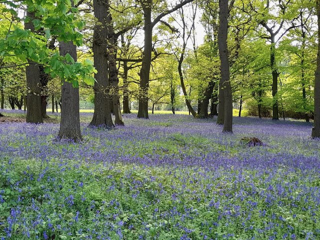
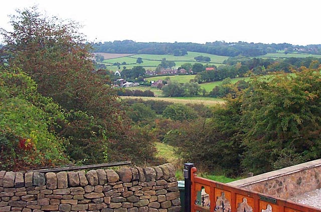
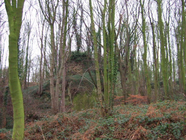
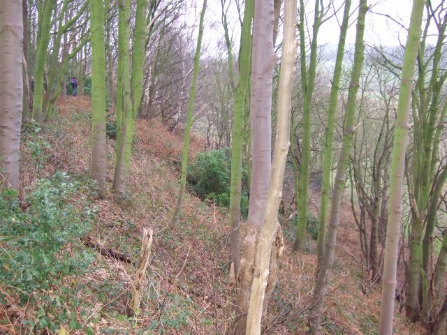
Abbott's Rough Plantation is a picturesque woodland area located in Derbyshire, England. Covering an extensive area, this plantation is known for its rich biodiversity and serene atmosphere. The woodland is primarily composed of various species of trees, including oak, beech, birch, and pine, which create a dense canopy that provides shade and shelter for a diverse range of flora and fauna.

The plantation is a popular destination for nature enthusiasts and hikers due to its well-maintained walking trails that wind through the dense forest. These trails offer visitors the opportunity to immerse themselves in the beauty of nature while exploring the woodland's hidden treasures.

One of the standout features of Abbott's Rough Plantation is its vibrant wildlife. The woodland is home to a variety of animals, including foxes, deer, squirrels, and numerous bird species. Birdwatchers can observe and listen to the melodious songs of woodpeckers, thrushes, and finches as they explore the plantation.

The plantation also boasts a diverse range of plant species, including wildflowers, ferns, and mosses, which add splashes of color and texture to the forest floor. During the spring season, the woodland comes alive with a carpet of bluebells, creating a breathtaking sight for visitors.

Abbott's Rough Plantation offers a tranquil escape from the hustle and bustle of everyday life. Whether it's a leisurely stroll, birdwatching, or simply enjoying the serenity of nature, this woodland sanctuary provides an ideal setting for relaxation and exploration.

If you have any feedback on the listing, please let us know in the comments section below.

Abbott's Rough Plantation Images

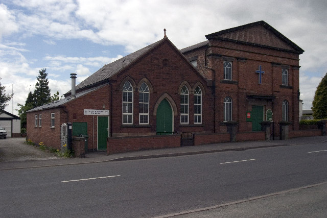
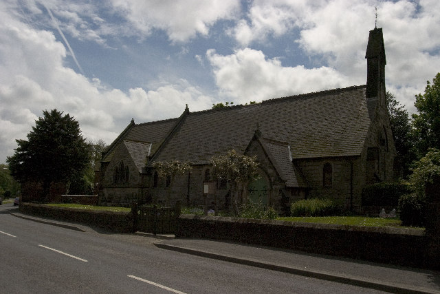
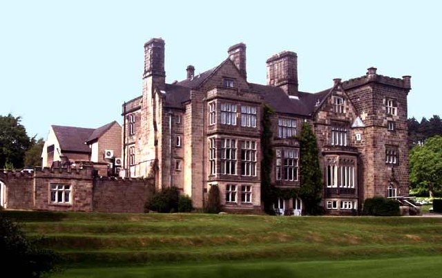
Images are sourced within 2km of 52.985054/-1.4230038 or Grid Reference SK3843. Thanks to Geograph Open Source API. All images are credited.

Bluebells in the woods Right next to the busy A609, the woodland floor is carpeted with bluebells.
Bluebells in the woods
Right next to the busy A609, the woodland floor is carpeted with bluebells.
Sitwell Arms Sitwell Arms Public House, Horsley Woodhouse/Woodside, Derbyshire. SK397441
Sitwell Arms
Sitwell Arms Public House, Horsley Woodhouse/Woodside, Derbyshire. SK397441
St Clements Church, Horsley St Clement's Church, Horsley, Derbyshire. SK375445
St Clements Church, Horsley
St Clement's Church, Horsley, Derbyshire. SK375445
Coxbench Station and level crossing Coxbench Station (now residential property) and level crossing on road junction requiring 3 roads to be closed at the same time. Line now disused.
Coxbench Station and level crossing
Coxbench Station (now residential property) and level crossing on road junction requiring 3 roads to be closed at the same time. Line now disused.
B6179 junction with road to Holbrook, A38 flyover Road Junction of B6179 (running left to right) with road from Coxbench (other side of A38 flyover) to Holbrook Station (now residential property, and out of shot behind photographer).
B6179 junction with road to Holbrook, A38 flyover
Road Junction of B6179 (running left to right) with road from Coxbench (other side of A38 flyover) to Holbrook Station (now residential property, and out of shot behind photographer).
Drum Hill Reservoir Drum Hill Reservoir (SK373420) taken from Morley Lane.
Drum Hill Reservoir
Drum Hill Reservoir (SK373420) taken from Morley Lane.
Morley Smithy Morley Smithy, road junction with Brick Kiln Lane and the A608 Derby to Heanor Road. The Three Horse Shoes public House is also plainly visible.
Morley Smithy
Morley Smithy, road junction with Brick Kiln Lane and the A608 Derby to Heanor Road. The Three Horse Shoes public House is also plainly visible.
Coach and Horses, Horsley Also road junction of Horsley Road (Front to right of picture) and Smalley Mill Road (dropping away to the left). Horsley, Derbyshire.
Coach and Horses, Horsley
Also road junction of Horsley Road (Front to right of picture) and Smalley Mill Road (dropping away to the left). Horsley, Derbyshire.
Horsley Woodhouse Post Office Horsley Woodhouse Post Office, A609, Horsley Woodhouse, Derbyshire, opposite the Central Methodist Church.
Horsley Woodhouse Post Office
Horsley Woodhouse Post Office, A609, Horsley Woodhouse, Derbyshire, opposite the Central Methodist Church.
Horsley Woodhouse Central Methodist Church Horsley Woodhouse Central Methodist Church, opposite Post Office, A609, Horsley Woodhouse, Derbyshire.
Horsley Woodhouse Central Methodist Church
Horsley Woodhouse Central Methodist Church, opposite Post Office, A609, Horsley Woodhouse, Derbyshire.
Horsley Woodhouse Church Horsley Woodhouse Church, A609, Horsley Woodhouse, Derbyshire SK396448
Horsley Woodhouse Church
Horsley Woodhouse Church, A609, Horsley Woodhouse, Derbyshire SK396448
Cloves Hill, Morley This view from near the top of Cloves Hill is towards Smalley.
Cloves Hill, Morley
This view from near the top of Cloves Hill is towards Smalley.
Breadsall Priory Breadsall Priory is now a hotel and leisure complex. The most famous resident of Breadsall Priory was the poet, physician and scientist Erasmus Darwin, who lived there for a short time until his death in 1802. Grandfather of Charles Darwin, Erasmus is one of the most remarkable and internationally important figures of the 18th century and is buried in Breadsall church.
<span class="nowrap"><a title="http://www.picturesofderby.co.uk/area_breadsall.htm" rel="nofollow ugc noopener" href="http://www.picturesofderby.co.uk/area_breadsall.htm">Link</a><img style="margin-left:2px;" alt="External link" title="External link - shift click to open in new window" src="https://s1.geograph.org.uk/img/external.png" width="10" height="10"/></span>
Breadsall Priory
Breadsall Priory is now a hotel and leisure complex. The most famous resident of Breadsall Priory was the poet, physician and scientist Erasmus Darwin, who lived there for a short time until his death in 1802. Grandfather of Charles Darwin, Erasmus is one of the most remarkable and internationally important figures of the 18th century and is buried in Breadsall church. LinkExternal link
Brackely Gate Road Junction
Horsley Lodge Golf Club Horsley Lodge golf centre and restaurant - yet another example of a farm and farmland being converted to leisure usage.
Horsley Lodge Golf Club
Horsley Lodge golf centre and restaurant - yet another example of a farm and farmland being converted to leisure usage.
Woodside Road Junction
Overgrown Remains of Horsley Castle Very little remains of the ruins of Horsley Castle, it is also extremely overgrown, taken on the Boxing Day walk led by the Shipley Park Ranger Service.
Fact or fiction; three items of discussion about the castle were, the stonework had been taken to construct Kedleston Hall, there is an underground tunnel back to Horsley and finally Dick Turpin was born here!
Overgrown Remains of Horsley Castle
Very little remains of the ruins of Horsley Castle, it is also extremely overgrown, taken on the Boxing Day walk led by the Shipley Park Ranger Service. Fact or fiction; three items of discussion about the castle were, the stonework had been taken to construct Kedleston Hall, there is an underground tunnel back to Horsley and finally Dick Turpin was born here!
Horsley Castle Rampart. The steep embankment on the south side of Horsley Castle,the ranger leading the walk can just be seen.
Horsley Castle Rampart.
The steep embankment on the south side of Horsley Castle,the ranger leading the walk can just be seen.
Show me another place!

Abbott's Rough Plantation is located at Grid Ref: SK3843 (Lat: 52.985054, Lng: -1.4230038)

Administrative County: Derbyshire

District: Amber Valley

Police Authority: Derbyshire

What 3 Words

///decreased.even.melt. Near Kilburn, Derbyshire

Related Wikis

Nearby Amenities

Located within 500m of 52.985054,-1.4230038
Barrier: cycle_barrier
Lat/Long: 52.9808162/-1.4248199
Barrier: stile
Ele: 139.0000000
Steps: 3
Stile: wall
Lat/Long: 52.981004/-1.4248351
Ele: 93
Lat/Long: 52.9851391/-1.4174921
Barrier: stile
Ele: 136
Stile: squeezer
Lat/Long: 52.9817754/-1.423083
Ele: 134
Lat/Long: 52.9827858/-1.4203646
Barrier: stile
Ele: 92.0000000
Steps: 2
Stile: stepover
Lat/Long: 52.9845521/-1.4161926
Ele: 137
Lat/Long: 52.9806819/-1.4212807
Barrier: stile
Ele: 138.0000000
Stile: squeezer
Lat/Long: 52.9810359/-1.4213102
The data included in this document is from www.openstreetmap.org. The data is made available under ODbL.

Have you been to Abbott's Rough Plantation?

Leave your review of Abbott's Rough Plantation below (or comments, questions and feedback).