Keepers Covert

Wood, Forest in Derbyshire Amber Valley

England

Keepers Covert

Sitwell Arms Sitwell Arms Public House, Horsley Woodhouse/Woodside, Derbyshire. SK397441
Sitwell Arms Credit: Rob Bradford

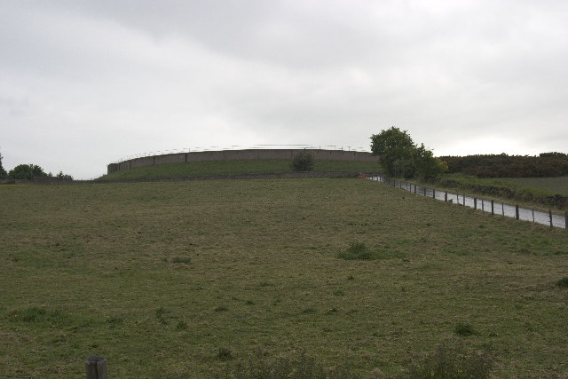
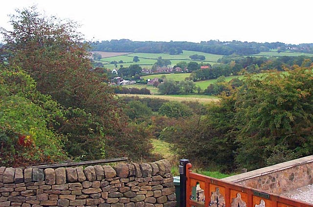
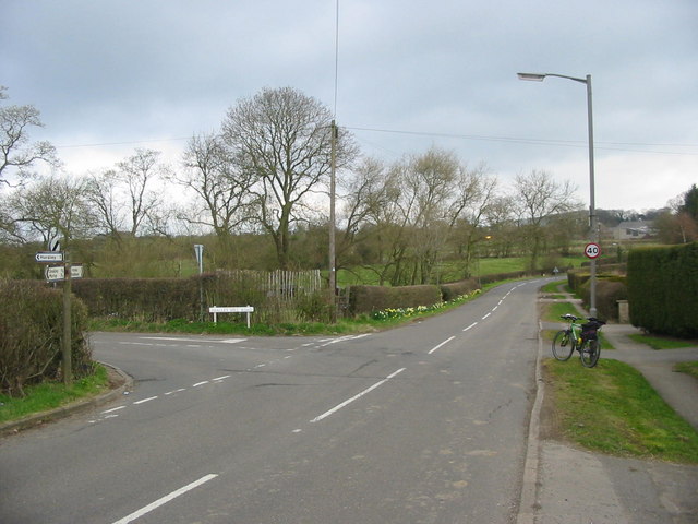
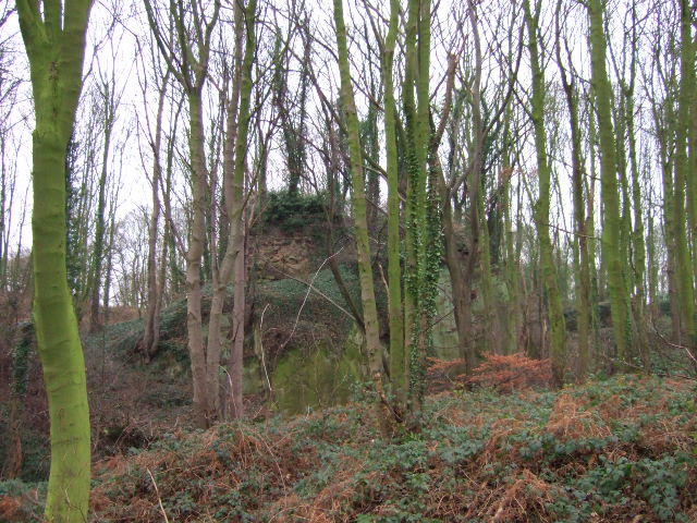
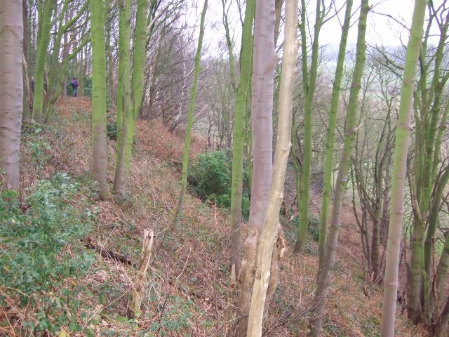
Keepers Covert is a woodland area located in Derbyshire, England. Situated within the larger region of the Peak District National Park, this forested area covers approximately 200 acres of land. The covert is known for its diverse range of tree species, including oak, birch, beech, and pine, which create a dense and enchanting woodland environment.

The forest is home to an array of wildlife, making it a popular spot for nature enthusiasts and wildlife photographers. Visitors have the opportunity to spot various species of birds, such as woodpeckers, owls, and buzzards, as well as mammals like deer, foxes, and badgers. The dense undergrowth provides a habitat for smaller creatures, including squirrels, rabbits, and hedgehogs.

Keepers Covert offers several walking trails that allow visitors to explore the forest at their own pace. These well-maintained paths meander through the woodland, providing opportunities for peaceful walks and a chance to immerse oneself in the natural beauty of the area. The forest also features picnic areas, allowing visitors to relax and enjoy a meal amidst the serene surroundings.

Additionally, Keepers Covert plays a vital role in conservation efforts. The forest is managed by the local authorities and conservation organizations to ensure the preservation of its natural features and protect the diverse ecosystem it sustains.

Overall, Keepers Covert in Derbyshire offers a tranquil and picturesque woodland experience for nature lovers, providing a sanctuary for wildlife and an escape from the hustle and bustle of everyday life.

If you have any feedback on the listing, please let us know in the comments section below.

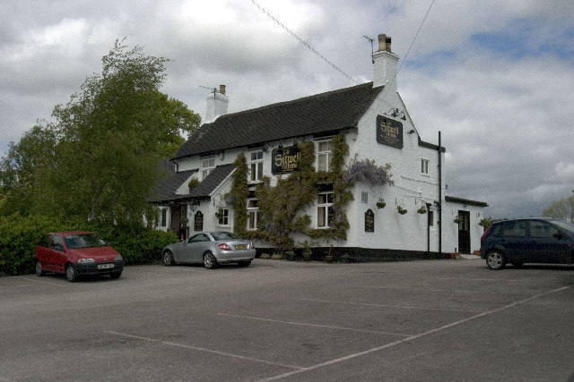
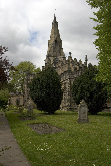
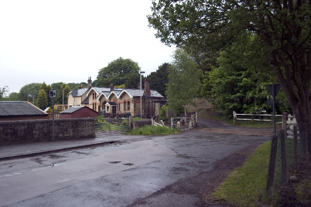
Keepers Covert Images

Images are sourced within 2km of 52.985207/-1.4324753 or Grid Reference SK3843. Thanks to Geograph Open Source API. All images are credited.

Sitwell Arms Sitwell Arms Public House, Horsley Woodhouse/Woodside, Derbyshire. SK397441
Sitwell Arms
Sitwell Arms Public House, Horsley Woodhouse/Woodside, Derbyshire. SK397441
St Clements Church, Horsley St Clement's Church, Horsley, Derbyshire. SK375445
St Clements Church, Horsley
St Clement's Church, Horsley, Derbyshire. SK375445
Coxbench Station and level crossing Coxbench Station (now residential property) and level crossing on road junction requiring 3 roads to be closed at the same time. Line now disused.
Coxbench Station and level crossing
Coxbench Station (now residential property) and level crossing on road junction requiring 3 roads to be closed at the same time. Line now disused.
B6179 junction with road to Holbrook, A38 flyover Road Junction of B6179 (running left to right) with road from Coxbench (other side of A38 flyover) to Holbrook Station (now residential property, and out of shot behind photographer).
B6179 junction with road to Holbrook, A38 flyover
Road Junction of B6179 (running left to right) with road from Coxbench (other side of A38 flyover) to Holbrook Station (now residential property, and out of shot behind photographer).
Drum Hill Reservoir Drum Hill Reservoir (SK373420) taken from Morley Lane.
Drum Hill Reservoir
Drum Hill Reservoir (SK373420) taken from Morley Lane.
Coach and Horses, Horsley Also road junction of Horsley Road (Front to right of picture) and Smalley Mill Road (dropping away to the left). Horsley, Derbyshire.
Coach and Horses, Horsley
Also road junction of Horsley Road (Front to right of picture) and Smalley Mill Road (dropping away to the left). Horsley, Derbyshire.
Horsley Woodhouse Post Office Horsley Woodhouse Post Office, A609, Horsley Woodhouse, Derbyshire, opposite the Central Methodist Church.
Horsley Woodhouse Post Office
Horsley Woodhouse Post Office, A609, Horsley Woodhouse, Derbyshire, opposite the Central Methodist Church.
Horsley Woodhouse Central Methodist Church Horsley Woodhouse Central Methodist Church, opposite Post Office, A609, Horsley Woodhouse, Derbyshire.
Horsley Woodhouse Central Methodist Church
Horsley Woodhouse Central Methodist Church, opposite Post Office, A609, Horsley Woodhouse, Derbyshire.
Cloves Hill, Morley This view from near the top of Cloves Hill is towards Smalley.
Cloves Hill, Morley
This view from near the top of Cloves Hill is towards Smalley.
Breadsall Priory Breadsall Priory is now a hotel and leisure complex. The most famous resident of Breadsall Priory was the poet, physician and scientist Erasmus Darwin, who lived there for a short time until his death in 1802. Grandfather of Charles Darwin, Erasmus is one of the most remarkable and internationally important figures of the 18th century and is buried in Breadsall church.

<span class="nowrap"><a title="http://www.picturesofderby.co.uk/area_breadsall.htm" rel="nofollow ugc noopener" href="http://www.picturesofderby.co.uk/area_breadsall.htm">Link</a><img style="margin-left:2px;" alt="External link" title="External link - shift click to open in new window" src="https://s1.geograph.org.uk/img/external.png" width="10" height="10"/></span>
Breadsall Priory
Breadsall Priory is now a hotel and leisure complex. The most famous resident of Breadsall Priory was the poet, physician and scientist Erasmus Darwin, who lived there for a short time until his death in 1802. Grandfather of Charles Darwin, Erasmus is one of the most remarkable and internationally important figures of the 18th century and is buried in Breadsall church. LinkExternal link
Sliproad Lower Kilburn Sliproad to the A38.
Sliproad
Lower Kilburn Sliproad to the A38.
Breadsall Priory Breadsall Priory is now a hotel and leisure complex. The most famous resident of Breadsall Priory was the poet, physician and scientist Erasmus Darwin, who lived there for a short time until his death in 1802. Grandfather of Charles Darwin, Erasmus is one of the most remarkable and internationally important figures of the 18th century and is buried in Breadsall church.
<span class="nowrap"><a title="http://www.picturesofderby.co.uk/area_breadsall.htm" rel="nofollow ugc noopener" href="http://www.picturesofderby.co.uk/area_breadsall.htm">Link</a><img style="margin-left:2px;" alt="External link" title="External link - shift click to open in new window" src="https://s1.geograph.org.uk/img/external.png" width="10" height="10"/></span>
Breadsall Priory
Breadsall Priory is now a hotel and leisure complex. The most famous resident of Breadsall Priory was the poet, physician and scientist Erasmus Darwin, who lived there for a short time until his death in 1802. Grandfather of Charles Darwin, Erasmus is one of the most remarkable and internationally important figures of the 18th century and is buried in Breadsall church. LinkExternal link
Trackway in Eatonpark Wood The Midshires Way and Centenary Way both follow the route of this ancient trackway through Eatonpark wood just north of Little Eaton.  On April 1st the month lived up to its showery reputation - a ferocious hail storm a few minutes earlier helping to turn the track in a muddy morass.
Trackway in Eatonpark Wood
The Midshires Way and Centenary Way both follow the route of this ancient trackway through Eatonpark wood just north of Little Eaton. On April 1st the month lived up to its showery reputation - a ferocious hail storm a few minutes earlier helping to turn the track in a muddy morass.
Brackely Gate Road Junction
Horsley Lodge Golf Club Horsley Lodge golf centre and restaurant - yet another example of a farm and farmland being converted to leisure usage.
Horsley Lodge Golf Club
Horsley Lodge golf centre and restaurant - yet another example of a farm and farmland being converted to leisure usage.
Woodside Road Junction
Overgrown Remains of Horsley Castle Very little remains of the ruins of Horsley Castle, it is also extremely overgrown, taken on the Boxing Day walk led by the Shipley Park Ranger Service.
Fact or fiction; three items of discussion about the castle were, the stonework had been taken to construct Kedleston Hall, there is an underground tunnel back to Horsley and finally Dick Turpin was born here!
Overgrown Remains of Horsley Castle
Very little remains of the ruins of Horsley Castle, it is also extremely overgrown, taken on the Boxing Day walk led by the Shipley Park Ranger Service. Fact or fiction; three items of discussion about the castle were, the stonework had been taken to construct Kedleston Hall, there is an underground tunnel back to Horsley and finally Dick Turpin was born here!
Horsley Castle Rampart. The steep embankment on the south side of Horsley Castle,the ranger leading the walk can just be seen.
Horsley Castle Rampart.
The steep embankment on the south side of Horsley Castle,the ranger leading the walk can just be seen.
Show me another place!

Keepers Covert is located at Grid Ref: SK3843 (Lat: 52.985207, Lng: -1.4324753)

Administrative County: Derbyshire

District: Amber Valley

Police Authority: Derbyshire

What 3 Words

///limp.demand.zest. Near Kilburn, Derbyshire

Related Wikis

Horston Castle

Horston Castle (sometimes spelt Horeston and also known as Horsley Castle) is about 1 mile to the south of the village of Horsley, some 5 miles north of...

Brackley Gate

Brackley Gate is a hamlet in the Erewash district, in Derbyshire, England. It forms part of the civil parish of Morley. It is located northeast of Derby...

Coxbench railway station

Coxbench railway station was a railway station which served the village of Coxbench in Derbyshire, England. It was opened by the Midland Railway in 1856...

Coxbench Hall

Coxbench Hall is a late 18th-century country house, now in use as a residential home for the elderly, situated at Holbrook, Amber Valley, Derbyshire. It...

Horsley, Derbyshire

Horsley is a small village in the Amber Valley district of Derbyshire, roughly 5 miles north of the City of Derby, England, with a population of 973 at...

St Clement's Church, Horsley

St Clement's Church, Horsley is a Grade I listed parish church in the Church of England in Horsley, Derbyshire. == History == The church dates from the...
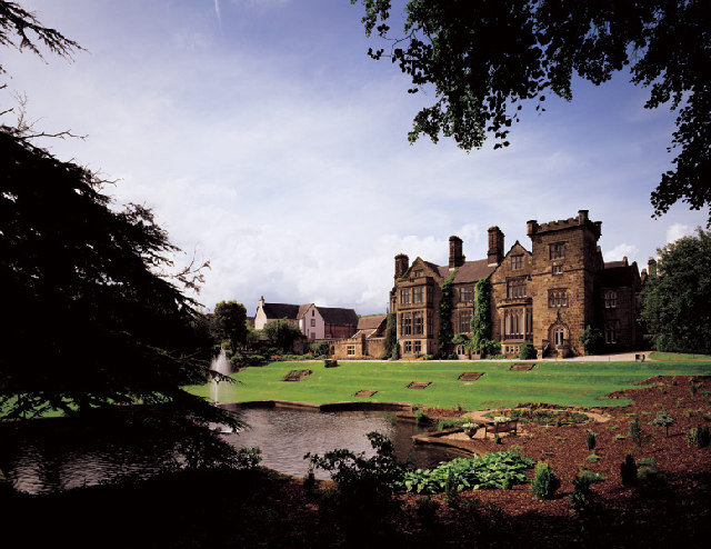
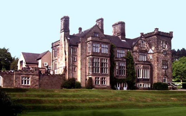
Breadsall Priory

Breadsall Priory is a former Augustinian priory in Derbyshire, situated around two kilometres north of Breadsall, and two kilometres east of Little Eaton...

Horsley Woodhouse

Horsley Woodhouse is a village and civil parish in the Amber Valley district of Derbyshire, in the East Midlands of England. The population of the civil...

Nearby Amenities

Located within 500m of 52.985207,-1.4324753
Power: tower
Source: OS OpenData VectorMap District
Lat/Long: 52.987349/-1.4380624
Power: tower
Source: OS OpenData VectorMap District
Lat/Long: 52.9855511/-1.4371316
Power: tower
Source: OS OpenData VectorMap District
Lat/Long: 52.9830074/-1.4341735
Power: tower
Source: OS OpenData VectorMap District
Lat/Long: 52.9810279/-1.4318798
Barrier: kissing_gate
Source: survey;gps
Lat/Long: 52.9858337/-1.4361539
Power: pole
Source: Bing
Lat/Long: 52.983028/-1.4328253
Power: pole
Source: Bing
Lat/Long: 52.9821625/-1.4318758
Power: pole
Source: Bing
Lat/Long: 52.9814083/-1.4305669
Barrier: kissing_gate
Lat/Long: 52.9857844/-1.4362192
The data included in this document is from www.openstreetmap.org. The data is made available under ODbL.

Have you been to Keepers Covert?

Leave your review of Keepers Covert below (or comments, questions and feedback).