Scarcroft Plantations

Wood, Forest in Yorkshire

England

Scarcroft Plantations

Pompocali Extensive earthworks on the course of an old Roman Road. No one is certain what they are but they may be the remains of a Roman Fort.
Pompocali Credit: Paul Allison

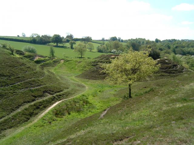
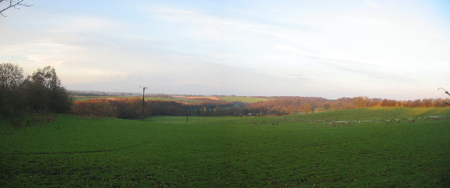
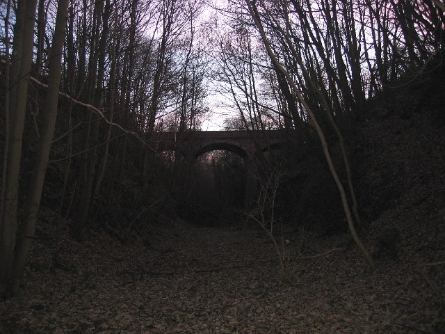
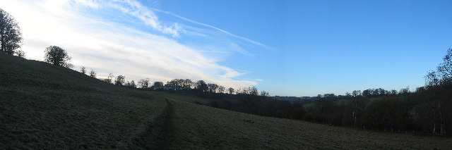
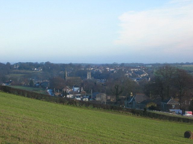
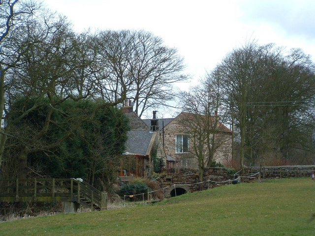
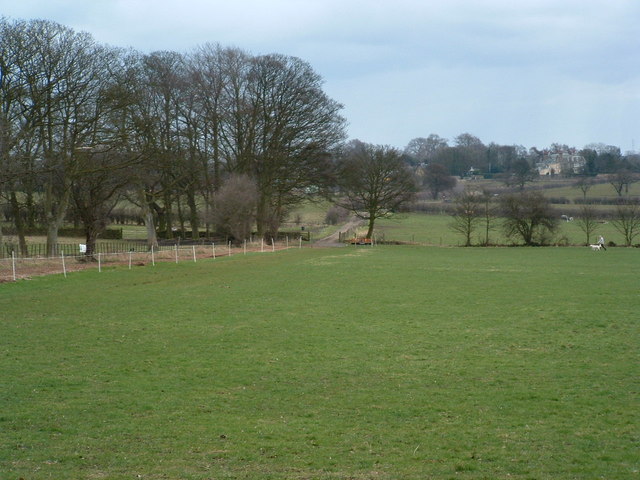
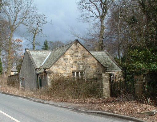
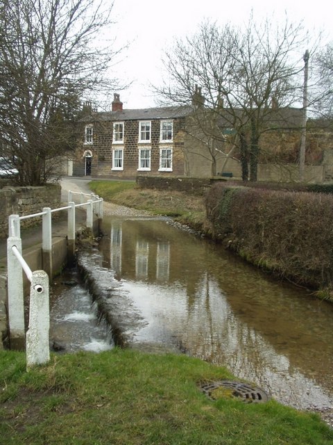
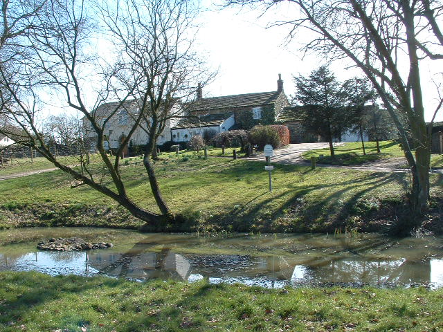
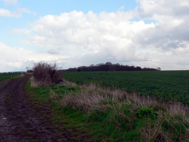
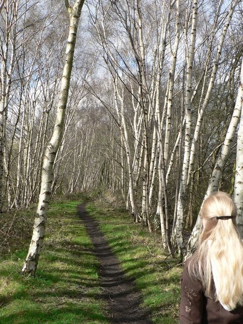
Scarcroft Plantations, located in Yorkshire, is a stunning woodland area that spans across a vast expanse of land. Nestled amidst the picturesque countryside, this plantation is a haven for nature enthusiasts and those seeking tranquility in a serene environment.

The woodland is characterized by its diverse array of trees, including oak, beech, and birch, which provide a lush and green canopy throughout the year. The plantation also boasts a rich variety of flora and fauna, making it a thriving ecosystem. Visitors can spot a range of wildlife, from squirrels and rabbits to a myriad of bird species.

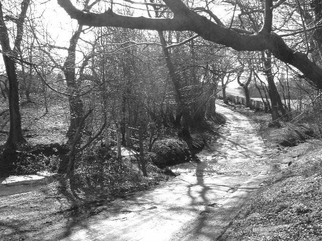
Scarcroft Plantations offer numerous walking trails, allowing visitors to explore the beauty of the woodland at their own pace. These trails wind through the forest, leading adventurers to hidden nooks and scenic viewpoints. The plantation is also equipped with picnic areas, providing a perfect spot for families and friends to enjoy a leisurely outdoor meal surrounded by nature's beauty.

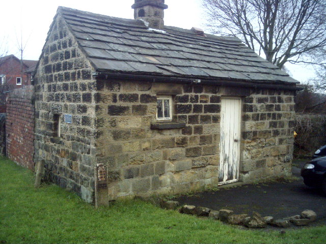
In addition to its natural splendor, Scarcroft Plantations holds historical significance. The site has been carefully managed for centuries, with evidence of human activity dating back to the medieval period. Ancient ruins and remnants of old buildings can still be found within the woodland, offering a glimpse into the region's past.

Overall, Scarcroft Plantations in Yorkshire is a captivating destination that seamlessly combines natural beauty with historical charm. Whether it's a peaceful stroll through the woods or an exploration of its rich heritage, visitors are sure to be enchanted by the allure of this woodland paradise.

If you have any feedback on the listing, please let us know in the comments section below.

Scarcroft Plantations Images

Images are sourced within 2km of 53.868148/-1.4506779 or Grid Reference SE3641. Thanks to Geograph Open Source API. All images are credited.

Pompocali Extensive earthworks on the course of an old Roman Road. No one is certain what they are but they may be the remains of a Roman Fort.
Pompocali
Extensive earthworks on the course of an old Roman Road. No one is certain what they are but they may be the remains of a Roman Fort.
St Peter's Church, Thorner Taken in the winter but still looks great.
St Peter's Church, Thorner
Taken in the winter but still looks great.
4 Camp Square, Thorner Happy school hols spent here ... Aunties.
4 Camp Square, Thorner
Happy school hols spent here ... Aunties.
View north from Scarcroft Hall Farm The old railway embankment can be seen on the left of the photo leading towards the bridge approximately 10 metres from where this photograph is taken.
View north from Scarcroft Hall Farm
The old railway embankment can be seen on the left of the photo leading towards the bridge approximately 10 metres from where this photograph is taken.
Bridge over dismantled railway Thorner Lane runs across the bridge.
Bridge over dismantled railway
Thorner Lane runs across the bridge.
Landscape towards Eltofts House Looking south-west from the centre of this square towards Eltofts House
Landscape towards Eltofts House
Looking south-west from the centre of this square towards Eltofts House
Thorner from the west Taken from the adjoining square (SE3640) from the fields north of Carr Lane looking towards the village.
Thorner from the west
Taken from the adjoining square (SE3640) from the fields north of Carr Lane looking towards the village.
Scarcroft Toll Bar House Built after the construction of the Wetherby/Leeds road in 1826. The Toll system lapsed by 1876 and the gates where removed.
Scarcroft Toll Bar House
Built after the construction of the Wetherby/Leeds road in 1826. The Toll system lapsed by 1876 and the gates where removed.
Lower Brandon Farm, Brandon Crescent
Track towards Wood Farm On older OS maps this is shown as a Roman Road.
Track towards Wood Farm
On older OS maps this is shown as a Roman Road.
Redundant gatehouse, Bay Horse Lane An increasingly sorry sight, the "big house" is still in use but entered from another road.
Redundant gatehouse, Bay Horse Lane
An increasingly sorry sight, the "big house" is still in use but entered from another road.
Ford and weir, Westfield Lane, Thorner Looking north-east across the ford towards the village. The stream comes from the right, behind the hedge, turns sharp left into the ford, runs towards the camera, then right down the little weir and under the footbridge.
Ford and weir, Westfield Lane, Thorner
Looking north-east across the ford towards the village. The stream comes from the right, behind the hedge, turns sharp left into the ford, runs towards the camera, then right down the little weir and under the footbridge.
Church View and St Peter's It's a nice photogenic church, worth a second picture.
Church View and St Peter's
It's a nice photogenic church, worth a second picture.
Bardsey Parish Church The Parish Church of All Hallows goes back to Saxon times.  The lower part of the tower dates from 800/825 and the upper from the tenth century.
Bardsey Parish Church
The Parish Church of All Hallows goes back to Saxon times. The lower part of the tower dates from 800/825 and the upper from the tenth century.
Bardsey village pond The fringe of the village seems an odd place for the village pond but the sign confirms its identity
Bardsey village pond
The fringe of the village seems an odd place for the village pond but the sign confirms its identity
Ford on Spear Fir 1 p.m. on the second day of Spring and it looks (and felt) like winter
Ford on Spear Fir
1 p.m. on the second day of Spring and it looks (and felt) like winter
Roman Road, Bardsey According to the OS Map, the track to the left of the hedge is the course of a Roman Road. How can they tell? It just looks like a muddy track at the edge of a field to me! The wood in the background is Stubbing Moor Plantation.
Roman Road, Bardsey
According to the OS Map, the track to the left of the hedge is the course of a Roman Road. How can they tell? It just looks like a muddy track at the edge of a field to me! The wood in the background is Stubbing Moor Plantation.
Silver Birch by the footpath, Scarcroft - Bardsey The old railway line is now a footpath, this is on the embankment of the section just north of Scarcroft Hill on the way to Bardsey.
Silver Birch by the footpath, Scarcroft - Bardsey
The old railway line is now a footpath, this is on the embankment of the section just north of Scarcroft Hill on the way to Bardsey.
Show me another place!

Scarcroft Plantations is located at Grid Ref: SE3641 (Lat: 53.868148, Lng: -1.4506779)

Division: West Riding

Unitary Authority: Leeds

Police Authority: West Yorkshire

What 3 Words

///waggled.barrel.magazines. Near Scarcroft, West Yorkshire

Related Wikis

Scarcroft

Scarcroft is a village and civil parish 6 miles (10 km) north east of Leeds city centre in the City of Leeds metropolitan borough, West Yorkshire, England...
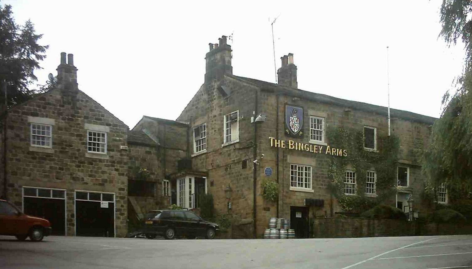
The Bingley Arms

The Bingley Arms is a public house in Bardsey, Leeds, West Yorkshire, England, and claims to be both the oldest surviving business and oldest surviving...

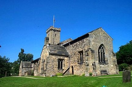
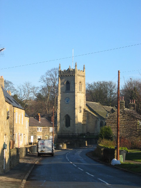
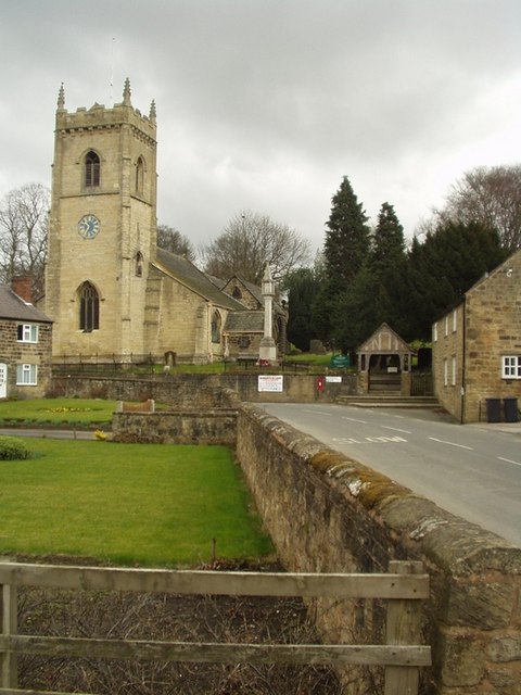
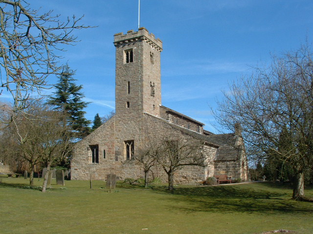
All Hallows Church, Bardsey

All Hallows Church in Bardsey, West Yorkshire, England is an active Anglican parish church in the archdeaconry of Leeds and the Diocese of Leeds. The Bardsey...

Bardsey cum Rigton

Bardsey cum Rigton is a civil parish in the City of Leeds metropolitan borough in West Yorkshire, England. According to the 2001 census it had a population...

Nearby Amenities

Located within 500m of 53.868148,-1.4506779
Bus Stop
Wetherby Road Ling Lane
Bus: yes
Local Ref: 45010206
Naptan AtcoCode: 450010206
Naptan Bearing: S
Naptan CommonName: Wetherby Road Ling Lane
Naptan Crossing: Ling Lane
Naptan Indicator: Stop 45010206
Naptan Landmark: YE College
Naptan PlusbusZoneRef: LEEDS
Naptan ShortCommonName: Ling Lane
Naptan Street: Wetherby Road
Naptan Verified: no
Public Transport: platform
Source: naptan_import
Lat/Long: 53.8657678/-1.450213
Bus Stop
Wetherby Road Thorner Lane
Bus: yes
Local Ref: 45010213
Naptan AtcoCode: 450010213
Naptan Bearing: SW
Naptan CommonName: Wetherby Road Thorner Lane
Naptan Crossing: Thorner Lane
Naptan Indicator: Stop 45010213
Naptan Landmark: The Bracken Fox PH
Naptan PlusbusZoneRef: LEEDS
Naptan ShortCommonName: Thorner Lane
Naptan Street: Wetherby Road
Naptan Verified: no
Public Transport: platform
Shelter: yes
Source: naptan_import
Lat/Long: 53.8712787/-1.4465362
Bus Stop
Wetherby Road Eversley View
Bus: yes
Local Ref: 45014844
Naptan AtcoCode: 450014844
Naptan Bearing: S
Naptan CommonName: Wetherby Road Eversley View
Naptan Crossing: Eversley View
Naptan Indicator: Stop 45014844
Naptan Notes: 3P ttcase still to fit
Naptan PlusbusZoneRef: LEEDS
Naptan ShortCommonName: Eversley View
Naptan Street: Wetherby Road
Naptan Verified: no
Public Transport: platform
Source: naptan_import
Lat/Long: 53.8643245/-1.4510531
Bus Stop
Wetherby Road Ling Lane
Bus: yes
Local Ref: 45014845
Naptan AtcoCode: 450014845
Naptan Bearing: N
Naptan CommonName: Wetherby Road Ling Lane
Naptan Crossing: Ling Lane
Naptan Indicator: Stop 45014845
Naptan PlusbusZoneRef: LEEDS
Naptan ShortCommonName: Ling Lane
Naptan Street: Wetherby Road
Naptan Verified: no
Public Transport: platform
Source: naptan_import
Lat/Long: 53.8665215/-1.4499294
Bus Stop
Wetherby Road
Bus: yes
Local Ref: 45024301
Naptan AtcoCode: 450024301
Naptan Bearing: N
Naptan CommonName: Wetherby Road
Naptan Crossing: Scarcroft Grange
Naptan Indicator: Stop 45024301
Naptan Landmark: Wood Farm
Naptan PlusbusZoneRef: LEEDS
Naptan ShortCommonName: Wood Farm
Naptan Street: Wetherby Road
Naptan Verified: no
Public Transport: platform
Source: naptan_import
Lat/Long: 53.8638059/-1.4516377
Syke Lane
Local Ref: 45025130
Naptan AtcoCode: 450025130
Naptan Bearing: E
Naptan BusStopType: CUS
Naptan CommonName: Syke Lane
Naptan Crossing: Wetherby Road
Naptan Indicator: Stop 45025130
Naptan PlusbusZoneRef: LEEDS
Naptan ShortCommonName: Wetherby Road
Naptan Street: Syke Lane
Naptan Verified: no
Source: naptan_import
Lat/Long: 53.8717646/-1.4466667
Bus Stop
Wetherby Road Scarcroft Village Hall
Bus: yes
Local Ref: 45027128
Naptan AtcoCode: 450027128
Naptan Bearing: NE
Naptan CommonName: Wetherby Road Scarcroft Village Hall
Naptan Crossing: Larch Wood
Naptan Indicator: Stop 45027128
Naptan Landmark: Village Hall
Naptan PlusbusZoneRef: LEEDS
Naptan ShortCommonName: Larch Wood
Naptan Street: Wetherby Road
Naptan Verified: no
Public Transport: platform
Source: naptan_import
Lat/Long: 53.8685498/-1.4488883
Bus Stop
Wetherby Road Scarcroft Village Hall
Bus: yes
Local Ref: 45027129
Naptan AtcoCode: 450027129
Naptan Bearing: SW
Naptan CommonName: Wetherby Road Scarcroft Village Hall
Naptan Crossing: Nr-At Larch Wood
Naptan Indicator: Stop 45027129
Naptan Landmark: Scarcroft Village Hall
Naptan PlusbusZoneRef: LEEDS
Naptan ShortCommonName: Larch Wood
Naptan Street: Wetherby Road
Naptan Verified: no
Public Transport: platform
Source: naptan_import
Lat/Long: 53.8690394/-1.4482235
Turning Circle
Lat/Long: 53.8691792/-1.4489726
Noexit: yes
Lat/Long: 53.8707338/-1.4465993
Turning Circle
Lat/Long: 53.8666226/-1.4504822
Turning Circle
Lat/Long: 53.8704713/-1.4508351
Turning Circle
Lat/Long: 53.8682239/-1.4487044
Post Box
Operator: Royal Mail
Operator Wikidata: Q638098
Post Box Type: lamp
Ref: LS14 770
Royal Cypher: EIIR
Royal Cypher Wikidata: Q33102113
Lat/Long: 53.8662012/-1.4509187
Public Bookcase
Scarcroft Book Exchange
Booth: K6
Disused Amenity: telephone
Man Made: telephone_box
Public Bookcase Type: phone_box
Lat/Long: 53.8717846/-1.4466922
Post Box
Operator: Royal Mail
Operator Wikidata: Q638098
Post Box Type: pillar
Ref: LS14 395
Royal Cypher: GVIR
Royal Cypher Wikidata: Q33102169
Lat/Long: 53.8717868/-1.4467254
Crossing
Crossing: traffic_signals
Crossing Ref: pelican
Lat/Long: 53.8713913/-1.4465115
Addr City: Leeds
Addr Housename: Blackburn Pavilion
Addr Postcode: LS14 3BQ
Addr Street: Syke Lane
Addr Suburb: Scarcroft
Craft: caterer
Fhrs Id: 1131633
Lat/Long: 53.8717942/-1.4551493
Defibrillator
Access: yes
Defibrillator Location: External wall of village hall to left of entrance
Defibrillator Location En: External wall of village hall to left of entrance
Emergency: defibrillator
Indoor: no
Opening Hours: 24/7
Ref: WCPAD025
Ref GB The Circuit: 80CB0E54-DAFB-49A3-9747-B0420149AFB8
Wheelchair: yes
Lat/Long: 53.8685683/-1.4484625
Noexit: yes
Lat/Long: 53.8696382/-1.4491471
Noexit: yes
Lat/Long: 53.8698095/-1.4493719
Waste Basket
Ref UK Leedscc Bin: 3168
Lat/Long: 53.871804/-1.446679
Waste Basket
Ref UK Leedscc Bin: 3610
Lat/Long: 53.871089/-1.446674
Waste Basket
Ref UK Leedscc Bin: 3604
Lat/Long: 53.868865/-1.448607
Access: yes
Entrance: yes
Lat/Long: 53.8675745/-1.4494008
Access: yes
Entrance: yes
Lat/Long: 53.8685593/-1.4488758
Noexit: yes
Lat/Long: 53.8687664/-1.4488248
Crossing
Crossing: unmarked
Lat/Long: 53.871065/-1.4549884
Entrance: yes
Lat/Long: 53.8685505/-1.4484751
The data included in this document is from www.openstreetmap.org. The data is made available under ODbL.

Have you been to Scarcroft Plantations?

Leave your review of Scarcroft Plantations below (or comments, questions and feedback).