Old Brickyard Plantation

Wood, Forest in Warwickshire Warwick

England

Old Brickyard Plantation

East on Kenilworth Greenway, Crackley The Greenway, a County Council amenity, follows the route of the former Kenilworth-Berkswell railway line. Here it is crossed by and connected to a public footpath, a track at this point, between north Kenilworth and south Coventry.
East on Kenilworth Greenway, Crackley Credit: Robin Stott

Old Brickyard Plantation is a historic site located in Warwickshire, a county in the West Midlands region of England. Situated in the woodlands of the Forest of Arden, this former brickyard turned plantation holds great historical significance in the region.

The plantation dates back to the 18th century when it was established as a brickyard to supply building materials for the growing town of Warwick. The site thrived during the Industrial Revolution, producing bricks for various construction projects in the area. However, with the decline of the brick-making industry in the late 19th century, the brickyard was eventually abandoned.

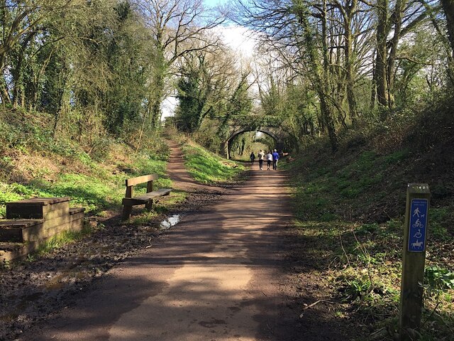
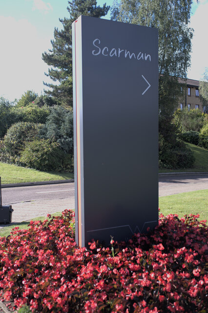
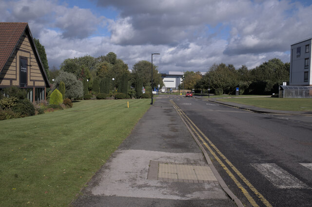
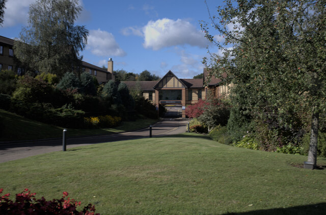
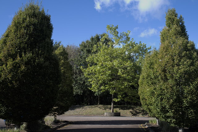
Today, Old Brickyard Plantation serves as a popular recreational area, offering visitors a glimpse into its rich past. The site is characterized by its picturesque woodlands, dense with a variety of tree species including oak, ash, and beech. Walking trails have been developed throughout the plantation, allowing visitors to explore the natural beauty of the surrounding forest.

In addition to its natural attractions, Old Brickyard Plantation is also home to several archaeological remains. The brick kilns and ruins of the former brickyard can still be seen, providing a fascinating glimpse into the area's industrial heritage. These historical features have been carefully preserved and protected, ensuring that future generations can appreciate the site's historical significance.

Old Brickyard Plantation offers a unique combination of natural beauty and historical interest, making it a must-visit destination for both nature enthusiasts and history buffs alike.

If you have any feedback on the listing, please let us know in the comments section below.

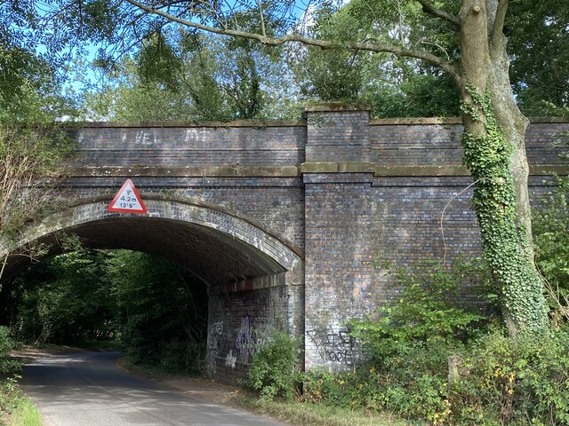
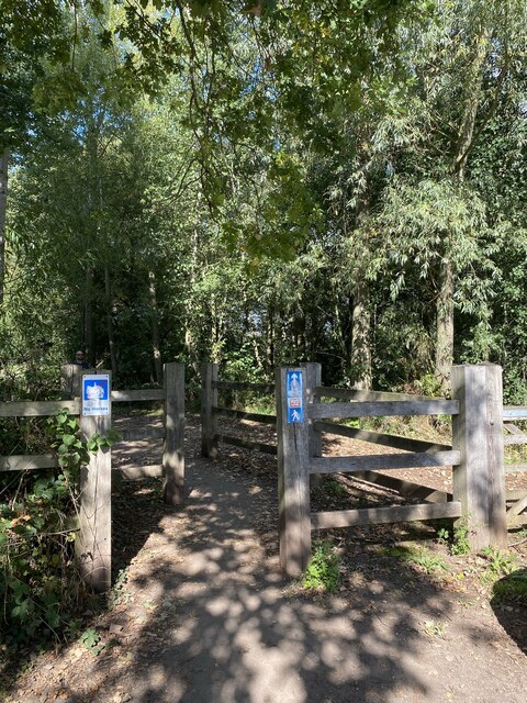
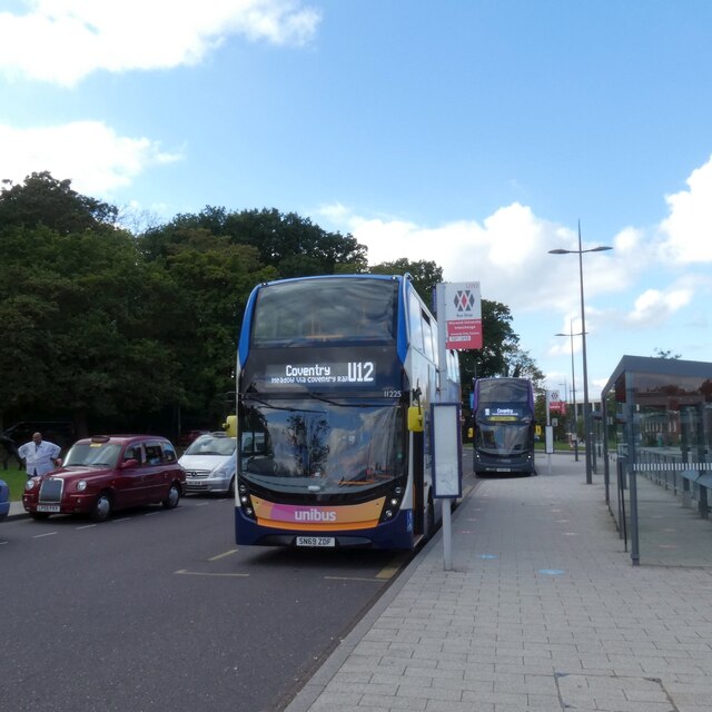
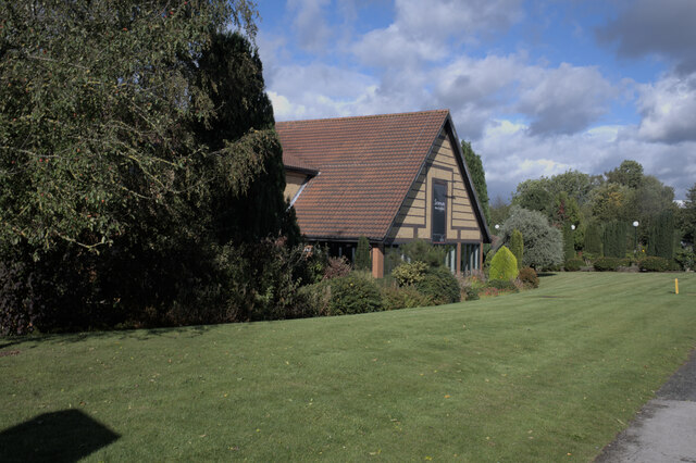
Old Brickyard Plantation Images

Images are sourced within 2km of 52.379272/-1.5641735 or Grid Reference SP2975. Thanks to Geograph Open Source API. All images are credited.

East on Kenilworth Greenway, Crackley The Greenway, a County Council amenity, follows the route of the former Kenilworth-Berkswell railway line. Here it is crossed by and connected to a public footpath, a track at this point, between north Kenilworth and south Coventry.
East on Kenilworth Greenway, Crackley
The Greenway, a County Council amenity, follows the route of the former Kenilworth-Berkswell railway line. Here it is crossed by and connected to a public footpath, a track at this point, between north Kenilworth and south Coventry.
Greek Orthodox Church, Westwood Heath Road, Coventry The flags of Cyprus, the United Kingdom and Greece can be seen flying outside the Greek Orthodox Church of the Holy Transfiguration. The church was open to the public on a Heritage Open Day. Tours of the church building were taking place and, in St. George's Hall, the red brick building visible to the right behind the church, could be seen a display on the history of the church and the Greek Cypriot community and another on the history of the Westwood Heath area by the Westwood Heath History Group. For the website of the church see here <span class="nowrap"><a title="https://greekchurchcoventry.org/index.html" rel="nofollow ugc noopener" href="https://greekchurchcoventry.org/index.html">Link</a><img style="margin-left:2px;" alt="External link" title="External link - shift click to open in new window" src="https://s1.geograph.org.uk/img/external.png" width="10" height="10"/></span> , for the website of the history group see here <span class="nowrap"><a title="https://westwoodheathra.wixsite.com/website" rel="nofollow ugc noopener" href="https://westwoodheathra.wixsite.com/website">Link</a><img style="margin-left:2px;" alt="External link" title="External link - shift click to open in new window" src="https://s1.geograph.org.uk/img/external.png" width="10" height="10"/></span> .

According to the church display, the first Cypriot migrants arrived in Coventry in the 1930s. At that time Cyprus was a colony of the British Empire. Increasing migration in the 1950s and 1960s led to the establishment of a Greek-language supplementary school and a Greek Orthodox church, which worshipped in Church of England churches. In 1977 the community acquired a Victorian school building in Westwood Heath. This was consecrated as an Orthodox church in 1978. It has since been extended, while classrooms for the Greek school have been built along with St George's Hall as a community venue <span class="nowrap"><a title="https://greekchurchcoventry.org/about-us.html" rel="nofollow ugc noopener" href="https://greekchurchcoventry.org/about-us.html">Link</a><img style="margin-left:2px;" alt="External link" title="External link - shift click to open in new window" src="https://s1.geograph.org.uk/img/external.png" width="10" height="10"/></span> . The site overlooks the Warwickshire countryside beyond the city.

The church itself has the rectangular shape and rows of wooden pews of a western church building, but there is no mistaking the Orthodox character of the painted icons on the walls and on the iconostasis, the screen which divides the sanctuary with the altar from the main body of the church.
Greek Orthodox Church, Westwood Heath Road, Coventry
The flags of Cyprus, the United Kingdom and Greece can be seen flying outside the Greek Orthodox Church of the Holy Transfiguration. The church was open to the public on a Heritage Open Day. Tours of the church building were taking place and, in St. George's Hall, the red brick building visible to the right behind the church, could be seen a display on the history of the church and the Greek Cypriot community and another on the history of the Westwood Heath area by the Westwood Heath History Group. For the website of the church see here LinkExternal link , for the website of the history group see here LinkExternal link . According to the church display, the first Cypriot migrants arrived in Coventry in the 1930s. At that time Cyprus was a colony of the British Empire. Increasing migration in the 1950s and 1960s led to the establishment of a Greek-language supplementary school and a Greek Orthodox church, which worshipped in Church of England churches. In 1977 the community acquired a Victorian school building in Westwood Heath. This was consecrated as an Orthodox church in 1978. It has since been extended, while classrooms for the Greek school have been built along with St George's Hall as a community venue LinkExternal link . The site overlooks the Warwickshire countryside beyond the city. The church itself has the rectangular shape and rows of wooden pews of a western church building, but there is no mistaking the Orthodox character of the painted icons on the walls and on the iconostasis, the screen which divides the sanctuary with the altar from the main body of the church.
Radcliffe halls of residence - University of Warwick
Car parking - Radcliffe halls of residence Note that electric vehicle charging points have been provided, but at the same position as the disabled provision, meaning the points could not be used when a disabled vehicle was parked - entirely legitimately - in the spaces.
Car parking - Radcliffe halls of residence
Note that electric vehicle charging points have been provided, but at the same position as the disabled provision, meaning the points could not be used when a disabled vehicle was parked - entirely legitimately - in the spaces.
Railway Bridge Bridge on the old Kenilworth to Birmingham line. Now the Coventry Way.
Railway Bridge
Bridge on the old Kenilworth to Birmingham line. Now the Coventry Way.
Footpath to Cryfield Footpath and cycleway, but not a bridleway.
Footpath to Cryfield
Footpath and cycleway, but not a bridleway.
Unibus at Warwick University The campus of Warwick University lies just on the outskirts of Coventry (which has its own university within the city) and quite some miles from Warwick itself. However there is a very frequent bus service both into Coventry and to Warwick via Kenilworth and Leamington Spa.
Unibus at Warwick University
The campus of Warwick University lies just on the outskirts of Coventry (which has its own university within the city) and quite some miles from Warwick itself. However there is a very frequent bus service both into Coventry and to Warwick via Kenilworth and Leamington Spa.
Scarman building, University of Warwick
Entrance sign Sign for the Scarman Building
Entrance sign
Sign for the Scarman Building
Scarman Road
Scarman Road
Entrance road, Scarman building See <a href="https://www.geograph.org.uk/photo/6982955">SP2976 : Entrance, with signage</a> for the door near the archway
Entrance road, Scarman building
See SP2976 : Entrance, with signage for the door near the archway
Entrance, with signage Entrance to the Scarman building, with various Covid-19 precaution signs
Entrance, with signage
Entrance to the Scarman building, with various Covid-19 precaution signs
Keep  your distance One of the signs in <a href="https://www.geograph.org.uk/photo/6982955">SP2976 : Entrance, with signage</a>
Keep your distance
One of the signs in SP2976 : Entrance, with signage
Have you got your face covering on? One of the signs in <a href="https://www.geograph.org.uk/photo/6982955">SP2976 : Entrance, with signage</a>
Have you got your face covering on?
One of the signs in SP2976 : Entrance, with signage
Thanks for wearing your face covering in this building One of the signs in <a href="https://www.geograph.org.uk/photo/6982955">SP2976 : Entrance, with signage</a>
Thanks for wearing your face covering in this building
One of the signs in SP2976 : Entrance, with signage
Temperature screening station Near to <a href="https://www.geograph.org.uk/photo/6982955">SP2976 : Entrance, with signage</a>
Temperature screening station
Electric Scooters All the rage at the moment, and still undergoing limited trials.  These have to be unlocked with a credit card to use them.
Electric Scooters
All the rage at the moment, and still undergoing limited trials. These have to be unlocked with a credit card to use them.
Car park trees Trees in the car park at the Scarman building.
Car park trees
Trees in the car park at the Scarman building.
Show me another place!

Old Brickyard Plantation is located at Grid Ref: SP2975 (Lat: 52.379272, Lng: -1.5641735)

Administrative County: Warwickshire

District: Warwick

Police Authority: Warwickshire

What 3 Words

///discrepancy.mash.tries. Near Kenilworth, Warwickshire

Related Wikis

University of Warwick

The University of Warwick ( WORR-ik; abbreviated as Warw. in post-nominal letters) is a public research university on the outskirts of Coventry between...

Warwick Arts Centre

Warwick Arts Centre is a multi-venue arts complex at the University of Warwick in Coventry, England. It attracts around 300,000 visitors a year to over...

Gibbet Hill (University of Warwick)

Gibbet Hill is the location of, and name for, the University of Warwick's southern campus, in the south of Coventry, England. The Gibbet Hill campus is...

Warwick Business School

Warwick Business School (WBS) is the business school of the University of Warwick and an academic department within the Faculty of Social Sciences. It...

WMG, University of Warwick

WMG, University of Warwick (formerly Warwick Manufacturing Group), is a UK-based research and education group combining collaborative research and development...

National Automotive Innovation Centre

The National Automotive Innovation Centre (NAIC), sometimes referred to as the National Automotive Innovation Campus, is a building at the University of...

Warwick Medical School

Warwick Medical School is the medical school of the University of Warwick and is located in Coventry, United Kingdom. It was opened in 2000 in partnership...

Coventry College of Education

Coventry College of Education existed as a separate institution until its incorporation into the University of Warwick in 1978 as the Westwood campus....

Nearby Amenities

Located within 500m of 52.379272,-1.5641735
Crossing
Crossing: uncontrolled
Crossing Ref: zebra
Tactile Paving: yes
Traffic Calming: hump
Lat/Long: 52.3816774/-1.5675075
Crossing
Crossing: unmarked
Crossing Markings: no
Crossing Ref: zebra
Tactile Paving: yes
Lat/Long: 52.3794267/-1.5606299
Barrier: lift_gate
Lat/Long: 52.3815259/-1.56785
Odbl: clean
Lat/Long: 52.3798847/-1.5645074
Post Box
Brand: Royal Mail
Brand Wikidata: Q638098
Brand Wikipedia: en:Royal Mail
Collection Times: Mo-Fr 17:00, Sa 10:30
Collection Times Checked: 2017-09-03
Operator: Royal Mail
Operator Wikidata: Q638098
Post Box Apertures: 2
Post Box Design: type_c
Post Box Type: pillar
Postal Code: CV4
Ref: CV4 22;CV4 22
Ref Duplicates: 2
Royal Cypher: EIIR
Royal Cypher Wikidata: Q33102113
Lat/Long: 52.379597/-1.5602605
Bicycle Parking
Bicycle Parking: stands
Capacity: 20
Covered: no
Lat/Long: 52.3820027/-1.5614601
Pub
The Dirty Duck
Contact Phone: +44 2476 572754
Fhrs Id: 239180
Food: yes
Level: 2
Opening Hours: Mo-Th 12:00-24:00; Fr-Sa 12:00-24:00; Su 00:00-01:00, 12:00-23:00
Real Ale: yes
Website: https://www.warwicksu.com/thedirtyduck/
Wheelchair: yes
Lat/Long: 52.3790091/-1.5601656
Bank
Santander
Addr Postcode: CV4 7AJ
Atm: yes
Brand: Santander
Brand Wikidata: Q7420065
Brand Wikipedia: en:Santander UK
Level: 0
Operator: Santander UK plc
Source: local_knowledge
Lat/Long: 52.3787283/-1.5603788
Crossing
Crossing: traffic_signals
Lat/Long: 52.3780902/-1.5626545
Entrance: main
Lat/Long: 52.3819258/-1.5623617
Entrance: main
Lat/Long: 52.3817348/-1.5620686
Entrance: main
Lat/Long: 52.3794097/-1.5613528
Crossing
Crossing: unmarked
Crossing Markings: no
Crossing Ref: zebra
Source: bing;local_knowledge
Lat/Long: 52.3792229/-1.5610702
Crossing
Button Operated: yes
Crossing: traffic_signals
Tactile Paving: yes
Traffic Signals Sound: yes
Lat/Long: 52.3817594/-1.5595927
Entrance: main
Lat/Long: 52.380302/-1.5614458
Bicycle Parking
Covered: yes
Lat/Long: 52.3828668/-1.5635102
Bus Stop
UR3
NaPTANAreaCode: 43000065202
Bench: yes
Bin: yes
Bus: yes
Lit: yes
Local Ref: UR3
Naptan AtcoCode: 43000065202
Naptan Bearing: SE
Naptan BusStopType: MKD
Naptan CommonName: Automotive Centre
Naptan Indicator: Stop UR3
Naptan NaptanCode: nwmdwpta
Naptan PlusbusZoneRef: BHAMNWS
Naptan Status: ACT
Naptan StopType: BCT
Naptan Street: WARWICK UNIVERSITY GROUNDS
Naptan Towards: Leamington Spa
Naptan Verified: no
Public Transport: platform
Route Ref: 43W;NU1;U1;U12;U17
Shelter: yes
Shelter Ref: 0065202
Source: WMCA
Tactile Paving: yes
Lat/Long: 52.3822352/-1.5601416
Access: private
Barrier: lift_gate
Lat/Long: 52.3768327/-1.5616184
Crossing
Button Operated: yes
Crossing: traffic_signals
Crossing Island: no
Source: local_knowledge
Tactile Paving: yes
Traffic Signals Sound: yes
Lat/Long: 52.3825175/-1.5607318
Rootes Grocery Store
Fhrs Id: 759826
Level: 0
Opening Hours: Mo-Fr 07:30-24:00, Sa 09:00-23:00, Su 11:00-17:00 "term time"
Operator: University of Warwick
Shop: convenience
Website: http://www.warwickretail.com/rootesgrocerystore
Wheelchair: yes
Lat/Long: 52.3794836/-1.5602382
Bank
Barclays
Addr Postcode: CV4 7AL
Atm: yes
Brand: Barclays
Brand Wikidata: Q245343
Brand Wikipedia: en:Barclays
Level: 0
Operator: Barckays plc
Source: locak_knowledge
Lat/Long: 52.3785611/-1.560595
Fast Food
The Bread Oven
Cuisine: sandwich
Layer: 1
Level: 1
Website: https://www.warwicksu.com/food/thebreadoven/
Lat/Long: 52.3790386/-1.5605022
Restaurant
Rootes Restaurant
Fhrs Id: 239473
Level: 1
Lat/Long: 52.3782592/-1.5610386
Nightclub
The Copper Rooms
Fhrs Id: 341607
Lat/Long: 52.3787884/-1.5601281
Cafe
Cafe Library
Level: 0
Lat/Long: 52.3814971/-1.5621563
Cafe
Cafe Social Sciences
Wheelchair: yes
Lat/Long: 52.3808145/-1.5625011
Crossing
Crossing: unmarked
Crossing Markings: no
Source: survey
Tactile Paving: yes
Lat/Long: 52.3830721/-1.5654221
Crossing
Crossing: unmarked
Crossing Markings: no
Source: survey
Tactile Paving: yes
Lat/Long: 52.3827143/-1.5649777
Crossing
Crossing: unmarked
Crossing Markings: no
Source: survey
Tactile Paving: yes
Lat/Long: 52.3826752/-1.5651092
Barrier: lift_gate
Lat/Long: 52.3820718/-1.5584083
Barrier: lift_gate
Motor Vehicle: private
Note: Telephone (yellow) attached to request access e.g. for grocery delivery etc.
Lat/Long: 52.3792805/-1.5583236
Entrance: main
Lat/Long: 52.3812714/-1.5634464
Barrier: lift_gate
Lat/Long: 52.3836832/-1.5639995
Crossing
Crossing: uncontrolled
Crossing Island: no
Crossing Ref: zebra
Tactile Paving: yes
Lat/Long: 52.3821158/-1.5667162
Barrier: lift_gate
Lat/Long: 52.3827693/-1.5678019
Barrier: lift_gate
Lat/Long: 52.382715/-1.5662558
Bicycle Parking
Bicycle Parking: stands
Capacity: 8
Covered: no
Lat/Long: 52.3813815/-1.5680559
Barrier: bollard
Bollard: fixed
Lat/Long: 52.3799878/-1.570964
Recycling
Location: overground
Recycling Cans: yes
Recycling Clothes: yes
Recycling Glass Bottles: yes
Recycling Paper: yes
Recycling Plastic: yes
Recycling Shoes: yes
Recycling Type: container
Lat/Long: 52.3809059/-1.5702609
Bicycle Parking
Bicycle Parking: stands
Capacity: 24
Covered: yes
Lat/Long: 52.3807665/-1.5693016
Parking
Access: private
Parking: street_side
Lat/Long: 52.3806732/-1.5697289
Bicycle Parking
Bicycle Parking: stands
Capacity: 24
Covered: yes
Lat/Long: 52.380455/-1.5707346
Parking
Access: private
Parking: street_side
Lat/Long: 52.3804734/-1.5703432
Bench
Lat/Long: 52.379406/-1.5714903
Parking
Access: private
Parking: surface
Lat/Long: 52.3786232/-1.5712683
Parking
Access: private
Parking: surface
Lat/Long: 52.3785429/-1.5710162
Bicycle Parking
Bicycle Parking: stands
Capacity: 8
Covered: no
Lat/Long: 52.3796301/-1.568216
Bicycle Parking
Bicycle Parking: stands
Capacity: 8
Covered: no
Lat/Long: 52.3797955/-1.5679934
Bicycle Parking
Bicycle Parking: stands
Capacity: 8
Covered: no
Lat/Long: 52.3799919/-1.5682723
Bicycle Parking
Bicycle Parking: stands
Capacity: 8
Covered: no
Lat/Long: 52.3785799/-1.5701684
Bicycle Parking
Bicycle Parking: stands
Capacity: 8
Covered: no
Lat/Long: 52.3786117/-1.5698092
Bicycle Parking
Bicycle Parking: stands
Capacity: 8
Covered: no
Lat/Long: 52.3787902/-1.5696241
Bicycle Parking
Bicycle Parking: stands
Capacity: 8
Covered: no
Lat/Long: 52.379039/-1.569262
Bicycle Parking
Bicycle Parking: stands
Capacity: 8
Covered: no
Lat/Long: 52.3791645/-1.5694423
Bicycle Parking
Bicycle Parking: stands
Capacity: 8
Covered: no
Lat/Long: 52.379188/-1.568967
Bicycle Parking
Bicycle Parking: stands
Capacity: 8
Covered: no
Lat/Long: 52.3793436/-1.569313
Bicycle Parking
Bicycle Parking: stands
Capacity: 8
Covered: no
Lat/Long: 52.3793747/-1.5686854
Bicycle Parking
Bicycle Parking: stands
Capacity: 8
Covered: no
Lat/Long: 52.3795351/-1.5690153
Access: private
Barrier: lift_gate
Odbl: clean
Odbl Note: see change of source
Source: local_knowledge
Lat/Long: 52.3799251/-1.5647832
Bicycle Parking
Jack Martin (CC19)
Bicycle Parking: anchors
Capacity: 30
Operator: University of Warwick
Lat/Long: 52.3797014/-1.5570802
Bicycle Parking
Jack Martin (CC20)
Bicycle Parking: anchors
Capacity: 30
Operator: University of Warwick
Source: University of Warwick
Lat/Long: 52.3794976/-1.5582307
Entrance: main
Lat/Long: 52.3798131/-1.55706
Parking Entrance
Lat/Long: 52.3821462/-1.5592267
Restaurant
Canopy
Level: 1
Lat/Long: 52.3793448/-1.5606243
Cafe
Curiositea
Cost Coffee: GBP1.95
Cuisine: coffee_shop
Fair Trade: only
Fhrs Id: 239404
Indoor Seating: yes
Level: 0
Opening Hours: Mo-Fr 09:00-19:00; Sa-Su 10:00-18:00
Outdoor Seating: yes
Toilets: yes
Toilets Wheelchair: yes
Website: https://www.warwicksu.com/curiositea/
Wheelchair: yes
Lat/Long: 52.3788515/-1.5606416
Bar
Terrace Bar
Fhrs Id: 240849
Layer: 1
Level: 1
Wheelchair: yes
Lat/Long: 52.3787811/-1.5606349
Entrance: yes
Lat/Long: 52.3827932/-1.5635742
Entrance: yes
Lat/Long: 52.3828574/-1.5617487
Entrance: yes
Lat/Long: 52.3828901/-1.5633817
Entrance: yes
Lat/Long: 52.3831348/-1.5613933
Entrance: main
Lat/Long: 52.3811791/-1.5612765
Entrance: main
Lat/Long: 52.3823822/-1.5634234
Entrance: main
Lat/Long: 52.3814455/-1.5621567
Entrance: main
Lat/Long: 52.381642/-1.5599147
Entrance: main
Lat/Long: 52.3798376/-1.5613401
Entrance: main
Lat/Long: 52.3824758/-1.5614804
Entrance: main
Lat/Long: 52.3819765/-1.5612533
Entrance: main
Lat/Long: 52.382994/-1.5632946
Entrance: main
Lat/Long: 52.3790181/-1.557956
Entrance: main
Lat/Long: 52.381686/-1.5602655
Entrance: main
Lat/Long: 52.3792831/-1.560683
Entrance: main
Lat/Long: 52.3807277/-1.5626339
Entrance: main
Lat/Long: 52.3821626/-1.5609589
Bicycle Parking
Bicycle Parking: stands
Capacity: 52
Covered: yes
Lat/Long: 52.3827006/-1.5613073
Bicycle Parking
Bicycle Parking: stands
Covered: yes
Lat/Long: 52.3821872/-1.5592309
Cinema
Warwick Arts Centre Cinema
Level: 1
Lat/Long: 52.3796421/-1.5618245
Entrance: main
Lat/Long: 52.3793869/-1.5606013
Entrance: main
Lat/Long: 52.3789877/-1.5606692
Barrier: lift_gate
Lat/Long: 52.37682/-1.5612991
Bench
Backrest: yes
Check Date: 2021-08-29
Colour: brown
Material: wood
Lat/Long: 52.3810429/-1.5649942
Barrier: stile
Material: wood
Stile: stepover
Lat/Long: 52.3757504/-1.5598395
Fast Food
Pret A Manger
Brand: Pret A Manger
Brand Wikidata: Q2109109
Brand Wikipedia: en:Pret a Manger
Cuisine: sandwich
Fhrs Id: 240514
Indoor Seating: yes
Level: 0
Outdoor Seating: yes
Short Name: Pret
Source: knowledge
Takeaway: yes
Wheelchair: yes
Lat/Long: 52.378592/-1.561113
Restaurant
Fusion
Cuisine: asian
Fhrs Id: 240963
Level: 1
Opening Hours: Mo-Fr 10:00-21:00; Sa 11:00-21:00; Su 12:00-21:00
Phone: +44 24 7615 0906
Source: local knowledge
Website: https://www2.warwick.ac.uk/services/retail/cafes/
Wheelchair: yes
Lat/Long: 52.3784695/-1.5610936
Bar
The Bar
Fhrs Id: 239453
Level: 1
Opening Hours: Mo-Fr 10:00-22:00; Sa 11:00-22:00; Su 12:00-22:00
Source: knowledge
Website: https://www2.warwick.ac.uk/services/retail/cafes/
Wheelchair: yes
Lat/Long: 52.3783715/-1.5613194
Man Made: surveillance
Surveillance: outdoor
Lat/Long: 52.3788646/-1.5598794
Place Of Worship
Islamic Prayer Hall
Level: 1
Religion: muslim
Source: knowledge
Lat/Long: 52.3806369/-1.561382
Bicycle Parking
Bicycle Parking: stands
Lat/Long: 52.3809799/-1.5628883
Bicycle Parking
Back of Rootes Grocery Store (CC39)
Access: permissive
Bicycle Parking: stands
Capacity: 28
Covered: yes
Operator: University of Warwick
Source: survey;University of Warwick
Lat/Long: 52.3796433/-1.5600371
Bicycle Parking
Bicycle Parking: stands
Capacity: 26
Covered: no
Lat/Long: 52.3813144/-1.5624718
Entrance: main
Lat/Long: 52.381228/-1.5626576
Entrance: main
Lat/Long: 52.3804633/-1.5615158
Entrance: main
Lat/Long: 52.3808504/-1.5626612
Barrier: lift_gate
Lat/Long: 52.3815571/-1.5633299
Post Office
University Of Warwick Post Office
Addr Postcode: CV4 7EQ
Brand: Post Office
Brand Wikidata: Q1783168
Brand Wikipedia: en:Post Office Ltd
Contact Website: https://www.postoffice.co.uk/branch-finder/1992058/university-of-warwick
Level: 0
Operator: Post Office Ltd
Ref Pol Id: 6775
Source: local_knowledge
Lat/Long: 52.3793131/-1.5604252
Crossing
Crossing: unmarked
Crossing Island: yes
Crossing Markings: no
Tactile Paving: yes
Lat/Long: 52.3806726/-1.5638379
Theatre
Warwick Arts Centre Theater
Payment Cash: yes
Wheelchair: yes
Lat/Long: 52.3796227/-1.561025
Crossing
Crossing: marked
Crossing Island: no
Crossing Markings: yes
Tactile Paving: yes
Lat/Long: 52.3762041/-1.5671317
Entrance: yes
Lat/Long: 52.3804019/-1.5633374
Entrance: yes
Lat/Long: 52.3804419/-1.5633319
Bench
Backrest: no
Check Date: 2021-08-29
Colour: brown
Material: wood
Lat/Long: 52.3809135/-1.5647703
Entrance: main
Lat/Long: 52.3829067/-1.5608124
Entrance: main
Lat/Long: 52.3805023/-1.5624494
Entrance: main
Lat/Long: 52.3800918/-1.5628163
Barrier: kissing_gate
Lat/Long: 52.375988/-1.559944
Crossing
Crossing: unmarked
Crossing Markings: no
Source: survey
Tactile Paving: yes
Lat/Long: 52.3830299/-1.5655313
Crossing
Crossing: unmarked
Crossing Markings: no
Source: survey
Tactile Paving: yes
Lat/Long: 52.3829688/-1.5650495
Crossing
Crossing: unmarked
Crossing Markings: no
Source: survey
Tactile Paving: yes
Lat/Long: 52.3827383/-1.5655817
Crossing
Crossing: unmarked
Crossing Markings: no
Source: survey
Tactile Paving: yes
Lat/Long: 52.3830102/-1.5651061
Entrance: main
Lat/Long: 52.3822892/-1.563496
Waste Basket
Lat/Long: 52.3819797/-1.5629575
Waste Basket
Lat/Long: 52.380146/-1.5655324
Waste Basket
Lat/Long: 52.3830799/-1.5625283
Disused Shop: yes
Level: 0
Source: Bing
Lat/Long: 52.3803545/-1.5616485
Bar
Warwick Arts Centre Cafe Bar
Addr Building: Warwick Arts Centre
Addr City: Coventry
Addr Place: University Of Warwick
Addr Postcode: CV4 7AL
Addr Street: Gibbet Hill Road
Fhrs Id: 240553
Indoor Seating: yes
Outdoor Seating: no
Source: Bing
Source Addr: FHRS Open Data
Lat/Long: 52.3798124/-1.5616471
Barrier: stile
Stile: stepover
Lat/Long: 52.3757487/-1.559668
Bicycle Parking
Opposite Bluebell 1 (CC98)
Bicycle Parking: stands
Covered: no
Operator: University of Warwick
Source: bing;University of Warwick
Lat/Long: 52.3771109/-1.5605464
Bicycle Parking
Opposite Bluebell 2 (CC97)
Bicycle Parking: stands
Covered: no
Operator: University of Warwick
Source: bing;University of Warwick
Lat/Long: 52.3776141/-1.5594869
Bicycle Parking
Bicycle Parking: stands
Capacity: 20
Covered: no
Source: bing
Lat/Long: 52.3779642/-1.5586336
Bicycle Parking
Bicycle Parking: stands
Covered: no
Source: bing
Lat/Long: 52.3784099/-1.5578675
3B Series No 1
Artist Name: Bernard Schottlander
Artwork Material: welded mild steel painted bright red
Artwork Type: sculpture
Heritage: 2
Heritage Operator: Historic England
Listed Status: Grade II
Source: bing
Start Date: 1968
Tourism: artwork
Lat/Long: 52.3779249/-1.5606705
Bench
Backrest: no
Check Date: 2021-09-12
Source: Bing
Lat/Long: 52.3778568/-1.560724
Bench
Backrest: no
Check Date: 2021-09-12
Source: Bing
Lat/Long: 52.3780274/-1.5607124
Waste Basket
Check Date: 2021-09-12
Source: local_knowledge
Lat/Long: 52.3780186/-1.5607081
IKEA Membership Space
Leisure: dance
Level: 0
Source: local_knowlege
Lat/Long: 52.3790165/-1.5605813
Entrance: yes
Source: local_knowlege
Lat/Long: 52.3786505/-1.5607449
Warwick RAG
Addr City: Coventry
Addr Street: University Road
Level: 1
Office: ngo
Source: local_knowledge
Website: https://www.warwicksu.com/rag/
Lat/Long: 52.3794545/-1.5603225
Toilets
Access: yes
Level: 0
Source: local_knowledge
Wheelchair: yes
Lat/Long: 52.376715/-1.5604696
Toilets
Changing Table: yes
Fee: no
Level: 0
Source: local_knowledge
Wheelchair: yes
Lat/Long: 52.3799913/-1.5615184
Toilets
Level: 1
Source: local_knowledge
Lat/Long: 52.3790547/-1.5602738
Recycling
Recycling Cardboard: yes
Recycling Glass: yes
Recycling Type: container
Source: local_knowledge
Lat/Long: 52.3763794/-1.5609259
Waste Disposal
Source: local_knowledge
Lat/Long: 52.3763753/-1.5608709
Recycling
Location: overground
Recycling Type: container
Source: survey
Lat/Long: 52.378097/-1.5597709
Toilets
Source: local_knowledge
Lat/Long: 52.3782825/-1.5613276
Bench
Backrest: no
Check Date: 2021-08-29
Colour: brown
Material: wood
Lat/Long: 52.3809807/-1.5648967
Bench
Backrest: no
Check Date: 2021-08-29
Colour: brown
Material: wood
Lat/Long: 52.3811443/-1.5651296
Bench
Backrest: yes
Check Date: 2021-08-29
Colour: brown
Material: wood
Lat/Long: 52.3809559/-1.5648801
Bench
Backrest: no
Check Date: 2021-08-29
Colour: brown
Material: wood
Lat/Long: 52.3810678/-1.5650108
Bench
Backrest: yes
Check Date: 2021-08-29
Colour: brown
Material: wood
Lat/Long: 52.3811194/-1.565113
Entrance: yes
Lat/Long: 52.3800065/-1.5610925
Bus Stop
UW3
Bench: no
Bin: no
Bus: yes
Lit: yes
Local Ref: UW3
Naptan AtcoCode: 43000065303
Naptan Bearing: SE
Naptan BusStopType: MKD
Naptan CommonName: Interchange
Naptan Indicator: Stop UW3
Naptan NaptanCode: nwmagwdm
Naptan PlusbusZoneRef: BHAMNWS
Naptan Status: ACT
Naptan StopType: BCT
Naptan Street: WARWICK UNIVERSITY GROUNDS
Naptan Verified: no
Public Transport: platform
Route Ref: NU1;NU2;U1;U12;X17
Shelter: yes
Source: WMCA
Tactile Paving: no
Lat/Long: 52.3798118/-1.5627027
Crossing
Crossing: unmarked
Crossing Markings: no
Lat/Long: 52.3791868/-1.5620396
Bus Stop
UW4
Bench: no
Bin: no
Bus: yes
Lit: yes
Local Ref: UW4
Naptan AtcoCode: 43000065304
Naptan Bearing: SE
Naptan BusStopType: MKD
Naptan CommonName: Interchange
Naptan Indicator: Stop UW4
Naptan NaptanCode: nwmwtwmt
Naptan PlusbusZoneRef: BHAMNWS
Naptan Status: ACT
Naptan StopType: BCT
Naptan Street: WARWICK UNIVERSITY GROUNDS
Naptan Verified: no
Public Transport: platform
Route Ref: 11;11U
Shelter: yes
Source: WMCA
Tactile Paving: no
Lat/Long: 52.3796359/-1.5624904
Bus Stop
UW5
Bench: no
Bin: no
Bus: yes
Lit: yes
Local Ref: UW5
Naptan AtcoCode: 43000065305
Naptan Bearing: SE
Naptan BusStopType: MKD
Naptan CommonName: Interchange
Naptan Indicator: Stop UW5
Naptan NaptanCode: nwmtpamj
Naptan PlusbusZoneRef: BHAMNWS
Naptan Status: ACT
Naptan StopType: BCT
Naptan Street: WARWICK UNIVERSITY GROUNDS
Naptan Verified: no
Public Transport: platform
Route Ref: NU1;U1;U12;U17;U2;X17
Shelter: yes
Source: WMCA
Tactile Paving: no
Lat/Long: 52.3794477/-1.5621962
Bus Stop
UW2
Bench: no
Bin: no
Bus: yes
Lit: yes
Local Ref: UW2
Naptan AtcoCode: 43000065302
Naptan Bearing: NW
Naptan BusStopType: MKD
Naptan CommonName: Interchange
Naptan Indicator: Stop UW2
Naptan NaptanCode: nwmtwdtm
Naptan PlusbusZoneRef: BHAMNWS
Naptan Status: ACT
Naptan StopType: BCT
Naptan Street: WARWICK UNIVERSITY GROUNDS
Naptan Towards: Kenilworth
Naptan Verified: no
Public Transport: platform
Route Ref: 12X;BHX;OXF;U17
Shelter: yes
Source: WMCA
Tactile Paving: no
Lat/Long: 52.3795244/-1.5626031
Bus Stop
UW1
Bench: no
Bin: no
Bus: yes
Lit: yes
Local Ref: UW1
Naptan AtcoCode: 43000065301
Naptan Bearing: NW
Naptan BusStopType: MKD
Naptan CommonName: Interchange
Naptan Indicator: Stop UW1
Naptan NaptanCode: nwmdwptd
Naptan PlusbusZoneRef: BHAMNWS
Naptan Status: ACT
Naptan StopType: BCT
Naptan Street: WARWICK UNIVERSITY GROUNDS
Naptan Towards: Coventry
Naptan Verified: no
Public Transport: platform
Route Ref: 11;11U;43;43A;43W;60;60A;U2
Shelter: yes
Source: WMCA
Tactile Paving: no
Lat/Long: 52.3797153/-1.562874
Bus Stop
Gibbet Hill Rd / Scarman Rd
Bench: yes
Bin: no
Bus: yes
Lit: yes
Local Ref: GH3
Naptan AtcoCode: 43001317101
Naptan Bearing: S
Naptan BusStopType: MKD
Naptan CommonName: Scarman Rd
Naptan Indicator: GH3
Naptan NaptanCode: nwmagpwp
Naptan PlusbusZoneRef: BHAMNWS
Naptan Status: ACT
Naptan StopType: BCT
Naptan Street: GIBBET HILL RD
Naptan Towards: Leamington
Naptan Verified: no
Public Transport: platform
Route Ref: 11;11U;43;43A;60;60A;U1;U2
Shelter: yes
Source: WMCA
Tactile Paving: no
Lat/Long: 52.382504/-1.5647906
Bus Stop
Gibbet Hill Rd / Scarman Rd
Bench: yes
Bin: no
Bus: yes
Lit: yes
Local Ref: GH4
Naptan AtcoCode: 43001317102
Naptan Bearing: N
Naptan BusStopType: MKD
Naptan CommonName: Scarman Rd
Naptan Indicator: GH4
Naptan NaptanCode: nwmagpwt
Naptan PlusbusZoneRef: BHAMNWS
Naptan Status: ACT
Naptan StopType: BCT
Naptan Street: GIBBET HILL RD
Naptan Towards: City Centre
Naptan Verified: no
Public Transport: platform
Route Ref: 11;11U;43;43A;43W;60;60A;U1;U17
Shelter: yes
Source: WMCA
Tactile Paving: no
Lat/Long: 52.3830821/-1.5656589
Crossing
Crossing: unmarked
Crossing Markings: no
Source: survey
Tactile Paving: yes
Lat/Long: 52.3827046/-1.5655293
Bus Station
University of Warwick Interchange
Bus: yes
Public Transport: station
Wheelchair: yes
Lat/Long: 52.3795828/-1.5626255
Entrance: main
Lat/Long: 52.3805215/-1.5651777
Bench
Backrest: yes
Check Date: 2021-08-29
Colour: brown
Material: wood
Lat/Long: 52.380814/-1.564607
Bench
Backrest: no
Check Date: 2021-08-29
Colour: brown
Material: wood
Lat/Long: 52.3808389/-1.5646236
Bench
Backrest: yes
Check Date: 2021-08-29
Colour: brown
Material: wood
Lat/Long: 52.3808887/-1.5647538
Bicycle Parking
Bicycle Parking: stands
Capacity: 16
Check Date Capacity: 2021-08-08
Covered: yes
Lat/Long: 52.3810355/-1.5658422
Taxi
Capacity: 8
Lat/Long: 52.3794222/-1.5626829
Crossing
Crossing Island: no
Crossing Markings: yes
Crossing Signals: no
Tactile Paving: yes
Lat/Long: 52.3791857/-1.5624017
Bicycle Parking
Bicycle Parking: stands
Capacity: 32
Covered: no
Source: Local knowledge
Lat/Long: 52.3816094/-1.5602555
Bicycle Parking
Bicycle Parking: stands
Capacity: 36
Covered: no
Source: Local knowledge
Lat/Long: 52.3816781/-1.5601268
Bicycle Parking
Capacity: 30
Covered: no
Source: survey
Lat/Long: 52.3816887/-1.5587531
Warwick Accommodation
Addr City: Coventry
Addr Postcode: CV4 7AL
Email: accommodation@warwick.ac.uk
Office: estate_agent
Phone: +44 24 7652 3772
Source: Local knowledge
Website: https://www2.warwick.ac.uk/services/accommodation
Lat/Long: 52.3805681/-1.5603281
Bbq
Lat/Long: 52.3770756/-1.5597493
Parking Entrance
Lat/Long: 52.3822061/-1.5591149
Information: terminal
Source: GPS survey
Tourism: information
Lat/Long: 52.3821663/-1.5600636
Bench
Backrest: yes
Source: survey
Lat/Long: 52.382802/-1.5604761
Bench
Backrest: yes
Source: survey
Lat/Long: 52.3828869/-1.5603267
Waste Basket
Check Date: 2023-08-31
Source: survey
Waste: trash
Lat/Long: 52.3828783/-1.5598056
Bench
Backrest: yes
Source: survey
Lat/Long: 52.3829039/-1.5602094
Toilets
Fee: no
Level: 3
Male: yes
Lat/Long: 52.3820334/-1.5631453
Toilets
Fee: no
Female: yes
Level: 3
Lat/Long: 52.3819761/-1.5630407
Vending Machine
Level: 3
Vending: sweets
Lat/Long: 52.3819695/-1.56314
Vending Machine
Level: 3
Vending: drinks
Lat/Long: 52.3819564/-1.5631105
Cinema
Student Cinema
Level: 3
Website: https://warwick.film
Lat/Long: 52.3817943/-1.5634216
Bicycle Parking
Bicycle Parking: stands
Capacity: 24
Covered: no
Lat/Long: 52.3821738/-1.5611015
Cafe
Cafe Humanities
Cuisine: coffee_shop
Opening Hours: Mo-Th 08:00-18:00; Fr 08:00-17:00
Lat/Long: 52.3817244/-1.5603142
Entrance: secondary
Lat/Long: 52.381744/-1.5603399
Toilets
Fee: no
Level: 0
Lat/Long: 52.381761/-1.5618453
Restaurant
Cafe Library (Restaurant)
Opening Hours: Mo-Fr 08:00-19:00
Takeaway: yes
Website: https://www2.warwick.ac.uk/services/retail/openingtimes/
Lat/Long: 52.3816038/-1.5618883
Bus Stop
Warwick University Grounds / University Security Office
Bus: yes
Naptan AtcoCode: 43001060902
Naptan Bearing: SW
Naptan BusStopType: MKD
Naptan CommonName: University Security Office
Naptan NaptanCode: nwmagwgt
Naptan Status: ACT
Naptan StopType: BCT
Naptan Street: WARWICK UNIVERSITY GROUNDS
Public Transport: platform
Route Ref: 43W
Source: WMCA
Lat/Long: 52.3832301/-1.5645312
Let's Not Be Stupid
Artist Name: Richard Deacon
Artwork Type: sculpture
Tourism: artwork
Lat/Long: 52.3789415/-1.5621993
Door: revolving
Entrance: secondary
Indoor Entrance: yes
Indoor Level: 0
Level: 0
Lat/Long: 52.3798357/-1.5590615
Door: revolving
Entrance: main
Indoor Entrance: yes
Indoor Level: 0
Level: 0
Lat/Long: 52.3802262/-1.5587799
Door: revolving
Entrance: main
Indoor Entrance: yes
Indoor Level: 0
Level: 0
Lat/Long: 52.3800563/-1.5590756
Indoor Door: yes
Indoor Level: 0
Level: 0
Lat/Long: 52.3800885/-1.5585887
Indoor Door: yes
Indoor Level: 0
Level: 0
Lat/Long: 52.3800605/-1.5586724
Indoor Door: yes
Indoor Level: 0
Level: 0
Lat/Long: 52.3800205/-1.5587685
Indoor Door: yes
Indoor Level: 0
Level: 0
Lat/Long: 52.3799826/-1.5588181
Indoor Door: yes
Indoor Level: 0
Level: 0
Lat/Long: 52.3799314/-1.5588637
Indoor Door: yes
Indoor Level: 0
Lat/Long: 52.3798399/-1.5588692
Indoor Door: yes
Indoor Level: 0
Level: 0
Lat/Long: 52.3798604/-1.5589362
Indoor Door: yes
Indoor Level: 0
Level: 0
Lat/Long: 52.3798727/-1.5589146
Indoor Door: yes
Indoor Level: 0
Level: 0
Lat/Long: 52.3799241/-1.5589927
Indoor Door: yes
Indoor Level: 0
Level: 0
Lat/Long: 52.3799122/-1.5590141
Indoor Door: yes
Indoor Level: 0
Level: 0
Lat/Long: 52.3799741/-1.5590759
Indoor Door: yes
Indoor Level: 0
Level: 0
Lat/Long: 52.3799676/-1.5588099
Indoor Door: yes
Indoor Level: 0
Level: 0
Lat/Long: 52.3800578/-1.5586519
Indoor Door: yes
Indoor Level: 0
Lat/Long: 52.3799142/-1.5588361
Indoor Door: yes
Indoor Level: 0
Level: 0
Lat/Long: 52.3800407/-1.5585443
Indoor Door: yes
Indoor Level: 0
Lat/Long: 52.3800707/-1.5585634
Indoor Door: yes
Indoor Level: 0
Lat/Long: 52.380095/-1.5584523
Indoor Door: yes
Indoor Level: 0
Level: 0
Lat/Long: 52.380174/-1.5585743
Door: hinged
Entrance: secondary
Indoor Entrance: yes
Indoor Level: 0
Level: 0
Wheelchair: yes
Lat/Long: 52.3801962/-1.5584324
Drinking Water
Cold Water: yes
Indoor Level: 0
Level: 0
Man Made: water_tap
Lat/Long: 52.3798738/-1.5590632
Door: hinged
Entrance: secondary
Indoor Entrance: yes
Indoor Level: 0
Level: 0
Wheelchair: yes
Lat/Long: 52.3798562/-1.559071
Door: hinged
Entrance: main
Indoor Entrance: yes
Indoor Level: 0
Level: 0
Wheelchair: yes
Lat/Long: 52.3802397/-1.5587379
Door: hinged
Entrance: main
Indoor Entrance: yes
Indoor Level: 0
Level: 0
Wheelchair: yes
Lat/Long: 52.380031/-1.5591021
Indoor Door: yes
Indoor Level: 1
Level: 1
Lat/Long: 52.3799699/-1.5585193
Indoor Door: yes
Indoor Level: 1
Level: 1
Lat/Long: 52.3798805/-1.558676
Indoor Door: yes
Indoor Level: 1
Level: 1
Lat/Long: 52.3799222/-1.5588274
Indoor Door: yes
Indoor Level: 1
Level: 1
Lat/Long: 52.3800664/-1.5585745
Indoor Door: yes
Indoor Level: 1
Level: 1
Lat/Long: 52.3798209/-1.5588371
Indoor Door: yes
Indoor Level: 1
Level: 1
Lat/Long: 52.3798329/-1.5588556
Indoor Door: yes
Indoor Level: 1
Level: 1
Lat/Long: 52.379963/-1.5590549
Indoor Door: yes
Indoor Level: 1
Level: 1
Lat/Long: 52.379975/-1.5590734
Indoor Door: yes
Indoor Level: 1
Level: 1
Lat/Long: 52.3800642/-1.5584028
Indoor Door: yes
Indoor Level: 1
Level: 1
Lat/Long: 52.3800786/-1.5584249
Indoor Door: yes
Indoor Level: 1
Level: 1
Lat/Long: 52.3802212/-1.5586439
Indoor Door: yes
Indoor Level: 1
Level: 1
Lat/Long: 52.3802081/-1.5586237
Indoor Door: yes
Indoor Level: 1
Level: 1
Lat/Long: 52.3800458/-1.558528
Indoor Door: yes
Indoor Level: 1
Lat/Long: 52.3798928/-1.5587973
Indoor Door: yes
Indoor Level: 0
Lat/Long: 52.3799011/-1.5587896
Vending Machine
Indoor Level: 0
Level: 0
Vending: sweets
Lat/Long: 52.3798889/-1.5590334
Vending Machine
Indoor Level: 0
Level: 0
Vending: drinks
Lat/Long: 52.3798828/-1.5590448
Door: hinged
Entrance: secondary
Indoor Entrance: yes
Indoor Level: 0
Level: 0
Wheelchair: yes
Lat/Long: 52.3800028/-1.5583954
Door: hinged
Entrance: secondary
Indoor Entrance: yes
Indoor Level: 0
Level: 0
Wheelchair: yes
Lat/Long: 52.3798085/-1.5587363
Entrance: yes
Lat/Long: 52.38173/-1.5585595
Entrance: yes
Lat/Long: 52.3817067/-1.5586416
Bicycle Parking
Cryfield (CV7)
Bicycle Parking: anchors
Capacity: 24
Covered: no
Operator: University of Warwick
Source: University of Warwick
Lat/Long: 52.3780553/-1.5637682
Bicycle Parking
Rootes Allesley House (CC4)
Bicycle Parking: anchors
Capacity: 5
Covered: no
Operator: University of Warwick
Source: bing:University of Warwick
Lat/Long: 52.3774277/-1.5617729
Bicycle Parking
Rootes Allesly House (CC6)
Bicycle Parking: anchors
Capacity: 5
Covered: no
Note: Outside main doors
Operator: Univeristy of Warwick
Source: bing;University of Warwick
Lat/Long: 52.3775938/-1.5614112
Bicycle Parking
Rootes Draycott House (CC1)
Bicycle Parking: anchors
Capacity: 5
Covered: no
Note: Outside main doors
Operator: University of Warwick
Source: University of Warwick
Lat/Long: 52.377165/-1.5617239
Bicycle Parking
Rootes Draycott House (CC3)
Bicycle Parking: anchors
Capacity: 5
Covered: no
Note: Outside main doors
Operator: University of Warwick
Source: University of Warwick
Lat/Long: 52.3773096/-1.5614182
Bicycle Parking
Rootes Draycott House (CC5)
Bicycle Parking: anchors
Capacity: 6
Covered: no
Note: Outside main doors
Operator: University of Warwick
Source: University of Warwick
Lat/Long: 52.3774739/-1.5610453
Bicycle Parking
Rootes Gibbet House (CC8)
Bicycle Parking: anchors
Capacity: 3
Covered: no
Note: Outside main doors
Operator: University of Warwick
Source: University of Warwick
Lat/Long: 52.3776405/-1.5606634
Bicycle Parking
Students' Union - behind (CC107)
Access: permissive
Bicycle Parking: stands
Capacity: 12
Covered: no
Note: Outside main doors
Operator: University of Warwick
Source: University of Warwick
Lat/Long: 52.3784067/-1.5605501
Bicycle Parking
Rootes Kirby Lodge (CC11)
Bicycle Parking: anchors
Note: Outside main doors
Operator: University of Warwick
Source: University of Warwick
Lat/Long: 52.3783816/-1.5593758
Bicycle Parking
Rootes Kirby Lodge (CC13)
Bicycle Parking: anchors
Note: Outside main doors
Operator: University of Warwick
Source: University of Warwick
Lat/Long: 52.3785612/-1.5590543
Bicycle Parking
Rootes Kirby Lodge (CC15)
Bicycle Parking: anchors
Note: Outside main doors
Operator: University of Warwick
Source: University of Warwick
Lat/Long: 52.3787426/-1.5587295
Bicycle Parking
Rootes Merriden House (CC10)
Bicycle Parking: anchors
Note: Outside main doors
Operator: University of Warwick
Source: University of Warwick
Lat/Long: 52.3781089/-1.5588873
Bicycle Parking
Rootes Merriden House (CC12)
Bicycle Parking: anchors
Note: Outside main doors
Operator: University of Warwick
Source: University of Warwick
Lat/Long: 52.3782673/-1.5585956
Bicycle Parking
Rootes Merriden House (CC14)
Bicycle Parking: anchors
Note: Outside main doors
Operator: University of Warwick
Source: University of Warwick
Lat/Long: 52.3784069/-1.5583289
Bicycle Parking
Health Centre (CC16)
Bicycle Parking: anchors
Note: Outside main doors
Operator: University of Warwick
Source: University of Warwick
Lat/Long: 52.3790597/-1.5580503
Bicycle Parking
Oculus (CC104)
Bicycle Parking: shed
Covered: yes
Operator: University of Warwick
Source: locak knowledge;University of Warwick
Lat/Long: 52.3797117/-1.5589524
Bicycle Parking
Oculus (CC103)
Bicycle Parking: stands
Operator: University of Warwick
Source: University of Warwick
Lat/Long: 52.3799079/-1.5592607
Bicycle Parking
Back of Rootes Grocery Store (CC38)
Access: permissive
Bicycle Parking: anchors
Covered: yes
Operator: University of Warwick
Source: University of Warwick
Lat/Long: 52.379359/-1.5599584
Bicycle Parking
Piazza (CC106)
Access: permissive
Bicycle Parking: stands
Capacity: 20
Covered: no
Operator: University of Warwick
Source: University of Warwick
Lat/Long: 52.3789039/-1.5610981
Bicycle Parking
Whitefields (CC37)
Bicycle Parking: wall_loops
Capacity: 3
Operator: University of Warwick
Source: University of Warwick
Lat/Long: 52.3795762/-1.5594963
Bicycle Parking
Bus interchange (CC51)
Access: permissive
Bicycle Parking: stands
Capacity: 10
Covered: no
Operator: University of Warwick
Source: University of Warwick
Lat/Long: 52.3796629/-1.5627445
Bicycle Parking
Bicycle Parking: stands
Capacity: 32
Source: survey
Lat/Long: 52.382032/-1.5613602
Bicycle Parking
Bicycle Parking: stands
Capacity: 12
Source: survey
Lat/Long: 52.3796387/-1.5598369
Waste Basket
Source: survey
Lat/Long: 52.3815884/-1.5610644
Bench
Backrest: yes
Source: survey
Lat/Long: 52.3811586/-1.5606561
Bench
Backrest: yes
Source: survey
Lat/Long: 52.3809541/-1.5605817
Waste Basket
Check Date: 2023-08-31
Source: survey
Lat/Long: 52.3812019/-1.5606713
Bench
Backrest: yes
Source: survey
Lat/Long: 52.3810509/-1.5606187
Waste Basket
Source: survey
Lat/Long: 52.3814713/-1.5589035
Crossing
Crossing: zebra
Tactile Paving: yes
Lat/Long: 52.3802448/-1.5591922
Charging Station
Capacity: 2
Operator: pulse
Source: local_knowledge
Lat/Long: 52.3829511/-1.5605624
Bench
Source: local_knowledge
Lat/Long: 52.3818875/-1.5583284
Needle of Knowledge Obelisk
Artist Name: Stefan Knapp
Source: survery
Tourism: artwork
Lat/Long: 52.3819406/-1.5639598
Bench
Backrest: yes
Source: survey
Lat/Long: 52.3811006/-1.5608607
Source: survery
Tourism: artwork
Lat/Long: 52.3809672/-1.5606941
Bench
Backrest: yes
Source: survey
Lat/Long: 52.3812211/-1.5605141
Bench
Backrest: yes
Source: survey
Lat/Long: 52.3813957/-1.5606421
Bench
Backrest: yes
Source: survey
Lat/Long: 52.3810485/-1.5609412
Waste Basket
Source: survery
Lat/Long: 52.3809036/-1.5606669
Bench
Backrest: yes
Source: survey
Lat/Long: 52.3811539/-1.560782
Bench
Backrest: yes
Source: survey
Lat/Long: 52.3813343/-1.5606183
Waste Basket
Source: survery
Lat/Long: 52.3810261/-1.5609946
Bench
Backrest: yes
Source: survey
Lat/Long: 52.3812397/-1.560564
Fountain
Lat/Long: 52.381692/-1.5663982
Days of Judgement - Cat 1
Tourism: artwork
Lat/Long: 52.3794931/-1.5629341
Butterworth Bench
Tourism: artwork
Lat/Long: 52.3801954/-1.5602585
White Koan
Artist Name: Liliane Lijn
Artwork Type: sculpture
Tourism: artwork
Lat/Long: 52.3800157/-1.5607843
Forest 2011 - 3 Planet
Artist Name: Atsuo Okamoto
Tourism: artwork
Lat/Long: 52.3803434/-1.560125
Forest Planet - 3 2009
Artist Name: Atsuo Okamoto
Tourism: artwork
Lat/Long: 52.380338/-1.559846
Forest 2011 - 2 Planet
Artist Name: Atsuo Okamoto
Tourism: artwork
Lat/Long: 52.3800969/-1.5598065
Flayed Stone III
Tourism: artwork
Lat/Long: 52.381038/-1.5608554
Bicycle Parking
Bicycle Parking: stands
Capacity: 12
Lat/Long: 52.3819453/-1.5584794
Bench
Backrest: no
Lat/Long: 52.3819757/-1.5584336
Bench
Backrest: no
Lat/Long: 52.3823774/-1.5611139
Bench
Backrest: no
Lat/Long: 52.3822789/-1.561279
Bench
Backrest: no
Lat/Long: 52.3821374/-1.5615368
Bicycle Parking
Bicycle Parking: stands
Capacity: 18
Covered: no
Lat/Long: 52.382454/-1.5609756
Bicycle Rental
Library Road
Brand: Beryl
Brand Wikidata: Q106575365
Capacity: 15
Email: support@beryl.cc
Fee: yes
Network: Beryl
Network Wikidata: Q106575365
Operator: Beryl
Operator Wikidata: Q106575369
Payment App: yes
Payment Cash: no
Payment Credit Cards: no
Payment Cryptocurrencies: no
Payment Debit Cards: no
Payment Electronic Purses: no
Phone: +44 20 3003 5044
Ref Gbfs: beryl_west_midlands:2916
Rental: city_bike;ebike
Source: TfWM/Serco
Website: https://beryl.cc/scheme/west-midlands
Lat/Long: 52.3823384/-1.5611851
Radio Warwick AM Mast
Communication Radio: yes
Man Made: mast
Tower Construction: freestanding
Tower Type: communication
Lat/Long: 52.383602/-1.5656223
Studio
RAW 1251AM
Addr Housename: Second Floor, SUHQ
Addr Street: Lord Bhattacharyya Way
Description: RAW 1251AM is the student radio station at The University of Warwick. They broadcast 24 hours a day, seven days a week.
Email: office@radio.warwick.ac.uk
Studio: radio
Website: https://www.radio.warwick.ac.uk
Wheelchair: yes
Wikidata: Q974557
Wikipedia: en:RAW 1251AM
Lat/Long: 52.3794743/-1.5602699
Song (Version V)
Artwork Type: sculpture
Tourism: artwork
Lat/Long: 52.3790643/-1.5656302
Reclining Stone
Artwork Type: sculpture
Tourism: artwork
Lat/Long: 52.3803872/-1.5680293
Black Cube
Artwork Type: sculpture
Tourism: artwork
Lat/Long: 52.3760474/-1.5647746
Hare
Artwork Type: sculpture
Tourism: artwork
Lat/Long: 52.3755495/-1.5654383
Cafe
Lat/Long: 52.381442/-1.5646283
Crossing
Crossing: unmarked
Crossing Markings: no
Tactile Paving: yes
Lat/Long: 52.3812079/-1.5659366
Around Zero
Artist Name: Michael Stallard
Artwork Type: sculpture
Tourism: artwork
Lat/Long: 52.3828245/-1.5602525
Bicycle Parking
Lat/Long: 52.3807248/-1.5602888
Ripple Effect
Artwork Type: sculpture
Tourism: artwork
Lat/Long: 52.379113/-1.5615943
Crossing
Lat/Long: 52.3772448/-1.5637969
Barrier: lift_gate
Lat/Long: 52.3763301/-1.5634682
Bench
Backrest: yes
Lat/Long: 52.3769813/-1.5634734
Waste Basket
Lat/Long: 52.3804321/-1.5633547
Waste Basket
Lat/Long: 52.3791522/-1.5620777
Bench
Backrest: no
Lat/Long: 52.3796238/-1.5624023
Waste Basket
Lat/Long: 52.3796701/-1.5624733
Street Lamp
Lamp Type: LED
Lat/Long: 52.3796363/-1.5624192
Bench
Backrest: no
Lat/Long: 52.3795084/-1.5622153
Grit Bin
Seasonal: no
Lat/Long: 52.3802413/-1.5624893
Street Lamp
Lamp Type: LED
Lat/Long: 52.3795219/-1.5622318
Bench
Backrest: yes
Lat/Long: 52.3796465/-1.5624377
Bench
Backrest: yes
Lat/Long: 52.3795317/-1.5622498
Bicycle Parking
Bicycle Parking: stands
Capacity: 10
Covered: no
Lat/Long: 52.3812356/-1.5634862
Bench
Backrest: yes
Lat/Long: 52.3820082/-1.5621962
Grit Bin
Lat/Long: 52.3825203/-1.5611688
Bench
Backrest: no
Lat/Long: 52.3811187/-1.5635425
Waste Basket
Lat/Long: 52.3827819/-1.5605002
Waste Basket
Lat/Long: 52.3816135/-1.5623284
Waste Basket
Lat/Long: 52.38292/-1.5601918
Bench
Backrest: no
Lat/Long: 52.381194/-1.5635546
Bicycle Parking
Bicycle Parking: stands
Lat/Long: 52.3818855/-1.5623827
Waste Basket
Lat/Long: 52.3805774/-1.563999
Bench
Backrest: no
Lat/Long: 52.3827543/-1.5607312
Bicycle Parking
Bicycle Parking: stands
Capacity: 10
Covered: no
Lat/Long: 52.3812763/-1.5634137
Bench
Backrest: yes
Lat/Long: 52.3822569/-1.5617732
Waste Basket
Lat/Long: 52.3823194/-1.5610627
Bench
Backrest: no
Lat/Long: 52.3811325/-1.5635173
Waste Basket
Waste: trash
Lat/Long: 52.3822503/-1.560181
Waste Basket
Lat/Long: 52.3816894/-1.5623193
Bench
Backrest: no
Lit: yes
Lat/Long: 52.3827314/-1.5607944
Waste Basket
Lat/Long: 52.381251/-1.5634629
Waste Basket
Lat/Long: 52.3819035/-1.5622655
Bicycle Parking
Bicycle Parking: stands
Capacity: 16
Covered: no
Lat/Long: 52.381097/-1.5635914
Bench
Backrest: no
Lit: yes
Lat/Long: 52.382783/-1.5607134
Waste Basket
Lat/Long: 52.3813059/-1.5630892
Bench
Backrest: yes
Lat/Long: 52.3821812/-1.5618986
Waste Basket
Lat/Long: 52.3829595/-1.5615413
Bench
Backrest: yes
Lat/Long: 52.3811782/-1.5635872
Waste Basket
Lat/Long: 52.3817368/-1.5621224
Bench
Backrest: no
Lit: yes
Lat/Long: 52.3827613/-1.560774
Waste Basket
Lat/Long: 52.3793803/-1.5606422
Waste Basket
Lat/Long: 52.3792475/-1.5606949
Waste Basket
Lat/Long: 52.3794198/-1.5605383
Bench
Backrest: no
Lat/Long: 52.3797954/-1.5603864
Bench
Backrest: no
Lat/Long: 52.3798196/-1.5603381
Waste Basket
Lat/Long: 52.3797751/-1.5604247
Street Lamp
Lat/Long: 52.3790676/-1.5610675
Street Lamp
Lat/Long: 52.3790387/-1.5612127
Street Lamp
Lat/Long: 52.3790528/-1.5616059
Street Lamp
Lat/Long: 52.3788422/-1.561096
Bench
Backrest: no
Lat/Long: 52.3790431/-1.561358
Bench
Backrest: no
Lat/Long: 52.3790587/-1.56176
Street Lamp
Lat/Long: 52.379157/-1.5607323
Bench
Backrest: yes
Lat/Long: 52.3790475/-1.5614939
Street Lamp
Lat/Long: 52.3791203/-1.5609879
Bench
Backrest: no
Lat/Long: 52.3790397/-1.5612529
Bench
Backrest: no
Lat/Long: 52.3790539/-1.5616588
Street Lamp
Lat/Long: 52.3789447/-1.5610856
Street Lamp
Lat/Long: 52.3790441/-1.5614043
Bench
Backrest: yes
Lat/Long: 52.3790619/-1.5618153
Street Lamp
Lat/Long: 52.3791128/-1.5608615
Bench
Backrest: no
Lat/Long: 52.3790495/-1.5615521
Waste Basket
Lat/Long: 52.3791372/-1.560727
Bench
Backrest: yes
Lat/Long: 52.3790405/-1.5613024
Bench
Backrest: yes
Lat/Long: 52.379055/-1.5617083
Street Lamp
Lat/Long: 52.3791485/-1.5612799
Grit Bin
Seasonal: no
Lat/Long: 52.378957/-1.5610897
Bench
Backrest: no
Lat/Long: 52.3790457/-1.5614461
Waste Basket
Lat/Long: 52.3793171/-1.558741
University
Centre for Interdisciplinary Methodologies
Addr City: Coventry
Addr Housename: Social Sciences, University of Warwick
Addr Postcode: CV4 7AL
Addr Street: Library Road
Contact Twitter: twitter.com/cimmethods
Internet Access: yes
Internet Access Ssid: Eduroam
Operator: University of Warwick
Operator Type: public
Short Name: CIM
Website: https://warwick.ac.uk/fac/cross_fac/cim/
Lat/Long: 52.3808638/-1.5635183
Bicycle Rental
The Oculus
Brand: Beryl
Brand Wikidata: Q106575365
Capacity: 9
Email: support@beryl.cc
Fee: yes
Network: Beryl
Network Wikidata: Q106575365
Operator: Beryl
Operator Wikidata: Q106575369
Payment App: yes
Payment Cash: no
Payment Credit Cards: no
Payment Cryptocurrencies: no
Payment Debit Cards: no
Payment Electronic Purses: no
Phone: +44 20 3003 5044
Ref Gbfs: beryl_west_midlands:2917
Rental: city_bike;ebike
Source: TfWM/Serco
Website: https://beryl.cc/scheme/west-midlands
Lat/Long: 52.3801105/-1.559257
Bicycle Rental
Warwick Lakeside
Brand: Beryl
Brand Wikidata: Q106575365
Capacity: 18
Email: support@beryl.cc
Fee: yes
Network: Beryl
Network Wikidata: Q106575365
Operator: Beryl
Operator Wikidata: Q106575369
Payment App: yes
Payment Cash: no
Payment Credit Cards: no
Payment Cryptocurrencies: no
Payment Debit Cards: no
Payment Electronic Purses: no
Phone: +44 20 3003 5044
Ref Gbfs: beryl_west_midlands:2918
Rental: city_bike;ebike
Source: TfWM/Serco
Website: https://beryl.cc/scheme/west-midlands
Lat/Long: 52.3801551/-1.5697082
Bicycle Rental
Warwick Interchange
Brand: Beryl
Brand Wikidata: Q106575365
Capacity: 18
Email: support@beryl.cc
Fee: yes
Network: Beryl
Network Wikidata: Q106575365
Operator: Beryl
Operator Wikidata: Q106575369
Payment App: yes
Payment Cash: no
Payment Credit Cards: no
Payment Cryptocurrencies: no
Payment Debit Cards: no
Payment Electronic Purses: no
Phone: +44 20 3003 5044
Ref Gbfs: beryl_west_midlands:2920
Rental: city_bike;ebike
Source: TfWM/Serco
Website: https://beryl.cc/scheme/west-midlands
Lat/Long: 52.3794897/-1.5621709
Bicycle Rental
Warwick Sports Hub
Brand: Beryl
Brand Wikidata: Q106575365
Capacity: 15
Email: support@beryl.cc
Fee: yes
Network: Beryl
Network Wikidata: Q106575365
Operator: Beryl
Operator Wikidata: Q106575369
Payment App: yes
Payment Cash: no
Payment Credit Cards: no
Payment Cryptocurrencies: no
Payment Debit Cards: no
Payment Electronic Purses: no
Phone: +44 20 3003 5044
Ref Gbfs: beryl_west_midlands:2925
Rental: city_bike;ebike
Source: TfWM/Serco
Website: https://beryl.cc/scheme/west-midlands
Lat/Long: 52.3775235/-1.5700168
Barrier: block
Lat/Long: 52.3818838/-1.5597815
Crossing
Crossing: unmarked
Crossing Markings: no
Lat/Long: 52.3815604/-1.5593504
Bicycle Parking
Capacity: 9
Lat/Long: 52.3821086/-1.5615842
Crossing
Lat/Long: 52.3806768/-1.5585996
Crossing
Lat/Long: 52.3798383/-1.5632443
Power: transformer
Source: bing
Lat/Long: 52.3837111/-1.5648437
Traffic Calming: bump
Lat/Long: 52.3818307/-1.5672099
Traffic Calming: bump
Lat/Long: 52.3819769/-1.5669552
Traffic Calming: bump
Lat/Long: 52.3825642/-1.565862
Generator Method: photovoltaic
Generator Output Electricity: yes
Generator Source: solar
Generator Type: solar_photovoltaic_panel
Location: roof
Power: generator
Lat/Long: 52.3817752/-1.5648504
Generator Method: photovoltaic
Generator Output Electricity: yes
Generator Source: solar
Generator Type: solar_photovoltaic_panel
Location: roof
Power: generator
Lat/Long: 52.3801248/-1.5587269
Crossing
Crossing: unmarked
Crossing Island: no
Crossing Markings: no
Tactile Paving: yes
Traffic Calming: table
Lat/Long: 52.3777303/-1.5696998
Entrance: main
Lat/Long: 52.3809829/-1.5633129
Entrance: yes
Lat/Long: 52.3807899/-1.5636754
Bicycle Rental
Micromobility UK
Brand: Beryl
Brand Wikidata: Q106575365
Capacity: 50
Email: support@beryl.cc
Fee: yes
Network: Beryl
Network Wikidata: Q106575365
Operator: Beryl
Operator Wikidata: Q106575369
Payment App: yes
Payment Cash: no
Payment Credit Cards: no
Payment Cryptocurrencies: no
Payment Debit Cards: no
Payment Electronic Purses: no
Phone: +44 20 3003 5044
Ref Gbfs: beryl_west_midlands:3934
Rental: city_bike;ebike
Website: https://beryl.cc/scheme/west-midlands
Lat/Long: 52.381294/-1.566064
Bicycle Rental
Cryfield
Brand: Beryl
Brand Wikidata: Q106575365
Capacity: 10
Email: support@beryl.cc
Fee: yes
Network: Beryl
Network Wikidata: Q106575365
Operator: Beryl
Operator Wikidata: Q106575369
Payment App: yes
Payment Cash: no
Payment Credit Cards: no
Payment Cryptocurrencies: no
Payment Debit Cards: no
Payment Electronic Purses: no
Phone: +44 20 3003 5044
Ref Gbfs: beryl_west_midlands:3922
Rental: city_bike;ebike
Website: https://beryl.cc/scheme/west-midlands
Lat/Long: 52.376698/-1.563528
Bicycle Rental
WBS
Brand: Beryl
Brand Wikidata: Q106575365
Capacity: 15
Email: support@beryl.cc
Fee: yes
Network: Beryl
Network Wikidata: Q106575365
Operator: Beryl
Operator Wikidata: Q106575369
Payment App: yes
Payment Cash: no
Payment Credit Cards: no
Payment Cryptocurrencies: no
Payment Debit Cards: no
Payment Electronic Purses: no
Phone: +44 20 3003 5044
Ref Gbfs: beryl_west_midlands:3915
Rental: city_bike;ebike
Website: https://beryl.cc/scheme/west-midlands
Lat/Long: 52.381138/-1.565108
Bicycle Rental
Bluebell
Brand: Beryl
Brand Wikidata: Q106575365
Capacity: 9
Email: support@beryl.cc
Fee: yes
Network: Beryl
Network Wikidata: Q106575365
Operator: Beryl
Operator Wikidata: Q106575369
Payment App: yes
Payment Cash: no
Payment Credit Cards: no
Payment Cryptocurrencies: no
Payment Debit Cards: no
Payment Electronic Purses: no
Phone: +44 20 3003 5044
Ref Gbfs: beryl_west_midlands:3923
Rental: city_bike;ebike
Website: https://beryl.cc/scheme/west-midlands
Lat/Long: 52.3779596/-1.5586084
Bicycle Rental
Library Road 2
Brand: Beryl
Brand Wikidata: Q106575365
Capacity: 10
Email: support@beryl.cc
Fee: yes
Network: Beryl
Network Wikidata: Q106575365
Operator: Beryl
Operator Wikidata: Q106575369
Payment App: yes
Payment Cash: no
Payment Credit Cards: no
Payment Cryptocurrencies: no
Payment Debit Cards: no
Payment Electronic Purses: no
Phone: +44 20 3003 5044
Ref Gbfs: beryl_west_midlands:3920
Rental: city_bike;ebike
Website: https://beryl.cc/scheme/west-midlands
Lat/Long: 52.381956/-1.562211
Entrance: yes
Lat/Long: 52.3807565/-1.5594678
Entrance: yes
Lat/Long: 52.3805622/-1.5597902
Restaurant
Benugo Bar & Kitchen at Warwick Arts Centre
Bar: yes
Cuisine: pizza;italian;pasta;coffee
Delivery: yes
Email: warwickarts@benugo.com
Indoor Seating: yes
Internet Access: wlan
Opening Hours: Mo-Sa 09:00-21:00, Su 10:30-21:00
Outdoor Seating: yes
Reservation: yes
Website: https://www.benugo.com/sites/restaurants/benugo-bar-kitchen-at-warwick-arts-centre/
Lat/Long: 52.3793932/-1.5616277
Crossing
Crossing Markings: zebra
Lat/Long: 52.3782105/-1.5712761
Entrance: yes
Lat/Long: 52.3825819/-1.5674147
Rolls-Royce RB211 fan
Historic: monument
Lat/Long: 52.3829126/-1.56565
Bicycle Parking
Bicycle Parking: shed
Lat/Long: 52.3772329/-1.5656652
Bench
Backrest: yes
Lat/Long: 52.3800936/-1.5687486
Bench
Backrest: yes
Lat/Long: 52.3800203/-1.5688502
Bench
Backrest: no
Lat/Long: 52.3788913/-1.5619046
Bench
Backrest: no
Lat/Long: 52.378759/-1.5619218
The data included in this document is from www.openstreetmap.org. The data is made available under ODbL.

Have you been to Old Brickyard Plantation?

Leave your review of Old Brickyard Plantation below (or comments, questions and feedback).