Denton

Settlement in Oxfordshire South Oxfordshire

England

Denton

Farmland, Cuddesdon A footpath descending through wheat to the east of the village.  The mast at Stokenchurch can be seen in the background atop the Chilterns.
Farmland, Cuddesdon Credit: Andrew Smith

Denton is a picturesque village situated in the county of Oxfordshire, England. It is nestled in the heart of the Cherwell Valley, surrounded by rolling hills and beautiful countryside. The village is located approximately 5 miles northeast of the town of Witney and 15 miles west of Oxford.

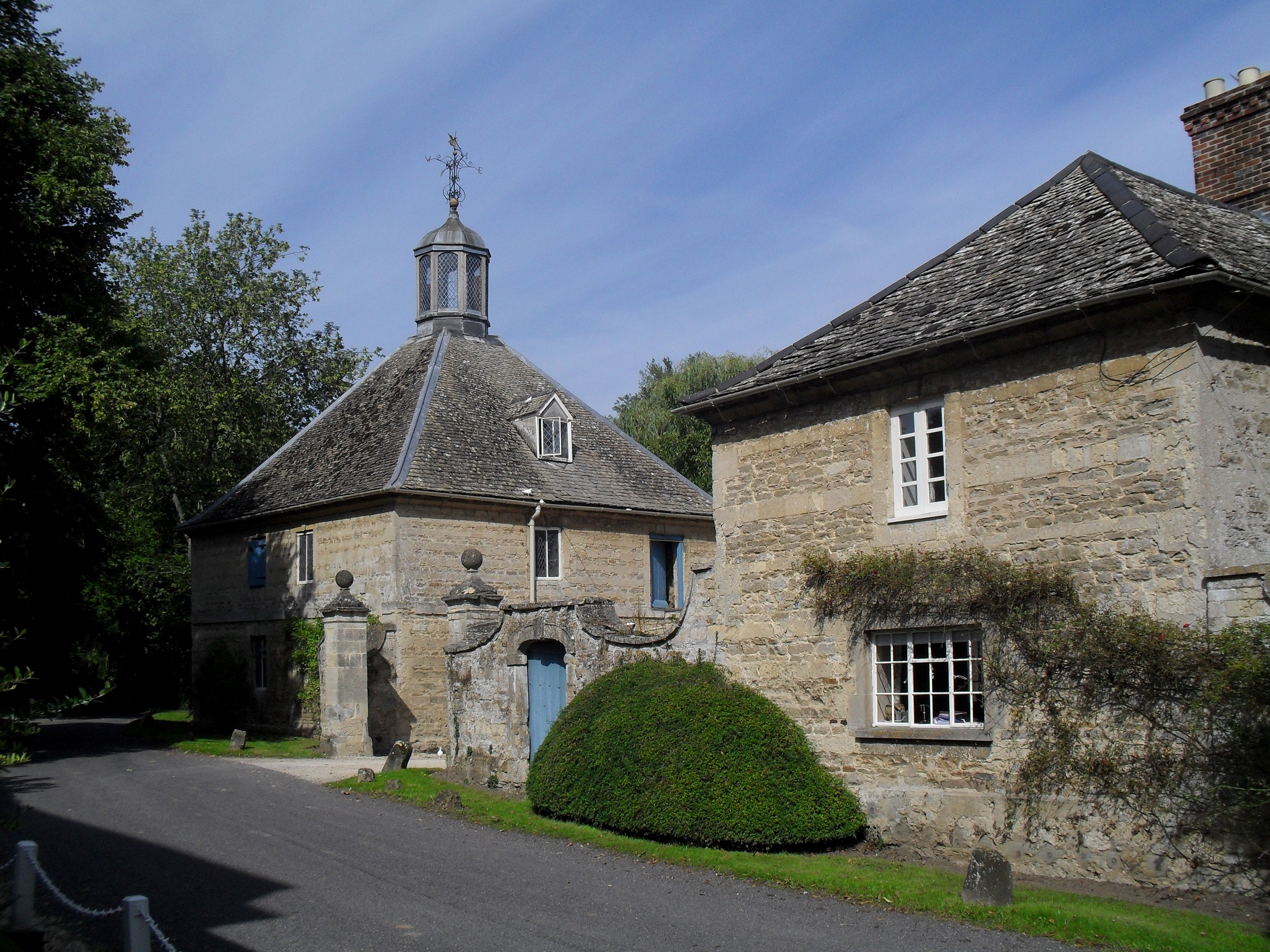
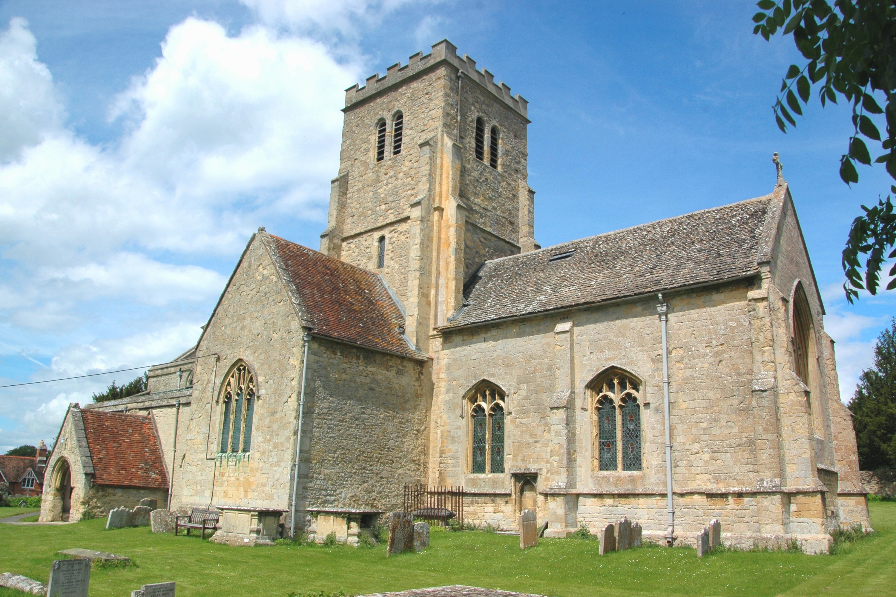
Denton is a quintessential English village, known for its charming thatched cottages, historic buildings, and tranquil atmosphere. The village has a small population of around 300 residents, contributing to its close-knit community feel. The centerpiece of the village is the 12th-century St. Mary's Church, a Grade II listed building with stunning architecture and a rich history.

The village is well-served by amenities, including a local pub, The Black Horse, where residents and visitors can enjoy traditional English fare and a friendly atmosphere. There is also a village hall, which hosts various community events throughout the year, fostering a sense of togetherness among the residents.

Denton's surrounding countryside offers numerous opportunities for outdoor activities and exploration. The nearby River Cherwell provides a picturesque setting for fishing, boating, and leisurely walks, while the rolling hills are perfect for cycling and hiking enthusiasts.

Despite its rural setting, Denton benefits from good transport links. The A40 road runs nearby, connecting the village to Oxford, Witney, and other nearby towns. Additionally, regular bus services operate in the area, providing easy access to surrounding areas.

Overall, Denton is a charming and idyllic village, offering a peaceful and picturesque escape from the hustle and bustle of city life.

If you have any feedback on the listing, please let us know in the comments section below.

Denton Images

Images are sourced within 2km of 51.717976/-1.141892 or Grid Reference SP5902. Thanks to Geograph Open Source API. All images are credited.

Farmland, Cuddesdon A footpath descending through wheat to the east of the village.  The mast at Stokenchurch can be seen in the background atop the Chilterns.
Farmland, Cuddesdon
A footpath descending through wheat to the east of the village. The mast at Stokenchurch can be seen in the background atop the Chilterns.
Farmland, Cuddesdon A crop of barley to the south of the village is close to coming into flower.
Farmland, Cuddesdon
A crop of barley to the south of the village is close to coming into flower.
Farmland, Little Milton Broadwater Planting and fields of wheat on ground rising to the east of the River Thame.
Farmland, Little Milton
Broadwater Planting and fields of wheat on ground rising to the east of the River Thame.
River Thame from Cuddesdon Mill Bridge
Farmland, Little Milton Fields of wheat to the south and west of Broadwater Planting.
Farmland, Little Milton
Fields of wheat to the south and west of Broadwater Planting.
Cuddesdon Mill
Cuddesdon Mill
All Saints Church, Cuddesdon
Entering Cuddesdon village Lane from Cuddesdon Mill up into Cuddesdon village
Entering Cuddesdon village
Lane from Cuddesdon Mill up into Cuddesdon village
Cuddesdon Lane View from the lane connecting Cuddesdon village with Cuddesdon Mill (centre right)
Views Farm on the Horizon.
Cuddesdon Lane
View from the lane connecting Cuddesdon village with Cuddesdon Mill (centre right) Views Farm on the Horizon.
Old bridge across Thame near Chippinghurst Manor
Old Bridge across River Thame looking towards Chippinghurst Manor
Cuddesdon Church
Cuddesdon Church
Hidden beyond the trees Chippinghurst Manor hidden beyond the trees by the River Thame
Hidden beyond the trees
Chippinghurst Manor hidden beyond the trees by the River Thame
Cuddesdon All Saints Cuddesdon All Saints Church tower behind Dowehouse Farm
Cuddesdon All Saints
Cuddesdon All Saints Church tower behind Dowehouse Farm
Lane heading to Cuddesdon Mill Lane heading to Cuddesdon Mill passing footpaths to Cuddesdon and Denton
Lane heading to Cuddesdon Mill
Lane heading to Cuddesdon Mill passing footpaths to Cuddesdon and Denton
The Thame Valley from Cuddesdon Cuddesdon village is on top of a low hill, about 100m AOD, in this direction overlooking the River Thame and out to the Chilterns on the horizon.
The Thame Valley from Cuddesdon
Cuddesdon village is on top of a low hill, about 100m AOD, in this direction overlooking the River Thame and out to the Chilterns on the horizon.
At the End of the Path On the map the path just seems to end in the middle of nowhere. A bit odd. What's that all about.
The remains of a fairly substantial building are here in the middle of a small wood. The only part remaining of any stature is the old chimney stack, usually the strongest part of a building.
You can see it must have had two storeys, with a loft above. So not just an old shed.
Anyway, that's where the footpath goes, although actually it looks like people wander on right down to the river at the bottom.
Well, nobody's going to see that notice, are they.
At the End of the Path
On the map the path just seems to end in the middle of nowhere. A bit odd. What's that all about. The remains of a fairly substantial building are here in the middle of a small wood. The only part remaining of any stature is the old chimney stack, usually the strongest part of a building. You can see it must have had two storeys, with a loft above. So not just an old shed. Anyway, that's where the footpath goes, although actually it looks like people wander on right down to the river at the bottom. Well, nobody's going to see that notice, are they.
It's all at Asda Two cheese and onion rolls, a Fish Licence and a can of Carlsberg please.
I wonder if they do those orange half price stickers when the season's coming to an end.
It's all at Asda
Two cheese and onion rolls, a Fish Licence and a can of Carlsberg please. I wonder if they do those orange half price stickers when the season's coming to an end.
Show me another place!

Denton is located at Grid Ref: SP5902 (Lat: 51.717976, Lng: -1.141892)

Administrative County: Oxfordshire

District: South Oxfordshire

Police Authority: Thames Valley

What 3 Words

///supposes.rejoiced.cocktail. Near Garsington, Oxfordshire

Related Wikis

Denton, Oxfordshire

Denton is a hamlet and former civil parish, now in the parish of Cuddesdon and Denton, in the South Oxfordshire district, in Oxfordshire, England. Denton...

Cuddesdon

Cuddesdon is a mainly rural village and former civil parish, now in the parish of Cuddesdon and Denton, in the South Oxfordshire district, in the county...

Bishop Edward King Chapel

Bishop Edward King Chapel is the chapel of Ripon College Cuddesdon, a Church of England theological college near Oxford, and of the Sisters of the Communities...

Waterstock House Training Centre

Waterstock House Training Centre (WHTC) is situated in the village of Waterstock in Oxfordshire, England. It is a well used venue for local and national...

Oxford Centre for Ecclesiology and Practical Theology

The Oxford Centre for Ecclesiology and Practical Theology (OxCEPT) is a research centre based at Ripon College Cuddesdon. == Overview == OxCEPT was founded...

Ripon College Cuddesdon

Ripon College Cuddesdon is a Church of England theological college in Cuddesdon, a village 5.5 miles (8.9 km) outside Oxford, England. The College trains...

Cuddesdon Palace

Cuddesdon Palace was the episcopal palace for the Bishop of Oxford, located near the village of Cuddesdon, Oxfordshire, England. == History == Cuddesdon...

Cuddesdon and Denton

Cuddesdon and Denton is a civil parish in the county of Oxfordshire, England. Forming part of South Oxfordshire district its main settlements are Cuddesdon...

Nearby Amenities

Located within 500m of 51.717976,-1.141892
Note: sign marking boundary of place
Source: photograph;gps_survey
Lat/Long: 51.7181833/-1.1446694
Denton
Place: hamlet
Wikidata: Q5259584
Wikipedia: en:Denton, Oxfordshire
Lat/Long: 51.7184785/-1.1394001
Post Box
Ref: OX44 101
Source: photograph
Lat/Long: 51.7182251/-1.1394605
Barrier: stile
Ele: 74.867798
Lat/Long: 51.7167578/-1.1472116
Barrier: stile
Lat/Long: 51.7173494/-1.1485355
Barrier: stile
Lat/Long: 51.7177665/-1.1489217
Barrier: stile
Lat/Long: 51.7182149/-1.1466537
Barrier: stile
Lat/Long: 51.7193589/-1.1432968
Barrier: stile
Lat/Long: 51.7194827/-1.1421757
Barrier: stile
Lat/Long: 51.7193475/-1.1418729
Barrier: stile
Ele: 66.456299
Lat/Long: 51.7179915/-1.1417871
Barrier: stile
Lat/Long: 51.7182627/-1.1405855
Bench
Created By: Potlatch 0.10f
Lat/Long: 51.7184435/-1.1399331
Barrier: stile
Lat/Long: 51.7174491/-1.139298
Barrier: stile
Ele: 64.774048
Lat/Long: 51.7175129/-1.1394267
Barrier: stile
Lat/Long: 51.7222497/-1.1414625
Barrier: stile
Lat/Long: 51.7211385/-1.1425011
Ford: yes
Lat/Long: 51.7218489/-1.1421946
Castle Farm
Naptan AtcoCode: 340001976OUT
Naptan Bearing: SW
Naptan BusStopType: CUS
Naptan CommonName: Castle Farm
Naptan Indicator: Outside
Naptan Landmark: Castle Farmhouse
Naptan NaptanCode: oxfawtda
Naptan Notes: Case Only
Naptan Street: Denton Hill
Naptan Verified: no
Source: naptan_import
Lat/Long: 51.7182316/-1.1393049
Bus Stop
Castle Farm
Bus: yes
Naptan AtcoCode: 340001976VIL
Naptan Bearing: NE
Naptan CommonName: Castle Farm
Naptan Indicator: Opposite
Naptan Landmark: Castle Farmhouse
Naptan NaptanCode: oxfgjtgw
Naptan Notes: Case Only
Naptan Street: Denton Hill
Public Transport: platform
Route Ref: 104
Source: naptan_import;survey
Lat/Long: 51.7183962/-1.139252
Barrier: stile
Lat/Long: 51.7208378/-1.136307
Barrier: stile
Lat/Long: 51.7203377/-1.1385654
Barrier: stile
Lat/Long: 51.7194021/-1.1427899
Power: pole
Source: Bing
Lat/Long: 51.7206369/-1.1461096
Power: pole
Source: Bing
Lat/Long: 51.7212635/-1.1445861
Power: pole
Source: Bing
Lat/Long: 51.7204243/-1.1469894
The data included in this document is from www.openstreetmap.org. The data is made available under ODbL.

Have you been to Denton?

Leave your review of Denton below (or comments, questions and feedback).