Coldridgedown Copse
Wood, Forest in Wiltshire
England
Coldridgedown Copse

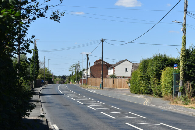
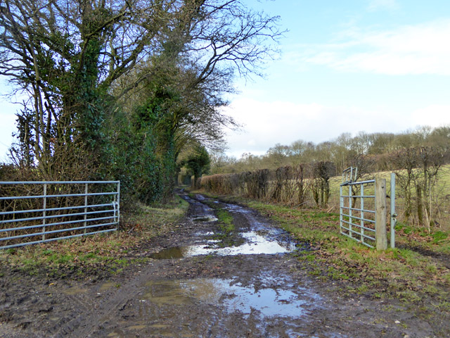
Coldridgedown Copse is a picturesque wooded area located in Wiltshire, England. Covering an approximate area of 25 acres, it is a charming and tranquil woodland that offers a peaceful retreat for nature enthusiasts. The copse is situated just south of the village of Coldridge, near the larger town of Trowbridge.
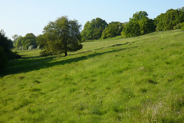
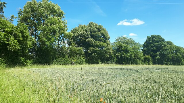
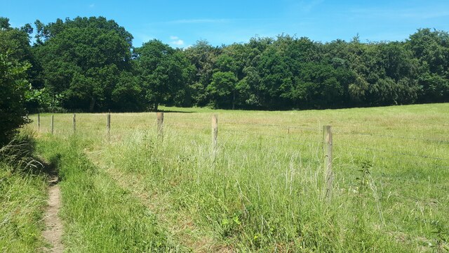
The woodland is predominantly composed of deciduous trees, including oak, beech, and ash, which provide a dense canopy that blocks out much of the sunlight, giving the copse a shady and cool atmosphere. The forest floor is covered with a thick layer of leaf litter, creating a soft and cushioned pathway for visitors to explore.
Coldridgedown Copse is home to a rich variety of wildlife. Birdwatchers can spot various species of birds, including woodpeckers, nightingales, and owls, while nature enthusiasts may see mammals such as deer, foxes, and badgers. The copse also supports a diverse range of insects, including butterflies, beetles, and spiders.
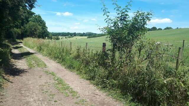
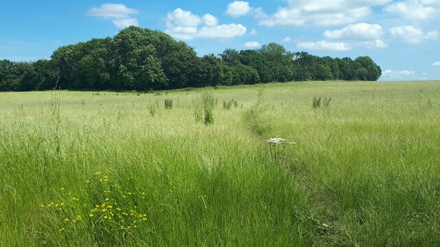
The woodland is crisscrossed by a network of footpaths, allowing visitors to explore the copse at their own pace. These paths wind through the trees, leading to open glades and small streams that meander through the woodland. The copse is a popular destination for walkers, joggers, and dog walkers who appreciate its peaceful ambiance and natural beauty.
Coldridgedown Copse offers a serene escape from the nearby urban areas, providing a haven for both wildlife and visitors seeking to reconnect with nature. Its diverse ecosystem and tranquil atmosphere make it a cherished natural resource in Wiltshire.
If you have any feedback on the listing, please let us know in the comments section below.
Coldridgedown Copse Images
Images are sourced within 2km of 51.264431/-1.5923651 or Grid Reference SU2851. Thanks to Geograph Open Source API. All images are credited.


Coldridgedown Copse is located at Grid Ref: SU2851 (Lat: 51.264431, Lng: -1.5923651)
Unitary Authority: Wiltshire
Police Authority: Wiltshire
What 3 Words
///admiral.reminder.boast. Near Ludgershall, Wiltshire
Nearby Locations
Related Wikis

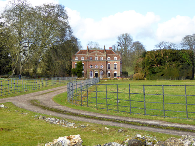
Biddesden House
Biddesden House (or Biddesden Park) is a Grade I listed English country house in east Wiltshire, about 5 miles (8 km) north-west of Andover, Hampshire...

Faberstown
Faberstown is a settlement in the civil parish of Ludgershall, Wiltshire, England. Its nearest town is Andover, approximately 6 miles (9.7 km) to the...

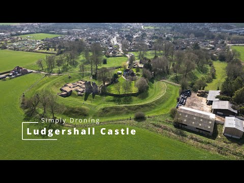
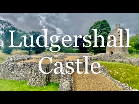
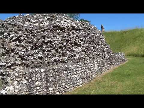
Ludgershall Castle
Ludgershall Castle is a ruined 12th-century fortified royal residence at Ludgershall in Wiltshire, England. Three large walls still remain of the castle...
Ludgershall, Wiltshire
Ludgershall ( LUG-ər-shawl, with a hard g) is a town and civil parish 16 miles (26 km) north east of Salisbury, Wiltshire, England. It is on the A342 road...

Ludgershall railway station, Wiltshire
Ludgershall railway station was a railway station which served the town of Ludgershall in Wiltshire, England from 1882 to 1961. == History == The station...
Perriam Down
Perriam Down or Perriam Downs, near Ludgershall, Wiltshire, England was a venue for five first-class cricket matches and at least three other matches between...

St Mary's Church, Chute Forest
St Mary's Church in Chute Forest, Wiltshire, England, was built between 1870 and 1871 and consecrated in 1875. It is recorded in the National Heritage...

Chute Forest
Chute Forest is a village and civil parish in east Wiltshire, England. The parish is bordered to the east and south by the county of Hampshire. The village...
Related Videos
![Ludgershall Castle Walking Tour [English Heritage]](https://i.ytimg.com/vi/cXxwGODv41I/hqdefault.jpg)
Ludgershall Castle Walking Tour [English Heritage]
Ludgershall Castle is a ruined 12th-century fortified royal residence at Ludgershall in Wiltshire, England. Three large walls still ...
Ludgershall Castle
Ludgershall Castle Wiltshire Filmed: 03/04/2023 What 3 Words: sprouting.ribs.choice Music By: https://audionautix.com.
🇬🇧 Ludgershall Castle | Forgotten royal hunting lodge 🏰
Forgotten royal hunting retreat #wiltshire #southeast #castle #ruin #uk #england #englishheritage #henryiii #walking ...
Ludgershall Castle
Dino's Epic Adventures.
Nearby Amenities
Located within 500m of 51.264431,-1.5923651Have you been to Coldridgedown Copse?
Leave your review of Coldridgedown Copse below (or comments, questions and feedback).