Surrey Farm Plantation

Wood, Forest in Yorkshire

England

Surrey Farm Plantation

Reservoir and milestones A view over the top Redmires reservoir with the information board erected by Yorkshire Water when the reservoir filled up again after works in 2018.  When the reservoir was empty it was possible to walk carefully to one of the milestones on the old route from Sheffield into Derbyshire via Long Causeway and Stanedge Pole.
Reservoir and milestones Credit: Chris Minto

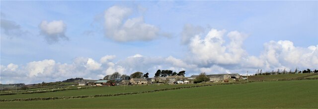
Surrey Farm Plantation, located in Yorkshire, England, is a picturesque woodland area known for its rich biodiversity and stunning natural beauty. Nestled amidst the rolling hills of Yorkshire, this plantation covers an expansive area of land, consisting mostly of dense forests and woodlands.

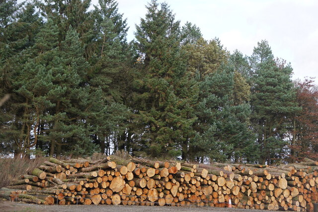
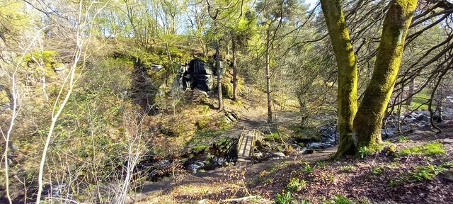
The plantation is home to a diverse range of flora and fauna, making it a haven for nature enthusiasts and wildlife lovers. Towering oak, beech, and pine trees dominate the landscape, providing a tranquil and serene atmosphere for visitors to enjoy. The forest floor is adorned with a carpet of vibrant wildflowers, creating a kaleidoscope of colors during the blooming season.

Surrey Farm Plantation is also home to a variety of wildlife species, including deer, foxes, badgers, and numerous bird species. Birdwatchers flock to the area to catch a glimpse of rare and migratory birds that call the plantation their temporary or permanent home.

The plantation offers several walking trails and paths, allowing visitors to explore the natural wonders at their own pace. These trails meander through the woodland, offering breathtaking views and opportunities to spot wildlife along the way.

In addition to its natural beauty, Surrey Farm Plantation also has historical significance. The plantation has been in existence for several centuries, with records dating back to the 17th century. It has played a vital role in the local economy, providing timber and resources for various industries.

Overall, Surrey Farm Plantation in Yorkshire is a haven of natural beauty, offering a peaceful escape from the hustle and bustle of daily life. Its diverse ecosystem and rich history make it a must-visit destination for nature enthusiasts and history buffs alike.

If you have any feedback on the listing, please let us know in the comments section below.

Surrey Farm Plantation Images

Images are sourced within 2km of 53.385027/-1.6060718 or Grid Reference SK2687. Thanks to Geograph Open Source API. All images are credited.

Reservoir and milestones A view over the top Redmires reservoir with the information board erected by Yorkshire Water when the reservoir filled up again after works in 2018.  When the reservoir was empty it was possible to walk carefully to one of the milestones on the old route from Sheffield into Derbyshire via Long Causeway and Stanedge Pole.
Reservoir and milestones
A view over the top Redmires reservoir with the information board erected by Yorkshire Water when the reservoir filled up again after works in 2018. When the reservoir was empty it was possible to walk carefully to one of the milestones on the old route from Sheffield into Derbyshire via Long Causeway and Stanedge Pole.
Information board A close up of the board erected by Yorkshire Water with information about the 3 remaining mileposts on the Long Causeway route from Sheffield into Derbyshire.
Information board
A close up of the board erected by Yorkshire Water with information about the 3 remaining mileposts on the Long Causeway route from Sheffield into Derbyshire.
Old milestone One of the 3 remaining milestones from the disused, except by walkers and cyclists, Long Causeway route from Sheffield into Derbyshire.  The gate has been variously fastened by barbed wire, twine and thick string.  This stone was previously in the fields to the south on the original line of Long Causeway.
Old milestone
One of the 3 remaining milestones from the disused, except by walkers and cyclists, Long Causeway route from Sheffield into Derbyshire. The gate has been variously fastened by barbed wire, twine and thick string. This stone was previously in the fields to the south on the original line of Long Causeway.
Rivelin Dams View over Rivelin Dams taken from Lodge Moor
Rivelin Dams
View over Rivelin Dams taken from Lodge Moor
Upper Redmires Reservoir, Fulwood
Timber, Redmires Reservoirs, Fulwood
Moorwood Farm, Stannington, Sheffield
Wyming Brook in Wyming Wood
Bridge over Wyming Brook in Wyming Wood
Moorwood Lane, Rivelin, Sheffield
Looking north from Long Lane, near Dungworth
Beeton Rod, near Dungworth
Moorland at Hollow Meadows
Wethercote Farm, Hollow Meadows
Rivelin Dam from the dam
The dam at Rivelin Lower Dam
Caspian Gull (Larus cachinnans), Redmires Reservoir The bird, at the centre, was colour-ringed above the knee (so the ring is covered by feathers in this view) and originated from a colony in Ijselmeer in the Netherlands. It had already been reported earlier at Kilnsea on the Yorkshire coast in early August.
Caspian Gull (Larus cachinnans), Redmires Reservoir
The bird, at the centre, was colour-ringed above the knee (so the ring is covered by feathers in this view) and originated from a colony in Ijselmeer in the Netherlands. It had already been reported earlier at Kilnsea on the Yorkshire coast in early August.
Approaching storm, Redmires Reservoirs
Show me another place!

Surrey Farm Plantation is located at Grid Ref: SK2687 (Lat: 53.385027, Lng: -1.6060718)

Division: West Riding

Unitary Authority: Sheffield

Police Authority: South Yorkshire

What 3 Words

///vows.plot.edges. Near Bradfield, South Yorkshire

Related Wikis

Rivelin Dams

Rivelin Dams are a pair of water storage reservoirs situated in the upper part of the Rivelin Valley, 5 miles (8 km) west of Sheffield in South Yorkshire...
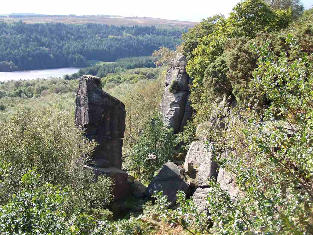
Rivelin Rocks

Rivelin Rocks are a gritstone edge or escarpment in the upper Rivelin Valley at grid reference SK279873, 9 kilometres (5.6 mi) west of Sheffield just off...

Wyming Brook

The Wyming Brook is a river in the City of Sheffield, England. Its source is the Redmires Reservoirs near the Hallam Moors. It flows in a north-easterly...
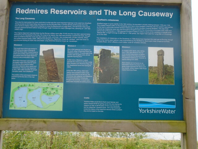
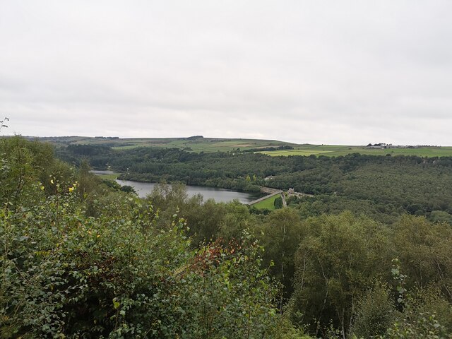
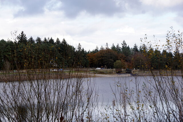
Redmires Reservoirs

The Redmires Reservoirs are a group of three reservoirs in Fulwood, Sheffield, South Yorkshire, England. They are fed from the Hallam Moors by various...
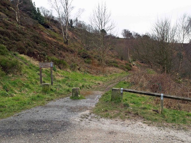
Fox Hagg

Fox Hagg is a small (33.25 hectares (82.2 acres)) nature reserve in the Rivelin Valley area of Sheffield, England. The Allen Sike flows along the north...

Hollow Meadows

Hollow Meadows is a hamlet in the civil parish of Bradfield, west of Sheffield in South Yorkshire, England. It lies along the A57 road, between Moscar...

Lodge Moor camp

Lodge Moor was a British military camp based near Redmires Reservoirs, Sheffield, that was best known for housing prisoners of war during World War II...

Lodge Moor Hospital

Lodge Moor Hospital is a former isolation hospital on Redmires Road in the Lodge Moor area of the City of Sheffield, England. The hospital which opened...

Nearby Amenities

Located within 500m of 53.385027,-1.6060718
Bus Stop
Manchester Road/Wyming Brook Drive
Bench: no
Bin: no
Bus: yes
Lit: no
Naptan AtcoCode: 370023248
Naptan Bearing: W
Naptan CommonName: Manchester Road/Wyming Brook Drive
Naptan Indicator: 23248
Naptan Landmark: OPPOSITE THE CABIN CAFE
Naptan PlusbusZoneRef: ROTHCEN
Naptan Street: Manchester Road
Naptan Verified: no
Public Transport: platform
Shelter: no
Source: naptan_import
Tactile Paving: no
Lat/Long: 53.3833842/-1.6041454
Bus Stop
Manchester Road/Wyming Brook Drive
Bench: no
Bin: no
Bus: yes
Lit: no
Naptan AtcoCode: 370026916
Naptan Bearing: E
Naptan BusStopType: CUS
Naptan CommonName: Manchester Road/Wyming Brook Drive
Naptan Indicator: 26916
Naptan Landmark: OPPOSITE THE CABIN CAFE
Naptan PlusbusZoneRef: ROTHCEN
Naptan Street: Manchester Road
Naptan Verified: no
Public Transport: platform
Shelter: no
Source: naptan_import
Tactile Paving: no
Lat/Long: 53.3834493/-1.6041521
Bus Stop
Manchester Road/Surrey Farm
Bench: no
Bin: no
Bus: yes
Naptan AtcoCode: 370027258
Naptan Bearing: N
Naptan CommonName: Manchester Road/Surrey Farm
Naptan Indicator: 27258
Naptan Landmark: Surrey Farm
Naptan PlusbusZoneRef: ROTHCEN
Naptan Street: Manchester Road
Naptan Verified: no
Public Transport: platform
Shelter: no
Source: naptan_import
Tactile Paving: no
Lat/Long: 53.3860989/-1.6123747
Barrier: stile
Foot: yes
Material: stone
Source: survey;gps
Stile: stepover
Lat/Long: 53.3852931/-1.6133892
Power: pole
Lat/Long: 53.3894202/-1.6076248
Power: pole
Lat/Long: 53.3892922/-1.6058545
Power: pole
Lat/Long: 53.3891387/-1.6037463
Barrier: stile
Lat/Long: 53.3863797/-1.6079309
Barrier: stile
Lat/Long: 53.3873013/-1.6080287
Barrier: stile
Foot: yes
Material: wood
Source: survey;gps
Stile: stepover
Lat/Long: 53.3858654/-1.6118477
Barrier: stile
Foot: yes
Material: stone
Source: survey;gps
Stile: stepover
Lat/Long: 53.385926/-1.6122615
Barrier: stile
Foot: yes
Material: stone
Source: survey;gps
Stile: stepover
Lat/Long: 53.3866856/-1.6108796
Barrier: stile
Material: stone
Source: survey;gps
Stile: stepover
Lat/Long: 53.3878777/-1.6100185
Barrier: stile
Lat/Long: 53.3861205/-1.599116
Barrier: stile
Lat/Long: 53.3845331/-1.6067403
Barrier: stile
Lat/Long: 53.3835113/-1.606024
Barrier: stile
Lat/Long: 53.3852315/-1.5994789
Parking
Parking: street_side
Lat/Long: 53.3833468/-1.6043625
Power: pole
Lat/Long: 53.3887798/-1.609393
Power: pole
Lat/Long: 53.3876519/-1.6054229
Power: pole
Lat/Long: 53.3872979/-1.6041212
Power: pole
Lat/Long: 53.3870478/-1.6032847
Power: pole
Lat/Long: 53.3867376/-1.6021802
Power: pole
Lat/Long: 53.3864246/-1.601071
Power: pole
Lat/Long: 53.3860555/-1.5997464
Power: pole
Lat/Long: 53.3858997/-1.5991895
Manchester Road/Wyming Brook Drive
Bus: yes
Public Transport: stop_position
Lat/Long: 53.3834263/-1.6041616
Manchester Road/Wyming Brook Drive
Bus: yes
Public Transport: stop_position
Lat/Long: 53.3834229/-1.6041339
Manchester Road/Surrey Farm
Bus: yes
Public Transport: stop_position
Lat/Long: 53.3860583/-1.6124259
Power: pole
Lat/Long: 53.3882249/-1.607414
Power: pole
Lat/Long: 53.3879256/-1.606374
Power: pole
Lat/Long: 53.3884882/-1.6083293
Reddicar Roof
Natural: stone
Lat/Long: 53.381072/-1.6035343
The data included in this document is from www.openstreetmap.org. The data is made available under ODbL.

Have you been to Surrey Farm Plantation?

Leave your review of Surrey Farm Plantation below (or comments, questions and feedback).