Dearnly

Settlement in Lancashire

England

Dearnly

Wildhouse Lane farm entrance
Wildhouse Lane farm entrance Credit: Colin Pyle

Dearnly is a small village located in Lancashire, England. Situated northeast of the town of Rochdale, it falls under the Metropolitan Borough of Rochdale. With a population of around 2,000 residents, Dearnly is a close-knit community that offers a tranquil and picturesque setting.

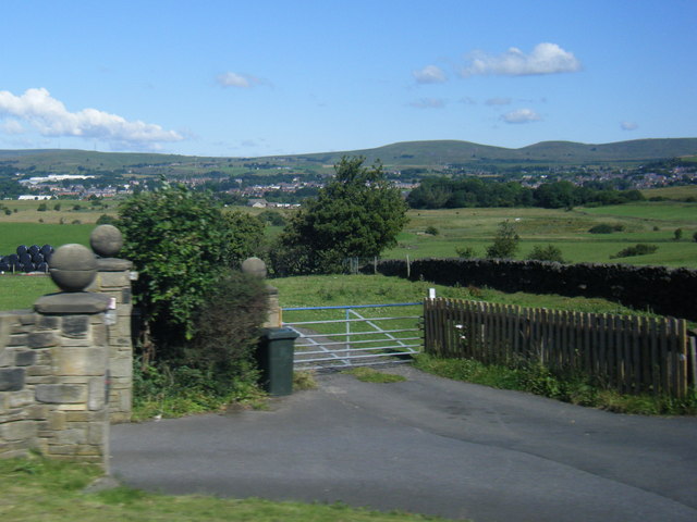
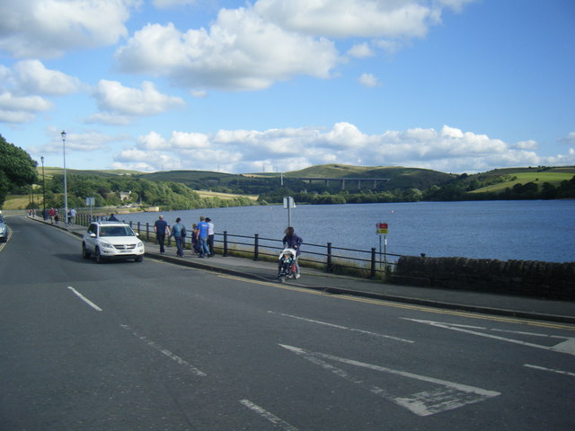
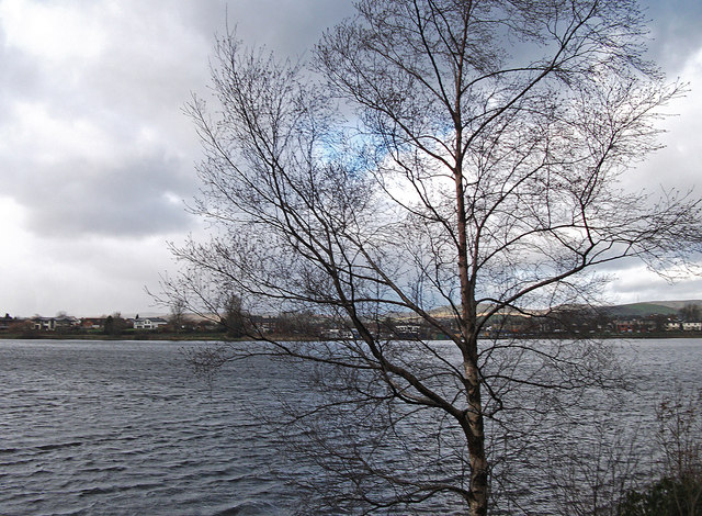
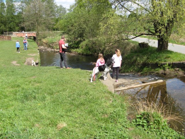
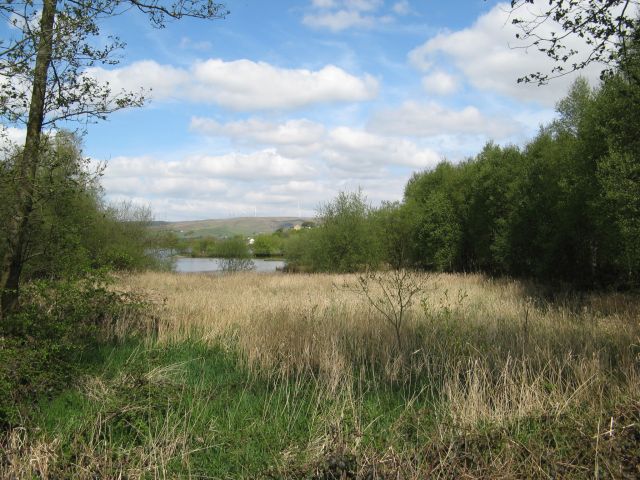
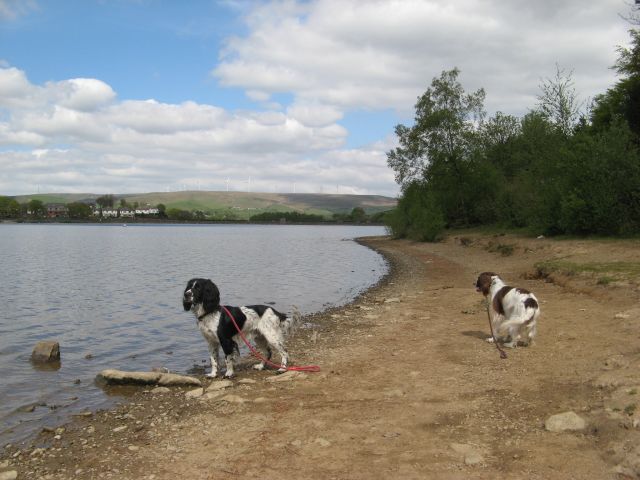
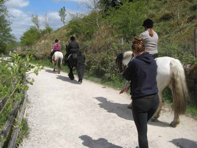
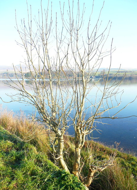
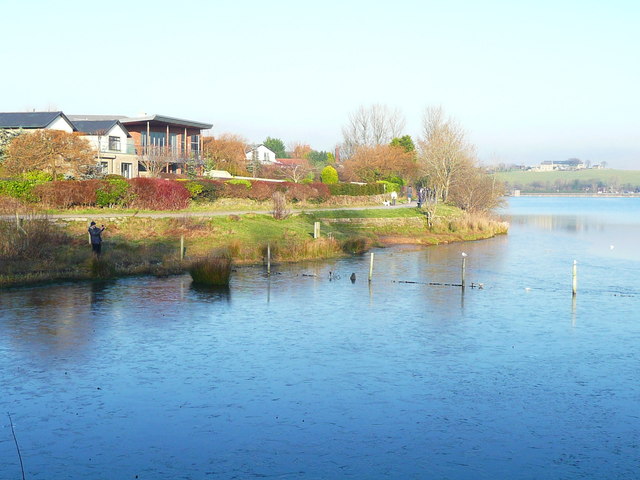
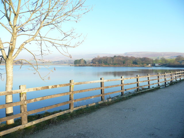
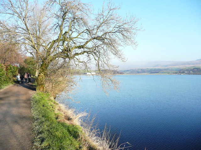
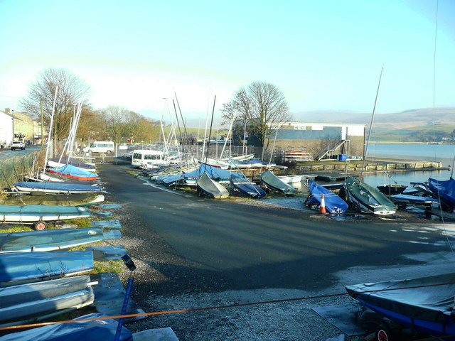
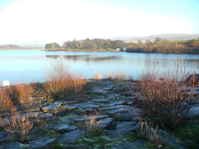
The village is surrounded by stunning countryside, with rolling hills and green fields creating a scenic backdrop. The area is known for its natural beauty, attracting visitors who enjoy outdoor activities such as hiking, cycling, and birdwatching. The nearby Hollingworth Lake Country Park offers a range of recreational opportunities, including sailing and fishing.

Dearnly has a rich history, dating back to medieval times. It was once a farming community, and remnants of its agricultural past can still be seen in the form of traditional stone-built farmhouses and barns. The village retains its rural charm, with narrow lanes and stone walls adding to its character.

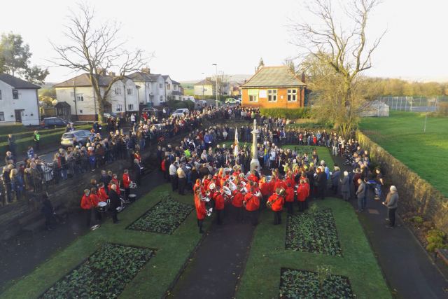
Despite its small size, Dearnly has a strong sense of community, with several local amenities catering to the needs of its residents. These include a village hall, a primary school, a post office, and a few small shops. The village is also well-connected, with good transport links to nearby towns and cities, making it an attractive place for commuters.

Dearnly offers a peaceful and idyllic lifestyle, combining the benefits of rural living with easy access to urban amenities. Its natural beauty, rich history, and strong community spirit make it a desirable place to live for those seeking a tranquil and picturesque setting.

If you have any feedback on the listing, please let us know in the comments section below.
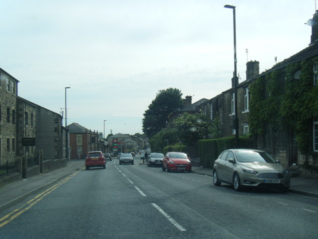
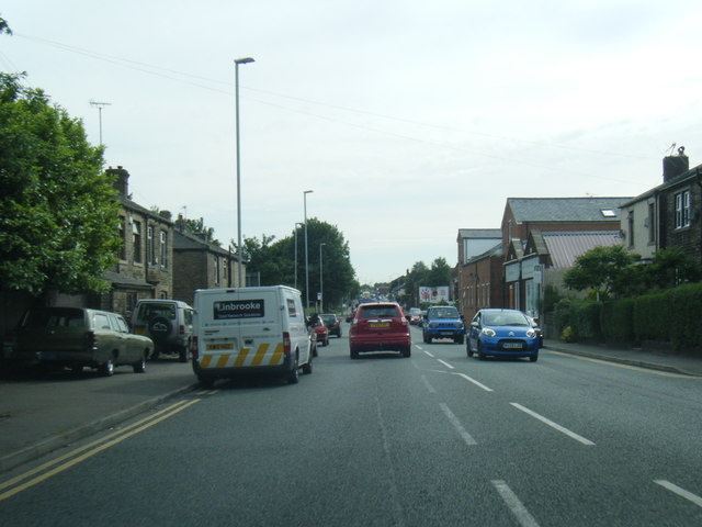
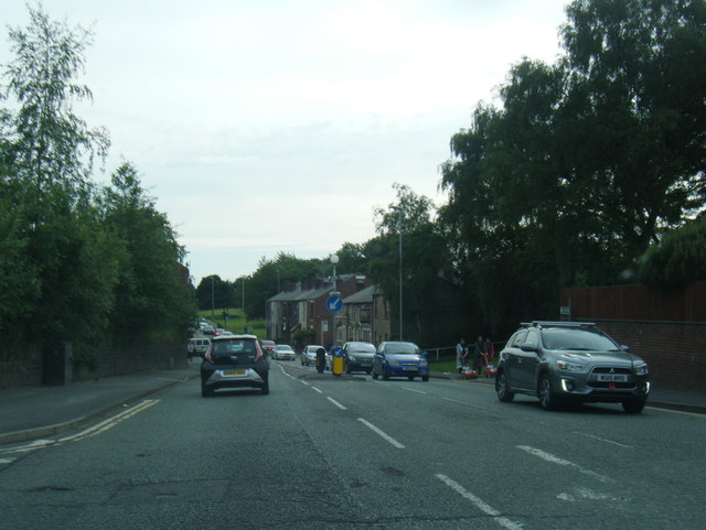
Dearnly Images

Images are sourced within 2km of 53.638209/-2.113402 or Grid Reference SD9215. Thanks to Geograph Open Source API. All images are credited.

Wildhouse Lane farm entrance
Hollingworth Lake with the elevated M62 beyond
Remembrance Sunday 2014 Remembrance Ceremony at the Wardle Memorial Garden, 9 November 2014, with the Wardle Academy Brass Band.

Taken from an upper floor window of the Wardle & Smallbridge Community Centre (former Wardle UDC offices).
Remembrance Sunday 2014
Remembrance Ceremony at the Wardle Memorial Garden, 9 November 2014, with the Wardle Academy Brass Band. Taken from an upper floor window of the Wardle & Smallbridge Community Centre (former Wardle UDC offices).
Silver birch at Hollingworth Lake Looking north over the lake from a point near the lakeside café.
Silver birch at Hollingworth Lake
Looking north over the lake from a point near the lakeside café.
Hollingworth Lake
Hollingworth Lake
Longden End Brook The brook passes over a gauging weir as it approaches Hollingworth Lake, a popular place for swimming dogs, it seems, though my assistant Madog is staying dry for a change.
Longden End Brook
The brook passes over a gauging weir as it approaches Hollingworth Lake, a popular place for swimming dogs, it seems, though my assistant Madog is staying dry for a change.
Wetland view An extensive reed bed is part of the nature reserve at the southern, shallow end of the reservoir, near to the influx of the Longden End Brook.
Wetland view
An extensive reed bed is part of the nature reserve at the southern, shallow end of the reservoir, near to the influx of the Longden End Brook.
Beach view A view of the southern margin of the reservoir, which is mostly shallow.
Beach view
A view of the southern margin of the reservoir, which is mostly shallow.
Equine traffic Horses taking the path around the lake.
Equine traffic
Horses taking the path around the lake.
A58 Church Street, Littleborough
A58 New road, Dearnley
A58 Halifax Road heading west
Ash tree, Hollingworth Lake There are several trees alongside the lakeside that have been cut about a metre above ground, prompting the production of a large number of thin branches.
Ash tree, Hollingworth Lake
There are several trees alongside the lakeside that have been cut about a metre above ground, prompting the production of a large number of thin branches.
Houses alongside Hollingworth Lake These houses have a good view of the lake, and have access from a residential road behind.
Houses alongside Hollingworth Lake
These houses have a good view of the lake, and have access from a residential road behind.
View from the lakeside path, Hollingworth Lake
The lakeside path, Hollingworth Lake
The boat yard, Hollingworth Lake
Rocky shore, Hollingworth Lake Here is a place where you can get down to the edge of the water safely.
Rocky shore, Hollingworth Lake
Here is a place where you can get down to the edge of the water safely.
Show me another place!

Dearnly is located at Grid Ref: SD9215 (Lat: 53.638209, Lng: -2.113402)

Unitary Authority: Rochdale

Police Authority: Greater Manchester

What 3 Words

///asking.rally.exchanges. Near Littleborough, Manchester

Related Wikis

Smithy Bridge railway station

Smithy Bridge railway station serves the village of Smithy Bridge and Hollingworth Lake near Rochdale in Greater Manchester, England. The station is on...

Birch Hill Hospital

Birch Hill Hospital is a health facility in Wardle, Littleborough, near Rochdale, Greater Manchester. It was managed by Pennine Acute Hospitals NHS Trust...

Featherstall Brook

Featherstall Brook is a watercourse in Greater Manchester and a tributary of the River Roch. == Tributaries == Middle Wood Brook Hills Brook

Smithy Bridge

Smithy Bridge is a suburb of Littleborough in the Metropolitan Borough of Rochdale, Greater Manchester, England. Hollingworth Lake Country Park is close...

Nearby Amenities

Located within 500m of 53.638209,-2.113402
Dearnley
Is In: Rochdale, Greater Manchester
Place: suburb
Source: npe
Lat/Long: 53.6383186/-2.1129669
Bus Stop
New Road/Stubley Hall
Bus: yes
Naptan AtcoCode: 1800NE49081
Naptan Bearing: NE
Naptan CommonName: New Road/Stubley Hall
Naptan Indicator: Shops
Naptan Landmark: HOUSE 8
Naptan NaptanCode: mangdwtd
Naptan PlusbusZoneRef: MNCRPIC
Naptan ShortCommonName: Stubley Hall
Naptan Street: NEW ROAD
Naptan Verified: no
Network: TfGM
Public Transport: platform
Source: naptan_import
Lat/Long: 53.6411352/-2.1119462
Bus Stop
New Road/Stubley Hall
Bus: yes
Naptan AtcoCode: 1800NE49091
Naptan Bearing: SW
Naptan CommonName: New Road/Stubley Hall
Naptan Indicator: House 20
Naptan Landmark: HOUSE 20
Naptan NaptanCode: mangdwtg
Naptan PlusbusZoneRef: MNCRPIC
Naptan ShortCommonName: Stubley Hall
Naptan Street: NEW ROAD
Naptan Verified: no
Network: TfGM
Public Transport: platform
Source: naptan_import
Lat/Long: 53.6405771/-2.1127616
Bus Stop
New Road/Dearnley Post Office
Bus: yes
Naptan AtcoCode: 1800NE49101
Naptan Bearing: NE
Naptan CommonName: New Road/Dearnley Post Office
Naptan Indicator: O/s House 68
Naptan Landmark: CROWTHER COURT
Naptan NaptanCode: mangdwtj
Naptan PlusbusZoneRef: MNCRPIC
Naptan ShortCommonName: Dearnley PO
Naptan Street: NEW ROAD
Naptan Verified: no
Network: TfGM
Public Transport: platform
Source: naptan_import
Lat/Long: 53.639766/-2.1150736
Bus Stop
New Road/Dearnley Post Office
Bus: yes
Naptan AtcoCode: 1800NE49111
Naptan Bearing: SW
Naptan CommonName: New Road/Dearnley Post Office
Naptan Indicator: House 103
Naptan Landmark: HOUSE 103
Naptan NaptanCode: mangdwtm
Naptan PlusbusZoneRef: MNCRPIC
Naptan ShortCommonName: Dearnley PO
Naptan Street: NEW ROAD
Naptan Verified: no
Network: TfGM
Public Transport: platform
Source: naptan_import
Lat/Long: 53.6395591/-2.1152394
Bus Stop
New Road/Paddock Head
Bus: yes
Naptan AtcoCode: 1800NE49121
Naptan Bearing: SW
Naptan CommonName: New Road/Paddock Head
Naptan Indicator: O/s House 135
Naptan Landmark: HOUSE 135
Naptan NaptanCode: mangdwtp
Naptan PlusbusZoneRef: MNCRPIC
Naptan ShortCommonName: Paddock Head
Naptan Street: NEW ROAD
Naptan Verified: no
Network: TfGM
Public Transport: platform
Source: naptan_import
Lat/Long: 53.6388293/-2.1170221
Bus Stop
New Road/Paddock Head
Bus: yes
Naptan AtcoCode: 1800NE49131
Naptan Bearing: NE
Naptan CommonName: New Road/Paddock Head
Naptan Indicator: O/s House 142
Naptan Landmark: HOUSE 142
Naptan NaptanCode: mangdwtw
Naptan PlusbusZoneRef: MNCRPIC
Naptan ShortCommonName: Paddock Head
Naptan Street: NEW ROAD
Naptan Verified: no
Network: TfGM
Public Transport: platform
Source: naptan_import
Lat/Long: 53.6387297/-2.117763
Bus Stop
Halifax Road/Mount Avenue (Stop B)
Bus: yes
Local Ref: B
Naptan AtcoCode: 1800NE49251
Naptan Bearing: NE
Naptan CommonName: Halifax Road/Mount Avenue (Stop B)
Naptan Indicator: Stop B
Naptan Landmark: HOUSE 763
Naptan NaptanCode: mangjajg
Naptan PlusbusZoneRef: MNCRPIC
Naptan ShortCommonName: Mount Avenue
Naptan Street: Halifax Rad
Naptan Verified: no
Network: TfGM
Public Transport: platform
Source: naptan_import
Lat/Long: 53.6378008/-2.1208458
Bus Stop
Halifax Road/Mount Avenue (Stop C)
Bus: yes
Local Ref: C
Naptan AtcoCode: 1800NE49261
Naptan Bearing: SW
Naptan CommonName: Halifax Road/Mount Avenue (Stop C)
Naptan Indicator: Stop C
Naptan Landmark: PETROL STATION
Naptan NaptanCode: mangjajm
Naptan PlusbusZoneRef: MNCRPIC
Naptan ShortCommonName: Mount Avenue
Naptan Street: HALIFAX ROAD
Naptan Verified: no
Network: TfGM
Public Transport: platform
Source: naptan_import
Lat/Long: 53.6377833/-2.1204223
Bus Stop
Smithy Bridge Road/Halifax Road (Stop E)
Bus: yes
Local Ref: E
Naptan AtcoCode: 1800NE49271
Naptan Bearing: SE
Naptan CommonName: Smithy Bridge Road/Halifax Road (Stop E)
Naptan Indicator: Stop E
Naptan Landmark: HOUSE 3
Naptan NaptanCode: mangjajp
Naptan PlusbusZoneRef: MNCRPIC
Naptan ShortCommonName: Halifax Road
Naptan Street: Smithy Brdge Road
Naptan Verified: no
Network: TfGM
Public Transport: platform
Source: naptan_import
Lat/Long: 53.6380368/-2.1185324
Bus Stop
Smithy Bridge Road/Halifax Road (Stop D)
Bus: yes
Local Ref: D
Naptan AtcoCode: 1800NE49281
Naptan Bearing: NW
Naptan CommonName: Smithy Bridge Road/Halifax Road (Stop D)
Naptan Indicator: Stop D
Naptan Landmark: STAFFORD COURT
Naptan NaptanCode: mangjajt
Naptan PlusbusZoneRef: MNCRPIC
Naptan ShortCommonName: Halifax Road
Naptan Street: Smithy Brdge Road
Naptan Verified: no
Network: TfGM
Public Transport: platform
Source: naptan_import
Lat/Long: 53.6376865/-2.1183197
Bus Stop
Smithy Bridge Road/Southview Road
Bus: yes
Naptan AtcoCode: 1800NE49291
Naptan Bearing: SE
Naptan CommonName: Smithy Bridge Road/Southview Road
Naptan Indicator: Field
Naptan Landmark: HALLIDAY COURT
Naptan NaptanCode: mangjajw
Naptan PlusbusZoneRef: MNCRPIC
Naptan ShortCommonName: Southview Road
Naptan Street: Smithy Brdge Road
Naptan Verified: no
Network: TfGM
Public Transport: platform
Shelter: no
Source: naptan_import;local knowledge
Lat/Long: 53.6359644/-2.1162567
Bus Stop
Smithy Bridge Road/Southview Road
Bus: yes
Naptan AtcoCode: 1800NE49301
Naptan Bearing: NW
Naptan CommonName: Smithy Bridge Road/Southview Road
Naptan Indicator: Opp Flats 4-18
Naptan Landmark: OPP FLATS 4-18
Naptan NaptanCode: mangjama
Naptan PlusbusZoneRef: MNCRPIC
Naptan ShortCommonName: Southview Road
Naptan Street: Smithy Brdge Road
Naptan Verified: no
Network: TfGM
Public Transport: platform
Shelter: yes
Source: naptan_import
Lat/Long: 53.6353637/-2.1159244
Bus Stop
Smithy Bridge Road/Rose Avenue
Bus: yes
Naptan AtcoCode: 1800NE49311
Naptan Bearing: SE
Naptan CommonName: Smithy Bridge Road/Rose Avenue
Naptan Indicator: Opp House 8
Naptan Landmark: HOUSE 8
Naptan NaptanCode: mangjamd
Naptan PlusbusZoneRef: MNCRPIC
Naptan ShortCommonName: Rose Avenue
Naptan Street: Smithy Brdge Road
Naptan Verified: no
Network: TfGM
Public Transport: platform
Source: naptan_import
Lat/Long: 53.6345888/-2.1148477
Bus Stop
Smithy Bridge Road/Rose Avenue
Bus: yes
Naptan AtcoCode: 1800NE49321
Naptan Bearing: NW
Naptan CommonName: Smithy Bridge Road/Rose Avenue
Naptan Indicator: O/s House 10
Naptan Landmark: HOUSE 10
Naptan NaptanCode: mangjamg
Naptan PlusbusZoneRef: MNCRPIC
Naptan ShortCommonName: Rose Avenue
Naptan Street: Smithy Brdge Road
Naptan Verified: no
Network: TfGM
Public Transport: platform
Source: naptan_import
Lat/Long: 53.6343461/-2.1148471
Post Office
Dearnley Post Office
Addr Country: GB
Addr Postcode: OL15 8NL
Brand: Post Office
Brand Wikidata: Q1783168
Contact Website: https://www.postoffice.co.uk/branch-finder/2374242/dearnley
Ref Pol Id: 9206
Lat/Long: 53.6394912/-2.1159742
Turning Circle
Source: bing
Lat/Long: 53.6376043/-2.1152196
Atm
Fee: no
Operator: CoOp
Lat/Long: 53.6374804/-2.1205522
Fuel
Shell
Brand: Shell
Brand Wikidata: Q110716465
Lat/Long: 53.6376903/-2.120292
Spar
Brand: Spar
Brand Wikidata: Q610492
Shop: supermarket
Website: https://www.spar.co.uk/store-locator/hal24750-spar-halifax-road/
Wheelchair: yes
Lat/Long: 53.6375838/-2.1207185
Pub
Ox and Plough
Wheelchair: no
Lat/Long: 53.6383885/-2.1189965
Restaurant
The Green Door
Lat/Long: 53.6390724/-2.1170382
Stubly Hall
Building: yes
Lat/Long: 53.6411349/-2.1107108
Generator Method: photovoltaic
Generator Output Electricity: yes
Generator Source: solar
Generator Type: solar_photovoltaic_panel
Location: roof
Power: generator
Lat/Long: 53.6389853/-2.1073731
Generator Method: photovoltaic
Generator Output Electricity: yes
Generator Source: solar
Generator Type: solar_photovoltaic_panel
Location: roof
Power: generator
Lat/Long: 53.6382542/-2.1164725
Generator Method: photovoltaic
Generator Output Electricity: yes
Generator Source: solar
Generator Type: solar_photovoltaic_panel
Location: roof
Power: generator
Lat/Long: 53.6382446/-2.1165288
Generator Method: photovoltaic
Generator Output Electricity: yes
Generator Source: solar
Generator Type: solar_photovoltaic_panel
Location: roof
Power: generator
Lat/Long: 53.6425513/-2.1134842
Generator Method: photovoltaic
Generator Output Electricity: yes
Generator Source: solar
Generator Type: solar_photovoltaic_panel
Location: roof
Power: generator
Lat/Long: 53.6426408/-2.1128487
Generator Method: photovoltaic
Generator Output Electricity: yes
Generator Source: solar
Generator Type: solar_photovoltaic_panel
Location: roof
Power: generator
Lat/Long: 53.6417412/-2.1120014
Generator Method: photovoltaic
Generator Output Electricity: yes
Generator Source: solar
Generator Type: solar_photovoltaic_panel
Location: roof
Power: generator
Lat/Long: 53.6363707/-2.1161212
Barrier: bollard
Bicycle: yes
Foot: yes
Horse: yes
Motor Vehicle: no
Lat/Long: 53.6390085/-2.1071542
Crossing
Crossing: marked
Lat/Long: 53.6392754/-2.116077
Parcel Locker
Watkins
Brand: Amazon Locker
Brand Wikidata: Q16974764
Opening Hours: 24/7
Lat/Long: 53.6376511/-2.1208594
Addr City: Littleborough
Addr Housenumber: 158
Addr Postcode: OL15 8NZ
Addr Street: Featherstall Road
Lat/Long: 53.6415339/-2.1111143
Addr City: Littleborough
Addr Housenumber: 160
Addr Postcode: OL15 8NZ
Addr Street: Featherstall Road
Lat/Long: 53.6415046/-2.1112144
Addr City: Littleborough
Addr Housenumber: 162
Addr Postcode: OL15 8NZ
Addr Street: Featherstall Road
Lat/Long: 53.6414749/-2.1113018
Addr City: Littleborough
Addr Housenumber: 163
Addr Postcode: OL15 8PH
Addr Street: Featherstall Road
Lat/Long: 53.6415012/-2.1100261
Addr City: Littleborough
Addr Housenumber: 165
Addr Postcode: OL15 8PH
Addr Street: Featherstall Road
Lat/Long: 53.6414859/-2.1101823
Addr City: Littleborough
Addr Housenumber: 4
Addr Postcode: OL15 8PF
Addr Street: Spenwood Road
Lat/Long: 53.6410413/-2.1088904
Addr City: Littleborough
Addr Housenumber: 12
Addr Postcode: OL15 8PF
Addr Street: Spenwood Road
Lat/Long: 53.6411093/-2.1083606
Addr City: Littleborough
Addr Housenumber: 11
Addr Postcode: OL15 8PF
Addr Street: Spenwood Road
Lat/Long: 53.6412879/-2.1084459
Addr City: Littleborough
Addr Housenumber: 13
Addr Postcode: OL15 8PF
Addr Street: Spenwood Road
Lat/Long: 53.6413197/-2.1082583
Addr City: Littleborough
Addr Housenumber: 15
Addr Postcode: OL15 8PF
Addr Street: Spenwood Road
Lat/Long: 53.6413343/-2.1081488
Addr City: Littleborough
Addr Housenumber: 2
Addr Postcode: OL15 8LT
Addr Street: James Street
Lat/Long: 53.6414771/-2.112069
Addr City: Littleborough
Addr Housenumber: 12
Addr Postcode: OL15 8LT
Addr Street: James Street
Lat/Long: 53.6413606/-2.112337
Addr City: Littleborough
Addr Housenumber: 16
Addr Postcode: OL15 8LT
Addr Street: James Street
Lat/Long: 53.6413036/-2.1125671
Addr City: Littleborough
Addr Housenumber: 14
Addr Postcode: OL15 8LT
Addr Street: James Street
Lat/Long: 53.6413301/-2.1125135
Addr City: Littleborough
Addr Housenumber: 10
Addr Postcode: OL15 8LT
Addr Street: James Street
Lat/Long: 53.6413818/-2.1122923
EK Motors
Addr Postcode: OL15 8QF
Addr Street: Smithy Bridge Road
Addr Unit: 2
Phone: 01706 375597
Service Vehicle Car Repair: yes
Service Vehicle Inspection: yes
Shop: car_repair
Website: https://www.ekmotors.co.uk
Lat/Long: 53.6350498/-2.1099268
The data included in this document is from www.openstreetmap.org. The data is made available under ODbL.

Have you been to Dearnly?

Leave your review of Dearnly below (or comments, questions and feedback).