Debdale

Settlement in Lancashire

England

Debdale

New build housing at Fairfield Beside Ashton Canal
New build housing at Fairfield Credit: Chris Morgan

Debdale is a small village located in the county of Lancashire, England. It is situated approximately 3 miles southeast of the town of Chorley and about 20 miles northwest of the city of Manchester. The village is nestled in a picturesque rural setting, surrounded by lush green fields and rolling hills.

Debdale has a rich history that dates back many centuries. The village is mentioned in the Domesday Book of 1086, which indicates its existence even before the Norman conquest of England. Throughout its history, Debdale has predominantly been an agricultural community, with farming being the primary occupation of its residents.

Today, Debdale remains a quiet and close-knit community, with a population of around 500 people. The village is known for its charming cottages and traditional architecture, which add to its overall appeal. Its peaceful atmosphere and natural beauty make Debdale an attractive place for those seeking a tranquil rural lifestyle.

Although Debdale is a small village, it provides several amenities for its residents. These include a local pub, a village hall, and a primary school. The village is also well-connected to the surrounding areas, with good road links to nearby towns and cities.

In terms of attractions, Debdale is close to the stunning West Pennine Moors, offering opportunities for outdoor activities such as hiking and cycling. The nearby town of Chorley provides additional amenities, including shops, restaurants, and leisure facilities.

In summary, Debdale is a picturesque and historic village in Lancashire, offering a peaceful rural lifestyle with access to nearby amenities and natural beauty.

If you have any feedback on the listing, please let us know in the comments section below.
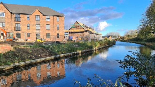
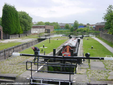
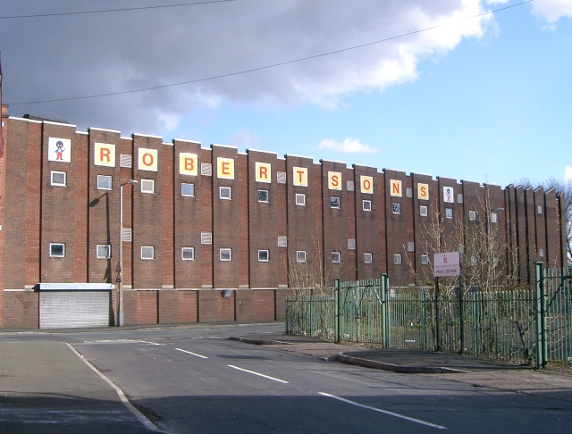
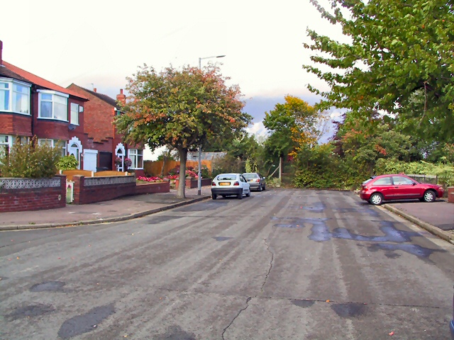
Debdale Images

Images are sourced within 2km of 53.459199/-2.155848 or Grid Reference SJ8995. Thanks to Geograph Open Source API. All images are credited.

New build housing at Fairfield Beside Ashton Canal
New build housing at Fairfield
Beside Ashton Canal
Fairfield Locks, Droylsden At one time, the locks on the Ashton Canal were so busy that a pair of locks was necessary here. Above the locks, the canal turns to the right at the former junction with the Hollinwood Branch Canal.
Fairfield Locks, Droylsden
At one time, the locks on the Ashton Canal were so busy that a pair of locks was necessary here. Above the locks, the canal turns to the right at the former junction with the Hollinwood Branch Canal.
Robertsons Jam Factory - Ashton Hill The home of Robertsons Jam in Droylsden
Robertsons Jam Factory - Ashton Hill
The home of Robertsons Jam in Droylsden
Audenshaw Reservoir
Audenshaw Reservoir
Fairfield Locks - Droylsden
St Anne, Higher Openshaw - Roman Catholic
Audenshaw Trough Bears the inscription -"THE RIGHTEOUS MAN REGARDETH THE LIFE OF HIS BEAST"
This trough was placed at the junction of Manchester Road and Audenshaw Road, Audenshaw in 1879 and is made of polished granite. At that time cattle and horses were still regular users of the highways and a Miss M Asworth had the trough installed for their well-being.
Adjacent to it is an old passenger tram electricity transformer.
Audenshaw Trough
Bears the inscription -"THE RIGHTEOUS MAN REGARDETH THE LIFE OF HIS BEAST" This trough was placed at the junction of Manchester Road and Audenshaw Road, Audenshaw in 1879 and is made of polished granite. At that time cattle and horses were still regular users of the highways and a Miss M Asworth had the trough installed for their well-being. Adjacent to it is an old passenger tram electricity transformer.
Cul-de-Sac Beyond the gate in the hedge at the bottom of Kingsdale Road lies Allot Gardens, at the edge of Denton Golf Club.
Cul-de-Sac
Beyond the gate in the hedge at the bottom of Kingsdale Road lies Allot Gardens, at the edge of Denton Golf Club.
Gorton Upper Reservoir One of the reservoirs at Gorton built by Manchester Corporation to store water for the city. Looking north from SJ90219646.
Gorton Upper Reservoir
One of the reservoirs at Gorton built by Manchester Corporation to store water for the city. Looking north from SJ90219646.
Pill Box A pill box from the time of the Second World War by the side of Gorton Upper Reservoir. SJ90218642.
Pill Box
A pill box from the time of the Second World War by the side of Gorton Upper Reservoir. SJ90218642.
Fore! A golfer tees off on Fairfield Golf Course, close to the Gorton Reservoirs. SJ90329654.
Fore!
A golfer tees off on Fairfield Golf Course, close to the Gorton Reservoirs. SJ90329654.
Fairfield Station, Tameside. Looking east along the line at Fairfield Station, Audenshaw, Tameside. SJ90439717.
Fairfield Station, Tameside.
Looking east along the line at Fairfield Station, Audenshaw, Tameside. SJ90439717.
Ashton Canal, Droylsden Looking in an easterly direction along the Ashton Canal at Droylsden by the side of the Robertson's Jam Factory. SJ90469766.
Ashton Canal, Droylsden
Looking in an easterly direction along the Ashton Canal at Droylsden by the side of the Robertson's Jam Factory. SJ90469766.
Morning Jog. A lone jogger running westwards along the Ashton Canal at Droylsden. SJ90469766.
Morning Jog.
A lone jogger running westwards along the Ashton Canal at Droylsden. SJ90469766.
Tameside Trail Looking in a northeasterly direction along King's Road, part of the Tameside trail as it passes between the Gorton and Audenshaw Reservoirs near Droylsden and the M60 Motorway. SJ 90709690.
Tameside Trail
Looking in a northeasterly direction along King's Road, part of the Tameside trail as it passes between the Gorton and Audenshaw Reservoirs near Droylsden and the M60 Motorway. SJ 90709690.
Denton Railway Station Denton station. Only one train a week stops here.
Denton Railway Station
Denton station. Only one train a week stops here.
Dane Bank Railway Bridge Having just driven over the M60 ring road, one then dips under the railway line at Dane Bank.
Dane Bank Railway Bridge
Having just driven over the M60 ring road, one then dips under the railway line at Dane Bank.
Moravian church, Fairfield The Moravian settlement in Fairfield was established in 1785 and remains a remarkably peaceful setting in the middle of industry, modern housing and busy roads. <span class="nowrap"><a title="http://www.billnkaz.demon.co.uk/moravian.htm" rel="nofollow ugc noopener" href="http://www.billnkaz.demon.co.uk/moravian.htm">Link</a><img style="margin-left:2px;" alt="External link" title="External link - shift click to open in new window" src="https://s1.geograph.org.uk/img/external.png" width="10" height="10"/></span>
Moravian church, Fairfield
The Moravian settlement in Fairfield was established in 1785 and remains a remarkably peaceful setting in the middle of industry, modern housing and busy roads. LinkExternal link
Show me another place!

Debdale is located at Grid Ref: SJ8995 (Lat: 53.459199, Lng: -2.155848)

Unitary Authority: Manchester

Police Authority: Greater Manchester

What 3 Words

///copper.next.belong. Near Droylsden, Manchester

Nearby Locations

Debdale

Related Wikis

Gorton Reservoirs

Gorton Reservoirs are two reservoirs on the boundary of Tameside and Manchester in the North West of England. They are Gorton Upper Reservoir and Gorton...
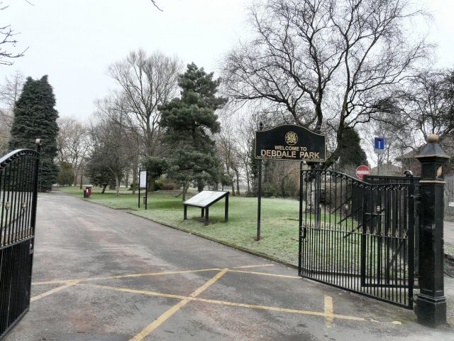
Debdale Park

Debdale Park is an inner-city park, located in the Gorton area of Manchester, England. At around 45 acres (18 ha), it is one of the largest inner-city...

Hyde Road railway station

Hyde Road was a railway station in Gorton, Manchester, England, on the Fallowfield Loop Line. It opened in 1892 and closed in 1958, when local passenger...

Gorton Heritage Trail

Gorton Heritage Trail is located approximately 3 miles from the centre of Manchester, England. The trail has been designed to promote and conserve the...

Nearby Amenities

Located within 500m of 53.459199,-2.155848
Telephone
Booth: KXPlus
Covered: booth
Operator: BT
Operator Wikidata: Q593786
Lat/Long: 53.4583282/-2.1612686
Post Box
Brand: Royal Mail
Brand Wikidata: Q638098
Brand Wikipedia: en:Royal Mail
Collection Times: Mo-Fr 09:00; Sa 07:00
Operator: Royal Mail
Operator Wikidata: Q638098
Post Box Type: lamp
Ref: M18 545D
Royal Cypher: EIIR
Lat/Long: 53.4581155/-2.161017
Bus Stop
Debdale Park, Reddish Lane / opposite Debdale Lane
Bus: yes
Naptan AtcoCode: 1800EB06971
Naptan Bearing: N
Naptan CommonName: Reddish Lane/Debdale Lane
Naptan Indicator: Adj Pub Car Prk
Naptan Landmark: PUBLIC HOUSE
Naptan NaptanCode: mantgdpa
Naptan PlusbusZoneRef: MNCRPIC
Naptan ShortCommonName: Debdale Lane
Naptan Street: REDDISH LANE
Network: TfGM
Operator: TfGM
Public Transport: platform
Source: naptan_import
Lat/Long: 53.4568231/-2.1601959
Bus Stop
North Reddish, Reddish Lane / opposite Athol Street
Bus: yes
Naptan AtcoCode: 1800EB10701
Naptan Bearing: SE
Naptan CommonName: Reddish Lane/Aspinal Church
Naptan Indicator: Church
Naptan Landmark: Supermarket
Naptan NaptanCode: managajm
Naptan PlusbusZoneRef: MNCRPIC
Naptan ShortCommonName: Aspinal Church
Naptan Street: REDDISH LANE
Naptan Verified: no
Network: TfGM
Operator: TfGM
Public Transport: platform
Shelter: yes
Source: naptan_import
Lat/Long: 53.4558177/-2.1591681
Bus Stop
Reddish Bridge, Hyde Road / Reddish Lane (Stop A)
Bench: no
Bin: yes
Bus: yes
Lit: yes
Local Ref: A
Naptan AtcoCode: 1800EB36981
Naptan Bearing: NW
Naptan CommonName: Hyde Road/Reddish Lane (Stop A)
Naptan Indicator: Stop A
Naptan Landmark: DRYCLEANERS
Naptan NaptanCode: manajmpa
Naptan PlusbusZoneRef: MNCRPIC
Naptan ShortCommonName: Reddish Lane
Naptan Street: HYDE ROAD
Naptan Verified: yes
Network: TfGM
Operator: TfGM
Public Transport: platform
Ref: A
Shelter: no
Source: naptan_import
Tactile Paving: no
Lat/Long: 53.4584654/-2.1615095
Bus Stop
Debdale Park, Hyde Road / near Tanyard Brow
Bench: no
Bin: no
Bus: yes
Lit: yes
Naptan AtcoCode: 1800EB36991
Naptan Bearing: SE
Naptan CommonName: Hyde Road/Tanyard Brow
Naptan Indicator: Opp House 774
Naptan Landmark: GYM
Naptan NaptanCode: manajmpd
Naptan Notes: INDICATOR AMENDED
Naptan PlusbusZoneRef: MNCRPIC
Naptan ShortCommonName: Tanyard Brow
Naptan Street: HYDE ROAD
Naptan Verified: yes
Network: TfGM
Operator: TfGM
Public Transport: platform
Shelter: yes
Source: naptan_import
Tactile Paving: no
Lat/Long: 53.4593775/-2.1632435
Bus Stop
Reddish Bridge, Reddish Lane / Debdale Park (Stop C)
Bus: yes
Local Ref: C
Naptan AtcoCode: 1800EB38171
Naptan Bearing: S
Naptan CommonName: Reddish Lane/Debdale Park (Stop C)
Naptan Indicator: Stop C
Naptan Landmark: HOUSE 17
Naptan NaptanCode: manajmpj
Naptan PlusbusZoneRef: MNCRPIC
Naptan ShortCommonName: Debdale Park
Naptan Street: REDDISH LANE
Naptan Verified: yes
Network: TfGM
Operator: TfGM
Public Transport: platform
Ref: C
Source: naptan_import
Lat/Long: 53.4572816/-2.1601073
Bus Stop
Reddish Bridge, Hyde Road / Debdale Park (Stop B)
Bench: yes
Bin: yes
Bus: yes
Lit: yes
Local Ref: B
Naptan AtcoCode: 1800EB38631
Naptan Bearing: E
Naptan CommonName: Hyde Road/Debdale Park (Stop B)
Naptan Indicator: Stop B
Naptan Landmark: DEBDALE PARK
Naptan NaptanCode: manajmpt
Naptan PlusbusZoneRef: MNCRPIC
Naptan ShortCommonName: Debdale Park
Naptan Street: HYDE ROAD
Naptan Verified: yes
Network: TfGM
Operator: TfGM
Public Transport: platform
Ref: B
Shelter: yes
Source: naptan_import
Tactile Paving: yes
Lat/Long: 53.458097/-2.1594092
Bus Stop
Debdale Park, Hyde Road / near Clumber Road
Bench: no
Bin: no
Bus: yes
Lit: yes
Naptan AtcoCode: 1800EB38641
Naptan Bearing: E
Naptan CommonName: Hyde Road/Clumber Road
Naptan Indicator: House 1093
Naptan Landmark: HOUSE 1093
Naptan NaptanCode: manajmpw
Naptan PlusbusZoneRef: MNCRPIC
Naptan ShortCommonName: Clumber Road
Naptan Street: HYDE ROAD
Naptan Verified: yes
Network: TfGM
Operator: TfGM
Public Transport: platform
Shelter: no
Source: naptan_import
Tactile Paving: no
Lat/Long: 53.4578366/-2.1549426
Bus Stop
Debdale Park, Hyde Road / opposite Clumber Road
Bench: yes
Bin: yes
Bus: yes
Lit: yes
Naptan AtcoCode: 1800EB38651
Naptan Bearing: W
Naptan CommonName: Hyde Road/Clumber Road
Naptan Indicator: Adj House 886
Naptan Landmark: HOUSE 886
Naptan NaptanCode: manajmta
Naptan PlusbusZoneRef: MNCRPIC
Naptan ShortCommonName: Clumber Road
Naptan Street: HYDE ROAD
Naptan Verified: yes
Network: TfGM
Operator: TfGM
Public Transport: platform
Shelter: yes
Source: naptan_import
Tactile Paving: no
Lat/Long: 53.4577771/-2.156578
Bus Stop
Thornley Park, Hyde Road / outside Thornley Park
Bench: yes
Bin: no
Bus: yes
Lit: yes
Naptan AtcoCode: 1800EB38661
Naptan Bearing: W
Naptan CommonName: Hyde Road/Thornley Park
Naptan Indicator: House 928
Naptan Landmark: HOUSE 928
Naptan NaptanCode: manajmtd
Naptan PlusbusZoneRef: MNCRPIC
Naptan ShortCommonName: Thornley Park
Naptan Street: HYDE ROAD
Naptan Verified: yes
Network: TfGM
Operator: TfGM
Public Transport: platform
Shelter: yes
Source: naptan_import
Tactile Paving: no
Lat/Long: 53.4576478/-2.1528711
Bus Stop
Thornley Park, Hyde Road / opposite Thornley Park
Bench: no
Bin: no
Bus: yes
Lit: yes
Naptan AtcoCode: 1800EB38671
Naptan Bearing: E
Naptan CommonName: Hyde Road/Thornley Park
Naptan Indicator: House 1131
Naptan Landmark: HOUSE 1131
Naptan NaptanCode: manajmtg
Naptan PlusbusZoneRef: MNCRPIC
Naptan ShortCommonName: Thornley Park
Naptan Street: HYDE ROAD
Naptan Verified: yes
Network: TfGM
Operator: TfGM
Public Transport: platform
Shelter: no
Source: naptan_import
Tactile Paving: no
Lat/Long: 53.4577647/-2.152357
Bus Stop
Denton, Balmoral Drive / opposite Ash Road
Bench: no
Bin: yes
Bus: yes
Lit: yes
Naptan AtcoCode: 1800EH44231
Naptan Bearing: SE
Naptan CommonName: Balmoral Drive/Ash Road
Naptan Indicator: O/s House 1
Naptan Landmark: HOUSE 1
Naptan NaptanCode: mandgtwp
Naptan PlusbusZoneRef: MNCRPIC
Naptan ShortCommonName: Ash Road
Naptan Street: BALMORAL DRIVE
Naptan Verified: yes
Network: TfGM
Operator: TfGM
Public Transport: platform
Shelter: no
Source: naptan_import
Tactile Paving: no
Lat/Long: 53.4571686/-2.1504372
Traffic Signals
Lat/Long: 53.4580859/-2.1600048
Barrier: bollard
Bicycle: yes
Foot: yes
Horse: yes
Motor Vehicle: no
Lat/Long: 53.4548278/-2.1571142
Turning Circle
Lat/Long: 53.458648/-2.1539648
Barrier: bollard
Bicycle: yes
Foot: yes
Horse: yes
Motor Vehicle: no
Lat/Long: 53.4554739/-2.1571184
Turning Circle
Lat/Long: 53.4598117/-2.1508298
Turning Circle
Lat/Long: 53.4593129/-2.1524048
Turning Circle
Lat/Long: 53.4595525/-2.1516306
Turning Circle
Lat/Long: 53.4589512/-2.1531067
Leisure: slipway
Lat/Long: 53.4600381/-2.1607659
The Pomona
Disused: yes
Disused Amenity: pub
Lat/Long: 53.4569047/-2.1602883
Traffic Signals
Lat/Long: 53.4578463/-2.1602719
Traffic Signals
Lat/Long: 53.4579308/-2.160017
Traffic Signals
Lat/Long: 53.4583161/-2.1605089
Traffic Signals
Lat/Long: 53.4583797/-2.1602025
Crossing: informal
Lat/Long: 53.4589329/-2.160638
Barrier: kissing_gate
Bicycle: no
Foot: yes
Horse: no
Motor Vehicle: no
Lat/Long: 53.4589344/-2.1605132
Noexit: yes
Lat/Long: 53.4601516/-2.1621688
Clyde Mount Guest House
Addr City: Manchester
Addr Country: GB
Addr Housenumber: 866
Addr Place: Debdale Park
Addr Postcode: M18 7LH
Addr Street: Hyde Road
Source: survey
Tourism: guest_house
Lat/Long: 53.457745/-2.1586585
Fast Food
Cottage Chippy
Lat/Long: 53.4570242/-2.1603367
Reddish Bridge
Is In: Gorton
Place: neighbourhood
Lat/Long: 53.4580134/-2.1602604
Traffic Signals
Crossing: traffic_signals
Traffic Signals: signal
Lat/Long: 53.4583977/-2.1604686
Traffic Signals
Traffic Signals: signal
Lat/Long: 53.4578433/-2.1603593
Traffic Signals
Traffic Signals: signal
Lat/Long: 53.4581165/-2.1603118
Traffic Signals
Traffic Signals: signal
Lat/Long: 53.4580189/-2.1602087
Barrier: bollard
Bicycle: yes
Foot: yes
Horse: yes
Motor Vehicle: no
Lat/Long: 53.4553223/-2.1569078
Generator Method: photovoltaic
Generator Output Electricity: yes
Generator Source: solar
Generator Type: solar_photovoltaic_panel
Location: roof
Power: generator
Lat/Long: 53.4560463/-2.1574246
Generator Method: photovoltaic
Generator Output Electricity: yes
Generator Source: solar
Generator Type: solar_photovoltaic_panel
Location: roof
Power: generator
Lat/Long: 53.455905/-2.1571752
Barrier: kerb
Check Date Tactile Paving: 2024-04-11
Kerb: sidewalk
Tactile Paving: no
Wheelchair: no
Lat/Long: 53.4589099/-2.1606847
Barrier: cycle_barrier
Bicycle: yes
Cycle Barrier: tilted
Foot: yes
Horse: no
Motor Vehicle: no
Lat/Long: 53.4574924/-2.1607223
Crossing
Button Operated: yes
Crossing: traffic_signals
Crossing Island: no
Crossing Markings: yes
Kerb: lowered
Tactile Paving: yes
Traffic Signals Sound: walk
Traffic Signals Vibration: yes
Lat/Long: 53.4578576/-2.1576453
Crossing
Crossing: marked
Crossing Island: no
Crossing Markings: yes
Kerb: lowered
Tactile Paving: yes
Lat/Long: 53.4577779/-2.1555009
Crossing
Crossing: marked
Crossing Markings: yes
Tactile Paving: yes
Lat/Long: 53.4581162/-2.1600954
Access: yes
Barrier: planter
Motor Vehicle: no
Lat/Long: 53.458006/-2.1608
Traffic Signals
Traffic Signals: crossing
Lat/Long: 53.4575619/-2.1503465
Traffic Signals
Traffic Signals: crossing
Lat/Long: 53.457657/-2.1507153
Bicycle Parking
Bicycle Parking: stands
Capacity: 6
Covered: no
Lat/Long: 53.4591264/-2.1616293
Pipeline: valve
Lat/Long: 53.4582688/-2.1501948
Barrier: kissing_gate
Bicycle: no
Foot: yes
Horse: no
Motor Vehicle: no
Lat/Long: 53.4617794/-2.1559057
Bicycle Parking
Bicycle Parking: stands
Capacity: 24
Covered: no
Lat/Long: 53.4598307/-2.1632165
Waste Basket
Lat/Long: 53.4635431/-2.1540672
Bench
Backrest: yes
Colour: green
Material: metal
Lat/Long: 53.4635337/-2.1541243
Bench
Backrest: yes
Colour: black
Material: plastic
Seats: 3
Lat/Long: 53.460941/-2.1546794
Bench
Backrest: yes
Colour: black
Material: plastic
Seats: 3
Lat/Long: 53.4609737/-2.154776
Waste Basket
Lat/Long: 53.4608696/-2.1549347
Barrier: bollard
Lat/Long: 53.4608708/-2.1548847
Post Box
Collection Times: Mo-Fr 09:00; Sa 07:00
Operator: Royal Mail
Operator Wikidata: Q638098
Post Box Type: pillar
Ref: M18 544D
Royal Cypher: GR
Lat/Long: 53.4578964/-2.1551385
Defibrillator
Access: yes
Defibrillator Location: On the Southwest wall of the Aviary;the wall closest to the toilets and nursery
Emergency: defibrillator
Indoor: no
Lat/Long: 53.4595675/-2.1566189
Barrier: kissing_gate
Bicycle: no
Foot: yes
Horse: no
Motor Vehicle: no
Lat/Long: 53.4592039/-2.160852
Barrier: bollard
Bollard: fixed
Lat/Long: 53.4599345/-2.1612384
Barrier: bollard
Bollard: removable
Lat/Long: 53.4596191/-2.1616939
Waste Basket
Lat/Long: 53.4572719/-2.1505934
Waste Basket
Lat/Long: 53.4602038/-2.1613003
Waste Basket
Lat/Long: 53.4574763/-2.1493356
Waste Basket
Lat/Long: 53.4605897/-2.1610168
Bench
Backrest: yes
Lat/Long: 53.4606562/-2.1610168
Waste Basket
Lat/Long: 53.4584983/-2.1615436
Bench
Backrest: yes
Lat/Long: 53.4608265/-2.1610464
Parcel Locker
Brand: InPost
Brand Wikidata: Q3182097
Parcel Mail In: yes
Parcel Pickup: yes
Lat/Long: 53.457462/-2.1500284
Waste Basket
Lat/Long: 53.4593493/-2.1619075
Bench
Backrest: yes
Lat/Long: 53.4607283/-2.1610328
Waste Basket
Lat/Long: 53.4599433/-2.1612711
Waste Basket
Lat/Long: 53.4576016/-2.1513221
Bench
Backrest: yes
Lat/Long: 53.4609701/-2.1610896
Bench
Backrest: yes
Lat/Long: 53.4605321/-2.1610105
Waste Basket
Lat/Long: 53.4581133/-2.1594732
Post Box
Collection Times: Mo-Fr 09:00; Sa 07:00
Operator: Royal Mail
Operator Wikidata: Q638098
Post Box Type: pillar
Ref: M34 179D
Royal Cypher: GR
Lat/Long: 53.4574727/-2.149224
The data included in this document is from www.openstreetmap.org. The data is made available under ODbL.

Have you been to Debdale?

Leave your review of Debdale below (or comments, questions and feedback).