Stubley Hall

Heritage Site in Lancashire

England

Stubley Hall

Wildhouse Lane farm entrance
Wildhouse Lane farm entrance Credit: Colin Pyle

Stubley Hall is a historic heritage site located in Lancashire, England. The hall is a fine example of Georgian architecture and is nestled amidst picturesque countryside, offering visitors a glimpse into the region's rich history.

Built in the late 18th century, Stubley Hall was originally a private residence for the influential Stubley family. The hall features a symmetrical facade with elegant sash windows, ornate cornices, and a central entrance portico, all of which reflect the architectural style of the Georgian era. The building is constructed using locally sourced stone, adding to its authentic charm.

Inside, visitors can explore the hall's well-preserved interiors, which boast intricate plasterwork, grand fireplaces, and period furniture. The rooms offer a fascinating insight into the lifestyle of the affluent families who once dwelled within its walls.

Surrounding the hall are beautifully landscaped gardens, complete with manicured lawns, flower beds, and mature trees. The gardens offer a tranquil retreat, allowing visitors to relax and enjoy the peaceful ambiance while admiring the stunning views of the Lancashire countryside.

Today, Stubley Hall serves as a popular venue for various events, including weddings, conferences, and exhibitions. Its historical significance and captivating setting make it an ideal location for both private and public gatherings.

Stubley Hall is a cherished heritage site in Lancashire, offering visitors an opportunity to step back in time and appreciate the architectural and historical wonders of the region.

If you have any feedback on the listing, please let us know in the comments section below.
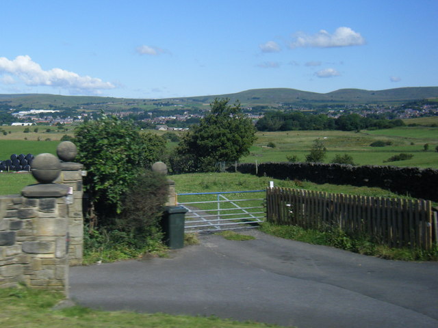
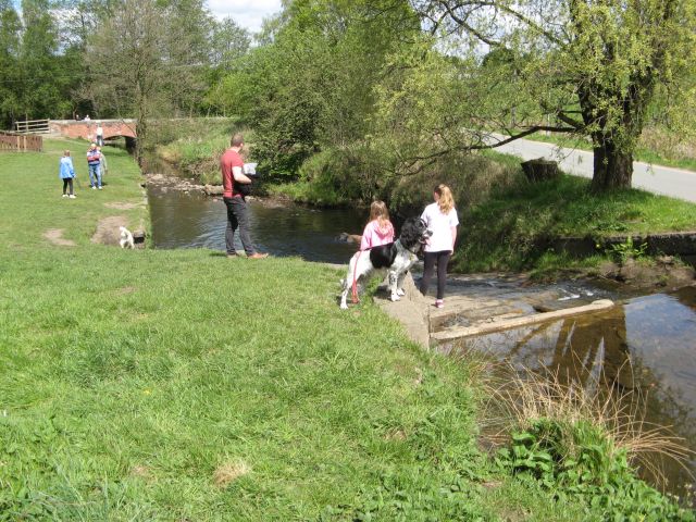
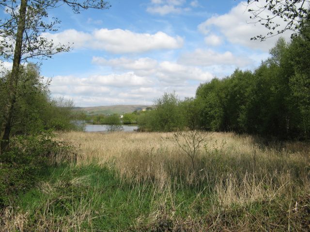
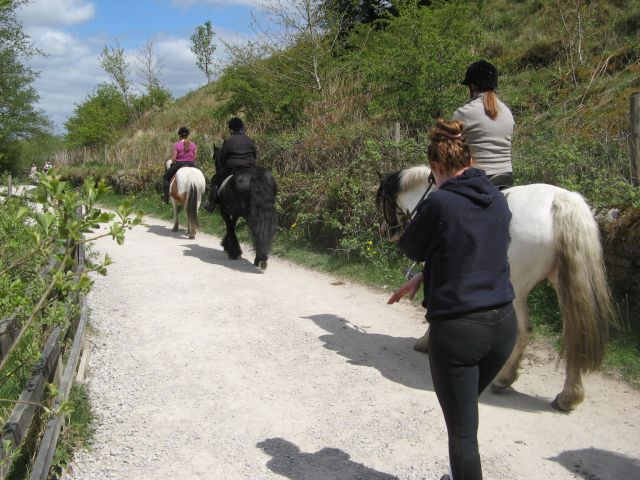
Stubley Hall Images

Images are sourced within 2km of 53.635/-2.113 or Grid Reference SD9215. Thanks to Geograph Open Source API. All images are credited.

Wildhouse Lane farm entrance
Hollingworth Lake with the elevated M62 beyond
Remembrance Sunday 2014 Remembrance Ceremony at the Wardle Memorial Garden, 9 November 2014, with the Wardle Academy Brass Band.

Taken from an upper floor window of the Wardle & Smallbridge Community Centre (former Wardle UDC offices).
Remembrance Sunday 2014
Remembrance Ceremony at the Wardle Memorial Garden, 9 November 2014, with the Wardle Academy Brass Band. Taken from an upper floor window of the Wardle & Smallbridge Community Centre (former Wardle UDC offices).
Silver birch at Hollingworth Lake Looking north over the lake from a point near the lakeside café.
Silver birch at Hollingworth Lake
Looking north over the lake from a point near the lakeside café.
Hollingworth Lake
Hollingworth Lake
Longden End Brook The brook passes over a gauging weir as it approaches Hollingworth Lake, a popular place for swimming dogs, it seems, though my assistant Madog is staying dry for a change.
Longden End Brook
The brook passes over a gauging weir as it approaches Hollingworth Lake, a popular place for swimming dogs, it seems, though my assistant Madog is staying dry for a change.
Wetland view An extensive reed bed is part of the nature reserve at the southern, shallow end of the reservoir, near to the influx of the Longden End Brook.
Wetland view
An extensive reed bed is part of the nature reserve at the southern, shallow end of the reservoir, near to the influx of the Longden End Brook.
Beach view A view of the southern margin of the reservoir, which is mostly shallow.
Beach view
A view of the southern margin of the reservoir, which is mostly shallow.
Equine traffic Horses taking the path around the lake.
Equine traffic
Horses taking the path around the lake.
A58 Church Street, Littleborough
A58 New road, Dearnley
A58 Halifax Road heading west
A662 at Clover Hall
A662 at Clover Hall
Ash tree, Hollingworth Lake There are several trees alongside the lakeside that have been cut about a metre above ground, prompting the production of a large number of thin branches.
Ash tree, Hollingworth Lake
There are several trees alongside the lakeside that have been cut about a metre above ground, prompting the production of a large number of thin branches.
Houses alongside Hollingworth Lake These houses have a good view of the lake, and have access from a residential road behind.
Houses alongside Hollingworth Lake
These houses have a good view of the lake, and have access from a residential road behind.
View from the lakeside path, Hollingworth Lake
The lakeside path, Hollingworth Lake
The boat yard, Hollingworth Lake
Show me another place!

Stubley Hall is located at Grid Ref: SD9215 (Lat: 53.635, Lng: -2.113)

Unitary Authority: Rochdale

Police Authority: Greater Manchester

What 3 Words

///rarely.unless.hulk. Near Littleborough, Manchester

Related Wikis

Smithy Bridge railway station

Smithy Bridge railway station serves the village of Smithy Bridge and Hollingworth Lake near Rochdale in Greater Manchester, England. The station is on...

Smithy Bridge

Smithy Bridge is a suburb of Littleborough in the Metropolitan Borough of Rochdale, Greater Manchester, England. Hollingworth Lake Country Park is close...

Birch Hill Hospital

Birch Hill Hospital is a health facility in Wardle, Littleborough, near Rochdale, Greater Manchester. It was managed by Pennine Acute Hospitals NHS Trust...

Featherstall Brook

Featherstall Brook is a watercourse in Greater Manchester and a tributary of the River Roch. == Tributaries == Middle Wood Brook Hills Brook

Nearby Amenities

Located within 500m of 53.635,-2.113
Dearnley
Is In: Rochdale, Greater Manchester
Place: suburb
Source: npe
Lat/Long: 53.6383186/-2.1129669
Bus Stop
Smithy Bridge Road/Halifax Road (Stop E)
Bus: yes
Local Ref: E
Naptan AtcoCode: 1800NE49271
Naptan Bearing: SE
Naptan CommonName: Smithy Bridge Road/Halifax Road (Stop E)
Naptan Indicator: Stop E
Naptan Landmark: HOUSE 3
Naptan NaptanCode: mangjajp
Naptan PlusbusZoneRef: MNCRPIC
Naptan ShortCommonName: Halifax Road
Naptan Street: Smithy Brdge Road
Naptan Verified: no
Network: TfGM
Public Transport: platform
Source: naptan_import
Lat/Long: 53.6380368/-2.1185324
Bus Stop
Smithy Bridge Road/Halifax Road (Stop D)
Bus: yes
Local Ref: D
Naptan AtcoCode: 1800NE49281
Naptan Bearing: NW
Naptan CommonName: Smithy Bridge Road/Halifax Road (Stop D)
Naptan Indicator: Stop D
Naptan Landmark: STAFFORD COURT
Naptan NaptanCode: mangjajt
Naptan PlusbusZoneRef: MNCRPIC
Naptan ShortCommonName: Halifax Road
Naptan Street: Smithy Brdge Road
Naptan Verified: no
Network: TfGM
Public Transport: platform
Source: naptan_import
Lat/Long: 53.6376865/-2.1183197
Bus Stop
Smithy Bridge Road/Southview Road
Bus: yes
Naptan AtcoCode: 1800NE49291
Naptan Bearing: SE
Naptan CommonName: Smithy Bridge Road/Southview Road
Naptan Indicator: Field
Naptan Landmark: HALLIDAY COURT
Naptan NaptanCode: mangjajw
Naptan PlusbusZoneRef: MNCRPIC
Naptan ShortCommonName: Southview Road
Naptan Street: Smithy Brdge Road
Naptan Verified: no
Network: TfGM
Public Transport: platform
Shelter: no
Source: naptan_import;local knowledge
Lat/Long: 53.6359644/-2.1162567
Bus Stop
Smithy Bridge Road/Southview Road
Bus: yes
Naptan AtcoCode: 1800NE49301
Naptan Bearing: NW
Naptan CommonName: Smithy Bridge Road/Southview Road
Naptan Indicator: Opp Flats 4-18
Naptan Landmark: OPP FLATS 4-18
Naptan NaptanCode: mangjama
Naptan PlusbusZoneRef: MNCRPIC
Naptan ShortCommonName: Southview Road
Naptan Street: Smithy Brdge Road
Naptan Verified: no
Network: TfGM
Public Transport: platform
Shelter: yes
Source: naptan_import
Lat/Long: 53.6353637/-2.1159244
Bus Stop
Smithy Bridge Road/Rose Avenue
Bus: yes
Naptan AtcoCode: 1800NE49311
Naptan Bearing: SE
Naptan CommonName: Smithy Bridge Road/Rose Avenue
Naptan Indicator: Opp House 8
Naptan Landmark: HOUSE 8
Naptan NaptanCode: mangjamd
Naptan PlusbusZoneRef: MNCRPIC
Naptan ShortCommonName: Rose Avenue
Naptan Street: Smithy Brdge Road
Naptan Verified: no
Network: TfGM
Public Transport: platform
Source: naptan_import
Lat/Long: 53.6345888/-2.1148477
Bus Stop
Smithy Bridge Road/Rose Avenue
Bus: yes
Naptan AtcoCode: 1800NE49321
Naptan Bearing: NW
Naptan CommonName: Smithy Bridge Road/Rose Avenue
Naptan Indicator: O/s House 10
Naptan Landmark: HOUSE 10
Naptan NaptanCode: mangjamg
Naptan PlusbusZoneRef: MNCRPIC
Naptan ShortCommonName: Rose Avenue
Naptan Street: Smithy Brdge Road
Naptan Verified: no
Network: TfGM
Public Transport: platform
Source: naptan_import
Lat/Long: 53.6343461/-2.1148471
Bus Stop
Smithy Bridge Road/Smithy Bridge Station
Bus: yes
Naptan AtcoCode: 1800NE49331
Naptan Bearing: NW
Naptan CommonName: Smithy Bridge Road/Smithy Bridge Station
Naptan Indicator: Railway Station
Naptan Landmark: HOUSE 38
Naptan NaptanCode: mangjamj
Naptan PlusbusZoneRef: MNCRPIC
Naptan ShortCommonName: Smithy Bridge Stn
Naptan Street: Smithy Brdge Road
Naptan Verified: no
Network: TfGM
Public Transport: platform
Source: naptan_import
Lat/Long: 53.6332154/-2.1129839
Bus Stop
Smithy Bridge Road/Smithy Bridge Station
Bus: yes
Naptan AtcoCode: 1800NE49341
Naptan Bearing: SE
Naptan CommonName: Smithy Bridge Road/Smithy Bridge Station
Naptan Indicator: Nr Bridge
Naptan Landmark: RAILWAY
Naptan NaptanCode: mangjamp
Naptan PlusbusZoneRef: MNCRPIC
Naptan ShortCommonName: Smithy Bridge Stn
Naptan Street: Smithy Brdge Road
Naptan Verified: no
Network: TfGM
Public Transport: platform
Source: naptan_import
Lat/Long: 53.6332157/-2.1126814
Bus Stop
Smithy Bridge Road/Post Office
Bus: yes
Naptan AtcoCode: 1800NE49351
Naptan Bearing: NW
Naptan CommonName: Smithy Bridge Road/Post Office
Naptan Indicator: Opp Post Office
Naptan Landmark: HOUSE 56
Naptan NaptanCode: mangjamt
Naptan PlusbusZoneRef: MNCRPIC
Naptan ShortCommonName: Post Office
Naptan Street: Smithy Brdge Road
Naptan Verified: no
Network: TfGM
Public Transport: platform
Source: naptan_import
Lat/Long: 53.6325712/-2.1098064
Bus Stop
Smithy Bridge Road/Post Office
Bus: yes
Naptan AtcoCode: 1800NE49361
Naptan Bearing: SE
Naptan CommonName: Smithy Bridge Road/Post Office
Naptan Indicator: Post Office
Naptan Landmark: HOUSE 61
Naptan NaptanCode: mangjamw
Naptan PlusbusZoneRef: MNCRPIC
Naptan ShortCommonName: Post Office
Naptan Street: Smithy Brdge Road
Naptan Verified: no
Network: TfGM
Public Transport: platform
Source: naptan_import
Lat/Long: 53.6326253/-2.1095343
Turning Circle
Source: bing
Lat/Long: 53.6329052/-2.1079668
Turning Circle
Source: bing
Lat/Long: 53.6336587/-2.1099407
Turning Circle
Source: bing
Lat/Long: 53.6308838/-2.1112634
Turning Circle
Source: bing
Lat/Long: 53.6376043/-2.1152196
The Smithybridge
Disused Amenity: pub
Lat/Long: 53.6329708/-2.1111991
Smithy Bridge Level Crossing
Railway: level_crossing
Lat/Long: 53.6333801/-2.1133226
Smithy Bridge Level Crossing
Railway: level_crossing
Lat/Long: 53.6333983/-2.1133702
Smithy Bridge
Public Transport: stop_position
Railway: stop
Train: yes
Lat/Long: 53.6330438/-2.1138323
Smithy Bridge
Naptan AtcoCode: 9100SMBG
Network: National Rail
Network Website: https://www.nationalrail.co.uk/stations/smb/
Network Wikidata: Q26334
Operator: Northern Rail
Operator Website: https://www.northernrailway.co.uk/stations/smithy-bridge
Operator Wikidata: Q85789775
Public Transport: station
Railway: station
Ref Crs: SMB
Source: npe
Train: yes
Wikidata: Q2490973
Wikipedia: en:Smithy Bridge railway station
Lat/Long: 53.6328465/-2.1140606
Generator Method: photovoltaic
Generator Output Electricity: yes
Generator Source: solar
Generator Type: solar_photovoltaic_panel
Location: roof
Power: generator
Lat/Long: 53.6382542/-2.1164725
Generator Method: photovoltaic
Generator Output Electricity: yes
Generator Source: solar
Generator Type: solar_photovoltaic_panel
Location: roof
Power: generator
Lat/Long: 53.6382446/-2.1165288
Generator Method: photovoltaic
Generator Output Electricity: yes
Generator Source: solar
Generator Type: solar_photovoltaic_panel
Location: roof
Power: generator
Lat/Long: 53.6363707/-2.1161212
Pharmacy
Unicare
Addr City: Littleborough
Addr Housenumber: 69
Addr Postcode: OL15 0DY
Addr Street: Smithybridge Road
Dispensing: yes
Drive Through: no
Healthcare: pharmacy
Opening Hours: Mo-Fr 09:00-17:00
Phone: +44 1706 373894
Lat/Long: 53.6326414/-2.1091619
Pub
Tophams Tavern
Addr City: Littleborough
Addr Housenumber: 18
Addr Postcode: OL15 8QF
Addr Street: Smithybridge Road
Smoking: outside
Lat/Long: 53.6336113/-2.1143251
EK Motors
Addr Postcode: OL15 8QF
Addr Street: Smithy Bridge Road
Addr Unit: 2
Phone: 01706 375597
Service Vehicle Car Repair: yes
Service Vehicle Inspection: yes
Shop: car_repair
Website: https://www.ekmotors.co.uk
Lat/Long: 53.6350498/-2.1099268
The data included in this document is from www.openstreetmap.org. The data is made available under ODbL.

Have you been to Stubley Hall?

Leave your review of Stubley Hall below (or comments, questions and feedback).