Coplow Wood

Wood, Forest in Warwickshire Warwick

England

Coplow Wood

Farmland beside Hampton Wood Farmland beside Hampton Wood to the north of Hampton Lucy.
Farmland beside Hampton Wood Credit: Philip Halling

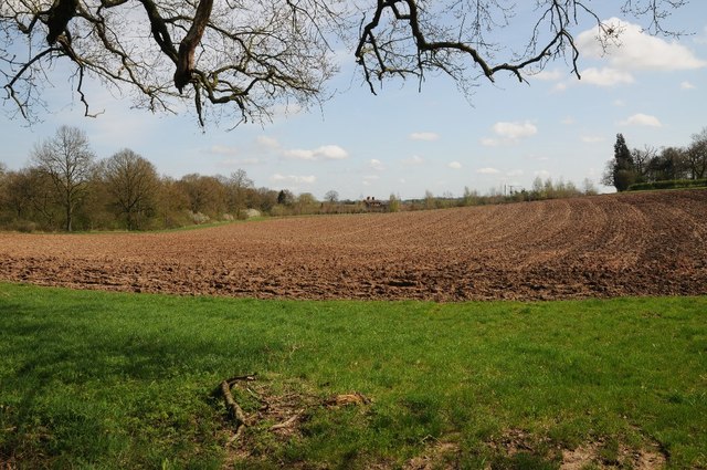
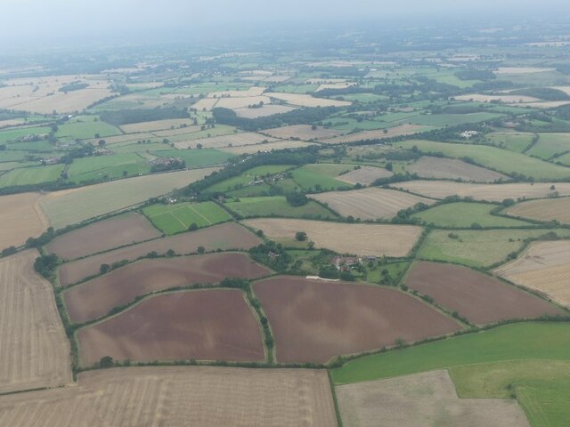
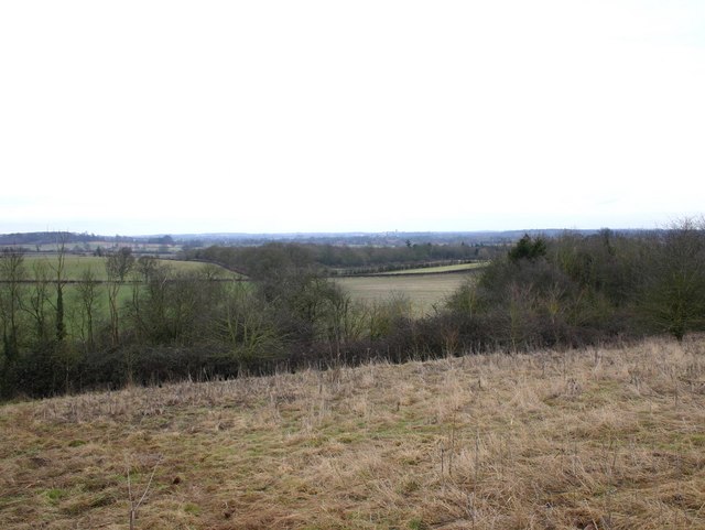
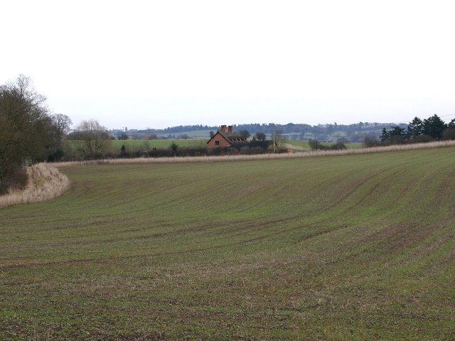
Coplow Wood is a picturesque woodland located in Warwickshire, England. Covering an area of approximately 40 acres, it is a popular destination for nature lovers and outdoor enthusiasts. The wood is situated near the village of Shilton and is easily accessible by foot or car.

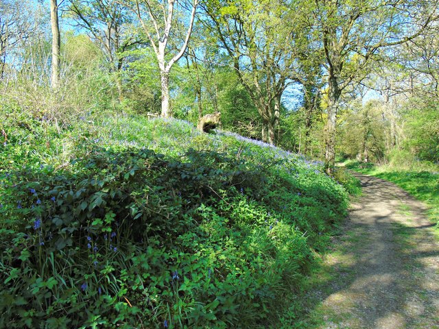
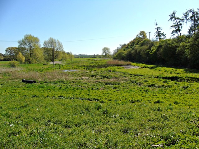
The woodland features a diverse range of tree species, including oak, ash, birch, and beech, creating a rich and vibrant habitat for various wildlife. Visitors can expect to see an abundance of bird species, such as woodpeckers, owls, and thrushes, as well as small mammals like squirrels, bats, and rabbits. The woodland floor is also home to a variety of wildflowers, adding to its natural beauty.

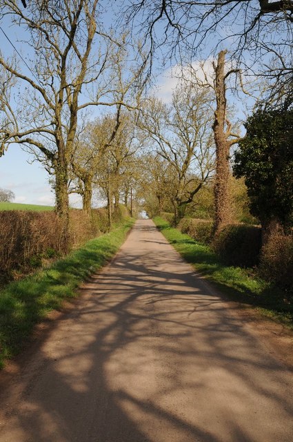
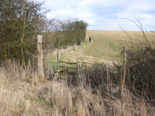
Coplow Wood offers several walking trails, providing visitors with the opportunity to explore its charming surroundings. The paths wind through the trees, allowing visitors to immerse themselves in the peaceful atmosphere and enjoy the tranquil sounds of nature. The wood is well-maintained, with clear signposts and information boards along the trails, making it easy for visitors to navigate.

The wood is managed by a local conservation group, ensuring its preservation and protection. There are designated areas for picnics and nature study, making it an ideal spot for families and educational visits. Dogs are welcome but must be kept on a leash to maintain the tranquil environment and protect the wildlife.

Overall, Coplow Wood is a delightful woodland retreat, offering a haven of natural beauty and tranquility for visitors to enjoy.

If you have any feedback on the listing, please let us know in the comments section below.
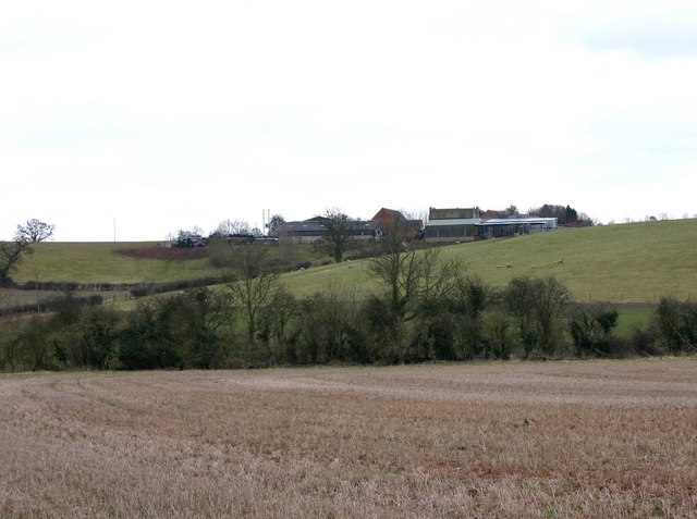
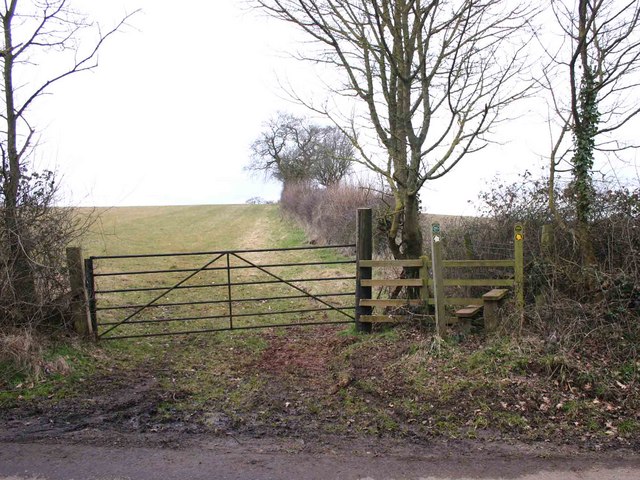
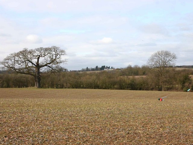
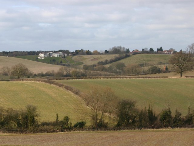
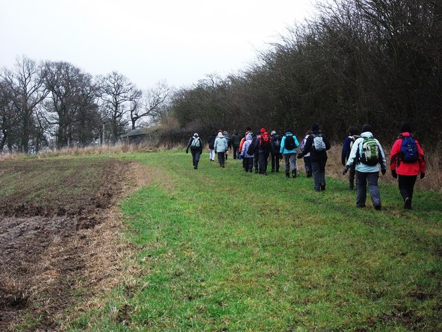
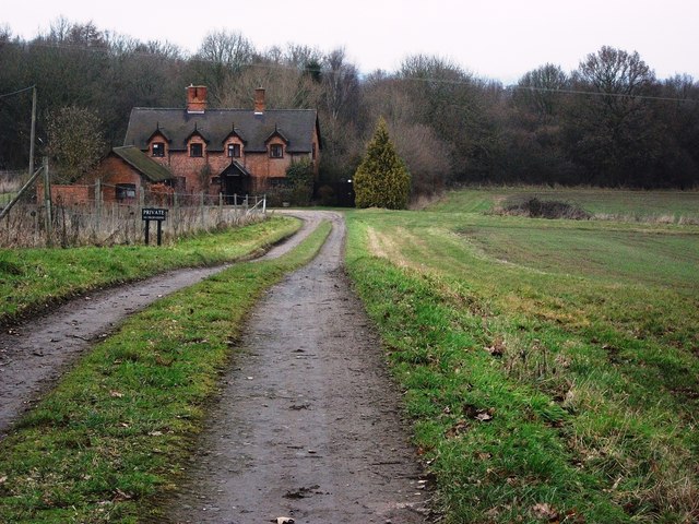
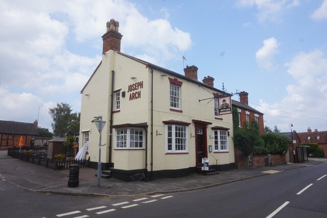
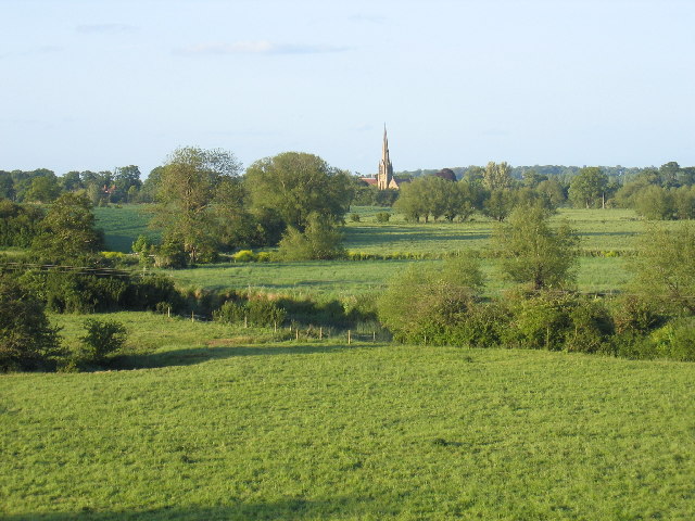
Coplow Wood Images

Images are sourced within 2km of 52.250498/-1.6338863 or Grid Reference SP2561. Thanks to Geograph Open Source API. All images are credited.

Farmland beside Hampton Wood Farmland beside Hampton Wood to the north of Hampton Lucy.
Farmland beside Hampton Wood
Farmland beside Hampton Wood to the north of Hampton Lucy.
Country road passing Hampton Wood Country road between Hampton Lucy and Sherbourne passing Hampton Wood.
Country road passing Hampton Wood
Country road between Hampton Lucy and Sherbourne passing Hampton Wood.
Track through Hampton Wood
Perimeter path around Hampton Wood
Track through Hampton Wood
Hampton Wood Meadow
Hampton Wood Meadow
Meadow Court Farm and fields, Lower Fulbrook: aerial 2021
Hampton Wood from Copdock Hill View North from near the top of Copdock Hill towards Hampton Wood.
Hampton Wood from Copdock Hill
View North from near the top of Copdock Hill towards Hampton Wood.
Wood Cottages, Hampton Wood View East from the lane from Hampton Lucy to Sherbourne towards Wood Cottages with Hampton Wood on the left.
Wood Cottages, Hampton Wood
View East from the lane from Hampton Lucy to Sherbourne towards Wood Cottages with Hampton Wood on the left.
Stile on the footpath to Hampton Wood View East over a stile on the path from Meadow Court Farm to Hampton Wood.
Stile on the footpath to Hampton Wood
View East over a stile on the path from Meadow Court Farm to Hampton Wood.
View towards Daisy Hill Farm Looking SSE from the footpath near Meadow Court Farm.
View towards Daisy Hill Farm
Looking SSE from the footpath near Meadow Court Farm.
Footpath to Meadow Court Farm from Hampton Wood Looking west where the footpath to Meadow Court Farm leaves the lane from Hampton Lucy to Sherbourne, opposite Hampton Wood.
Footpath to Meadow Court Farm from Hampton Wood
Looking west where the footpath to Meadow Court Farm leaves the lane from Hampton Lucy to Sherbourne, opposite Hampton Wood.
View towards Meadow Court Farm Looking WNW from the footpath to Meadow Court Farm towards the farm in the distance. In the foreground to the right is a bird scarer. It appeared to be powered by a small propane bottle, and periodically made an explosive bang. There were no birds to be seen anywhere, so it must have been working.
View towards Meadow Court Farm
Looking WNW from the footpath to Meadow Court Farm towards the farm in the distance. In the foreground to the right is a bird scarer. It appeared to be powered by a small propane bottle, and periodically made an explosive bang. There were no birds to be seen anywhere, so it must have been working.
View NNW from the footpath to Meadow Court Farm A view of the extensive farmland in this area. The large, white building on the left in the distance is at <a href="https://www.geograph.org.uk/gridref/SP245609">SP245609</a>. It is a modern classical style house called 'Palladio' with access from the A46 dual carriageway. <span class="nowrap"><a title="http://apps.stratford.gov.uk/eplanning/AppDetail.aspx?appkey=L6BBUMPM04S00" rel="nofollow ugc noopener" href="http://apps.stratford.gov.uk/eplanning/AppDetail.aspx?appkey=L6BBUMPM04S00">Link</a><img style="margin-left:2px;" alt="External link" title="External link - shift click to open in new window" src="https://s1.geograph.org.uk/img/external.png" width="10" height="10"/></span>
View NNW from the footpath to Meadow Court Farm
A view of the extensive farmland in this area. The large, white building on the left in the distance is at SP245609. It is a modern classical style house called 'Palladio' with access from the A46 dual carriageway. LinkExternal link
Walking along a footpath near The Thatched House, Copdock Hill
Wood Cottages, Hampton Wood
Joseph Arch public house, Barford
Show me another place!

Coplow Wood is located at Grid Ref: SP2561 (Lat: 52.250498, Lng: -1.6338863)

Administrative County: Warwickshire

District: Warwick

Police Authority: Warwickshire

What 3 Words

///truckload.grills.rated. Near Warwick, Warwickshire

Related Wikis

Sherbourne, Warwickshire

Sherbourne is a village and civil parish in the Warwick district of Warwickshire, England. The population of the civil parish at the 2011 Census was 174...

Fulbrook, Warwickshire

Fulbrook is a small parish and deserted village in Warwickshire, England, situated about 4 miles (6 km) north-east of Stratford upon Avon. Population details...

M40 minibus crash

On 18 November 1993, just after midnight, a minibus was involved in a fatal collision with a maintenance vehicle on the M40 motorway near Warwick, England...

Longbridge Interchange

Longbridge Interchange (also known as Longbridge Island) is a major road and motorway junction between Warwick and Sherbourne, Warwickshire, connecting...

Nearby Amenities

Located within 500m of 52.250498,-1.6338863
Brand: National Grid
Brand Wikidata: Q1465461
Material: wood
Operator: National Grid Electricity Distribution
Operator Old: Western Power Distribution
Operator Wikidata: Q7988183
Owner: National Grid Electricity Distribution (East Midlands) Plc
Owner Wikidata: Q114348127
Power: pole
Lat/Long: 52.2498335/-1.6398092
Brand: National Grid
Brand Wikidata: Q1465461
Material: wood
Operator: National Grid Electricity Distribution
Operator Old: Western Power Distribution
Operator Wikidata: Q7988183
Owner: National Grid Electricity Distribution (East Midlands) Plc
Owner Wikidata: Q114348127
Power: pole
Lat/Long: 52.2511326/-1.6383925
Brand: National Grid
Brand Wikidata: Q1465461
Material: wood
Operator: National Grid Electricity Distribution
Operator Old: Western Power Distribution
Operator Wikidata: Q7988183
Owner: National Grid Electricity Distribution (East Midlands) Plc
Owner Wikidata: Q114348127
Power: pole
Lat/Long: 52.2517532/-1.6377139
Brand: National Grid
Brand Wikidata: Q1465461
Material: wood
Operator: National Grid Electricity Distribution
Operator Old: Western Power Distribution
Operator Wikidata: Q7988183
Owner: National Grid Electricity Distribution (East Midlands) Plc
Owner Wikidata: Q114348127
Power: pole
Lat/Long: 52.252433/-1.6369817
Brand: National Grid
Brand Wikidata: Q1465461
Material: wood
Operator: National Grid Electricity Distribution
Operator Old: Western Power Distribution
Operator Wikidata: Q7988183
Owner: National Grid Electricity Distribution (East Midlands) Plc
Owner Wikidata: Q114348127
Power: pole
Lat/Long: 52.2530324/-1.6363031
Brand: National Grid
Brand Wikidata: Q1465461
Material: wood
Operator: National Grid Electricity Distribution
Operator Old: Western Power Distribution
Operator Wikidata: Q7988183
Owner: National Grid Electricity Distribution (East Midlands) Plc
Owner Wikidata: Q114348127
Power: pole
Lat/Long: 52.253924/-1.6360804
Brand: National Grid
Brand Wikidata: Q1465461
Material: wood
Operator: National Grid Electricity Distribution
Operator Old: Western Power Distribution
Operator Wikidata: Q7988183
Owner: National Grid Electricity Distribution (East Midlands) Plc
Owner Wikidata: Q114348127
Power: pole
Lat/Long: 52.2546957/-1.6358659
Brand: National Grid
Brand Wikidata: Q1465461
Frequency: 50
Material: wood
Operator: National Grid Electricity Distribution
Operator Old: Western Power Distribution
Operator Wikidata: Q7988183
Owner: National Grid Electricity Distribution (East Midlands) Plc
Owner Wikidata: Q114348127
Power: pole
Ref: 931919
Source: wpd_opendata
Transformer: distribution
Voltage Primary: 11000
Voltage Secondary: 400
Lat/Long: 52.2492524/-1.6404015
Brand: National Grid
Brand Wikidata: Q1465461
Material: wood
Operator: National Grid Electricity Distribution
Operator Old: Western Power Distribution
Operator Wikidata: Q7988183
Owner: National Grid Electricity Distribution (East Midlands) Plc
Owner Wikidata: Q114348127
Power: pole
Lat/Long: 52.2505943/-1.6390122
The data included in this document is from www.openstreetmap.org. The data is made available under ODbL.

Have you been to Coplow Wood?

Leave your review of Coplow Wood below (or comments, questions and feedback).