Collin Wood

Wood, Forest in Yorkshire Harrogate

England

Collin Wood

Rehoboth Chapel (disused) now much extended and converted into an impressive house.
Rehoboth Chapel (disused) Credit: Malcolm Street

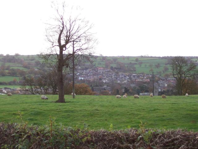
Collin Wood, located in Yorkshire, England, is a picturesque forest that captivates visitors with its natural beauty and tranquil atmosphere. Nestled amidst rolling hills and valleys, this enchanting woodland covers a vast area, offering an idyllic escape from the hustle and bustle of city life.

The wood is characterized by its diverse tree species, including oak, beech, and birch, which create a dense canopy providing shelter to an array of wildlife. Walking through the forest, visitors may encounter squirrels scurrying along the branches, birds singing their melodious tunes, and if lucky, even glimpses of deer gracefully roaming in the undergrowth.

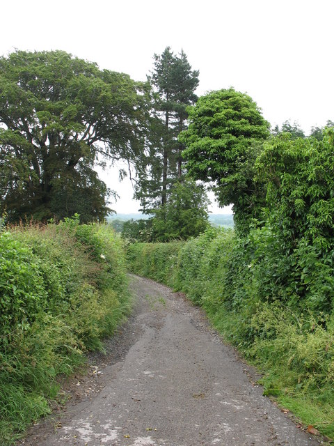
The forest boasts a network of well-maintained trails, allowing visitors to explore its depths at their own pace. These paths wind through peaceful glades, babbling brooks, and hidden clearings, offering opportunities for hikers, nature enthusiasts, and photographers to immerse themselves in the natural wonders that Collin Wood has to offer.

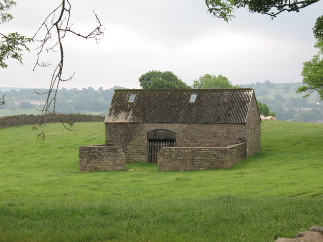
In addition to its natural beauty, Collin Wood also holds historical significance. The forest was once part of a vast hunting ground for nobles and aristocrats, and remnants of ancient hunting lodges and structures can still be found within its boundaries. These remnants provide a glimpse into the region's past and add an element of intrigue to the woodland experience.

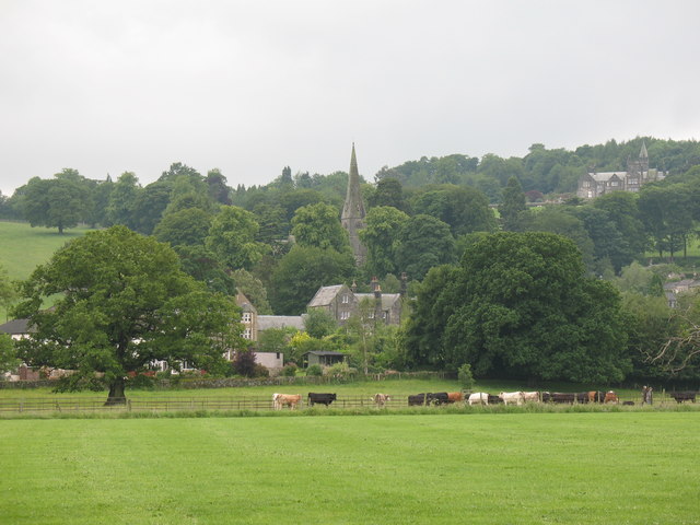
Collin Wood is a true gem, offering a serene retreat for those seeking solace in nature's embrace. Its lush greenery, abundant wildlife, and rich history make it a must-visit destination for anyone looking to connect with the natural world and experience the beauty of Yorkshire's countryside.

If you have any feedback on the listing, please let us know in the comments section below.

Collin Wood Images

Images are sourced within 2km of 54.034031/-1.6245933 or Grid Reference SE2459. Thanks to Geograph Open Source API. All images are credited.
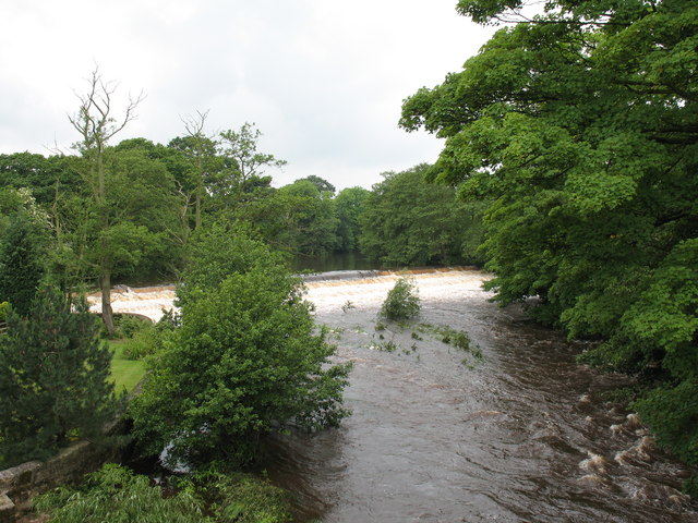
Rehoboth Chapel (disused) now much extended and converted into an impressive house.
Rehoboth Chapel (disused)
now much extended and converted into an impressive house.
St James's Church, Birstwith
Birstwith Post Office & General Store
Hampsthwaite Church
Hampsthwaite Church
Hampsthwaite Bridge
Hampsthwaite Bridge
Bus Shelter in Hampsthwaite
Hampsthwaite
Hampsthwaite
Clint Bank Cross and Stocks Exact date unknown, relocated here by Harrogate Round Table, the pillar of the cross has been damaged but the base remains sound.
Clint Bank Cross and Stocks
Exact date unknown, relocated here by Harrogate Round Table, the pillar of the cross has been damaged but the base remains sound.
Junction of Nidderdale Way, Hollybank Lane and the road to Hampsthwaite
Hampsthwaite looking south from Clint
Stone Barn, Clint A stone barn in good condition - a pity about the corrugated roof.
Stone Barn, Clint
A stone barn in good condition - a pity about the corrugated roof.
Old routeway at Clint This was a well used route in medieval times, and in John Ogilby's map of 1665 is shown as part of the main 'road' from York to Lancaster.  Now it is a quiet bridleway.
Old routeway at Clint
This was a well used route in medieval times, and in John Ogilby's map of 1665 is shown as part of the main 'road' from York to Lancaster. Now it is a quiet bridleway.
View across playing fields at Birstwith The goalposts have been taken down for the summer, so there is a clear view of grazing cattle and the village church on the hill.
View across playing fields at Birstwith
The goalposts have been taken down for the summer, so there is a clear view of grazing cattle and the village church on the hill.
Mill race, Birstwith The mill race flows from the weir on the Nidd to Birstwith Mill [seen here] which now produces animal feeds.
Mill race, Birstwith
The mill race flows from the weir on the Nidd to Birstwith Mill [seen here] which now produces animal feeds.
Old Station Inn, Birstwith Village pub in Birstwith, only a few yards from the site of the former railway station.
Old Station Inn, Birstwith
Village pub in Birstwith, only a few yards from the site of the former railway station.
Birstwith weir. The weir at Birstwith is one of many on the River Nidd. This one maintains the water level for the mill race.
Birstwith weir.
The weir at Birstwith is one of many on the River Nidd. This one maintains the water level for the mill race.
Hampsthwaite Memorial Hall Smart modern hall in the centre of this prosperous village.
Hampsthwaite Memorial Hall
Smart modern hall in the centre of this prosperous village.
The Joiners Arms Excellent village pub serving wholesome food, real ales, and displaying a huge number of gravy boats.
The Joiners Arms
Excellent village pub serving wholesome food, real ales, and displaying a huge number of gravy boats.
Show me another place!

Collin Wood is located at Grid Ref: SE2459 (Lat: 54.034031, Lng: -1.6245933)

Division: West Riding

Administrative County: North Yorkshire

District: Harrogate

Police Authority: North Yorkshire

What 3 Words

///translate.widely.retract. Near Harrogate, North Yorkshire

Related Wikis

Birstwith railway station

Birstwith railway station served the village of Birstwith, North Yorkshire, England from 1862 to 1964 on the Nidd Valley Railway. == History == The station...

Birstwith

Birstwith is a village and civil parish in the Harrogate district of North Yorkshire, England. It is part of the Nidderdale, and is situated on the River...

Clint, North Yorkshire

Clint is a village in Nidderdale in North Yorkshire, England. It lies on the north bank of the River Nidd, 4 miles north-west of Harrogate. Clint is...

Swarcliffe Hall

Swarcliffe Hall is a large hall that was constructed in 1800 in Birstwith, near Harrogate, England. The current house was built by John Greenwood in 1850...

Burnt Yates

Burnt Yates is a village in the Borough of Harrogate in North Yorkshire, England. == Community == The village name possibly derived from 'Burnt Gates'...

Hampsthwaite

Hampsthwaite is a large village and civil parish in Nidderdale in the Harrogate district of North Yorkshire, England. It lies on the south bank of the...

Hampsthwaite railway station

Hampsthwaite railway station served the village of Hampsthwaite, North Yorkshire, England from 1866 to 1950 on the Nidd Valley Railway. == History == The...

Shaw Mills

Shaw Mills is a hamlet in the civil parish of Bishop Thornton, Shaw Mills and Warsill, in Nidderdale in the Harrogate district, North Yorkshire, England...

Nearby Amenities

Located within 500m of 54.034031,-1.6245933
Source: www.npemap.org.uk
Uk Postcode Centroid: HG3
Lat/Long: 54.032452/-1.619915
Public Bookcase
Books: childrens
Booth: K6
Disused Amenity: telephone
Man Made: telephone_box
Operator: Birstwith Parish Council
Public Bookcase Type: phone_box
Lat/Long: 54.0345029/-1.6259127
Doctors
Healthcare: doctor
Lat/Long: 54.0350006/-1.6245057
Bus Stop
Lat/Long: 54.0332209/-1.6278998
Bus Stop
Naptan AtcoCode: 3200YNA06584
Naptan NaptanCode: 32006584
Lat/Long: 54.0349093/-1.625489
Waterway: weir
Lat/Long: 54.0334908/-1.6295766
Barrier: stile
Lat/Long: 54.037627/-1.6216921
Power: pole
Lat/Long: 54.0359449/-1.6188111
Power: pole
Lat/Long: 54.0359449/-1.6201602
Power: pole
Lat/Long: 54.0359464/-1.6215308
Power: pole
Lat/Long: 54.0359401/-1.6242372
Generator Method: photovoltaic
Generator Output Electricity: yes
Generator Source: solar
Generator Type: solar_photovoltaic_panel
Power: generator
Lat/Long: 54.0337676/-1.6257044
Generator Method: photovoltaic
Generator Output Electricity: yes
Generator Source: solar
Generator Type: solar_photovoltaic_panel
Power: generator
Lat/Long: 54.0332833/-1.6251637
Generator Method: photovoltaic
Generator Output Electricity: yes
Generator Source: solar
Generator Type: solar_photovoltaic_panel
Power: generator
Lat/Long: 54.0335446/-1.6240359
Man Made: utility_pole
Lat/Long: 54.0324958/-1.6258004
Man Made: utility_pole
Lat/Long: 54.0326423/-1.6247195
Man Made: utility_pole
Lat/Long: 54.0327967/-1.623483
Barrier: stile
Lat/Long: 54.0332361/-1.6282599
Birstwith
Historic Railway: station
Railway: site
Wikidata: Q46996882
Wikipedia: en:Birstwith railway station
Lat/Long: 54.0335894/-1.6265955
Defibrillator
Access: yes
Defibrillator Location: outside Station Hotel, Birstwith
Emergency: defibrillator
Indoor: no
Lat/Long: 54.0340424/-1.6268794
The data included in this document is from www.openstreetmap.org. The data is made available under ODbL.

Have you been to Collin Wood?

Leave your review of Collin Wood below (or comments, questions and feedback).