Arne

Settlement in Dorset

England

Arne

Motor Vessel Oklahoma (formerly MTB 453), Long Island, 1957 MV Oklahoma moored at Long Island in 1957. Formerly HMS MTB 453, she was built for wartime service for the Royal Navy as a fast motor torpedo boat by the British Power Boat Co. at Hythe, near Southampton in 1943. She subsequently took part with distinction in Operation Neptune, the code name for the naval phase of the Allied Invasion of Normandy.  

Almost 72 feet long (22 metres), she was powered by three 1250 H.P. Packard Engines giving 40 Knots max, 35 Knots continuous. Crewed by 2 officers and 12 ratings, her armament comprised a 6 pdr gun, twin 20 mm Oerlikons, two twin Vickers Gas Operated Guns, two Mk VII Depth Charges, and two 18" Torpedo Tubes. 

After the war, MTB 453 was sold off, probably one of the 127 former Royal Navy motor torpedo boats beached on the sands off Shipstal Point in 1945. Offered by the Director of Small Craft Disposals as suitable for conversion into 'floating homes', it was seen as one answer to the post-war housing problem, although most probably went for scrap in the end.

On holiday on Long Island in 1957, guests of the owners of MV Oklahoma. Scanned from a tiny print taken with a Kodak Brownie 127, my first camera; sadly, the camera was subsequently swept overboard from the deck of "Oklahoma" by a gust of wind, ending up in the water.
Motor Vessel Oklahoma (formerly MTB 453), Long Island, 1957 Credit: Mike Searle

Arne is a small village located on the Isle of Purbeck in Dorset, England. Situated on the edge of Poole Harbour, it is known for its picturesque beauty and diverse wildlife. With a population of around 200 residents, Arne offers a tranquil and rural setting for its inhabitants.

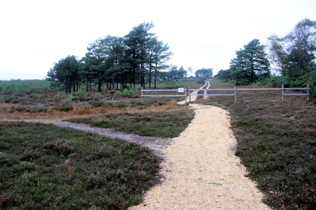
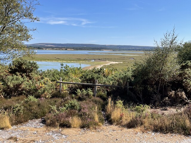
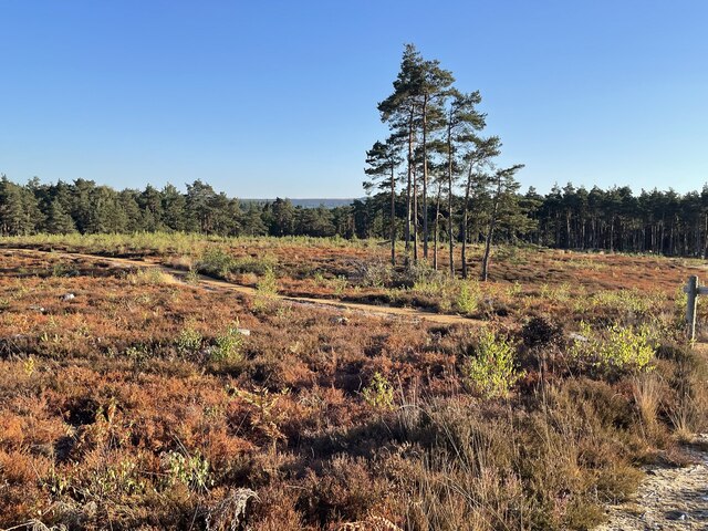
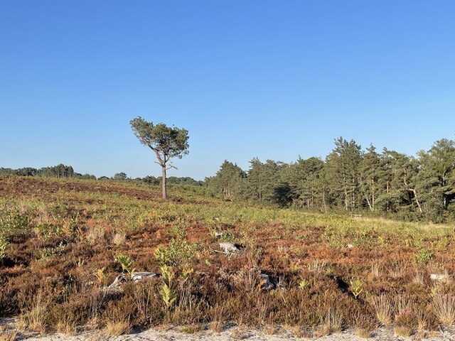
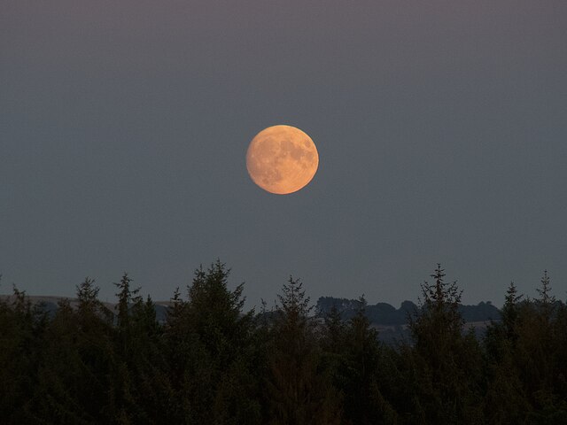
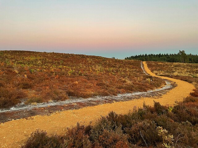
The village is surrounded by Arne Nature Reserve, managed by the Royal Society for the Protection of Birds (RSPB). This expansive reserve covers over 500 hectares of heathland, woodland, and saltmarsh, making it a haven for nature enthusiasts and birdwatchers. Arne Nature Reserve is home to a wide variety of bird species, including rare and endangered ones like the Dartford warbler and the redstart.

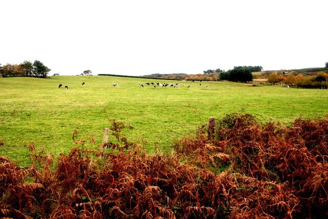
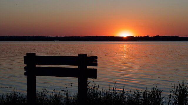
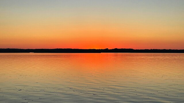
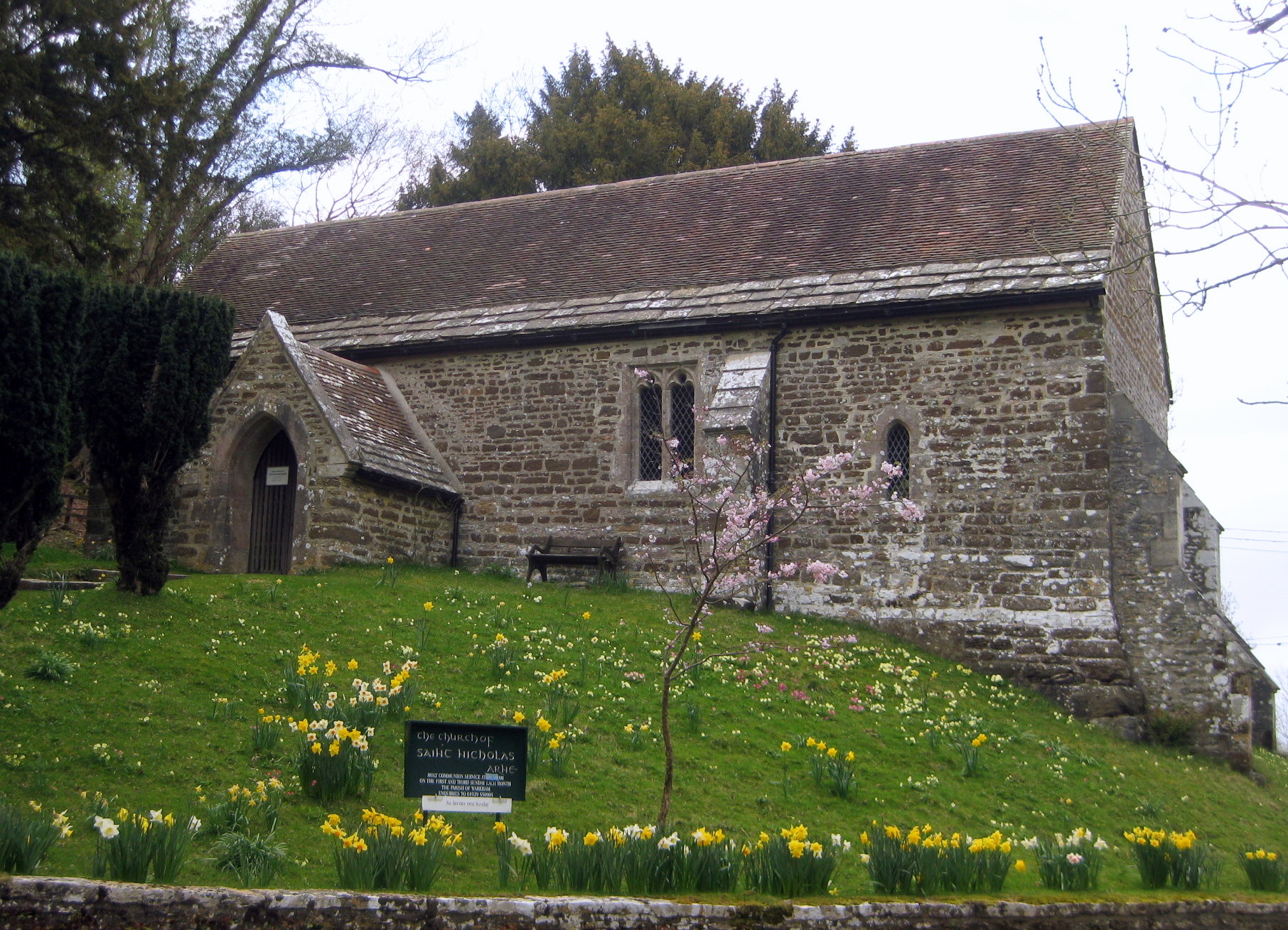
Arne also boasts stunning views of the surrounding countryside, with rolling hills and expansive marshes creating a unique landscape. The village itself features a mix of architectural styles, including charming thatched cottages and traditional stone houses.

Despite its rural setting, Arne is well-connected to neighboring towns and cities. The nearby town of Wareham is just a short drive away, offering a range of amenities such as shops, supermarkets, and restaurants. Additionally, the bustling coastal town of Poole is easily accessible, providing further opportunities for leisure and entertainment.

In conclusion, Arne is a peaceful village nestled within the natural beauty of Dorset's countryside. With its diverse wildlife, stunning views, and convenient location, it offers a unique and idyllic place to call home.

If you have any feedback on the listing, please let us know in the comments section below.
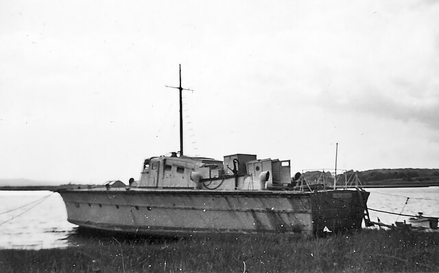
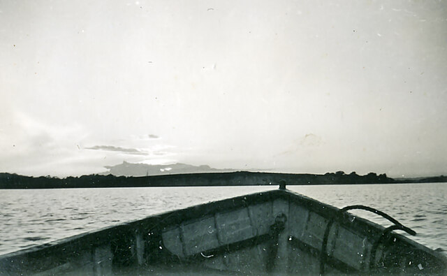
Arne Images

Images are sourced within 2km of 50.692766/-2.0402399 or Grid Reference SY9788. Thanks to Geograph Open Source API. All images are credited.

Motor Vessel Oklahoma (formerly MTB 453), Long Island, 1957 MV Oklahoma moored at Long Island in 1957. Formerly HMS MTB 453, she was built for wartime service for the Royal Navy as a fast motor torpedo boat by the British Power Boat Co. at Hythe, near Southampton in 1943. She subsequently took part with distinction in Operation Neptune, the code name for the naval phase of the Allied Invasion of Normandy.  

Almost 72 feet long (22 metres), she was powered by three 1250 H.P. Packard Engines giving 40 Knots max, 35 Knots continuous. Crewed by 2 officers and 12 ratings, her armament comprised a 6 pdr gun, twin 20 mm Oerlikons, two twin Vickers Gas Operated Guns, two Mk VII Depth Charges, and two 18" Torpedo Tubes. 

After the war, MTB 453 was sold off, probably one of the 127 former Royal Navy motor torpedo boats beached on the sands off Shipstal Point in 1945. Offered by the Director of Small Craft Disposals as suitable for conversion into 'floating homes', it was seen as one answer to the post-war housing problem, although most probably went for scrap in the end.

On holiday on Long Island in 1957, guests of the owners of MV Oklahoma. Scanned from a tiny print taken with a Kodak Brownie 127, my first camera; sadly, the camera was subsequently swept overboard from the deck of "Oklahoma" by a gust of wind, ending up in the water.
Motor Vessel Oklahoma (formerly MTB 453), Long Island, 1957
MV Oklahoma moored at Long Island in 1957. Formerly HMS MTB 453, she was built for wartime service for the Royal Navy as a fast motor torpedo boat by the British Power Boat Co. at Hythe, near Southampton in 1943. She subsequently took part with distinction in Operation Neptune, the code name for the naval phase of the Allied Invasion of Normandy. Almost 72 feet long (22 metres), she was powered by three 1250 H.P. Packard Engines giving 40 Knots max, 35 Knots continuous. Crewed by 2 officers and 12 ratings, her armament comprised a 6 pdr gun, twin 20 mm Oerlikons, two twin Vickers Gas Operated Guns, two Mk VII Depth Charges, and two 18" Torpedo Tubes. After the war, MTB 453 was sold off, probably one of the 127 former Royal Navy motor torpedo boats beached on the sands off Shipstal Point in 1945. Offered by the Director of Small Craft Disposals as suitable for conversion into 'floating homes', it was seen as one answer to the post-war housing problem, although most probably went for scrap in the end. On holiday on Long Island in 1957, guests of the owners of MV Oklahoma. Scanned from a tiny print taken with a Kodak Brownie 127, my first camera; sadly, the camera was subsequently swept overboard from the deck of "Oklahoma" by a gust of wind, ending up in the water.
Mid channel, south of Shipstal Point in 1957 Mid-channel outward from Long Island, heading for the shore below Shipstal Point in 1957.
Mid channel, south of Shipstal Point in 1957
Mid-channel outward from Long Island, heading for the shore below Shipstal Point in 1957.
Heathland Track on the Arne Peninsula This track leads north across the heath off the Arne Road. The track is just inside an area of access land.
Heathland Track on the Arne Peninsula
This track leads north across the heath off the Arne Road. The track is just inside an area of access land.
Pasture Field on the Arne Peninsula The bracken round this field of dairy cows had already died back to a golden brown.
Pasture Field on the Arne Peninsula
The bracken round this field of dairy cows had already died back to a golden brown.
Path on Grip Heath Part of the RSPB’s Arne Nature Reserve on the Arne peninsula
Path on Grip Heath
Part of the RSPB’s Arne Nature Reserve on the Arne peninsula
View over Wych Channel to Round Island From the RSPB nature reserve on the Arne peninsula
View over Wych Channel to Round Island
From the RSPB nature reserve on the Arne peninsula
Parched fields on the Arne peninsula  During a summer that has been much hotter and drier than usual
Parched fields on the Arne peninsula
During a summer that has been much hotter and drier than usual
View over Wych Channel From the path to Shipstal Point
View over Wych Channel
From the path to Shipstal Point
Hyde’s Heath Part of the RSPB’s Arne Nature Reserve
Hyde’s Heath
Part of the RSPB’s Arne Nature Reserve
Solitary tree on Hyde’s Heath On RSPB’s Arne Nature Reserve
Solitary tree on Hyde’s Heath
On RSPB’s Arne Nature Reserve
Stepped path in the RSPB Arne Nature Reserve
Sunset over Wareham Channel Seen from Hydes Heath on the RSPB National Nature Reserve
Sunset over Wareham Channel
Seen from Hydes Heath on the RSPB National Nature Reserve
Conifer trees in Salterns Copse Heathland on the Arne peninsula
Conifer trees in Salterns Copse
Heathland on the Arne peninsula
Sunset over Wareham Channel
A solitary swan at sunset On the Wareham Channel
A solitary swan at sunset
On the Wareham Channel
Sunset over the Wareham Channel Viewed from the RSPB's Hyde's Heath Nature Reserve
Sunset over the Wareham Channel
Viewed from the RSPB's Hyde's Heath Nature Reserve
Moonrise over Saltern's Copse A not quite Supermoon (that was the next day) seen from RSPB's Hyde's Heath Nature Reserve
Moonrise over Saltern's Copse
A not quite Supermoon (that was the next day) seen from RSPB's Hyde's Heath Nature Reserve
Path on Hyde's Heath On RSPB's Arne nature reserve
Path on Hyde's Heath
On RSPB's Arne nature reserve
Show me another place!

Arne is located at Grid Ref: SY9788 (Lat: 50.692766, Lng: -2.0402399)

Unitary Authority: Dorset

Police Authority: Dorset

What 3 Words

///river.tigers.slot. Near Poole, Dorset

Nearby Locations

Arne Big Wood

Related Wikis

Arne, Dorset

Arne is a village and civil parish in Dorset, England, situated 4 miles (6.4 km) east of Wareham. The local travel links are located at Wareham railway...

Arne RSPB reserve

Arne RSPB reserve is a 5.634-square-kilometre (1,392-acre) nature reserve and Site of Special Scientific Interest (SSSI) maintained by the RSPB and located...

Long Island (Dorset)

Long Island is an uninhabited island in Poole Harbour in the English county of Dorset. It lies just off the shore of the Arne Peninsular in the south-west...

Round Island (Dorset)

Round Island is an island in Poole Harbour in the English county of Dorset. It lies just off the shore of the Arne Peninsula in the south-west of the harbour...

Mid Dorset and North Poole (UK Parliament constituency)

Mid Dorset and North Poole is a constituency represented in the House of Commons of the UK Parliament since 2015 by Michael Tomlinson, a Conservative....

Gigger's Island

Gigger's Island is an island in Poole Harbour in the English county of Dorset. The island is situated near to the Frome and Piddle rivers, near to the...

Hamworthy Beach

Hamworthy Beach is situated between the Marine Camp and Rockley Sands in Poole Bay, Dorset, known to locals but more difficult to find for outsiders. The...

River Piddle

The River Piddle or Trent or North River is a small rural Dorset river which rises in the Dorset Downs and flows into Poole Harbour near Wareham. ��2...

Nearby Amenities

Located within 500m of 50.692766,-2.0402399
RSPB Arne
Leisure: nature_reserve
Wikidata: Q4794643
Lat/Long: 50.6900441/-2.0401048
Passing Place
Lat/Long: 50.6887377/-2.0427028
Bicycle Parking
Bicycle Parking: stands
Capacity: 10
Covered: no
Lat/Long: 50.690205/-2.0411668
Toilets
Lat/Long: 50.6894224/-2.0407651
RSPB Arne
Board Type: wildlife
Information: board
Tourism: information
Lat/Long: 50.690307/-2.0410756
Barrier: kissing_gate
Lat/Long: 50.6931065/-2.0387613
Arne
Place: village
Lat/Long: 50.6931939/-2.0399862
Material: wood
Power: pole
Source: bing
Lat/Long: 50.6908442/-2.0351027
Material: wood
Power: pole
Source: bing
Lat/Long: 50.6917457/-2.033827
Camera Mount: post
Camera Type: dome
Check Date: 2022-08-10
Height: 1.5
Man Made: surveillance
Surveillance: public
Surveillance Type: camera
Lat/Long: 50.6908048/-2.0410673
Arne Hill
Ele: 50
Natural: peak
Lat/Long: 50.693604/-2.0452364
Crossing: informal
Lat/Long: 50.6903306/-2.0412621
Crossing
Lat/Long: 50.6911576/-2.0406189
Entrance: main
Lat/Long: 50.6908959/-2.0418428
Bench
Backrest: no
Lat/Long: 50.6901827/-2.0387646
Bench
Backrest: no
Lat/Long: 50.6902319/-2.0385829
Defibrillator
Defibrillator Location: on outside wall
Emergency: defibrillator
Indoor: no
Lat/Long: 50.6908894/-2.0416677
Bench
Backrest: no
Lat/Long: 50.690561/-2.0370338
Barrier: chain
Lat/Long: 50.690648/-2.0406001
Entrance: yes
Lat/Long: 50.6908985/-2.0416517
Toilets
Access: customers
Changing Table: yes
Toilets Disposal: flush
Wheelchair: yes
Lat/Long: 50.6909927/-2.0418177
Bus Stop
2RN
Bus: yes
Departures Board: no
Naptan AtcoCode: 1200DOA91271
Naptan Bearing: SW
Naptan BusStopType: CUS
Naptan CommonName: Arne RSPB Nature Reserve
Naptan Indicator: SW-bound
Naptan NaptanCode: dordtpwj
Naptan Verified: no
Public Transport: platform
Shelter: no
Lat/Long: 50.6895652/-2.0414436
Information: guidepost
Operator: RSPB
Ref: 5
Tourism: information
Lat/Long: 50.6930127/-2.0388684
Bench
Lat/Long: 50.692642/-2.0405574
Addr Housename: School House
Lat/Long: 50.692523/-2.040231
Information: guidepost
Operator: RSPB
Ref: 1
Tourism: information
Lat/Long: 50.6905539/-2.039423
Bicycle Parking
Bicycle Parking: stands
Capacity: 6
Covered: no
Lat/Long: 50.6899264/-2.0412305
Bench
Backrest: no
Lat/Long: 50.6960935/-2.0381086
Bench
Lat/Long: 50.6952091/-2.0388854
Ladybird Spider
Tourism: artwork
Lat/Long: 50.6904913/-2.0416672
Tourism: picnic_site
Lat/Long: 50.6908329/-2.0418407
Leisure: playground
Lat/Long: 50.6952306/-2.0361045
The data included in this document is from www.openstreetmap.org. The data is made available under ODbL.

Have you been to Arne?

Leave your review of Arne below (or comments, questions and feedback).