Big Wood

Wood, Forest in Dorset

England

Big Wood

Beach below Ham Common, Poole Harbour
Beach below Ham Common, Poole Harbour Credit: Phil Champion

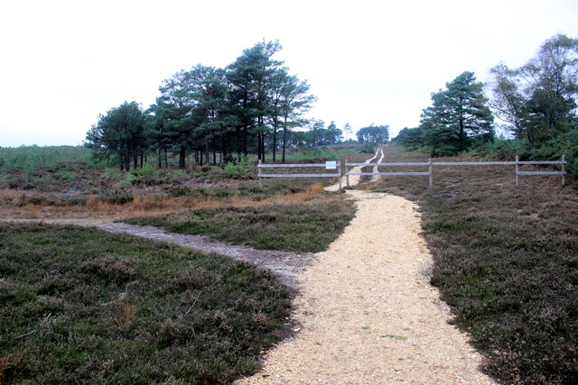
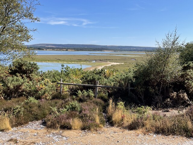
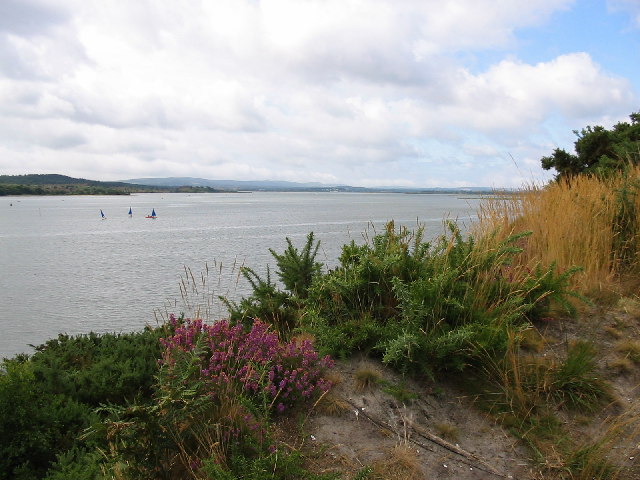
Big Wood is a picturesque forest located in the county of Dorset, England. Covering an area of approximately 500 acres, this woodland is a popular destination for nature enthusiasts and outdoor adventurers. The wood is situated in close proximity to the village of Wood, hence its name.

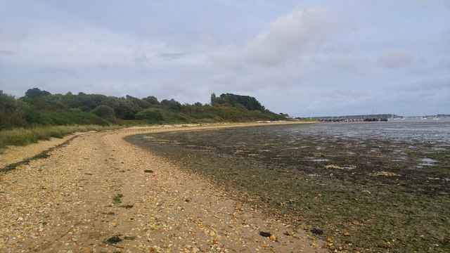
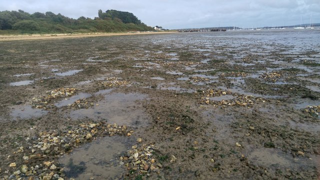
Big Wood is known for its diverse range of flora and fauna, making it a haven for wildlife. The forest is primarily composed of broadleaf trees, including oak, beech, and ash. These towering trees create a dense canopy, providing shelter and creating a serene atmosphere within the wood. The forest floor is covered with a lush carpet of ferns, bluebells, and wildflowers, adding to its natural beauty.

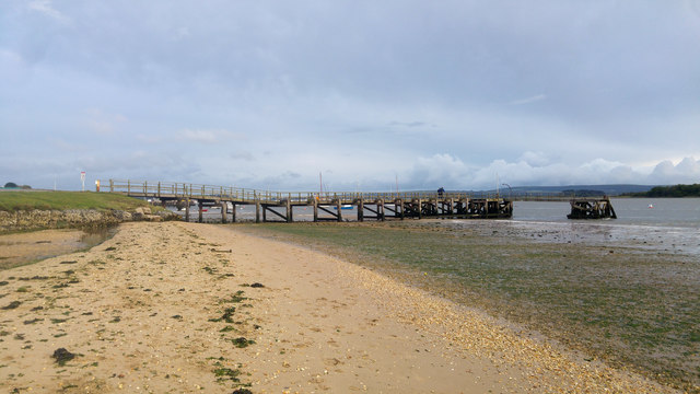
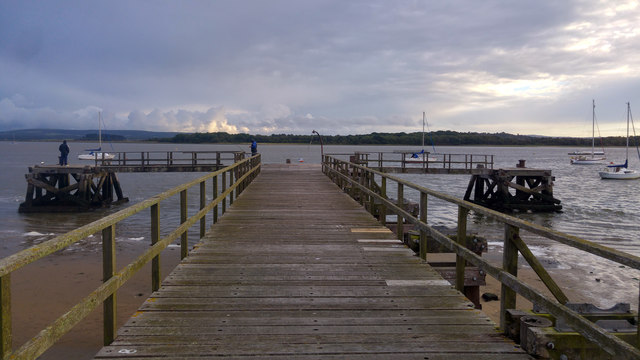
The wood is crisscrossed with a network of walking trails, allowing visitors to explore its enchanting surroundings. These paths vary in difficulty, catering to both casual strollers and more experienced hikers. As visitors venture deeper into the forest, they may encounter hidden glades, babbling brooks, and even the occasional deer or fox.

Big Wood also offers a range of recreational activities. There are designated picnic areas and open spaces for families to enjoy a leisurely day out. Additionally, the wood is a popular spot for birdwatching, with a variety of bird species calling it home.

Overall, Big Wood in Dorset provides a tranquil and idyllic escape from the hustle and bustle of everyday life, offering visitors a chance to immerse themselves in the beauty of nature.

If you have any feedback on the listing, please let us know in the comments section below.
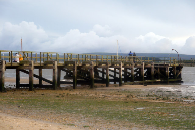
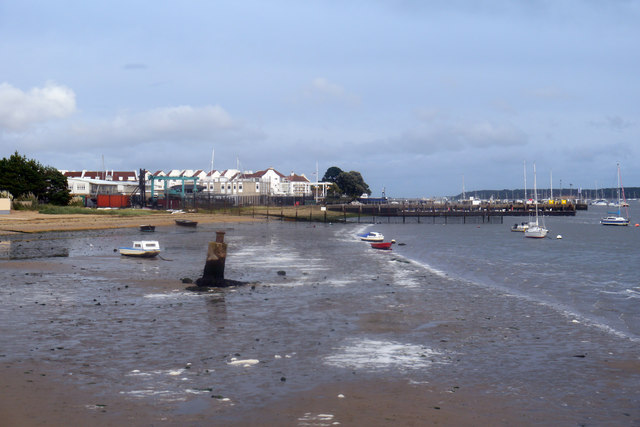
Big Wood Images

Images are sourced within 2km of 50.697867/-2.0351753 or Grid Reference SY9788. Thanks to Geograph Open Source API. All images are credited.

Beach below Ham Common, Poole Harbour
Foreshore near Ham Common and Hamworthy Beach, Poole Harbour
Hamworthy Beach and Lake Pier, Poole Harbour
Lake Pier, Poole Harbour
Lake Pier, Wareham Channel, Poole Harbour
Foreshore east of Lake Pier, Poole Harbour Looking towards RM Poole and beyond to the rooftops of houses and apartments at Moriconium Quay.
Foreshore east of Lake Pier, Poole Harbour
Looking towards RM Poole and beyond to the rooftops of houses and apartments at Moriconium Quay.
Trainers and 7-Up - Lake Pier, Wareham Channel Not sure what these are doing here or what happened to the owner.
Trainers and 7-Up - Lake Pier, Wareham Channel
Not sure what these are doing here or what happened to the owner.
RAF Hamworthy - WW2 Pillbox (1) -
Pillbox (Type FW3/26): EDoB ID: e48119
A type 26 pillbox overlooking the waterway with a large embrasure in the front that was probably for a mounted heavy machine gun (HMG).

This RAF Coastal Command base had in their fleet of flying boats Consolidated PBY Catalinas, and Short Sunderlands. The base was operational at Poole Harbour from 1939 - 1948, and was used also by the Royal Navy, the RAAF, and by BOAC (British Overseas Airways Corporation). Little remains today, and the land based area has become the scene of both commercial and military activity.

<a href="https://www.geograph.org.uk/photo/6794344">SY9890 : RAF Hamworthy - WW2 Pillbox (2)</a>
RAF Hamworthy - WW2 Pillbox (1)
- Pillbox (Type FW3/26): EDoB ID: e48119 A type 26 pillbox overlooking the waterway with a large embrasure in the front that was probably for a mounted heavy machine gun (HMG). This RAF Coastal Command base had in their fleet of flying boats Consolidated PBY Catalinas, and Short Sunderlands. The base was operational at Poole Harbour from 1939 - 1948, and was used also by the Royal Navy, the RAAF, and by BOAC (British Overseas Airways Corporation). Little remains today, and the land based area has become the scene of both commercial and military activity. SY9890 : RAF Hamworthy - WW2 Pillbox (2)
RAF Hamworthy - WW2 Pillbox (2) -
Pillbox (Type FW3/26): EDoB ID: e48119
Side view with its single embrasure, with an identical arrangement on the opposite side.

<a href="https://www.geograph.org.uk/photo/6794355">SY9890 : RAF Hamworthy - former WW2 control tower</a>
RAF Hamworthy - WW2 Pillbox (2)
- Pillbox (Type FW3/26): EDoB ID: e48119 Side view with its single embrasure, with an identical arrangement on the opposite side. SY9890 : RAF Hamworthy - former WW2 control tower
Motor Vessel Oklahoma (formerly MTB 453), Long Island, 1957 MV Oklahoma moored at Long Island in 1957. Formerly HMS MTB 453, she was built for wartime service for the Royal Navy as a fast motor torpedo boat by the British Power Boat Co. at Hythe, near Southampton in 1943. She subsequently took part with distinction in Operation Neptune, the code name for the naval phase of the Allied Invasion of Normandy.  

Almost 72 feet long (22 metres), she was powered by three 1250 H.P. Packard Engines giving 40 Knots max, 35 Knots continuous. Crewed by 2 officers and 12 ratings, her armament comprised a 6 pdr gun, twin 20 mm Oerlikons, two twin Vickers Gas Operated Guns, two Mk VII Depth Charges, and two 18" Torpedo Tubes. 

After the war, MTB 453 was sold off, probably one of the 127 former Royal Navy motor torpedo boats beached on the sands off Shipstal Point in 1945. Offered by the Director of Small Craft Disposals as suitable for conversion into 'floating homes', it was seen as one answer to the post-war housing problem, although most probably went for scrap in the end.

On holiday on Long Island in 1957, guests of the owners of MV Oklahoma. Scanned from a tiny print taken with a Kodak Brownie 127, my first camera; sadly, the camera was subsequently swept overboard from the deck of "Oklahoma" by a gust of wind, ending up in the water.
Motor Vessel Oklahoma (formerly MTB 453), Long Island, 1957
MV Oklahoma moored at Long Island in 1957. Formerly HMS MTB 453, she was built for wartime service for the Royal Navy as a fast motor torpedo boat by the British Power Boat Co. at Hythe, near Southampton in 1943. She subsequently took part with distinction in Operation Neptune, the code name for the naval phase of the Allied Invasion of Normandy. Almost 72 feet long (22 metres), she was powered by three 1250 H.P. Packard Engines giving 40 Knots max, 35 Knots continuous. Crewed by 2 officers and 12 ratings, her armament comprised a 6 pdr gun, twin 20 mm Oerlikons, two twin Vickers Gas Operated Guns, two Mk VII Depth Charges, and two 18" Torpedo Tubes. After the war, MTB 453 was sold off, probably one of the 127 former Royal Navy motor torpedo boats beached on the sands off Shipstal Point in 1945. Offered by the Director of Small Craft Disposals as suitable for conversion into 'floating homes', it was seen as one answer to the post-war housing problem, although most probably went for scrap in the end. On holiday on Long Island in 1957, guests of the owners of MV Oklahoma. Scanned from a tiny print taken with a Kodak Brownie 127, my first camera; sadly, the camera was subsequently swept overboard from the deck of "Oklahoma" by a gust of wind, ending up in the water.
Mid channel, south of Shipstal Point in 1957 Mid-channel outward from Long Island, heading for the shore below Shipstal Point in 1957.
Mid channel, south of Shipstal Point in 1957
Mid-channel outward from Long Island, heading for the shore below Shipstal Point in 1957.
Heathland Track on the Arne Peninsula This track leads north across the heath off the Arne Road. The track is just inside an area of access land.
Heathland Track on the Arne Peninsula
This track leads north across the heath off the Arne Road. The track is just inside an area of access land.
Path on Grip Heath Part of the RSPB’s Arne Nature Reserve on the Arne peninsula
Path on Grip Heath
Part of the RSPB’s Arne Nature Reserve on the Arne peninsula
View over Wych Channel to Round Island From the RSPB nature reserve on the Arne peninsula
View over Wych Channel to Round Island
From the RSPB nature reserve on the Arne peninsula
Parched fields on the Arne peninsula  During a summer that has been much hotter and drier than usual
Parched fields on the Arne peninsula
During a summer that has been much hotter and drier than usual
View over Wych Channel From the path to Shipstal Point
View over Wych Channel
From the path to Shipstal Point
Stepped path in the RSPB Arne Nature Reserve
Lake Pier, Hamworthy February, but looking worthy of July!
Lake Pier, Hamworthy
February, but looking worthy of July!
Show me another place!

Big Wood is located at Grid Ref: SY9788 (Lat: 50.697867, Lng: -2.0351753)

Unitary Authority: Dorset

Police Authority: Dorset

What 3 Words

///tiles.basis.fingernails. Near Poole, Dorset

Nearby Locations

Arne Big Wood

Related Wikis

Arne, Dorset

Arne is a village and civil parish in Dorset, England, situated 4 miles (6.4 km) east of Wareham. The local travel links are located at Wareham railway...

Long Island (Dorset)

Long Island is an uninhabited island in Poole Harbour in the English county of Dorset. It lies just off the shore of the Arne Peninsular in the south-west...

Arne RSPB reserve

Arne RSPB reserve is a 5.634-square-kilometre (1,392-acre) nature reserve and Site of Special Scientific Interest (SSSI) maintained by the RSPB and located...

Round Island (Dorset)

Round Island is an island in Poole Harbour in the English county of Dorset. It lies just off the shore of the Arne Peninsula in the south-west of the harbour...

Hamworthy Beach

Hamworthy Beach is situated between the Marine Camp and Rockley Sands in Poole Bay, Dorset, known to locals but more difficult to find for outsiders. The...

Ham Common, Dorset

Ham Common is a Local Nature Reserve at Hamworthy, near Poole, Dorset. Located on the north west shores of Poole Harbour, it is predominantly a heathland...

Mid Dorset and North Poole (UK Parliament constituency)

Mid Dorset and North Poole is a constituency represented in the House of Commons of the UK Parliament since 2015 by Michael Tomlinson, a Conservative....

RM Poole

Royal Marines Base Poole (RM Poole) is a British naval base located in Hamworthy a suburb of Poole, Dorset, England on the Poole Harbour and is the centre...

Nearby Amenities

Located within 500m of 50.697867,-2.0351753
Source: PGS
Lat/Long: 50.6991976/-2.0287125
Source: PGS
Lat/Long: 50.6977791/-2.0282417
Source: PGS
Lat/Long: 50.6978029/-2.0285773
Source: PGS
Lat/Long: 50.6973923/-2.028865
Source: PGS
Lat/Long: 50.6969464/-2.0285268
Source: PGS
Lat/Long: 50.6972182/-2.0289951
Source: PGS
Lat/Long: 50.6969981/-2.029432
Source: PGS
Lat/Long: 50.6974465/-2.0293017
Created By: almien_coastlines
Source: PGS
Lat/Long: 50.697769/-2.029211
Source: PGS
Lat/Long: 50.6980925/-2.0291223
Source: PGS
Lat/Long: 50.698088/-2.028751
Source: PGS
Lat/Long: 50.6987706/-2.0308313
Created By: almien_coastlines
Source: PGS
Lat/Long: 50.69843/-2.031619
Source: PGS
Lat/Long: 50.6989642/-2.0310212
Source: PGS
Lat/Long: 50.6991729/-2.0305877
Source: PGS
Lat/Long: 50.6990034/-2.0304612
Source: PGS
Lat/Long: 50.6989974/-2.0301276
Source: PGS
Lat/Long: 50.6990314/-2.0298093
Created By: almien_coastlines
Source: PGS
Lat/Long: 50.699184/-2.029788
Created By: almien_coastlines
Source: PGS
Lat/Long: 50.700209/-2.029767
Source: PGS
Lat/Long: 50.701143/-2.0303681
Created By: almien_coastlines
Source: PGS
Lat/Long: 50.700487/-2.032384
Source: PGS
Lat/Long: 50.7011044/-2.03207
Source: PGS
Lat/Long: 50.7012482/-2.0320875
Source: PGS
Lat/Long: 50.7013284/-2.0318693
Source: PGS
Lat/Long: 50.7017026/-2.0319092
Source: PGS
Lat/Long: 50.7019167/-2.0325346
Shipstal Hide
Access Disabled: no
Building: yes
Building Levels: 2
Leisure: bird_hide
Operator: RSPB
Lat/Long: 50.6970288/-2.0318752
Material: wood
Power: pole
Source: bing
Lat/Long: 50.7005679/-2.0387297
Material: wood
Power: pole
Source: bing
Lat/Long: 50.7012264/-2.0379029
Material: wood
Power: pole
Source: bing
Lat/Long: 50.7018747/-2.0370979
Bench
Backrest: yes
Lat/Long: 50.696546/-2.0330769
Bench
Backrest: yes
Lat/Long: 50.6943644/-2.0330179
Bench
Backrest: no
Lat/Long: 50.6953541/-2.0310465
Bench
Lat/Long: 50.697074/-2.0319097
Bench
Backrest: no
Lat/Long: 50.6960935/-2.0381086
Bench
Lat/Long: 50.6952091/-2.0388854
Leisure: playground
Lat/Long: 50.6952306/-2.0361045
The data included in this document is from www.openstreetmap.org. The data is made available under ODbL.

Have you been to Big Wood?

Leave your review of Big Wood below (or comments, questions and feedback).