North Cliff Plantation

Wood, Forest in Derbyshire Derbyshire Dales

England

North Cliff Plantation

Woodland behind the Eyre Arms This woodland on this hill behind the Eyre Arms is just to the south-west of the centre of SK27.
Woodland behind the Eyre Arms Credit: Roger Temple

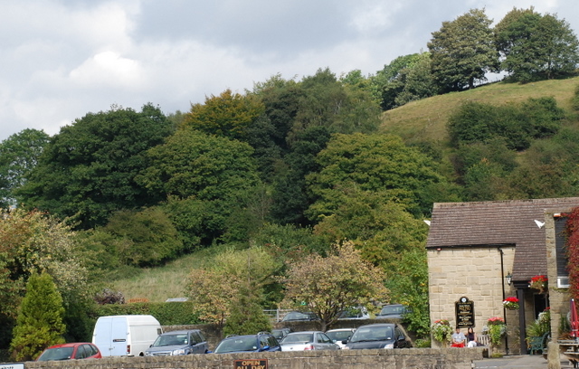
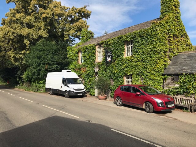
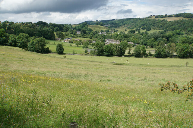
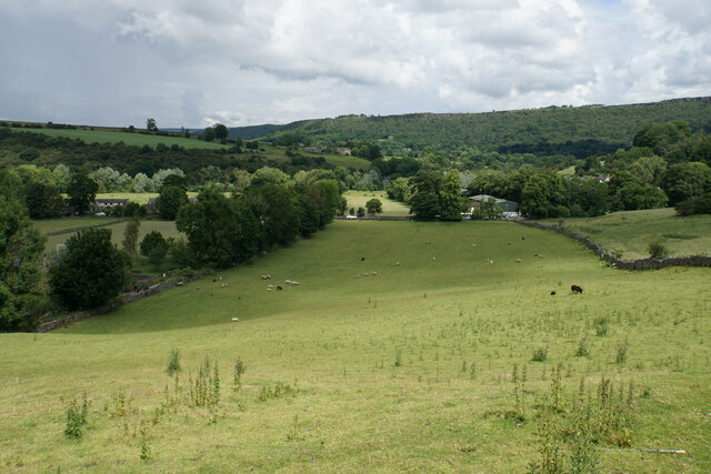
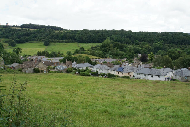
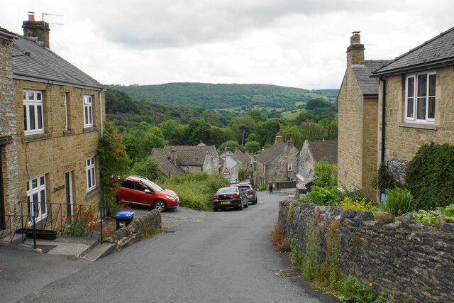
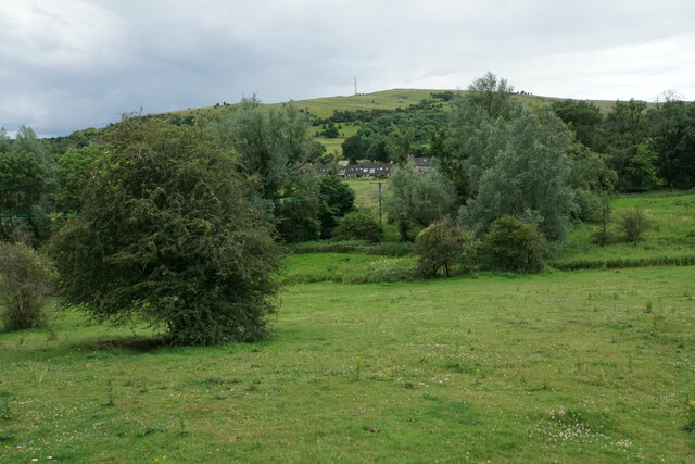
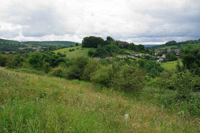
North Cliff Plantation is a stunning wooded area located in Derbyshire, England. Spanning over a vast expanse, this plantation is renowned for its breathtaking beauty and diverse flora and fauna. Nestled within the heart of the Derbyshire countryside, it offers a tranquil escape for nature enthusiasts and outdoor adventurers alike.

The plantation boasts a dense forest that is home to a wide range of tree species, including oak, beech, and birch. These towering trees create a lush canopy, providing a haven for an abundance of wildlife. Visitors may be lucky enough to spot deer, foxes, and various bird species as they explore the plantation's extensive network of walking trails.

One of the highlights of North Cliff Plantation is the stunning woodlands. The woodland area is full of ancient trees, some of which are hundreds of years old, giving the plantation an enchanting and timeless feel. These ancient trees provide a habitat for a myriad of woodland creatures, such as squirrels, woodpeckers, and bats.

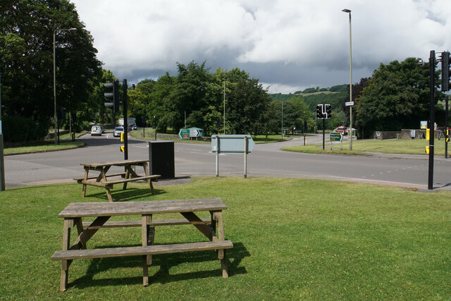
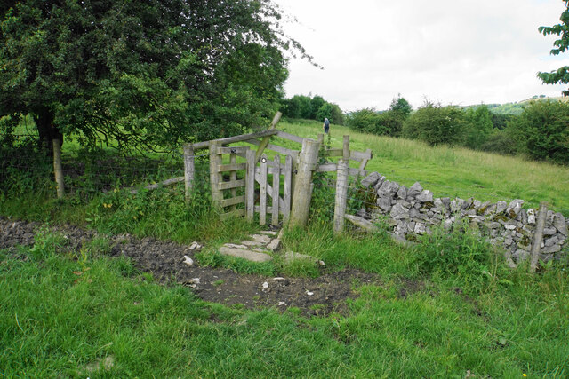
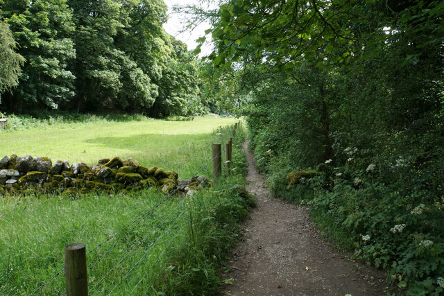
In addition to its natural beauty, North Cliff Plantation offers various recreational activities for visitors. The well-maintained walking trails provide an opportunity to immerse oneself in the peaceful surroundings and enjoy the serenity of nature. Picnic areas and benches are scattered throughout the plantation, allowing visitors to relax and take in the picturesque scenery.

North Cliff Plantation is a true gem in Derbyshire, offering a captivating blend of natural beauty and outdoor activities. Whether one is seeking a peaceful retreat or an adventurous hike, this woodland paradise is sure to leave a lasting impression.

If you have any feedback on the listing, please let us know in the comments section below.

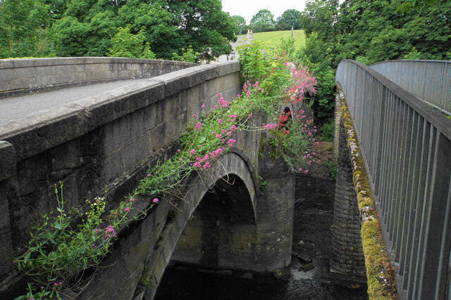
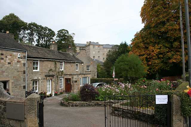
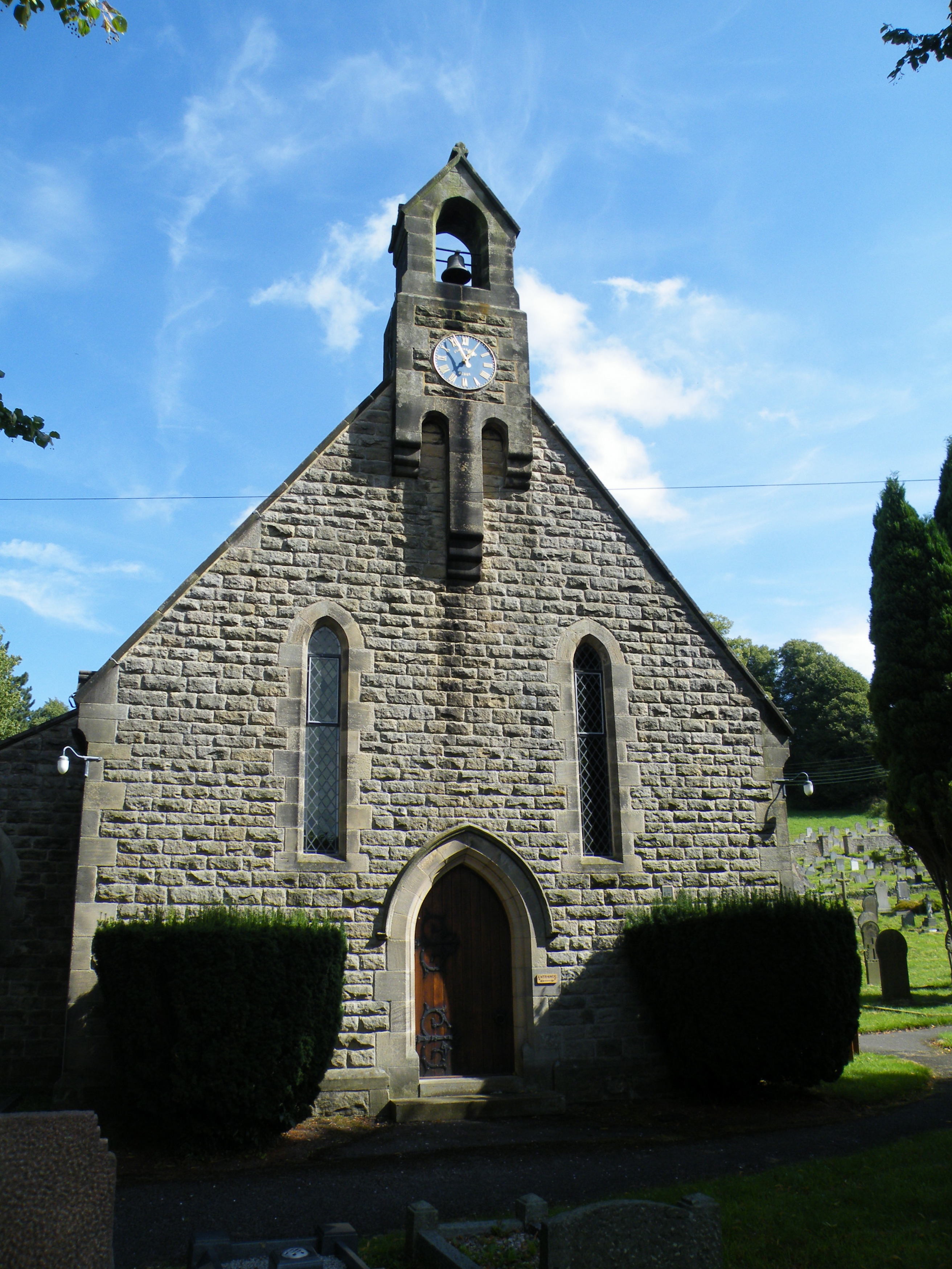
North Cliff Plantation Images

Images are sourced within 2km of 53.261416/-1.6468745 or Grid Reference SK2373. Thanks to Geograph Open Source API. All images are credited.

Woodland behind the Eyre Arms This woodland on this hill behind the Eyre Arms is just to the south-west of the centre of SK27.
Woodland behind the Eyre Arms
This woodland on this hill behind the Eyre Arms is just to the south-west of the centre of SK27.
The Eyre Arms The sign on the building says Eyre Arms whereas the one across the road says the Old Eyre Alms <a href="https://www.geograph.org.uk/photo/4888611">SK2272 : The Old Eyre Arms, Hassop</a> which would differentiate it from the other Eyre Arms a few miles away in Calver <a href="https://www.geograph.org.uk/photo/3614234">SK2374 : An Eyre of Importance (8)</a>.  Take your pick!
The Eyre Arms
The sign on the building says Eyre Arms whereas the one across the road says the Old Eyre Alms SK2272 : The Old Eyre Arms, Hassop which would differentiate it from the other Eyre Arms a few miles away in Calver SK2374 : An Eyre of Importance (8). Take your pick!
The sign of The Eyre Arms See <a href="https://www.geograph.org.uk/photo/6922970">SK2272 : The Eyre Arms</a>
The sign of The Eyre Arms
Crossroads in Calver A lot of people will only know Calver from these crossroads, as the A623 passes through, and the A625 turns off. There is a village green here, with more on the opposite side, but the village has quieter and more attractive bits.
Crossroads in Calver
A lot of people will only know Calver from these crossroads, as the A623 passes through, and the A625 turns off. There is a village green here, with more on the opposite side, but the village has quieter and more attractive bits.
Hillside below Calver Low Looking down towards Stoney Middleton. Eyam is just visible further up the far hill.
Hillside below Calver Low
Looking down towards Stoney Middleton. Eyam is just visible further up the far hill.
Field at the bottom of Coombs Dale The A623 runs at the other end of the field. The Derwent valley is in the background with Froggatt Edge on the far side.
Field at the bottom of Coombs Dale
The A623 runs at the other end of the field. The Derwent valley is in the background with Froggatt Edge on the far side.
Footpath and gate above Stoney Middleton The wooden structures around the gate show some evolutionary randomness.
Footpath and gate above Stoney Middleton
The wooden structures around the gate show some evolutionary randomness.
Hillside below Eaton Fold A chance to look down on the rooftops of Stoney Middleton.
Hillside below Eaton Fold
A chance to look down on the rooftops of Stoney Middleton.
Middleton Lane A steeply descending road through Stoney Middleton. The Derwent valley is in the distance.
Middleton Lane
A steeply descending road through Stoney Middleton. The Derwent valley is in the distance.
Green fields at the bottom of Middleton Dale Calver Peak is opposite.
Green fields at the bottom of Middleton Dale
Calver Peak is opposite.
Hillside above Stoke Brook The course of Stoke Brook below is obscured by shrubbery. Opposite is Hare Knoll and Calver.
Hillside above Stoke Brook
The course of Stoke Brook below is obscured by shrubbery. Opposite is Hare Knoll and Calver.
Fields by Knouchley Farm Looking down the Derwent Valley, with Curbar and Baslow Edges up on the left.
Fields by Knouchley Farm
Looking down the Derwent Valley, with Curbar and Baslow Edges up on the left.
Hilly farmland near Knouchley Farm Part of the western side of the Derwent valley opposite Froggatt.
Hilly farmland near Knouchley Farm
Part of the western side of the Derwent valley opposite Froggatt.
Path down to the Derwent Froggatt Edge is at the top of the other side.
Path down to the Derwent
Froggatt Edge is at the top of the other side.
River Derwent by New Bridge On the opposite side is the Shuttle House, for which the local authority conservation records are here: <span class="nowrap"><a title="https://her.derbyshire.gov.uk/Monument/MDR3974" rel="nofollow ugc noopener" href="https://her.derbyshire.gov.uk/Monument/MDR3974">Link</a><img style="margin-left:2px;" alt="External link" title="External link - shift click to open in new window" src="https://s1.geograph.org.uk/img/external.png" width="10" height="10"/></span>.
River Derwent by New Bridge
On the opposite side is the Shuttle House, for which the local authority conservation records are here: LinkExternal link.
Path by the River Derwent You can't see a great deal of the river through the foliage on the right.
Path by the River Derwent
You can't see a great deal of the river through the foliage on the right.
River Derwent near Calver Both sides of this stretch of the river are lined by trees. There is quite a lot of white water below Calver Weir.
River Derwent near Calver
Both sides of this stretch of the river are lined by trees. There is quite a lot of white water below Calver Weir.
Bridges over the River Derwent The bridge on the left carried the old main road from Baslow before it was replaced by a new Calver Bridge. The bridge on the right is a footbridge.
Bridges over the River Derwent
The bridge on the left carried the old main road from Baslow before it was replaced by a new Calver Bridge. The bridge on the right is a footbridge.
Show me another place!

North Cliff Plantation is located at Grid Ref: SK2373 (Lat: 53.261416, Lng: -1.6468745)

Administrative County: Derbyshire

District: Derbyshire Dales

Police Authority: Derbyshire

What 3 Words

///highs.storming.rainbow. Near Baslow, Derbyshire

Related Wikis

Calver

Calver (Old English Calf Slope) is a village and civil parish in Derbyshire, England. The population of the civil parish at the 2011 census was 710....

All Saints' Church, Curbar

All Saints’ Church, Curbar is a Church of England parish church in Curbar, Derbyshire. == History == Until the church was built, the nearest parish church...

Cliff College

Cliff College is a Christian theological college in Calver, Derbyshire, that teaches Biblical Theology at the undergraduate level and a number of mission...

Middleton Hall, Stoney Middleton

Middleton Hall is a restored 17th-century country house at Stoney Middleton, Derbyshire. It is a Grade II listed building.The house was built in the mid...

Upper Derwent Valley

The Upper Derwent Valley is an area of the Peak District National Park in England. It largely lies in Derbyshire, but its north eastern area lies in Sheffield...

St Martin's Church, Stoney Middleton

St Martin's Church is a Grade II* listed parish church in the Church of England in Stoney Middleton, Derbyshire. == History == The church dates from the...

Curbar

Curbar is a village and civil parish in the Derbyshire Dales district of Derbyshire, England. The population based on the 2011 Census was 417. Curbar is...

Baslow Hall

Baslow Hall is a Grade II listed building in Baslow, Derbyshire. == History == Baslow Hall, just off Calver Road, was built in 1907 to the designs of the...

Nearby Amenities

Located within 500m of 53.261416,-1.6468745
Barrier: stile
Material: wood
Source: survey;gps
Step Count: 2
Stile: stepover
Lat/Long: 53.2629072/-1.6477739
Parking
Access: yes
Fee: no
Parking: surface
Lat/Long: 53.2611038/-1.6459718
Barrier: stile
Material: stone
Source: survey;gps
Stile: squeezer
Lat/Long: 53.2640839/-1.6435934
Barrier: stile
Material: stone
Source: survey;gps
Stile: squeezer
Lat/Long: 53.2645368/-1.6434033
Information: guidepost
Operator: Peak & Northern Footpaths Society
Ref: 542
Source: survey;gps
Tourism: information
Lat/Long: 53.2586837/-1.6478086
Parking
Capacity: 2
Lat/Long: 53.257573/-1.6460606
Parking
Capacity: 3
Lat/Long: 53.2572084/-1.644398
The data included in this document is from www.openstreetmap.org. The data is made available under ODbL.

Have you been to North Cliff Plantation?

Leave your review of North Cliff Plantation below (or comments, questions and feedback).