High Lee Wood

Wood, Forest in Derbyshire Derbyshire Dales

England

High Lee Wood

View towards High Neb from western edge of Hathersage Moor
View towards High Neb from western edge of Hathersage Moor Credit: Colin Park

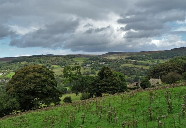
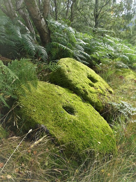
High Lee Wood is a sprawling forest located in Derbyshire, England. Covering an area of approximately 200 hectares, the wood is characterized by its rich biodiversity and natural beauty. The woodland consists primarily of native deciduous trees, including oak, birch, and beech, which create a dense canopy overhead. This provides a habitat for a wide range of wildlife, such as deer, foxes, and various bird species.

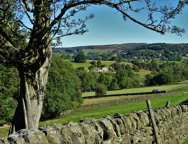
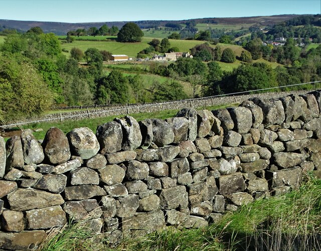
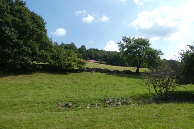
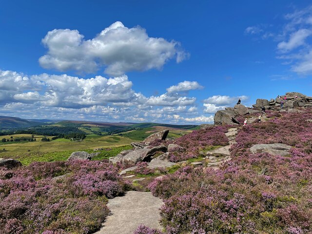
The wood is crisscrossed by a network of walking trails, allowing visitors to explore the area and immerse themselves in nature. These trails offer stunning views of the surrounding countryside, with rolling hills and picturesque valleys serving as a backdrop. The wood is particularly popular among hikers and nature enthusiasts, who can enjoy a peaceful and tranquil environment away from the bustle of city life.

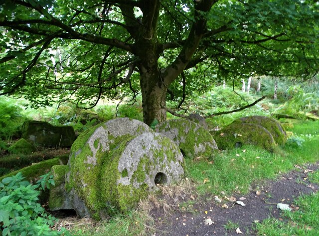
In addition to its natural beauty, High Lee Wood also holds historical and cultural significance. The wood is believed to have been used as a hunting ground by the local lord in medieval times. Today, remnants of the past can still be found in the form of ancient stone walls and ruins of old buildings, adding an air of mystery and intrigue to the wood.

High Lee Wood is managed by a local conservation organization, which strives to preserve its natural heritage and ensure its sustainability for future generations. The wood serves as an important educational resource, with guided tours and workshops available to schools and community groups.

Overall, High Lee Wood is a treasure trove of natural wonders, offering visitors a chance to connect with nature, explore its history, and enjoy the tranquility of the forest.

If you have any feedback on the listing, please let us know in the comments section below.

High Lee Wood Images

Images are sourced within 2km of 53.327176/-1.6463021 or Grid Reference SK2381. Thanks to Geograph Open Source API. All images are credited.

View towards High Neb from western edge of Hathersage Moor
Path leading down to Mitchell Field from Hathersage Moor
Hazelford Hall above The Hope Valley
View to Broadhay from Highlow Wood Broadhay is the farm you can see in the centre of this photograph with Hathersage beyond
View to Broadhay from Highlow Wood
Broadhay is the farm you can see in the centre of this photograph with Hathersage beyond
Drystone wall  with view to Broadhay
Drystone wall with view to Broadhay
Moss covered and abandoned millstones In Oxhay Wood. It is said that a day arrived in the early twentieth century when the demand for millstones suddenly dried up.
Moss covered and abandoned millstones
In Oxhay Wood. It is said that a day arrived in the early twentieth century when the demand for millstones suddenly dried up.
Abandoned millstones by the track to Bolehill Quarry
Stone trough in the woods By the track to Bole Hill Quarry. I last photographed it from a different angle in 2017 <a title="https://www.geograph.org.uk/photo/5464654" href="https://www.geograph.org.uk/photo/5464654">Link</a>
Stone trough in the woods
By the track to Bole Hill Quarry. I last photographed it from a different angle in 2017 Link
Towards the railway A DB class 66 hauls a train towards Grindleford on the Hope Valley Line.
Towards the railway
A DB class 66 hauls a train towards Grindleford on the Hope Valley Line.
Bend beside Surprise View Looking along Sheffield Road which leads to Hathersage.
Bend beside Surprise View
Looking along Sheffield Road which leads to Hathersage.
B6001 above the Derwent Looking along the road between Grindleford and Hathersage.
B6001 above the Derwent
Looking along the road between Grindleford and Hathersage.
Trough in a drystone wall at Barn in the Wood
Path towards Coppice Wood
From Over Owler Tor Looking towards Stanage Edge
From Over Owler Tor
Looking towards Stanage Edge
Approaching Mother Cap Rock outcrop on Hathersage Moor
Approaching Mother Cap
Rock outcrop on Hathersage Moor
River Derwent and Millstone Edge from Leadmill Bridge, Derbyshire A view in the Derwent Valley of the Derbyshire Peak District, near to the village of Hathersage.  Technically the Millstone Edge (the line of cliffs in the background) are located within the city of Sheffield, South Yorkshire.  Sheffield is the only British city to have part of a national park within its boundaries.
River Derwent and Millstone Edge from Leadmill Bridge, Derbyshire
A view in the Derwent Valley of the Derbyshire Peak District, near to the village of Hathersage. Technically the Millstone Edge (the line of cliffs in the background) are located within the city of Sheffield, South Yorkshire. Sheffield is the only British city to have part of a national park within its boundaries.
On Hathersage Moor Looking north west from the footpath below Over Owler Tor
On Hathersage Moor
Looking north west from the footpath below Over Owler Tor
Show me another place!

High Lee Wood is located at Grid Ref: SK2381 (Lat: 53.327176, Lng: -1.6463021)

Administrative County: Derbyshire

District: Derbyshire Dales

Police Authority: Derbyshire

What 3 Words

///bloodshot.upstarts.dolphin. Near Hathersage, Derbyshire

Related Wikis

Hathersage railway station

Hathersage railway station serves the village of Hathersage in the Derbyshire Peak District, in England. == History == The station was opened on 25 June...

St Michael and All Angels' Church, Hathersage

St Michael and All Angels’ Church, Hathersage, is a Grade I listed parish church in the Church of England in Hathersage, Derbyshire. == History == The...

Hathersage

Hathersage ( HATHə-sidge) is a village and civil parish in the Peak District in Derbyshire, England. It lies slightly to the north of the River Derwent...

Hood Brook

Hood Brook is a stream in the Derbyshire Peak District, originating near Stanage Edge, close to Robin Hoods Cave. == Background == Hood Brook flows south...

Master's Edge

Master's Edge is an 18-metre (59 ft) gritstone arête that is a rock climbing route in the "Corners Area" of Millstone Edge quarry, in the Peak District...

Bretton Brook

Bretton Brook is a stream flowing through Bretton in the Derbyshire Peak District. The stream is a tributary of the Highlow Brook, which is a direct...

Highlow Brook

Highlow Brook is a stream in the civil parish of Highlow in the Derbyshire Peak District. The stream is a tributaries of the River Derwent, flowing southeast...

Higger Tor

Higger Tor or Higgar Tor is a gritstone tor in the Dark Peak, in the north of the Peak District National Park in England. It overlooks the Burbage Valley...

Nearby Amenities

Located within 500m of 53.327176,-1.6463021
Hathersage (The Dale)
Bus: yes
Public Transport: stop_position
Lat/Long: 53.3258841/-1.6467216
Post Box
Brand: Royal Mail
Brand Wikidata: Q638098
Check Date Collection Times: 2022-02-05
Collection Times: Mo-Fr 09:00; Sa 07:00
Note: mounted in brick pillar
Operator: Royal Mail
Operator Wikidata: Q638098
Post Box Type: wall
Ref: S32 338D
Royal Cypher: EVIIR
Royal Cypher Wikidata: Q33102324
Source: survey
Lat/Long: 53.3271051/-1.6531978
Cafe
Lat/Long: 53.3250933/-1.651538
David Mellor Design Museum & Cafe
Addr City: Hope Valley
Addr Housename: The Round Building
Addr Postcode: S32 1BA
Addr Suburb: Hathersage
Opening Hours: Mo-Sa 10:00-17:00; Su 11:00-17:00
Tourism: museum
Website: https://www.davidmellordesign.com/shops/hathersage/
Lat/Long: 53.325175/-1.6516909
Shop: cookery
Lat/Long: 53.3252199/-1.6518263
Traffic Signals
Lat/Long: 53.324696/-1.6514888
Traffic Signals
Lat/Long: 53.3246238/-1.6515287
Traffic Signals
Lat/Long: 53.3246191/-1.6516712
Hathersage (High Leigh)
Bus: yes
Public Transport: stop_position
Lat/Long: 53.3274009/-1.6491947
Source: Bing
Lat/Long: 53.3289766/-1.6525863
Street Lamp
Source: survey
Lat/Long: 53.3307275/-1.6504943
Barrier: stile
Material: stone
Source: survey;gps
Stile: squeezer
Lat/Long: 53.3233304/-1.6431162
Post Box
Post Box Type: wall
Ref: S32 337
Royal Cypher: EIIR
Royal Cypher Wikidata: Q33102113
Lat/Long: 53.3278214/-1.6492688
Bus Stop
Hathersage (Crossland Road)
Bus: yes
Naptan AtcoCode: 1000DHSR3491
Naptan NaptanCode: dbsapmjt
Public Transport: platform
Shelter: no
Lat/Long: 53.3299119/-1.6503044
Hathersage
Naptan AtcoCode: 9100HATHRSG
Network: National Rail
Network Website: https://www.nationalrail.co.uk/stations/hsg/
Network Wikidata: Q26334
Operator: Northern Rail
Operator Website: https://www.northernrailway.co.uk/stations/hathersage
Operator Wikidata: Q85789775
Railway: station
Ref Crs: HSG
Wheelchair: yes
Wikidata: Q2375578
Wikipedia: en:Hathersage railway station
Lat/Long: 53.3259212/-1.6521354
The Valley Health Club
Addr City: Hope Valley
Addr Housenumber: Unit 1
Addr Postcode: S32 1DP
Addr Street: Heather Lane
Addr Suburb: Hathersage
Email: info@hopevalleyhealthclub.co.uk
Leisure: fitness_centre
Phone: +44 1433 650 100
Website: http://www.hopevalleyhealthclub.co.uk/
Lat/Long: 53.3257971/-1.6511803
Bench
Backrest: yes
Lat/Long: 53.328988/-1.6522884
Bench
Backrest: yes
Lat/Long: 53.3287566/-1.6519471
Bench
Backrest: yes
Lat/Long: 53.3287926/-1.6519464
Bench
Backrest: yes
Lat/Long: 53.3288138/-1.6519477
Bench
Backrest: yes
Lat/Long: 53.3290509/-1.6517814
Bench
Backrest: yes
Lat/Long: 53.3289091/-1.6519403
Bench
Backrest: yes
Lat/Long: 53.3289336/-1.6519357
Hathersage (Crossland Road)
Bus: yes
Public Transport: stop_position
Lat/Long: 53.3299183/-1.6502036
Hathersage (Crossland Road)
Bus: yes
Public Transport: stop_position
Lat/Long: 53.3302452/-1.6501989
Post Box
Collection Times: Mo-Fr 09:00; Sa 07:00
Post Box Type: wall
Ref: S32 626
Royal Cypher: VR
Royal Cypher Wikidata: Q33102356
Lat/Long: 53.3241832/-1.6406826
Hathersage
Public Transport: stop_position
Railway: stop
Train: yes
Lat/Long: 53.3257891/-1.6517185
Hathersage
Public Transport: stop_position
Railway: stop
Train: yes
Lat/Long: 53.3260114/-1.6524087
Bus Stop
Hathersage (The Dale)
Bus: yes
Naptan AtcoCode: 1000DHSR3494
Naptan NaptanCode: dbsapmpd
Public Transport: platform
Lat/Long: 53.3259102/-1.6467006
Bus Stop
Hathersage (The Dale)
Bus: yes
Naptan AtcoCode: 1000DHSR3495
Naptan NaptanCode: dbsapmpg
Public Transport: platform
Shelter: no
Lat/Long: 53.3258766/-1.6468414
Hathersage (The Dale)
Bus: yes
Public Transport: stop_position
Lat/Long: 53.3259072/-1.6468324
Bus Stop
Hathersage (High Leigh)
Bus: yes
Naptan AtcoCode: 1000DHSR3492
Naptan NaptanCode: dbsapmjw
Public Transport: platform
Lat/Long: 53.3277474/-1.6492556
Bus Stop
Hathersage (High Leigh)
Bus: yes
Naptan AtcoCode: 1000DHSR3493
Naptan NaptanCode: dbsapmpa
Public Transport: platform
Lat/Long: 53.3273723/-1.6492414
Hathersage (High Leigh)
Bus: yes
Public Transport: stop_position
Lat/Long: 53.3277391/-1.6493206
Bus Stop
Hathersage (Crossland Road)
Bus: yes
Naptan AtcoCode: 1000DHSR3490
Naptan NaptanCode: dbsapmjp
Public Transport: platform
Shelter: no
Lat/Long: 53.3302332/-1.6501315
Bus Stop
Hathersage (Railway Station)
Bench: no
Bin: no
Bus: yes
Lit: no
Public Transport: platform
Shelter: no
Tactile Paving: no
Lat/Long: 53.3270697/-1.6533922
Bus Stop
Hathersage (Railway Station)
Bench: yes
Bin: yes
Bus: yes
Lit: no
Public Transport: platform
Shelter: no
Tactile Paving: no
Lat/Long: 53.3269848/-1.6535183
Generator Method: photovoltaic
Generator Output Electricity: yes
Generator Source: solar
Generator Type: solar_photovoltaic_panel
Location: roof
Power: generator
Lat/Long: 53.3288358/-1.6504857
Generator Method: photovoltaic
Generator Output Electricity: yes
Generator Source: solar
Generator Type: solar_photovoltaic_panel
Location: roof
Power: generator
Lat/Long: 53.3278426/-1.6523525
Generator Method: photovoltaic
Generator Output Electricity: yes
Generator Source: solar
Generator Type: solar_photovoltaic_panel
Location: roof
Power: generator
Lat/Long: 53.3263368/-1.6517356
Generator Method: photovoltaic
Generator Output Electricity: yes
Generator Source: solar
Generator Type: solar_photovoltaic_panel
Location: roof
Power: generator
Lat/Long: 53.3263271/-1.6518375
Generator Method: photovoltaic
Generator Output Electricity: yes
Generator Source: solar
Generator Type: solar_photovoltaic_panel
Location: roof
Power: generator
Lat/Long: 53.3262951/-1.6512099
Generator Method: photovoltaic
Generator Output Electricity: yes
Generator Source: solar
Generator Type: solar_photovoltaic_panel
Location: roof
Power: generator
Lat/Long: 53.3264096/-1.651572
Bicycle Parking
Bicycle Parking: stands
Capacity: 8
Lat/Long: 53.3259263/-1.6518331
Bench
Backrest: yes
Direction: W
Material: wood
Lat/Long: 53.3291578/-1.6509437
Bench
Backrest: yes
Direction: W
Material: wood
Lat/Long: 53.3290913/-1.6509638
Bicycle Parking
Bicycle Parking: stands
Capacity: 8
Covered: no
Lat/Long: 53.3289112/-1.6530181
Bench
Backrest: yes
Lat/Long: 53.3295426/-1.6504079
Leisure: fitness_station
Sport: fitness
Lat/Long: 53.3290325/-1.6514462
The data included in this document is from www.openstreetmap.org. The data is made available under ODbL.

Have you been to High Lee Wood?

Leave your review of High Lee Wood below (or comments, questions and feedback).